From Surf Wiki (app.surf) — the open knowledge base
Eastern Washington
Geographical region in the United States
Geographical region in the United States
| Field | Value |
|---|---|
| name | Eastern Washington |
| nickname | Eastside |
| image_map | Eastern Washington map.svg |
| settlement_type | Geographic region |
| population_as_of | 2020 census |
| population_total | 1,667,593 |
| population_density_sq_mi | auto |
| area_total_sq_mi | 46620 |
| subdivision_type | Country |
| subdivision_name | United States |
| subdivision_type1 | State |
| subdivision_name1 | Washington |
| elevation_max_ft | 12,276 |
| elevation_max_point | Mount Adams |
| elevation_min_ft | 79 |
| elevation_min_point | Columbia River at White Salmon |
| ~80 |
the geographic region
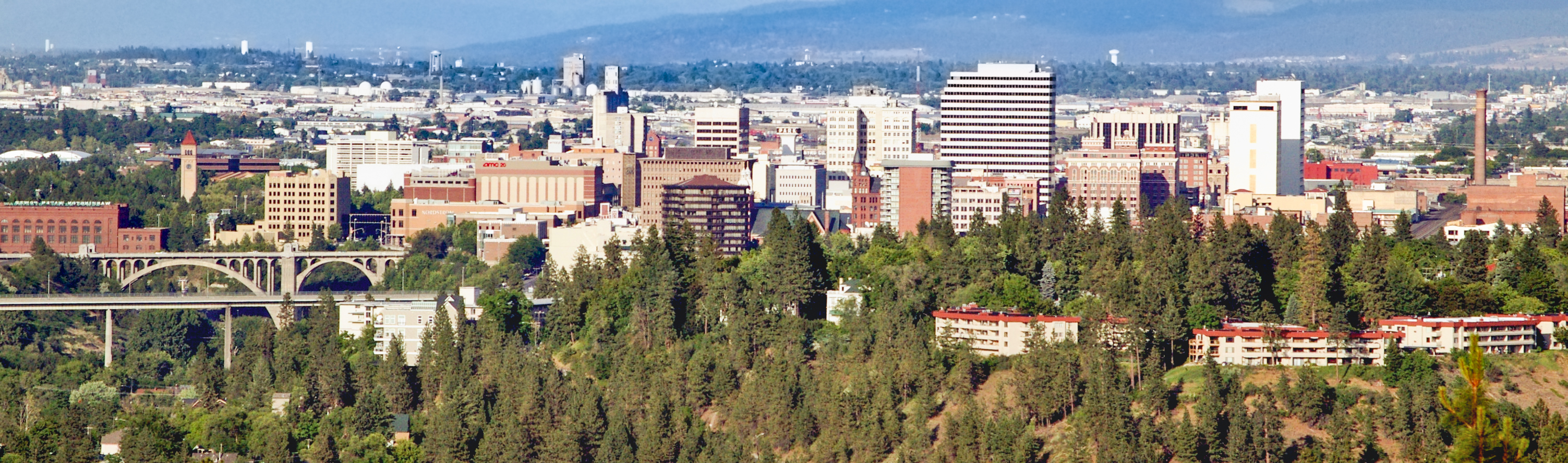
~80 Eastern Washington is the region of the U.S. state of Washington located east of the Cascade Range. It contains the city of Spokane (the second largest city in the state), the Tri-Cities, the Columbia River and the Grand Coulee Dam, the Hanford Nuclear Reservation and the fertile farmlands of the Yakima Valley and the Palouse. Unlike in Western Washington, the climate is dry, including some desert environments.
Geography
Nomenclature
Other terms used for Eastern Washington or large parts of it include:
- Columbia Basin
- Eastside or east side of the state
- Inland Empire/Inland Northwest (also includes the Idaho Panhandle)
- "The 509" (in reference to the local area code)
Cities
Notable cities and towns in Eastern Washington include:
- Spokane
- Spokane Valley
- Yakima
- Kennewick
- Pasco
- Richland
- Wenatchee
- Walla Walla
- Pullman
- Moses Lake
- Ellensburg
- Sunnyside
- West Richland
- East Wenatchee
- Liberty Lake
- Cheney
- Grandview
- Airway Heights
Protected areas

- Hanford Reach National Monument
- Lake Roosevelt National Recreation Area
- Juniper Dunes Wilderness
- Salmo-Priest Wilderness
- Wenaha-Tucannon Wilderness (partial)
- Colville National Forest
- Idaho Panhandle National Forest (partial)
- Kaniksu National Forest (partial)
- Okanogan–Wenatchee National Forest
- Umatilla National Forest (partial)
- Columbia National Wildlife Refuge
- Conboy Lake National Wildlife Refuge
- Little Pend Oreille National Wildlife Refuge
- McNary National Wildlife Refuge
- Saddle Mountain National Wildlife Refuge
- Toppenish National Wildlife Refuge
- Turnbull National Wildlife Refuge
- Umatilla National Wildlife Refuge (partial)
- Crawford State Park
Counties
Eastern Washington is composed of:
- Adams
- Asotin
- Benton
- Chelan
- Columbia
- Douglas
- Ferry
- Franklin
- Garfield
- Grant
- Kittitas
- Klickitat
- Lincoln
- Okanogan
- Pend Oreille
- Spokane
- Stevens
- Walla Walla
- Whitman
- Yakima
Some definitions also include part of Skamania County that lies east of the ridge line of the Cascade Mountains.
Climate

A significant difference between Eastern Washington and the western half of the state is its climate. While the west half of the state is located in a rainy oceanic climate, the eastern half receives little rainfall due to the rainshadow created by the Cascade Mountains. Also, due to being farther from the sea, the east side has both hotter summers and colder winters than the west. Most communities in Eastern Washington, for example, have significant yearly snowfall, while in the west snowfall is minimal and not seen every year. The east and west do still have some climatic traits in common, though: more rainfall in winter than summer, a lack of severe storms, and milder temperature ranges than more inland locations.
There is some variation in both temperature and rainfall throughout Eastern Washington. Generally, lower elevations are both hotter and drier than higher elevations. This is easily seen in the comparison between low-elevation Richland with higher elevation Spokane.
|Jan record high F = 74 |Feb record high F = 74 |Mar record high F = 87 |Apr record high F = 95 |May record high F = 105 |Jun record high F = 111 |Jul record high F = 115 |Aug record high F = 115 |Sep record high F = 106 |Oct record high F = 89 |Nov record high F = 79 |Dec record high F = 71 |year record high F=
| Jan avg record high F = 58.3 | Feb avg record high F = 62.6 | Mar avg record high F = 72.7 | Apr avg record high F = 83.4 | May avg record high F = 93.0 | Jun avg record high F = 99.7 | Jul avg record high F = 105.7 | Aug avg record high F = 102.7 | Sep avg record high F = 93.8 | Oct avg record high F = 80.8 | Nov avg record high F = 68.3 | Dec avg record high F = 59.6 | year avg record high F = 106.4
| Jan avg record low F = 8.5 | Feb avg record low F = 14.4 | Mar avg record low F = 21.5 | Apr avg record low F = 25.7 | May avg record low F = 32.2 | Jun avg record low F = 41.8 | Jul avg record low F = 47.0 | Aug avg record low F = 45.5 | Sep avg record low F = 35.2 | Oct avg record low F = 24.0 | Nov avg record low F = 16.6 | Dec avg record low F = 9.3 | year avg record low F =3.4
|Jan record low F = −27 |Feb record low F = −23 |Mar record low F = 10 |Apr record low F = 18 |May record low F = 26 |Jun record low F = 35 |Jul record low F = 38 |Aug record low F = 37 |Sep record low F = 21 |Oct record low F = 9 |Nov record low F = −12 |Dec record low F = −22 |year record low F= | access-date = March 11, 2018 | archive-date = April 18, 2019 | archive-url = https://web.archive.org/web/20190418233749/https://w2.weather.gov/climate/xmacis.php?wfo=pdt | url-status = dead
|Jan record high F= 62 |Feb record high F= 64 |Mar record high F= 75 |Apr record high F= 90 |May record high F= 97 |Jun record high F= 108 |Jul record high F= 112 |Aug record high F= 112 |Sep record high F= 102 |Oct record high F= 87 |Nov record high F= 70 |Dec record high F= 63
|Jan avg record high F = 51.5 |Feb avg record high F = 54.3 |Mar avg record high F = 64.9 |Apr avg record high F = 76.2 |May avg record high F = 86.6 |Jun avg record high F = 93.5 |Jul avg record high F = 100.3 |Aug avg record high F = 99.2 |Sep avg record high F = 90.6 |Oct avg record high F = 76.6 |Nov avg record high F = 59.6 |Dec avg record high F = 51.6 |year avg record high F= 101.9
|Jan avg record low F = 0.7 |Feb avg record low F = 7.0 |Mar avg record low F = 17.8 |Apr avg record low F = 26.8 |May avg record low F = 32.0 |Jun avg record low F = 40.2 |Jul avg record low F = 45.5 |Aug avg record low F = 44.2 |Sep avg record low F = 34.5 |Oct avg record low F = 25.3 |Nov avg record low F = 15.1 |Dec avg record low F = 5.82 |year avg record low F= -6.4
|Jan record low F= -30 |Feb record low F= -24 |Mar record low F= -10 |Apr record low F= 14 |May record low F= 24 |Jun record low F= 33 |Jul record low F= 37 |Aug record low F= 30 |Sep record low F= 22 |Oct record low F= 7 |Nov record low F= -13 |Dec record low F= -25
|access-date= March 11, 2018 |archive-date= September 21, 2016 |archive-url= https://web.archive.org/web/20160921055956/http://w2.weather.gov/climate/xmacis.php?wfo=otx |url-status= dead
Population
Compared to Western Washington, Eastern Washington has roughly twice the land area and one-fourth the population. As of the 2020 census, Eastern Washington was home to 1,667,593 of the state's total 7,705,281 residents, making its population comparable to that of West Virginia. The population growth rate between the two is roughly the same. Of Washington's ten Congressional districts, Eastern Washington exactly encompasses two (the 4th and 5th), aside from a small portion of the 8th in Chelan, Douglas, and Kittitas Counties.
Education
Eastern Washington hosts a number of universities including three of the state's five public universities.
Public institutions
- Central Washington University
- Eastern Washington University
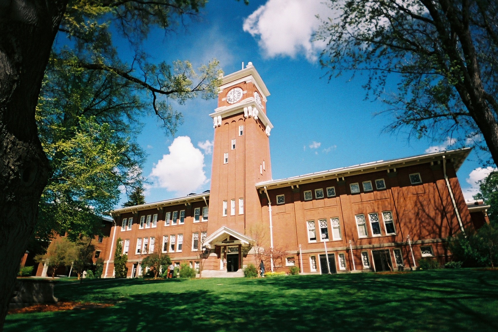
- Washington State University
- A number of local community colleges including:
- Big Bend Community College
- Columbia Basin College
- Spokane Community College
- Spokane Falls Community College
- Walla Walla Community College
- Wenatchee Valley College
- Yakima Valley College
Private institutions
- Gonzaga University
- Heritage University
- Pacific Northwest University of Health Sciences
- Walla Walla University
- Whitman College
- Whitworth University
Research institutions
- Pacific Northwest National Laboratory
- Chimpanzee and Human Communication Institute at Central Washington University
Proposed statehood

There have been sporadic movements to create a 51st state out of Eastern Washington by splitting the current state down the Cascades, but proposals have rarely progressed out of the state legislature's committees. Bills in the Washington State Legislature which would have requested the United States Congress to take up the question were proposed in 1996, 1999, 2005, and 2017. Proposed names for the new state have included Lincoln, Columbia, Liberty, or simply Eastern Washington. Many of these proposals would include the Idaho Panhandle as part of the proposed state of Lincoln.
Eastern Washington tends to vote Republican, whereas Western Washington usually votes Democratic. Even Spokane, the proposed capital and largest city, is in a fairly reliably Republican county despite tending to have a higher democratic vote than other Eastern Washington cities. The only fairly consistently Democratic county is the college town dominated Whitman County, which even then is far less Democratic than Western Washington.
Images
File:Palouse Hills from Steptoe Butte.jpg|The Palouse Hills of southeastern Washington File:Dry Falls.jpg|Dry Falls in the semi-desert Channeled Scablands that dominate much of eastern Washington. File:Eastern Washington Truck.jpg|Truck transport going east on Highway 2, near Waterville Image:Azwell WA.jpg|Apple orchards in Azwell, Washington surrounding a community of pickers' cabins
References
References
- (September 8, 2010). "WSP Eastside Recruiter Returns to Face Recruitment Challenge". [[Washington State Patrol]] Government and Media Relations.
- (March 4, 2010). "Eastside steelheading enters last month". [[Bellingham Herald]].
- (October 17, 2007). "Eastside Earthquakes Get Attention At Conference In Yakima". [[Oregon Public Broadcasting]].
- "WAC 222-16-010". [[Washington State Legislature]].
- "KENNEWICK, WASHINGTON (454154)". [[Western Regional Climate Center]].
- "SPOKANE, WASHINGTON (457933)". [[Western Regional Climate Center]].
- "Census QuickFacts: Washington".
- (29 September 2021). "Proposed changes to Washington state's Congressional districts released".
- "Lawmakers want to make eastern Wash. its own state". USA TODAY.
- Hallenberg, Pia. (February 12, 2017). "A 51st state, called Liberty, would have political clout and an ag-based economy". Spokesman-Review.
This article was imported from Wikipedia and is available under the Creative Commons Attribution-ShareAlike 4.0 License. Content has been adapted to SurfDoc format. Original contributors can be found on the article history page.
Ask Mako anything about Eastern Washington — get instant answers, deeper analysis, and related topics.
Research with MakoFree with your Surf account
Create a free account to save articles, ask Mako questions, and organize your research.
Sign up freeThis content may have been generated or modified by AI. CloudSurf Software LLC is not responsible for the accuracy, completeness, or reliability of AI-generated content. Always verify important information from primary sources.
Report