From Surf Wiki (app.surf) — the open knowledge base
East Hollywood, Los Angeles
Neighborhood of Los Angeles, California

Neighborhood of Los Angeles, California
| Field | Value |
|---|---|
| name | East Hollywood |
| native_name | |
| named_for | Location east of Hollywood |
| image_skyline | Little Armenia Los Angeles view edit1.jpg |
| image_caption | East Hollywood as viewed from the Griffith Observatory |
| image_map | Map of East Hollywood, Los Angeles, California.jpg |
| map_caption | Boundaries of East Hollywood as drawn by the Los Angeles Times |
| pushpin_map | United States Los Angeles Central |
| pushpin_label_position | bottom |
| pushpin_map_caption | Location within Central Los Angeles |
| subdivision_type | Country |
| subdivision_name | United States |
| subdivision_type1 | State |
| subdivision_name1 | California |
| subdivision_type2 | County |
| subdivision_name2 | Los Angeles |
| subdivision_type3 | City |
| subdivision_name3 | Los Angeles |
| settlement_type | Neighborhood of Los Angeles |
| timezone | PST |
| utc_offset | -8 |
| timezone_DST | PDT |
| utc_offset_DST | -7 |
| coordinates | |
| elevation_ft | 338 |
| elevation_footnotes | |
| postal_code_type | Zip codes |
| postal_code | 90027, 90029 |
| area_codes | 213, 323 |
East Hollywood is a densely populated neighborhood with approximately 78,000 residents that is part of the Hollywood area of the central region of Los Angeles, California. Among sites in East Hollywood are Los Angeles City College, Barnsdall Art Park, seven public and five private schools; a Los Angeles Public Library branch, and three hospitals. Almost two-thirds of the people living there were born outside the United States and 90% are renters. According to the 2000 census, the neighborhood has high percentages of people who had never married and single parents.
History
In the early 20th century, the East Hollywood area was a farming village which also encompasses some of what is now Los Feliz. Some of the neighborhood was formerly known as Prospect Park. In 1910, the towns of Hollywood and East Hollywood approved annexation to the City of Los Angeles in order to tap into the city water supply. In 1914, Children's Hospital was moved from downtown L.A. to Vermont Avenue and Sunset Boulevard.
In 1916 steel magnate Andrew Carnegie donated the money to construct the Cahuenga Branch of the Los Angeles Public Library on Santa Monica Boulevard. In the early 1920s, Barnsdall Park was built. The 1920s was also a time of massive immigration into East Hollywood. Armenian immigrants established the community which is now Little Armenia. The University of California Southern Branch, needing more space, moved west at the end of the 1920s to a ranch called Westwood and became UCLA. The old Southern Branch campus became Los Angeles Junior College which was later renamed Los Angeles City College.
In 1930, Cedars of Lebanon Hospital was formed when Kaspare Cohn Hospital moved from East Los Angeles to a new building on Fountain Avenue and was renamed.
US 101, the Hollywood Freeway, was built between 1947 and 1949. In the summer of 1999, three Metro Red Line subway stations opened, connecting East Hollywood more efficiently to the rest of the city.
Demographics
The 2000 U.S. census counted 73,967 residents in the 2.38-square-mile East Hollywood neighborhood—or 31,095 people per square mile, the third-highest population density in the city. In 2008, the city estimated that the population had increased to 78,192 - or 32,853 people per square mile. In 2000 the median age for residents was 31, about average for city and county neighborhoods; the percentage of residents aged 19 to 34 was among the county's highest.
The neighborhood was "moderately diverse" ethnically within Los Angeles, the statistics being Latino people of any race, 60.4%; Asians, 15.5%; non-Hispanic Whites, 17.5%; blacks, 2.4%; and others, 4.1%. El Salvador (21.2%) and Mexico (20.1%) were the most common places of birth for the 66.5% of the residents who were born abroad—which was a high percentage compared to Los Angeles as a whole.
The median yearly household income in 2008 dollars was $29,927, considered low for the city, and high percentages of households earned $40,000 or less. Renters occupied 91.3% of the housing stock, and house-or apartment-owners held 8.7%. The average household size of three people was average for Los Angeles. The percentages of never-married women (33.3%) and men (42.6%) were among the county's highest. One-fifth of the 3,281 families were headed by single parents, a high rate for Los Angeles. In 2000 there were 1,509 veterans, or 2.8% of the population, a low rate compared with the rest of the city and county.
Homeless population
In 2022, there were 528 homeless people in East Hollywood.
Geography
East Hollywood Neighborhood Council
According to The East Hollywood Neighborhood Council, East Hollywood is bounded by Western Avenue on the west, Hollywood Boulevard on the north, Hoover Street on the east, and the Hollywood Freeway on the south. It contains these districts:
- District 1: Thai Town
- District 2: Hollymont Junction
- District 3: Hollyset Junction
- District 4: Little Armenia West
- District 5: College Village
- District 6: Virgil Village
Mapping L.A.
According to the Mapping L.A. project of the Los Angeles Times, East Hollywood borders Los Feliz to the north and Silver Lake, about 4 miles from downtown Los Angeles to the east. It also borders Wilshire Center to the south and Hollywood on the west.
According to the Times, East Hollywood includes the smaller neighborhoods of Thai Town, Little Armenia, and Melrose Hill. (Melrose Hill is within the Hollywood Studio District Neighborhood Council.) Additionally, the Times does not mention Virgil Village, but the neighborhood is within the boundaries set by the Times.
Transportation
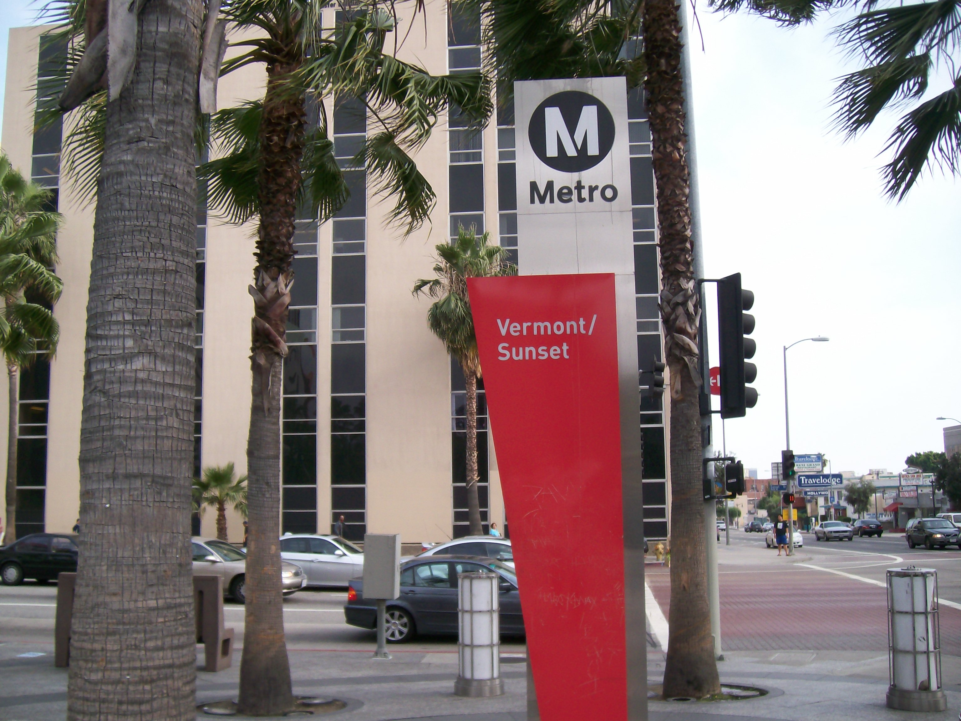
East Hollywood is served by the Metro B Line subway which runs north–south along Vermont Avenue and east–west along Hollywood Boulevard.
Metro subway stations include:
- Vermont/Beverly
- Vermont/Santa Monica
- Vermont/Sunset
- Hollywood/Western
Over a dozen bus lines run on the major thoroughfares, including Metro's Rapid and Local service lines. Los Angeles Department of Transportation's DASH shuttle lines, serving East Hollywood, Hollywood, and the Griffith Observatory, also operate in the area.
The 101/Hollywood Freeway cuts northwest from downtown Los Angeles, through Hollywood to the San Fernando Valley.
Education
Thirteen percent of East Hollywood residents aged 25 and older had earned a four-year degree by 2000, an average figure for the city and the county, but the percentage of residents with less than a high school diploma was high for the county.
Schools within East Hollywood's borders:
Public
- Lexington Avenue Primary Center, elementary, 4564 West Lexington Avenue
- Kingsley Elementary School, 5200 West Virginia Avenue
- Ramona Elementary School, 1133 North Mariposa Avenue
- Lockwood Avenue Elementary School, 4345 Lockwood Avenue
- Dayton Heights Elementary School, 607 North Westmoreland Avenue
- Alexandria Avenue Elementary School, 4211 Oakwood Avenue
- Harvard Elementary School, 330 North Harvard Boulevard
Private
- Alex Pilibos Armenian School, K-12, 1625 North Alexandria Avenue
- Progressive Student Learning Academy, 1518 North Alexandria Avenue
- Canyon Oaks School, 1414 North Catalina Street
- Immaculate Heart of Mary Elementary School, 1055 North Alexandria Avenue
- Blind Children's Center, Inc., 4120 Marathon Street
Notable places

- Barnsdall Art Park
- Braille Institute
- Cahuenga Branch of the Los Angeles Public Library; on the U.S. National Register of Historic Places
- Children's Hospital Los Angeles
- Hollyhock House
- Hollywood Presbyterian Medical Center
- Los Angeles City College
- Rincón Chileno
- Self-Realization Fellowship
- Vista Theatre
Notable people
- Charles Bukowski, writer
- Leonardo DiCaprio, actor and film producer
- Harry Northup, poet and actor
References
References
- "Worldwide Elevation Finder".
- (28 January 2020). "Helping Everyone to Help Themselves - Andrew Carnegie and Libraries". Los Angeles Public Library.
- "East Hollywood". Los Angeles Times.
- "Homeless Count by City/Community".
- "East Hollywood Neighborhood Council Map".
- "Neighborhood Council Boundary Map – East Hollywood Neighborhood Council".
- "Hollywood Studio District Neighborhood Council Map".
- "East Hollywood Schools". Los Angeles Times.
- (1 July 2003). "The Hunchback of East Hollywood: A Biography of Charles Bukowski". Headpress/Critical Vision.
This article was imported from Wikipedia and is available under the Creative Commons Attribution-ShareAlike 4.0 License. Content has been adapted to SurfDoc format. Original contributors can be found on the article history page.
Ask Mako anything about East Hollywood, Los Angeles — get instant answers, deeper analysis, and related topics.
Research with MakoFree with your Surf account
Create a free account to save articles, ask Mako questions, and organize your research.
Sign up freeThis content may have been generated or modified by AI. CloudSurf Software LLC is not responsible for the accuracy, completeness, or reliability of AI-generated content. Always verify important information from primary sources.
Report