From Surf Wiki (app.surf) — the open knowledge base
Doi Phu Kha National Park
Natural area in Northern Thailand
Natural area in Northern Thailand
| Field | Value |
|---|---|
| name | Doi Phu Kha National Park |
| alt_name | อุทยานแห่งชาติดอยภูคา |
| iucn_category | II |
| photo | 2006 1004 nan doi phuka 03.jpg |
| map | Thailand |
| map_caption | Location within Thailand |
| location | Nan Province, Thailand |
| nearest_city | Nan |
| coordinates | |
| area_km2 | 1704 |
| established | June 17, 1999 |
| visitation_num | 63,102 |
| visitation_year | 2019 |
| governing_body | Department of National Park, Wildlife and Plant Conservation |
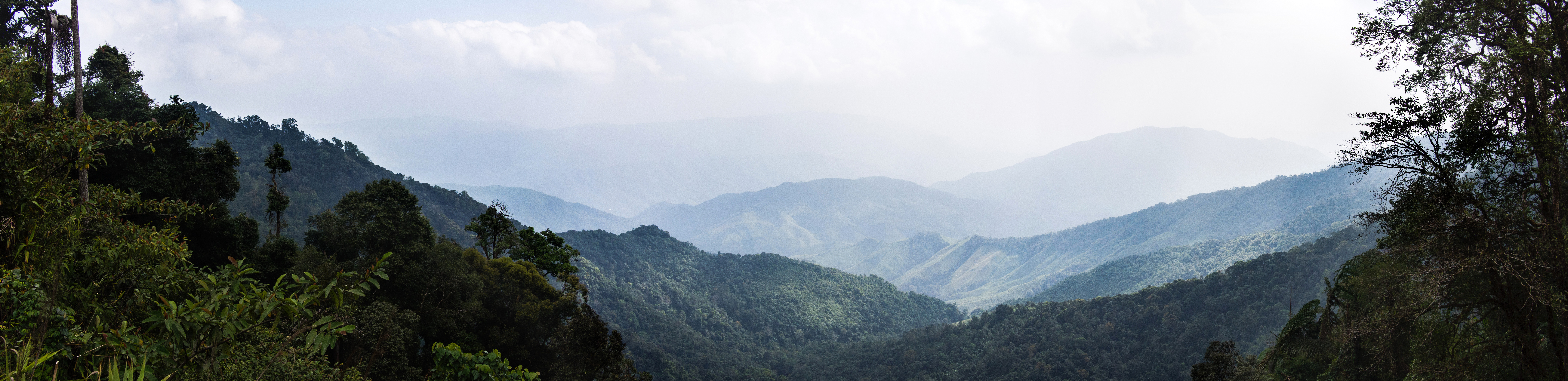
Doi Phu Kha National Park () covers parts of 8 districts in the Luang Prabang Range, Nan Province, Northern Thailand and has rich natural resources. It is Northern Thailand's largest National park and rivers such as Nan River and Pua River, have their sources within the area of the range under the protection of the park limits. Khun Nan National Park is located north of the park area.
1,980 m high Doi Phu Kha, located within the parks perimeter, gives its name to the park. There are many caves in the park area. The park is named after chomphu phu kha ( Bretschneidera sinensis), a tree with attractive pink flower bunches, which together with Caryota gigas and Acer wilsonii, are rare species of plant which in Thailand can be found only in this park. There are natural rock formations on 1,837 m high Doi Phu Wae peak. The ascent takes 3 days and 2 nights. The scenery of the sea of mist and the mountain range is the reward for the trekkers who can reach Phu Wae peak.
The park was established on June 17, 1999 with an area of 1,065,000 rai ~ 1704 km2. Doi Phu Kha National Park is part of the Luang Prabang montane rain forests ecoregion.
King Bhumibol Adulyadej has blamed the destruction of Thailand's forested areas on the greed of some state officials. This is evident in large zones of Doi Phu Kha National Park that were formerly covered with virgin forest and that have been deforested even while having national park status.
Location
|}
References
References
- [http://www.trekthailand.net/north8/index.html Doi Phu Kha National Park]
- (1999-06-17). "Royal Decree specifying the area as a National Park in 1999". Royal Gazette.
- "Luang Prabang montane rain forests - Globalspecies".
- [http://www.bangkokpost.com/news/local/281457/king-says-greed-a-factor-in-floods King says greed a factor in floods - Govt urged to find ways to prevent deforestation]
- "Doi Phu Kha National Park".
This article was imported from Wikipedia and is available under the Creative Commons Attribution-ShareAlike 4.0 License. Content has been adapted to SurfDoc format. Original contributors can be found on the article history page.
Ask Mako anything about Doi Phu Kha National Park — get instant answers, deeper analysis, and related topics.
Research with MakoFree with your Surf account
Create a free account to save articles, ask Mako questions, and organize your research.
Sign up freeThis content may have been generated or modified by AI. CloudSurf Software LLC is not responsible for the accuracy, completeness, or reliability of AI-generated content. Always verify important information from primary sources.
Report