From Surf Wiki (app.surf) — the open knowledge base
Diemen

| Field | Value |
|---|---|
| name | Diemen |
| settlement_type | Town and municipality |
| image_skyline | Oud Diemen, 1.jpg |
| image_size | 280px |
| image_caption | A view of Diemen |
| image_flag | Flag of Diemen (municipality).svg |
| flag_size | 100x67px |
| image_shield | Coat of arms of Diemen.svg |
| shield_size | 100x80px |
| image_map | Map - NL - Municipality code 0384 (2009).svg |
| map_alt | Highlighted position of Diemen in a municipal map of North Holland |
| map_caption | Location in North Holland and the Netherlands |
| coordinates | |
| subdivision_type | Country |
| subdivision_name | Netherlands |
| subdivision_type1 | Province |
| subdivision_name1 | North Holland |
| government_footnotes | {{cite web |
| url | http://www.diemen.nl/bestuur-politiek-en-organisatie/bestuur/college-van-bw/wie-is-wie/ |
| title | College van B&W – Wie is wie |
| language | nl |
| publisher | Municipality of Diemen |
| access-date | 21 June 2015 |
| url-status | dead |
| archive-url | https://web.archive.org/web/20150621210923/http://www.diemen.nl/bestuur-politiek-en-organisatie/bestuur/college-van-bw/wie-is-wie/ |
| archive-date | 21 June 2015 |
| df | dmy |
| governing_body | Municipal council |
| leader_party | D66 |
| leader_title | Mayor |
| leader_name | Erik Boog |
| unit_pref | Metric |
| area_footnotes | |
| area_total_km2 | |
| area_land_km2 | |
| area_water_km2 | |
| elevation_footnotes | {{cite web |
| url | http://www.ahn.nl/postcodetool |
| title | Postcodetool for 1111ZB |
| language | nl |
| author | |
| work | Actueel Hoogtebestand Nederland |
| publisher | Het Waterschapshuis |
| access-date | 27 February 2014}} |
| elevation_m | −1 |
| elevation_max_footnotes | tags -- |
| elevation_min_footnotes | tags -- |
| population_footnotes | |
| population_total | |
| population_as_of | |
| population_density_km2 | |
| population_demonym | Diemenaar |
| timezone | CET |
| utc_offset | +1 |
| timezone_DST | CEST |
| utc_offset_DST | +2 |
| postal_code_type | Postcode |
| postal_code | 1110–1113 |
| area_code_type | Area code |
| area_code | 020 |
| website |
|access-date=21 June 2015 |url-status=dead |archive-url=https://web.archive.org/web/20150621210923/http://www.diemen.nl/bestuur-politiek-en-organisatie/bestuur/college-van-bw/wie-is-wie/ |archive-date=21 June 2015 tags -- |access-date = 27 February 2014}} Diemen () is a town and municipality with a population of in the province of North Holland, Netherlands. It is located approximately 6 km (3.7 mi) southeast of Amsterdam's city centre, within the Amsterdam metropolitan area.
Etymology
The name Diemen comes from the river Diem, which originates from die eme, meaning the water.
Geography
Diemen is located in the province North Holland, in the west of the Netherlands. The town is part of the urban area of Amsterdam and is situated between Amsterdam-Oost (IJburg, Watergraafsmeer), Ouder-Amstel (Duivendrecht), Amsterdam-Zuidoost (Bijlmer, Driemond), and Muiden.
Three waterways cross the municipality: the Weespertrekvaart from west to south, the Amsterdam–Rhine Canal from north to east, and the river Diem from south to north. The river is the namesake of Diemen. The town can be divided into three neighbourhoods: Diemen Noord, Diemen Centrum, and Diemen Zuid.
Diemen Noord () is located on the south bank of the Amsterdam–Rhine Canal, which separates it from the Amsterdam neighbourhood IJburg, on the west bank of the river Diem, and on the north side of the Amsterdam–Zutphen railway. The area contains houses, a few of which are recreated late medieval houses, a minor shopping centre, and in the east a green area called Diemerpolder.
Diemen Centrum () extends from the Watergraafsmeer in the west, from which it is separated by the A10 motorway, all the way to the north-east of municipality with the rural area Overdiemerpolder, an electricity plant, and the green area Diemervijfhoek. The neighbourhood contains houses and apartment buildings, the largest shopping centre, and the town hall. The train station Diemen is located between Noord and Centrum.
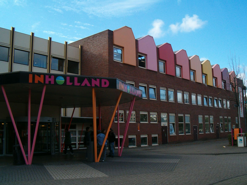
Diemen Zuid () is located next to Duivendrecht, Bijlmer, and Driemond. It contains houses and apartment buildings, a minor shopping centre, and a location of Inholland University of Applied Sciences. On the south-west border is the railway station Diemen Zuid for metros and trains. The east part of the neighbourhood contains an industrial area and a green area called Diemerbos.
Demographics
The municipality has a population of 25,915 and a population density of 2,161 /km2. 51,2% Dutch background, 48,8% No Dutch background
Government
The municipal government consists of the executive college of the mayor and aldermen and the elected municipal council. The municipal building is located at the D.J. den Hartoglaan 1.
After the 2010 local elections in the Netherlands, a coalition of Labour Party (PvdA), GreenLeft (GL), Democrats 66 (D66), and Socialist Party (SP) was formed in Diemen. The mayor is (D66). Following the 2018 elections, negotiations are ongoing for forming the next governing coalition.
The municipal council of Diemen consists of 21 elected members. The seats are divided as follows:
- GreenLeft – 5 seats
- D66 – 4 seats
- PvdA – 3 seats
- VVD – 3 seats
- Leefbaar Diemen – 2 seats
- Ouderenpartij Diemen – 2 seats
- CDA – 1 seat
- Ons Diemen – 1 seat
Transportation

The motorways A1 (E231) and A9 pass through the municipality of Diemen, and the motorway A10 (Amsterdam ring) lies just outside the municipal border with Amsterdam.
Diemen has two train stations, Diemen on the Amsterdam–Zutphen railway and Diemen Zuid on the Weesp–Leiden railway. All train services to and from Diemen are operated by the Nederlandse Spoorwegen (NS). The railway station Diemen Zuid connects the town to the metro network of the Gemeentelijk Vervoerbedrijf (GVB).
Tram (line 19), bus and night bus services connect Diemen to Amsterdam and other towns in the area.
Bus service line 44 drives from Diemen North to the railway and metrostation Amsterdam Bijlmer Arena
Metro line 53 stops at two stations (Diemen Zuid and Verrijn Stuartweg) in the Southern district of the town.
Education
There are six primary schools in Diemen. The three public schools are De Octopus, De Venser, and* 'de Noorderbreedte*. The two ecumenical schools are De Ark and De Kersenboom, which is both public and ecumenical. De Nieuwe Kring is a Jenaplan school and Sint-Petrusschool is a Roman Catholic school. 't Palet and De Duif merged in 2014 and formed the Noorderbreedte. 't Palet was a public school and De Duif was an ecumenical school.
There are no secondary schools in Diemen. The nearest secondary schools are in Amsterdam and Weesp.
There are two institutes of tertiary education in Diemen: the universities of applied sciences HBO Nederland and Inholland both have a location in Diemen Zuid. The nearest universities are in Amsterdam.
Notable people

- Pieter Nieuwland (1764 in Diemermeer – 1794) a Dutch nautical scientist, chemist, mathematician and poet
- Rudi Falkenhagen (1933 in Diemen – 2005) a Dutch actor
Sport
- Barend Bonneveld (1887 in Diemen – 1978) a Dutch heavyweight wrestler, competed at the 1912 and 1920 Summer Olympics
- Maarten Arens (born 1972 in Diemen) a Dutch judoka
- Junas Naciri (born 1973 in Diemen) a Dutch retired footballer with 336 club caps
- Levi Heimans (born 1985 in Diemen) a Dutch track cyclist, competed at the 2004 Summer Olympics
- Daley Blind (born 1990 in Diemen) a Dutch professional footballer playing for AFC Ajax with over 300 club caps and over 70 international caps
- Adam Maher (born 1993 in Diemen) a Dutch professional footballer with over 200 club caps
- Riejanne Markus (born 1994 in Diemen) a Dutch world champion cyclist
Gallery
File:Diemen, Netherlands - panoramio (2).jpg|Diemen, panoramio File:Stammerdijk 36 Driemond Diemen1.JPG|Stammerdijk 36 Driemond Diemen File:Sint-Petrusbandenkerk-diemen.jpg|Sint-Petrusbandenkerk, Diemen File:Weespertrekvaart.jpg|Weespertrekvaart File:Fortwachterswoning - Diemen - 20340706 - RCE.jpg|Fortwachterswoning - Diemen
References
References
- {{Dutch municipality total area. dataref
- {{Dutch municipality population. dataref
- {{in lang
- . (23 December 2013). ["Bevolkingsontwikkeling; regio per maand"](http://statline.cbs.nl/StatWeb/publication/?DM=SLNL&PA=37230NED&D1=17-18&D2=101-619,621,624-632&D3=l&LA=EN&HDR=T&STB=G1,G2&VW=T). *[[Statistics Netherlands*.
- (18 May 2015). "Nieuwe burgemeester Diemen". [[Government of the Netherlands]].
- (28 March 2018). "Groenlinks gaat met alle partijen in gesprek over coalitie". DiemerNieuws.nl.
- "Definitieve uitslag gemeenteraadsverkiezing 2018". Diemen Municipality.
- {{in lang. nl [http://www.lokaaltotaal.nl/rubriek/diemen/verenigingen/basisonderwijs Basisonderwijs], [http://Lokaaltotaal.nl/Diemen Lokaaltotaal.nl/Diemen]. Retrieved on 2013-05-22.
- {{in lang. nl [http://www.lokaaltotaal.nl/rubriek/diemen/verenigingen/voortgezet-onderwijs Voortgezet onderwijs], [http://Lokaaltotaal.nl/Diemen Lokaaltotaal.nl/Diemen]. Retrieved on 2013-05-22.
- {{in lang. nl [http://www.lokaaltotaal.nl/rubriek/diemen/verenigingen/hbo HBO], [http://Lokaaltotaal.nl/Diemen Lokaaltotaal.nl/Diemen]. Retrieved on 2013-05-22.
- [https://www.imdb.com/name/nm0266246/ IMDb Database] retrieved 31 January 2020
This article was imported from Wikipedia and is available under the Creative Commons Attribution-ShareAlike 4.0 License. Content has been adapted to SurfDoc format. Original contributors can be found on the article history page.
Ask Mako anything about Diemen — get instant answers, deeper analysis, and related topics.
Research with MakoFree with your Surf account
Create a free account to save articles, ask Mako questions, and organize your research.
Sign up freeThis content may have been generated or modified by AI. CloudSurf Software LLC is not responsible for the accuracy, completeness, or reliability of AI-generated content. Always verify important information from primary sources.
Report