From Surf Wiki (app.surf) — the open knowledge base
Cumberland County, Tennessee
County in Tennessee, United States

County in Tennessee, United States
| Field | Value |
|---|---|
| county | Cumberland County |
| state | Tennessee |
| flag | Flag of Cumberland County, Tennessee.png |
| seal | File:Cumberland-county-tn-seal.png |
| founded | November 16, 1855 |
| named for | Cumberland Mountains |
| seat wl | Crossville |
| largest city wl | Crossville |
| area_total_sq_mi | 685 |
| area_land_sq_mi | 681 |
| area_water_sq_mi | 3.8 |
| area percentage | 0.6% |
| census yr | 2020 |
| pop | 61145 |
| density_sq_mi | 82 |
| time zone | Central |
| web | cumberlandcountytn.gov |
| ex image | Cumberland County Courthouse, Crossville TN.jpg |
| ex image cap | Cumberland County Courthouse in Crossville |
| district | 6th |
Cumberland County is a county located in the U.S. state of Tennessee. As of the 2020 census, the population was 61,145. Its county seat is Crossville. Cumberland County comprises the Crossville, TN micropolitan statistical area.
History
Cumberland County was formed in 1856 from parts of Bledsoe, Roane, Morgan, Fentress, Rhea, Putnam, Overton, and White. During the Civil War, the county was nearly evenly split between those supporting the Union and those supporting the Confederacy.
In 1787, the North Carolina legislature ordered widening and improvements to Avery's Trace, the trail that ran from North Carolina through Knoxville and what is now Cumberland County to Nashville. They raised funds by a lottery and completed a project that built a wagon road. This slightly improved travel, but still required a bone jarring trip. The road was often muddy and crossed stone slabs so that it was only passable in some places on foot. Reportedly wagons could not get down the steep grade at Spencer's Mountain without locking brakes on all wheels and dragging a tree behind to slow the descent. The mountain top was described as "quite denuded of trees."
Cumberland County was the site of an important saltpeter mine. Saltpeter is the main ingredient of gunpowder and was obtained by leaching the earth from Grassy Cove Saltpeter Cave. Richard Green Waterhouse settled in this area in 1800. In his "Diary, Journal, and Memoirs" he states that he went with William Kelly into Grassy cove and explored his (Kelly's) saltpeter cave on October 7, 1812.
According to Barr (1961), Dicky Mathews began the manufacture of gunpowder at the cave in 1859. His son was killed by an explosion at Powder House Spring below the cave. This is an exceptionally large cave and evidence of mining extends far from the entrance. The leaching vats were located in a large room near the entrance, but this room is damp and the wooden vats have deteriorated to the point that they are difficult to recognize.
During the 1930s, as part of the New Deal, the federal government's Subsistence Homesteads Division established the Cumberland Homesteads outside of Crossville. The program provided land and houses for 250 impoverished families. Cumberland Mountain State Park was built as part of this project.
Geography
According to the U.S. Census Bureau, the county has a total area of 685 sqmi, of which 681 sqmi is land and 3.8 sqmi (0.6%) is water. It is the fourth-largest county in Tennessee by area. The county is located atop the Cumberland Plateau. The southernmost of the Cumberland Mountains, known locally as the Crab Orchard Mountains, rise in the northeastern part of the county.
The county is home to a number of karst formations, most notably at Grassy Cove, a large, closed depression located southeast of Crossville. It is 3 miles wide, 5 miles long, and over 1,000 feet deep. All of the water draining into Grassy Cove flows underground through a large cave system and emerges 4 miles southwest at the head of the Sequatchie Valley to form the Sequatchie River.
The Tennessee Divide, where the watersheds of the Cumberland River and the Tennessee River meet, passes through the county. The source of the Caney Fork is located west of the divide, while the source of the Obed River is located east of the divide.
Adjacent counties
- Fentress County (north)
- Morgan County (northeast/EST Border)
- Roane County (east/EST Border)
- Rhea County (southeast/EST Border)
- Bledsoe County (south)
- Van Buren County (southwest)
- White County (west)
- Putnam County (northwest)
National protected area
- Obed Wild and Scenic River (part)
State protected areas
- Bledsoe State Forest (part)
- Catoosa Wildlife Management Area (part)
- Cumberland Mountain State Park
- Cumberland Trail (part)
- Keyes-Harrison Wildlife Management Area
- Luper Mountain Wildlife Management Area
- Mount Roosevelt Wildlife Management Area (part)
- Ozone Falls State Natural Area
Demographics
|align-fn=center 1790-1960 1900-1990 1990-2000 2010-2014
2020 census
| Race | Number | Percentage | White (non-Hispanic) | Black or African American (non-Hispanic) | Native American | Asian | Pacific Islander | Other/Mixed | Hispanic or Latino |
|---|---|---|---|---|---|---|---|---|---|
| 56,313 | 92.1% | ||||||||
| 299 | 0.49% | ||||||||
| 130 | 0.21% | ||||||||
| 366 | 0.6% | ||||||||
| 12 | 0.02% | ||||||||
| 2,089 | 3.42% | ||||||||
| 1,936 | 3.17% |
As of the 2020 census, there were 61,145 people, 25,801 households, and 17,692 families residing in the county. The median age was 53.6 years, 17.3% of residents were under the age of 18, and 32.9% were 65 years of age or older. For every 100 females there were 94.7 males, and for every 100 females age 18 and over there were 92.5 males.
The racial makeup of the county was 93.0% White, 0.5% Black or African American, 0.3% American Indian and Alaska Native, 0.6% Asian,
46.1% of residents lived in urban areas, while 53.9% lived in rural areas.
There were 26,933 households in the county, of which 20.6% had children under the age of 18 living in them. Of all households, 53.5% were married-couple households, 16.2% were households with a male householder and no spouse or partner present, and 24.9% were households with a female householder and no spouse or partner present. About 28.1% of all households were made up of individuals and 15.9% had someone living alone who was 65 years of age or older.
There were 30,479 housing units, of which 11.6% were vacant. Among occupied housing units, 77.6% were owner-occupied and 22.4% were renter-occupied. The homeowner vacancy rate was 1.8% and the rental vacancy rate was 8.8%.
2010 census
As of the census of 2010, there were 56,053 people, 23,791 households, and 16,954 families residing in the county. The population density was 82.3 /mi2.
There were 28,151 housing units at an average density of 41.3 /mi2. The racial makeup of the county was 96.08% White, 0.3% Black or African American, 0.3% Native American, 0.4% Asian, 0.1% Pacific Islander, 1.1% from other races, and 1% from two or more races. 2.3% of the population were Hispanic or Latino of any race.
According to the 2014 American Community Survey the largest ancestry groups in Cumberland County were German (15%), American (14.8%), Irish (12.9%), and English (11.8%).
There were 23,791 households, out of which 24.7% had children under the age of 18 living with them, 57.4% were married couples living together, 9.7% had a female householder with no husband present, 4.2% had a male householder with no wife present, and 28.7% were non-families. 24.4% of all households were one-person, and 11.9% had someone living alone who was 65 years of age or older. The average household size was 2.33 and the average family size was 2.72.
The population was distributed by age as follows, with 19.1% under the age of 18, 6.6% from 18 to 24, 20% from 25 to 44, 28.4% from 45 to 64, and 26% who were 65 years of age or older. The median age was 48.3 years. For every 100 females there were 95.5 males. For every 100 females age 18 and over, there were 92.9 males.
2000 census
According to the 2000 census, the median income for a household in the county was $30,901, and the median income for a family was $35,928. Males had a median income of $26,559 versus $20,644 for females. The per capita income for the county was $16,808. About 11.10% of families and 14.70% of the population were below the poverty line, including 21.80% of those under age 18 and 9.30% of those age 65 or over.
Education
The Cumberland County School District oversees two high schools, nine elementary schools, and one charter school. Schools include Cumberland County & Stone Memorial High Schools.
Communities
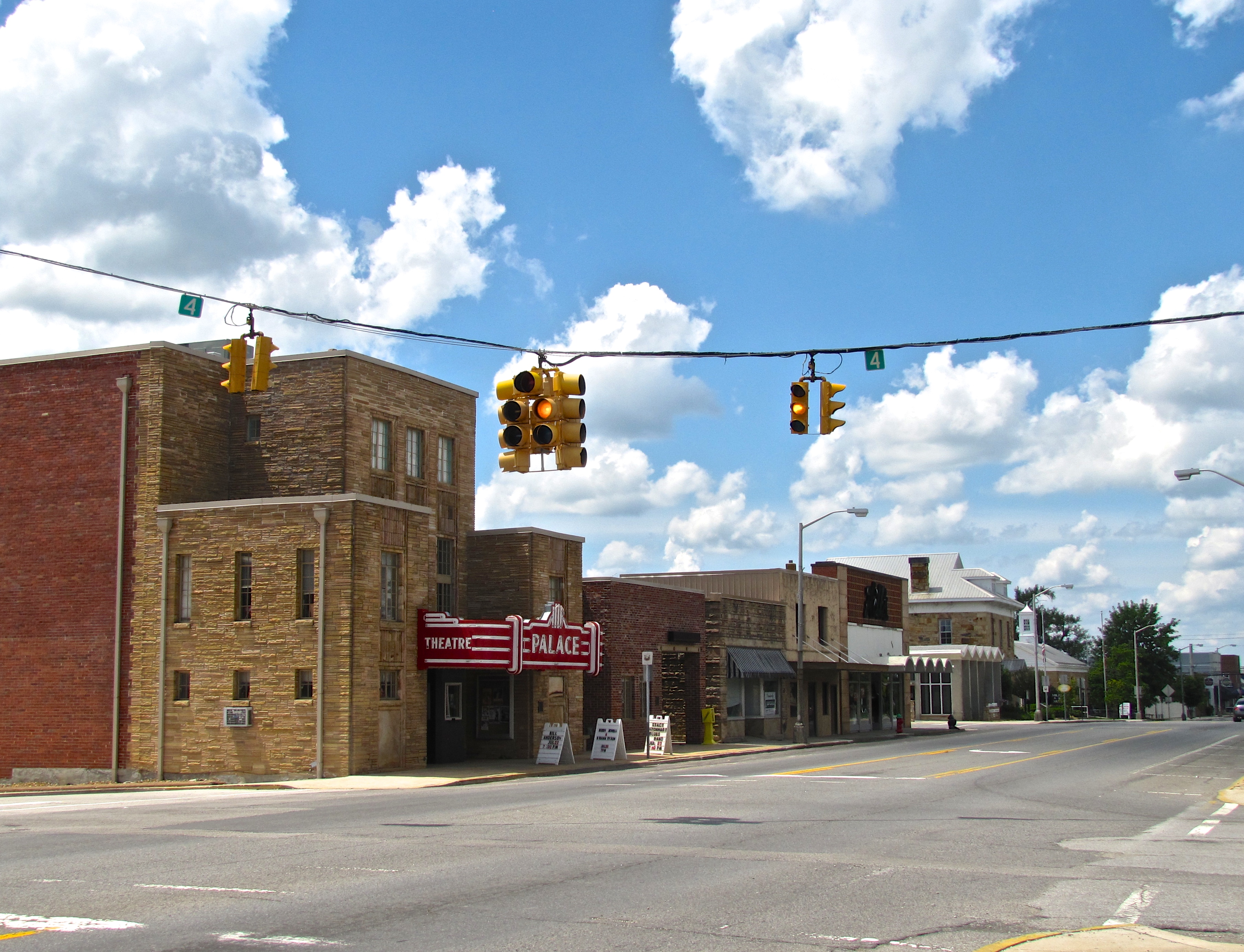
Cities
- Crab Orchard
- Crossville (county seat)
Town
- Pleasant Hill
Census-designated places
- Bowman
- Fairfield Glade
- Lake Tansi
- Mayland
Unincorporated communities
- Alloway
- Bowling
- Cumberland Cove
- Grassy Cove
- Midway
- Ozone
- Renegade Mountain
- Westel, Tennessee
Politics
Like all of East Tennessee, Cumberland County is powerfully Republican, and has generally been favorable to the party since the Civil War. Five Democratic presidential candidates have won the county since then, but none have reached 52 percent of the county's vote. For example, Franklin Roosevelt and Lyndon Johnson only won the county by fewer than 100 votes even as they won over 40 states and 400 electoral votes. The Democrats have only managed 40 percent of the county's vote five other times.
References
References
- "Cumberland County TNGenWeb".
- [http://www.state.tn.us/sos/bluebook/05-06/44-counties.pdf Origins Of Tennessee County Names], ''[[Tennessee Blue Book]]'' 2005-2006, pages 508-513.
- "Census - Geography Profile: Cumberland County, Tennessee". [[United States Census Bureau]].
- "Find a County". National Association of Counties.
- United States Census Bureau, [https://www.census.gov/econ/census02/data/metro1/M18900.HTM Crossville, TN Micropolitan Statistical Area]. Retrieved: June 25, 2013.
- G. Donald Brookhart, "[http://tennesseeencyclopedia.net/entry.php?rec=336 Cumberland County]," ''Tennessee Encyclopedia of History and Culture''. Retrieved: June 25, 2013.
- Larry Matthews, "Caves of Grassy Cove," National Speleological Society, August 2014, pp. 29-30. {{ISBN. 978-1-68044-003-4.
- Thomas C. Barr, Jr., "Caves of Tennessee", Bulletin 64 of the Tennessee Division of Geology, 1961, 568 pages.
- (August 22, 2012). "2010 Census Gazetteer Files". United States Census Bureau.
- "U.S. Decennial Census". United States Census Bureau.
- "Historical Census Browser". University of Virginia Library.
- (March 27, 1995). "Population of Counties by Decennial Census: 1900 to 1990". United States Census Bureau.
- (April 2, 2001). "Census 2000 PHC-T-4. Ranking Tables for Counties: 1990 and 2000". United States Census Bureau.
- "State & County QuickFacts". United States Census Bureau.
- "Explore Census Data".
- (2021). "2020 Decennial Census Demographic Profile (DP1)".
- (2021). "2020 Decennial Census Redistricting Data (Public Law 94-171)".
- (2023). "2020 Decennial Census Demographic and Housing Characteristics (DHC)".
- "U.S. Census website". [[United States Census Bureau]].
- "Tennessee 2010: Population Housing and Unit Costs". [[United States Census Bureau]].
- Leip, David. "Dave Leip's Atlas of U.S. Presidential Elections".
This article was imported from Wikipedia and is available under the Creative Commons Attribution-ShareAlike 4.0 License. Content has been adapted to SurfDoc format. Original contributors can be found on the article history page.
Ask Mako anything about Cumberland County, Tennessee — get instant answers, deeper analysis, and related topics.
Research with MakoFree with your Surf account
Create a free account to save articles, ask Mako questions, and organize your research.
Sign up freeThis content may have been generated or modified by AI. CloudSurf Software LLC is not responsible for the accuracy, completeness, or reliability of AI-generated content. Always verify important information from primary sources.
Report