From Surf Wiki (app.surf) — the open knowledge base
County Route 554 (New Jersey)
Highway in New Jersey, United States
_just_west_of_U.S._Route_9_(Main_Street)_in_Barnegat_Township,_Ocean_County,_New_Jersey.jpg)
Highway in New Jersey, United States
| Field | Value |
|---|---|
| state | NJ |
| type | CR |
| route | 554 |
| map | |
| map_custom | yes |
| map_notes | CR 554 highlighted in red |
| length_mi | 6.07 |
| length_ref | |
| length_round | 2 |
| direction_a | West |
| direction_b | East |
| terminus_a | in Barnegat Township |
| junction | in Barnegat Township |
| terminus_b | in Barnegat Township |
| counties | Ocean |
| previous_type | CR |
| previous_route | 553 |
| next_type | CR |
| next_route | 555 |
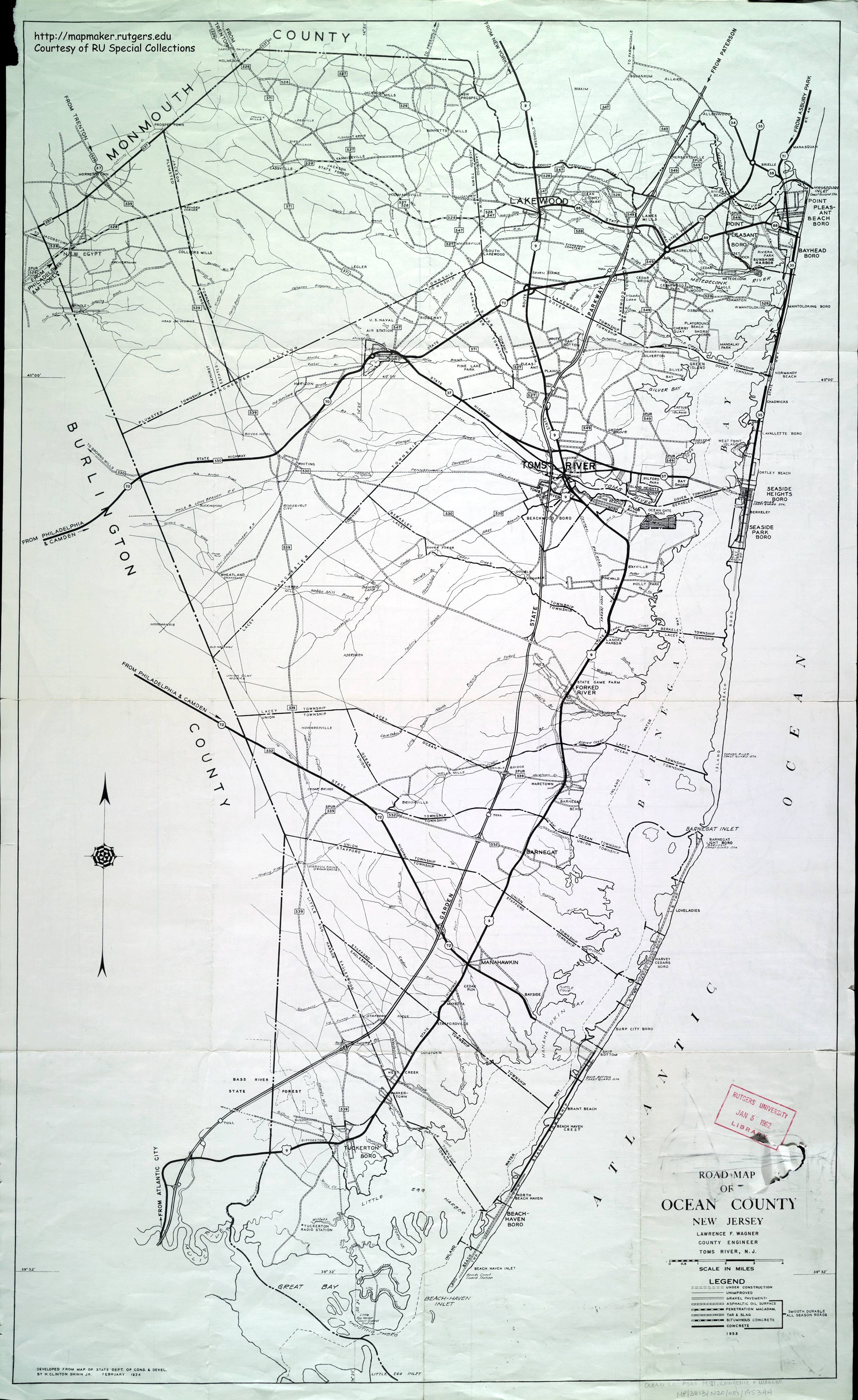
County Route 554 (CR 554) is a county highway in the U.S. state of New Jersey. The highway extends 6.07 mi from Barnegat Boulevard (Route 72) to Main Street (U.S. Route 9 or US 9) in Barnegat Township. The highway was designated as the easternmost segment of CR 532 in the early 1950s and was later a portion of CR 534, but as it had no connection to the western segment, it was renamed by 1984.
Route description
CR 554 begins at an intersection with Route 72 in Barnegat Township, heading east on two-lane undivided Barnegat Road. The road runs through forested areas of the Pine Barrens and intersects CR 611. Farther to the east, the route runs near wooded neighborhoods as Bay Avenue, coming to junctions with CR 111 and CR 105. CR 554 comes to a partial interchange with the Garden State Parkway that has access to and from the northbound direction of the parkway. After the interchange, CR 554 passes through business areas and intersects CR 8 and CR 10. In the community of Barnegat, the route comes to its eastern terminus at US 9.
Major intersections
References
References
- (March 2019). "County Route 554 Straight Line Diagram". [[New Jersey Department of Transportation]].
- (1953). "Road Map of Ocean County, New Jersey". Lawrence F. Wagner, County Engineer.
- (December 2023). "Hammonton, New Jersey 1:100,000-scale metric topographic map". United States Geological Survey.
- "overview of County Route 554".
This article was imported from Wikipedia and is available under the Creative Commons Attribution-ShareAlike 4.0 License. Content has been adapted to SurfDoc format. Original contributors can be found on the article history page.
Ask Mako anything about County Route 554 (New Jersey) — get instant answers, deeper analysis, and related topics.
Research with MakoFree with your Surf account
Create a free account to save articles, ask Mako questions, and organize your research.
Sign up freeThis content may have been generated or modified by AI. CloudSurf Software LLC is not responsible for the accuracy, completeness, or reliability of AI-generated content. Always verify important information from primary sources.
Report