From Surf Wiki (app.surf) — the open knowledge base
Conduit Avenue
Avenue in Brooklyn and Queens, New York

Avenue in Brooklyn and Queens, New York
| Field | Value |
|---|---|
| alternate_name | Conduit Boulevard |
| North / South Conduit Avenue | |
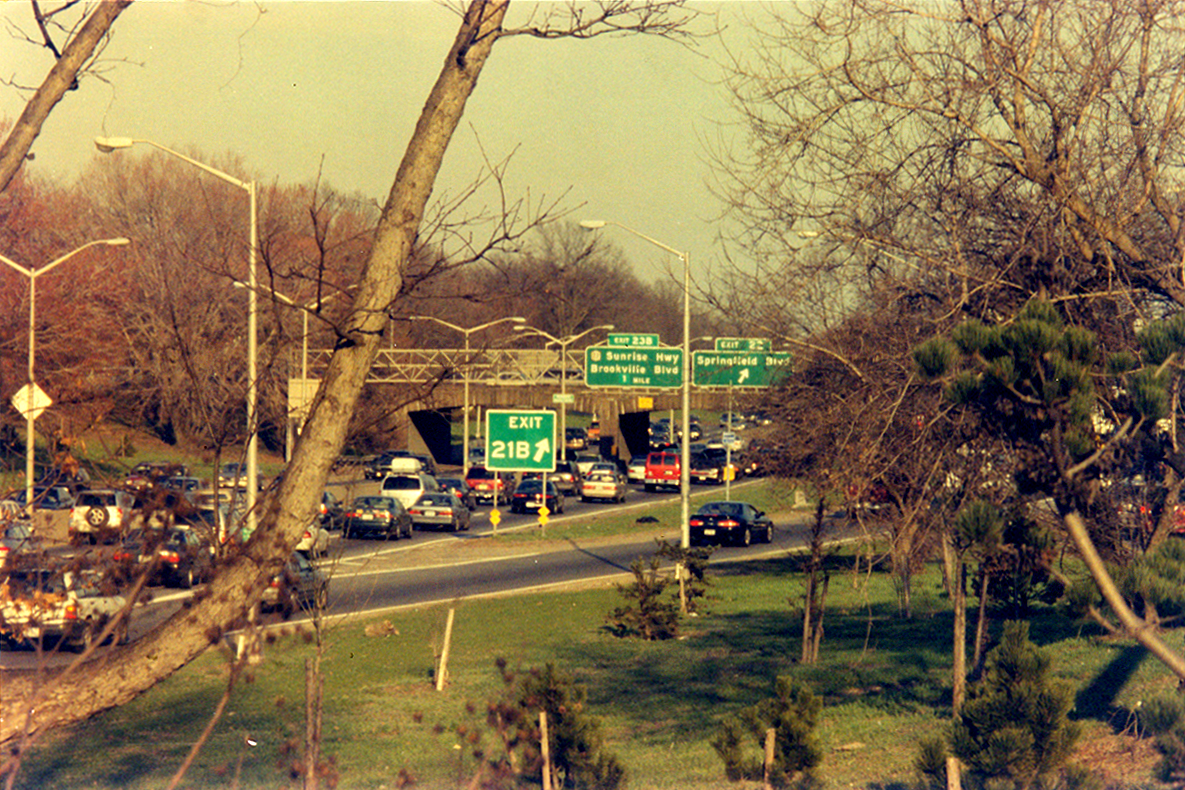
| image | Conduit Blvd median Sutter jeh.JPG |
| image_alt | Wide median strip at the Brooklyn-Queens border |
| caption | Wide median strip at the Brooklyn-Queens border |
| namesake | Ridgewood Aqueduct |
| owner | City of New York |
| maint | NYSDOT and NYCDOT |
| length_mi | 8.0 |
| length_ref | |
| location | Brooklyn and Queens, New York City |
| direction_a | West |
| terminus_a | Atlantic Avenue in Cypress Hills |
| direction_b | East |
| terminus_b | in Rosedale |
| junction | in Lindenwood |
| in South Ozone Park | |
| in South Ozone Park | |
| JFK Expressway in South Ozone Park | |
| in Laurelton | |
| inauguration_date |
North / South Conduit Avenue in South Ozone Park in South Ozone Park JFK Expressway in South Ozone Park in Laurelton Conduit Avenue (Conduit Boulevard in Brooklyn) is an arterial road in New York City, the vast majority of which is in Queens. The divided highway runs from Atlantic Avenue in Cypress Hills, Brooklyn to Hook Creek Boulevard in Rosedale, Queens at the Nassau County border. The thoroughfare is named after an aqueduct in its right-of-way.
Conduit Avenue and Conduit Boulevard were conceived in 1921 as part of the Conduit Highway, later the Sunrise Highway, with the original highway opening in 1929. The highway was expanded in 1940 as part of the construction of the Belt Parkway. The Brooklyn section was originally supposed to host Interstate 78 within its median, but this section was ultimately not built.
Etymology
Conduit Avenue and Conduit Boulevard are named for the conduit of the Brooklyn Waterworks, which fed Ridgewood Reservoir. The roads were constructed on the former right-of-way of the aqueduct. The conduit was known as the Ridgewood Aqueduct.
Route
West of Cross Bay Boulevard, Conduit Boulevard has a wide, grassy median strip and runs adjacent to a number of parks with playgrounds. Conduit Boulevard serves as the boundary between the Brooklyn neighborhoods of Cypress Hills and City Line, and the Queens neighborhoods of Ozone Park and Lindenwood. Between the Shore Parkway and the Laurelton Parkway, Conduit Avenue serves as the service road for Southern Parkway. East of Brookville Boulevard, South Conduit Avenue parallels the Montauk Branch of the Long Island Rail Road (LIRR) and continues as Sunrise Highway in Valley Stream. At 225th Street, North Conduit Avenue diverges to the north to Hook Creek Boulevard, while the Sunrise Highway merges into the avenue to the south.
Conduit Avenue is designated as New York State Route 27 between Linden Boulevard and the Nassau County border and accommodates car, bus and truck traffic. Westbound vehicles use the roadway named North Conduit Avenue; eastbound vehicles use South Conduit Avenue.
The western segment of the highway, between Atlantic Avenue and Cross Bay Boulevard, was originally slated to be the eastern part of a planned, but never built, Bushwick Expressway. That highway was proposed to run from the Williamsburg Bridge through Williamsburg, Bushwick and East New York before feeding into the Belt Parkway.
Transportation
Conduit Avenue and Conduit Boulevard are served by the following bus routes:
- The buses run on the corridor east of Springfield Boulevard. The Q85 diverts either to 243rd Street (Rosedale), or from Francis Lewis Boulevard (Jamaica). The Q89 continues until Conduit’s eastern end towards Green Acres Mall, and is joined with the and weekend buses east of Hook Creek Boulevard.
- Overnight weekend Q5 service to Rosedale goes in the opposite direction to Francis Lewis Boulevard, using the parallel Sunrise Highway.
- East of Linden Boulevard, the BM5 express runs in both directions to Cross Bay Boulevard, then north on its journey to Manhattan. JFK-bound service goes to 90th Street and continues via Nassau Expressway, while Brooklyn-bound service originates at Lefferts Boulevard.
- buses to JFK Airport run from 130th Street to 134th Street.
In addition, the Aqueduct–North Conduit Avenue station of the New York City Subway, served by the , is near Cohancy Street.
History
The original Brooklyn Waterworks brick conduit stretched from Long Island to the Ridgewood Pumping Station, now the site of City Line Park, in East New York. There, the water was pushed via a steam-powered pump north through a "force tube" into the Ridgewood Reservoir; the route of this tube is now Force Tube Avenue. The reservoir was opened in 1858, and the pumping station in 1886. The aqueduct was located on the north side of what is now Conduit Avenue, and was built on a right-of-way that had not been developed at the time. When the City of Brooklyn was consolidated as a borough of New York City in 1898, New York City gained possession of the Brooklyn Waterworks' assets, including the reservoir and its 25 mi long aqueduct stretching to Massapequa in Nassau County. At this time, the right-of-way was still largely undeveloped, with the conduits located underground. Both Force Tube Avenue and Conduit Avenue were laid out and paved by the 1910s.
Plans to construct a highway along the conduit path emerged around 1913. In 1921, the New York State Legislature signed a bill to construct a highway along the right-of-way known as Conduit Highway, ending in Amityville. The route included both Conduit Avenue and the Sunrise Highway. The original plans called for a grade-separated parkway, but the route was later designed to be 30 to wide. The highway was planned to relieve congestion on Merrick Road/Merrick Boulevard. Construction began on the highway in 1924 or 1925. In conjunction with the project, what was then Linden Avenue was extended east from Kings Highway to Conduit Boulevard, becoming Linden Boulevard. The highway was referred to by various names including Conduit Boulevard and Pipe Line Boulevard. By 1928, the entire stretch from Brooklyn to Amityville was officially named the Sunrise Highway, following efforts by the Long Island Chamber of Commerce. The label Conduit was deemed "an unattractive one and quite meaningless." The Sunrise Highway name, meanwhile, was reference to the nickname for Long Island, "Land of the Sunrise Trails". The entire highway was opened on June 9, 1929. An inauguration ceremony was held at Liberty Avenue in Brooklyn. In 1931, the city planned to extend Conduit Boulevard north to Jamaica Avenue along Force Tube Avenue, which would require condemning property along the avenue in order to widen it, but this never took place.
In the early 1930s, it was proposed to convert the Conduit Boulevard route between Linden Boulevard and Laurelton Boulevard/Brookville Boulevard into a state parkway, with North and South Conduit Avenues created as service roads for the parkway. The purpose of the project was to create express highway links between Brooklyn and Nassau County, via Linden Boulevard, Sunrise Highway, and the Southern State Parkway. The original 1931 plans, known as the Southern State Parkway extension, called for an arterial road adjacent to the existing narrow Sunrise Highway. Later plans called for a parkway. As early as July 1934, land was acquired via eminent domain to widen Conduit Boulevard and build the new parkway. The project would become the Southern Parkway section of the Belt Parkway, which would connect to the Belt system's Laurelton Parkway at Brookville Boulevard and feed into the Southern State Parkway. In justifying the conversion of the Conduit route into part of the Belt system, New York City Parks commissioner Robert Moses cited the "approximately 10,000,000 cars" traveling the route on an annual basis, and the need for a highway link between Brooklyn and Long Island to create "the ultimate circumferential boulevard."
North and South Conduit Avenue were constructed as service roads along with the Southern Parkway. Shortly after the opening of the Belt Parkway system in 1940, Conduit Boulevard west of the parkway was expanded into a six-lane highway, with the right-of-way widened to create the grassy median. The project was undertaken in conjunction with the widening of Atlantic Avenue and grade separation of the Long Island Rail Road's Atlantic Branch.

Around 1954, officials proposed constructing the Bushwick Expressway as part of Interstate 78, between the Williamsburg Bridge and the Nassau Expressway (NY 878). The expressway would have followed Broadway, Bushwick Avenue, and the Conduit Boulevard/Avenue corridor within Brooklyn. The widened median of Conduit Boulevard would have facilitated the expressway. The Bushwick Expressway was opposed due to the destruction of residences and businesses in Brooklyn and Queens that would be required; the TBTA estimated that nearly 4,000 families would be displaced by the expressway. The Bushwick Expressway plan was later truncated and later dropped entirely in 1969. Governor Nelson Rockefeller eliminated the expressway from the state's construction plans in March 1971.
In 2000, NYC Parks published a report in which it proposed constructing a bikeway and horse trail within the large grassy median of Conduit Boulevard. The trails would be part of a greenway along the southern and eastern edges of Queens, running from East New York, Brooklyn, along the Laurelton Parkway and Cross Island Parkway to Bayside, Queens. The greenway itself had been proposed in the 1990s. However, , the full greenway had not been constructed due to disagreements within the Howard Beach community. In 2025, the New York City Department of Transportation began studying safety upgrades to the westernmost 3 mi of Conduit Avenue and Boulevard.
References
References
- {{google maps. link
- Herszenhorn, David M.. (August 28, 1995). "Officers Arrest 18 and Seize Cars in Drag Racing Sting Operation in Queens". [[The New York Times]].
- (September 17, 2015). "Where the narrow old Conduit met Cross Bay Blvd.". Queens Chronicle.
- {{Cite NYC bus map. Q
- "City Line Park: History". [[New York City Department of Parks and Recreation]].
- (1981). "Nassau Expressway Construction, New York City: Environmental Impact Statement". [[United States Department of Transportation]], [[Federal Transit Administration]], [[New York State Department of Transportation]].
- (November 19, 1998). "Gotham: A History of New York City to 1898". [[Oxford University Press]].
- {{cite Hidden Waters NYC
- (July 21, 2002). "F.Y.I.". [[The New York Times]].
- (July 17, 1921). "New Long Island Highway". [[The New York Times]].
- (November 9, 1911). "Changing the Map or Plan of the City of New York by Laying Out Force Tube Avenue, From Jamaica Avenue to Dinsmore Place, Borough of Brooklyn". [[New York City Board of Estimate]], M.B. Brown Printing & Binding Company.
- (June 9, 1916). "Local Improvements". [[New York City Board of Estimate]].
- (June 1, 1913). "New Map Adopted: Marks Important Step in Queens Borough Development". [[The New York Times]].
- (July 21, 1934). "Plans Ready for Extension of Highway: Sunrise Development Will Be Considered on July 30". Long Island Daily Press.
- (April 1921). "Bringing the Center of Long Island an Hour Closer to New York: New Proposed Conduit Highway on City-Owned Property Would Relieve Congestion on South Shore Roads". Automobile Club of America.
- (April 29, 1928). "Sunrise Highway Long Island Boon; Provides Traffic and Realty Benefits for Queens and Nassau Counties". [[The New York Times]].
- (November 2, 1924). "City Can Start on Conduit Boulevard in a Week, Says Riegelmann; $2,000,000 Linden Boulevard Link Awaits Shovels; Nassau Cash Ready, but City Holds Back". [[Brooklyn Daily Eagle]].
- (March 10, 1928). "Dobson Asks Civics Aid on Proposal". Long Island Daily Press.
- (June 9, 1929). "LONG ISLAND OPENS SUNRISE HIGHWAY; 300 Motors Parade 26 Miles From Brooklyn to Amityville in Celebration.". [[The New York Times]].
- (March 3, 1931). "Protests Local Levy Plan for Sunrise Link: Taxpayers Object to Full Condemnation Cost on Force Tube Avenue". [[Brooklyn Daily Eagle]].
- (May 22, 1932). "5 New Factors Seen Boosting Sunrise Hwy: Increased Utility for Artery Predicted After Improvements". Long Island Daily Press.
- (September 17, 1931). "Two Road Plans Are Approved: State and City Would Join in Long Island Scheme". [[The Sun (New York)]].
- (September 16, 1931). "URGES EXTENSION OF 2 QUEENS DRIVES". [[The New York Times]].
- (January 25, 1937). "Final Plans Drafted for New Parkway: Sunrise Highway Improvement to Take Several Years". Long Island Daily Press.
- (April 29, 1935). "Work is Started on Parkway Span". The Nassau Daily Review.
- (December 7, 1937). "Moses Plans Parkways Into Heart of City; Proposal Would Link Up Huge Westchester and Long Island Systems". [[The Sun (New York)]].
- (December 7, 1937). "Moses Plans Parkways Into Heart of City; Proposal Would Link Up Huge Westchester and Long Island Systems". [[The Sun (New York)]].
- (February 19, 1938). "Traffic Arteries to Cost $7,880,000". [[The New York Times]].
- (June 29, 1940). "Belt Road To Open to Traffic Today". [[The New York Times]].
- (June 16, 1941). "Moses Asks Funds For Belt Road Link; Will Submit to Mayor Today Plan for Widening Conduit Blvd. at $2,200,000". [[The New York Times]].
- (June 16, 1941). "2 Million Sought By Moses For Highway Link: Would Widen Conduit Blvd.-Atlantic Ave. Project Ready in 1942". [[Brooklyn Daily Eagle]].
- (October 7, 1954). "Super Unit Urged For City Services". The New York Times.
- (1960). "New York City". [[Rand McNally and Company]].
- (May 1964). "Expressway Plans". [[Regional Plan Association]].
- (June 10, 1963). "Moses Urges 3d Queens Tunnel, With Condition: Asserts It Would Be Useless Without City Approval of 2 Expressway Links". The New York Times.
- (June 18, 1963). "Dream Road Links Nothing". Brooklyn World-Telegram.
- (November 2008). "Broadway Junction Transportation Study: NYC Department of City Planning Final Report-November 2008". [[New York City Department of City Planning]].
- (July 9, 1966). "Some Good News...". New York Recorder.
- (September 15, 1966). "Less Driving Into Manhattan". The New York Times.
- Clarity, James F.. (April 26, 1967). "U.S. Aid Is Quietly Pledged For Cross Brooklyn Expressway". The New York Times.
- Roberts, Sam. (October 7, 1985). "The Legacy of Westway: Lessons from Its Demise". The New York Times.
- Cliness, Francis X.. (March 25, 1971). "Lower Manhattan Road Killed Under State Plan". The New York Times.
- (July 2000). "Greenway Master Plan: Conduit-Southern Queens-Laurelton-Cross Island". [[New York City Department of City Planning]], [[New York City Department of Parks and Recreation]].
- (March 27, 2014). "Howard Beach unsure about greenway plan". Queens Chronicle.
- Russo-Lennon, Barbara. (May 12, 2025). "DOT launches study aimed at making Conduit Avenue in Brooklyn and Queens safer".
- "DOT launches safety study to reimagine Conduit Avenue, a crash-prone corridor linking Brooklyn and Queens". Russo-Lennon. Barbara. (May 12, 2025). link
This article was imported from Wikipedia and is available under the Creative Commons Attribution-ShareAlike 4.0 License. Content has been adapted to SurfDoc format. Original contributors can be found on the article history page.
Ask Mako anything about Conduit Avenue — get instant answers, deeper analysis, and related topics.
Research with MakoFree with your Surf account
Create a free account to save articles, ask Mako questions, and organize your research.
Sign up freeThis content may have been generated or modified by AI. CloudSurf Software LLC is not responsible for the accuracy, completeness, or reliability of AI-generated content. Always verify important information from primary sources.
Report