From Surf Wiki (app.surf) — the open knowledge base
Climate of the Philippines
none

none
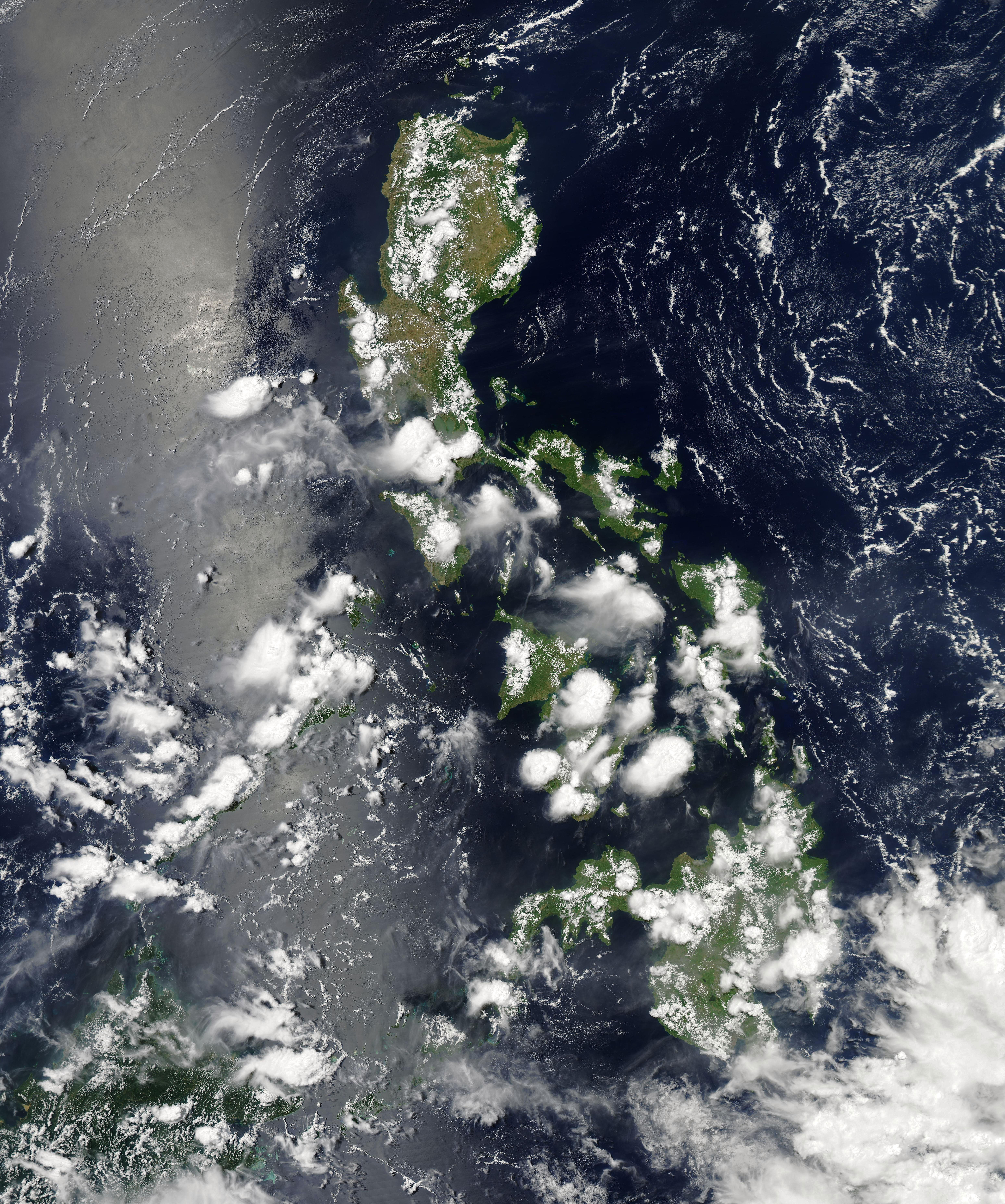
The Philippines has five types of climates: tropical rainforest, tropical monsoon, tropical savanna, humid subtropical and oceanic (the latter two are found in higher-altitude areas). The country overall is characterized by relatively high temperature, oppressive humidity and plenty of rainfall. There are two seasons in the country: the wet season and the dry season, based upon the amount of rainfall. This is also dependent on location in the country as some areas experience rain all throughout the year (see ). The warm months of the year are March through October; the winter monsoon brings cooler air from November to February. May is the warmest month, and January, the coolest.
Weather in the Philippines is monitored by the PAGASA (Philippine Atmospheric, Geophysical and Astronomical Services Administration).
Rainfall
Monsoons are large-scale sea breezes which occur when the temperature on land is significantly warmer or cooler than the temperature of the ocean. Most summer monsoons or southwest monsoons () have a dominant westerly component and a strong tendency to ascend and produce copious amounts of rain (because of the condensation of water vapor in the rising air). The intensity and duration, however, are not uniform from year to year. Winter monsoons or northeast monsoons (), by contrast, have a dominant easterly component and a strong tendency to diverge, subside and cause drought.

The summer monsoon brings heavy rains to most of the archipelago from May to October. Annual average rainfall ranges from as much as 5000 mm in the mountainous east coast section of the country, to less than 1000 mm in some of the sheltered valleys. Monsoon rains, although hard and drenching, are not normally associated with high winds and waves.
At least 30 percent of the annual rainfall in the northern Philippines can be traced to tropical cyclones, while the southern islands receiving less than 10 percent of their annual rainfall from tropical cyclones. The wettest known tropical cyclone to impact the archipelago was the July 1911 cyclone, when the total precipitation for Baguio was distributed over the four days as: 14th – 879.8 mm, 15th – 733.6 mm, 16th – 424.9 mm, 17th – 200.4 mm; followed by extraordinary drought from October 1911 to May 1912, so that the annual amount of those two years were hardly noticeable.
Typhoons
Main article: Typhoons in the Philippines
The Philippine archipelago sits across the typhoon belt, where dangerous storms occur from July through October. Climate change exacerbates the situation with typhoons in the Philippines. Bagyo is the Filipino term for any tropical cyclone in the Philippine Islands. From the statistics gathered by PAGASA from 1948 to 2004, around 28 storms and/or typhoons per year enter the Philippine Area of Responsibility (PAR) – the designated area assigned to PAGASA to monitor during weather disturbances. Of those that made landfall or crossed the Philippines, the average was nine per year. In 1993, a record nineteen typhoons made landfall in the country, making it the most in one year. The fewest per year were four during the years 1955, 1958, 1992, and 1997.
PAGASA categorizes typhoons into five types according to wind speed. Once a tropical cyclone enters the PAR, regardless of strength, it is given a local name for identification purposes by the media, government, and the general public.
Tropical Cyclone Wind Signals (TCWS)
The Philippines has experienced a number of extremely damaging tropical cyclones, particularly typhoons with sustained winds of at least 185 km/h. For a long time, the Philippines used a four-level warning system to alert citizens of incoming tropical cyclones that would make landfall in the country, but the extensive damage and loss of life caused by Typhoon Haiyan (Yolanda) in 2013 made it inadequate. Because of this, the warning system was increased to five levels, and a Super Typhoon (STY) category was adopted in 2015. Initially, super typhoons were defined as typhoons with maximum sustained winds of more than 220 km/h, but the threshold was lowered to those of at least 185 km/h after PAGASA revised its system of wind signals in 2022.
Notable typhoons to hit the Philippines
This list only includes super typhoons that made landfall in the country at powerful wind speeds and intensities, and wrought extensive damage at the same time. Several weaker storms have made landfall in the country, although they produced extensive damage and high losses of life, such as tropical storms Ondoy and Sendong, both of which accumulated over 400 deaths.
Typhoon Angela (Rosing, 1995)
In November 1995, Typhoon Angela, a catastrophic Category 5-equivalent super typhoon, known locally as Rosing, made landfall in the province of Catanduanes and skirted throughout the island of Luzon. Bicol Region and Metro Manila were the hardest hit areas, and signal #4 was even raised in the latter, a feat that would not happen in the area for 25 years. One-minute sustained winds reached speeds of 290 km/h. Rosing took 936 lives and caused over 10 billion pesos in damage. It was considered the most powerful typhoon to ever hit Metro Manila in terms of wind speeds.
Typhoon Bopha (Pablo, 2012)
The most powerful typhoon to ever strike the island of Mindanao, typhoon Bopha, locally known as Pablo, made landfall in eastern Mindanao as a powerful category 5-equivalent super typhoon, with one-minute measured sustained winds reaching speeds of 280 km/h. Davao Region was one of the worst hit areas, particularly Davao Oriental, where the typhoon made its first land interaction. Over 42 billion pesos (US$1.04 billion) was recorded over time, making it the costliest storm to impact Mindanao, as well as the whole country, at that time. At least 1,067 people died and 834 people were reported missing. Most of the damage was caused by storm surges and winds.
Typhoon Haiyan (Yolanda, 2013)
One of the most powerful storms to make landfall anywhere in the world in terms of wind speeds, Typhoon Haiyan, locally known as Yolanda, made landfall in several areas across the country in November of 2013 as a Category 5-equivalent super typhoon. The islands of Leyte and Samar were the hardest hit by the typhoon, especially the city of Tacloban, where the storm's eyewall passed through. More than 6,300 people died from its storm surges and powerful winds, with damages up to 90 billion pesos, making it the deadliest and most destructive typhoon to hit the country on record. In addition, over 1,000 went missing, and nearly 20,000 were injured. One-minute sustained winds reached up to 315 km/h, cementing Yolanda (Haiyan) as the strongest storm in history in terms of reliably measured wind speeds, until it was surpassed by Hurricane Patricia of the eastern Pacific region in 2015.
Typhoon Goni (Rolly, 2020)
The most powerful tropical cyclone to make landfall anywhere in the world in terms of one-minute measured wind speeds, Typhoon Goni, locally known as Rolly, made landfall in Catanduanes as a powerful Category 5-equivalent super typhoon, and was one of the series of storms that made landfall in the Philippines between October and November 2020. At landfall, one-minute measured wind speeds were at 315 km/h. Bicol Region was the worst hit by the typhoon, and signal #4 was once again raised in Metro Manila, the first time since the above-mentioned Angela (Rosing). Evacuation processes were also complicated due to the COVID-19 pandemic, as health and safety protocols were implemented at the time of impact to prevent the spread of the virus. Damages from the storm reached over 20 billion pesos (US$369 million).
Climate types {{anchor|Coronas Climate Types}}
| Four kinds of tropical sunshine (°C) | Four kinds of tropical rain (mm) | |
|---|---|---|
| {{Graph:Chart | width = 290 | |
| {{Graph:Chart | type=rect | width = 290 |
There are four recognized climate types in the Philippines, and they are based on the distribution of rainfall (See the Philippine Climate Map at the top). They are described as follows:
| Type IV | Rainfall is more or less evenly distributed throughout the year. |
|---|
| Climate: Type I | Manila | Jan | Feb | Mar | Apr | May | Jun | Jul | Aug | Sep | Oct | Nov | Dec | Year | climate-data.org February 2016 | |
|---|---|---|---|---|---|---|---|---|---|---|---|---|---|---|---|---|
| Average high | °C | |||||||||||||||
| °F | 29.8 C | 30.6 C | 32.3 C | 33.7 C | 33.8 C | 32.1 C | 31.0 C | 30.5 C | 30.6 C | 30.9 C | 30.5 C | 29.7 C | {{rnd | (29.8+30.6+32.3+33.7+33.8+32.1+31.0+30.5+30.6+30.9+30.5+29.7)/12 | 1}} C | |
| Average mean | °C | |||||||||||||||
| °F | 25.7 C | 26.1 C | 27.5 C | 28.8 C | 29.3 C | 28.3 C | 27.5 C | 27.3 C | 27.2 C | 27.3 C | 26.8 C | 25.9 C | {{rnd | (25.7+26.1+27.5+28.8+29.3+28.3+27.5+27.3+27.2+27.3+26.8+25.9)/12 | 1}} C | |
| Average low | °C | |||||||||||||||
| °F | 21.6 C | 21.6 C | 22.7 C | 24.0 C | 24.9 C | 24.6 C | 24.1 C | 24.1 C | 23.9 C | 23.7 C | 23.1 C | 22.2 C | {{rnd | (21.6+21.6+22.7+24.0+24.9+24.6+24.1+24.1+23.9+23.7+23.1+22.2)/12 | 1}} C | |
| Average rainfall | mm | |||||||||||||||
| in | 17 mm | 8 mm | 13 mm | 26 mm | 125 mm | 273 mm | 407 mm | 441 mm | 346 mm | 193 mm | 135 mm | 63 mm | {{rnd | 17+8+13+26+125+273+407+441+346+193+135+63 | 0}} mm |
|- |
| Climate: Type II | Borongan, Eastern Samar | Jan | Feb | Mar | Apr | May | Jun | Jul | Aug | Sep | Oct | Nov | Dec | Year | climate-data.org February 2016 | |
|---|---|---|---|---|---|---|---|---|---|---|---|---|---|---|---|---|
| Average high | °C | |||||||||||||||
| °F | 29.1 C | 29.3 C | 30.1 C | 31.1 C | 31.8 C | 32.1 C | 32.0 C | 32.2 C | 32.3 C | 31.5 C | 30.5 C | 29.7 C | {{rnd | (29.1+29.3+30.1+31.1+31.8+32.1+32.0+32.2+32.3+31.5+30.5+29.7)/12 | 1}} C | |
| Average mean | °C | |||||||||||||||
| °F | 25.8 C | 25.8 C | 26.4 C | 27.1 C | 27.7 C | 27.9 C | 27.8 C | 27.9 C | 28.0 C | 27.4 C | 26.7 C | 26.3 C | {{rnd | ( 25.8+25.8+26.4+27.1+27.7+27.9+27.8+27.9+28.0+27.4+26.7+26.3)/12 | 1}} C | |
| Average low | °C | |||||||||||||||
| °F | 22.5 C | 22.4 C | 22.7 C | 23.2 C | 23.7 C | 23.7 C | 23.6 C | 23.7 C | 23.7 C | 23.3 C | 23.0 C | 22.9 C | {{rnd | (22.5+22.4+22.7+23.2+23.7+23.7+23.6+23.7+23.7+23.3+23.0+22.9)/12 | 1}} C | |
| Average rainfall | mm | |||||||||||||||
| in | 565 mm | 394 mm | 308 mm | 262 mm | 315 mm | 221 mm | 218 mm | 201 mm | 194 mm | 290 mm | 508 mm | 633 mm | {{rnd | 565+394+308+262+315+221+218+201+194+290+508+633 | 0}} mm |
|- |
| Climate: Type III | Cebu City | Jan | Feb | Mar | Apr | May | Jun | Jul | Aug | Sep | Oct | Nov | Dec | Year | climate-data.org February 2016 | |
|---|---|---|---|---|---|---|---|---|---|---|---|---|---|---|---|---|
| Average high | °C | |||||||||||||||
| °F | 30.2 C | 30.4 C | 31.4 C | 32.5 C | 33.0 C | 32.3 C | 31.9 C | 31.9 C | 31.7 C | 31.5 C | 31.3 C | 30.7 C | {{rnd | (30.2+30.4+31.4+32.5+33.0+32.3+31.9+31.9+31.7+31.5+31.3+30.7)/12 | 1}} C | |
| Average mean | °C | |||||||||||||||
| °F | 26.3 C | 26.5 C | 27.1 C | 28.1 C | 28.6 C | 28.2 C | 27.9 C | 27.9 C | 27.7 C | 27.5 C | 27.4 C | 26.9 C | {{rnd | (26.3+26.5+27.1+28.1+28.6+28.2+27.9+27.9+27.7+27.5+27.4+26.9)/12 | 1}} C | |
| Average low | °C | |||||||||||||||
| °F | 22.5 C | 22.6 C | 22.8 C | 23.7 C | 24.3 C | 24.1 C | 23.9 C | 24.0 C | 23.7 C | 23.6 C | 23.5 C | 23.1 C | {{rnd | (22.5+22.6+22.8+23.7+24.3+24.1+23.9+24.0+23.7+23.6+23.5+23.1)/12 | 1}} C | |
| Average rainfall | mm | |||||||||||||||
| in | 103 mm | 79 mm | 59 mm | 65 mm | 115 mm | 176 mm | 192 mm | 164 mm | 174 mm | 193 mm | 166 mm | 121 mm | {{rnd | 103+79+59+65+115+176+192+164+174+193+166+121 | 0}} mm |
|- |
| Climate: Type IV | General Santos | Jan | Feb | Mar | Apr | May | Jun | Jul | Aug | Sep | Oct | Nov | Dec | Year | climate-data.org February 2016 | |
|---|---|---|---|---|---|---|---|---|---|---|---|---|---|---|---|---|
| Average high | °C | |||||||||||||||
| °F | 32.2 C | 32.5 C | 33.1 C | 33.4 C | 32.3 C | 31.4 C | 31.0 C | 31.1 C | 31.5 C | 31.9 C | 31.2 C | 32.1 C | {{rnd | (32.2+32.5+33.1+33.4+32.3+31.4+31.0+31.1+31.5+31.9+32.2+32.1)/12 | 1}} C | |
| Average mean | °C | |||||||||||||||
| °F | 26.8 C | 27.0 C | 27.4 C | 27.9 C | 27.5 C | 26.9 C | 26.5 C | 26.5 C | 26.8 C | 27.1 C | 27.1 C | 26.9 C | {{rnd | (26.8+27.0+27.4+27.9+27.5+26.9+26.5+26.5+26.8+27.1+27.1+26.9)/12 | 1}} C | |
| Average low | °C | |||||||||||||||
| °F | 21.4 C | 21.5 C | 21.7 C | 22.4 C | 22.7 C | 22.4 C | 22.0 C | 22.0 C | 22.2 C | 22.3 C | 22.0 C | 21.8 C | {{rnd | (21.4+21.5+21.7+22.4+22.7+22.4+22.0+22.0+22.2+22.3+22.0+21.8)/12 | 1}} C | |
| Average rainfall | mm | |||||||||||||||
| in | 68 mm | 69 mm | 47 mm | 57 mm | 108 mm | 118 mm | 110 mm | 93 mm | 84 mm | 113 mm | 98 mm | 87 mm | {{rnd | 68+69+47+57+108+118+110+93+84+113+98+87 | 0}} mm |
|}
Temperature
The average year-round temperature measured from all the weather stations in the Philippines, except Baguio, is 26.6 C. Cooler days are usually felt in the month of January with temperature averaging at 25.5 C and the warmest days, in the month of May with a mean of 28.3 C. Elevation factors significantly in the variation of temperature in the Philippines. In Baguio, with an elevation of 1,500 m above sea level, the mean average is 18.3 °C or cooler by about 4.3 C-change. In 1915, a one-year study was conducted by William H. Brown of the Philippine Journal of Science on top of Mount Banahaw at 2,100 m elevation. The mean temperature measured was 18.6 °C, a difference of 10 C-change from the lowland mean temperature.
| Category | Jan | Feb | Mar | Apr | May | Jun | Jul | Aug | Sep | Oct | Nov | Dec |
|---|---|---|---|---|---|---|---|---|---|---|---|---|
| Min | 20.67 | 20.57 | 21.09 | 21.98 | 22.55 | 22.35 | 22.03 | 22.07 | 21.97 | 21.76 | 21.64 | 21.31 |
| Mean | 24.72 | 24.88 | 25.71 | 26.68 | 27.02 | 26.47 | 25.94 | 25.92 | 25.9 | 25.83 | 25.65 | 25.21 |
| Max | 28.82 | 29.24 | 30.38 | 31.42 | 31.54 | 30.65 | 29.9 | 29.82 | 29.87 | 29.96 | 29.72 | 29.16 |
| Precipitation (mm) | 136.93 | 96.05 | 92.56 | 97.66 | 188.95 | 248.37 | 291.02 | 310.68 | 281.05 | 280.74 | 230.51 | 206.84 |
Humidity
Relative humidity is high in the Philippines. A high amount of moisture in the air makes hot temperatures feel hotter. This quantity of moisture is due to different factors, including evaporation from the seas that surround the country on all sides, the different prevailing winds in the different seasons of the year, and abundant tropical rain. The first may be considered a general cause of the great humidity, which is generally observed in all the islands throughout the year. The last two may influence the different degrees of humidity for the different months of the year and for the different regions of the archipelago.
Seasons
The climate of the country is divided into two main seasons:
- the rainy season, from May or June to October; associated with the Southwest Monsoon (Hanging Habagat). In 2025, the Philippine Atmospheric, Geophysical and Astronomical Services Administration (PAGASA) officially declared the start of the rainy season on June 3.
- the dry season, from October or November to May or June. The dry season may be subdivided further into (a) the cool dry season, from October or November to March or April, associated with the Northeast Monsoon (Hanging Amihan) and (b) the hot dry season, from March or April to May or June.
| Months | November–February | March–May | June–August | September–October | Rainfall | Temperature | Season |
|---|---|---|---|---|---|---|---|
| Dry | Wet | ||||||
| Cool | Hot | ||||||
| Cool Dry | Hot Dry | Rainy |
Climate change
Notes
References
Sources
-
{{cite book |archive-date = December 22, 2015 |access-date = December 6, 2015 |archive-url = https://web.archive.org/web/20151222154921/http://quod.lib.umich.edu/p/philamer/agh9000.0001.001 |url-status = live
-
{{cite book | editor1-first = Hidetoshi | editor1-last = Arakawa
-
{{cite book | author1-link = Roman Kintanar
References
- link. (August 6, 2011 Retrieved on June 11, 2008.)
- Overland, Indra et al. (2017) ''[https://www.researchgate.net/publication/320622312 Impact of Climate Change on ASEAN International Affairs: Risk and Opportunity Multiplier] {{Webarchive. link. (July 28, 2020 '', Norwegian Institute of International Affairs (NUPI) and Myanmar Institute of International and Strategic Studies (MISIS).)
- Philippine Atmospheric, Geophysical and Astronomical Services Administration. "[http://kidlat.pagasa.dost.gov.ph/cab/statfram.htm Tropical Cyclone Statistics] {{webarchive. link. (May 25, 2013". Retrieved on June 26, 2010.)
- [[Atlantic Oceanographic and Meteorological Laboratory]], [[Hurricane]] Research Division. "Frequently Asked Questions: What are the upcoming tropical cyclone names?". [[National Oceanic and Atmospheric Administration.
- (March 23, 2022). "PAGASA redefines 'super typhoon', revises wind signals". [[ABS-CBN News]].
- "Climatological Information for Manila". AmbiWeb GmbH.
- "Climatological Information for Borongan, Eastern Samar". AmbiWeb GmbH.
- "Climatological Information for Cebu City". AmbiWeb GmbH.
- "Climatological Information for General Santos". AmbiWeb GmbH.
- "World Bank Climate Change Knowledge Portal".
- (May 30, 2025). "Southwest monsoon now here, and rainy season not far behind".
- (October 7, 2024). "Southwest monsoon season over for 2024, says PAGASA".
- Ong, Ghio. "PAGASA declares onset of rainy season".
- (26 March 2021). "'Summer' is here: Philippines' hot dry season begins". [[Rappler]].
- "Climate of the Philippines". Philippine Atmospheric, Geophysical and Astronomical Services Administration.
This article was imported from Wikipedia and is available under the Creative Commons Attribution-ShareAlike 4.0 License. Content has been adapted to SurfDoc format. Original contributors can be found on the article history page.
Ask Mako anything about Climate of the Philippines — get instant answers, deeper analysis, and related topics.
Research with MakoFree with your Surf account
Create a free account to save articles, ask Mako questions, and organize your research.
Sign up freeThis content may have been generated or modified by AI. CloudSurf Software LLC is not responsible for the accuracy, completeness, or reliability of AI-generated content. Always verify important information from primary sources.
Report