From Surf Wiki (app.surf) — the open knowledge base
Clark County, Missouri
County in Missouri, United States

County in Missouri, United States
| Field | Value |
|---|---|
| county | Clark County |
| state | Missouri |
| founded year | 1836 |
| founded date | December 16 |
| seat wl | Kahoka |
| largest city wl | Kahoka |
| area_total_sq_mi | 512 |
| area_land_sq_mi | 505 |
| area_water_sq_mi | 7.1 |
| area percentage | 1.4 |
| population_as_of | 2020 |
| population_total | 6634 |
| population_density_sq_mi | auto |
| time zone | Central |
| named for | William Clark |
| district | 6th |
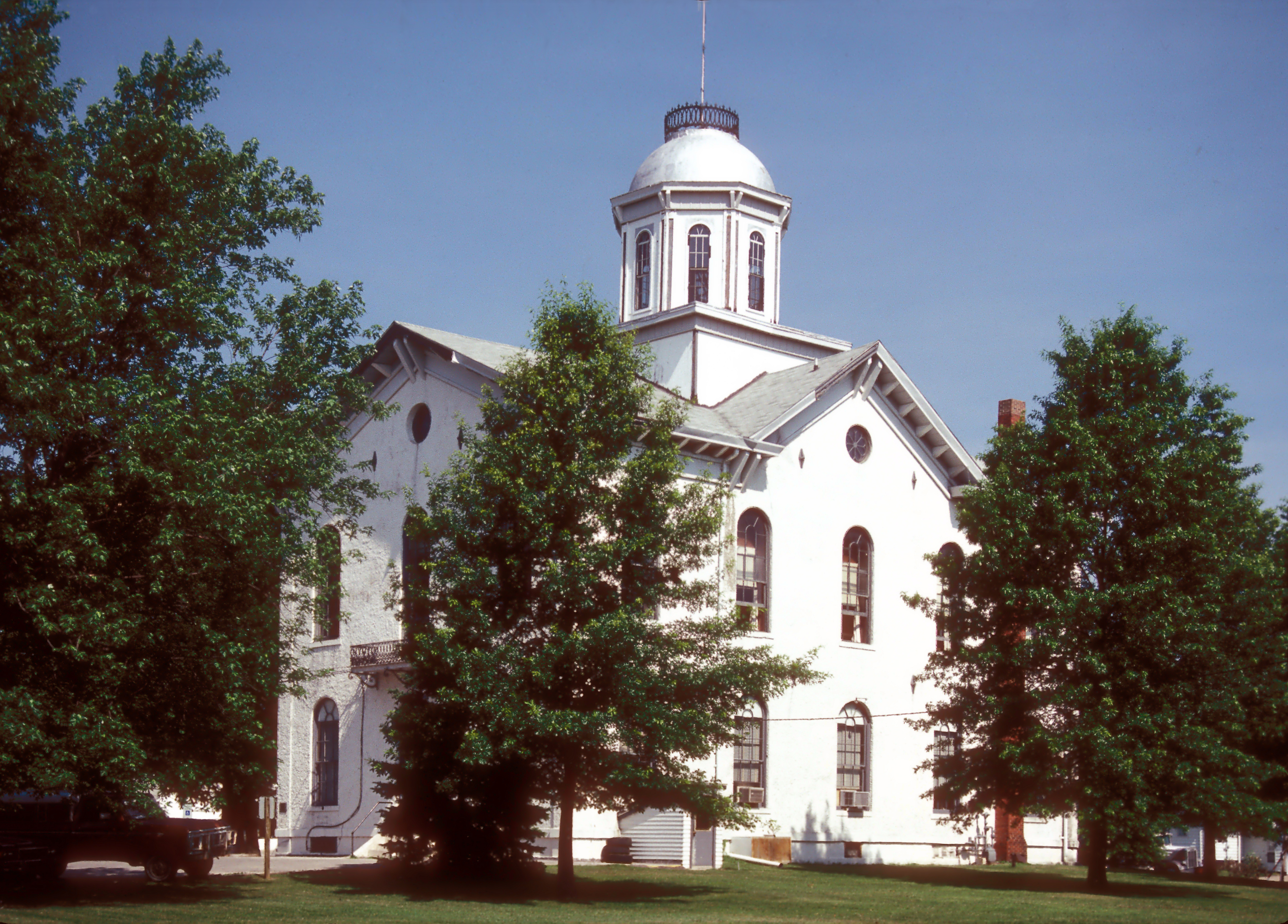
| ex image | Clark County MO courthouse 20151003-014.jpg |
| ex image cap | Clark County Courthouse in Kahoka |
| website | https://clarkcountymo.org/ |
Clark County is a county located in the U.S. state of Missouri. As of the 2020 census, its population was 6,634. Its county seat is Kahoka. The county was organized December 16, 1836, and named for William Clark, leader of the Lewis and Clark Expedition and later Governor of Missouri Territory.
Clark County is part of the Fort Madison–Keokuk, IA-IL-MO Micropolitan Statistical Area.
History
Missouri folklorist Margot Ford McMillen wrote that early settlers were attracted by Clark County's good and inexpensive agricultural land. One section was called "Bit Nation" because land was sold there for just twelve and one-half cents ("one bit" of a Spanish dollar) an acre. In 1861, the Battle of Athens during the American Civil War took place in the town of Athens, Missouri in Clark County. The Battle of Athens Historical Site is a state park in Clark County at the site of the battle.
Geography
According to the U.S. Census Bureau, the county has a total area of 512 sqmi, of which 505 sqmi is land and 7.1 sqmi (1.4%) is water.
Adjacent counties
- Van Buren County, Iowa (north)
- Lee County, Iowa (northeast)
- Hancock County, Illinois (east)
- Lewis County (south)
- Knox County (southwest)
- Scotland County (west)
Major highways
- [[File:US 61.svg|20px]] U.S. Route 61
- [[File:US 136.svg|25px]] U.S. Route 136
- [[File:MO-27.svg|20px]] Route 27
- [[File:MO-81.svg|20px]] Route 81
National protected area
- Great River National Wildlife Refuge (part)
Demographics
|align-fn=center 1790-1960 1900-1990 1990-2000 2010-2015
2020 census
As of the 2020 census, the county had a population of 6,634. The median age was 43.5 years. 23.7% of residents were under the age of 18 and 22.3% of residents were 65 years of age or older. For every 100 females there were 101.8 males, and for every 100 females age 18 and over there were 99.9 males age 18 and over.
The racial makeup of the county was 95.9% White, 0.3% Black or African American, 0.1% American Indian and Alaska Native, 0.2% Asian, 0.0% Native Hawaiian and Pacific Islander, 0.3% from some other race, and 3.2% from two or more races. Hispanic or Latino residents of any race comprised 0.8% of the population.
As of the 2020 census, 0.0% of residents lived in urban areas, while 100.0% lived in rural areas.
There were 2,752 households in the county, of which 28.2% had children under the age of 18 living with them and 23.2% had a female householder with no spouse or partner present. About 31.2% of all households were made up of individuals and 16.1% had someone living alone who was 65 years of age or older.
There were 3,216 housing units, of which 14.4% were vacant. Among occupied housing units, 75.4% were owner-occupied and 24.6% were renter-occupied. The homeowner vacancy rate was 1.4% and the rental vacancy rate was 5.4%.
Racial and ethnic composition
| Race / Ethnicity (NH = Non-Hispanic) | title=1980 Census of Population - General Social and Economic Characteristics - Missouri- Table 16 - Persons by Spanish Origin, Race, and Sex: 1980 | url=https://www2.census.gov/library/publications/decennial/1980/volume-1/missouri/1980a_moabc-02.pdf | website=United States Census Bureau | page=20-25}} | Pop 1990 | title=P004: Hispanic or Latino, and Not Hispanic or Latino by Race – 2000: DEC Summary File 1 – Clark County, Missouri | url=https://data.census.gov/table?g=050XX00US29045&tid=DECENNIALSF12000.P004 | website=United States Census Bureau | access-date= }} | title=P2: Hispanic or Latino, and Not Hispanic or Latino by Race – 2010: DEC Redistricting Data (PL 94-171) – Clark County, Missouri | url=https://data.census.gov/cedsci/table?q=p2&g=050XX00US29045&tid=DECENNIALPL2010.P2 | website=United States Census Bureau | access-date= }} | Pop 2020 | % 1980 | % 1990 | % 2000 | % 2010 | % 2020 |
|---|---|---|---|---|---|---|---|---|---|---|---|---|---|---|---|---|---|---|---|
| White alone (NH) | 8,447 | 7,506 | 7,294 | 6,978 | 6,337 | 99.46% | 99.46% | 98.35% | 97.74% | 95.52% | |||||||||
| Black or African American alone (NH) | 6 | 3 | 5 | 19 | 21 | 0.07% | 0.04% | 0.07% | 0.27% | 0.32% | |||||||||
| Native American or Alaska Native alone (NH) | 3 | 6 | 15 | 8 | 9 | 0.04% | 0.08% | 0.20% | 0.11% | 0.14% | |||||||||
| Asian alone (NH) | 7 | 4 | 5 | 22 | 12 | 0.08% | 0.05% | 0.07% | 0.31% | 0.18% | |||||||||
| Native Hawaiian or Pacific Islander alone (NH) | x | x | 1 | 0 | 0 | x | x | 0.01% | 0.00% | 0.00% | |||||||||
| Other race alone (NH) | 2 | 2 | 0 | 0 | 10 | 0.02% | 0.03% | 0.00% | 0.00% | 0.15% | |||||||||
| Mixed race or Multiracial (NH) | x | x | 44 | 70 | 195 | x | x | 0.59% | 0.98% | 2.94% | |||||||||
| Hispanic or Latino (any race) | 28 | 26 | 52 | 42 | 50 | 0.33% | 0.34% | 0.70% | 0.59% | 0.75% | |||||||||
| Total | 8,493 | 7,547 | 7,416 | 7,139 | 6,634 | 100.00% | 100.00% | 100.00% | 100.00% | 100.00% |
2010 census
As of the census of 2010, there were 7,139 people, 2,966 households, and 2,079 families residing in the county. The population density was 15 /mi2. There were 3,483 housing units at an average density of 7 /mi2. The racial makeup of the county was 98.83% White, 0.07% Black or African American, 0.20% Native American, 0.07% Asian, 0.01% Pacific Islander, 0.22% from other races, and 0.61% from two or more races. Approximately 0.70% of the population were Hispanic or Latino of any race.
There were 2,966 households, out of which 30.30% had children under the age of 18 living with them, 58.70% were married couples living together, 7.00% had a female householder with no husband present, and 29.90% were non-families. 26.40% of all households were made up of individuals, and 13.60% had someone living alone who was 65 years of age or older. The average household size was 2.46 and the average family size was 2.95.
In the county, the population was spread out, with 25.00% under the age of 18, 7.80% from 18 to 24, 25.50% from 25 to 44, 25.00% from 45 to 64, and 16.70% who were 65 years of age or older. The median age was 39 years. For every 100 females, there were 97.60 males. For every 100 females age 18 and over, there were 94.00 males.
The median income for a household in the county was $29,457, and the median income for a family was $36,270. Males had a median income of $27,279 versus $19,917 for females. The per capita income for the county was $15,988. About 10.80% of families and 14.10% of the population were below the poverty line, including 19.70% of those under age 18 and 12.70% of those age 65 or over.
Education
There are four school districts covering portions of the county, including those which have schools and/or administration buildings in other counties:
- Canton R-V School District
- Clark County R-I School District
- Lewis County C-1 School District
- Scotland County R-I School District
Wyaconda C-1 School District closed in 2008. The Revere C-3 School District closed in 2012.
Public schools
- Clark County R-I School District – Kahoka
- Running Fox Elementary School (PK-05)
- Black Hawk Elementary School (K-05)
- Clark County Middle School (06-08)
- Clark County High School (09-12)
Private schools
- Shiloh Christian School – Kahoka (03-12) – Nondenominational Christianity
Public libraries
- Northeast Missouri Library Service
Communities
Cities
- Alexandria
- Kahoka (county seat)
- Revere
- Wayland
- Wyaconda
Villages
- Luray
Census-designated places
- Medill
- St. Francisville
Other unincorporated places
- Acasto
- Anson
- Antioch
- Ashton
- Athens
- Chambersburg
- Clark City
- Dumas
- Fairmont
- Gregory Landing
- Neeper
- Peaksville
- St. Patrick
- Union
- Waterloo
- Winchester
Townships (all inactive)
- Clay
- Des Moines
- Folker
- Grant
- Jackson
- Jefferson
- Lincoln
- Madison
- Sweet Home
- Union
- Vernon
- Washington
- Wyaconda
Politics
Local
The Republican Party controls politics at the local level in Clark County. As of 2018, Republicans hold nine of fourteen of the elected positions in the county.
State
| Year | Republican | Democratic | Third Parties |
|---|---|---|---|
| 2024 | 80.10% 2,616 | 17.02% 556 | 2.88% 94 |
| 2020 | 79.09% 2,667 | 19.22% 648 | 1.69% 57 |
| 2016 | 62.34% 2,053 | 34.74% 1,144 | 2.92% 96 |
| 2012 | 40.78% 1,312 | 56.64% 1,822 | 2.58% 83 |
| 2008 | 51.33% 1,772 | 46.00% 1,588 | 1.67% 92 |
| 2004 | 66.98% 2,469 | 30.63% 1,129 | 2.38% 88 |
| 2000 | 46.47% 1,751 | 51.17% 1,928 | 2.36% 89 |
| 1996 | 29.87% 966 | 68.46% 2,214 | 1.67% 54 |
All of Clark County is included in Missouri's 4th District in the Missouri House of Representatives and is represented by Craig Redmon (R-Ewing).
All of Clark County is a part of Missouri's 18th District in the Missouri Senate and is currently represented by Cindy O'Laughlin (R-Shelbina).
Federal
All of Clark County is included in Missouri's 6th Congressional District and is currently represented by Sam Graves (R-Tarkio) in the U.S. House of Representatives.
References
References
- "2020: DEC Redistricting Data (PL 94-171)". [[United States Census Bureau]].
- "Find a County". National Association of Counties.
- Eaton, David Wolfe. (1916). "How Missouri Counties, Towns and Streams Were Named". The State Historical Society of Missouri.
- Gannett, Henry. (1905). "The Origin of Certain Place Names in the United States". Govt. Print. Off..
- McMillen, Margot Ford. (1994). "''Paris, Tightwad and Peculiar: Missouri Place Names''". University of Missouri Press.
- "Battle of Athens State Historical Site". Missouri Department of Natural Resources.
- (August 22, 2012). "2010 Census Gazetteer Files". United States Census Bureau.
- "U.S. Decennial Census". United States Census Bureau.
- "Historical Census Browser". University of Virginia Library.
- "Population of Counties by Decennial Census: 1900 to 1990". United States Census Bureau.
- "Census 2000 PHC-T-4. Ranking Tables for Counties: 1990 and 2000". United States Census Bureau.
- (2021). "2020 Decennial Census Demographic Profile (DP1)".
- (2021). "2020 Decennial Census Redistricting Data (Public Law 94-171)".
- (2023). "2020 Decennial Census Demographic and Housing Characteristics (DHC)".
- "1980 Census of Population - General Social and Economic Characteristics - Missouri- Table 16 - Persons by Spanish Origin, Race, and Sex: 1980".
- "1990 Census of Population - General Population Characteristics - Missouri: Table 5 - Race and Hispanic Origin".
- "P004: Hispanic or Latino, and Not Hispanic or Latino by Race – 2000: DEC Summary File 1 – Clark County, Missouri".
- "P2: Hispanic or Latino, and Not Hispanic or Latino by Race – 2010: DEC Redistricting Data (PL 94-171) – Clark County, Missouri".
- "P2: Hispanic or Latino, and Not Hispanic or Latino by Race – 2020: DEC Redistricting Data (PL 94-171) – Clark County, Missouri".
- included in the Asian category in the 1980 Census
- included in the Asian category in the 1990 Census
- not an option in the 1980 Census
- not an option in the 1990 Census
- "U.S. Census website". [[United States Census Bureau]].
- Geography Division. (January 12, 2021). "2020 CENSUS - SCHOOL DISTRICT REFERENCE MAP: Clark County, MO". [[U.S. Census Bureau]].
- Pierceall, Ann. (2008-05-16). "Sting of disappointment lingers over Wyaconda school district's last day". [[Herald-Whig]].
- Whitfield, Jim. (2012-04-05). "A rural school district will become a part of history". [[KHQA]].
- Breeding, Marshall. "Northeast Missouri Library Service". Libraries.org.
- Leip, David. "Dave Leip's Atlas of U.S. Presidential Elections".
This article was imported from Wikipedia and is available under the Creative Commons Attribution-ShareAlike 4.0 License. Content has been adapted to SurfDoc format. Original contributors can be found on the article history page.
Ask Mako anything about Clark County, Missouri — get instant answers, deeper analysis, and related topics.
Research with MakoFree with your Surf account
Create a free account to save articles, ask Mako questions, and organize your research.
Sign up freeThis content may have been generated or modified by AI. CloudSurf Software LLC is not responsible for the accuracy, completeness, or reliability of AI-generated content. Always verify important information from primary sources.
Report