From Surf Wiki (app.surf) — the open knowledge base
City of Brisbane
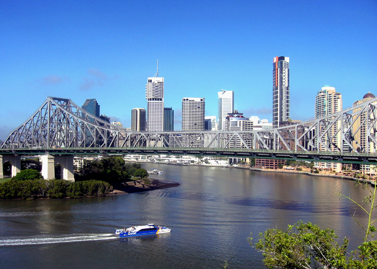
.jpg)
| Field | Value |
|---|---|
| type | lga |
| name | City of Brisbane |
| state | qld |
| image | {{multiple image |
| border | infobox |
| total_width | 280 |
| perrow | 1/1 |
| caption_align | center |
| image1 | SEQ-Councils-Brisbane.png |
| caption1 | Location within South East Queensland |
| image2 | Flag_of_Brisbane.svg |
| caption2 | Flag of the City of Brisbane |
| coordinates | |
| local_map | yes |
| zoom | 8 -- |
| pop | 1242825 |
| pop_year | |
| pop_footnotes | |
| poprank | 1st |
| est | 30 October 1924 |
| area | 1342.7 |
| area_footnotes | |
| timezone | AEST |
| utc | +10:00 |
| mayor | Adrian Schrinner (LNP) |
| mayortitle | Lord Mayor |
| seat | Brisbane CBD (City Hall) |
| region | South East Queensland |
| stategov | Algester, Aspley, Bulimba, Chatsworth, Clayfield, Cooper, Everton, Ferny Grove, Greenslopes, Inala, Lytton, Maiwar, Mansfield, McConnel, Miller, Moggill, Mount Ommaney, Nudgee, Sandgate, South Brisbane, Stafford, Stretton, Toohey |
| fedgov | Brisbane, Blair, Bonner, Dickson, Griffith, Lilley, Moreton, Oxley, Petrie, Rankin, Ryan |
| logo | Brisbane City Council.svg |
| url | http://www.brisbane.qld.gov.au/ |
| near-n | Moreton Bay |
| near-ne | Moreton Bay |
| near-e | Moreton Bay |
| near-se | Redland |
| near-s | Logan |
| near-sw | Ipswich |
| near-w | Somerset |
| near-nw | Somerset |
the local government area that has jurisdiction that serves the city proper
| near-n = Moreton Bay | near-ne = Moreton Bay | near-e = Moreton Bay | near-se = Redland | near-s = Logan | near-sw = Ipswich | near-w = Somerset | near-nw = Somerset The City of Brisbane is a local government area (LGA) which comprises the inner portion of Greater Brisbane, the capital of Queensland, Australia. Its governing body is the Brisbane City Council.
The LGAs in the other mainland state capitals (Sydney, Melbourne, Perth and Adelaide) are generally responsible only for the central business districts and inner neighbourhoods of those cities. However, the City of Brisbane administers a significant portion of the Brisbane Greater Capital City Statistical Area (GCCSA), accounting for just under half its population. As such, it has a larger population than any other local government area in Australia. The City of Brisbane was the first Australian LGA to reach a population of more than one million. Its population is roughly equivalent to the populations of Tasmania, the Australian Capital Territory and the Northern Territory combined. In 2016–2017, the council administered a budget of over $3 billion, by far the largest budget compared to those of the City of Sydney and City of Melbourne LGAs.
The City derives from cities, towns and shires that merged in 1925. The main offices and central library of the council are at 266 George Street, also known as Brisbane Square. Brisbane City Hall houses the Council Chamber, the offices of the Lord Mayor and Deputy Mayor, meeting and reception rooms and the Museum of Brisbane.
In the , the City of Brisbane had a population of 1,242,825 people.
Suburbs
The City of Brisbane includes the following settlements:
Inner suburbs
- Bardon
- Bowen Hills
- Brisbane CBD
- East Brisbane
- Fortitude Valley
- Herston
- Highgate Hill
- Kangaroo Point
- Kelvin Grove
- New Farm
- Newstead
- Paddington
- Petrie Terrace
- Red Hill
- South Brisbane
- Spring Hill
- Teneriffe
- West End
- Woolloongabba
Total: 19
Northern suburbs
- Albion
- Alderley
- Ascot
- Aspley
- Bald Hills
- Banyo
- Boondall
- Bracken Ridge
- Bridgeman Downs
- Brighton
- Brisbane Airport
- Carseldine
- Chermside
- Chermside West
- Clayfield
- Deagon
- Eagle Farm
- Everton Park
- Ferny Grove
- Fitzgibbon
- Gaythorne
- Geebung
- Gordon Park
- Grange
- Hamilton
- Hendra
- Kalinga
- Kedron
- Keperra
- Lutwyche
- McDowall
- Mitchelton
- Myrtletown
- Newmarket
- Northgate
- Nudgee
- Nudgee Beach
- Nundah
- Pinkenba
- Sandgate
- Shorncliffe
- Stafford
- Stafford Heights
- Taigum
- Virginia
- Wavell Heights
- Wilston
- Windsor
- Wooloowin
- Zillmere
Total: 50
Southern suburbs
- Acacia Ridge
- Algester
- Annerley
- Archerfield
- Burbank
- Calamvale
- Coopers Plains
- Darra
- Doolandella
- Drewvale
- Durack
- Dutton Park
- Eight Mile Plains
- Ellen Grove
- Fairfield
- Forest Lake
- Greenslopes
- Heathwood
- Holland Park
- Holland Park West
- Inala
- Karawatha
- Kuraby
- Larapinta
- MacGregor
- Mackenzie
- Mansfield
- Moorooka
- Mount Gravatt
- Mount Gravatt East
- Nathan
- Pallara
- Parkinson
- Richlands
- Robertson
- Rochedale
- Rocklea
- Runcorn
- Salisbury
- Seventeen Mile Rocks
- Sinnamon Park
- Stones Corner
- Stretton
- Sumner
- Sunnybank
- Sunnybank Hills
- Tarragindi
- Tennyson
- Upper Mount Gravatt
- Wacol
- Willawong
- Wishart
- Yeerongpilly
- Yeronga
Total: 54
Eastern suburbs
- Balmoral
- Belmont
- Bulimba
- Camp Hill
- Cannon Hill
- Carina
- Carina Heights
- Carindale
- Chandler
- Coorparoo
- Gumdale
- Hawthorne
- Hemmant
- Lota
- Lytton
- Manly
- Manly West
- Morningside
- Murarrie
- Norman Park
- Port of Brisbane
- Ransome
- Seven Hills
- Tingalpa
- Wakerley
- Wynnum
- Wynnum West
Total: 27
Western suburbs
- Anstead
- Ashgrove
- Auchenflower
- Banks Creek
- Bellbowrie
- Brookfield
- Chapel Hill
- Chelmer
- Chuwar
- Corinda
- England Creek
- Enoggera
- Enoggera Reservoir
- Ferny Grove
- Fig Tree Pocket
- Graceville
- Indooroopilly
- Jamboree Heights
- Jindalee
- Karana Downs
- Kenmore
- Kenmore Hills
- Kholo
- Lake Manchester
- Middle Park
- Milton
- Moggill
- Mount Coot-tha
- Mount Crosby
- Mount Ommaney
- Oxley
- Pinjarra Hills
- Pullenvale
- Riverhills
- Sherwood
- Sinnamon Park
- St Lucia
- Taringa
- The Gap
- Toowong
- Upper Brookfield
- Upper Kedron
- Westlake Total: 43
Moreton Bay
- Bulwer
- Cowan Cowan
- Kooringal
- Moreton Bay
- Moreton Island Total: 5
History


The Government of Queensland created the City of Brisbane with a view to uniting the Brisbane metropolitan area under a single planning and governance structure. The City of Brisbane Act 1924 received assent from the Governor on 30 October 1924. On 1 October 1925, twenty local government areas of various sizes were abolished and merged into the new city, namely:
- Cities:
- Brisbane
- South Brisbane
- Towns:
- Hamilton
- Ithaca
- Sandgate
- Toowong
- Windsor
- Wynnum
- Shires:
- Balmoral
- Belmont
- Coorparoo
- Enoggera
- Kedron
- Moggill
- Sherwood
- Stephens
- Taringa
- Tingalpa
- Toombul
- Yeerongpilly
The council also assumed responsibility for several quasi-autonomous government authorities, such as the Brisbane Tramways Trust.
Demographics
| Selected historical census data for City of Brisbane local government area | Census year | id=LGA31000 | name=City of Brisbane (C) | access-date=3 December 2017 | quick=on}} | id=LGA31000 | name=City of Brisbane (C) | access-date=3 December 2017 | quick=on}} | id=LGA31000 | name=City of Brisbane (C) | access-date=3 December 2017 | quick=on}} | id=LGA31000 | name=Brisbane (C) | access-date=28 August 2020 | quick=on}} | id=LGA31000 | name=Brisbane (C) | access-date=24 October 2022 | quick=on}} | Cultural and language diversity | Religious affiliation | Median weekly incomes | Dwelling structure |
|---|---|---|---|---|---|---|---|---|---|---|---|---|---|---|---|---|---|---|---|---|---|---|---|---|---|
| Population | Estimated residents on census night | 1,242,825 | |||||||||||||||||||||||
| LGA rank in terms of size within Queensland | 1st | 1st | 1st | ||||||||||||||||||||||
| % of Queensland population | 24.37% | 24.49% | 24.05% | 24.05% | |||||||||||||||||||||
| % of Australian population | 4.66% | 4.82% | 4.84% | 4.83% | |||||||||||||||||||||
| Ancestry, | |||||||||||||||||||||||||
| top responses | English | 25.0% | 24.3% | ||||||||||||||||||||||
| Australian | 23.1% | 20.2% | |||||||||||||||||||||||
| Irish | 9.5% | 9.7% | |||||||||||||||||||||||
| Scottish | 7.4% | 7.4% | |||||||||||||||||||||||
| Chinese | 4.1% | 5.2% | |||||||||||||||||||||||
| Language, | |||||||||||||||||||||||||
| top responses | |||||||||||||||||||||||||
| (other than English) | Mandarin | 1.4% | 1.9% | 2.6% | 4.1% | ||||||||||||||||||||
| Cantonese | 1.4% | 1.4% | 1.5% | 1.5% | |||||||||||||||||||||
| Vietnamese | 1.3% | 1.4% | 1.5% | 1.6% | |||||||||||||||||||||
| Italian | 1.1% | 0.9% | 0.8% | ||||||||||||||||||||||
| Greek | 0.8% | 0.7% | |||||||||||||||||||||||
| Spanish | 0.7% | 0.9% | |||||||||||||||||||||||
| Korean | 1.0% | ||||||||||||||||||||||||
| Religious affiliation, | |||||||||||||||||||||||||
| top responses | Catholic | 28.0% | 27.1% | 26.3% | 23.1% | ||||||||||||||||||||
| Anglican | 19.5% | 17.2% | 14.8% | 11.0% | |||||||||||||||||||||
| No religion | 15.0% | 18.5% | 23.3% | 31.6% | |||||||||||||||||||||
| Uniting | 7.8% | 6.6% | 5.6% | 4.0% | |||||||||||||||||||||
| Presbyterian | 3.7% | 3.2% | |||||||||||||||||||||||
| Buddhism | 3.0% | ||||||||||||||||||||||||
| Personal income | Median weekly personal income | 556 | 696 | 770 | |||||||||||||||||||||
| % of Australian median income | 119.3% | 120.6% | 116.3% | ||||||||||||||||||||||
| Family income | Median weekly family income | 1403 | 1873 | 2091 | |||||||||||||||||||||
| % of Australian median income | 119.8% | 126.5% | 120.6% | ||||||||||||||||||||||
| Household income | Median weekly household income | 1157 | 1547 | 1746 | |||||||||||||||||||||
| % of Australian median income | 112.7% | 125.4% | 121.4% | ||||||||||||||||||||||
| Dwelling type | Separate house | 74.7% | 71.9% | 70.9% | 67.4% | ||||||||||||||||||||
| Semi-detached, terrace or townhouse | 6.7% | 7.9% | 9.7% | 10.4% | |||||||||||||||||||||
| Flat or apartment | 17.2% | 19.3% | 18.8% | 21.3% |
Heritage
The Brisbane City Council maintains the Brisbane Local Heritage Register, a list of nominated sites that satisfy the council's heritage criteria.
Governance
Main article: Brisbane City Council
The City of Brisbane is governed by the Brisbane City Council, the largest local council in Australia. The Brisbane City Council has its power divided between a lord mayor, a parliamentary-style council of twenty-six councillors representing single-member wards of approximately 30,000 voters (roughly equivalent in size to state electorates), and a civic cabinet comprising the lord mayor, the deputy mayor (drawn from the majority on council) and the chairpersons of the seven standing committees drawn from the membership of council. Due to the City of Brisbane's status as the country's largest LGA, the lord mayor is elected by the largest single-member electorate in Australia. Like all mayors in Queensland, the lord mayor is vested with very broad executive power.
The Brisbane City Council operates under the City of Brisbane Act 2010, while other local governments in Queensland are governed by the Local Government Act 2009. Council meetings are held at Level 2, City Hall, 64 Adelaide Street, Brisbane City every Tuesday at 2pm except during recess and holiday periods. This temporary venue is in use due to the restoration work being performed on the traditional venue Brisbane City Hall. Council Meetings generally open to the public, excluding the Civic Cabinet.
Wards
|Brisbane City Council |South Brisbane City Council |Hamilton Town Council |Ithaca Town Council |Sandgate Town Council |Toowong Town Council |Windsor Town Council |Wynnum Town Council |Balmoral Shire Council |Belmont Shire Council |Coorparoo Shire Council |Enoggera Shire Council |Kedron Shire Council |Moggill Shire Council |Sherwood Shire Council |Stephens Shire Council |Taringa Shire Council |Tingalpa Shire Council |Toombul Shire Council |Yeerongpilly Shire Council
- Majority (19)
- Opposition (8)
The city of Brisbane is divided by 26 wards, each of which is represented by a councillor. Elections for these positions are held every four years. delivered a Liberal National Party majority, with the wards of the City of Brisbane represented by the following councillors:
| Party | Wards | Current Chamber (Total 26 Wards) | ||
|---|---|---|---|---|
| Liberal National | {{bartable | 19 | ||
| Labor | {{bartable | 5 | ||
| Greens | {{bartable | 2 | ||
| Independent | {{bartable | 1 |
| Ward | Party | Councillor | |
|---|---|---|---|
| Bracken Ridge | LNP | ||
| Calamvale | Labor | ||
| Central | LNP | ||
| Chandler | LNP | ||
| Coorparoo | LNP | ||
| Deagon | Labor | ||
| Doboy | LNP | ||
| Enoggera | LNP | ||
| Forest Lake | Labor | ||
| Hamilton | LNP | ||
| Holland Park | LNP | ||
| Jamboree | LNP | ||
| MacGregor | LNP | ||
| Marchant | LNP | ||
| McDowall | LNP | ||
| Moorooka | Labor | ||
| Morningside | Labor | ||
| Northgate | LNP | ||
| Paddington | Greens | ||
| Pullenvale | LNP | ||
| Runcorn | LNP | ||
| Tennyson | Independent | ||
| The Gabba | Greens | ||
| The Gap | LNP | ||
| Walter Taylor | LNP | ||
| Wynnum Manly | LNP |
Heraldry

The motto of the City of Brisbane is Meliora sequimur, Latin for We aim for better things. The council's corporate slogan is Dedicated to a better Brisbane. The city's colours are blue and gold. Its corporate logo was introduced in 1982 in preparation for the Commonwealth Games hosted in Brisbane that year. It features a stylised version of Brisbane's City Hall which opened in 1930. The city's floral emblems are the (exotic) poinsettia and Brisbane wattle, and its faunal emblems are the graceful tree frog and the koala.
Amenities
Brisbane City Council operate libraries in Annerley, Ashgrove, Banyo, Bracken Ridge, Brisbane CBD (Brisbane Square), Bulimba, Carina, Carindale (Westfield Carindale), Chermside, Coopers Plains, Corinda, Everton Park, Fairfield, Upper Mount Gravatt (Garden City), Grange, Hamilton, Holland Park, Inala, Indooroopilly, Kenmore, Mitchelton, Mount Coot-tha (Botanic Gardens), Mount Gravatt, Mount Ommaney, New Farm, Nundah, Sandgate, Stones Corner, Sunnybank Hills, Toowong, West End, Wynnum, and Zillmere. In addition, it operates a mobile library service to Aspley, Bellbowrie, Brighton, Ellen Grove, Forest Lake, Manly West, Mount Crosby and The Gap. There is also a pop-up library that attends community events and festivals, as well as visiting various parks around Brisbane for children's storytime sessions (a list of dates and places is published some months in advance).
Sister cities
Brisbane's sister cities are:
- UAE Abu Dhabi, United Arab Emirates (2009)
- NZL Auckland, New Zealand (1988)
- CHN Chongqing, China (2005)
- KOR Daejeon, South Korea (2002)
- IND Hyderabad, India (2010)
- TWN Kaohsiung, Taiwan (1997)
- JPN Kobe, Japan (1985)
- IDN Semarang, Indonesia (1993)
- CHN Shenzhen, China (1992)
Nice, France was formerly a sister city of Brisbane until the relationship was severed in 1995 as protest against the Chirac government's decision to resume nuclear testing in the Pacific Ocean. Bangkok became a sister city of Brisbane in 1997, but the partnership ended in 2017 at the latest.
Notes
References
References
- (27 March 2019). "3218.0 – Regional Population Growth, Australia, 2017-18: Population Estimates by Local Government Area (ASGS 2018), 2017 to 2018". [[Australian Bureau of Statistics]].
- (25 November 2009). "Table 1: Population growth and turnover in Local Government Areas (LGAs), 2006 to 2011". [[Australian Bureau of Statistics]].
- Hiroaki Suzuki. (2010). "Eco2 Cities: Ecological Cities as Economic Cities". World Bank.
- (2 June 2017). "Council Annual Plan and Budget 2016–17". Brisbane City Council.
- "City of Sydney Annual Report General Purpose Financial Statements 2016/17".
- "Annual Plan and Budget 2016-2017".
- [http://www.legislation.qld.gov.au/LEGISLTN/REPEALED/C/CityBrisA24_01C_.pdf City of Brisbane Act 1924] {{Webarchive. link. (13 March 2011 (accessed 23 January 2011))
- {{Census 2001 AUS
- {{Census 2006 AUS
- {{Census 2011 AUS
- {{Census 2016 AUS
- {{Census 2021 AUS
- "QUEENSLAND HERITAGE ACT 1992 – SECT 113". Queensland Government.
- "Summary of Current Enrolment per Ward (Enrolment figures as at 31 January 2019)". Brisbane City Council.
- Sweeting, David. (2017-03-15). "Directly Elected Mayors in Urban Governance: Impact and Practice". Policy Press.
- Sansom, Graham. (September 2012). "Australian Mayors: What Can and Should They Do?".
- "Meeting dates & locations". Brisbane City Council.
- "City Hall Restoration". Brisbane City Council.
- Stone, Lucy. (31 May 2022). "Brisbane councillors to receive second pay rise in nine months after 2.5 per cent increase recommended". ABC News.
- (4 February 2024). "Super Saturday". [[The Courier Mail]].
- (2024-03-06). "Voters head to the polls in Australia's biggest council election race that Antony Green describes as 'significant'". ABC News.
- Queensland, Electoral Commission of. (2024-03-20). "Election events".
- (July 2019). "2024 Local Government Elections: Brisbane City". Electoral Commission of Queensland.
- (2024-04-05). "Brisbane City Council Election 2024 Results".
- "Symbols used by Council".
- (3 January 2018). "Library opening hours and locations".
- "Mobile library services".
- (5 June 2017). "The Pop-up Library".
- "Brisbane Sister Cities".
- Thomas, Nicholas. (2004). "Re-Orienting Australia-China Relations: 1972 to the Present". Ashgate Publishing, Ltd..
- (August 2017). "Sister Cities – Brisbane City Council".
- "Brisbane".
This article was imported from Wikipedia and is available under the Creative Commons Attribution-ShareAlike 4.0 License. Content has been adapted to SurfDoc format. Original contributors can be found on the article history page.
Ask Mako anything about City of Brisbane — get instant answers, deeper analysis, and related topics.
Research with MakoFree with your Surf account
Create a free account to save articles, ask Mako questions, and organize your research.
Sign up freeThis content may have been generated or modified by AI. CloudSurf Software LLC is not responsible for the accuracy, completeness, or reliability of AI-generated content. Always verify important information from primary sources.
Report