From Surf Wiki (app.surf) — the open knowledge base
Circumferential Road 3
Third beltway of Metro Manila's highways

Third beltway of Metro Manila's highways
| Field | Value | |||
|---|---|---|---|---|
| country | PHL | |||
| name | Circumferential Road 3 | |||
| marker_image | ||||
| alternate_name | C-3 Road | |||
| image | 5th Avenue, Caloocan, Jun 2025.jpg | |||
| image_notes | C-3 (5th Avenue) eastbound in Caloocan | |||
| maint | the Department of Public Works and Highways and Metropolitan Manila Development Authority | |||
| length_km | 10.8 | |||
| allocation | {{plainlist | |||
| * {{jct | country | PHL | N | 130}} from Navotas to Quezon City |
| direction_a | North | |||
| terminus_a | in Navotas | |||
| junction | * and in Caloocan | |||
| direction_b | South | |||
| terminus_b | N. Domingo Street in San Juan | |||
| cities | Caloocan, Navotas, Quezon City, and San Juan |
- from Navotas to Quezon City Circumferential Road 3 (C-3), informally known as the C-3 Road, is a network of roads and bridges which comprise the third beltway of Metro Manila in the Philippines. Spanning some 10.8 km, it connects the cities of Caloocan, Navotas, Quezon City, and San Juan.
The road's segment from its northern terminus at Radial Road 10 in Navotas to its intersection with Magsaysay Boulevard and Aurora Boulevard in Quezon City forms the entire National Route 130 (N130) of the Philippine highway network
History
The development of a major road network in Manila was first conceived in the Metropolitan Thoroughfare Plan of 1945, predicting that the metropolis would expand further to the shorelines of Laguna de Bay. The plan proposed the laying of circumferential roads 1 to 6 and radial roads 1 to 10.
The route was originally planned to be a complete beltway around the city of Manila, from Navotas in the north to Pasay at the south. In 1978, the feasibility study conducted by the Japan International Cooperation Agency of the road was conducted, consisting of two projects: the main route between Ayala Avenue, Makati, and Rizal Avenue, Caloocan, and a spur leading to Balintawak, with a total length of 15 km. However, possibly due to right of way issues, the part between San Juan and Makati was not completed. The Metro Manila Skybridge was supposed to be the missing link of the route between G. Araneta Avenue in Quezon City and South Avenue in Makati, with several interchanges. However, it was cancelled due to the Skyway Stage 3 project occupying the portion of the San Juan River. South Avenue, Ayala Avenue Extension, and Gil Puyat Avenue were later removed from the alignment of C-3.
In the JICA-conducted study, the elevated Expressway Route C-3, was also planned as early as 1993 to traverse above the C-3 alignment from Navotas to Mandaluyong. Also, another proposal in the late 1990s, called the R-10/C-3 Expressway, totaling the length of 7.5 km from the Metro Manila Skyway to the Manila North Harbor, with a solicited proposal submitted by the joint venture of the Philippine National Construction Corporation and Kværner of Norway. The completion of this project will allow cargo traffic to pass without being hampered by urban congestion. In 2003, JICA also conducted a study again on the elevated expressway under a planned public-private partnership, with a length of 16.59 km (C-3 Expressway has a length of 8.99 km), and in 2007, there are plans to extend the Metro Manila Skyway towards the port area as a linkage, but was only realized by the C-3–R-10 spur of NLEX Harbor Link and Skyway Stage 3 constructed and opened more than two decades later.
Route description
C-3 Road
C-3 Road is the portion of C-3 from R-10 in Navotas to Baltazar Street, located past the Philippine National Railways railroad crossing and the Caloocan Interchange of the NLEX Harbor Link and Connector projects in Caloocan.
5th Avenue
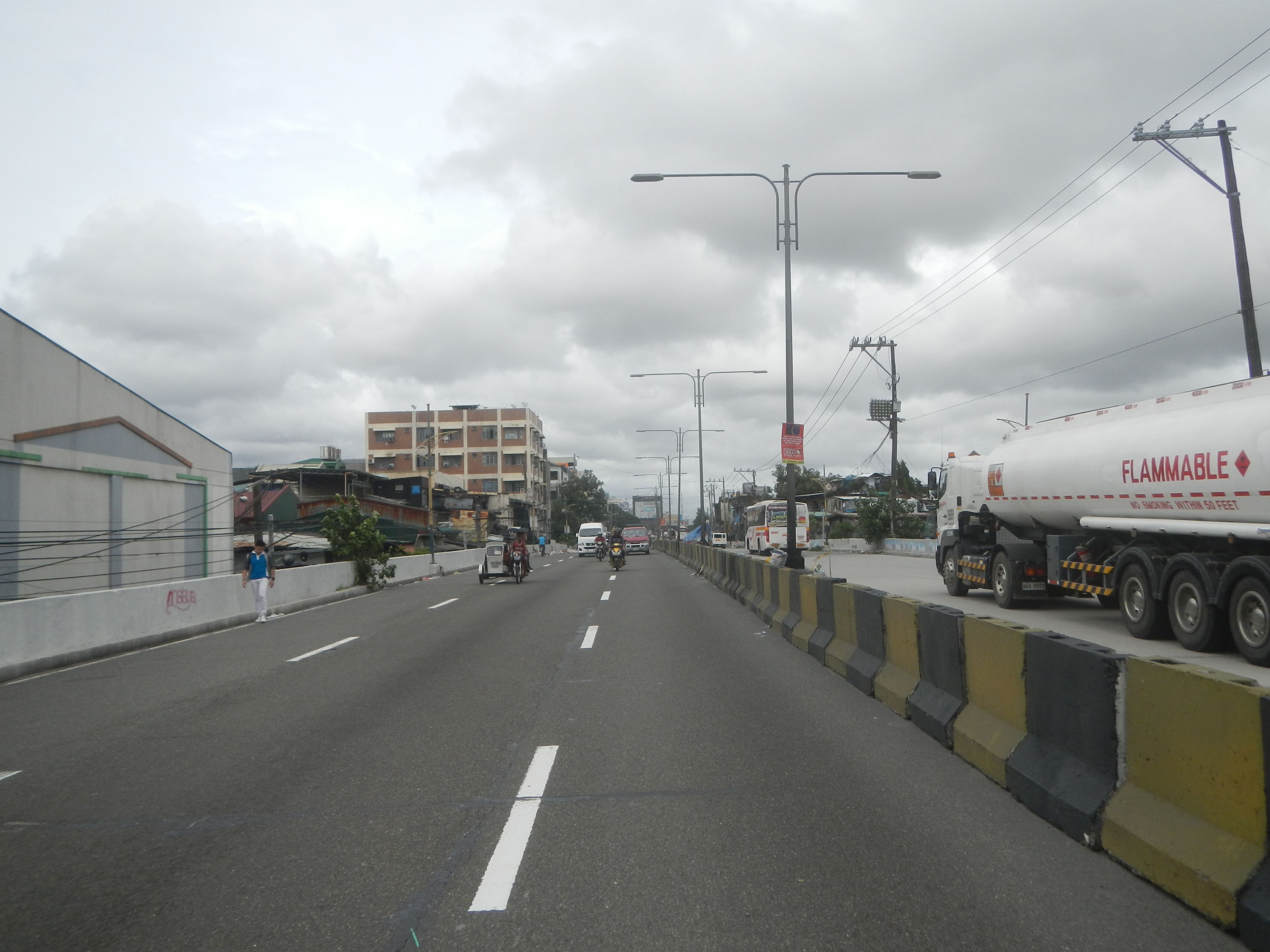
Past Baltazar Street, C-3 becomes 5th Avenue, a six-lane, two-way traffic roadway from Caloocan to A. Bonifacio Avenue in Quezon City. Before its expansion, this roadway was a two-lane, one-way traffic roadway eastwards. The expansion aimed to accommodate and connect C-3 Road (east) and C-3 Road (west) to eastbound and westbound traffic. Being the fifth avenue running east–west from the city's border with Manila in the south, it passes through the areas of Grace Park West, Grace Park East, and Barrio San Jose, as well as the northern boundary of La Loma Cemetery in Caloocan before entering Quezon City.
Sergeant Rivera Avenue
After crossing A. Bonifacio Avenue, C-3 becomes Sgt. Rivera Avenue, a main road in Quezon City with six lanes. Skyway's alignment over C-3 begins at this road. It becomes G. Araneta after turning southwards after its intersection with Santo Domingo Avenue. The names G. Araneta and Sgt. Rivera are often used interchangeably by people in this segment of the C-3.
Gregorio Araneta Avenue
Main article: Gregorio Araneta Avenue
.jpg)
C-3 becomes G. Araneta Avenue after turning southwards after its intersection with Santo Domingo Avenue up to its terminus at N. Domingo Street in San Juan. This area of C-3 is well known for its big funeral parlors, such as Arlington and La Funeraria Paz, and SM City Sta. Mesa. It is also considered a flood-prone area as the lowest area in the C-3 network (the other being the area where it crosses with Aurora Boulevard). The Talayan Creek also runs along the road median from Toctocan Street to Quezon Avenue and is notorious for overflowing during the rainy season.
References
References
- "Metro Manila Infrastructure Development". [[University of the Philippines Diliman]].
- "Latest alignment of all radial and circumferential roads in Metro Manila". Department of Public Works and Highways.
- (July 2013). "PH, JICA prepares new Metro Manila road network development plan".
- (September 1973). "Urban Transport Study in Manila Metropolitan Area". Overseas Technical Cooperation Agency.
- "Feasibility Study on C-3 and R-4 and Related Roads Project".
- (March 1978). "Feasibility Study on C-3 and R-4 and Related Roads Project". Japan International Cooperation Agency & Department of Public Works and Highways.
- "The Official Website of the Metropolitan Manila Development Authority".
- Melican, Nathaniel R.. (July 1, 2012). "Metro mayors okay 'Skybridge' project". Philippine Daily Inquirer.
- Amojelar, Darwin G.. (March 12, 2020). "SMC completes 'new' bridge over San Juan River". Manila Standard.
- Katahira & Engineers International. (October 29, 1993). "Metro Manila Urban Expressway System Study".
- "METRO MANILA URBAN TRANSPORTATION INTEGRATION STUDY: FINAL REPORT".
- The World Bank. (May 1999). "Asian Toll Road Development Program Review of Recent Toll Road Experience in Selected Countries and Preliminary Tool Kit for Toll Road Development".
- (March 2003). "The Development of The Public-private Partnership Technique for The Metro Manila Urban Expressway Network". Almec Corporation.
- "Chinese funds for Skyway sought". The Manila Times.
This article was imported from Wikipedia and is available under the Creative Commons Attribution-ShareAlike 4.0 License. Content has been adapted to SurfDoc format. Original contributors can be found on the article history page.
Ask Mako anything about Circumferential Road 3 — get instant answers, deeper analysis, and related topics.
Research with MakoFree with your Surf account
Create a free account to save articles, ask Mako questions, and organize your research.
Sign up freeThis content may have been generated or modified by AI. CloudSurf Software LLC is not responsible for the accuracy, completeness, or reliability of AI-generated content. Always verify important information from primary sources.
Report