From Surf Wiki (app.surf) — the open knowledge base
Chom Thong, Phitsanulok

| Field | Value |
|---|---|
| official_name | Chom Thong |
| native_name | จอมทอง |
| settlement_type | Tambon |
| image_seal | File:Logo of Chom Thong, Phitsanulok.png |
| subdivision_type | Country |
| subdivision_name | Thailand |
| subdivision_type2 | Province |
| subdivision_name2 | Phitsanulok |
| subdivision_type3 | District |
| subdivision_name3 | Mueang Phitsanulok |
| government_type | Subdistrict Administrative Organization (SAO) |
| area_total_km2 | 35.8 |
| population_as_of | 2022 |
| population_footnotes | |
| population_total | 3,995 |
| population_density_km2 | 112 |
| timezone | ICT |
| utc_offset | +7 |
| postal_code_type | Postal code |
| postal_code | 65000 |
| area_code_type | Calling code |
| area_code | 055 |
| blank_name_sec1 | Geocode |
| blank_info_sec1 | 65011200 |
| website |
**Chom Thong ** () is a subdistrict in the Mueang Phitsanulok District of Phitsanulok Province, Thailand. In 2022, it had a population of 3,995 and 1,641 households. The economy of this subdistrict is mainly based on agriculture and fishery.
Geography
The topography of Chom Thong subdistrict is completely flat fertile lowlands and is located in the lower northern part of Thailand. The subdistrict is bordered to the north by Phrom Phiram district, to the east by Pak Thok subdistrict, to the south by Ban Krang subdistrict and to the west by Phai Kho Don subdistrict. Chom Thong subdistrict lies in the Nan Basin, which is part of the Chao Phraya Watershed. The Nan river flows through the subdistrict. The Khwae Noi River flows on the boundary of Chom Thong and Pak Thok subdistricts and joins the Nan River. An irrigation canal (Huai Nong Khlong Bueng) flows from Phrom Phiram district through Chom Thong subdistrict and is an important water source for agricultural consumption and a raw water source to produce village water supply.
History
People were digging for gold in the area of tree pagodas near the village called Ban Kra'om Thong (). Later they changed the name to Ban Chom Thong.
On 16 December 1996 Ministry of Interior announced the establishment of Chom Thong Subdistrict Administrative Organization - SAO (ongkan borihan suan tambon). On 25 December 1996 it was published in Government Gazette, volume 113, section 52 Ngor.
Administration
Central government
The administration of ฺChom Thong subdistrict (tambon) is responsible for an area that covers 22,380 rai ~ 35.8 sqkm and consists of nine administrative villages (muban). As of 2022: 3,995 people and 1,641 households.
| Village | English | Thai | People | Households |
|---|---|---|---|---|
| Moo1 | Ban Tha Takhian | บ้านท่าตะเคียน | 607 | 258 |
| Moo2 | Ban Tha Takhian | บ้านท่าตะเคียน | 182 | 80 |
| Moo3 | Ban Tha Takhian | บ้านท่าตะเคียน | 414 | 169 |
| Moo4 | Ban Pak Thok | บ้านปากโทก | 519 | 255 |
| Moo5 | Ban Chom Thong | บ้านจอมทอง | 488 | 208 |
| Moo6 | Ban Chom Thong | บ้านจอมทอง | 540 | 206 |
| Moo7 | Ban Chom Thong | บ้านจอมทอง | 433 | 190 |
| Moo8 | Ban Tha Pho | บ้านท่าโพธิ์ | 670 | 220 |
| Moo9 | Ban Pho Thong | บ้านโพธิ์ทอง | 142 | 55 |
Local government
Chom Thong Subdistrict Administrative Organization - Chom Thong SAO () covers the whole Chom Thong subdistrict.
Temples
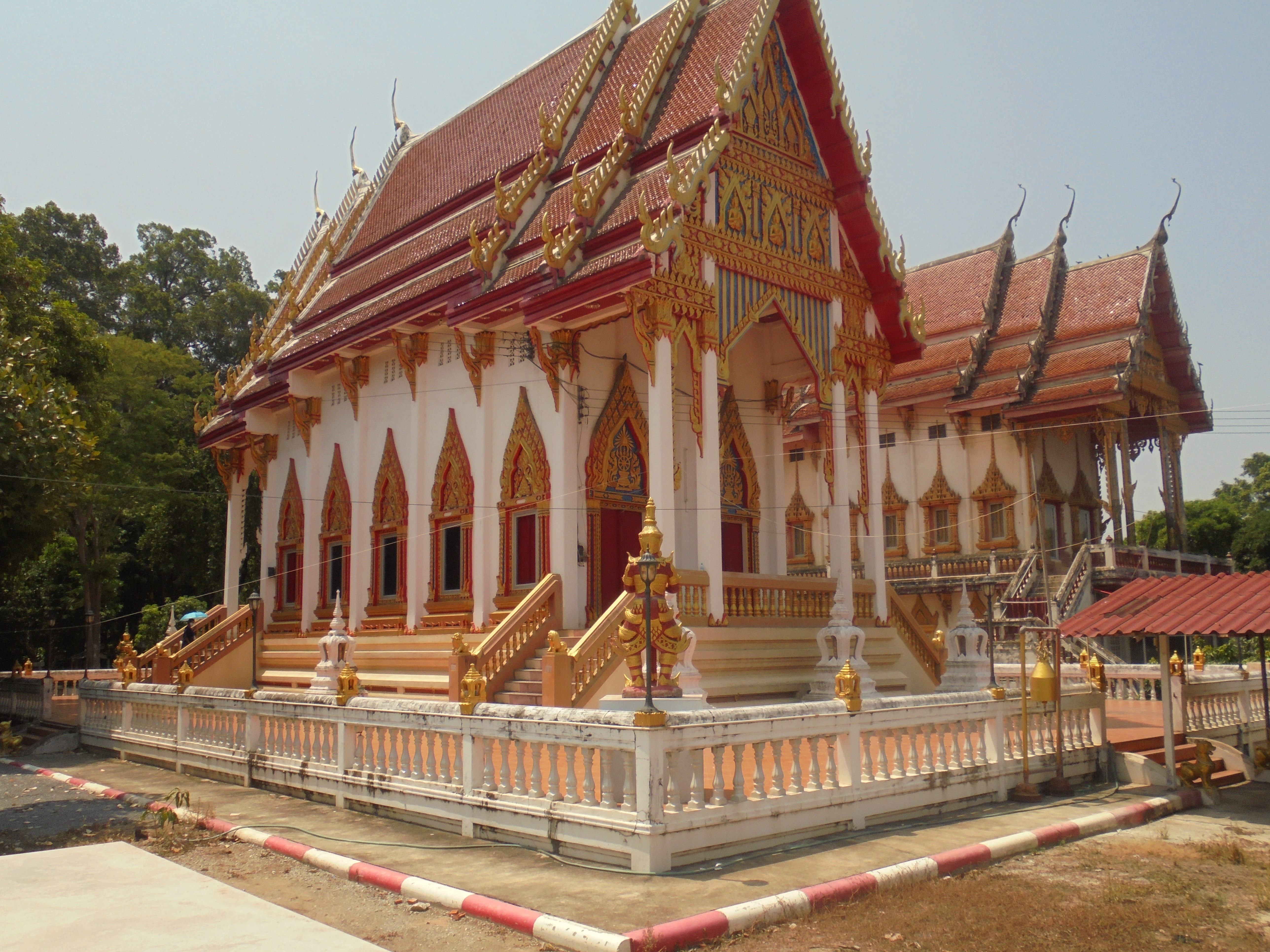
Chom Thong subdistrict is home to the following active temples, where Theravada Buddhism is practised by local residents:
| Temple name | Thai | Location | ||
|---|---|---|---|---|
| Wat Tha Takhian | ||||
| Wat Koh Kaew | ||||
| Wat Sala Sung | ||||
| Wat Chom Thong |
Economy
Of the population 80% are engaged in agriculture (farming), include rice and fruit, and fishery. The fruits that are planted are Burmese grape, coconut, jackfruit, Mango plum, pomelo, sapodilla, etc.
Education
The following schools are located in Chom Thong subdistrict.
- Wat Tha Takhian school - Moo3
- Wat Chom Thong school - Moo5
Healthcare
There are Chom Thong health-promoting hospitals in Moo2 and Moo5.
Transport
- Highway 12, Phitsanulok-Sukhothai route
- Highway 126, Phitsanulok bypass road
- National road 1086, Phitsanulok-Wat Bot/Phrom Phiram route
Electricity
All households in Chom Thong subdistrict have access to the electricity grid of Provincial Electricity Authority (PEA).
Waterworks
Of Chom Thong subdistrict 1,500 households, out of a total of 1,641 households, have access to the water network of Provincial Waterworks Authority (PWA). All households have access to the village water supply system in every village.
Communications
All households in Chom Thong subdistrict have access to the mobile telephone network. Of the fixed telephone only six villages have access (village 1, 2, 3, 5, 6 and 8) and three don't (village 4, 7 and 9).
References
References
- "Official statistics registration systems". Department of Provincial Administration.
- "อาณาเบตติดต่อ".
- "ภูมิประเทศ".
- "ประวัติตำบล".
- "ประวัติหน่วยงาน".
- "เขตการปกครอง".
- "list of temples".
- "อาชีพประชากร".
- "การศึกษาในตำบล".
- "การสาธารณสุขในตำบล".
- "ไฟฟ้าในตำบล".
- "ประปาในตำบล".
- "การสื่อสารในตำบล".
This article was imported from Wikipedia and is available under the Creative Commons Attribution-ShareAlike 4.0 License. Content has been adapted to SurfDoc format. Original contributors can be found on the article history page.
Ask Mako anything about Chom Thong, Phitsanulok — get instant answers, deeper analysis, and related topics.
Research with MakoFree with your Surf account
Create a free account to save articles, ask Mako questions, and organize your research.
Sign up freeThis content may have been generated or modified by AI. CloudSurf Software LLC is not responsible for the accuracy, completeness, or reliability of AI-generated content. Always verify important information from primary sources.
Report