From Surf Wiki (app.surf) — the open knowledge base
Cherokee County, Oklahoma
County in Oklahoma, United States
County in Oklahoma, United States
| Field | Value |
|---|---|
| county | Cherokee County |
| state | Oklahoma |
| ex image | Cherokee National Capitol.jpg |
| ex image size | 300px |
| ex image cap | Cherokee National Capitol in Tahlequah. |
| founded year | 1907 |
| seat wl | Tahlequah |
| largest city wl | Tahlequah |
| area_total_sq_mi | 776 |
| area_land_sq_mi | 749 |
| area_water_sq_mi | 27 |
| area percentage | 3.5% |
| population_as_of | 2020 |
| population_total | 47078 |
| density_sq_mi | auto |
| named for | Cherokee Nation |
| time zone | Central |
| district | 2nd |
| website | https://cherokee.okcounties.org/about |
Cherokee County is a county located in the U.S. state of Oklahoma. As of the 2020 census, the population was 47,078. Its county seat is Tahlequah, which is also the capital of the Cherokee Nation.
Cherokee County comprises the Tahlequah, OK micropolitan statistical area.
History
According to a historian, Cherokee County was established in 1907. However, the Encyclopedia of Oklahoma History and Culture, states that it was created from the Tahlequah District of the Cherokee Nation in 1906.
The Cherokee moved to this area as a result of the forced relocation brought about by the Indian Removal Act of 1830, also known as Trail Of Tears. The first significant settlements were at the site of Park Hill, where there was already a mission community, and Tahlequah, which became the seat of Cherokee government. However, the Civil War divided the tribe and caused many of the early structures to be destroyed. Non-Indians began moving into the area illegally starting in the mid-1870s, and became the majority by the 1890s.
In 1851, the Cherokee Male Seminary opened in Tahlequah and the Cherokee Female Seminary opened in Park Hill. The latter burned down in 1887 and was rebuilt in Tahlequah. A 1910 fire destroyed the Male Seminary. The Female Seminary became Northeastern State Normal School after statehood in 1907 and is now part of Northeastern State University.
During 1901 – 1903, The Ozark and Cherokee Central Railway, which later became part of the St. Louis and San Francisco Railway was the first to build a track in the county. It boosted the shipment of farm products through the 1920s, but declined during the Great Depression. All rail service ceased in 1942.
Geography
According to the U.S. Census Bureau, the county has a total area of 776 sqmi, of which 749 sqmi is land and 2.7 sqmi (3.5%) is water.
The county lies in the foothills of the Ozark Mountains. It includes most of Tenkiller Lake and part of Fort Gibson Lake. The principal river running through it is the Illinois River. Grand River (Oklahoma) forms part of its western boundary.
Major highways
- [[Image:US 62.svg|20px]] U.S. Highway 62
- [[Image:Oklahoma State Highway 10.svg|20px]] State Highway 10
- [[Image:Oklahoma State Highway 51.svg|20px]] State Highway 51
- [[Image:Oklahoma State Highway 82.svg|20px]] State Highway 82
Adjacent counties
- Delaware County (north)
- Adair County (east)
- Sequoyah County (south)
- Muskogee County (southwest)
- Wagoner County (west)
- Mayes County (northwest)
Demographics
|align-fn=center 1790-1960 1900-1990 1990-2000 2010
2020 census
As of the 2020 United States census, the county had a population of 47,078. Of the residents, 23.6% were under the age of 18 and 17.2% were 65 years of age or older; the median age was 37.0 years. For every 100 females there were 95.1 males, and for every 100 females age 18 and over there were 93.3 males.
The racial makeup of the county was 44.2% White, 1.1% Black or African American, 34.6% American Indian and Alaska Native, 0.7% Asian, 3.1% from some other race, and 16.3% from two or more races. Hispanic or Latino residents of any race comprised 7.3% of the population.
There were 18,023 households in the county, of which 31.0% had children under the age of 18 living with them and 28.1% had a female householder with no spouse or partner present. About 28.4% of all households were made up of individuals and 12.0% had someone living alone who was 65 years of age or older.
There were 22,033 housing units, of which 18.2% were vacant. Among occupied housing units, 64.6% were owner-occupied and 35.4% were renter-occupied. The homeowner vacancy rate was 2.1% and the rental vacancy rate was 12.2%.
2000 census
As of the census of 2000, there were 42,521 people, 16,175 households, and 11,079 families residing in the county. The population density was 57 /mi2. There were 19,499 housing units at an average density of 26 /mi2. The racial makeup of the county was 56.41% White, 1.20% Black or African American, 32.42% Native American, 0.27% Asian, 0.04% Pacific Islander, 2.10% from other races, and 7.56% from two or more races. 4.14% of the population were Hispanic or Latino of any race. 92.7% spoke English, 3.8% Spanish and 2.7% Cherokee as their first language.
In 2000, there were 16,175 households, out of which 32.70% had children under the age of 18 living with them, 52.50% were married couples living together, 11.90% had a female householder with no husband present, and 31.50% were non-families. 25.30% of all households were made up of individuals, and 9.00% had someone living alone who was 65 years of age or older. The average household size was 2.52 and the average family size was 3.04. In the county, the population was spread out, with 26.30% under the age of 18, 14.60% from 18 to 24, 25.70% from 25 to 44, 21.50% from 45 to 64, and 12.00% who were 65 years of age or older. The median age was 32 years. For every 100 females there were 96.30 males. For every 100 females age 18 and over, there were 92.10 males.
As of 2000, the median income for a household in the county was $26,536, and the median income for a family was $32,369. Males had a median income of $25,993 versus $21,048 for females. The per capita income for the county was $13,436. About 17.00% of families and 22.90% of the population were below the poverty line, including 28.40% of those under age 18 and 13.80% of those age 65 or over. In 2021, the median household income was an estimated $47,421.
Education
Primary & secondary education
Public K-12 school districts in the county include:
K-12 school districts:
- Fort Gibson Public Schools
- Hulbert Public Schools
- Kansas Public Schools
- Locust Grove Public Schools
- Oaks-Mission Public Schools
- Tahlequah Public Schools
- Westville Public Schools
Elementary school districts:
- Briggs Public School
- Grand View Public School
- Keys Public Schools
- Lowrey Public School
- Norwood Public School
- Peggs Public School
- Shady Grove Public School
- Tenkiller Public School
- Woodall Public School
Charter school:
- Cherokee Immersion School
Bureau of Indian Education (BIE)-affiliated tribal school:
- Sequoyah Schools
Colleges

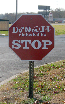
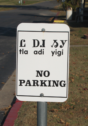
Northeastern State University is the oldest institution of higher learning in the state of Oklahoma as well as one of the oldest institutions of higher learning west of the Mississippi River. Tahlequah is home to the capital of the Cherokee Nation of Oklahoma and about 25 percent of the students at NSU identify themselves as American Indian. The university has many courses focused on Native American linguistics, and offers Cherokee language Education as a major. Cherokee can be studied as a second language, and some classes are taught in Cherokee for first language speakers as well.
Politics
Despite the county being home to a significant Native American population and a historically wide Democratic registration advantage, the county has voted Republican in every presidential election in the 21st century. Donald Trump beat Joe Biden 63%-34% in 2020. However, the county still will on occasion support local Democrats, as it narrowly voted for Democrat Drew Edmondson over Republican Kevin Stitt in the 2018 gubernatorial race.
| Voter Registration and Party Enrollment as of May 31, 2023 | Party | Number of voters | Percentage | Total | 26,373 | 100% |
|---|---|---|---|---|---|---|
| Democratic | 10,590 | 40.15% | ||||
| Republican | 10,845 | 41.12% | ||||
| Others | 4,938 | 18.72% |
Economy
Since statehood, the economy of Cherokee County has been based on agriculture, especially production of corn, wheat and vegetables. However, the percentage of the population engaged in farming has declined from 62 percent in 1940 to 4.4 percent in 1990. This is largely due to increased urbanization around Tahlequah since World War II. Agriculture remains very important. In 2002, this county ranked first in Oklahoma for the value of nursery and greenhouse crops and seventh in the state for poultry and eggs. Illinois River and Lake Tenkiller tourism are perhaps of greater economic impact than agriculture, and both have lodging, water sports and recreation outfitters, fishing equipment and guides, eating and drinking establishments, campgrounds, festival events, and organizations for the conservation of resources.
Major non-agricultural employers in the county now include the Cherokee Nation government and Northeastern State University,
Communities
City
- Tahlequah (county seat)
Towns
- Fort Gibson
- Hulbert
- Oaks
Census-designated places
- Barber
- Briggs
- Caney
- Caney Ridge
- Cookson
- Dry Creek
- Eldon
- Etta
- Gideon
- Grandview
- Johnson Prairie
- Keys
- Lost City
- Lowrey
- Moodys
- Norwood
- Park Hill
- Peggs
- Pettit
- Pumpkin Hollow
- Rocky Ford
- Shady Grove
- Sparrowhawk
- Steely Hollow
- Tenkiller
- Teresita
- Welling
- Woodall
- Zeb
Other unincorporated community
- Pumpkin Center
- Qualls
NRHP sites
Main article: National Register of Historic Places listings in Cherokee County, Oklahoma
The following sites in Cherokee County are listed on the National Register of Historic Places:
Notable people
- Bamboo Harvester, the horse who played television's Mr. Ed
- Sam Claphan, football player
- Robert Conley, author of numerous books about the Cherokee Indians
- Alice Brown Davis, Principal Chief of the Seminole Tribe of Oklahoma
- Wilma Mankiller, first female Principal Chief of the Cherokee Nation
- Jackson Narcomey, Muscogee Creek artist
- Wilson Rawls, author of Where the Red Fern Grows and Summer of the Monkeys
- Hastings Shade, Cherokee traditionalist and author
- Sonny Sixkiller, Cherokee football player
- Wes Studi, Cherokee actor
- Ryan Helsley, Professional Baseball Player, St Louis Cardinals
Notes
References
References
- "Cherokee County, Oklahoma". [[United States Census Bureau]].
- "Find a County". National Association of Counties.
- Burnett, Amanda. [http://www.okhistory.org/publications/enc/entry.php?entry=CH017 "Cherokee County,"] ''Encyclopedia of Oklahoma History and Culture'', 2009. Accessed March 28, 2015.
- ''Columbia-Lippincott Gazetteer''. p. 386
- (August 22, 2012). "2010 Census Gazetteer Files". United States Census Bureau.
- "U.S. Decennial Census". United States Census Bureau.
- "Historical Census Browser". University of Virginia Library.
- (March 27, 1995). "Population of Counties by Decennial Census: 1900 to 1990". United States Census Bureau.
- (April 2, 2001). "Census 2000 PHC-T-4. Ranking Tables for Counties: 1990 and 2000". United States Census Bureau.
- "State & County QuickFacts". United States Census Bureau.
- (2021). "2020 Decennial Census Demographic Profile (DP1)".
- (2021). "2020 Decennial Census Redistricting Data (Public Law 94-171)".
- "U.S. Census website". [[United States Census Bureau]].
- "Quickfacts: Cherokee County, OK".
- Geography Division. (December 22, 2020). "2020 CENSUS - SCHOOL DISTRICT REFERENCE MAP: Cherokee County, OK". [[U.S. Census Bureau]].
- "General Information". NSU.
- "Northeastern State University".
-
- auElement.html() +. "NSU, Cherokee Nation Partner to Train and Hire Language Instructors - ICTMN.com". Indiancountrytodaymedianetwork.com.
- "Cherokee". Ethnologue.
- "Oklahoma Governor Election Results 2018: Live Midterm Map by County & Analysis".
- (May 31, 2023). "Voter Registration Totals".
- Leip, David. "Dave Leip's Atlas of U.S. Presidential Elections".
- "United States Department of the Interior. National Park Service. "Park Hill Mission Cemetery - National Register of Historic Places Registration Form." December 6, 2006.".
This article was imported from Wikipedia and is available under the Creative Commons Attribution-ShareAlike 4.0 License. Content has been adapted to SurfDoc format. Original contributors can be found on the article history page.
Ask Mako anything about Cherokee County, Oklahoma — get instant answers, deeper analysis, and related topics.
Research with MakoFree with your Surf account
Create a free account to save articles, ask Mako questions, and organize your research.
Sign up freeThis content may have been generated or modified by AI. CloudSurf Software LLC is not responsible for the accuracy, completeness, or reliability of AI-generated content. Always verify important information from primary sources.
Report