From Surf Wiki (app.surf) — the open knowledge base
Chatham, Illinois
| Field | Value |
|---|---|
| name | Chatham |
| official_name | Village of Chatham |
| settlement_type | Village |
| motto | Where families grow. |
| image_map | File:Sangamon County Illinois Incorporated and Unincorporated areas Chatham Highlighted.svg |
| mapsize | 300px |
| map_caption | Location of Chatham in Sangamon County, Illinois. |
| subdivision_type | Country |
| subdivision_name | United States |
| subdivision_type1 | State |
| subdivision_name1 | Illinois |
| subdivision_type2 | County |
| subdivision_name2 | Sangamon |
| subdivision_type3 | Township |
| subdivision_name3 | Chatham, Ball |
| established_title | Founded |
| leader_title | Mayor |
| governing_body | Chatham Chamber of Commerce |
| unit_pref | Imperial |
| area_footnotes | |
| area_total_km2 | 19.08 |
| area_total_sq_mi | 7.37 |
| area_land_km2 | 19.07 |
| area_land_sq_mi | 7.36 |
| area_water_km2 | 0.01 |
| area_water_sq_mi | 0.00 |
| population_as_of | 2020 |
| population_total | 14377 |
| population_density_km2 | 753.83 |
| population_density_sq_mi | 1952.34 |
| timezone | CST |
| utc_offset | -6 |
| timezone_DST | CDT |
| utc_offset_DST | -5 |
| elevation_footnotes | |
| elevation_ft | 597 |
| coordinates | |
| coordinates_footnotes | |
| postal_code_type | ZIP code |
| postal_code | 62629 |
| area_code | 217, 447 |
| blank_name | FIPS code |
| blank_info | 17-12684 |
| blank1_name | GNIS feature ID |
| blank1_info | 2397606 |
| website |
the Sangamon County village
Chatham is a village in Sangamon County, Illinois, United States. It is located 2.8 mi south of Springfield. The population was 11,500 as of the 2010 census and 14,377 as of 2020. The village lies along the original alignment of historic U.S. Route 66 (Illinois Route 4).
Chatham is part of the Springfield, Illinois Metropolitan Statistical Area.
Geography
According to the 2010 census, Chatham has a total area of 5.722 sqmi, of which 5.72 sqmi (or 99.97%) is land and 0.002 sqmi (or 0.03%) is water.{{cite web |access-date=August 2, 2015 |archive-url=https://archive.today/20200213044722/http://factfinder.census.gov/bkmk/table/1.0/en/DEC/10_SF1/G001/1600000US1712684 |archive-date=February 13, 2020 |url-status=dead
Demographics
As of the census of 2010, the racial makeup of the village was 93.57% White, 2.47% African American, 0.09% Native American, 1.85% Asian, 0.46% from other races, and 1.57% from two or more races. Hispanic or Latino of any race were 1.97% of the population.
As of the census of 2000, there were 8,583 people, 3,083 households, and 2,472 families residing in the village. The population density was 1,728.7 PD/sqmi. There were 3,165 housing units at an average density of 637.4 /sqmi. The racial makeup of the village was 97.48% White, 0.77% African American, 0.15% Native American, 0.90% Asian, 0.15% from other races, and 0.55% from two or more races. Hispanic or Latino of any race were 0.77% of the population.
There were 3,083 households, out of which 47.4% had children under the age of 18 living with them, 65.9% were married couples living together, 11.1% had a female householder with no husband present, and 19.8% were non-families. 16.5% of all households were made up of individuals, and 4.7% had someone living alone who was 65 years of age or older. The average household size was 2.78 and the average family size was 3.13.
In the village, the population was spread out, with 32.0% under the age of 18, 6.5% from 18 to 24, 31.7% from 25 to 44, 22.6% from 45 to 64, and 7.2% who were 65 years of age or older. The median age was 35 years. For every 100 females, there were 96.4 males. For every 100 females age 18 and over, there were 90.6 males.
The median income for a household in the village was $60,350, and the median income for a family was $64,257. Males had a median income of $45,543 versus $31,883 for females. The per capita income for the village was $23,167. About 2.8% of families and 4.7% of the population were below the poverty line, including 5.2% of those under age 18 and 5.6% of those age 65 or over.
Education
Chatham is part of the Ball-Chatham School District, which includes Glenwood High School, three elementary schools, an Intermediate School, and a middle school.
Festivals
Every June the Chatham American Legion Homecoming Festival takes place in the Chatham town square. Each year in July, Chatham is host to the Chatham Sweet Corn Festival and Illinois Championship Cow Chip Throw sponsored by the Chatham Jaycees. Each year in September Chatham Jaycees host the Octoberfest in the Chatham town square.
Places of interest
- Chatham Railroad Museum (1902)
- Caldwell Farmstead (National Register of Historic Places)
- Interurban Trail, a mixed-use rails-to-trails trail, (Chatham and Woodside townships, 4.75 mi. in length)
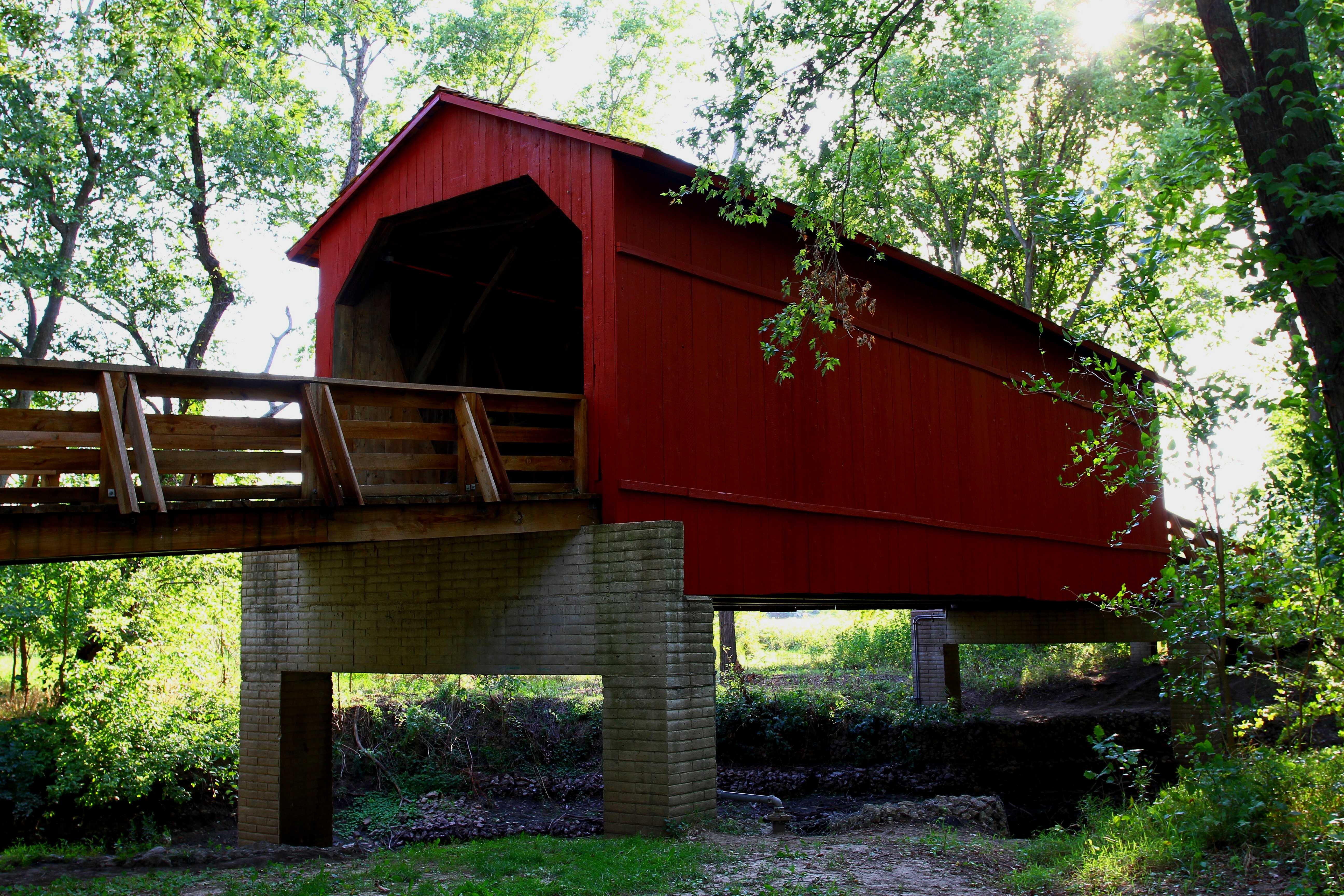
- Sugar Creek Covered Bridge is located 5 mi southeast of Chatham.
Notable people
- Kenneth Boyle, Illinois state representative and lawyer
- Kelci Bryant, Olympic diver
- Reid Detmers, pitcher for the Los Angeles Angels
- Gracie Gold, US and Olympic figure skater
- Phil Maton, MLB pitcher
- Nick Maton, MLB infielder
- Jayson Werth, outfielder for various teams
References
References
- "2020 U.S. Gazetteer Files". United States Census Bureau.
- {{GNIS. 2397606
- "Census of Population and Housing". Census.gov.
- "CensusViewer".
- "U.S. Census website". [[United States Census Bureau]].
- [http://www.chathamjaycees.net/ Chatham Jaycees] website. Retrieved August 21, 2010.
- "Railroad Museum".
This article was imported from Wikipedia and is available under the Creative Commons Attribution-ShareAlike 4.0 License. Content has been adapted to SurfDoc format. Original contributors can be found on the article history page.
Ask Mako anything about Chatham, Illinois — get instant answers, deeper analysis, and related topics.
Research with MakoFree with your Surf account
Create a free account to save articles, ask Mako questions, and organize your research.
Sign up freeThis content may have been generated or modified by AI. CloudSurf Software LLC is not responsible for the accuracy, completeness, or reliability of AI-generated content. Always verify important information from primary sources.
Report