From Surf Wiki (app.surf) — the open knowledge base
Charterhouse, Somerset
Hamlet in Somerset, England

Hamlet in Somerset, England
| Field | Value |
|---|---|
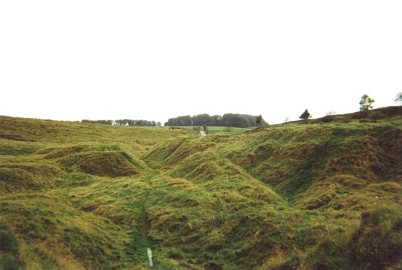
| static_image | Charterhouse, Somerset.JPG |
| static_image_width | 240px |
| static_image_caption | Charterhouse, looking west |
| country | England |
| official_name | Charterhouse |
| coordinates | |
| civil_parish | Priddy |
| unitary_england | Somerset Council |
| lieutenancy_england | Somerset |
| region | South West England |
| constituency_westminster | Wells and Mendip Hills |
| post_town | BRISTOL |
| postcode_district | BS40 |
| postcode_area | BS |
| dial_code | 01761 |
| os_grid_reference | ST497557 |
Charterhouse, also known as Charterhouse-on-Mendip, is a hamlet and former civil parish, now in the parish of Priddy, in the Mendip Hills Area of Outstanding Natural Beauty (AONB) in the Somerset district, in the ceremonial county of Somerset, England. The area between Charterhouse and Cheddar Gorge including Velvet Bottom and Ubley Warren is covered by the Cheddar Complex Site of Special Scientific Interest. In 1931 the parish had a population of 68.
Name
The name is believed to come from the Carthusian order of Chartreuse in France, which was established in Witham (near Frome) in 1181 and formed a cell at Charterhouse in 1283 with a grant to mine lead ore.
History
There is evidence, in the form of burials in local caves, of human occupation since the late Neolithic/Early Bronze Age. A 2024 study of bones from a mass grave found in caves at Charthouse Warren in the 1970s suggests that 37 people were massacred in a violent cannibalistic event occurring between 2200-2000 BC.
The lead and silver mines at Charterhouse were first operated on a large scale by the Romans, from at least AD 49. At first the lead/silver industries were tightly controlled by the Roman military, but within a short time the extraction of these metals was contracted out to civilian companies, probably because the silver content of the local ore was not particularly high. There was also some kind of 'fortlet' here in the 1st century, and an amphitheatre. The Roman landscape has been designated as a Scheduled Ancient Monument.
The parish was part of the Winterstoke Hundred.
Charter-House-on-Mendip was an extra-parochial ville, from 1858 Charterhouse was a civil parish in its own right, on 1 April 1933 the parish was abolished and merged with Blagdon and Cheddar.
After the Dissolution of the Monasteries, it was granted to Robert May who constructed a substantial house here and one of his descendants John May became High Sheriff of Somerset in 1602.
There is further evidence of mine workings in the medieval and Victorian periods, some of which survives within the Blackmoor Nature Reserve owned by Somerset County Council. There is also evidence of a rectangular medieval enclosure.
Caves
There are several caves in the limestone around the village including Manor Farm Swallet and Upper Flood Swallet.
Church

The Church of St Hugh was built in 1908 by W.D. Caroe, on the initiative of the Rev. Menzies Lambrick, from the former welfare hall for the lead miners. It is a Grade II* listed building. A cross in the churchyard and the churchyard wall are also listed buildings.
The roof-truss, screen, rood, and altar are all made of carved whitened oak.
References
References
- "Population statistics Charterhouse ExP/CP through time". [[A Vision of Britain through Time]].
- Robinson, Stephen. (1992). "Somerset Place Names". The Dovecote Press Ltd.
- Reid, Robert Douglas. (1979). "Some buildings of Mendip". The Mendip Society.
- "Autumn newsletter 2007". Mendip Hills AONB.
- "Mendip Hills: An Archaeological Survey of the Area of Outstanding Natural Beauty". Somerset County Council Archaeological Projects.
- Addley, Esther. (16 December 2024). "Something horrible’: Somerset pit reveals bronze age cannibalism". The Guardian.
- Havinden, Michael. (1981). "The Somerset Landscape". Hodder and Stoughton.
- "Major Romano-British Settlement Charterhouse on Mendip, Avon". Roman Britain.org.
- "Charterhouse". Big Roman Dig.
- Firth, Hannah. (2007). "Mendip from the air". South West Heritage Trust.
- "Somerset Hundreds". GENUKI.
- "History of Charterhouse, in Mendip and Somerset". A Vision of Britain through Time.
- "Relationships and changes Charterhouse ExP/CP through time". A Vision of Britain through Time.
- "Mendip Hills: An Archaeological Survey of the Area of Outstanding Natural Beauty". Somerset County Council Archaeological Projects.
- Gough, J.W.. (1967). "The mines of Mendip". David & Charles.
- Adkins, Lesley and Roy. (1992). "A Field Guide to Somerset Archaeology". Dovecote Press.
- Staveacre, Tony. (December 2006). "Christmas at Charterhouse". Mendip Times.
- {{NHLE
- {{NHLE
- {{NHLE
This article was imported from Wikipedia and is available under the Creative Commons Attribution-ShareAlike 4.0 License. Content has been adapted to SurfDoc format. Original contributors can be found on the article history page.
Ask Mako anything about Charterhouse, Somerset — get instant answers, deeper analysis, and related topics.
Research with MakoFree with your Surf account
Create a free account to save articles, ask Mako questions, and organize your research.
Sign up freeThis content may have been generated or modified by AI. CloudSurf Software LLC is not responsible for the accuracy, completeness, or reliability of AI-generated content. Always verify important information from primary sources.
Report