From Surf Wiki (app.surf) — the open knowledge base
Chanthaburi province

| Field | Value |
|---|---|
| name | Chanthaburi |
| native_name | จันทบุรี |
| native_name_lang | th |
| settlement_type | Province |
| image_skyline | {{multiple image |
| border | infobox |
| total_width | 280 |
| image_style | border:1; |
| perrow | 2/2/2 |
| image1 | เนินนางพญา จ.จันทบุรี.jpg |
| image2 | Taksin Maharat Bridge.jpg |
| image3 | Sweet Christmas Chanthaburi.jpg |
| image4 | Khao Khitchakut National Park02.jpg |
| image5 | อุทยานแห่งชาติน้ำตกพลิ้ว.jpg |
| image6 | Thung Na Choei Public Park (Chanthaburi) 09.JPG |
| image_size | 200px |
| image_caption | From top: Noen Nang Phaya, viewpoint of Chaloem Burapha Chonlathit Road, Na Yai Am; Taksin Maharat Bridge crosses the Chanthaburi River at Laem Sing; Cathedral of the Immaculate Conception in Christmas Eve; Sacred balancing rock and Buddha footprint on the top of Mount Khitchakut; Phlio Waterfall; Monument of King Taksin at Thung Na Choei Public Park |
| nicknames | Mueang Chan |
| (Thai: เมืองจันท์) | |
| Chanthabun | |
| (Thai: จันทบูร) | |
| mottoes | "น้ำตกลือเลื่อง เมืองผลไม้ พริกไทยพันธุ์ดี อัญมณีมากเหลือ เสื่อจันทบูร สมบูรณ์ธรรมชาติ สมเด็จพระเจ้าตากสินมหาราช รวมญาติกู้ชาติที่จันทบุรี" |
| ("Renowned waterfalls. Town of fruit. Good pepper. Bountiful jewels. Chanthaboon Mats. Rich in nature. King Taksin the Great reunited the people and reclaimed our independence at Chanthaburi.") | |
| image_seal | Seal Chanthaburi (1).svg |
| image_flag | Flag of Chanthaburi.svg |
| image_map | Thailand Chanthaburi locator map.svg |
| mapsize | frameless |
| map_caption | Map of Thailand highlighting Chanthaburi province |
| subdivision_type | Country |
| subdivision_name | Thailand |
| seat_type | Capital |
| seat | Chanthaburi |
| leader_title | Governor |
| leader_name | Monsit Paisarntanawat |
| leader_title1 | PAO Chief Executive |
| leader_name1 | Thanaphon Kitkarn |
| area_footnotes | |
| area_total_km2 | 6,415 |
| area_rank | 33rd |
| population_footnotes | |
| population_total | 536,388 |
| population_as_of | 2024 |
| population_rank | 48th |
| population_density_km2 | 83 |
| population_density_rank | 58th |
| demographics_type2 | GDP |
| demographics2_footnotes | |
| demographics2_title1 | Total |
| demographics2_info1 | baht 138 billion |
| (US$4.0 billion) (2019) | |
| demographics_type1 | Human Achievement Index |
| demographics1_footnotes | |
| demographics1_title1 | HAI (2022) |
| demographics1_info1 | 0.6323 "somewhat low" |
| Ranked 49th | |
| timezone1 | ICT |
| utc_offset1 | +7 |
| postal_code_type | Postal code |
| postal_code | 22xxx |
| area_code_type | Calling code |
| area_code | 039 |
| iso_code | TH-22 |
| website | |
(Thai: เมืองจันท์) Chanthabun (Thai: จันทบูร) ("Renowned waterfalls. Town of fruit. Good pepper. Bountiful jewels. Chanthaboon Mats. Rich in nature. King Taksin the Great reunited the people and reclaimed our independence at Chanthaburi.") (US$4.0 billion) (2019) Ranked 49th
Chanthaburi (, ; Chong: จันกะบูย chankabui, ) is one of seven provinces (changwat) in eastern Thailand, on the border with Battambang and Pailin of Cambodia, on the shore of the Gulf of Thailand. Neighbouring provinces are Trat in the east and Rayong, Chonburi, Chachoengsao, and Sa Kaeo to the west and north.
History
The indigenous people of the Chanthaburi region are the Chong. The Chong have lived in the area since the Ayutthaya Kingdom, and are thought to have been early inhabitants of Cambodia, possibly pre-dating the Khmer. In Chanthaburi province, the Chong predominantly inhabit the districts of Khao Khitchakut, Pong Nam Ron, and Makham.
After the Paknam crisis in 1893, French colonial troops occupied Chanthaburi, returning it in 1905 when Thailand gave up ownership of the western part of Cambodia. A significant minority of Chanthaburi citizens are ethnic Vietnamese, who came there in three waves: first in the 19th century during anti-Catholic persecutions in Cochin China; a second wave in the 1920s to 1940s fleeing French Indochina; and a third wave after the communist victory in Vietnam in 1975. The town of Chanthaburi has been the seat of a Bishop of Chanthaburi since 1944.
Chanthaburi once used to be an important source of gemstones, especially rubies and sapphires. While the Chantaboon Waterfront Community was developed over three centuries ago during the reign of King Narai along the banks of the River Mae Nam Chantaburi. It was an essential transportation and trade hub.
Geography

While the southern part of the province is on the shore of the Gulf of Thailand and thus is mostly coastal alluvial plains, the interior of the province is mountainous. The Chanthaburi Mountains in the north has the highest elevation in the province, the 1,675 m high Khao Soi Dao Tai peak. The main river of the province is the Chanthaburi River. The total forest area is 2,076 km² or 32.4 percent of provincial area.
Together with the neighboring province, Trat, Chanthaburi is a center of gemstone mining, especially rubies and sapphires. Tropical fruits are also among the main products of the province. In 2000, it produced nearly 380,000 tonnes of durian, which was 45.57 percent of Thailand's durian production, approximately 27 percent of the entire world's production.
Symbols
The provincial seal shows the moon surrounded by an aura. Inside the moon disc is a rabbit, as in Thai folklore the dark areas on the moon (maria) form the shape of a rabbit. The seal symbolizes the peace and tranquility of the province. The moon also refers to the meaning of the province, "City of Moon", from Chantha- (, lit. 'moon') and buri (, lit. 'city').
The flag of the province also shows the seal in the middle, a white rabbit on a yellow moon disc, on a blue disc. The background of the flag is red, with the name of province in yellow written below the seal.
The provincial tree is Diospyros decandra. The provincial flower is an orchid (Dendrobium friedericksianum). The brackish fish flagfin prawn goby (Mahidolia mystacina) is the provincial aquatic animal, what with Chanthaburi is the type locality.
The provincial slogan is "Renowned waterfalls. Town of fruit. Good pepper. Bountiful jewels. Chanthaboon Mats. Rich in nature. King Taksin the Great reunited the people and reclaimed our independence at Chanthaburi".
National parks
There area four national parks, along with three other national parks, make up region 2 (Si Racha) of Thailand's protected areas.(Visitors in fiscal year 2024)
| Khao Khitchakut National Park | 59 km2 | (582,744) |
|---|
Wildlife sanctuaries
There are three wildlife sanctuaries, along with one other wildlife sanctuary, make up region 2 (Si Racha) of Thailand's protected areas.
| Khlong Kruea Wai Wildlife Sanctuary | 265 km2 |
|---|
| 4 | Khao Khitchakut |
|---|
| 7 | Khlong Kruea Wai |
|---|
|}
Administrative divisions

Provincial government
The province is divided into 10 districts (amphoes). These are further subdivided into 76 subdistricts (tambons) and 690 villages (mubans).
- Mueang Chanthaburi
- Khlung
- Tha Mai
- Pong Nam Ron
- Makham
- Laem Sing
- Soi Dao
- Kaeng Hang Maeo
- Na Yai Am
- Khao Khitchakut
Local government
As of 26 November 2019 there are: one Chanthaburi Provincial Administration Organisation () and 47 municipal (th) areas in the province. Chanthaburi, Chanthanimit, Khlung, Tha Chang and Tha Mai have town (th) status. Further 42 subdistrict municipalities (thesaban tambon). The non-municipal areas are administered by 34 Subdistrict Administrative Organisations - SAO (th).
Transportation
Roads
Highway 3 (Sukhumvit Road) passes near Chanthaburi and connects to Rayong, Pattaya, Chonburi, and Bangkok to the northwest and Trat to the southeast. Route 317 connects Chanthaburi to Sa Kaeo.
Air
There is no airport in Chanthaburi. The nearest airport is Trat Airport, 66 km from the center of Chanthaburi.
Human achievement index 2022
| Province Chanthaburi, with an HAI 2022 value of 0.6323 is "somewhat low", occupies place 49 in the ranking. |
|---|
Since 2003, United Nations Development Programme (UNDP) in Thailand has tracked progress on human development at sub-national level using the Human achievement index (HAI), a composite index covering all the eight key areas of human development. National Economic and Social Development Board (NESDB) has taken over this task since 2017.
| 62–77 | "Low" |
|---|
| [[File:HAI 2022 rankings.svg | 950px]] |
|---|
Health
Chanthaburi's main hospital is Prapokklao Hospital, operated by the Ministry of Public Health.
Local food
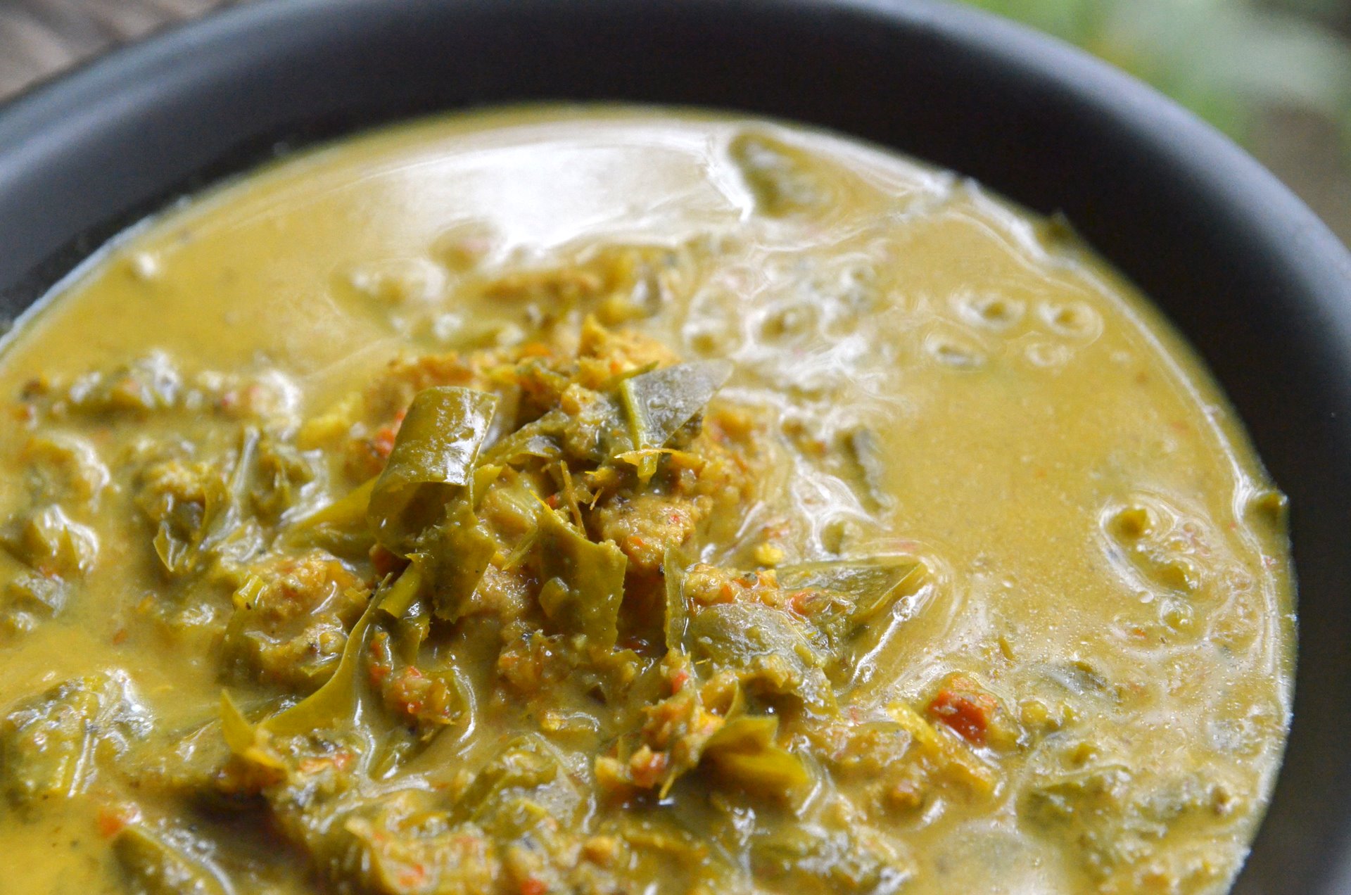
- Mu chamuang (หมูชะมวง): a curry is made from pork belly, herbs and sour grape apple shimba Chamuang (Garcinia cowa) leaves which is a popular dish of Chanthaburi and other provinces in eastern region.
- Kuaytiew mu liang (ก๋วยเตี๋ยวหมูเลียง): stewed pork noodles in Rĕw (Amomum villosum) herbal thicken soup which is unique local food.
- Khanom khuai ling (ขนมควยลิง): traditional dessert of Chanthaburi with a long history, its name literally means "monkey's dick snack".
- Kuaytiew sen chan pad pu (ก๋วยเตี๋ยวเส้นจันท์ผัดปู): a kind of Pad thai that uses Chanthaburi's rice noodles stir-fried with crab meat.
- Pathongko jim nam jim (ปาท่องโก๋จิ้มน้ำจิ้ม): Chinese deep-fried dough stick, or locally known as pathongko eaten with sweet and sour dipping sauce.
- Kaeng som bai sundan (แกงส้มใบสันดาน): a variation of Thai spicy and sour curry Kaeng som with leaves of a plant called Sundan (สันดาน, Cissus hastata), a species of liana. Selected by the Department of Cultural Promotion to be the provincial menu.
References
References
- "Table 2 Forest area Separate province year 2019". Royal Forest Department.
- "Official statistics registration systems". Department of Provincial Administration (DOPA).
- (July 2019). "''Gross Regional and Provincial Product, 2019 Edition''". Office of the National Economic and Social Development Council (NESDC).
- "ข้อมูลสถิติดัชนีความก้าวหน้าของคน ปี 2565 (PDF)".
- องค์ บรรจุน. ''สยามหลากเผ่าหลายพันธุ์.'' กรุงเทพฯ: มติชน, 2553, หน้า 128 {{in lang. th
- (19 October 2012). "Oknation". OK Nation.
- (22 June 2019). "Chantaburi on the table". The Nation.
- (2019). "ตารางที่ 2 พี้นที่ป่าไม้ แยกรายจังหวัด พ.ศ.2562".
- Chao Khong Ran. "ตำนานพลอยเมืองจันท์". luckyjewelista.
- "Archived copy".
- "Archived copy".
- "ตราประจำจังหวัดจันทบุรี". M-culture.go.th.
- (12 July 2019). "ดอกเหลืองจันทบูร ดอกไม้ประจำจังหวัดจันทบุรี". panmai.com.
- "สถิตินักท่องเที่ยวที่เข้าไปอุทยนห่งชาติ ปีงบประมาณ พ.ศ. 2567".
- (26 November 2019). "Number of local government organizations by province". Department of Local Administration (DLA).
- "ประเภทของทางหลวง". Highwayweigh.go.th.
- "หมูชะมวง". RBRU e-Culture.
- "ก๋วยเตี๋ยวหมูเลียง". RBRU e-Culture.
- (2017-07-11). "ไม่ได้ทะลึ่งนะ ชื่อแบบนี้จริงๆ 'ขนมxxxลิง' ไฮไลต์เด็ดขนมแปลกเมืองจันท์". Thai Rath.
- "ก๋วยเตี๋ยวเส้นจันท์ผัดปู". RBRU e-Culture.
- หลงรักเมืองจันท์. (2023-10-13). "บอกเลยว่าเด็ด "ปาท่องโก๋ เมืองจันท์ ต้องมีน้ำจิ้ม"". Facebook.
- หน้า 9, ''เสน่ห์ไทย''. '''[[Thairath. ไทยรัฐ]]'''ปีที่ 75 ฉบับที่ 24330 วันอาทิตย์ที่ 1 กันยายน พ.ศ. 2567 แรม 13 ค่ำ เดือน 9 ปีมะโรง (in Thai)
This article was imported from Wikipedia and is available under the Creative Commons Attribution-ShareAlike 4.0 License. Content has been adapted to SurfDoc format. Original contributors can be found on the article history page.
Ask Mako anything about Chanthaburi province — get instant answers, deeper analysis, and related topics.
Research with MakoFree with your Surf account
Create a free account to save articles, ask Mako questions, and organize your research.
Sign up freeThis content may have been generated or modified by AI. CloudSurf Software LLC is not responsible for the accuracy, completeness, or reliability of AI-generated content. Always verify important information from primary sources.
Report