From Surf Wiki (app.surf) — the open knowledge base
CFB Gagetown
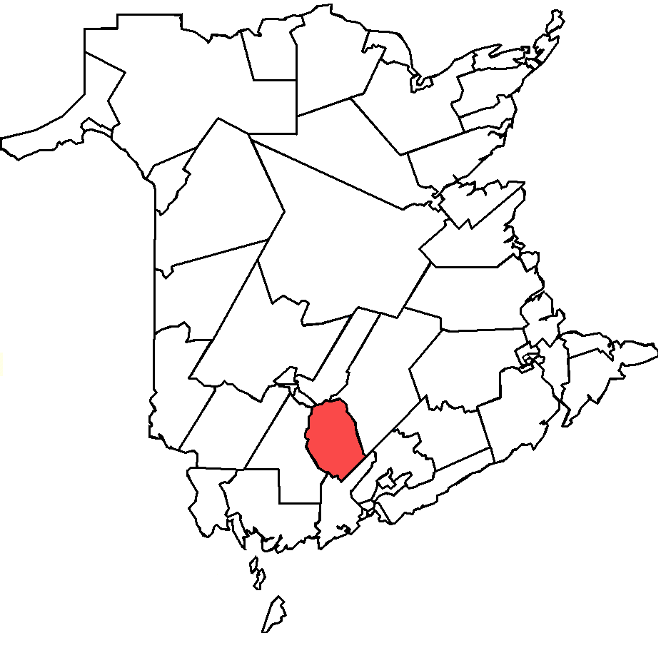
Military base in New Brunswick, Canada
Military base in New Brunswick, Canada
| Field | Value |
|---|---|
| name | 5th Canadian Division Support Base Gagetown |
| nativename | Gagetown Heliport |
| IATA | YCX |
| ICAO | CYCX |
| WMO | 71701 |
| type | Military |
| owner | Government of Canada |
| operator | Canadian Armed Forces |
| location | Oromocto, New Brunswick |
| built | 1958 |
| used | |
| commander | Colonel K.E. Osmond |
| occupants | C Squadron, Royal Canadian Dragoons, 2nd Battalion, The Royal Canadian Regiment, 4th Artillery Regiment (General Support), 4 Engineer Support Regiment, 5th Canadian Division Training Centre, 5th Canadian Division Support Group, 31 Military Police Company |
| timezone | AST |
| utc | UTC−04:00 |
| summer | ADT |
| utcs | UTC−03:00 |
| elevation-f | 166 |
| coordinates | |
| pushpin_map | Canada New Brunswick#Canada |
| pushpin_label | CYCX |
| website | https://www.canada.ca/en/army/corporate/5-canadian-division/5-canadian-division-support-base-gagetown.html |
| h1-number | H1 |
| h1-length-f | 150 |
| h1-surface | Asphalt |
| footnotes | Source: Canada Flight Supplement |
| Environment Canada |
| nativename-a = | nativename-r = | image-width = | owner-oper = | city-served = | elevation-f = 166 | h1-number = H1 | h1-length-f = 150 | h1-surface = Asphalt | stat-year = | stat1-header = | stat1-data = Environment Canada
5th Canadian Division Support Base (5 CDSB) Gagetown, commonly known as CFB Gagetown, is a large Canadian Forces Base covering an area over 1100 km2, located in southwestern New Brunswick.
At 274,000 acres, it is the biggest facility in Eastern Canada, and Canada's second-largest facility.
Construction of the base
Existing training facilities dating from the First and Second World Wars in eastern Canada were relatively small (Camp Debert, Camp Aldershot, Sussex Military Camp, Camp Valcartier, Camp Petawawa, Camp Utopia), thus a new facility was considered. At the same time, regional economic development planners saw an opportunity for a military base to benefit the economy of southwestern New Brunswick.
The area under consideration was an expansive plateau west of the Saint John River between the cities of Saint John and Fredericton, measuring approximately 60 km in length and 40 km in width; more accurately it runs between Oromocto in the north to Welsford in the south, and between the Saint John River in the east and the south branch of the Oromocto River in the west.
Over 900 families inhabited the area primarily engaged in agriculture and forestry. The terrain was variable, providing mixed Acadian forest, swamp and marshland, as well as open farming areas similar to the North European Plain. The influence of the St. Croix Highlands, part of the Appalachian Mountain range, creates hilly terrain and valleys in the southern and western part of the region close to the Nerepis and Oromocto rivers.
,_403_Sqn,_Gagetown_(1).JPG)
The expropriation of lands began in the early 1950s, much to the surprise of local residents who had been kept in the dark about the expropriation until the last minute. In total, between 2,000 and 3,000 residents were forced to move. An additional 44 cemeteries were within the expropriated land. The base was surveyed so as to not affect some of the historic communities along the western bank of the Saint John River such as Arcadia, Hampstead, and Browns Flat; the expropriation began several kilometres west of the river and eliminated the communities of Petersville, Hibernia, New Jerusalem, North Clones and others. This remains the largest single land expropriation in the history of New Brunswick.
The base headquarters were chosen for the northern part of the base adjacent to the (then) small village of Oromocto. In preparation for the influx of service personnel, Oromocto was redesigned as a "planned" town, with buried electrical utilities and residential and commercial clustering typical of larger planned towns such as Richmond Hill, Ontario.
Construction of the base facilities in Oromocto benefited from convenient railway connections provided by Canadian National and Canadian Pacific railways. A new alignment of the Trans-Canada Highway was built on the eastern bank of the Saint John River, opposite from Oromocto in the early 1960s (see Route 2) and a new highway bridge across the Saint John River connected the Trans-Canada Highway to the village of Burton, just south of Oromocto and near the east gate for the base.
The Gagetown Military Camp (or Camp Gagetown) opened in 1956 and was named after the village of Gagetown, although the base was located west of this historic village and was headquartered 25 km to its north in Oromocto. The base's territory measured 1129 km2 and included numerous live-fire ranges for infantry, armoured, and artillery units, as well as aerial weapons ranges.
At the time of its opening in 1956, until the opening of Shoalwater Bay Military Training Area in Australia in 1965, Camp Gagetown was the largest military training facility in the Commonwealth of Nations. By comparison, CFB Suffield has 2690 km2 with 2270 km2 usable by the military, and 420 km2 designated as the Suffield National Wildlife Area.

The training area has been heavily "landscaped" over the years by military foresters and many woodlines have been sculpted to form shapes recognizable from the air, including:
- Scotty Dog Woods
- Square Woods
- Flag Woods
- The "CTC" cutting
- The "Maple Leaf" cutting
Operations

Initially, Camp Gagetown was the home base for army regiments including The Black Watch and The Royal Canadian Regiment; however, budget cuts in the 1960s saw a gradual reduction, and the demise of their parent formation, 3 Brigade Group. In 1968, the Army, Air Force and Navy were merged to form the unified Canadian Forces and Camp Gagetown was renamed Canadian Forces Base Gagetown (CFB Gagetown).
In the post-unification armed forces, CFB Gagetown functioned as the primary combat training centre for Force Mobile Command (renamed Land Force Command in the 1990s). In the early 1970s Combat Training Centre Gagetown (CTC Gagetown) was established as a unit at CFB Gagetown comprising armour, artillery, and infantry training schools. In the early 1970s 422 and 403 helicopter squadrons were relocated to CFB Gagetown.PPfact{{ Their helipad is located at the end of Champlain Road. In the 1990s the Canadian Forces School of Military Engineering was relocated to CFB Gagetown from CFB Chilliwack.
The 1980s saw numerous new training facilities built and ranges modernized, and this continued into the 1990s as the Canadian Forces closed smaller bases. A large training building housing much of CTC was opened in late 1992.
CFB Gagetown continues to function as the army's primary training facility, although due to risk of forest fires in recent years, live-fire training has been pushed primarily to the fall-winter-spring seasons.
Units and formations

Principal units and formations of the CFB Gagetown are:
- 5th Canadian Division
- Combat Training Centre (Royal Canadian Armoured Corps School, Royal Canadian Artillery School, Canadian Forces School of Military Engineering, Infantry School and Tactics School)
- 5th Canadian Division Support Group
- 42 Health Services
- 1 Dental Unit Detachment Gagetown and the Joint Personnel Support Unit
- 2nd Battalion, The Royal Canadian Regiment
- 4th Artillery Regiment (General Support), RCA
- 4 Engineer Support Regiment
- 403 Helicopter Operational Training Squadron
- C Squadron, The Royal Canadian Dragoons
- Joint Meteorological Centre
- Canadian Army Trials and Evaluation Unit
- 5th Canadian Division Training Centre
- 3 Military Police Regiment Detachment Gagetown
- Argonaut Army Cadet Summer Training Centre
Defoliant testing
Main article: Agent Orange#Canada
Portions of the training area were subject to testing of defoliants during the 1960s. The use of Agent Orange and Agent Purple has led to an inquiry as to its long-term effects upon the soldiers and civilian base personnel who were exposed to it. The affected areas had soil tests that measured dioxin levels at 143 times the Canadian Council of Ministers of the Environment guidelines for maximum exposure.
St. Mary's Chapel
CFB Gagetown has a chapel that is administered by the Military Ordinariate of Canada. Services at the chapel are available for all military persons and the civilian personnel of the base. During the week, the chapel organizes Mass in French and English.
Economic facts
- The base and its lodger units provide full-time employment to approximately 6,500 military members and 1,000 civilians.
- The base contributes over to the local economy annually.
- The base contributes more than to the provincial economy annually.
References
References
- {{CFS
- "Synoptic/Metstat Station Information".
- (August 27, 2013). "Reactions mixed over name change at CFB Gagetown". CTV Atlantic.
- [http://archives.gnb.ca/Search/Cemeteries/CFBG/Introduction.aspx?culture=en-CA Canadian Forces Base Gagetown Cemeteries]
- (25 February 2013). "5th Canadian Division Support Base - Gagetown".
- [https://www.oromocto.ca/advantage-oromocto Oromocto is Accessible and Affordable!]
- [https://www.thecanadianencyclopedia.ca/en/article/canadian-forces-base-gagetown Canadian Forces Base Gagetown]
- (2018-08-04). "Remembering the places that disappeared when CFB Gagetown was born".
- "Provincial Archives of New Brunswick". [[Provincial Archives of New Brunswick]].
- (November 22, 1952). "They Don't Want to Leave". The Star Weekly.
- [https://www.oromocto.ca/history History: From the days of wooden ships...]
- "New Neighbours in New Brunswick". The Canadian Military Engineers Association.
- [http://www.btb.termiumplus.gc.ca/tpv2alpha/alpha-eng.html?lang=eng&i=1&index=ent&srchtxt=5th%20canadian%20division%20support%20base%20gagetown The Government of Canada’s terminology and linguistic data bank.]
- "5th Canadian Division Support Base Gagetown".
- "Units and Formations - 5th Canadian Division".
- "St. Mary's Chapel (Gagetown)".
- "Base Services".
- "City of Fredericton".
This article was imported from Wikipedia and is available under the Creative Commons Attribution-ShareAlike 4.0 License. Content has been adapted to SurfDoc format. Original contributors can be found on the article history page.
Ask Mako anything about CFB Gagetown — get instant answers, deeper analysis, and related topics.
Research with MakoFree with your Surf account
Create a free account to save articles, ask Mako questions, and organize your research.
Sign up freeThis content may have been generated or modified by AI. CloudSurf Software LLC is not responsible for the accuracy, completeness, or reliability of AI-generated content. Always verify important information from primary sources.
Report