From Surf Wiki (app.surf) — the open knowledge base
Carroll County, Virginia
County in Virginia, United States
County in Virginia, United States
| Field | Value |
|---|---|
| county | Carroll County |
| state | Virginia |
| seal | Carroll Co Va Seal.png |
| founded | 1842 |
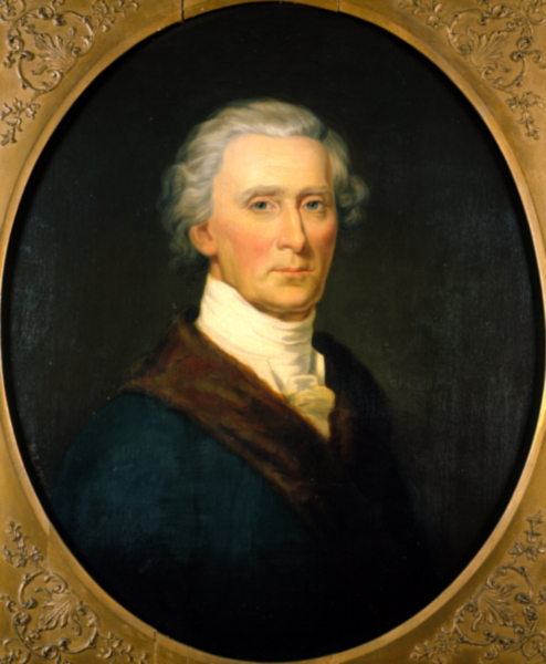
| named for | Charles Carroll |
| seat wl | Hillsville |
| largest city wl | Hillsville |
| city type | town |
| area_total_sq_mi | 478 |
| area_land_sq_mi | 475 |
| area_water_sq_mi | 3 |
| area percentage | 0.6 |
| population_as_of | 2020 |
| population_total | 29155 |
| population_density_sq_mi | auto |
| web | www.carrollcountyva.org |
| time zone | Eastern |
| ex image | CarrollCountyCourtFront.JPG |
| ex image cap | Carroll County Courthouse and Confederate Monument |
| district | 9th |
Carroll County is a United States county located in the southwestern part of the Commonwealth of Virginia. Roughly one fifth of the county lies in the Virginia Piedmont region, while the rest is part of the Appalachian Mountains. The county seat and only town is Hillsville.
The county was established in 1842 from part of Grayson County, and was officially named in honor of Charles Carroll, a signer of the Declaration of Independence. The borders of Carroll County were later expanded by including land from Patrick County.
The total size of the county is 478 mi2, and, as of the 2020 census, the population was 29,155.
History
The first European settlers arrived in the region in the mid 18th century. These were primarily Scotch-Irish pioneers, who were used to high mountain altitudes. However, early settlement was slow, mostly due to the poor agricultural soil of the area. As a result, lead mining was one of the first economic activities in the region.
As the area's population density increased, Carroll County was created in 1842 from part of Grayson County. The new county was officially named for Charles Carroll, a signer of the Declaration of Independence, from Maryland. However, other accounts assert that John Carroll, a Virginia state legislator, had named the county in his own honor, but was blocked by a political rival who had it officially named for Charles Carroll instead.
Parts of Patrick County were added later to increase the size of Carroll County. The first piece was taken in 1845, and another part, which would later become the Fancy Gap District, was added in 1854.
Geography
It is the only county in Virginia with Piedmont topography of roughly one fifth in the southeast part of the county and mountain topography of roughly four fifths elsewhere of the county. The Blue Ridge escarpment usually defines the county lines in both North Carolina and Virginia. The CDP community of Cana is in the Virginia Piedmont while the rest of the county is in the Appalachian Mountains.
According to the U.S. Census Bureau, the county has a total area of 478 sqmi, of which 475 sqmi is land and 3 sqmi (0.6%) is water.
Adjacent counties / Independent city
- Galax - west
- Grayson County - west
- Wythe County - northwest
- Pulaski County - north
- Floyd County - northeast
- Patrick County - southeast
- Surry County, North Carolina - south
Protected areas
National
- Blue Ridge Parkway (part)
- Jefferson National Forest (part)
- Mount Rogers National Recreation Area (part)
Other
- Devil's Den Nature Preserve
Major highways
- (future)
Demographics
|align-fn=center 1790-1960 1900-1990 1990-2000 2010 2020
Racial and ethnic composition
| Race / Ethnicity (NH = Non-Hispanic) | title=P2 HHispanic or Latino, and Not Hispanic or Latino by Race – 2010: DEC Redistricting Data (PL 94-171) - Carroll County, Virginia | url=https://data.census.gov/cedsci/table?q=p2&g=0500000US51035&tid=DECENNIALPL2010.P2 | website=United States Census Bureau}} | title=P2 Hispanic or Latino, and Not Hispanic or Latino by Race – 2020: DEC Redistricting Data (PL 94-171) - Carroll County, Virginia | url=https://data.census.gov/cedsci/table?q=p2&g=0500000US51035&tid=DECENNIALPL2020.P2 | website=United States Census Bureau}} | % 2010 | % 2020 |
|---|---|---|---|---|---|---|---|---|
| White alone (NH) | 28,820 | 27,040 | 95.93% | 92.75% | ||||
| Black or African American alone (NH) | 177 | 163 | 0.59% | 0.56% | ||||
| Native American or Alaska Native alone (NH) | 49 | 35 | 0.16% | 0.12% | ||||
| Asian alone (NH) | 51 | 80 | 0.17% | 0.27% | ||||
| Pacific Islander alone (NH) | 5 | 3 | 0.02% | 0.01% | ||||
| Some Other Race alone (NH) | 11 | 42 | 0.04% | 0.14% | ||||
| Mixed Race or Multi-Racial (NH) | 153 | 750 | 0.51% | 2.57% | ||||
| Hispanic or Latino (any race) | 776 | 1,042 | 2.58% | 3.57% | ||||
| Total | 30,042 | 29,155 | 100.00% | 100.00% |
2020 census
As of the 2020 census, the county had a population of 29,155. The median age was 48.7 years. 18.7% of residents were under the age of 18 and 25.2% of residents were 65 years of age or older. For every 100 females there were 96.4 males, and for every 100 females age 18 and over there were 95.2 males age 18 and over.
The racial makeup of the county was 93.5% White, 0.6% Black or African American, 0.2% American Indian and Alaska Native, 0.3% Asian, 0.0% Native Hawaiian and Pacific Islander, 1.8% from some other race, and 3.6% from two or more races. Hispanic or Latino residents of any race comprised 3.6% of the population.
2.4% of residents lived in urban areas, while 97.6% lived in rural areas.
There were 12,744 households in the county, of which 23.1% had children under the age of 18 living with them and 25.1% had a female householder with no spouse or partner present. About 30.3% of all households were made up of individuals and 16.3% had someone living alone who was 65 years of age or older.
There were 16,579 housing units, of which 23.1% were vacant. Among occupied housing units, 77.1% were owner-occupied and 22.9% were renter-occupied. The homeowner vacancy rate was 1.9% and the rental vacancy rate was 8.0%.
2000 Census
As of the census of 2000, there were 29,245 people, 12,186 households, and 8,786 families residing in the county. The population density was 61 /mi2. There were 14,680 housing units at an average density of 31 /mi2. The racial makeup of the county was 97.97% White, 0.44% Black or African American, 0.14% Native American, 0.10% Asian, 0.82% from other races, and 0.53% from two or more races. 1.64% of the population were Hispanic or Latino of any race.
There were 12,186 households, out of which 27.80% had children under the age of 18 living with them, 59.70% were married couples living together, 8.60% had a female householder with no husband present, and 27.90% were non-families. 25.40% of all households were made up of individuals, and 12.20% had someone living alone who was 65 years of age or older. The average household size was 2.36 and the average family size was 2.80.
In the county, the population was spread out, with 21.10% under the age of 18, 7.20% from 18 to 24, 28.00% from 25 to 44, 26.70% from 45 to 64, and 17.00% who were 65 years of age or older. The median age was 41 years. For every 100 females there were 97.20 males. For every 100 females aged 18 and over, there were 94.10 males. The median income for a household in the county was $30,597, and the median income for a family was $36,755. Males had a median income of $25,907 versus $19,697 for females. The per capita income for the county was $16,475. About 8.70% of families and 12.50% of the population were below the poverty line, including 15.70% of those under age 18 and 14.10% of those age 65 or over.
Government and politics
Carroll County, like neighboring Floyd, is a historical anomaly in being a solidly Republican county in “Solid South” Virginia, due to desertions from the Confederate army during the Civil War. It was the only county in Virginia to vote for William Howard Taft during the 1912 election, and the only Democrat to carry the county in a presidential election since 1896 has been Franklin D. Roosevelt in 1932. Since 1980 no Democrat has gained forty percent of the county's vote, and even with Virginian Tim Kaine on the ticket, Hillary Clinton gained less than twenty percent in the 2016 election. Democratic Senatorial candidate Mark Warner did however carry Carroll County in his landslide 2008 victory.
Education
Public high schools
Carroll County High School, in Hillsville, serves the county. Home of the Cavaliers, CCHS is a 9-12 comprehensive high school. The school was created by the consolidation of Woodlawn High School (Woodlawn, Virginia) and Hillsville High School (Hillsville, Virginia).
Communities
Town
- Hillsville
Census-designated places
- Cana
- Fancy Gap
- Hilltown (also in Grayson County)
- Woodlawn
Other unincorporated communities
- Austinville
- Dugspur
- Lambsburg
- Laurel Fork
- Sylvatus
Notable people
- Floyd Allen (1856-1913) – former landowner and chief patriarch of the powerful Allen clan; convicted and executed for murder after sensational 1912 Hillsville courthouse shootout that killed five people including Circuit Judge Thornton Massie, Commonwealth's Attorney William Foster, and sheriff Lewis Webb.
- Doc Ayers – former Major League Baseball pitcher, Washington Senators, Detroit Tigers
- Kylene Barker – Miss America 1979
- Frank Beamer – former head football coach at Virginia Tech
- George Lafayette Carter – former land and railroad entrepreneur instrumental in the establishment of East Tennessee State University
- Charles B. Morris (1931-1996) – former U.S. Army, awarded the Medal of Honor, 1967
- Ernest Stoneman (1893–1968) – former country musician
References
References
- "Find a County". National Association of Counties.
- "Carroll County, Virginia".
- "A Brief History Of Carroll County, Virginia". The Journal of Mountain Life.
- Gannett, Henry. (1905). "The Origin of Certain Place Names in the United States". Govt. Print. Off..
- (2004). "Southwest Virginia Crossroads: An Almanac of Place Names and Places to See". Overmountain Press.
- (February 12, 2011). "US Gazetteer files: 2010, 2000, and 1990". [[United States Census Bureau]].
- "Census of Population and Housing from 1790-2000". [[US Census Bureau]].
- "Historical Census Browser". University of Virginia Library.
- "Population of Counties by Decennial Census: 1900 to 1990". United States Census Bureau.
- "Census 2000 PHC-T-4. Ranking Tables for Counties: 1990 and 2000". United States Census Bureau.
- "P2 HHispanic or Latino, and Not Hispanic or Latino by Race – 2010: DEC Redistricting Data (PL 94-171) - Carroll County, Virginia".
- "P2 Hispanic or Latino, and Not Hispanic or Latino by Race – 2020: DEC Redistricting Data (PL 94-171) - Carroll County, Virginia".
- (2021). "2020 Decennial Census Demographic Profile (DP1)".
- (2021). "2020 Decennial Census Redistricting Data (Public Law 94-171)".
- (2023). "2020 Decennial Census Demographic and Housing Characteristics (DHC)".
- "U.S. Census website". [[United States Census Bureau]].
- Menendez, Albert J.; ''The Geography of Presidential Elections in the United States, 1868-2004'', pp. 323, 326, 329 {{ISBN. 0786422173
- David Leip. "Dave Leip's Atlas of U.S. Presidential Elections". Uselectionatlas.org.
This article was imported from Wikipedia and is available under the Creative Commons Attribution-ShareAlike 4.0 License. Content has been adapted to SurfDoc format. Original contributors can be found on the article history page.
Ask Mako anything about Carroll County, Virginia — get instant answers, deeper analysis, and related topics.
Research with MakoFree with your Surf account
Create a free account to save articles, ask Mako questions, and organize your research.
Sign up freeThis content may have been generated or modified by AI. CloudSurf Software LLC is not responsible for the accuracy, completeness, or reliability of AI-generated content. Always verify important information from primary sources.
Report