From Surf Wiki (app.surf) — the open knowledge base
Carbon County, Montana
County in Montana, United States
County in Montana, United States
| Field | Value |
|---|---|
| county | Carbon County |
| state | Montana |
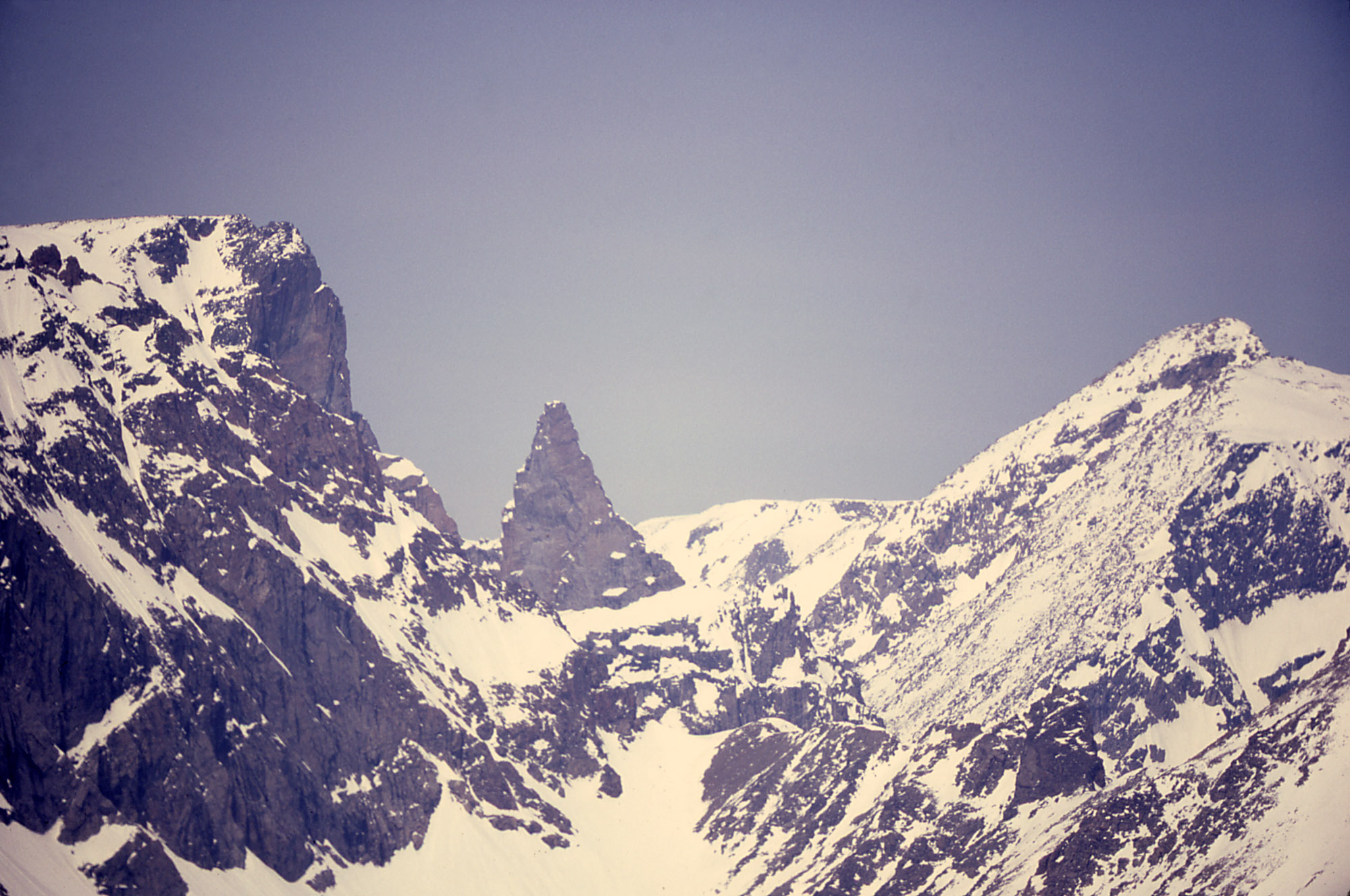
| ex image | Red Lodge Palisades.jpg |
| ex image size | 220px |
| ex image cap | Palisades |
| founded date | March 4 |
| founded year | 1895 |
| seat wl | Red Lodge |
| largest city wl | Red Lodge |
| area_total_sq_mi | 2062 |
| area_land_sq_mi | 2049 |
| area_water_sq_mi | 13 |
| area percentage | 0.6 |
| population_as_of | 2020 |
| population_total | 10473 |
| pop_est_as_of | 2024 |
| population_est | 11498 |
| population_density_sq_mi | auto |
| web | http://co.carbon.mt.us/ |
| district | 2nd |
| time zone | Mountain |
- Montana county number 10
Carbon County is a county located in the U.S. state of Montana. As of the 2020 census, the population was 10,473. Its county seat is Red Lodge.
Carbon County is part of the Billings, MT Metropolitan Statistical Area.
History
Carbon County was named for the rich coal deposits found in the area. It was organized on March 4, 1895, from portions of Park and Yellowstone counties.
Land from Park and Yellowstone counties was used to form Carbon County on March 4, 1895. More than sixty federally designated historic sites are located in the county, including Petroglyph Canyon, one of the state's most important rock art sites.
The first commercial oil well in the state was established in Elk Basin fields in 1915.
Geography
According to the United States Census Bureau, the county has a total area of 2062 sqmi, of which 2049 sqmi is land and 13 sqmi (0.6%) is water.
Granite Peak, the state's highest mountain, is found in Carbon County's Beartooth Mountains. The Beartooth Highway, one of the "most spectacular alpine highways", links Red Lodge to Cooke City. The Pryor Mountains are in the east of the county, along with the Big Horn River.
Major highways
- [[File:US 212.svg|20px]] U.S. Highway 212
- [[File:US 310.svg|20px]] U.S. Highway 310
- [[File:MT-72.svg|20px]] Montana Highway 72
- [[File:MT-78.svg|20px]] Montana Highway 78
Adjacent counties
- Park County - west
- Stillwater County - north
- Yellowstone County - northeast
- Big Horn County - east
- Big Horn County, Wyoming - southeast
- Park County, Wyoming - south
National protected areas
- Bighorn Canyon National Recreation Area (part)
- Custer National Forest (part)
- Gallatin National Forest (part)
Politics
Carbon County has voted Republican in every presidential election since 1968.
Demographics
|align-fn=center 1790–1960, 1900–1990, 1990–2000, 2010–2020, 2023
2020 census
As of the 2020 census, the county had a population of 10,473, with 18.8% of residents under the age of 18 and 25.6% aged 65 or older; the median age was 50.0 years. For every 100 females there were 102.1 males, and for every 100 females age 18 and over there were 103.0 males. None of the residents lived in urban areas and 100.0% lived in rural areas.
The racial makeup of the county was 92.8% White, 0.2% Black or African American, 1.1% American Indian and Alaska Native, 0.2% Asian, 0.7% from some other race, and 5.0% from two or more races; Hispanic or Latino residents of any race comprised 2.5% of the population.
There were 4,694 households, of which 21.7% had children under the age of 18 living with them and 20.9% had a female householder with no spouse or partner present. About 31.5% of all households were made up of individuals and 14.8% had someone living alone who was 65 years of age or older.
There were 6,359 housing units, of which 26.2% were vacant. Among occupied housing units, 77.1% were owner-occupied and 22.9% were renter-occupied. The homeowner vacancy rate was 1.7% and the rental vacancy rate was 11.7%.
2010 census
As of the 2010 census, there were 10,078 people, 4,571 households, and 2,884 families living in the county. The population density was 4.9 PD/sqmi. There were 6,441 housing units at an average density of 3.1 /mi2. The racial makeup of the county was 97.2% white, 0.8% American Indian, 0.3% black or African American, 0.2% Asian, 0.4% from other races, and 1.0% from two or more races. Those of Hispanic or Latino origin made up 1.9% of the population. In terms of ancestry, 32.3% were German, 16.2% were Irish, 14.5% were English, 12.6% were American, and 6.6% were Norwegian.
Of the 4,571 households, 23.6% had children under the age of 18 living with them, 53.4% were married couples living together, 6.1% had a female householder with no husband present, 36.9% were non-families, and 31.2% of all households were made up of individuals. The average household size was 2.19 and the average family size was 2.74. The median age was 48.1 years.
The median income for a household in the county was $49,010 and the median income for a family was $59,823. Males had a median income of $41,241 versus $26,150 for females. The per capita income for the county was $24,983. About 8.1% of families and 12.2% of the population were below the poverty line, including 14.1% of those under age 18 and 11.1% of those age 65 or over.
Economy
During the early history of Carbon County, coal mining was the predominant industry. The current economy relies on agriculture, recreation, and tourism.
In 2009 the top employers were Beartooth Hospital & Health Center, Red Lodge Mountain, and the Red Lodge Pizza Company.
In December 2014, construction began on a large windfarm, Mud Springs Wind Ranch, with 120 wind turbines, 12 mi southeast of Bridger.
Communities

City
- Red Lodge (county seat)
Towns
- Bearcreek
- Bridger
- Fromberg
- Joliet
Census-designated places
- Belfry
- Boyd
- Edgar
- Fox
- Luther (originally Linley)
- Montaqua
- Roberts
- Rockvale
- Roscoe (originally Morris)
- Silesia
Unincorporated communities
- Alpine
- Bowler
- George Place
- Peterson Place
- Richel Lodge
- Selmes
- Warren
- Washoe
Former communities
- Carbonado
- Chance
- Chickentown
- Fairbanks
- Gebo (originally Coalville)
- Golden
- International
- New Caledonia
- Riverview
- Scotch Coulee
- Stringtown
References
References
- "State & County QuickFacts". United States Census Bureau.
- "Find a County". National Association of Counties.
- Carbon County. "Welcome to Carbon County".
- {{NRISref
- Vincent, William B. ''[https://web.archive.org/web/20130619214256/http://geonames.usgs.gov/pls/gazpublic/GAZVECTOR.feat_folder?p_file=406018 National Register of Historic Places Inventory/Nomination: Petroglyph Canyon]''. National Park Service, September 4, 1974, 3.
- Merrill, Andrea. (1997). "Montana almanac". Falcon Publishing.
- (August 22, 2012). "2010 Census Gazetteer Files". United States Census Bureau.
- America's Byways. "Beartooth Highway-Montana".
- Leip, David. "Atlas of US Presidential Elections".
- The leading "other" candidate, [[Progressive Party (United States, 1912). Progressive]] [[Theodore Roosevelt]], received 766 votes, while Socialist candidate [[Eugene V. Debs. Eugene Debs]] received 388 votes.
- "County Population Totals and Components of Change: 2020-2024". United States Census Bureau.
- "U.S. Decennial Census". United States Census Bureau.
- "Historical Census Browser". University of Virginia Library.
- "Population of Counties by Decennial Census: 1900 to 1990". United States Census Bureau.
- "Census 2000 PHC-T-4. Ranking Tables for Counties: 1990 and 2000". United States Census Bureau.
- (2023). "2020 Decennial Census Demographic and Housing Characteristics (DHC)". United States Census Bureau.
- (2021). "2020 Decennial Census Demographic Profile (DP1)". United States Census Bureau.
- (2021). "2020 Decennial Census Redistricting Data (Public Law 94-171)". United States Census Bureau.
- Montana Dept. of Labor and Industry. (September 2010). "Demographic & Economic Information for Carbon County".
- Lutney, Tom. (December 19, 2014). "Major wind farm breaks ground near Bridger". [[Missoulian]].
- [https://www.google.com/maps/place/Alpine,+MT+59071/@45.2013313,-109.6500362,15z/data=!3m1!4b1!4m5!3m4!1s0x534f18c406e35cbb:0x3fe65ea0dfbf400b!8m2!3d45.2013322!4d-109.6412814 ''Alpine, Carbon County MT'' Google Maps (accessed December 31, 2018)]
- [https://www.google.com/maps/place/George+Place,+MT+59001/@45.3602201,-109.5072546,15z/data=!3m1!4b1!4m5!3m4!1s0x534f3a066564c599:0xb1a1c69582c085e2!8m2!3d45.360221!4d-109.4984998 ''George Place, Carbon County MT'' Google Maps (accessed December 31, 2018)]
- [https://www.google.com/maps/place/Peterson+Place,+MT+59071/@45.3738313,-109.4647532,15z/data=!3m1!4b1!4m5!3m4!1s0x534f30d31d290bdb:0x87751c27dc938ea6!8m2!3d45.3738322!4d-109.4559984 ''Peterson Place, Carbon County MT'' Google Maps (accessed December 31, 2018)]
- [https://www.google.com/maps/place/Richel+Lodge,+MT+59068/@45.0818885,-109.384191,15z/data=!3m1!4b1!4m5!3m4!1s0x534ed96113b299d7:0xe6ff0fd7928891aa!8m2!3d45.0818893!4d-109.3754362 ''Richel Lodge, Carbon County MT'' Google Maps (accessed December 31, 2018)]
- [https://www.google.com/maps/place/Selmes,+MT+59070/@45.3918888,-109.1408528,15z/data=!3m1!4b1!4m5!3m4!1s0x5348ce57b9396e6f:0xcd98e05e31646261!8m2!3d45.3918897!4d-109.132098 ''Selmes, Carbon County MT'' Google Maps (accessed December 31, 2018)]
This article was imported from Wikipedia and is available under the Creative Commons Attribution-ShareAlike 4.0 License. Content has been adapted to SurfDoc format. Original contributors can be found on the article history page.
Ask Mako anything about Carbon County, Montana — get instant answers, deeper analysis, and related topics.
Research with MakoFree with your Surf account
Create a free account to save articles, ask Mako questions, and organize your research.
Sign up freeThis content may have been generated or modified by AI. CloudSurf Software LLC is not responsible for the accuracy, completeness, or reliability of AI-generated content. Always verify important information from primary sources.
Report