From Surf Wiki (app.surf) — the open knowledge base
Campobello Island
Island in Campobello, New Brunswick, Canada

Island in Campobello, New Brunswick, Canada
| Field | Value |
|---|---|
| name | Campobello Island |
| other_name | Port aux Coquilles (Seashell Harbour) |
| Abahquict ("Parallel to Shore") | |
| settlement_type | Rural community |
| image_skyline | Lighthouse on Campobello Island.jpg |
| image_caption | Head Harbour Lighthouse and station, Passamaquoddy Bay |
| pushpin_map | Canada#New Brunswick |
| pushpin_map_caption | Location of Campobello Island in Canada |
| coordinates | |
| subdivision_type | Country |
| subdivision_name | Canada |
| subdivision_type1 | Province |
| subdivision_name1 | New Brunswick |
| subdivision_type2 | County |
| subdivision_name2 | Charlotte County |
| established_title | Erected |
| established_date | 1803 |
| unit_pref | |
| area_footnotes | |
| area_land_km2 | 39.59 |
| population_as_of | 2021 |
| population_footnotes | |
| population_total | 949 |
| population_density_km2 | 24 |
| population_blank1_title | Pop 2016-2021 |
| population_blank1 | 8.8% |
| population_blank2_title | Dwellings |
| population_blank2 | 612 |
| population_density_blank1_km2 | 24 |
| leader_title1 | Mayor |
| leader_name1 | Harvey Matthews |
| leader_title2 | Councillor |
| leader_name2 | Alex Carroll |
| leader_title3 | Councillor |
| leader_name3 | Kyle Fletcher |
| leader_title4 | Councillor |
| leader_name4 | Dianna Parker |
| timezone | AST |
| utc_offset | -4 |
| timezone_DST | ADT |
| utc_offset_DST | -3 |
| elevation_min_m | 0 |
| elevation_max_m | 90 |
Abahquict ("Parallel to Shore")
Campobello Island (, also ) is the largest and only inhabited island in Campobello Parish in Charlotte County in southwestern New Brunswick, Canada, near the border with Maine, United States. It is the site of the Roosevelt Campobello International Park, Head Harbour Lighthouse, and of Herring Cove Provincial Park.
It has been an incorporated rural community since 2010 and is a member of the Southwest New Brunswick Service Commission (SNBSC).
In 1770, the island was granted to Capt. William Owen, who named it in honour of Lord William Campbell, who was governor of Nova Scotia, and noting "Campo Bello" meant "Beautiful Field" in Italian.
History
There are no traces of settlement by the Passamaquoddy or Norsemen who may have visited the island. The first Europeans in the region were Pierre Dugua de Mons and Samuel de Champlain, who founded the nearby 1604 Saint Croix Island settlement.Pedersen, Mark. "Islands Rich in History", Leader-Post, April 13 1974 It has been speculated that the fort of Jean Serreau di St Aubin, known to have been built somewhere in the Passamaquoddy Bay but vacated in the years surrounding King William's War and Benjamin Church's 1704 expulsion of the French from the Bay, may have been situated on Campobello.
In 1713, the Treaty of Utrecht (1713) made the island part of British Nova Scotia. The first known settler from the British Isles was James Boud of Kilmarnock, who settled in 1760. Its first post office opened in 1795.
In 1770, the island was granted to Captain Owen who dubbed it "my island", and "just as a ship's master at-sea was the ultimate authority...Owen decided the best system for Campobello would be for the island to consider itself at-sea". Owen immediately set to work building a town he dubbed New Warrington (Wilson's Beach, today) but after only a year on the island in June 1771, Owen was recalled to active military service; he never returned to Campobello Island although still advertising for industrious farmers to help settle it before his 1778 death in Madras, India. His one year on the island "launched a feudal dynasty that was to reign well over a century".
During the War of 1812 the British Navy seized coastal lands in Maine as far south as the Penobscot River but returned them following the war, except for offshore islands. Capt. Owen wrote to the Prince Regent, noting that if the Crown insisted on ordering Campobello residents to perform military drills on the mainland as he had cautioned against, the Crown may find Campobello fighting against it, and stating "the Crown alone, without our consent, has no right to tax us".
In 1817, the United States relinquished its claim to Campobello, Deer, and Grand Manan islands, in exchange for islands in Cobscook Bay. The provincial government of New Brunswick funded the construction of Head Harbour Lighthouse, or East Quoddy Head Light, in 1829; this light station would be a counterpart to West Quoddy Head Light which the United States built in the previous decades. As of 1842, Thomas Wyer was one of three commissioners of the lighthouses on Machias Seal Island, Campobello and at Saint Andrews.

In 1835, the illegitimate son of Captain Owen, Vice-Admiral William Fitzwilliam Owen, became sole proprietor of the island and took great interest in his advanced years in building the island community but struggled with an "addiction" to local women.
In 1866, a band of more than 700 members of the Fenian Brotherhood arrived at the Maine shore opposite the island with the intention of seizing Campobello but were dispersed by British warships from Halifax.
British naval officer John James Robinson became owner of the island in 1857 by virtue of having married Owen's daughter.
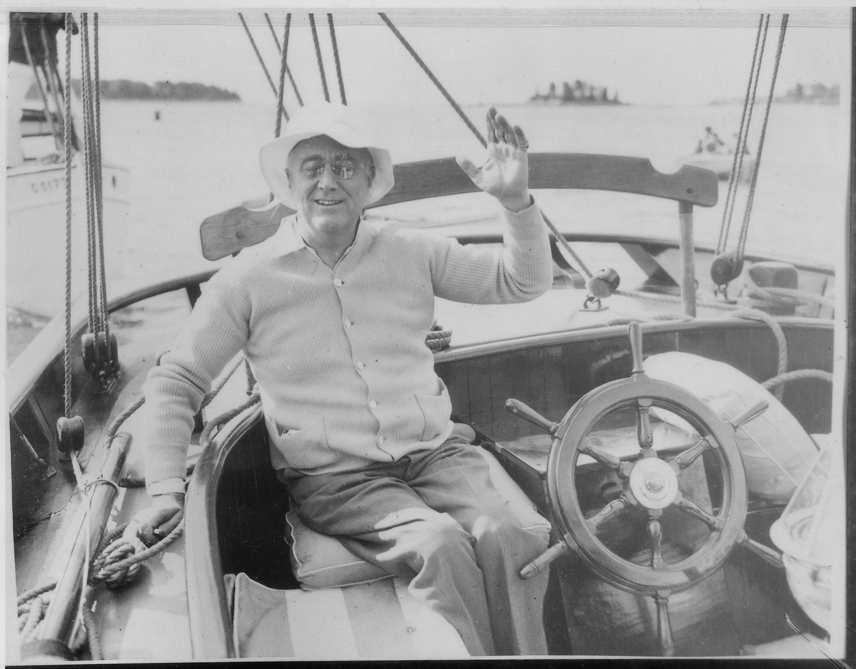
In 1867, Captain Robinson Owen was staunchly against Canadian Confederation. In 1881, the widow of Capt. Robinson Owen sold 1,200 acres of the island to a group of American businessmen including James Roosevelt and the island was developed as a resort summer colony, which ended "the dynasty" of Owens ruling the island. A luxurious resort hotel and many grand estates were built. From 1883, the Roosevelt family famously made Campobello Island their summer home.Pedersen, Mark. "Islands Rich in History", Leader-Post, April 13 1974
Religion
The journals of William Owen note that he held Anglican religious service in a shed for all the members of his new settlement on June 10 1770 just days after their arrival. William's son David Owen built a church in which he himself preached and performed marriages. Upon taking over, David's brother William Fitzwilliam introduced a lesser form of Droit du seigneur, insisting that he personally had the right to every wife's first kiss on the island following marriage.
Captain Robinson Owen built a Baptist church at North Road that was destroyed and rebuilt following the Saxby Gale, and Wilson's Beach remained staunchly Baptist, while Owen built a new Anglican church and cetered at Welchpool.
In 1842 the Anglican bishop consecrated the church and cemetery; the block of stone from which the baptismal font was carved was taken from the "Church of the Knights Templar at Malta" and transported by Owen's son-in-law.
Smuggling

The population was increased by United Empire Loyalists after the American Revolutionary War. Smuggling was a major part of the island's prosperity around this time, starting as soon as 1807 and contributing to residents' economic freedom from the Owens'. In later years, it was remarked that merchant ships secretly putting ashore at Eastport, Maine would report in ledgers that they travelled to "Sweden" once or twice a day with their wares. Many of the smuggling ships used Swedish flags, or other unaligned European nations, to avoid seizure. Following his defection, General Benedict Arnold set up a smuggling operation on Campobello Island transiting Saint John goods.
The first major smuggling trial in the Bay of Fundy convicted Gillam Butler, of Campobello Island in 1796 of illegally importing US whale oil under the pretense it was harvested in New Brunswick. Southwestern New Brunswick smugglers in the late 18th century were "the overwhelming majority of the local political machinery, including the judiciary" - and a 1796 seizure found contraband tied to the "leading figures and magistrates" of Campobello, Grand Manan and Indian Island.
In 1808, it was noted in US military channels that the settlement of Moose Island had grown solely through its ability to smuggle goods with Campobello. During the War of 1812, the need for American food to move into Canada, and British goods to move into the United States led historial Charles W. Kendall to assert that "during the war there was a tacit treaty on the Maine and New Brunswick frontier...customs officials did not recognize it, but American and British merchants did." The close of the war brought an end to the first major period of smuggling on Campobello.
Through the 19th century, smuggling was a major industry on Campobello. In 1898, it was noted that "many of the inhabitants here may be considered...daring in carrying on a successful illicit trade, to rival even the far-famed Dirk Hatteraick.
Smuggling, or rum running, became notable again following the 1870 economic downturn - and hit its heydey during the 1920s Prohibition. Police boats began waiting in the waters to intercept and search vessels travelling between the countries. In 1883, the US Treasury Department charged three evangelical deacons from Lubec with smuggling "immense quantities of wool, skins, rags and lead" purchased in New Brunswick and brought to Patch's Factory of Campobello to be snuck across the border by locals at night.
In 2019, senator David Adams Richards raised concerns that the anti-smuggling provisions of Bill C-21 would unfairly target Campobello residents who needed to bring materials through the United States.
Shipwrecks

On January 21 1865, the British-flagged schooner Liseon was wrecked on the shore of Campobello.
On May 24, 1841 the Admiral Benbow was wrecked on the shore of Campobello, with all crew rescued.
Geography

The island is at the entrance to Passamaquoddy Bay, adjacent to the entrance to Cobscook Bay, and within the Bay of Fundy. The island is one of the Fundy Islands. The island has no road connection to the rest of Canada; it is connected by the Franklin Delano Roosevelt Bridge to nearby Lubec, Maine. Reaching mainland Canada by car without crossing an international border is possible only during the summer season and requires two separate ferry trips, first to nearby Deer Island, then to L'Etete.
The ferry to Deer Island was stopped in 2017 after the boat sank, leaving the island without a direct connection to the rest of Canada. Service was restored and became year-round due to the COVID pandemic.
The jurisdiction of the eponymous rural community and of the census division include Head Harbour Island.
Measuring 14 km long and about 5 km wide, it has an area of 39.6 km2. On the north is a high bluff headland, East Quoddy Point. On the west are Charley Point and the Mulholland Point navigation light.
Economy

The island has several good harbours, and the majority of residents are employed in the fishing, aquaculture or tourism industries.
The two major tourist attractions on the island are Herring Cove Provincial Park and Roosevelt Campobello International Park. The latter was created in 1964 and was officially opened by U.S. President Lyndon Johnson and Canadian Prime Minister Lester Pearson in 1966.
Infrastructure
The island's only highway, Route 774, is connected by the Franklin Delano Roosevelt Bridge to Lubec, Maine. Its only connection with the Canadian mainland is through a seasonal ferry to Deer Island which goes onward to the mainland.
United States Customs and Border Protection service began searching packages to the island, originating in Canada, in 2019, prompting outcry.
In 2020, residents renewed demands for a bridge, due to the restrictions imposed on both sides of the border during the COVID-19 pandemic in North America. The government paid for an autumn extension of the ferry until winter.
The island has one school, Campobello Island Consolidated School, for all school grades, in the Anglophone South School District.
Communities
Communities within the rural community:
- North Road
- Otter Cove
- Welshpool
- Wilsons Beach
Bodies of water
Bodies of waterNot including brooks, ponds or coves. at least partly within the rural community:
- Friars Bay
- Lake Glensevern
- Harbour de Lute
- Head Harbour
- Head Harbour Passage
- Lubec Channel
- Lubec Narrows
- Mill Cove Creek
- Mill Stream
- Quoddy Narrows
- Passamaquoddy Bay
Demographics
In the 2021 Census of Population conducted by Statistics Canada, Campobello Island had a population of living in of its total private dwellings, a change of from its 2016 population of . With a land area of 39.59 km2, it had a population density of in 2021.
Campobello Parish, NB | 1991 |1317 | 1996 |1305 | 2001 |1195 | 2006 |1056 | 2011 | 925 | 2016 | 872 | 2021 | 949
Language
| Canada census mother tongue - Campobello Parish, New Brunswick | Census | Total | Year | Responses | Count | Trend | Pop % | Count | Trend | Pop % | Count | Trend | Pop % | Count | Trend | Pop % |
|---|---|---|---|---|---|---|---|---|---|---|---|---|---|---|---|---|
| 885 | 10.2% | 98.88% | 5 | 83.3% | 0.56% | 0 | 0.0% | 0.00% | 5 | |||||||
| 985 | 15.4% | 95.17% | 30 | n/a% | 2.90% | 0 | 0.0% | 0.00% | 20 | |||||||
| 1,165 | 9.0% | 100.00% | 0 | 0.0% | 0.00% | 0 | 0.0% | 0.00% | 0 | |||||||
| 1,280 | n/a | 100.00% | 0 | n/a | 0.00% | 0 | n/a | 0.00% | 0 |
Notes
References
References
- (March 2003). "Campobello Island". Arcadia.
- Government of Canada, Statistics Canada. (9 February 2022). "Profile table, Census Profile, 2021 Census of Population - Campobello Island, Rural community (RCR) [Census subdivision], New Brunswick".
- "Campobello Island". [[Oxford University Press]].
- {{Cite Merriam-Webster. Campobello
- "Campobello". [[HarperCollins]].
- (2005). "The Partition of Nova Scotia". Electronic text centre (UNB Libraries).
- "New Brunswick Regulation 84-168 under the Municipalities Act (O.C. 84-582)". Government of New Brunswick.
- link. (19 March 2007 ; Statistics Canada.)
- (July 2017). "Communities in each of the 12 Regional Service Commissions (RSC) / Les communautés dans chacune des 12 Commissions de services régionaux (CSR)".
- (1896). "A Monograph of the Place-Nomenclature of the Province of New Brunswick". Royal Society of Canada.
- Ingersoll, L.K.. (1979). "Owen, William". University of Toronto/Université Laval.
- Proceedings and Transactions of the Royal Society of Canada, 1883, https://archive.org/details/proceedingstrans2121roya/page/n415/mode/2up?q=%22deer+island%22
- (1901). "David Owen of Campobello, New Brunswick". Acadiensis.
- True man, Stuart, "An Intimate History of New Brunswick", 1970
- https://ia804501.us.archive.org/8/items/cihm_38425/cihm_38425.pdf {{Bare URL PDF. (July 2025)
- Cornell, Paul G.. (1985). "Owen, William Fitz William". University of Toronto/Université Laval.
- Jennifer Crump. (26 July 2010). "Canada Under Attack". Dundurn.
- Buescher, John. "[http://teachinghistory.org/history-content/ask-a-historian/19821 What Happened to the Fenians After 1866?]" [http://www.teachinghistory.org Teachinghistory.org], accessed 8 October 2011
- Lorimer, John G. "History of Islands and Islets in the Bay of Fundy, Charlotte County, New Brunswick", [https://archive.org/details/historyofislands00lori/page/n5/mode/2up Archive.org copy], 1876
- https://secure-sha.org/assets/documents/meetings/2012/Final2012ConferenceAbstractProgram.pdf {{Bare URL PDF. (January 2026)
- Erika J. Waters. (2010). "Kittery to Bar Harbor: Touring Coastal Maine". Arcadia Publishing.
- (March 2003). "Campobello Island". Arcadia.
- "Campobello, an Historical Sketch - Wikisource, the free online library".
- "Bluebloods, Black Market". Saltscapes.
- https://digitalcommons.colby.edu/cgi/viewcontent.cgi?article=2511&context=cq
- "Bootleggers and Benedict Arnold | St. Croix Historical Society".
- Craven, Paul. "Petty Justice: Low Law and the Sessions System in Charlotte County"
- "Loyalist Borderlands on Campobello Island: The Ordeal of Gillam Butler, Part Two | the Loyalist Collection".
- (14 October 2019). "Borderland Smuggling: Patriots, Loyalists, and Illicit Trade in the Northeast, 1783-1820". University Press of Florida.
- (1997). "Prize and Prejudice: Privateering and Naval Prize in Atlantic Canada in the War of 1812". Oxford University Press.
- (26 August 2021). "Roosevelt Cottage, Campobello Island".
- (29 July 2019). "Rowing Friar Roads".
- https://www.google.ca/books/edition/The_History_of_Canada_Canada_under_Briti/1T8TAAAAYAAJ?hl=en&gbpv=1&dq=smugglers+grand+manan&pg=RA2-PA250&printsec=frontcover, Chapter III
- (1884). "House documents".
- "The island Canada forgot: On Campobello, citizens are left exiles in their own land". Financial Post.
- Mercantile Ship News". The Standard. No. 12646. London. 18 February 1865. p. 6.
- "Shipping Intelligence". The Hull Packet. No. 2948. Hull. 18 June 1841.
- Paul Karr. (18 March 2005). "Frommer'sMaine Coast". John Wiley & Sons.
- (23 January 2018). "The island Canada forgot: On Campobello, citizens are left exiles in their own land". [[Financial Post]].
- (16 December 2021). "Campobello ferry to run all winter amid worsening COVID situation". CBC News.
- U.S. Coast and Geodetic Survey. (1879). "Atlantic Local Coast Pilot: Sub-division 1: Passamaquoddy Bay to Schoodic". U.S. Government Printing Office.
- Richardson Clover. (1891). "Sailing Directions for Nova Scotia, Bay of Fundy, and South Shore of Gulf of St. Lawrence". U.S. Government Printing Office.
- David Goss. (2002). "St. George and Its Neighbours". Arcadia Publishing.
- (December 2019). "Canadian islanders angry over US mail searches". [[BBC]].
- "On quiet Campobello Island, Canadians angered by US inspection of their mail". [[Boston Globe]].
- Steve McKinley. (3 January 2021). "Cut off by geography and COVID-19, this Canadian island is calling out for a link to the rest of Canada — to no avail". Toronto Star.
- Shelby Thevenot. (21 December 2020). "Canada extends restrictions on U.S. travellers until January 21". Toronto Star.
- Hadeel Ibrahim. (11 December 2020). "Campobello ferry service extended to January". CBC News.
- "No. 166". Department of Natural Resources and Energy Development.
- "501". Government of New Brunswick.
- "Search the Canadian Geographical Names Database (CGNDB)".
- (February 9, 2022). "Population and dwelling counts: Canada, provinces and territories, census divisions and census subdivisions (municipalities), New Brunswick". [[Statistics Canada]].
- Statistics Canada: [[Canada 1996 Census. 1996]], [[Canada 2001 Census. 2001]], [[Canada 2006 Census. 2006]], [[Canada 2011 Census. 2011]] census
- (8 February 2017). "Census Profile, 2016 Census: Campobello Island, Rural community [Census subdivision]". Statistics Canada.
This article was imported from Wikipedia and is available under the Creative Commons Attribution-ShareAlike 4.0 License. Content has been adapted to SurfDoc format. Original contributors can be found on the article history page.
Ask Mako anything about Campobello Island — get instant answers, deeper analysis, and related topics.
Research with MakoFree with your Surf account
Create a free account to save articles, ask Mako questions, and organize your research.
Sign up freeThis content may have been generated or modified by AI. CloudSurf Software LLC is not responsible for the accuracy, completeness, or reliability of AI-generated content. Always verify important information from primary sources.
Report