From Surf Wiki (app.surf) — the open knowledge base
California State Route 37
Highway in California

Highway in California
| Field | Value | |||
|---|---|---|---|---|
| state | CA | |||
| type | SR | |||
| route | 37 | |||
| section | 337 | |||
| map | ||||
| map_custom | yes | |||
| map_notes | SR 37 highlighted in red | |||
| length_mi | 21.494 | |||
| length_ref | ||||
| established | 1917 | |||
| 1934 | ||||
| direction_a | West | |||
| terminus_a | in Novato | |||
| junction | {{plainlist | |||
| *{{jct | state | CA | SR | 121}} at Sears Point |
| *{{jct | state | CA | SR | 29}} in Vallejo |
| direction_b | East | |||
| terminus_b | in Vallejo | |||
| counties | Marin, Sonoma, Solano | |||
| previous_type | SR | |||
| previous_route | 36 | |||
| next_type | SR | |||
| next_route | 38 |
1934
- at Sears Point
- in Vallejo
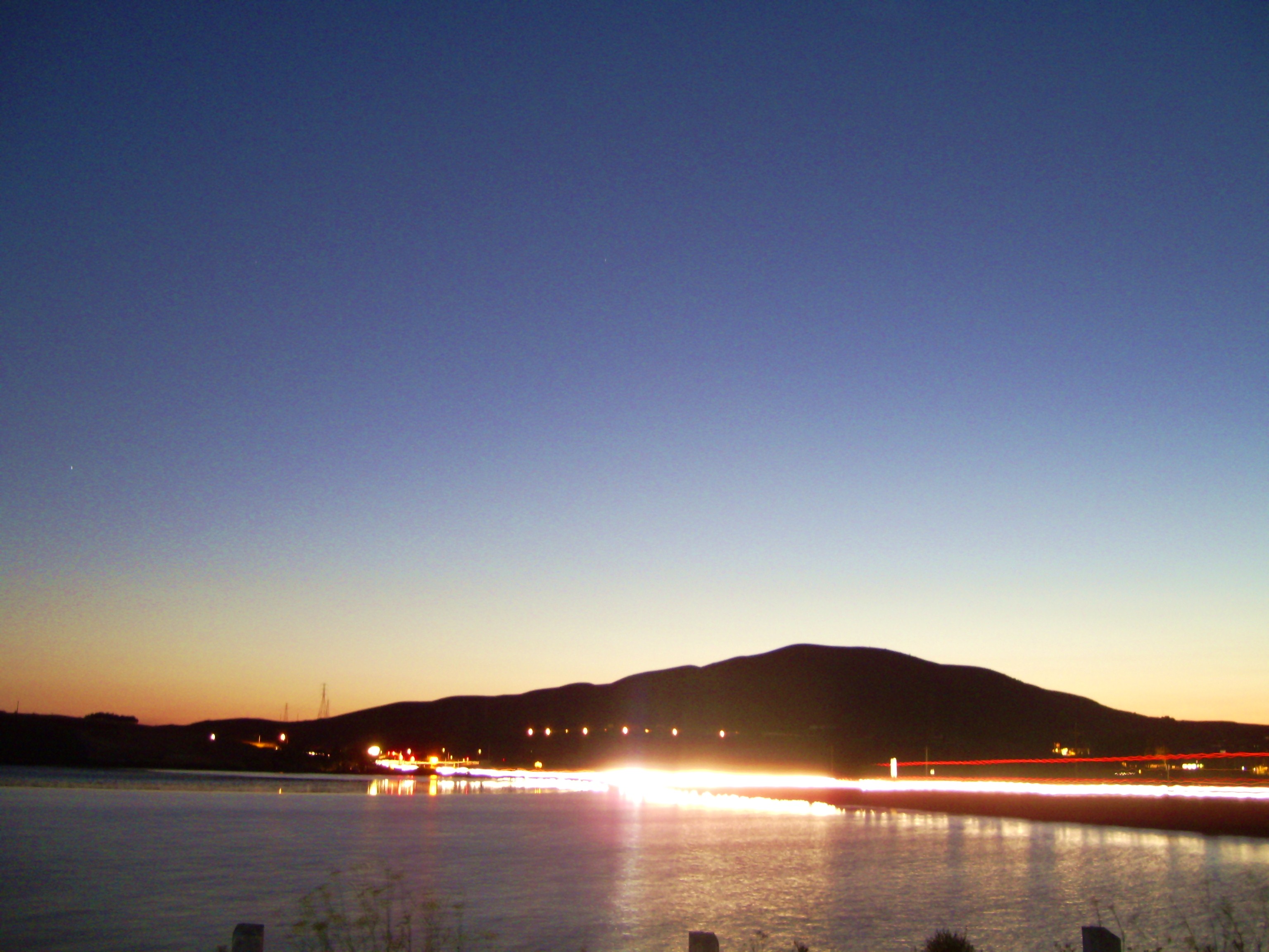
State Route 37 (SR 37) is a state highway in the U.S. state of California that runs 21 mi along the northern shore of San Pablo Bay. It serves as a vital connection in the North Bay region of the San Francisco Bay Area, running from U.S. Route 101 in Novato, through northeastern Marin County, and the southern tips of both Sonoma and Solano Counties to Interstate 80 in Vallejo. Sonoma Raceway and Six Flags Discovery Kingdom are accessible from Highway 37.
The section of Highway 37 between Sears Point and Vallejo was the Sears Point Toll Road, a toll road managed by Golden Gate Ferry, before it was purchased by the State in 1938. The highway has been proposed to be built to freeway standards since the early 1950s. However, the proposal was met with many economic and environmental obstacles, making the task all but impossible for much of the route. The route is plagued by flooding which can be exacerbated by levee breaks near Vallejo. Most of the highway crosses a marsh that is home to endangered salt marsh harvest mice. A section of highway was once known as "Blood Alley" for its high rate of fatal accidents. A concrete barrier built in the 1990s eliminated those fatal head-on collisions. By 2022, there have been proposals to reinstate tolls between Sears Point and Vallejo to help pay for flooding and other improvements.
Route description
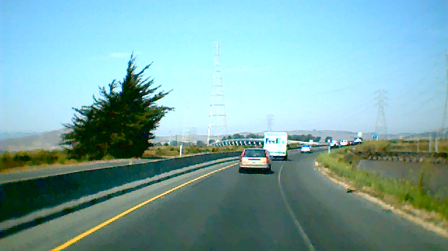
Intended to run from State Route 251, a highway that has not been constructed, SR 37 begins in Novato with a junction at U.S. Route 101 and heads northeast as a freeway for about a quarter mile before becoming a four-lane expressway. The route passes over the Petaluma River into Sonoma County before meeting the southern terminus of State Route 121 at a signal-controlled intersection near Sears Point and the Sonoma Raceway.
The route continues as a divided two-lane expressway in a more easterly, then southeasterly, direction as it crosses Tolay Creek and proceeds through the Napa Sonoma Marsh at the northern edge of San Pablo Bay. Before the construction of the barrier in 1995, this portion of SR 37 was three lanes with the middle lane alternately serving as a passing lane for each direction. This stretch of highway was given the nickname of "Blood Alley" for its high-rate of fatal accidents. With the middle lane removed, accidents dropped dramatically.
SR 37 becomes a four-lane freeway on Mare Island, approaching northern Vallejo. After it crosses over the Napa River Bridge, it continues as a freeway, overlapping the old highway alignment and passing north of the old road known as Marine World Parkway (due to its proximity to the Six Flags Discovery Kingdom, previously known as Marine World). SR 37 travels in a northeasterly direction along the White Slough before turning east as it crosses over State Route 29 and heads to its eastern terminus at I-80 as the James Capoot Memorial Highway (honoring a Vallejo police officer who was killed in the line of duty). In the early 1990s, the stretch between Fairgrounds Drive, which serves as the entrance to Discovery Kingdom, and Mini Drive was upgraded to a freeway. In 2004 and 2005, following over fifty years of complications, the remaining non-freeway section in Vallejo was upgraded as well.
SR 37 is also known as Randy Bolt Memorial Highway from SR 29 to Skaggs Road (honoring a California Department of Justice agent who was killed in the line of duty in an accident along SR 37), and Sears Point Toll Road, which was originally a toll road that ran from SR 121 to Vallejo. SR 37 is part of the California Freeway and Expressway System, but is not part of the National Highway System, a network of highways that are considered essential to the country's economy, defense, and mobility by the Federal Highway Administration. SR 37 is eligible for the State Scenic Highway System, but it is not officially designated as a scenic highway by the California Department of Transportation.
History
The stretch of road east of Sears Point was once part of the historical El Camino Real. As a result of the State Highways Acts of the early 20th century, the Black Point Cut-off was built over it and opened to traffic in 1917. This highway followed the current alignment east of Sears Point, before diverting northeast along present-day Route 121. It was first designated Legislative Route 8 (LRN 8), later being signed as State Route 37.
Prior to being under State control, the section between Sears Point and Vallejo was known as the Sears Point Toll Road, a toll road managed by Golden Gate Ferry that was built over an ancient Native American trail. When it was purchased by the State in 1938, tolls were removed; it then became signed as State Route 48 until 1964.
Route 37 was redefined in the 1964 state highway renumbering as a route starting at SR 251, then SR 17, near Nicasio and ending at I-80 near Lake Chabot. The whole of SR 37 has been proposed to be built to freeway standards since the early 1950s. However, the proposal was met with many economic and environmental obstacles, making the task all but impossible for much of the route.
Sears Point Toll Road ===


As late as 1926, Golden Gate Ferries, owners of the Sears Point Toll Road Co., began plans to build the Sears Point Toll Road, The paved toll road was to be built on top of an ancient Native American trail along the San Pablo Bay shore between the Sacramento Highway and the Black Point cut-off (LRN 8) near Sears Point. It was expected to cost $775,000USD, with a toll not exceeding $0.35. Toll road officials explained the purpose of the road: to stimulate motor vehicle usage by reducing the commute times and expenses of motorists traveling from the East Bay and Sacramento areas by offering a more direct route toward Marin, Sonoma and the Redwood Highway. The road opened for traffic in 1928.
On November 29, 1932, the California State Highway Commission received a recommendation to purchase the road and was able to invest $418,000USD by 1936. However, the U.S. Navy owned rights to the right-of-way of part of the route, and opposed the purchase. This resulted in congressional actions to establish a clear title deed for the route. House Representative Richard J. Welch was one of the earliest government officials to pressure the State of California to acquire the toll road in order to convert it into a toll-free highway. He argued that having only one toll road to travel in order to reach the Golden Gate Bridge would benefit commuters; he also cited the ten and seventh-tenths-mile difference in distance between the toll road and a route through Napa. A Navy Department deed permitting the State to purchase the road was granted by the Attorney General on October 26, 1938. The highway then became signed as State Route 48 until the 1964 renumbering.
Highway upgrading in Vallejo

By 1955, talks began about upgrading the highway. After a proposition to turn much of the route into a toll road failed, it was decided a four-lane freeway would be the best decision. However, opposition from residents in surrounding neighborhoods as well as a federal oil embargo only allowed widening of the approach between Fairgrounds Drive and I-80. In 1977, a levee broke and flooded a portion of the developed land, turning it into protected wetlands that is home to endangered species. Because of its new status, environmental studies were needed in order to continue the project.
Soon after, the project was split into different phases to handle problems with particular areas. It was first divided between the newly created marshlands and the section between SR 29 (Sonoma Boulevard) and I-80. With Marine World being relocated, the city was able to widen the latter section and build an overpass across Fairgrounds Drive in 1992.
"Blood Alley"
While the Vallejo section of SR 37 was being updated, another problem with the route would hinder its progress. The section between Sears Point and Mare Island was plagued with fatal accidents, earning its nickname of "Blood Alley". Between 1966 and 1970, 27 people lost their lives on it. In a preliminary effort to reduce the fatalities, officials established both a daylight test section, requiring all cars to keep their headlights on during the day, and passing lanes. However, these efforts were ineffective.
In 1993, local resident Jim Poulos campaigned to have a barrier erected after the death of his 18-year-old son, Frankie, on "Blood Alley". At this time, the situation with this stretch only worsened as the death toll between 1990 and 1996 rose to thirty-one. At first, Caltrans thought the barrier would make matters worse since it would be difficult for emergency vehicles to attend to accidents; environmental issues were also cited. Caltrans was waiting for the ability to create a causeway to span the area instead. Poulos continued his campaign despite opposition, and was granted the barrier in 1995. The barrier was not built without controversy, as it also eliminated the passing lanes. However, since the barriers were built, there were no longer any crossover accidents as of 2005.
While the median was built, a few problems needed to be resolved in order for the road to work both safely and in an environmentally friendly way. Emergency personnel needed to quickly access accidents and provide them easy transport to nearby hospitals. To alleviate this problem, Caltrans implemented electric gate technology, which would allow emergency vehicles to cut through certain parts of the median. The other problem was to both protect the plant life and the salt marsh harvest mice residing around the highway. As a result, crews placed timbers and sheeting to protect foliage, and added holes into the median barrier to allow the mice to cross the highway.
White Slough and Sonoma Boulevard interchange

To protect White Slough while still allowing the widening of SR 37, the White Slough Protection and Development Act was passed in 1990. It allowed up to 13 acres of wetlands to be filled but required at least four times as much wetland restoration elsewhere in the Bay Area.
After environmental studies on the White Slough, Caltrans widened and elevated that section of the road and converted it to a freeway. To accommodate bicycles and pedestrians, a cycleway was built along the eastbound side of the freeway. Finally, Caltrans completed the overpass which crossed SR 29, Broadway, and Mini Drive (bypassing Marine World Parkway, three traffic signaled intersections, and a railroad grade crossing). The project was completed in the summer of 2005, and fully open to traffic on August 20.
2019 flooding

The highway is increasingly subject to flooding as the 21 mi route is near sea level. The road was closed for a total of 28 days during the winter of 2016-17.
On the morning of Friday February 15, 2019, the westernmost portion of the westbound highway (between Atherton Ave. and U.S. Route 101) was closed due to flooding caused by a levee break. Marin County declared a state of emergency, and public works crews worked 24 hours a day pumping water and repairing the levee. It was expected to be closed for at least a week, however the highway fully reopened on the morning of Wednesday, February 20, 2019.
Future
In 2017, it was estimated that it would cost $4 billion to fix all the flooding, traffic, and other issues along the corridor, and based on transportation funding levels it would take until 2088 to come up with that amount of money.
In 2022, California State Senator Bill Dodd introduced new legislation that would make the route a toll road again between Sears Point and at least Mare Island. The proposed law would use the toll revenues to help pay for the flooding and traffic improvements. It has been opposed by a number of commuters, particular Solano county residents who commute west to jobs in Sonoma or Marin counties. In May 2023, the California Transportation Commission unanimously approved a plan to toll both directions, as well as widen the highway from a two-lane road to one with carpool lanes by converting the existing shoulders. The proposed toll in each direction would be half of the toll on the seven state-owned Bay Area bridges operated by the Bay Area Toll Authority. Toll collection would not begin until the new carpool lanes are completed, regular bus service along the highway's corridor is established, and a toll discount program for low income users is established.
Major intersections
Exits on the westernmost portion of the route are unnumbered.
Popular culture
Train's 2012 album California 37 is named after State Route 37, with the album cover prominently featuring the route's highway shield.
AFI released a song titled "Rabbits Are Roadkill on Rt. 37" on its 2006 album Decemberunderground.
References
References
- Gafni, Matthias. "'Blood Alley' Dad's crusade curbs carnage". ANG Newspapers.
- (1 September 2013). "Portion of Highway 37 to be named after Jim Capoot". Vallejo Times Herald.
- "Caltrans Route 37 Improvements".
- "Route 37 Freeway Draft Environmental Impact Statement". California Department of Transportation.
- Gafni, Matthias. "'Perserverance'[sic] at a high price". ANG Newspapers.
- {{CA Named Freeways
- {{CAFESystem
- {{FHWA NHS map
- {{FHWA NHS
- {{CA scenic
- {{Caltrans scenic
- [[wikisource:California Streets and Highways Code, Chapter 2, Article 3, Section 301-635#Section 635. California Streets and Highways Code, Chapter 2, Article 3, Section 635]]
- LeBaron, Gaye. (September 10, 1995). "The Damp and Difficult History of Highway 37 <!--". Santa Rosa Press Democrat.
- "Road Map of California 1936". State of California Department of Public Works.
- "Road Map of California 1956". State of California Department of Public Works.
- (October 1, 1927). "Golden Gate Ferries, Inc.". Berkeley Daily Gazette.
- {{cite CAstat. (1984)
- {{cite CAstat. (1963)
- (October 1, 1926). "Award Contract on Sears Point Cut-off". Berkeley Daily Gazette.
- (November 29, 1932). "Ask Showdown on Sears Point Road". Berkeley Daily Gazette.
- (June 17, 1936). "Sears Point Road Status Undecided". Berkeley Daily Press.
- (October 14, 1938). "Sears Point Road Acquisition Aided". Berkeley Daily Gazette.
- (September 14, 1936). "Ask Showdown on Sears Point Road". Berkeley Daily Gazette.
- (October 25, 1938). "Approves Toll Road Purchase". Berkeley Daily Press.
- "'Experimental idea: Daylight Headlight Test fails to return the expected results". ANG Newspapers.
- "Crews improvise to erect Highway 37 median". ANG Newspapers.
- "California Government Code Section 66670-66682".
- Cobb, Steve. (August 14, 2005). "Route 37 Traffic Switch onto New Alignment Starts Tonight in Vallejo". [[California Department of Transportation]].
- Alexander, Kurtis. (2020-08-05). "Sea level rise to choke Bay Area traffic as far away as Santa Rosa, Napa, study shows".
- Miller, Craig. (2019-04-15). "North Bay's Highway 37 Is Going to Be a Serious Climate Mess". KQED.
- Hollyfield, Amy. (2019-02-15). "WB Hwy 37 in Novato closed until Saturday due to flooding".
- (2019-02-16). "Marin County Under State Of Emergency As Crews Work To Stop Flooding On Highway 37".
- FOX. "Stretch of Hwy 37 in Marin County expected to be closed a week due to flood damage".
- (2019-02-20). "Westbound Hwy 37 reopens in Novato following closure due to flooding".
- (24 May 2017). "Roadshow: Delay in highway fix estimated at … 71 years?".
- (27 May 2022). "Highway 37 toll road plan advances in state Senate". North Bay Business Journal.
- (24 April 2023). "New toll could be coming to State Route 37, angering some North Bay commuters". KGO-TV.
- (18 May 2023). "New Toll Approved for Part of Highway 37 in the North Bay". KNTV-TV.
- (July 2007)
- Staff. (2005–2006). "All Traffic Volumes on CSHS". California Department of Transportation.
- Staff. (2021). "Traffic Volumes: Annual Average Daily Traffic (AADT)". California Department of Transportation.
- Faizah, Saif. "State Route 37 Freeway Interchanges". California Department of Transportation.
- "Morning Skaggs Island Raptor Tours". U.S. Fish and Wildlife Service.
- "Skaggs Island Raptor Tours". U.S. Fish and Wildlife Service.
This article was imported from Wikipedia and is available under the Creative Commons Attribution-ShareAlike 4.0 License. Content has been adapted to SurfDoc format. Original contributors can be found on the article history page.
Ask Mako anything about California State Route 37 — get instant answers, deeper analysis, and related topics.
Research with MakoFree with your Surf account
Create a free account to save articles, ask Mako questions, and organize your research.
Sign up freeThis content may have been generated or modified by AI. CloudSurf Software LLC is not responsible for the accuracy, completeness, or reliability of AI-generated content. Always verify important information from primary sources.
Report