From Surf Wiki (app.surf) — the open knowledge base
Caballo Island
Island in Philippines
Island in Philippines
| Field | Value |
|---|---|
| name | Caballo Island |
| image_name | Caballo Island.jpg |
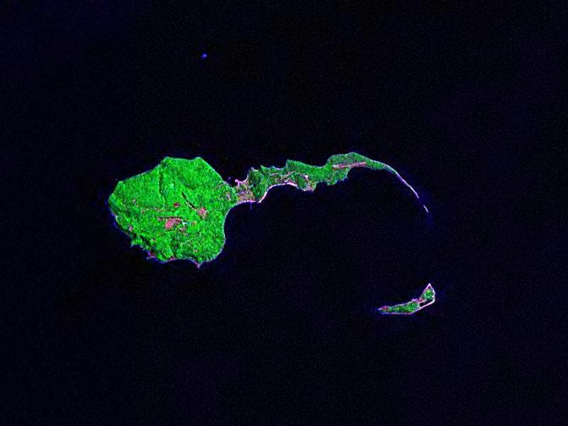
| image_caption | Caballo Island, as seen from Corregidor Island in March 2019 |
| image_map | |
| coordinates | |
| location | Manila Bay |
| area_sqmi | |
| length_km | 1.21 |
| width_km | 0.32 |
| coastline_mi | |
| elevation_m | 116 |
| highest_mount | |
| country | Philippines |
| country_admin_divisions_title | Region |
| country_admin_divisions | Calabarzon |
| country_admin_divisions_title_1 | Province |
| country_admin_divisions_1 | Cavite |
| country_admin_divisions_title_2 | City |
| country_admin_divisions_2 | Cavite City |
| website | Fort Hughes |
Caballo Island (which means "Horse Island" in Spanish) is a bluff, rocky island located at the entrance to Manila Bay in the Philippines. It is about 1.2 km long with the highest elevation at 381 feet high. Caballo, along with the larger Corregidor (2 km to the north), divides the entrance to the bay into two broad and deep channels, known as the North and South Channel.
The whole island was formerly occupied by Fort Hughes, a U.S. defense fortification before World War II. It was heavily bombed during the war.
Geological history
Caballo and Corregidor Islands are believed to be the rims of the Corregidor Caldera. The gap between the two islands is only about 1/4 mile with a depth of 7 fathom and is never used for large vessel navigation.
In November 2014, Filipino peacekeepers from Liberia who were quarantined on the island for 21 days due to concerns about Ebola were cleared to return to the mainland. At that time West Africa was having an outbreak of the disease.
Current tenants
The island — as of 2010 — was occupied by the Philippine Navy and is off limits to civilians. Remains of the old fortifications, batteries and structures have been abandoned and left rusting in the open after World War II.
References
References
- U.S. Coast and Geodetic Survey, "United States Coast Pilot Philippine Islands Part I", pp.71-72. Washington Government Printing Office, 1919.
- Becker, George F., "The Geology of the Philippine Islands", p.53. Washington Government Printing Office, 1901.
- (December 2, 2014). "Pinoy peacekeepers leave Caballo Island". GMA News.
- Feredo, Tony. "[http://www.corregidor.org/chs_feredo/feredo_report_1.htm Visit to a Nearby Island]". Corregidor.org. Retrieved on 2010-09-20.
This article was imported from Wikipedia and is available under the Creative Commons Attribution-ShareAlike 4.0 License. Content has been adapted to SurfDoc format. Original contributors can be found on the article history page.
Ask Mako anything about Caballo Island — get instant answers, deeper analysis, and related topics.
Research with MakoFree with your Surf account
Create a free account to save articles, ask Mako questions, and organize your research.
Sign up freeThis content may have been generated or modified by AI. CloudSurf Software LLC is not responsible for the accuracy, completeness, or reliability of AI-generated content. Always verify important information from primary sources.
Report