From Surf Wiki (app.surf) — the open knowledge base
Bwindi Impenetrable National Park
National park in Uganda
National park in Uganda
| Field | Value | |
|---|---|---|
| name | Bwindi Impenetrable National Park | |
| iucn_category | II | |
| photo | Bwindi.JPG | |
| photo_caption | Mountain gorillas in Bwindi Impenetrable Forest | |
| location | Kanungu District, Uganda | |
| nearest_city | Kanungu | |
| embedded1 | {{designation list | embed=yes |
| designation1 | WHS | |
| designation1_date | 1994 (18th session) | |
| designation1_type | Natural | |
| designation1_criteria | vii, x | |
| designation1_number | 682 | |
| designation1_free1name | Region | |
| designation1_free1value | Africa | |
| coords | ||
| map | Uganda | |
| map_caption | Location of Bwindi Impenetrable National Park | |
| area_km2 | 331 | |
| established | 1991 | |
| governing_body | Uganda Wildlife Authority | |
| website | https://nationalparks.ug/park?bwindi-impenetrable |
Bwindi Impenetrable National Park is a national park in southwestern Uganda. It is part of the Bwindi Impenetrable Forest and is situated along the Democratic Republic of the Congo border next to the Virunga National Park and on the edge of the Albertine Rift. Composed of 321 km2 of both lowland and montane forest, it is accessible only on foot. It is a United Nations Educational, Scientific and Cultural Organization-designated World Heritage Site.
Species diversity is a feature of the park. It provides habitat for 120 species of mammals, 350 species of birds, 310 species of butterflies, 27 species of frogs, chameleons, geckos, and many endangered species. Floristically, the park is among the most diverse forests in East Africa, with more than 1,000 flowering plant species, including 200 species of trees and 104 species of ferns. The northern (low elevation) sector has many species of Guineo-Congolian flora, including two endangered species, the brown mahogany and Brazzeia longipedicellata. In particular, the area shares in the high levels of endemisms of the Albertine Rift.
The park is a sanctuary for colobus monkeys, chimpanzees, and many birds such as hornbills and turacos. It is most notable for the 400 Bwindi gorillas, half of the world's population of the endangered mountain gorillas. Fourteen mountain gorilla groups live in four different sectors of Buhoma, Ruhijja, Rushaga and the Nkuringo in the districts of Kanungu, Kabale and Kisoro respectively, all under the management of Uganda Wildlife Authority.
History

In 1932, two blocks of the Bwindi Impenetrable Forest were designated as Crown Forest Reserves. The northern block was designated as the "Kayonza Crown Forest Reserve", and the southern block designated as the "Kasatora Crown Forest Reserve". These reserves had a combined area of 207 km2. In 1942, the two reserves were combined and enlarged, and was under the joint control of the Ugandan government's game and forest departments.
In 1964, the reserve was designated as an animal sanctuary to provide extra protection for its mountain gorillas and renamed the Impenetrable Central Forest Reserve. In 1966, two other forest reserves became part of the main reserve, increasing its area to almost 321 km2. The park continued to be managed as both a game sanctuary and forest reserve.
In 1991, the Impenetrable Central Forest Reserve, along with Mgahinga National Park and Rwenzori Mountains National Park, was designated as a national park and renamed Bwindi Impenetrable National Park. It covered an area of 330.8 km2. The national park was declared in part to protect a range of species within it, most notably the mountain gorilla. The reclassification of the park had a large impact on the Indigenous Batwa people, who were evicted from the forest and no longer permitted to enter the park or access its resources.
In March 1999, a force of 100–150 former Rwandan Interahamwe guerrillas infiltrated across the border from the DRC and kidnapped 14 foreign tourists and their Ugandan guide from the park headquarters, eventually releasing six and murdering the remaining eight with machetes and clubs. Several victims were reportedly tortured, and at least one of the female victims was raped. The Ugandan guide was doused with gasoline and lit on fire. The Interahamwe attack was reportedly intended to "destabilize Uganda" and frighten away tourist traffic from the park, depriving the Ugandan government of income. The park was forced to close for several months, and the popularity of the gorilla tours suffered badly for several years, though attendance has since recovered due to greater stability in the area. An armed guard also now accompanies every tour group.
Geography and climate

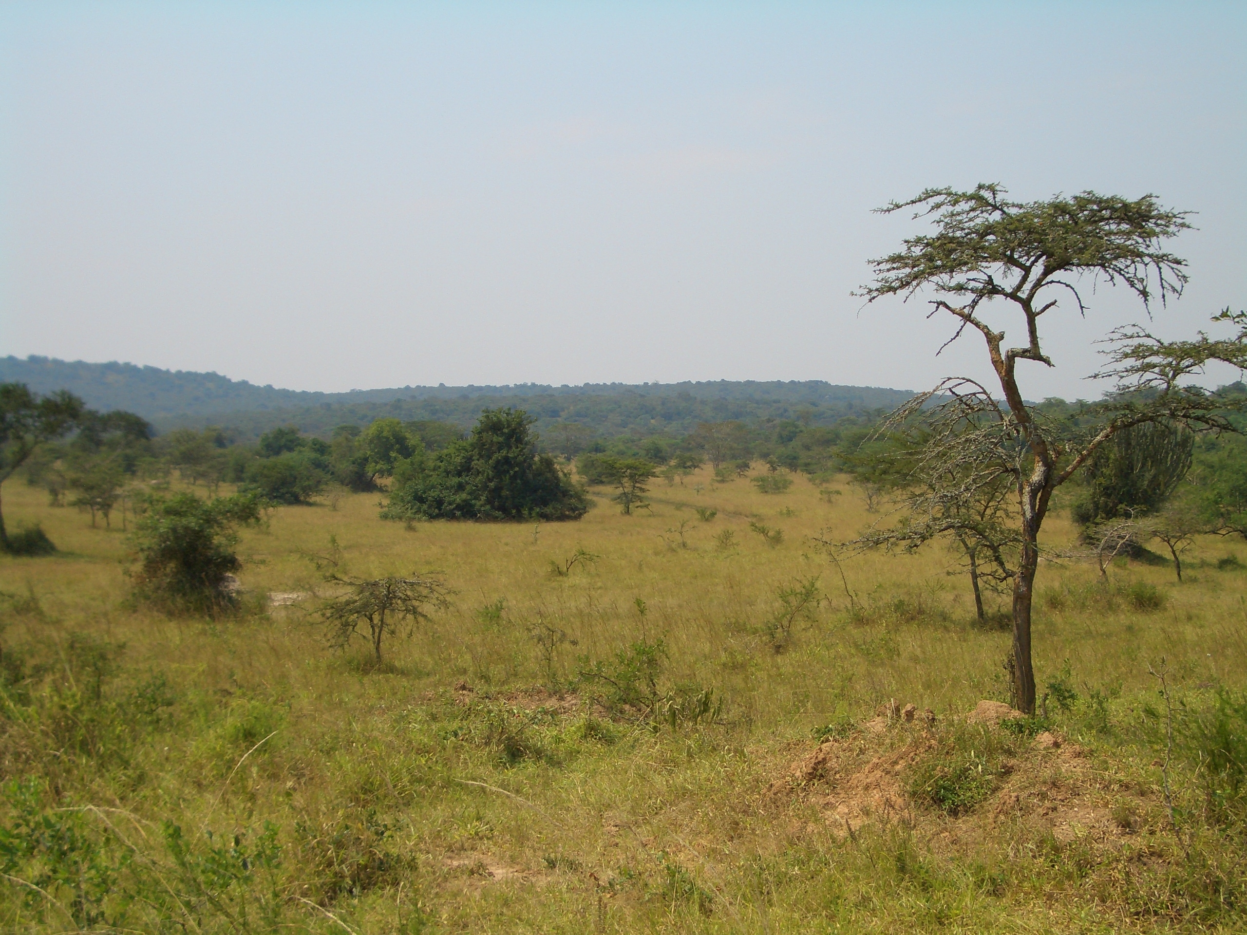
Kabale town to the south-east is the nearest main town to the park, 29 km away by road. The park is composed of two blocks of forest that are connected by a corridor of forest. The shape of the park is a legacy of previous conservation management, when the original two forest blocks were protected in 1932. There is agricultural land where there were previously trees directly outside the park's borders. Cultivation in this area is intense.
The park's underlying geology consists of Precambrian shale phyllite, quartz, quartzite, schist, and granite. The park is at the edge of the Western Rift Valley in the highest parts of the Kigezi Highlands, Its topography is very rugged, with narrow valleys intersected by rivers and steep hills. Elevations in the park range from 1190 to, and 60 percent of the park has an elevation of over 2000 m. The highest elevation is Rwamunyonyi Hill at the eastern edge of the park. The lowest part of the park is at its most northern tip.
The forest is an important water catchment area. With a generally impermeable underlying geology where water mostly flows through large fault structures, water infiltration and aquifers are limited. Much of the park's rainfall forms streams, and the forest has a dense network of streams. The forest is the source of many rivers that flow to the north, west, and south. Major rivers that rise in the park include the Ivi, Munyaga, Ihihizo, Ishasha, and Ntengyere rivers, which flow into Lake Edward. Other rivers flow into Lakes Mutanda and Bunyonyi. Bwindi supplies water to local agricultural areas.
Bwindi has a tropical climate. The park's forest plays an important role in regulating the surrounding area's environment and climate.
Biodiversity


The Bwindi Impenetrable Forest is old, complex, and biologically rich. Diverse species are a feature of the park, and it became a UNESCO World Heritage Site because of its ecological importance. Among East African forests, Bwindi has some of the richest populations of trees, small mammals, birds, reptiles, butterflies, and moths. The park's diverse species are partly a result of the large variations of elevation and habitat types in the park, and may also be because the forest was a refuge for species during glaciations in the Pleistocene epoch. The park's forests are afromontane, which is a rare vegetation type on the African continent. one of the few large tracts of East African forest where this occurs.
Bwindi Impenetrable National Park is important for the conservation of the afromontane fauna, especially species endemic to the Western Rift Valley's mountains. and more than 45 are small mammals. Along with mountain gorilla, species in the park include common chimpanzee, L'Hoest's monkey, African elephant, African green broadbill, and cream-banded swallowtail, black and white colobus, red-tailed monkeys, vervets, the giant forest hog. The fish species in the park's rivers and streams are not well known.
Mountain gorillas
_female_eating_root.jpg)
Bwindi Impenetrable National Park hosts a population of the mountain gorilla (Gorilla beringei beringei), known as the Bwindi population, which makes up almost half of all the mountain gorillas in the world. to 320 individuals in 2002 to 340 individuals in 2006. Poaching, disease and habitat loss are the greatest threat to the gorillas.
The mountain gorilla is an endangered species, with an estimated total population of about 650 individuals. There are no mountain gorillas in captivity, but during the 1960s and 1970s, some were captured to start captive breeding.
Conservation

The park is owned by the Uganda Wildlife Authority, a parastatal government body. The park has total protection, although communities adjacent to the park can access some of its resources.
The areas bordering the park have a high population density of over 300 PD/km2. Some of the people who live in these areas are among the poorest people in Uganda. The high population and poor agricultural practices place great pressure on the Bwindi forest, and are one of the biggest threats to the park. Ninety percent of the people are dependent on subsistence agriculture, as agriculture is one of the area's few ways of earning income.
Prior to Bwindi's gazetting as a national park in 1991, the park was designated as a forest reserve, and regulations about the right to access the forest were more liberal and seldom enforced. People have lost livestock and crops from wildlife, and there have been some human deaths. The habituation of gorillas to humans in order to facilitate tourism may have increased the damage they do to local people's property because their fear of people has decreased.
References
References
- Korbee, D.. (2007). "Environmental Security in Bwindi: A focus on farmers". Institute for Environmental Security.
- Namara, A.. (2006). "From Paternalism to Real Partnership with Local Communities? Experiences from Bwindi Impenetrable National Park (Uganda)". Africa Development.
- Adams, W. M.. (2001). "Green Development: Environment and Sustainability in the Third World". Routledge.
- "Bwindi Impenetrable National Park". UNESCO World Heritage Centre.
- (1999). "Uganda tourists 'butchered'". BBC.
- (2006). "Court finds Rwandan guilty of murdering tourists 7 years ago". UN Office for the Coordination of Humanitarian Affairs.
- Gurrieri, J.. "Virunga – Bwindi Region: Republic of Rwanda, Republic of Uganda, Democratic Republic of Congo". United States Department of Agriculture.
- Lanjouw, A.. (2001). "Beyond Boundaries: Transboundary Natural Resource Management for Mountain Gorillas in the Virunga-Bwindi Region". Biodiversity Support Program, World Wildlife Fund.
- Hodd, M.. (2002). "East Africa Handbook: The Travel Guide". Footprint Travel Guides.
- "Mountain Gorilla Population Rebounds in Uganda". LiveScience.com.
- Robbins, M.. (2007). "Intergroup encounters in mountain gorillas of Bwindi Impenetrable National Park, Uganda". Behaviour.
- "About IGCP". International Gorilla Conservation Programme.
This article was imported from Wikipedia and is available under the Creative Commons Attribution-ShareAlike 4.0 License. Content has been adapted to SurfDoc format. Original contributors can be found on the article history page.
Ask Mako anything about Bwindi Impenetrable National Park — get instant answers, deeper analysis, and related topics.
Research with MakoFree with your Surf account
Create a free account to save articles, ask Mako questions, and organize your research.
Sign up freeThis content may have been generated or modified by AI. CloudSurf Software LLC is not responsible for the accuracy, completeness, or reliability of AI-generated content. Always verify important information from primary sources.
Report