From Surf Wiki (app.surf) — the open knowledge base
Burnett River

| Field | Value |
|---|---|
| name | Burnett |
| name_etymology | James Charles Burnett |
| image | BurnettRiver 1.jpg |
| image_size | 280 |
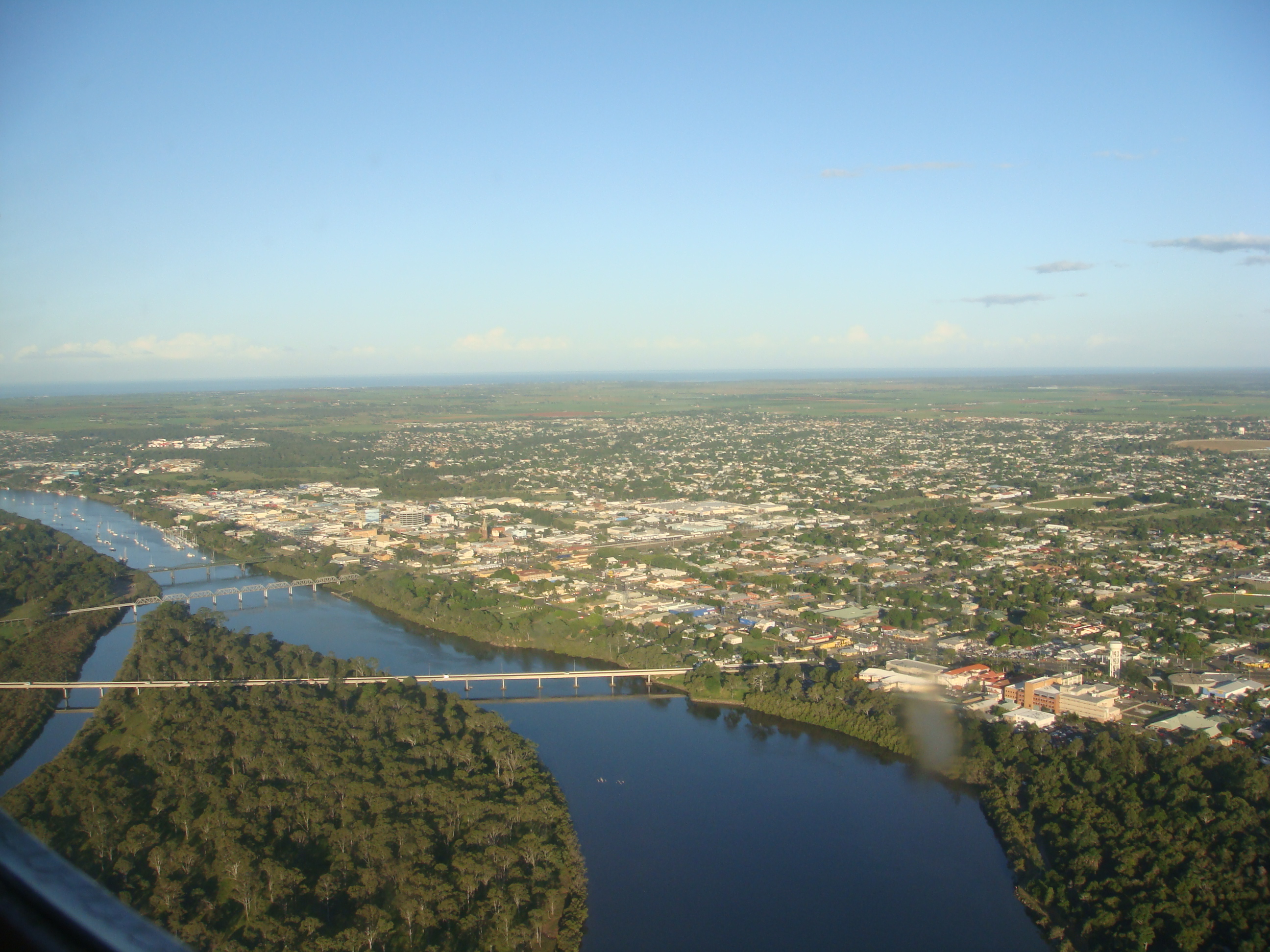
| image_caption | The Burnett River with the city of Bundaberg on either side |
| pushpin_map | Australia Queensland |
| pushpin_map_caption | Location of Burnett River mouth in Queensland |
| subdivision_type1 | Country |
| subdivision_name1 | Australia |
| subdivision_type2 | State |
| subdivision_name2 | Queensland |
| subdivision_type3 | Regions |
| subdivision_name3 | Central Queensland, Wide Bay–Burnett |
| subdivision_type5 | Cities |
| subdivision_name5 | Mundubbera, Gayndah, Wallaville, Bundaberg, Burnett Heads |
| length | 435 km |
| discharge1_location | Near mouth |
| discharge1_avg | 2,460,984 ML/yr |
| source1 | Mount Gaeta, Great Dividing Range |
| source1_location | near Monto |
| source1_coordinates | |
| mouth | Coral Sea |
| mouth_location | Burnett Heads |
| mouth_coordinates | |
| mouth_elevation | 0 m |
| basin_size | 32,220 km2 |
| tributaries_right | Three Moon Creek, Nogo River, Auburn River, Boyne River, Barambah Creek |
| custom_label | Reservoir |
| custom_data | Paradise Dam |
| extra |
The Burnett River is a river in the Wide Bay–Burnett and Central Queensland regions of Queensland, Australia.
Course and features
The Burnett River rises in the Burnett Range, part of the Great Dividing Range, close to Mount Gaeta and east of Monto. It drains a basin covering 33,210 km² which is 1.9% of the total area of Queensland.
The river flows generally south past Eidsvold and Mundubbera before heading east, adjacent to the townships of Gayndah and Wallaville before entering the city of Bundaberg. The river flows into the Coral Sea at Burnett Heads, roughly 20 km from Bundaberg. The river descends 485 m over its 435 km course.
The Burnett River region is largely given over to growing sugar cane and small crops. The river is part of the Brigalow Belt and South East Queensland bioregions.
Major tributaries
Three Moon Creek
Three Moon Creek rises near Kroombit Tops National Park north of Monto and flows south through Monto and Mulgildie, it is dammed near Cania Gorge to form Lake Cania, before emptying into the Burnett River south-east of Abercorn.
Nogo River
The Nogo River rises in the hills north-west of Monto, is dammed west of Abercorn to form Wuruma Lake, and flows south-east to join the Burnett near Ceratodus.
Auburn River
The Auburn River rises in the hills about 20 km west of Cracow, flows south before swinging to the north-east at its confluence with Johnson Creek, passing through the Auburn River National Park, a little-known and untouched piece of pristine bush including Auburn Waterfall, and flows into the Burnett River west of Mundubbera.
Boyne River
The Boyne River rises in the Bunya Mountains National Park south-west of Kingaroy and flows in a general northerly direction, it is dammed near Proston to form Lake Boondooma, emptying into the Burnett River near Mundubbera, only 5 km from the Burnett River-Auburn River confluence.
Barambah Creek
Barambah Creek rises in the hills between Kingaroy and the Sunshine Coast, north of Jimna and flows in a generally northerly direction, it flows just below the dam wall of Lake Barambah, also known as Bjelke-Petersen Dam, before meeting the Burnett River north-east of Gayndah near Ban Ban Springs.
History
Prehistory
The Burnett River area was historically inhabited by the Taribelang Aboriginal tribe.
European exploration
The river is named after James Charles Burnett, the first European explorer to visit the river in 1847.
Dam construction
Construction of the Paradise Dam on the Burnett River, 80 km upstream from Bundaberg, was completed in November 2005. The dam reservoir has a capacity of 300000 ML. Named after the old gold mining township of Paradise, which is now submerged under the waters of the reservoir, all of the structures and artefacts found at the site were transferred to the nearby town of Biggenden. The design of the dam complies with environmental guidelines and includes a fish ladder that allows fish such as the Queensland lungfish to travel upstream as well as downstream from the dam wall.
Paradise Dam was damaged in 2013 floods, and currently operates at reduced capacity. In early 2024, the Queensland Government announced it would be replaced by a new Paradise Dam rather than attempting further repairs.
Fish
The Burnett River, together with the nearby Mary River, is home to the Queensland lungfish, one of the most ancient of the extant vertebrate species. The longest-lived known individual known for the Queensland lungfish, a male nicknamed "Granddad", was born and captured in the Burnett River before being transported to the Shedd Aquarium in Chicago, Illinois in 1933, where he lived to the estimated age of 109 years old before he died of natural causes in 2017.
References
References
- "Drainage Basin: Burnett River".
- "Map of Burnett River, QLD". Bonzle Digital Atlas of Australia.
- Department of Environment and Science, Queensland Government. (2013). "Burnett drainage basin — facts and maps".
- Reed, A. W.. (1973). "Place Names of Australia". A. H. & A. W. Reed.
- "Paradise Dam Improvement Project - New dam wall".
- (2022-01-01). "Tell Us a Story Granddad: Age and Origin of an Iconic Australian Lungfish". Frontiers in Environmental Science.
This article was imported from Wikipedia and is available under the Creative Commons Attribution-ShareAlike 4.0 License. Content has been adapted to SurfDoc format. Original contributors can be found on the article history page.
Ask Mako anything about Burnett River — get instant answers, deeper analysis, and related topics.
Research with MakoFree with your Surf account
Create a free account to save articles, ask Mako questions, and organize your research.
Sign up freeThis content may have been generated or modified by AI. CloudSurf Software LLC is not responsible for the accuracy, completeness, or reliability of AI-generated content. Always verify important information from primary sources.
Report