From Surf Wiki (app.surf) — the open knowledge base
Buckeye, Arizona
City in Maricopa County, Arizona, United States

City in Maricopa County, Arizona, United States
| Field | Value |
|---|---|
| name | Buckeye, Arizona |
| settlement_type | City |
| image_skyline | Buckeye-Downtown Monroe Ave.jpg |
| image_caption | Historic downtown Buckeye as seen from Monroe Avenue in October 2015 |
| image_flag | Flag of Buckeye, Arizona.svg |
| image_map | File:Maricopa County Arizona Incorporated and Unincorporated areas Buckeye Highlighted 0407940.svg |
| map_caption | Location in Maricopa County, Arizona |
| pushpin_label | Buckeye |
| pushpin_label_position | top |
| pushpin_map | USA Arizona#USA |
| subdivision_type | Country |
| subdivision_type1 | State |
| subdivision_type2 | County |
| subdivision_name | United States |
| subdivision_name1 | Arizona |
| subdivision_name2 | Maricopa |
| government_type | Council-Manager |
| leader_title | Mayor |
| leader_name | Eric Orsborn |
| leader_title1 | Vice Mayor |
| leader_name1 | Craig Heustis |
| leader_title2 | City Council |
| leader_name2 | Tony Youngker |
| Jamaine Berry | |
| Curtis Beard | |
| Patrick HagEstad | |
| Craig Heustis | |
| Clay Goodman | |
| leader_title3 | City Manager |
| leader_name3 | Doug Sandstrom |
| leader_title4 | City Clerk |
| leader_name4 | Lucinda J. Aja |
| established_date | 1888 |
| unit_pref | Imperial |
| area_footnotes | |
| area_total_km2 | 1018.29 |
| area_total_sq_mi | 393.2 |
| elevation_ft | 1076 |
| elevation_footnotes | |
| population_as_of | 2020 |
| population_footnotes | |
| population_total | 91502 |
| population_density_km2 | 89.90 |
| population_density_sq_mi | 232.84 |
| timezone | MST (no DST) |
| utc_offset | −7 |
| coordinates | |
| postal_code_type | ZIP codes |
| postal_code | 85326, 85396 |
| area_codes | 623, 602, 480, 928 |
| blank_name | FIPS code |
| blank_info | |
| blank2_name | GNIS feature ID |
| blank2_info | 2411736 |
| website | |
| area_land_km2 | 1017.83 |
| area_water_km2 | 0.45 |
| area_land_sq_mi | 393 |
| area_water_sq_mi | 0.18 |
Jamaine Berry Curtis Beard Patrick HagEstad Craig Heustis Clay Goodman
Buckeye is a city in Maricopa County, Arizona, United States. It is Arizona's second-largest city by area, and it is the westernmost suburb in the Phoenix Metropolitan Area. As of the 2020 census, the population was 91,502, up from 50,876 in 2010, and 6,537 in 2000. It was the fastest-growing city in the United States for 2017, 2018, and 2021.
History
The Buckeye area was first inhabited by the Hohokam culture. In 1877, Thomas Newt Clanton led a group of six men, three women, and ten children from Creston, Iowa, to Arizona, where they settled in the Buckeye area.
Early settler Malie M. Jackson developed 10 mi of the Buckeye Canal from 1884 to 1886, which he named after his home state of Ohio's moniker, "The Buckeye State". The town was founded in 1888 and originally named "Sidney", after Jackson's hometown in Ohio. However, because of the significance of the canal, the town became known as Buckeye. The name was legally changed to Buckeye in 1910. The town was incorporated in 1929, at which time it included 440 acre. The town's first mayor was Hugh M. Watson (1956–1958), who founded the Buckeye Valley Bank. Today, Watson Road is the site of the city's commercial center.
In 2008, Buckeye was featured on The NewsHour with Jim Lehrer as part of a week-long series entitled "Blueprint America".
A vote to designate the town as the City of Buckeye became effective in 2014.
In May 2019, population estimates released by the U.S. Census Bureau placed Buckeye as the fastest growing city in the United States by percentage from 2017–2018, growing by 8.5%.
Geography
Buckeye is located approximately 30 mi west of downtown Phoenix in the Buckeye Valley. Interstate 10 passes through the central part of the city, north of the original town center. U.S. Route 80 once passed through the city, while Arizona State Route 85 skirts what was the city's west edge. The city limits now extend 30 mi to the north and 16 mi to the south of the original town center.
According to the United States Census Bureau, the city has a total area of 393.2 sqmi, of which 0.2 sqmi, or 0.04%, were listed as water. The Gila River flows westward through the Buckeye Valley south of the center of the city. The Buckeye Hills and Little Rainbow Valley are to the south, beyond which the city limits extend as far as Margies Peak. To the north the city limits include the southern part of the White Tank Mountains and continue north nearly as far as City of Surprise. The Hassayampa River, a tributary of the Gila, flows southward through the northern part of the Buckeye city limits.
Soils in Buckeye are alkaline and mostly well drained loam or clay loam except in northern neighborhoods such as Verrado, where gravelly sand or sandy loam with varying degrees of excessive drainage are common.
Neighborhoods
The original Buckeye was built around downtown's main street, Monroe Avenue. There are currently nearly 30 master planned communities planned for Buckeye. Those communities under development in which homes are occupied include Riata West, Sundance, Verrado, Sienna Hills, Westpark, Tartesso and Festival Ranch.
Other unbuilt planned communities within Buckeye include Teravalis (planned for nearly 300,000 inhabitants), Sun Valley Villages, Spurlock Ranch, Trillium, Elianto, Westwind, Silver Rock, Henry Park, Southwest Ranch and Montierre.
Sundance Towne Center, a shopping center developed by Vestar Development in the Sundance community, opened in 2007.
Climate
Buckeye has a hot desert climate (Köppen BWh), with abundant sunshine due to the stable descending air of the eastern side of the subtropical anticyclone aloft and at sea level over the southwestern United States. Summers, as with most of the Sonoran Desert, are extremely hot, with 121.0 afternoons reaching 100 F and 181.6 afternoons reaching 90 F. The record high temperature of 128 F occurred on July 28, 1995, and temperatures above 86 F may occur in any month. Cooler weather may occasionally occur during summer, but such periods are no less unpleasant as they result from monsoonal weather, with its attendant higher cloudiness and humidity; however, actual rainfall from the monsoon is much more infrequent than in Flagstaff, Nogales or even Tucson. The heaviest daily rainfall has been 4.90 in on September 2, 1894, but between 1971 and 2000 no month had more rainfall than 4.52 in in December 1984.
The winter season from November to March is warm to very warm during the day, not much cooler than 68 F during a typical afternoon, but 20.2 mornings typically fall to or below 32 F, though no snowfall was recorded during the 1971 to 2000 period, and only twelve afternoons did not reach 50 F. The coldest temperature recorded in Buckeye was 11 F on January 8, 1913.
|Jan record high F = 100 |Feb record high F = 92 |Mar record high F = 101 |Apr record high F = 106 |May record high F = 115 |Jun record high F = 122 |Jul record high F = 125 |Aug record high F = 120 |Sep record high F = 119 |Oct record high F = 108 |Nov record high F = 96 |Dec record high F = 87 |year record high F = 125 |Jan record low F = 11 |Feb record low F = 18 |Mar record low F = 20 |Apr record low F = 29 |May record low F = 32 |Jun record low F = 42 |Jul record low F = 49 |Aug record low F = 48 |Sep record low F = 41 |Oct record low F = 26 |Nov record low F = 20 |Dec record low F = 12 |year record low F = 11 Retrieved on November 21, 2016.
Demographics
| align-fn = center

| Race / Ethnicity (NH = Non-Hispanic) | title=P004 Hispanic or Latino, and Not Hispanic or Latino by Race – 2000: DEC Summary File 1 – Buckeye city, Arizona | url=https://data.census.gov/table/DECENNIALSF12000.P004?g=160XX00US0407940 | website=United States Census Bureau}} | title=P2 Hispanic or Latino, and Not Hispanic or Latino by Race – 2010: DEC Redistricting Data (PL 94-171) – Buckeye city, Arizona | url=https://data.census.gov/table?g=160XX00US0407940&tid=DECENNIALPL2010.P2 | website=United States Census Bureau}} | % 2000 | % 2010 |
|---|---|---|---|---|---|---|---|---|
| White alone (NH) | 3,748 | 25,375 | 43,071 | 57.34% | ||||
| Black or African American alone (NH) | 215 | 3,412 | 6,187 | 3.29% | ||||
| Native American or Alaska Native alone (NH) | 86 | 602 | 947 | 1.32% | ||||
| Asian alone (NH) | 24 | 849 | 1,435 | 0.37% | ||||
| Pacific Islander alone (NH) | 0 | 79 | 234 | 0.00% | ||||
| Some Other Race alone (NH) | 4 | 100 | 484 | 0.06% | ||||
| Mixed Race or Multi-Racial (NH) | 64 | 970 | 3,507 | 0.98% | ||||
| Hispanic or Latino (any race) | 2,396 | 19,489 | 35,637 | 36.65% | ||||
| Total | 6,537 | 50,876 | 91,502 | 100.00% |
Buckeye first appeared on the 1910 U.S. Census as a precinct of Maricopa County. It appeared again in 1920 as the 48th precinct of Maricopa County (Buckeye). It incorporated as a town in 1929 and has appeared on every successive census. On January 1, 2014, Buckeye was upgraded to city status.
In 2015, the population of the city was 62,582 people living in 21,628 households.
As of the census of 2010, there were 50,876 people residing in 16,499 households in the city. The population density was 135.6 PD/sqmi. There were 18,207 housing units. 10.8% of the population were born overseas.
In terms of age brackets, the population was spread out, with 9.1% under the age of 5; 30.6% under the age of 18; 53% aged between 18 and 64 and 6.7% were 65 years of age or older. 45.4% percent of the population are women.
From 2012 to 2016, the median income for a household in the town was $58,711. The per capita income for the town was $20,446. Both of these numbers are in 2016 dollars. About 12.4% of the population were below the poverty line.
Economy
Top employers in the city of Buckeye as of 2018.
| # | Employer | # of Employees |
|---|---|---|
| 1 | State of Arizona | 1,220 |
| 2 | Walmart | 1,120 |
| 3 | Buckeye Union High School District | 500 |
| 4 | City of Buckeye | 480 |
| 5 | Litchfield Elementary School District | 470 |
| 6 | Buckeye Elementary School District | 320 |
| 7 | Clayton Homes Inc. | 300 |
| 8 | Liberty Elementary School District | 230 |
| 9 | Agua Fria Union High School District | 160 |
| 10 | Youngker High School | 150 |
Parks and recreation

A popular recreation destination in Buckeye is the Buckeye Hills Regional Park. It is located 7 mi south of downtown Buckeye on State Route 85, at mile marker 144. A 900 acre Buckeye Lake is planned.
The City of Buckeye's Skyline Regional Park is an 8700 acre mountain preserve located in the southern White Tank Mountains. As of August 2020, the park features just under 20 miles of trails for hikers, mountain bikers and equestrians, picnic areas and camping. Entry to the park is free.
Education
The city of Buckeye is served by the following school districts:
- Wickenburg Unified School District
- Saddle Mountain Unified School District #90
- Agua Fria Union High School District
- Buckeye Union High School District
- Arlington Elementary School District
- Buckeye Elementary School District
- Liberty Elementary School District
- Litchfield Elementary School District
- Morristown Elementary School District
- Palo Verde Elementary School District
Other schools:
- The Odyssey Preparatory Academy
Estrella Mountain Community College recently renovated the original historic Buckeye Union High School building on Eason Avenue near 9th Street, also known as the "A" Wing, and started holding classes in this new satellite facility in the fall of 2011. Named the Buckeye Educational Center, this facility provides academic courses, job training programs and community education classes.
Media
There are several local newspapers, including the West Valley View, and The Arizona Republics Southwest Valley edition, the Buckeye Independent and the Buckeye Press.
Defunct media organizations include The Buckeye Star, Buckeye Valley News and the Buckeye Sun.
Infrastructure
Transportation
Buckeye is served by five highways, a municipal airport, several nearby airports, and the railroad.
Roads
Major roadways serving the city include:
- [[File:I-10.svg|20px]] Interstate 10
- Sun Valley Parkway
- Maricopa County (MC) 85
Bus
Buckeye is served by Valley Metro via a rural bus line connecting Phoenix–Goodyear–Gila Bend–Ajo. Valley Metro also provides express commute service from Buckeye to downtown Phoenix.
Rail
In 1910, the Arizona Eastern Railroad came to Buckeye; the first car in 1911; a steam rail line connected it to Phoenix by 1912; and a state highway by 1915. The coming of the railroad was so significant that the business district was moved to accommodate the location of the railroad station. As a result, Buckeye was booming. By 1912, major buildings were constructed, along with expansion of the business community.
Union Pacific operates a rail line running east–west generally through the center of the city.
Air
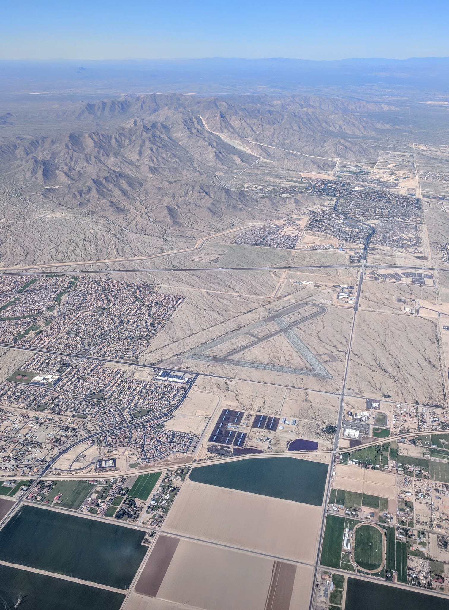
The Buckeye Municipal Airport (ICAO identifier KBXK) is owned and operated by the city government. Scheduled commercial air service is at Phoenix Sky Harbor or Mesa Gateway airport.
Notable people
- Kole Calhoun, (1987–), baseball outfielder
- Sue Hardesty (1933–2022), writer
- Upton Sinclair (1878–1968), author
References
References
- "Eric Orsborn | City of Buckeye".
- "Mayor and Council | City of Buckeye".
- "2021 U.S. Gazetteer Files: Arizona". United States Census Bureau.
- "Buckeye city, Arizona: 2020 DEC Redistricting Data (PL 94-171)". U.S. Census Bureau.
- {{GNIS. 2411736
- [https://www.nbcdfw.com/news/local/DFW-Fastest-Growing-Metro-in-US-Fort-Worth-Moves-Up-13th-Largest-City-510330671.html DFW Fastest-Growing Metro in US, Fort Worth Moves Up 13th Largest City]
- "Fastest-Growing Cities Primarily in the South and West".
- (March 8, 1982). "Hohokam and Patayan: Prehistory of Southwestern Arizona". Academic Press.
- "History".
- "Buckeye, AZ - Official Website - History".
- (October 15, 2008). "America in Gridlock – Nowhere to Grow – Blueprint America". Public Broadcasting Service.
- (January 27, 2014). "Buckeye officially changes name from 'town' to 'city'".
- "Buckeye, Phoenix are fastest growing cities in the United States".
- "TIGERweb: Buckeye, Arizona". Geography Division, U.S. Census Bureau.
- "SoilWeb: An Online Soil Survey Browser | California Soil Resource Lab".
- https://www.census.gov/quickfacts/fact/table/buckeyecityarizona/PST045224 {{Bare URL inline. (August 2025)
- "Census of Population and Housing". Census.gov.
- "P004 Hispanic or Latino, and Not Hispanic or Latino by Race – 2000: DEC Summary File 1 – Buckeye city, Arizona".
- "P2 Hispanic or Latino, and Not Hispanic or Latino by Race – 2010: DEC Redistricting Data (PL 94-171) – Buckeye city, Arizona".
- "P2 Hispanic or Latino, and Not Hispanic or Latino by Race – 2020: DEC Redistricting Data (PL 94-171) – Buckeye city, Arizona".
- (1910). "Supplement for Arizona - Population, Agriculture, Manufactures, Mines and Quarries".
- (1924). "Fourteenth Census of the United States - State Compendium - Arizona". U.S. Government Printing Office.
- "About Us | Roosevelt Irrigation District".
- "Buckeye's 2015 special census count reveals city's official population".
- City of Buckeye. (June 2019). "ECONOMIC AND DEMOGRAPHIC OVERVIEW".
- "Buckeye Union High School School A-Wing". U.S. Department of the Interior.
- "Skyline Regional Park Trails".
- "2020 CENSUS - SCHOOL DISTRICT REFERENCE MAP: Maricopa County, AZ". [[U.S. Census Bureau]].
- "Saddle Mountain Unified School District #90".
- "Career and Education / Home".
- "Buckeye Independent homepage".
- "Buckeye Press".
- "Buckeye, AZ - Official News Site - West Valley News".
- "Chapter 5 - Transportation".
- (January 16, 2014). "Route 785 makes new stops in Buckeye". Valley Metro.
- "Arizona Railroads". Arizona Department of Transportation.
- "Buckeye Municipal Airport". City of Buckeye.
- "Buckeye, AZ - Official Website - Airport".
This article was imported from Wikipedia and is available under the Creative Commons Attribution-ShareAlike 4.0 License. Content has been adapted to SurfDoc format. Original contributors can be found on the article history page.
Ask Mako anything about Buckeye, Arizona — get instant answers, deeper analysis, and related topics.
Research with MakoFree with your Surf account
Create a free account to save articles, ask Mako questions, and organize your research.
Sign up freeThis content may have been generated or modified by AI. CloudSurf Software LLC is not responsible for the accuracy, completeness, or reliability of AI-generated content. Always verify important information from primary sources.
Report