From Surf Wiki (app.surf) — the open knowledge base
Broward County, Florida
County in Florida, United States

County in Florida, United States
| Field | Value | ||||||||||||||||||||||||||||||||||||||||||||||||||||||||||
|---|---|---|---|---|---|---|---|---|---|---|---|---|---|---|---|---|---|---|---|---|---|---|---|---|---|---|---|---|---|---|---|---|---|---|---|---|---|---|---|---|---|---|---|---|---|---|---|---|---|---|---|---|---|---|---|---|---|---|---|
| <!-- See the table at Template:Infobox settlement for all fields and descriptions of their usage. --> | name | Broward County | |||||||||||||||||||||||||||||||||||||||||||||||||||||||||
| settlement_type | County | ||||||||||||||||||||||||||||||||||||||||||||||||||||||||||
| <!-- images, nickname, motto ------> | image_skyline | {{photomontage | |||||||||||||||||||||||||||||||||||||||||||||||||||||||||
| photo1a | Ft Lauderdale Skyline.jpg | ||||||||||||||||||||||||||||||||||||||||||||||||||||||||||
| photo2b | Florida-Hollywood-Water Tank.jpg | ||||||||||||||||||||||||||||||||||||||||||||||||||||||||||
| photo3a | Tarpon River Neighborhood in Fort Lauderdale, Florida .jpg | ||||||||||||||||||||||||||||||||||||||||||||||||||||||||||
| photo3b | Dania Beach, FL, USA - panoramio (2).jpg | ||||||||||||||||||||||||||||||||||||||||||||||||||||||||||
| photo4a | Las Olas Beach.jpg | ||||||||||||||||||||||||||||||||||||||||||||||||||||||||||
| photo4b | Sawgrass Mills 180133.jpg | ||||||||||||||||||||||||||||||||||||||||||||||||||||||||||
| photo5a | BB&T Center (Sunrise).JPG | ||||||||||||||||||||||||||||||||||||||||||||||||||||||||||
| photo5b | Pompano Beach, FL, USA - panoramio (11).jpg | ||||||||||||||||||||||||||||||||||||||||||||||||||||||||||
| spacing | 1 | ||||||||||||||||||||||||||||||||||||||||||||||||||||||||||
| color_border | white | ||||||||||||||||||||||||||||||||||||||||||||||||||||||||||
| color | white | ||||||||||||||||||||||||||||||||||||||||||||||||||||||||||
| size | 270 | ||||||||||||||||||||||||||||||||||||||||||||||||||||||||||
| foot_montage | Images, from top down, left to right: Fort Lauderdale skyline; Hollywood water tower; Tarpon River neighborhood; Dania Beach pier; lifeguard station on Las Olas Beach; Sawgrass Mills shopping mall in Sunrise; Amerant Bank Arena; docked boats in Pompano Beach | ||||||||||||||||||||||||||||||||||||||||||||||||||||||||||
| image_flag | Flag of Broward County, Florida.svg | ||||||||||||||||||||||||||||||||||||||||||||||||||||||||||
| image_blank_emblem | Logo of Broward County, Florida.svg | ||||||||||||||||||||||||||||||||||||||||||||||||||||||||||
| blank_emblem_type | Logo | ||||||||||||||||||||||||||||||||||||||||||||||||||||||||||
| nickname | |||||||||||||||||||||||||||||||||||||||||||||||||||||||||||
| image_map | Map of Florida highlighting Broward County.svg | ||||||||||||||||||||||||||||||||||||||||||||||||||||||||||
| pushpin_map | USA | ||||||||||||||||||||||||||||||||||||||||||||||||||||||||||
| pushpin_map_caption | Location within the United States | ||||||||||||||||||||||||||||||||||||||||||||||||||||||||||
| pushpin_label_position | top | ||||||||||||||||||||||||||||||||||||||||||||||||||||||||||
| coordinates | |||||||||||||||||||||||||||||||||||||||||||||||||||||||||||
| coor_pinpoint | |||||||||||||||||||||||||||||||||||||||||||||||||||||||||||
| coordinates_footnotes | |||||||||||||||||||||||||||||||||||||||||||||||||||||||||||
| <!-- Location -------------> | subdivision_type | Country | |||||||||||||||||||||||||||||||||||||||||||||||||||||||||
| subdivision_name | |||||||||||||||||||||||||||||||||||||||||||||||||||||||||||
| subdivision_type1 | State | ||||||||||||||||||||||||||||||||||||||||||||||||||||||||||
| subdivision_name1 | Florida | ||||||||||||||||||||||||||||||||||||||||||||||||||||||||||
| subdivision_type2 | Region | ||||||||||||||||||||||||||||||||||||||||||||||||||||||||||
| subdivision_name2 | South Florida | ||||||||||||||||||||||||||||||||||||||||||||||||||||||||||
| subdivision_type3 | Metro area | ||||||||||||||||||||||||||||||||||||||||||||||||||||||||||
| subdivision_name3 | Miami | ||||||||||||||||||||||||||||||||||||||||||||||||||||||||||
| <!-- History --------------> | established_title | Founded | |||||||||||||||||||||||||||||||||||||||||||||||||||||||||
| established_date | April 30, 1915 | ||||||||||||||||||||||||||||||||||||||||||||||||||||||||||
| named_for | Napoleon B. Broward | ||||||||||||||||||||||||||||||||||||||||||||||||||||||||||
| <!-- Parts ----------------> | seat_type | County seat | |||||||||||||||||||||||||||||||||||||||||||||||||||||||||
| seat | Fort Lauderdale | ||||||||||||||||||||||||||||||||||||||||||||||||||||||||||
| seat1_type | Largest city | ||||||||||||||||||||||||||||||||||||||||||||||||||||||||||
| seat1 | Fort Lauderdale | ||||||||||||||||||||||||||||||||||||||||||||||||||||||||||
| parts_type | Incorporated cities | ||||||||||||||||||||||||||||||||||||||||||||||||||||||||||
| parts | 24 | ||||||||||||||||||||||||||||||||||||||||||||||||||||||||||
| <!-- Government -----------> | government_type | Council–manager government | |||||||||||||||||||||||||||||||||||||||||||||||||||||||||
| governing_body | Board of County Commissioners | ||||||||||||||||||||||||||||||||||||||||||||||||||||||||||
| leader_title | Board of County Commissioners | ||||||||||||||||||||||||||||||||||||||||||||||||||||||||||
| leader_name | {{Collapsible list | ||||||||||||||||||||||||||||||||||||||||||||||||||||||||||
| title | Commissioners | ||||||||||||||||||||||||||||||||||||||||||||||||||||||||||
| frame_style | border:none; padding:0; | ||||||||||||||||||||||||||||||||||||||||||||||||||||||||||
| list_style | text-align:left; | ||||||||||||||||||||||||||||||||||||||||||||||||||||||||||
| 1 | Nan H. Rich (D) | ||||||||||||||||||||||||||||||||||||||||||||||||||||||||||
| (District 1) | |||||||||||||||||||||||||||||||||||||||||||||||||||||||||||
| 2 | Mark D. Bogen (D) | ||||||||||||||||||||||||||||||||||||||||||||||||||||||||||
| (District 2) | |||||||||||||||||||||||||||||||||||||||||||||||||||||||||||
| 3 | Michael Udine (D) | ||||||||||||||||||||||||||||||||||||||||||||||||||||||||||
| (District 3) | |||||||||||||||||||||||||||||||||||||||||||||||||||||||||||
| 4 | Lamar P. Fisher (D) | ||||||||||||||||||||||||||||||||||||||||||||||||||||||||||
| (District 4) | |||||||||||||||||||||||||||||||||||||||||||||||||||||||||||
| 5 | Steven A. Geller (D) | ||||||||||||||||||||||||||||||||||||||||||||||||||||||||||
| (District 5) | |||||||||||||||||||||||||||||||||||||||||||||||||||||||||||
| 6 | Beam Furr (D) | ||||||||||||||||||||||||||||||||||||||||||||||||||||||||||
| (District 6) | |||||||||||||||||||||||||||||||||||||||||||||||||||||||||||
| 7 | Alexandra P. Davis | ||||||||||||||||||||||||||||||||||||||||||||||||||||||||||
| (District 7) | |||||||||||||||||||||||||||||||||||||||||||||||||||||||||||
| 8 | Robert McKinzie (D) | ||||||||||||||||||||||||||||||||||||||||||||||||||||||||||
| (District 8) | |||||||||||||||||||||||||||||||||||||||||||||||||||||||||||
| 9 | Hazelle P. Rogers (D) | ||||||||||||||||||||||||||||||||||||||||||||||||||||||||||
| (District 9)}} | |||||||||||||||||||||||||||||||||||||||||||||||||||||||||||
| leader_title1 | Mayor | ||||||||||||||||||||||||||||||||||||||||||||||||||||||||||
| leader_name1 | Beam Furr (D) | ||||||||||||||||||||||||||||||||||||||||||||||||||||||||||
| leader_title2 | Vice Mayor | ||||||||||||||||||||||||||||||||||||||||||||||||||||||||||
| leader_name2 | Mark D. Bogen (D) | ||||||||||||||||||||||||||||||||||||||||||||||||||||||||||
| leader_title3 | County administrator | ||||||||||||||||||||||||||||||||||||||||||||||||||||||||||
| leader_name3 | Monica Cepero | ||||||||||||||||||||||||||||||||||||||||||||||||||||||||||
| <!-- Area -----------------> | unit_pref | US | |||||||||||||||||||||||||||||||||||||||||||||||||||||||||
| area_total_sq_mi | 1322.817 | ||||||||||||||||||||||||||||||||||||||||||||||||||||||||||
| area_land_sq_mi | 1203.105 | ||||||||||||||||||||||||||||||||||||||||||||||||||||||||||
| area_water_sq_mi | 119.712 | ||||||||||||||||||||||||||||||||||||||||||||||||||||||||||
| <!-- Elevation ------------> | area_urban_sq_mi | 409.2 | |||||||||||||||||||||||||||||||||||||||||||||||||||||||||
| elevation_max_point | Pine Island Ridge | ||||||||||||||||||||||||||||||||||||||||||||||||||||||||||
| elevation_max_ft | 29 | ||||||||||||||||||||||||||||||||||||||||||||||||||||||||||
| elevation_min_point | |||||||||||||||||||||||||||||||||||||||||||||||||||||||||||
| elevation_min_ft | 0 | ||||||||||||||||||||||||||||||||||||||||||||||||||||||||||
| <!-- Population -----------> | population_footnotes | ||||||||||||||||||||||||||||||||||||||||||||||||||||||||||
| population_as_of | 2020 | ||||||||||||||||||||||||||||||||||||||||||||||||||||||||||
| population_total | 1944375 | ||||||||||||||||||||||||||||||||||||||||||||||||||||||||||
| pop_est_as_of | 2023 | ||||||||||||||||||||||||||||||||||||||||||||||||||||||||||
| population_est | 1962531 | ||||||||||||||||||||||||||||||||||||||||||||||||||||||||||
| population_density_sq_mi | auto | ||||||||||||||||||||||||||||||||||||||||||||||||||||||||||
| pop_est_footnotes | |||||||||||||||||||||||||||||||||||||||||||||||||||||||||||
| population_density_urban_sq_mi | 4751 | ||||||||||||||||||||||||||||||||||||||||||||||||||||||||||
| population_rank | 17th in the United States | ||||||||||||||||||||||||||||||||||||||||||||||||||||||||||
| 2nd in Florida | |||||||||||||||||||||||||||||||||||||||||||||||||||||||||||
| <!-- GDP -----------> | demographics_type2 | GDP | |||||||||||||||||||||||||||||||||||||||||||||||||||||||||
| demographics2_footnotes | |||||||||||||||||||||||||||||||||||||||||||||||||||||||||||
| demographics2_title1 | Total | ||||||||||||||||||||||||||||||||||||||||||||||||||||||||||
| demographics2_info1 | $162.924 billion (2023) | ||||||||||||||||||||||||||||||||||||||||||||||||||||||||||
| <!-- Time zones -----------> | timezone | Eastern Time Zone | |||||||||||||||||||||||||||||||||||||||||||||||||||||||||
| utc_offset | −5 | ||||||||||||||||||||||||||||||||||||||||||||||||||||||||||
| timezone_DST | Eastern Daylight Time | ||||||||||||||||||||||||||||||||||||||||||||||||||||||||||
| utc_offset_DST | −4 | ||||||||||||||||||||||||||||||||||||||||||||||||||||||||||
| <!-- Codes ----------------> | postal_code_type | ZIP Codes | |||||||||||||||||||||||||||||||||||||||||||||||||||||||||
| postal_code | 33004, 33009, 33019–33021,33023–33029, 33060, 33062–33069, 33071, 33073, 33076, 33301, 33304–33306, 33308–33317, 33319, 33321–33328, 33330–33332, 33334, 33351, 33441–33442 | ||||||||||||||||||||||||||||||||||||||||||||||||||||||||||
| area_code_type | Area codes | ||||||||||||||||||||||||||||||||||||||||||||||||||||||||||
| area_code | 754/954 | ||||||||||||||||||||||||||||||||||||||||||||||||||||||||||
| blank_name_sec1 | FIPS code | ||||||||||||||||||||||||||||||||||||||||||||||||||||||||||
| blank_info_sec1 | 12011 | ||||||||||||||||||||||||||||||||||||||||||||||||||||||||||
| blank1_name_sec1 | GNIS feature ID | ||||||||||||||||||||||||||||||||||||||||||||||||||||||||||
| blank1_info_sec1 | |||||||||||||||||||||||||||||||||||||||||||||||||||||||||||
| blank_name_sec2 | Primary airport | ||||||||||||||||||||||||||||||||||||||||||||||||||||||||||
| blank_info_sec2 | Fort Lauderdale–Hollywood International Airport | ||||||||||||||||||||||||||||||||||||||||||||||||||||||||||
| FLL (major/international) | |||||||||||||||||||||||||||||||||||||||||||||||||||||||||||
| blank1_name_sec2 | Secondary airport | ||||||||||||||||||||||||||||||||||||||||||||||||||||||||||
| blank1_info_sec2 | Miami International Airport- | ||||||||||||||||||||||||||||||||||||||||||||||||||||||||||
| MIA (international/neighboring county)- | |||||||||||||||||||||||||||||||||||||||||||||||||||||||||||
| Palm Beach International Airport- | |||||||||||||||||||||||||||||||||||||||||||||||||||||||||||
| PBI (international/neighboring county)- | |||||||||||||||||||||||||||||||||||||||||||||||||||||||||||
| North Perry Airport- | |||||||||||||||||||||||||||||||||||||||||||||||||||||||||||
| HWO (regional)- | |||||||||||||||||||||||||||||||||||||||||||||||||||||||||||
| Fort Lauderdale Executive Airport- | |||||||||||||||||||||||||||||||||||||||||||||||||||||||||||
| FXE (regional)- | |||||||||||||||||||||||||||||||||||||||||||||||||||||||||||
| Pompano Beach Airpark- | |||||||||||||||||||||||||||||||||||||||||||||||||||||||||||
| PMP (regional) | |||||||||||||||||||||||||||||||||||||||||||||||||||||||||||
| blank2_name_sec2 | Interstates | ||||||||||||||||||||||||||||||||||||||||||||||||||||||||||
| blank2_info_sec2 | [[File:I-75.svg | 26px | link = Interstate 75 in Florida]] [[File:I-95.svg | 26px | link = Interstate 95 in Florida]] [[File:I-595.svg | 31px | link = Interstate 595 (Florida)]] | ||||||||||||||||||||||||||||||||||||||||||||||||||||
| blank3_name_sec2 | U.S. Routes | ||||||||||||||||||||||||||||||||||||||||||||||||||||||||||
| blank3_info_sec2 | [[File:US 1.svg | 31px | link = U.S. Route 1 in Florida]] [[File:US 27.svg | 31px | link = U.S. Route 27 in Florida]] [[File:US 441.svg | 31px | link = U.S. Route 441 in Florida]] | ||||||||||||||||||||||||||||||||||||||||||||||||||||
| blank4_name_sec2 | State roads | ||||||||||||||||||||||||||||||||||||||||||||||||||||||||||
| blank4_info_sec2 | [[File:Florida's Turnpike shield.svg | 27px | link = Florida's Turnpike]] [[File:Florida A1A.svg | 27px | link = Florida State Road A1A]] [[File:Florida 5.svg | 27px | link=Florida State Road 5]] [[File:Florida 7.svg | 27px | link=Florida State Road 7]] [[File:Florida 9.svg | 27px | link=Florida State Road 9]] [[File:Florida 25.svg | 27px | link=Florida State Road 25]] [[File:Florida 84.svg | 27px | link=Florida State Road 84]] [[File:Florida 93.svg | 27px | link=Florida State Road 93]] [[File:Florida 736.svg | 27px | link=Florida State Road 736]] [[File:Florida 810.svg | 27px | link=Florida State Road 810]] [[File:Florida 811.svg | 27px | link=Florida State Road 811]] [[File:Florida 814.svg | 27px | link=Florida State Road 814]] [[File:Florida 816.svg | 27px | link=Florida State Road 816]] [[File:Florida 817.svg | 27px | link=Florida State Road 817]] [[File:Florida 818.svg | 27px | link=Florida State Road 818]] [[File:Florida 820.svg | 27px | link=Florida State Road 820]] [[File:Florida 822.svg | 27px | link=Florida State Road 822]] [[File:Florida 823.svg | 27px | link=Florida State Road 823]] [[File:Florida 824.svg | 27px | link=Florida State Road 824]] [[File:Florida 838.svg | 27px | link=Florida State Road 838]] [[File:Florida 842.svg | 27px | link=Florida State Road 842]] [[File:Florida 845.svg | 27px | link=Florida State Road 845]] [[File:Florida 848.svg | 27px | link=Florida State Road 848]] [[File:Florida 849.svg | 27px | link=Florida State Road 849]] [[File:Florida 852.svg | 27px | link=Florida State Road 852]] [[File:Florida 858.svg | 27px | link=Florida State Road 858]] [[File:Florida 862.svg | 27px | link=Florida State Road 862]] [[File:Florida 869.svg | 27px | link=Florida State Road 869]] [[File:Florida 870.svg | 27px | link=Florida State Road 870]] |
| blank5_name_sec2 | Congressional districts | ||||||||||||||||||||||||||||||||||||||||||||||||||||||||||
| blank5_info_sec2 | 20th, 23rd, 24th, 25th | ||||||||||||||||||||||||||||||||||||||||||||||||||||||||||
| blank7_name_sec2 | Commuter rail | ||||||||||||||||||||||||||||||||||||||||||||||||||||||||||
| blank7_info_sec2 | Amtrak, Brightline, Tri-Rail | ||||||||||||||||||||||||||||||||||||||||||||||||||||||||||
| website | |||||||||||||||||||||||||||||||||||||||||||||||||||||||||||
| blank_emblem_alt | Logo |
(District 1) (District 2) (District 3) (District 4) (District 5) (District 6) (District 7) (District 8) (District 9)}} 2nd in Florida FLL (major/international) MIA (international/neighboring county)- Palm Beach International Airport- PBI (international/neighboring county)- North Perry Airport- HWO (regional)- Fort Lauderdale Executive Airport- FXE (regional)- Pompano Beach Airpark- PMP (regional)
Broward County ( ) is a county in Florida, United States, located in the Miami metropolitan area. It is Florida's second-most populous county after Miami-Dade County and the 17th-most populous in the United States, with 1,944,375 residents as of the 2020 census. Its county seat and most populous city is Fort Lauderdale, which had a population of 182,760 as of 2020. The county is part of the South Florida region of the state.
Broward County is one of the three counties that make up the Miami metropolitan area, which is home to 6.14 million people as of 2020. It is also one of the most ethnically diverse counties in the entire country. As of 2022, Broward County has a gross domestic product of $124.8 billion, the second-largest GDP of Florida's 67 counties and the 25th-largest for the nation's 3,033 counties.
History
Native people
The earliest evidence of Native American settlement in the Miami region came from about 12,000 years ago. The first inhabitants settled on the banks of the Miami River, with the main villages on the northern banks.
The inhabitants at the time of first European contact were the Tequesta people, who controlled much of southeastern Florida, including what is now Miami-Dade County, Broward County, and the southern part of Palm Beach County. The Tequesta Indians fished, hunted, and gathered the fruit and roots of plants for food, but did not practice any form of agriculture. They buried the small bones of the deceased with the rest of the body, and put the larger bones in a box for the village people to see. The Tequesta are credited with making the Miami Circle.
Founding of Broward
Broward County was founded on April 30, 1915. It was intended to be named Everglades County, but then-Speaker of the Florida House of Representatives Ion Farris amended the bill that established the county to name it in honor of Napoleon Bonaparte Broward, governor of Florida from 1905 to 1909.
Throughout his term as governor, Broward championed Everglades drainage and was remembered for his campaign to turn the Everglades into "useful land". This opened up much of today's urban Broward County for development, first as agricultural land and later as residential. A year before Broward became governor, Dania became the first incorporated community of what is now Broward County, followed by Pompano in 1908, and Fort Lauderdale in 1911.
In 1915, Palm Beach and Dade counties contributed nearly equal portions of land to create Broward County.
Broward County began a huge development boom after its incorporation, with the first "tourist hotel", in Fort Lauderdale, opening in 1919. A year later, developers began dredging wetlands in the county to create island communities.
Land boom and rapid growth
By 1925, the boom was considered to have reached its peak, but the 1926 Miami hurricane caused economic depression in the county. The county saw another population and development boom post-World War II when the transformation from agricultural to urbanized residential area began.
In 1967, Coconut Creek was incorporated.
The effects of a national recession hit the county in 1974 and the population growth finally slowed. This is from a peak growth percentage change of 297.9% which saw the population of Broward grow from 83,933 as of 1950 to 333,946 in 1960. The population subsequently experienced an 85.7% population growth which brought the population to a total of 620,100 in 1970.
Recent history
The structure of the Broward County government was signed into law in 1975 with the passage of the Broward County charter. In the same year, the Seminole Tribe of Florida incorporated as a governing entity and began organizing cigarette sales, bingo and land leases that would bring millions of dollars in annual revenue in later years. In 1976, Interstate 95 was completed through Broward County.
On January 19, 1977, snow fell in South Florida for the first time in recorded history. Snow was seen across all of South Florida as far south as Homestead and even on Miami Beach. Snow was officially reported by weather observers in West Palm Beach, LaBelle, Hollywood, and Royal Palm Ranger Station in southern Miami-Dade County.
In the year 1980, the US census reported over 1 million people living in Broward County.
On August 24, 1992, Hurricane Andrew passed through Broward County County, causing $100 million in damage in the county and leaving many residents homeless.
In the year 2000, the US census reported a total population of 1,623,018. The town of South West Ranches was incorporated this year.
On March 1, 2005, West Park became Broward County's 31st municipality to be incorporated.
On October 24, 2005, Hurricane Wilma hit South Florida leaving the entire area damaged and causing almost universal power outages. Wilma was the most damaging storm in Broward County since Hurricane King in 1950. Broward experienced wind speeds between 80 and which endured for about five hours.
On February 14, 2018, the city of Parkland became the scene of a deadly mass shooting perpetrated by a 19-year-old former student of Stoneman Douglas High School. The trial of the perpetrator of the shooting, Nikolas Cruz, was held at the Seventeenth Judicial Circuit Court of Florida in Broward County in 2022 with Judge Elizabeth Scherer presiding. Cruz was sentenced to life without the possibility of parole.
In June 2020, following the George Floyd protests, some residents called for the county to be renamed due to Governor Broward's support for segregation and the Back-to-Africa movement.
Geography
| Broward County, FL |56.2|75|2.7 |57.9|77.2|2.6 |60.9|79.7|3.7 |64.1|83.3|2.9 |68.7|87|4.3 |72.9|89.6|8.6 |74|91.2|6.9 |74.4|91.3|7.7 |73.9|89.5|7.9 |70.2|85.8|5.1 |64.6|80.9|3.4 |59.1|76.6|2.2
Broward County has an average elevation of 6 ft above sea level. It is rather new geologically and at the eastern edge of the Florida Platform, a carbonate plateau created millions of years ago. Broward County is composed of Oolite limestone while western Broward is composed mostly of Bryozoa. Broward is among the last areas of Florida to be created and populated with fauna and flora, mostly in the Pleistocene.
Of developable land in Broward County, approximately 471 sqmi, the majority is built upon, as the urban area is bordered by the Atlantic Ocean to the east and the Everglades Wildlife Management Area to the west. Within developable land, Broward County has a population density of 3,740 per square mile (1,444 per square kilometer).
Broward approved the construction of Osborne Reef, an artificial reef made of tires off the Fort Lauderdale beach, but it has proven to be an environmental disaster.
Adjacent counties
- Palm Beach County - north
- Miami-Dade County - south
- Collier County - west
- Hendry County - northwest
Demographics
|align-fn=center
1920–1970 1980 1990 2000 2010 2020 2022
2020 census
As of the 2020 census, the county had a population of 1,944,375. The median age was 41.4 years, 20.5% of residents were under the age of 18, and 17.2% were 65 years of age or older. For every 100 females there were 93.4 males, and for every 100 females age 18 and over there were 90.8 males age 18 and over.
The racial makeup of the county was 39.9% White, 27.4% Black or African American, 0.4% American Indian and Alaska Native, 3.9% Asian,
100.0% of residents lived in urban areas, while
There were 756,657 households in the county, of which 30.1% had children under the age of 18 living in them. Of all households, 42.6% were married-couple households, 19.5% were households with a male householder and no spouse or partner present, and 30.9% were households with a female householder and no spouse or partner present. About 27.7% of all households were made up of individuals and 11.5% had someone living alone who was 65 years of age or older.
There were 860,329 housing units, of which 12.1% were vacant. Among occupied housing units, 60.9% were owner-occupied and 39.1% were renter-occupied. The homeowner vacancy rate was 1.6% and the rental vacancy rate was 7.7%.
Racial and ethnic composition

Non-Hispanic White
Hispanic
Black or African American
Equal
| Historical racial composition | 2020 | 2010 | 2000 | 1990 | 1980 | Population | 1,944,375 | 1,748,066 | 1,623,018 | 1,255,488 | 1,018,200 |
|---|---|---|---|---|---|---|---|---|---|---|---|
| White (non-Hispanic) | 33.1% | 43.5% | 58.0% | 74.9% | 84.3% | ||||||
| Hispanic or Latino | 31.3% | 25.1% | 16.7% | 8.6% | 4.0% | ||||||
| Black or African American (non-Hispanic) | 26.6% | 25.7% | 20.0% | 14.9% | 10.9% | ||||||
| Asian (non-Hispanic) | 3.8% | 3.2% | 2.3% | 1.3% | 0.8% | ||||||
| Native American (non-Hispanic) | 0.2% | 0.2% | 0.2% | 0.2% | |||||||
| Some other race (non-Hispanic) | 1.1% | 0.5% | 0.4% | 0.1% | |||||||
| Two or more races (non-Hispanic) | 3.8% | 1.7% | 2.4% | N/A | N/A |

| Demographic characteristics | 2020 | 2010 | 2000 | 1990 | 1980 | Population | 1,944,375 | 1,748,066 | 1,623,018 | 1,255,488 | 1,018,200 |
|---|---|---|---|---|---|---|---|---|---|---|---|
| Households | 860,329 | 810,388 | 741,043 | 528,442 | 417,517 | ||||||
| Persons per household | 2.26 | 2.16 | 2.19 | 2.38 | 2.44 | ||||||
| Sex Ratio | 93.4 | 93.9 | 93.3 | 91.9 | 91.0 | ||||||
| Ages 0–17 | 20.5% | 22.4% | 23.6% | 20.4% | 21.0% | ||||||
| Ages 18–64 | 62.3% | 63.3% | 60.3% | 58.8% | 57.0% | ||||||
| Ages 65 + | 17.2% | 14.3% | 16.1% | 20.8% | 22.0% | ||||||
| Median age | 41.4 | 39.7 | 37.8 | 37.6 | 38.7 |
| Economic indicators | 2018–22 American Community Survey | Broward County | Florida |
|---|---|---|---|
| Median income | $39,690 | $37,826 | |
| Median household income | $70,331 | $67,917 | |
| Poverty Rate | 12.4% | 12.9% | |
| High school diploma | 90.0% | 89.3% | |
| Bachelor's degree | 34.9% | 32.3% | |
| Advanced degree | 13.3% | 12.1% |
| Language spoken at home | 2020 | 2010 | 2000 | 1990 | 1980 |
|---|---|---|---|---|---|
| English only | 57.5% | 62.5% | 71.2% | 82.3% | 88.3% |
| Spanish or Spanish Creole | 27.6% | 22.9% | 16.3% | 8.0% | 3.7% |
| French or Haitian Creole | 7.0% | 7.2% | 5.4% | 3.3% | 1.4% |
| Other Languages | 7.8% | 7.4% | 7.1% | 6.4% | 6.6% |
| Nativity | 2020 | 2010 | 2000 | 1990 | 1980 |
|---|---|---|---|---|---|
| % population native-born | 64.6% | 68.6% | 74.7% | 84.2% | 88.9% |
| ... born in the United States | 61.0% | 65.7% | 72.2% | 82.3% | 87.8% |
| ... born in Puerto Rico or Island Areas | 2.1% | 1.9% | 1.7% | 1.1% | 1.0% |
| ... born to American parents abroad | 1.4% | 1.1% | 0.8% | 0.8% | |
| % population foreign-born | 35.4% | 31.4% | 25.3% | 15.8% | 11.1% |
| ... born in Jamaica | 4.5% | 4.5% | 3.7% | 1.8% | 0.5% |
| ... born in Haiti | 4.4% | 4.1% | 2.9% | 1.5% | N/A |
| ... born in Colombia | 3.4% | 2.8% | 2.0% | 0.8% | N/A |
| ... born in Cuba | 3.2% | 2.5% | 2.0% | 1.3% | 0.8% |
| ... born in Venezuela | 2.5% | 1.2% | 0.6% | 0.1% | N/A |
| ... born in Brazil | 1.5% | 1.1% | 0.9% | 0.2% | N/A |
| ... born in Peru | 1.2% | 1.2% | 0.8% | 0.3% | N/A |
| ... born in the Dominican Republic | 1.0% | 0.9% | 0.6% | 0.2% | |
| ... born in Mexico | 1.0% | 0.8% | 0.7% | 0.2% | 0.1% |
| ... born in Canada | 0.8% | 1.0% | 1.3% | 1.2% | 1.4% |
| ... born in Honduras | 0.8% | 0.6% | 0.3% | 0.1% | N/A |
| ... born in Trinidad and Tobago | 0.7% | 0.7% | 0.6% | 0.5% | N/A |
| ... born in Argentina | 0.6% | 0.4% | 0.3% | 0.2% | N/A |
| ... born in India | 0.6% | 0.5% | 0.3% | 0.1% | 0.1% |
| ... born in China | 0.5% | 0.35% | 0.2% | 0.1% | 0.1% |
| ... born in El Salvador | 0.5% | 0.4% | 0.3% | 0.1% | N/A |
| ... born in Ecuador | 0.5% | 0.6% | 0.3% | 0.2% | N/A |
| ... born in the United Kingdom | 0.4% | 0.5% | 0.6% | 0.7% | 0.7% |
| ... born in Russia | 0.3% | 0.2% | 0.2% | 0.5% | 0.9% |
| ... born in Italy | 0.2% | 0.3% | 0.4% | 0.5% | 0.8% |
| ... born in Germany | 0.2% | 0.3% | 0.5% | 0.6% | 0.8% |
| ... born in Poland | 0.2% | 0.2% | 0.4% | 0.6% | 0.7% |
| ... born in other countries | 6.9% | 6.6% | 5.6% | 4.1% | 4.3% |
Law, government, and politics
Broward County mayors
| Name | Start of Term | End of Term |
|---|---|---|
| Beam Furr | November 19, 2024 | |
| Nan H. Rich | November 28, 2023 | November 19, 2024 |
| Lamar P. Fisher | November 29, 2022 | November 28, 2023 |
| Michael Udine | November 16, 2021 | November 29, 2022 |
| Steven A. Geller | November 17, 2020 | November 16, 2021 |
| Dale V.C. Holness | November 19, 2019 | November 17, 2020 |
| Mark Bogen | Nov. 2018 | Nov. 2019 |
| Beam Furr | Nov. 2017 | Nov. 2018 |
| Barbara Sharief | November 17, 2016 | November 17, 2017 |
| Marty Kiar | November 17, 2015 | November 17, 2016 |
| Tim Ryan | November 18, 2014 | November 17, 2015 |
| Barbara Sharief | November 19, 2013 | November 18, 2014 |
The Broward County Charter provides for a separation between the legislative and administrative functions of government. The Board of County Commissioners is the legislative branch of Broward County Government. The County Commission is composed of nine members elected by district. Commissioners must be a resident of the district where they seek election. Each year the Commission elects a mayor and vice mayor. The mayor's functions are primarily ceremonial; serving as presiding officer and as the county's official representative. The Commission appoints the County Administrator, County Attorney and County Auditor. The commission also appoints numerous advisory and regulatory boards.
The County Commission meets in formal session the first four Tuesdays of each month at 10:00 a.m. in Room 422 of the Broward County Governmental Center. Over 507,000 cable subscribers in Broward County have access to Government-access television (GATV) coverage of Commission meetings, which are broadcast live beginning at 10:00 a.m. each Tuesday, and rebroadcast at 5:30 p.m. the following Friday. Meetings can also be viewed via webcasting at www.broward.org.
The Broward County Sheriff's Office (BSO) has 5,400 employees, and is the largest sheriff's department in Florida. The BSO was founded in 1915. Sheriff Gregory Tony has been the Sheriff heading the agency since 2019, when he replaced Sheriff Scott Israel, who had been Sheriff since 2013.
Politics
Overview
Broward County has been a Democratic stronghold since 1992, voting for the party's presidential nominee in every election since then. It is now considered one of the most reliably Democratic counties in the state, still generally voting for Democrats even in statewide landslide losses, in presidential and gubernatorial elections.
It gave greater than 60% support to the Democratic party nominee in every election since 1996 until 2024. In 2024, Democratic nominee Kamala Harris won below 60% of the vote in the county for the first time since 1992. It had also given Democrat Charlie Crist less than 60% of the vote in the 2022 Florida gubernatorial election.
From 1948 to 1988, the county leaned Republican, voting for the Republican nominee in every election except 1976, even supporting Republican Barry Goldwater by a 56–44 margin while he lost the national election in a landslide.
Unlike Miami-Dade County to the south, where many of the immigrants are Republican-leaning Cuban-Americans, Cubans comprise only a small proportion of the immigrant population in Broward County. The county's population is also over 25% African American, a predominantly Democratic-leaning group.
| Year | Republican | Democratic | Third parties |
|---|---|---|---|
| 2022 | 41.97% 251,238 (DeSantis/Incumbent) | 57.35% 343,286 (Crist) | 0.68% 4,083 |
| 2018 | 31.30% 222,012 (DeSantis) | 67.98% 482,152 (Gillum) | 0.68% 5,015 |
| 2014 | 29.52% 138,394 (Scott/Incumbent) | 68.02% 318,950 (Crist) | 2.46% 11,549 |
| 2010 | 33.40% 140,445 (Scott) | 64.59% 271,606 (Sink) | 2.01% 8,480 |
| 2006 | 35.09% 143,043 (Crist) | 62.81% 256,072 (Davis) | 2.10% 8,558 |
| 2002 | 40.02% 175,756 (Bush/Incumbent) | 59.05% 259,370 (McBride) | 0.93% 4,076 |
| 1998 | 37.93% 137,494 (Bush) | 62.07% 225,010 (McKay) | 0.00% 8 |
| 1994 | 34.61% 138,333 (Bush) | 65.39% 261,368 (Chiles/Incumbent) | 0.00% 11 |
| 1990 | 34.37% 113,869 (Martinez/Incumbent) | 65.63% 217,422 (Chiles) | 0.00% 12 |
Voter registration
According to the Secretary of State's office, Democrats maintain a plurality among registered voters in Broward County. The county is also one of the few counties in the state where Independents outnumber Republicans.
| Registered voters as of April 30, 2025: | Total population | Registered voters | Democratic | Republican | Democratic–Republican spread | Minor parties | No party affiliation |
|---|---|---|---|---|---|---|---|
| 2,037,472 | |||||||
| 1,181,801 | ~58% | ||||||
| 521,669 | 44.14% | ||||||
| 279,154 | 23.62% | ||||||
| +242,515 | +20.52% | ||||||
| 28,741 | 2.43% | ||||||
| 352,237 | 29.80% |
Ordinances
Broward's code of ordinances consists of resolutions, administrative rules and regulations passed in order to secure a responsive and efficient form of local government.
The county maintains a distinctive rule regarding communication between the county and bidders for county contracts, known as the Cone of Silence. This rule prevents staff involved in a purchasing process from communicating with bidders from the time when the solicitation is issued, and County Commissioners from the time when bids are opened, until the vote to award the contract or the time when all bids are rejected.
Economy
Silver Airways has its headquarters on the property of Fort Lauderdale-Hollywood International Airport in an unincorporated area. Other companies with headquarters in unincorporated areas include Locair.
Spirit Airlines relocated its headquarters to Dania Beach on April 18, 2024. Prior to that, the airline operated out of Miramar for 24 years, since December 1999.
When Chalk's International Airlines existed, its headquarters was on the grounds of the airport in an unincorporated area. When Bimini Island Air existed, its headquarters were in an unincorporated area.
By far the largest agricultural sector is nurseries, greenhouses, floricultures, and sod. This supplies ornamental uses in the area.
Education
Primary and secondary schools
Broward County Schools, the sole school district in the county, has the sixth largest school district in the country and the second largest in the state after the Miami-Dade district.
Regionally accredited colleges and universities
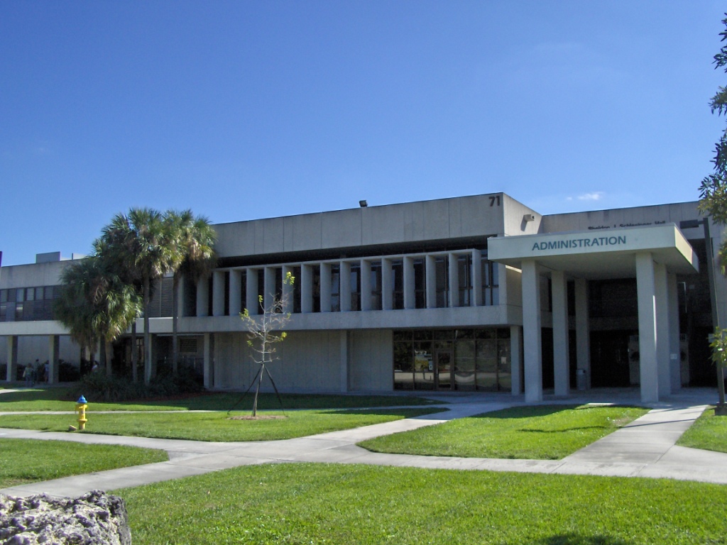
- Broward College
- Florida Atlantic University (Branch campuses)
- Nova Southeastern University
- Keiser University
Other adult education providers
- DeVry University
- University of Phoenix
- The Art Institute of Fort Lauderdale
- Florida Career College
- Brown Mackie College
- Atlantic Technical Center and Technical High School
- McFatter Technical College and Technical High School
- Sheridan Technical College and Technical High School
Public libraries
The Broward County Library is one of the largest public library systems in the country, comprising 38 branch locations. There are also five municipal public libraries in the county that are not part of the Broward County Library system: Ethel M. Gordon Oakland Park Library, Lighthouse Point Library, Helen B. Hoffman Plantation Library, Richard C. Sullivan Public Library of Wilton Manors, and Parkland Public Library.
Library Resources
Broward County libraries provide many resources to the public. For high-schoolers looking to prepare themselves for college, the library offers college readiness & SAT/ACT prep courses. For adults looking to learn computer skills, adult computer classes are also offered. These resources are free of cost, therefore, all it takes is registering to participate. In addition to the many resources offered at the library, bus passes are also sold at most Broward County libraries. If you want to enjoy some of these resources, you can simply download the app to utilize them on the go. There are nine apps available for download: Broward County Library (BCL WoW), Freegal Music, Hoopla, Overdrive, Libby, Axis 360, RBdigital Magazines, Rosetta Stone, and Brainfuse.
Sites of interest
_003.jpg)

Museums and historical collections
- African-American Research Library and Cultural Center, Fort Lauderdale
- Bonnet House Museum & Gardens, Fort Lauderdale
- Coral Springs Museum of Art, Coral Springs
- Fort Lauderdale Antique Car Museum, Fort Lauderdale
- Fort Lauderdale History Center, Fort Lauderdale
- Naval Air Station Fort Lauderdale Museum, Fort Lauderdale
- NSU Art Museum, Fort Lauderdale
- Plantation Historical Museum, Plantation
- Stranahan House, Fort Lauderdale
- The International Game Fish Association, including the Fishing Hall of Fame & Museum, Dania Beach
- The International Swimming Hall of Fame, Fort Lauderdale
- The Museum of Discovery and Science, Fort Lauderdale
- Wiener Museum of Decorative Arts, Dania Beach
- Young at Art Museum, Davie
Nature and wildlife areas

- Anne Kolb Nature Center, Hollywood
- Butterfly World, a botanical sanctuary in Coconut Creek
- Everglades Holiday Park, featuring airboat rides and alligator shows
- Fern Forest Nature Center, Coconut Creek
- Flamingo Gardens, a botanical garden and wildlife sanctuary
- Secret Woods Nature Center, Dania Beach
- Sawgrass Recreation Park[[File:Evergladesairboattour.jpg|alt=An airboat tour in Everglades Holiday Park|thumb|An airboat tour in Everglades Holiday Park]]
Other areas and attractions
- Beach Place, a strip of stores, restaurants, and bars across the street from the beach along the Atlantic coast, in Fort Lauderdale
- Broward Center for the Performing Arts
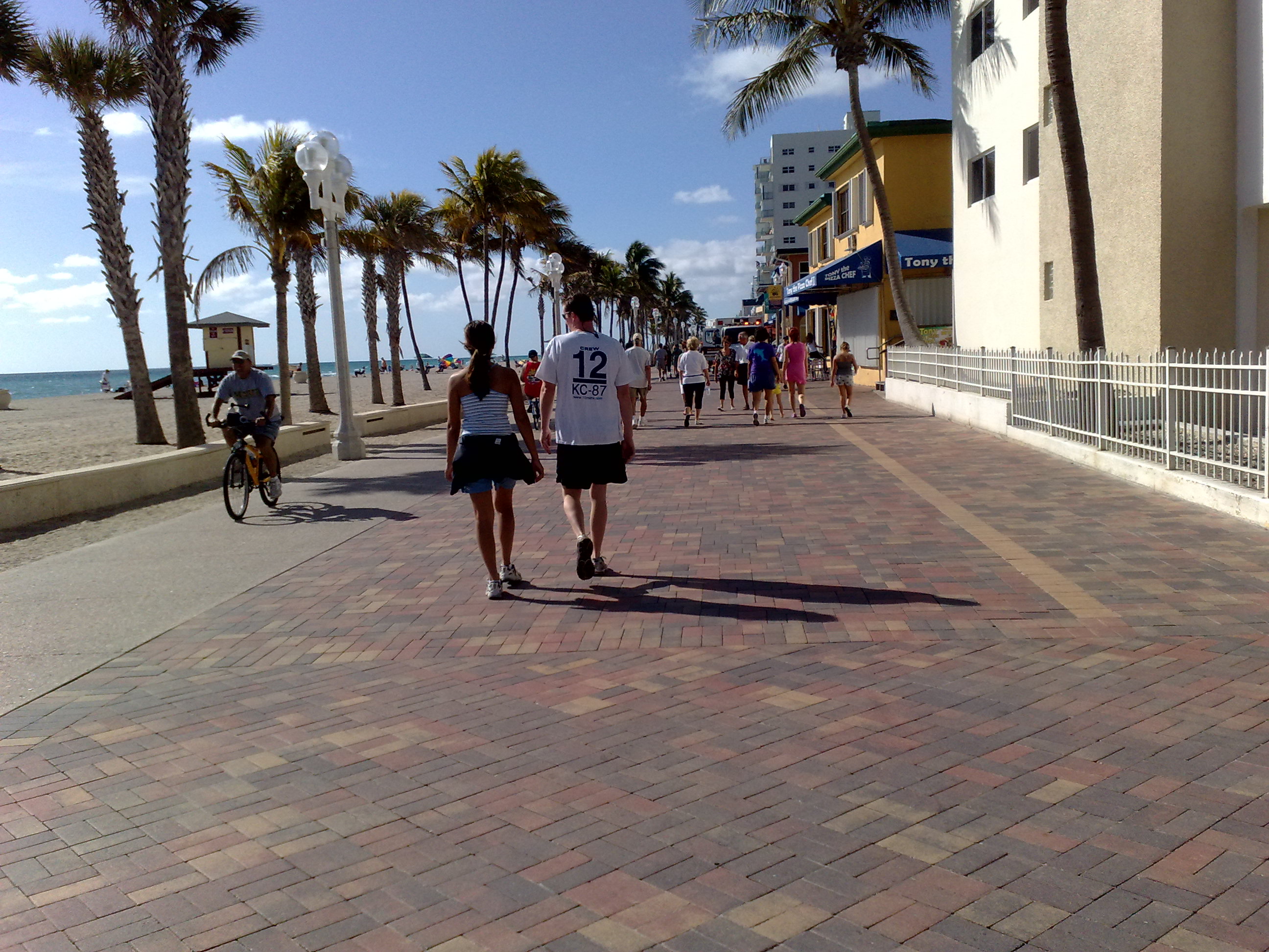
- Hollywood Beach Broadwalk
- Florida Grand Opera
- Fort Lauderdale Swap Shop (colloquially known to locals as simply the Swap Shop)
- Sawgrass Mills, a large outlet shopping mall in Sunrise
- Amerant Bank Arena in Sunrise, where the NHL's Florida Panthers play their games
- The Festival Flea Market Mall in Pompano Beach, America's largest indoor flea market
- Riverside Hotel, Fort Lauderdale's oldest continuously operating hotel
- Riverwalk (Fort Lauderdale)
Additionally, with 23 miles of beach, Broward County is a popular destination for scuba diving, snorkeling, and droves of young Spring break tourists from around the world.
Transportation
Airports

Fort Lauderdale–Hollywood International Airport serves as the primary airport of the Broward County area. The airport is bounded by the cities Fort Lauderdale, Hollywood and Dania Beach, 3 mi southwest of downtown Fort Lauderdale and 21 mi north of Miami. The airport is near cruise line terminals at Port Everglades and is popular among tourists bound for the Caribbean. Since the late 1990s, FLL has become an intercontinental gateway, although Miami International Airport still handles most long-haul flights. FLL is ranked as the 19th busiest airport (in terms of passenger traffic) in the United States, as well as the nation's 14th busiest international air gateway and one of the world's 50 busiest airports. FLL is classified by the US Federal Aviation Administration as a "major hub" facility serving commercial air traffic. In 2017 the airport processed 32,511,053 passengers (11.3% more than 2016) including 7,183,275 international passengers (18.6% more than 2016).
- North Perry Airport
- Fort Lauderdale Executive Airport
- Pompano Beach Airpark
- Downtown Fort Lauderdale Heliport

Public transportation
- Broward County Transit
- Sun Trolley
Major expressways

- [[File:I-95.svg|25px]] Interstate 95
- [[File:I-75.svg|25px]] Interstate 75
- [[File:I-595.svg|25px]] Interstate 595 (Port Everglades Expressway)
- [[File:Florida's Turnpike shield.svg|25px]] Florida's Turnpike (SR 91)
- [[File:Florida's Turnpike shield.svg|25px]] Homestead Extension (SR 821)
- [[File:Toll Florida 869.svg|24px]] State Road 869 (Sawgrass Expressway)
Railroads
- Passenger services: Amtrak, Brightline, and Tri-Rail
- Freight services: Florida East Coast Railway and CSX Transportation
Street grid
A street grid stretches throughout Broward County. Most of this grid is loosely based on three primary eastern municipalities, (from South to North) Hollywood, Fort Lauderdale, and Pompano Beach. Deerfield Beach—another primary eastern municipality—has its own street grid, as do two smaller municipalities—Dania Beach and Hallandale Beach.
Greenways System
Construction is underway on a network of recreational trails to connect cities and points of interest in the county.
Communities

Municipalities
Municipality populations are based on the 2020 US census using their QuickFacts with 5,000 residents and above, while municipalities under 5,000 people are based on their US Decennial Census.
| # | Incorporated community | Designation | Date incorporated | Population |
|---|---|---|---|---|
| 1 | Parkland | City | 34,670 | |
| 2 | Coconut Creek | City | 57,833 | |
| 3 | Deerfield Beach | City | 86,859 | |
| 4 | Coral Springs | City | 134,394 | |
| 5 | Margate | City | 58,712 | |
| 6 | Pompano Beach | City | 112,046 | |
| 7 | Lighthouse Point | City | 10,486 | |
| 8 | Hillsboro Beach | Town | 1,987 | |
| 9 | Tamarac | City | 71,897 | |
| 10 | North Lauderdale | City | 44,794 | |
| 11 | Lauderdale-by-the-Sea | Town | 6,198 | |
| 12 | Sea Ranch Lakes | Village | 540 | |
| 13 | Oakland Park | City | 44,229 | |
| 14 | Wilton Manors | City | 11,426 | |
| 15 | Lazy Lake | Village | 33 | |
| 16 | Fort Lauderdale | City | 182,760 | |
| 17 | Lauderdale Lakes | City | 35,954 | |
| 18 | Lauderhill | City | 74,482 | |
| 19 | Sunrise | City | 97,335 | |
| 20 | Plantation | City | 91,750 | |
| 21 | Weston | City | 68,107 | |
| 22 | Davie | Town | 105,691 | |
| 23 | Dania Beach | City | 31,723 | |
| 24 | Hollywood | City | 153,067 | |
| 25 | Southwest Ranches | Town | 7,607 | |
| 26 | Cooper City | City | 34,401 | |
| 27 | Pembroke Pines | City | 171,178 | |
| 28 | Miramar | City | 134,721 | |
| 29 | West Park | City | 15,130 | |
| 30 | Pembroke Park | Town | 6,260 | |
| 31 | Hallandale Beach | City | 41,217 |
Former unincorporated neighborhoods
In the 1980s, the Broward County Commission adopted a policy of having all populated places in the county be part of a municipality. Municipalities were often reluctant to annex neighborhoods which were not projected to yield enough tax revenue to cover the costs of providing services to those neighborhoods. In 2001 the Broward County Legislative Delegation adopted a policy encouraging the annexation of all unincorporated areas in Broward County into municipalities by October 1, 2005. Formerly unincorporated neighborhoods that have been annexed into existing municipalities or combined to form new municipalities include:
Remaining unincorporated neighborhoods
By late in the first decade of the 21st century, annexation of remaining neighborhoods had stalled. the Broward County Municipal Services District serves seven unincorporated neighborhoods, including six census designated places (Boulevard Gardens, Broadview Park, Franklin Park, Hillsboro Pines, Roosevelt Gardens and Washington Park) and a parcel with a population of 72 in 2018, Hillsboro Ranches. Other areas in the developed part of the county that are not in municipalities include the Hollywood Seminole Indian Reservation, Fort Lauderdale-Hollywood International Airport, several landfills and resource recovery facilities, and other scattered small parcels with few or no residents.
Notes
References
References
- "2018 Gazetteer Countries".
- "County Commission".
- (June 17, 2020). "By blocking mayor vote, Broward embraces business as usual, again | Editorial".
- link. "County Commission County Commission"
- link. "Pine Island Ridge Natural Area"
- Sea level at the Atlantic Ocean.
- "P2: HISPANIC OR LATINO, AND NOT ... - Census Bureau Table". U.S. Census Bureau.
- (March 30, 2023). "County Population Totals and Components of Change: 2020-2022". U.S. Census Bureau.
- "Gross Domestic Product: All Industries in Broward County, FL".
- (August 12, 2021). "Racial and Ethnic Diversity in the United States: 2010 Census and 2020 Census". U.S. Census Bureau.
- "Gross Domestic Product by County and Metropolitan Area, 2022". [[Bureau of Economic Analysis]].
- Parks, Arva Moore. (1991). "Miami: The Magic City". Centennial Press.
- "Miami Circle to Brickell Avenue – From Native to NOW! – HistoryMiami Museum".
- "broward county history".
- "Broward County History | See The Historical Timeline from 1400 BC".
- "FLORIDA Population of Counties by Decennial Census: 1900 to 1990".
- (November 2, 2015). "Our Organization".
- "40th Anniversary of Snow in South Florida".
- "TPC NHC HURRICANE ANDREW".
- "U.S. Census website". United States Census Bureau.
- "About West Park".
- US Department of Commerce, NOAA. "Wilma".
- Spencer, Terry. (October 13, 2022). "Parkland school shooter spared from execution for killing 17".
- (June 19, 2020). "Why some Floridians want to rename Broward County, Plantation and Lee County". The Miami Herald.
- "Broward County, FL Weather - USA.com™".
- (February 12, 2011). "US Gazetteer files: 2010, 2000, and 1990". [[United States Census Bureau]].
- [http://www.fiu.edu/~whitmand/Courses/Fl_geo_notes.html Notes on Florida Geography, Florida International University]
- (February 16, 2007). "Tire reef off Florida proves a disaster - U.S. news - Environment - NBC News". NBC News.
- "Annual Estimates of the Resident Population for Counties: April 1, 2020 to July 1, 2023". United States Census Bureau.
- (2023). "Census Counts: 1830-2020". Office of Economic and Demographic Research, The Florida Legislature.
- "General Population Characteristics FLORIDA 1980 Census of Population". U.S. Census Bureau.
- "1990 Census of Population General Population Characteristics Florida Section 1 of 2". U.S. Census Bureau.
- "PL002: HISPANIC OR LATINO, AND NOT ... - Census Bureau Table". U.S. Census Bureau.
- "P2: HISPANIC OR LATINO, AND NOT ... - Census Bureau Table". U.S. Census Bureau.
- (2021). "2020 Decennial Census Demographic Profile (DP1)".
- (2021). "2020 Decennial Census Redistricting Data (Public Law 94-171)".
- (2023). "2020 Decennial Census Demographic and Housing Characteristics (DHC)".
- "H1 | OCCUPANCY STATUS". U.S. Census Bureau.
- "P12 | SEX BY AGE FOR SELECTED AGE CATEGORIES". U.S. Census Bureau.
- "P13 | MEDIAN AGE BY SEX". U.S. Census Bureau.
- "H1 | OCCUPANCY STATUS". U.S. Census Bureau.
- "P12 | SEX BY AGE". U.S. Census Bureau.
- "P13 | MEDIAN AGE BY SEX". U.S. Census Bureau.
- "H003 | OCCUPANCY STATUS [3]". U.S. Census Bureau.
- "P012 | SEX BY AGE [49]". U.S. Census Bureau.
- "P013 | MEDIAN AGE BY SEX [3]". U.S. Census Bureau.
- "General Population Characteristics FLORIDA 1980 Census of Population". U.S. Census Bureau.
- "S2001: EARNINGS IN THE PAST 12 ... - Census Bureau Table". U.S. Census Bureau.
- "S1901: INCOME IN THE PAST 12 MONTHS ... - Census Bureau Table". U.S. Census Bureau.
- "S1701: POVERTY STATUS IN THE PAST ... - Census Bureau Table". U.S. Census Bureau.
- "S1501: EDUCATIONAL ATTAINMENT - Census Bureau Table". U.S. Census Bureau.
- "C16001: LANGUAGE SPOKEN AT HOME FOR ... - Census Bureau Table". U.S. Census Bureau.
- "B16001: LANGUAGE SPOKEN AT HOME BY - Census Bureau Table". U.S. Census Bureau.
- "PCT010: AGE BY LANGUAGE SPOKEN AT ... - Census Bureau Table". U.S. Census Bureau.
- "1990 Census of Population General Social and Economic Characteristics Florida Section 1 of 3". U.S. Census Bureau.
- "General Social and Economic Characteristics FLORIDA 1980 Census of Population". U.S. Census Bureau.
- "B05001: NATIVITY AND CITIZENSHIP ... - Census Bureau Table". U.S. Census Bureau.
- "B05006: PLACE OF BIRTH FOR THE ... - Census Bureau Table". U.S. Census Bureau.
- "B05001: NATIVITY AND CITIZENSHIP ... - Census Bureau Table". U.S. Census Bureau.
- "B05006: PLACE OF BIRTH FOR THE ... - Census Bureau Table". U.S. Census Bureau.
- "P021: PLACE OF BIRTH BY CITIZENSHIP ... - Census Bureau Table". U.S. Census Bureau.
- "PCT019: PLACE OF BIRTH FOR THE ... - Census Bureau Table". U.S. Census Bureau.
- "New Mayor and Vice Mayor Selected in Broward County".
- (November 28, 2023). "Nan Rich sworn in as Broward County mayor, Beam Furr as vice mayor - WSVN 7News | Miami News, Weather, Sports | Fort Lauderdale".
- (November 29, 2022). "Broward Commissioners select new mayor, vice mayor".
- (November 16, 2021). "Michael Udine appointed new mayor of Broward County".
- (November 17, 2020). "Steve Geller named Broward County mayor".
- (November 19, 2019). "New mayor elected for Broward County".
- (November 27, 2018). "Mark Bogen chosen as new Broward mayor". Sun Sentinel.
- (November 28, 2017). "Broward County gets new mayor after outgoing leader touts accomplishments". Sun Sentinel.
- "Archived copy".
- "Broward Sheriff's Office - About the Broward Sheriff's Office". Broward County Sheriff's Office.
- (Jan 2022). "EXPLORE BSO'S FASCINATING HISTORY AT BROWARD LIBRARY MUSEUM EXHIBIT".
- (2010). "Out of the Muck: A History of the Broward Sheriff's Office, 1915-2000". Carolina Academic Press.
- (April 7, 2014). "BSO trying to track down its history".
- (January 8, 2013). "Scott Israel Sworn In As Broward Sheriff".
- Mary Ellen Klas. (June 18, 2019). "Attorneys for ex-Broward sheriff claim 'brutal political ploy'".
- Ron DeSantis. (January 11, 2019). "Executive order 19-14; Executive Order of Suspension". www.flgov.com.
- [http://www.sptimes.com/2002/04/28/news_pf/State/Broward_Power.shtml State:Broward Power]. [[St. Petersburg Times]]. Retrieved November 14, 2006.
- [http://www.sun-sentinel.com/news/politics/elections/orl-elections-nationalmap-ap,0,5015729.htmlpage 2008 General Election Results] {{webarchive. link. (October 11, 2012. [[South Florida Sun-Sentinel]]. Retrieved November 11, 2008.)
- Leip, David. "Dave Leip's Atlas of U.S. Presidential Elections".
- "U.S. Census Bureau QuickFacts: Broward County, Florida".
- "Voter Registration - By County and Party - Division of Elections - Florida Department of State".
- Broward Legal Directory, [https://www.browardlegaldirectory.com/broward-county-florida-laws-ordinances Broward County Florida Laws and Ordinances], accessed February 21, 2021
- Broward County, Finance and Administration Services Department, [https://www.broward.org/Purchasing/Documents/ConeOfSilence.pdf Cone of Silence], accessed January 16, 2020
- Board of County Commissioners, [https://www.broward.org/Commission/Documents/ord2004_31.pdf Ordinance No. 2004-31], enacted August 24, 2004, accessed February 21, 2021
- "[http://www.broward.org/Airport/Business/Pages/TenantDirectory.aspx Fort Lauderdale-Hollywood International Airport > Business > Tenant Directory] {{webarchive. link. (2011-12-27 ." Broward County. Retrieved on December 17, 2011. "1100 Lee Wagener Blvd. Fort Lauderdale, FL33315")
- "[http://www.gulfstreamair.com/contact.shtml Contact Us] {{Webarchive. link. (April 19, 2009 ." Gulfstream International Airlines. Retrieved on December 17, 2011. "1100 Lee Wagener Blvd, Suite 201 Ft. Lauderdale, FL 33315.")
- link. (June 8, 2011 ." City of Dania Beach. Retrieved on May 12, 2010.)
- "[https://web.archive.org/web/20090507185056/http://www.locair.net/pages/contact.htm Contact Us]." [[Locair]]. Retrieved on June 19, 2010. "Locair, Inc. 268 SW 33rd St. Fort Lauderdale, FL 33315"
- "Spirit Airlines Unveils New Spirit Central Campus in Dania Beach, Florida".
- (August 1, 2011). "Spirit Airlines – History". Spirit Airlines, Inc..
- "[https://web.archive.org/web/20040331100714/http://www.flychalks.com/ Administration]." [[Chalk's International Airlines]]. March 31, 2004. Retrieved on December 17, 2011. "Chalk's International Airlines 704 SW 34th Street Ft Lauderdale, Fl. 33315"
- "[https://web.archive.org/web/*/http://www.flybia.com/contactus.asp Contact Us]." Bimini Island Air. Retrieved on July 12, 2011. "Bimini Island Air, Inc./Ltd. 3000 NW 59 Street Fort Lauderdale, FL 33309"
- (2017). "2017 Census - State and County Profiles - Florida - Broward County".
- "2020 CENSUS - SCHOOL DISTRICT REFERENCE MAP: Broward County, FL". [[U.S. Census Bureau]].
- "Broward County Transit".
- "Library".
- (January 29, 2019). "Ft. Lauderdale Antique Car Museum".
- (January 29, 2019). "Plantation Historical MUseum".
- (January 29, 2019). "Wiener Museum of Decorative Arts".
- Park, Everglades Holiday. "Everglades Airboat Tours {{!}} Airboat Tours and Rides".
- "South Florida Beach Dive Sites".
- "More spring tourists filling hotels". Sun Sentinel.
- (December 2016). "TOTAL PASSENGERS (ARRIVING + DEPARTING) – Monthly Stats". broward.org.
- "Topic Galleries - South Florida". Sun-sentinel.com.
- "Welcome To Broward County Greenways". Broward.org.
- (March 2018). "Topic Galleries". OrlandoSentinel.com.
- "United States Census Bureau: QuickFacts". [[United States Census Bureau]].
- "U.S. Decennial Census". United States Census Bureau.
- Hulse, Carl. (June 16, 1985). "Broward's Annexation Drive Set to Begin". South Florida Sun Sentinel.
- Jackson, David. (November 13, 1985). "Unincorporated Areas Not an Easy Issue to Resolve". South Florida Sun Sentinel.
- (August 2001). "Broward Delegation Annexation Policy".
- Ortega, Juan. (October 21, 2007). "Annexation push leaves some behind". South Florida Sun Sentinel.
- (2018). "Broward Municipal Services District".
- (June 2016). "Municipal Services District".
This article was imported from Wikipedia and is available under the Creative Commons Attribution-ShareAlike 4.0 License. Content has been adapted to SurfDoc format. Original contributors can be found on the article history page.
Ask Mako anything about Broward County, Florida — get instant answers, deeper analysis, and related topics.
Research with MakoFree with your Surf account
Create a free account to save articles, ask Mako questions, and organize your research.
Sign up freeThis content may have been generated or modified by AI. CloudSurf Software LLC is not responsible for the accuracy, completeness, or reliability of AI-generated content. Always verify important information from primary sources.
Report