From Surf Wiki (app.surf) — the open knowledge base
Bradley County, Tennessee
County in Tennessee, United States

County in Tennessee, United States
| Field | Value |
|---|---|
| county | Bradley County |
| state | Tennessee |
| seal | BradleyCountyTennesseeSeal.png |
| founded year | 1836 |
| founded date | May 2 |
| named for | Edward Bradley, state legislator |
| seat wl | Cleveland |
| motto | "Agriculture and Industry" |
| ZIP codes | 37310, 37311, 37312, 37320, 37323, 37353, 37364 |
| largest city wl | Cleveland |
| area_total_sq_mi | 331 |
| area_land_sq_mi | 329 |
| area_water_sq_mi | 2.7 |
| area percentage | 0.8% |
| census yr | 2020 |
| pop | 108620 |
| density_sq_mi | 330.15 |
| time zone | Eastern |
| web | www.bradleycountytn.gov |
| ex image | The Bradley County Courthouse in Cleveland, Tennessee.jpg |
| ex image cap | Bradley County Courthouse in Cleveland |
| district | 3rd |
Bradley County is a county located in the southeastern portion of the U.S. state of Tennessee. As of the 2020 census, the population was 108,620, making it the thirteenth most populous county in Tennessee. Its county seat is Cleveland. It is named for Colonel Edward Bradley of Shelby County, Tennessee, who was colonel of Hale's Regiment in the American Revolution and the 15th Regiment of the Tennessee Volunteers in the War of 1812. Bradley County is included in the Cleveland, Tennessee Metropolitan Statistical Area, which is also included in the Chattanooga-Cleveland-Dalton, TN-GA-AL Combined Statistical Area.
History
Indigenous peoples occupied this territory, especially along the waterways, for thousands of years before European contact. The first Europeans to see this area were likely Hernando De Soto and his expedition on June 2, 1540, while traveling through the Southeast interior of the North American continent. They encountered peoples of the South Appalachian Mississippian culture.
The historic Muscogee Creek and Yuchi occupied areas of what became Tennessee. The Yuchi town of Chestowee was located on the south bank of the lower Hiwassee River. They later moved from Tennessee into Georgia and South Carolina under pressure from the Cherokee, who were rising to power in the region. Cherokee warriors from the Middle Towns destroyed Chestowee in 1714, encouraged by English fur traders from South Carolina. Archeological surveys suggest that Chestowee was located at what is known as the Rymer archeological site, identified in later studies as within the European-American J.P. Rymer farm.
The Cherokee became predominant in this area and referred to a large region in present-day Bradley County as Chatata, meaning "clear water". The Yuchi, while speaking a different language, allied with the Muscogee Creek when moving into their territory in Georgia and Alabama.
In anticipation of forced removal of the Cherokee by treaty cession in this area north of the Hiwassee River, white settlers began to move here. In 1821, the Cherokee Agency, the official liaison between the U.S. Government and the Cherokee Nation, was moved to present-day Charleston, Tennessee. Between 1832 and 1838, the Cherokee moved their capital to the Red Clay Council Grounds, on the southern border of Bradley County with Georgia; it served as the Cherokee capital and the last council grounds of the Cherokee Nation-East. This property is now a state park, Red Clay State Park.
The Cherokee Removal began after some of their leaders signed the Treaty of New Echota, signed on December 29, 1835. The government had earlier tried to persuade them to move to Indian Territory; these leaders signed the treaty while trying to gain the best conditions for their people, as they believed it was inevitable.
General Winfield Scott was directed to remove the Cherokee from the Southeast, and set up the headquarters at Fort Cass in Charleston. Several internment camps were established in Bradley County in the valleys between Charleston and Cleveland, Tennessee, where the Cherokee were held in preparation for the journey westward. This became known as the Trail of Tears. Two of the largest internment camps were located at Rattlesnake Springs.
European-American development of Bradley County
Bradley County was established by the legislature on February 10, 1836. It was named to honor Colonel Edward Bradley who served in the War of 1812. The first election in Bradley County took place on April 2, 1836. On May 2, 1836, the location for the county seat of Cleveland was chosen. On January 20, 1838, Cleveland, which had a population of 400, was formally recognized by the state legislature as the seat of Bradley County. Cleveland was incorporated on February 2, 1842.
Like most East Tennessee counties, the voters of Bradley County were largely opposed to secession on the eve of the Civil War. In Tennessee's Ordinance of Secession referendum on June 8, 1861, the county's residents voted against secession - 1,382 to 507. No major battles were fought in Bradley County, but several major skirmishes between Union and Confederate troops took place there. In 1864, Confederate soldiers failed in an attempt to destroy a Union train near the Tasso community, an effort that resulted in destroying a Confederate train instead.
The bridge over the Hiwassee River was burned on November 8, 1861, by members of the East Tennessee bridge-burning conspiracy led by Alfred Cate. On November 4, 1862, a train accident south of Cleveland near the Black Fox community killed 17 members of the 33rd Regiment Alabama Infantry, who were being transported to Chattanooga. Union soldiers under the command of William Tecumseh Sherman camped at Cleveland, Tasso, and Blue Springs on multiple occasions during the latter half of the war. The city of Cleveland was occupied by the Confederate Army from 1861 to 1863.
Geography
According to the U.S. Census Bureau, the county has a total area of 331 sqmi, of which 329 sqmi is land and 2.7 sqmi (0.8%) is water. The county is situated on a series of paralleling ridges running north-northeasterly which are part of the Ridge and Valley Appalachians. The highest of these, Candies Creek Ridge, runs through the center of Cleveland. Located in between these ridges are creeks, and there are several springs in the county, which made the area favorable to early settlers. The highest point in the county is located on the Hamilton County line along White Oak Mountain. The county is bordered on the north by the Hiwassee River. The majority of the county is located in the Tennessee Valley drainage basin, except for approximately the southeastern third, which is located in the Mobile Bay Watershed and contains the Conasauga River. This river is the only river in Tennessee that is not part of the Mississippi River Watershed.
Adjacent counties
- Meigs County (northwest)
- McMinn County (north)
- Polk County (east)
- Murray County, Georgia (southeast)
- Whitfield County, Georgia (south)
- Hamilton County (west)
State protected areas
- Chickamauga Wildlife Management Area (part)
- Charlotte Anne Finnell Neal Wildlife Management Area
- Red Clay State Park
Demographics
|align-fn=center 1790-1960 1900-1990 1990-2000 2010-2020
2020 census
As of the 2020 census, the county had a population of 108,620. The median age was 39.7 years, with 21.8% of residents under the age of 18 and 17.7% aged 65 or older.
For every 100 females there were 94.0 males, and for every 100 females age 18 and over there were 91.4 males age 18 and over.
The racial makeup of the county was 82.4% White, 4.8% Black or African American, 0.4% American Indian and Alaska Native, 1.1% Asian, 0.1% Native Hawaiian and Pacific Islander, 3.6% from some other race, and 7.5% from two or more races. Hispanic or Latino residents of any race comprised 7.8% of the population.
68.1% of residents lived in urban areas, while 31.9% lived in rural areas.
There were 41,847 households in the county, of which 30.6% had children under the age of 18 living in them. Of all households, 49.9% were married-couple households, 17.0% were households with a male householder and no spouse or partner present, and 26.7% were households with a female householder and no spouse or partner present. About 25.5% of all households were made up of individuals and 11.1% had someone living alone who was 65 years of age or older.
There were 44,781 housing units, of which 6.6% were vacant. Among occupied housing units, 64.3% were owner-occupied and 35.7% were renter-occupied. The homeowner vacancy rate was 1.3% and the rental vacancy rate was 6.1%. The census counted 26,516 families residing in the county.
Racial and ethnic composition
| Race | Number | Percentage | White (non-Hispanic) | Black or African American (non-Hispanic) | Native American | Asian | Pacific Islander | Other/Mixed | Hispanic or Latino |
|---|---|---|---|---|---|---|---|---|---|
| 87,830 | 80.86% | ||||||||
| 5,105 | 4.7% | ||||||||
| 271 | 0.25% | ||||||||
| 1,188 | 1.09% | ||||||||
| 117 | 0.11% | ||||||||
| 5,648 | 5.2% | ||||||||
| 8,461 | 7.79% |
2010 census
As of the census of 2010, there were 98,963 people, 37,947 households, and 26,867 families residing in the county. The population density was 298.98 persons per square mile. There were 41,395 housing units at an average density of 125.06 per square mile. The racial makeup of the county was 92.10% White, 4.27% Black or African American, 0.33% Native American, 0.86% Asian, 0.06% Native Hawaiian or Pacific Islander, and 1.45% from two or more races. Hispanics or Latinos (of any race) were 4.71% of the population. The largest ancestral groups were Irish 14.27%, German 12.62%, English 8.91%, Italian 2.39%, and Dutch 2.18%. An estimated 3.90% of the population was foreign-born, and an estimated 7.54% were veterans.
Of all of the households, 29.07% had children under the age of 18 living in them, 53.58% were married couples living together, 4.78% had a male householder with no wife present, 12.44% had a female householder with no husband present, and 29.2% were non-family households, with 23.8% of householders living alone. 33.27% of all households had individuals under the age of 18 living in them, and 26.36% had individuals aged 65 and older living in them. The average household size was 2.54 persons, and the average family size was 2.98 persons.
The population was spread out, with 22.97% under the age of 18, 62.88% ages 18 to 64, and 14.15% over the age of 65. The median age was 37.9 years. 51.32% of the population was female and 48.68% was male.
The median household income was $40,032, and the average per capita income was approximately $21,444. Males had a median income of $37,735 versus $28,585 for females. Approximately 11.6% of families and 16.0% of the population were below the poverty line, including 20.2% of those under the age of 18 and 10.8% of those age 65 or over.
Economy
With thirteen Fortune 500 manufacturers, Cleveland has the fifth largest industrial economy in Tennessee. Cleveland is home to a variety of industries, including household cooking equipment, foodstuff, textiles, furniture, storage batteries, pharmaceuticals, industrial cleaning products, photographic processing, industrial and domestic chemicals, and automotive parts. Major employers include Whirlpool, Johnston Coca-Cola, Mars, Incorporated, Procter & Gamble, Duracell, Hardwick Clothes, and Cleveland Chair Company. Wacker Polysilicon, Olin Corporation, Amazon, and Arch Chemicals have factories and distribution centers in Charleston. Resolute Forest Products, formerly Bowater, has a plant across the river from Charleston in Calhoun.
Agriculture in Bradley County has an annual market value of over $105 million. Bradley County is also home to farms which raise beef cattle, dairy, and crops, such as corn, soybeans, and fruits and vegetables.
Government
Bradley County has a 14-member county commission form of government, with two commissioners from each of seven districts. The commission is headed by a chairman and vice chairman, who are chosen by fellow commissioners. The current chairman is Tom Crye from District 2 and the current vice chairman is Bill Winters from District 7. The county executive (or "county mayor") separately elected, is Republican D. Gary Davis. Other elected officials include county clerk, circuit and criminal court clerk, register of deeds, assessor of property, trustee, and road superintendent. Elections take place every even year, with primaries in the first week of May and general elections in the first week of August, along with the state primary.
| District | Seat A | Seat B |
|---|---|---|
| District 1 | Daniel Beaty | Mike Hughes |
| District 2 | Louie Alford | Tom Crye |
| District 3 | Milan Blake | Denny Collins |
| District 4 | Scott Gilbert | Howard Thompson |
| District 5 | Bobby Goins | Cindy Slater |
| District 6 | Tim Mason | Tommy Ledford |
| District 7 | Josh Rogers | Bill Winters |
Bradley County is located in Tennessee's 3rd congressional district, represented by Republican Chuck Fleischmann. For the Tennessee House of Representatives, Bradley County is part of both District 22, represented by Republican Dan Howell, and District 24, represented by Republican Kevin Raper. Bradley County is represented in the Tennessee Senate, by Republican J. Adam Lowe
Cleveland and Bradley County have always been majority-Republican, as has most of East Tennessee, even when Tennessee was part of the Solid South. Since the Republican Party's founding, only two Democratic Presidential Candidates have won Bradley County; Woodrow Wilson in 1912 and Franklin Delano Roosevelt in 1936. In both the 2000 and 2004 Presidential elections, the Republican candidate received the highest percentage of the popular vote in Bradley County out of all of Tennessee's counties.
Infrastructure
Transportation
Air
Hardwick Field, also known as Cleveland Municipal Airport, was the county's principal airport from 1955 to 2013. Cleveland Regional Jetport, located approximately two miles east of Hardwick Field opened on January 25, 2013, replacing Hardwick Field.
Rail
The county is served by the Norfolk Southern Railway, which forks in Cleveland and provides logistics for industries.
Highways
Interstate 75 traverses the county from the southwest to the north, passing through the western edge of Cleveland. There are four exits on I-75 in Bradley County: three in Cleveland and one in Charleston. U.S. Route 11 and U.S. Route 64 intersect in downtown Cleveland. U.S. 11 connects to Chattanooga to the southwest and Athens to the north. U.S. 64 connects to Murphy, North Carolina to the east. S.R. 60 connects Cleveland to Dayton to the northwest and Dalton, Georgia to the south. APD-40, made up of the U.S. 64 Bypass and a section of S.R. 60 forms a beltway and bypass route around the business district of Cleveland. The U.S. 11 Bypass bypasses downtown Cleveland to the west.
Principal highways

- [[File:I-75.svg|25px|link=Interstate 75 in Tennessee]] Interstate 75
- [[File:US 11.svg|25px|link=U.S. Route 11 in Tennessee]] U.S. Route 11
- [[File:Bypass plate.png|25px|link=Special routes of U.S. Route 11#Cleveland bypass route]]
- [[File:US 64.svg|25px|link=U.S. Route 64 in Tennessee]] U.S. Route 64
- [[File:Bypass plate.png|25px|link=APD-40]]
- [[File:US 74.svg|25px|link=U.S. Route 74]] U.S. Route 74
- [[File:tennessee 60.svg|25px|link=Tennessee State Route 60]] S.R. 60
- [[File:Tennessee 40.svg|25px|link=Tennessee State Route 40]] S.R. 40
- [[File:Tennessee 2.svg|25px|alt=|link=Tennessee State Route 2]] S.R. 2
- [[File:Tennessee 311.svg|25px|link=APD-40]] S.R. 311
- Paul Huff Parkway
Secondary highways
- [[File:Secondary Tennessee 74.svg|25px|alt=|link=Tennessee State Route 74]] S.R. 74
- [[File:Secondary Tennessee 306.svg|25px|alt=|link=Tennessee State Route 306]] S.R. 306
- [[File:Secondary Tennessee 308.svg|25px|alt=|link=Tennessee State Route 308]] S.R. 308
- [[File:Secondary Tennessee 312.svg|25px|alt=|link=Tennessee State Route 312]] S.R. 312
- [[File:Secondary Tennessee 313.svg|25px|alt=|link=Tennessee State Route 313]] S.R. 313
- [[File:Secondary Tennessee 317.svg|25px|alt=|link=Tennessee State Route 317]] S.R. 317
Utilities
Cleveland Utilities is a city-owned corporation which provides electricity, water, and sewer service to the city of Cleveland and surrounding areas. The Calhoun-Charleston Utilities District provides water to Charleston. The rest of the county is provided water by the Hiwassee Utilities Commission, Ocoee Utility District, Eastside Utility District, and Savannah Valley Utility District.
Healthcare
Prior to 2008, the county's two main hospitals were Bradley Memorial Hospital and Cleveland Community Hospital. They ran independently until 2008 when they were both purchased by SkyRidge Medical Center. In 2015, the two hospitals were purchased by Tennova Healthcare. Bradley Healthcare & Rehabilitation Center is a nursing home that serves the county. Bradley County Emergency Medical Services is an emergency medical service (EMS) agency of the county government that was established in 1972 and consists of six stations, eight ambulances, and two ancillary vehicles, along with more than 60 full-time employees and more than 25 part-time employees.
Education
Cleveland State Community College and Lee University are located in Bradley County. Public schools in the county are managed by the Bradley County Schools school district or the Cleveland City Schools school district. The county district has four public high schools: Bradley Central High School, Walker Valley High School, GOAL Academy, and REACH Adult High school. Cleveland High School is operated by the city school district. There is one State-accredited private Christian college preparatory school: Tennessee Christian Preparatory School.
Private schools
- Tennessee Christian Preparatory School
- Cleveland Christian School
- Bowman Hills Adventist School
- Shenandoah Baptist Academy
- United Christian Academy
- Vanguard Christian Academy
- Bachman Academy
Higher education
- Lee University
- Cleveland State Community College
- Pentecostal Theological Seminary
Media
Newspapers
The Cleveland Daily Banner is the county's primary newspaper. The paper was first published in 1854, making it one of the oldest in the state. Additionally, the Chattanooga Times Free Press, a paper based in Chattanooga, also serves as a primary source of news for Bradley County residents.
Radio
Several radio stations located within Chattanooga and neighboring cities serve Bradley County, along with others licensed to Cleveland, which are listed below:
| Call sign | Frequency | Format |
|---|---|---|
| W207C1 (WAYW) | 89.3 FM | Contemporary Christian |
| WSAA | 93.1 FM | Air 1, Contemporary Christian |
| WALI | 97.1 | Lite rock |
| WOOP-LP | 99.9 FM | Country |
| WUSY | 100.7 FM | Country |
| W267BI | 101.3 FM | Talk |
| WCLE-FM | 104.1 FM | Adult contemporary |
| W290CA (WTSE) | 105.9 FM | Contemporary Christian |
| WBAC | 1340 AM | News/Talk |
| WCLE-AM | 1570 AM | Talk |
Television
Bradley County is served by several TV stations licensed both in the county and in neighboring counties. Stations licensed in Cleveland include:
| Call sign | Channel | Network |
|---|---|---|
| WPDP-CD | 25 | ABC, Fox, My Network TV |
| WTNB-CD | 27 | Heartland |
| WFLI-TV | 42, 53 | The CW, Me-TV |
Communities

Cities
- Cleveland (county seat)
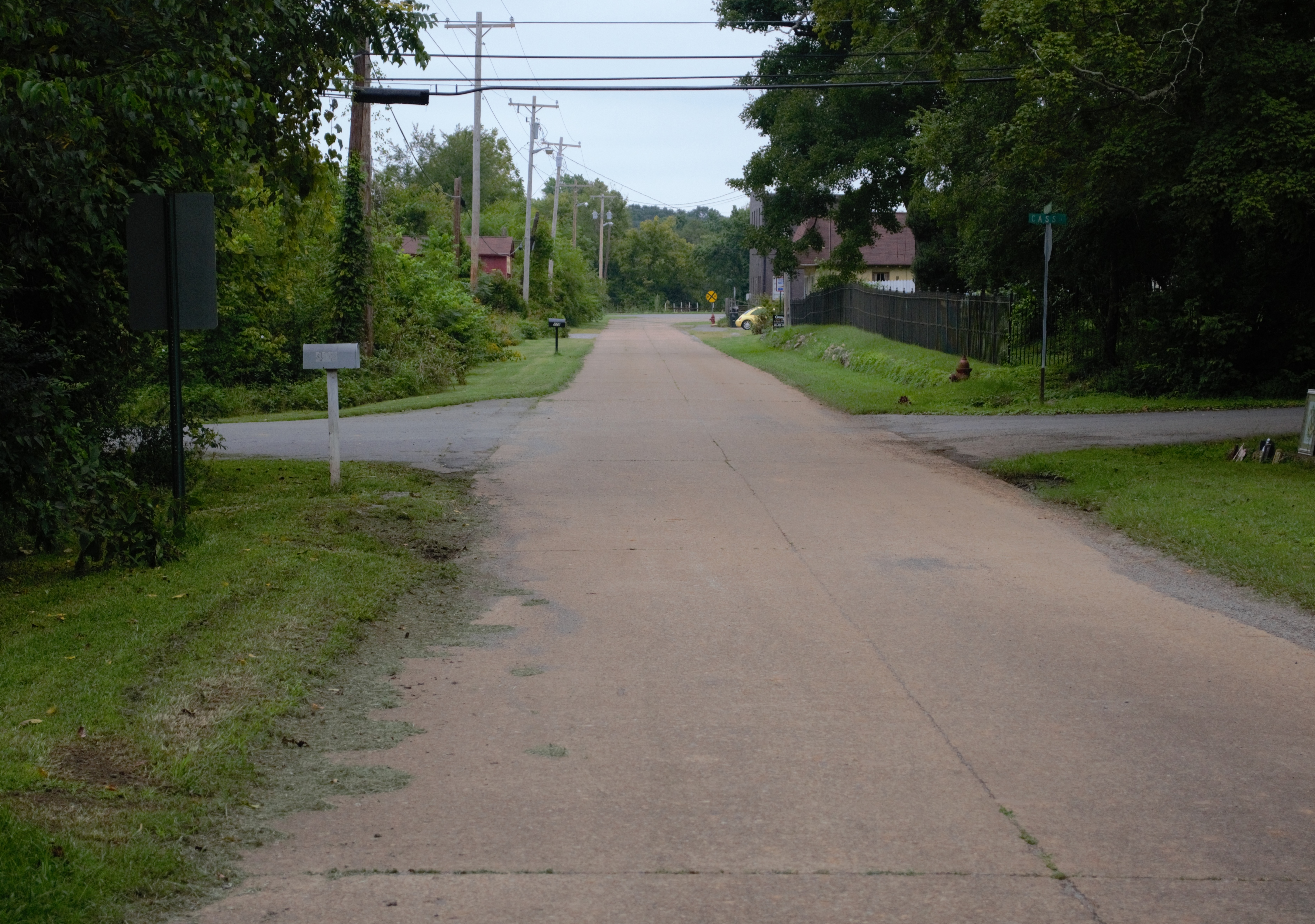
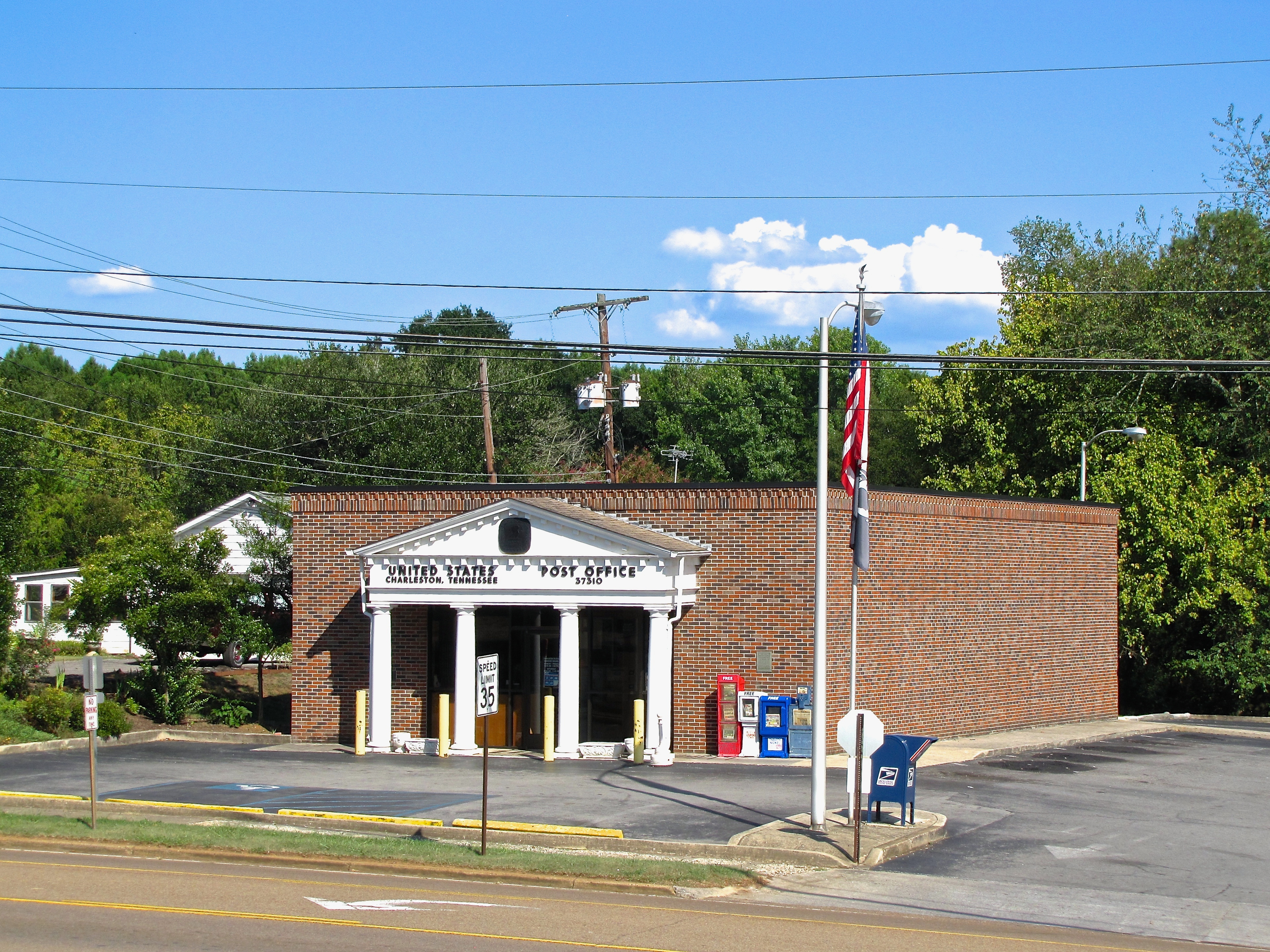
- Charleston
Census-designated places
- East Cleveland
- Hopewell
- McDonald
- South Cleveland
- Wildwood Lake
Unincorporated communities
- Georgetown
- Misty Ridge
- Prospect
- Tasso
- Waterville
References
Notes
References
- John C. Bowman, "[https://tennesseeencyclopedia.net/entry.php?rec=126 Bradley County]," ''Tennessee Encyclopedia of History and Culture''. Retrieved: March 31, 2013.
- Seal of Bradley County, Tennessee
- "Bradley County, TN - Tennessee ZIP Codes".
- "Bradley County, Tennessee". United States Census Bureau.
- "Find a County". National Association of Counties.
- Higgins, Randall. (August 24, 2011). "Drive seeks $95,000 for historic Bradley site Rattlesnake Springs". [[Chattanooga Times Free Press]].
- . (August 6, 2016). ["Our Hometown 2016"](http://clevelandbanner.com/stories/our-hometown-2016,39825). *[[Cleveland Daily Banner]]*.
- " [http://www.tngenweb.org/bradley/b_gdsp.htm Goodspeed's History of Bradley County, Tennessee]," published in 1887. Transcribed for web content and maintained by TNGenWeb - Bradley County. Retrieved: December 30, 2007.
- William Snell, "Cleveland," ''An Encyclopedia of East Tennessee'' (Children's Museum of Oak Ridge, 1981), pp. 108-111.
- Temple, Oliver Perry. (1899). "East Tennessee and the Civil War". R. Clarke Company.
- Jameson, W.C.. (1997). "Lost and Buried Treasures of the Civil War". Lyons Press.
- Temple, ''East Tennessee and the Civil War'', pp. 370-406.
- [https://web.archive.org/web/20140225031354/http://www.nps.gov/stri/historyculture/loader.cfm?csModule=security/getfile&PageID=157391 ''W.E. Mathews Preston Diary and Regimental History'', SPR393, Alabama Dept. of Archives and History], page 14.
- Hardy, Lucina Welch. (March 1962). "An Album of Historical Memories: Chatata - Tasso, Bradley County, Tennessee, 1830 -1961". Hardy & Randolph.
- Shemo, Christina. (October 14, 2005). "Legends abound". Cleveland Daily Banner.
- "[https://tnmap.tn.gov/civilwar/Civil%20War%20Trails%20Installation%20Sites%20with%20descriptions.pdf Tennessee Civil War Trails Program]," June 9, 2011, pp. 1-2. Accessed: March 12, 2015.
- (August 22, 2012). "2010 Census Gazetteer Files". United States Census Bureau.
- (1976). "East Cleveland, Tennessee". [[US Geological Survey]].
- US Geological Survey. (1965). "Charleston, Tenn.". [[U.S. Department of the Interior]].
- US Geological Survey. (1965). "Charleston, Tenn.". [[U.S. Department of the Interior]].
- Carey, Bill. (October 2017). "Conasauga River nearly became important in Tennessee history". Tennessee Magazine.
- "Population and Housing Unit Estimates".
- "U.S. Decennial Census". United States Census Bureau.
- "Historical Census Browser". University of Virginia Library.
- (March 27, 1995). "Population of Counties by Decennial Census: 1900 to 1990". United States Census Bureau.
- (April 2, 2001). "Census 2000 PHC-T-4. Ranking Tables for Counties: 1990 and 2000". United States Census Bureau.
- (2021). "2020 Decennial Census Demographic Profile (DP1)".
- (2021). "2020 Decennial Census Redistricting Data (Public Law 94-171)".
- (2023). "2020 Decennial Census Demographic and Housing Characteristics (DHC)".
- "Explore Census Data".
- . ["Community Facts"](https://data.census.gov/cedsci/). *[[United States Census Bureau]]*.
- "U.S. Census website". [[United States Census Bureau]].
- (November 2, 2012). "Welcome to Cleveland, Tennessee!".
- "Archived copy".
- (June 2, 2017). "Wacker starts work on $150 million plant expansion in Bradley County". Chattanooga Times-Free Press.
- (March 13, 2013). "Paper mill in Calhoun, Tenn., once known as Bowater, idles its last newsprint machine". [[Chattanooga Times Free Press]].
- . (2018). ["Bradley County, Tennessee - 2017 Census of Agriculture"](https://www.nass.usda.gov/Publications/AgCensus/2017/Online_Resources/County_Profiles/Tennessee/cp47011.pdf). *U.S. Department of Agriculture*.
- . (2012). ["County Profile: Bradley County, Tennessee"](https://www.agcensus.usda.gov/Publications/2012/Online_Resources/County_Profiles/Tennessee/cp47011.pdf). *[[U.S. Department of Agriculture]]*.
- Leip, David. "Dave Leip's Atlas of U.S. Presidential Elections".
- [https://bradleycountytn.gov/county_commission.html#cc County Commission - County Commissioners] bradleycountytn.gov
- Each district is also assigned a [[constable]], also elected.[https://bradleycountytn.gov/constables.html Constables by District] bradleycountytn.gov
- [https://bradleycountytn.gov/mayors_office.html County Mayor, Gary Davis] bradleycountytn.gov
- . (2018). ["Key Dates for Voters"](http://www.bradleyelections.com/ElectionSchedulePDFs/KeyDatesForVoters.pdf). *Bradley County Election Commission*.
- "Congressman Chuck Fleischmann". United States House of Representatives.
- Tennessee General Assembly. (2017). "State House District 22". [[Tennessee General Assembly]].
- Tennessee General Assembly. (2017). "State House District 24". [[Tennessee General Assembly]].
- Lilliard, Roy G.. (1980). "Bradley County". Memphis State University Press.
- (December 29, 2013). "Cleveland's Hardwick Field officially closes Tuesday". Cleveland Daily Banner.
- (December 27, 2013). "Cleveland's oldest airport, Hardwick Field, to close at year's end". Chattanooga Times Free Press.
- . ["FAA Information, Cleveland Regional Jetport"](https://www.airnav.com/airport/KRZR).
- (2016). "Official Transportation Map (back)". [[Tennessee Department of Transportation.
- . ["About CU"](http://cms7.revize.com/revize/clevelandutilities/consumer_information/about_cu.php). *Cleveland Utilities*.
- . (2013). ["Bradley County Comprehensive Plan"](https://bradleycountytn.gov/uploads/planning_dept_11_1679795299.pdf).
- . (2008). ["Community forms Sky Ridge Medical Center"](http://easttn.medicalnewsinc.com/news.php?viewStory=713).
- Staff Report. (September 30, 2015). "SkyRidge hospital renamed Tennova Healthcare-Cleveland". [[Chattanooga Times Free Press]].
- . (2014). ["Bradley County EMS"](http://www.bradleyco.net/ems_aboutus.aspx). *Bradley County, TN*.
- "Cleveland Daily Banner - Bradley County News Online Magazine".
- . ["Radio Stations in Cleveland, Tennessee"](http://www.radio-locator.com/cgi-bin/locate?select=city&city=Cleveland&state=TN&band=Both&dx=0&sort=freq). *Radio Locator*.
- Pro Content and Design. "Television station listings in Cleveland, Tennessee". Pro Content and Design.
This article was imported from Wikipedia and is available under the Creative Commons Attribution-ShareAlike 4.0 License. Content has been adapted to SurfDoc format. Original contributors can be found on the article history page.
Ask Mako anything about Bradley County, Tennessee — get instant answers, deeper analysis, and related topics.
Research with MakoFree with your Surf account
Create a free account to save articles, ask Mako questions, and organize your research.
Sign up freeThis content may have been generated or modified by AI. CloudSurf Software LLC is not responsible for the accuracy, completeness, or reliability of AI-generated content. Always verify important information from primary sources.
Report