From Surf Wiki (app.surf) — the open knowledge base
Boulevards of the Marshals
Thoroughfare in Paris, France

Thoroughfare in Paris, France


The Boulevards of the Marshals (, ) are a series of traffic arteries that together encircle the city of Paris, France, just inside its city limits. Development of the Boulevards began in the 1860s under Napoleon III who named nineteen of them after a Marshal who served under his uncle, Napoleon I. Never officially designated as a thoroughfare, the name came into gradual use during the 20th century as the work was completed and the various segments came to be perceived as a whole.
From 1951 to the early 2000s, the circuit was served by the PC (Petite Ceinture: small beltway) buses. They have since been replaced by the Tramway des Maréchaux (Île-de-France tramway Lines 3a and 3b) except in the 16th arrondissement.
History
The Boulevards of the Marshals occupy the route of the former Rue Militaire (Military Road), built in the 1840s as part of the new Thiers Fortifications which circled Paris. Adjacent to the inner perimeter of the walls and bastions, the Rue was a service road used to transfer soldiers and deliver supplies. During the 1850s, work began on a modern replacement, the Chemin de fer de Petite Ceinture ("Smaller Belt Railway"), its path typically 100 meters further inside, and which in peacetime would transport merchandise and passengers between the capital's six mainline railway stations. [[File:Porte de Gentilly - Porte - Paris 13 - Médiathèque de l'architecture et du patrimoine - APMH00037740.jpg|left|thumb|Boulevard Kellerman, adjacent to the fortifications at the Porte de Gentilly, 1910. |278x278px]] Relegated to a secondary role in the city's defense, the Rue Militaire became part of Haussmann's effort to improve Paris’ arterial streets. In 1859 the city obtained from the Army the right to improve and maintain it, with the intention to widen it to six meters, pave it, and build sidewalks. In 1861, after the annexation of the outer districts that expanded the city limits to the fortifications, the city secured authorization to widen the Rue to the standard boulevard forty meters, expropriating civilian property inside the loop if necessary. In 1864, amidst the deluges of new street designations for the city, the Rue Militaire was divided into 19 sections, each a Boulevard named after a Marshal of Napoleon I. Such reflected Napoleon III's practice of anchoring the legitimacy of his regime on the Bonaparte family, particularly his famous uncle. They were to be a “ring road boulevard” (boulevard de ceinture), but no collective name was ever officially given.
Whatever the initial ambitions, only a few short stretches of the military service road were rebuilt as actual boulevards during the Second Empire. However, much work was done on the circuit over the next thirty years with the goal of encouraging development in the less populated outer districts. In 1919 the fortifications were ceded to the city and demolished over the following decade, prompting further improvements of the Boulevards to accommodate anticipated development of the newly available real estate as well as the advent of the automobile. By 1939, all the boulevards had the 20-meter central carriageways envisaged 80 years before. From the 1930s, the Boulevards were served by the PC bus. The range of the automobile and the bus fostered the notion that the segments had become a single, circular thoroughfare comparable to the Grands Boulevards in central Paris, or the Exterior Boulevards whose path was followed by Metro Lines 2 and 6.
After World War II, faced with the sharp growth of automobile usage and growing traffic volume, Paris embraced the motorway. The Boulevards of the Marshals, now heavily used, were quickly judged to be inadequate. Between 1956 and 1973 a new ring-road, the Boulevard Périphérique, was built on the 250 meter-wide field-of-fire belt outside the now-demolished fortifications. A pedestrian-free, limited access motorway designed for high-speed driving, few referred to Le Périph as a boulevard, and it had little in common with its 19th century predecessor. Moreover, as congestion proved unrelenting, the Boulevards of the Marshals were reengineered in an effort to permit their traffic to approach motorway speeds and volume: widening the carriageway, reducing the number of traffic lights and pedestrian crossings, and building underpasses under major intersections.
In the closing years of the 20th century, Paris began changing its automobile policies, including restricting parking, promoting mass transit and cycling, and redesigning its traffic arteries. In the early 2000s, much of the Boulevards of the Marshals were rebuilt to create a more pedestrian-friendly environment, focused on new tramways along 85% of its circuit. The stated objectives of the tramway and the latest remake of the Boulevards were to provide more public transport capacity than the PC buses, reduce the presence of cars and related services, reclaim public space, stimulate commercial and community life, and narrow the livability gap as compared with Paris’ poorer suburbs.
The Boulevards and the Marshals
The Boulevards of the Marshals concept was adulterated just as it was coming to fruition. In 1932, during a period of renewed attention to the French Navy, a section of Boulevard Lannes was renamed Boulevard de l’Amiral Bruix. Étienne Eustache Bruix was a high-ranking naval officer and administrator under the Directory and Consulate, but not a marshal or its naval equivalent. In 1987, a section of Boulevard Victor was renamed Boulevard du Général-Martial-Valin. Valin was commander of the Free French air force, a hero of the liberation of Paris, and served in other high military posts until the 1960s. In 2005, a section of Boulevard Masséna was renamed the Boulevard du General-Jean-Simon. Simon had a distinguished military career with the Free French and the postwar army, and in the late 20th century was a prominent figure in various civic and military associations honoring the Liberation. Neither Valin nor Simon was granted the distinction of Marshal.
The Boulevards never included all 26 of Napoleon's marshals. Seven were omitted from the new names that his nephew bestowed on the Rue Militaire in 1864. Four were straightforward. Napoleon himself had removed Pierre Augereau, Auguste de Marmont, and Catherine-Dominique de Pérignon from the list of marshals during the Hundred Days. Charles-Jean-Baptiste Bernadotte presumably ceased to be a French marshal when he became Crown Prince of Sweden in 1810 (and he later joined the Sixth Coalition that defeated Napoleon).
As for the others, Emmanuel de Grouchy, to whom Napoleon granted the title in 1815 for helping him return to power and was afterwards proscribed by the Bourbons, was vilified by the Bonapartists for his fateful decisions at the Battle of Waterloo. Bon-Adrien Jeannot de Moncey and Nicolas Charles Marie Oudinot already had Paris streets named for them -- rue Moncey in the 9th arr (1844) and rue Oudinot in the 7th arr (1851) -- but these were minor streets whose names could easily have been changed again had they been given a boulevard segment. Neither man had rejoined Napoleon during the Hundred Days, but neither had MacDonald, Massena, Suchet and Victor.
One of the omitted marshals, Pierre Augereau, who burned his political bridges with both the Bourbons and the Bonapartists during the regime changes of 1814-15, nonetheless today has his name on a Paris street: rue Augereau in the 7th arr, in 1894 a private street renamed by its proprietors.
List of boulevards
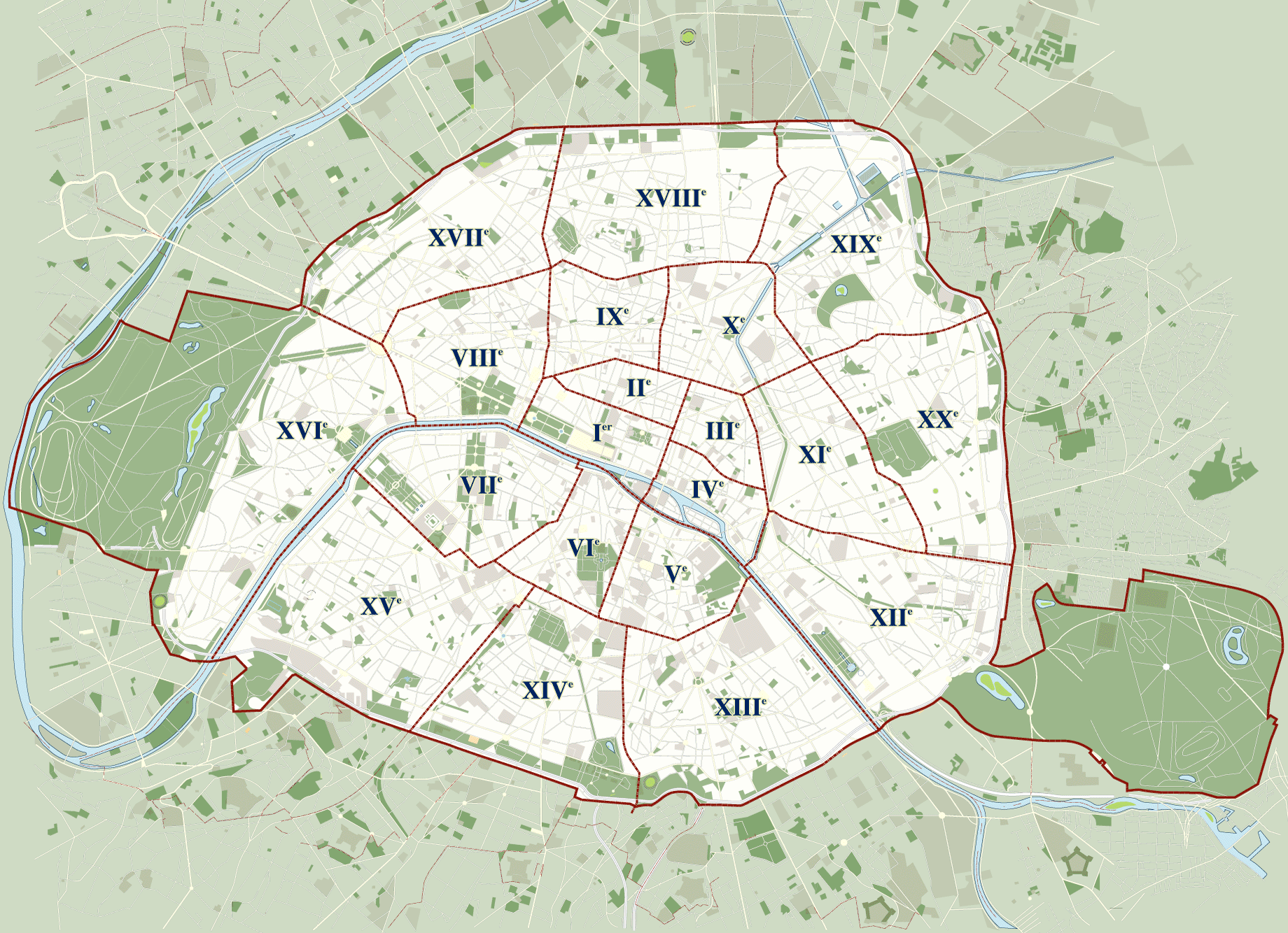
The list below starts at the Porte de Vincennes and continues in ascending numerical order of arrondissements, from the 12th to the 20th; in effect, around Paris in clockwise fashion, beginning from the 3:00 position. Also noted are the connections of each to the Paris Métro, the Réseau Express Régional (RER), the Paris Tramway Line 3, the city gates of Paris, and the main roads leaving the capital for adjacent communes.
Legend:
| : tramway stop, line 3. |
|---|
| Arrondissement | Boulevard | Porte | Trunk roads | Border communes | ||
|---|---|---|---|---|---|---|
| 12th | Boulevard Soult | Porte de Vincennes | [[File:Arrow green2 en.svg | 18px]]route nationale 34 | Saint-Mandé | |
| Porte de Saint-Mandé | ||||||
| Porte de Montempoivre | ||||||
| Porte Dorée | ||||||
| Boulevard Poniatowski | Bois de Vincennes | |||||
| Porte de Reuilly | ||||||
| Porte de Charenton | [[File:Arrow green2 en.svg | 18px]]route nationale 6 | ||||
| Charenton-le-Pont | ||||||
| Porte de Bercy | [[File:Arrow green2 en.svg | 18px]]A4 autoroute | ||||
| Seine | Pont National | |||||
| 13th | Boulevard du Général-Jean-Simon | Porte de la Gare | Ivry-sur-Seine | |||
| Porte de Vitry | ||||||
| Boulevard Masséna | ||||||
| Porte d'Ivry – | ||||||
| Porte de Choisy – | nowrap | [[File:Arrow green2 en.svg | 18px]]route nationale 305 | |||
| Porte d'Italie – | [[File:Arrow green2 en.svg | 18px]]route nationale 7 | Le Kremlin-Bicêtre | |||
| Boulevard Kellermann | [[File:Arrow green2 en.svg | 18px]]A6b | ||||
| Poterne des Peupliers | Gentilly | |||||
| Porte de Gentilly – | ||||||
| 14th | Boulevard Jourdan | |||||
| [[File:Arrow green2 en.svg | 18px]]A6a | |||||
| Porte d'Arcueil | ||||||
| Montrouge | ||||||
| Porte d'Orléans – | [[File:Arrow green2 en.svg | 18px]]route nationale 20 | ||||
| Boulevard Brune | ||||||
| Porte de Montrouge | ||||||
| Porte de Châtillon | ||||||
| Malakoff | ||||||
| Porte Didot | ||||||
| Porte de Vanves – | ||||||
| 15th | Boulevard Lefebvre | Porte Brancion | Vanves | |||
| Porte de Plaisance et Porte de la Plaine | ||||||
| Porte de Versailles – | Issy-les-Moulineaux | |||||
| Boulevard Victor | ||||||
| Porte d'Issy-les-Moulineaux | ||||||
| Porte de Sèvres – | ||||||
| Boulevard du Général-Martial-Valin | ||||||
| Seine | Pont du Garigliano | |||||
| 16th | Bois de Boulogne | Porte de Boulogne | Boulogne-Billancourt | |||
| Porte de l'Hippodrome | ||||||
| Porte de la Seine | ||||||
| Porte de Madrid | ||||||
| Porte Saint-James | ||||||
| Porte de Neuilly | ||||||
| Porte des Sablons | ||||||
| Boulevard Murat | Porte du Point-du-Jour | Boulogne-Billancourt | ||||
| Porte de Saint-Cloud – | [[File:Arrow green2 en.svg | 18px]]route nationale 10 | ||||
| Porte Molitor – | ||||||
| Bois de Boulogne | ||||||
| Porte d'Auteuil – | [[File:Arrow green2 en.svg | 18px]]A13 autoroute | ||||
| Boulevard Suchet | ||||||
| Porte de Passy | ||||||
| Porte de la Muette | ||||||
| Boulevard Lannes | ||||||
| Porte Dauphine – – | ||||||
| Boulevard de l'Amiral-Bruix | ||||||
| Porte Maillot – – | [[File:Arrow green2 en.svg | 18px]]route nationale 13 | ||||
| 17th | Boulevard Gouvion-Saint-Cyr | Neuilly-sur-Seine | ||||
| Porte des Ternes | ||||||
| Porte de Villiers | ||||||
| Levallois-Perret | ||||||
| Porte de Champerret – – | ||||||
| Boulevard Berthier | ||||||
| Porte de Courcelles | ||||||
| Porte d'Asnières | ||||||
| Porte de Clichy – – | Clichy | |||||
| Boulevard Bessières | ||||||
| Porte Pouchet | Saint-Ouen – | |||||
| Porte de Saint-Ouen | ||||||
| 18th | Boulevard Ney | |||||
| Porte Montmartre | ||||||
| Porte de Clignancourt – | [[File:Arrow green2 en.svg | 18px]]route nationale 14 | ||||
| Porte des Poissonniers | ||||||
| Saint-Denis | ||||||
| Porte de la Chapelle – | [[File:Arrow green2 en.svg | 18px]]Route nationale 1 et A1 autoroute | ||||
| Porte d'Aubervilliers | [[File:Arrow green2 en.svg | 18px]]route nationale 301 | Aubervilliers | |||
| 19th | Boulevard Macdonald | |||||
| Canal Saint-Denis | ||||||
| Porte de la Villette – | [[File:Arrow green2 en.svg | 18px]]Route nationale 2 | ||||
| Pantin | ||||||
| Canal de l'Ourcq | ||||||
| Boulevard Sérurier | ||||||
| Porte de Pantin – | [[File:Arrow green2 en.svg | 18px]]Route nationale 3 | ||||
| Le Pré-Saint-Gervais | ||||||
| Porte Chaumont | ||||||
| Porte Brunet | ||||||
| Porte du Pré-Saint-Gervais – | ||||||
| Porte des Lilas – | ||||||
| 20th | Boulevard Mortier | Les Lilas | ||||
| Porte de Ménilmontant | Bagnolet | |||||
| Porte de Bagnolet – | [[File:Arrow green2 en.svg | 18px]]A3 autoroute | ||||
| Boulevard Davout | ||||||
| Porte de Montreuil – | [[File:Arrow green2 en.svg | 18px]]route nationale 302 | Montreuil | |||
| Porte de Vincennes | ||||||
| Saint-Mandé |
Transportation
The speed limit on the boulevards is generally 50 km/h. They do not constitute an expressway or limited-access motorway in the fashion of the Boulevard Périphérique.
The Paris Tramway (Ile-de-France) covers most of the Boulevards of the Marshals, with two lines sharing a terminus at Porte the Vincennes. Line 3a follows the boulevards along the southern half of the circuit, while line 3b follows the northern circuit. There is no tramway on a section of the route near the Bois de Boulogne, between the Pont du Garigliano and Porte Dauphine. That section is covered by the last surviving PC bus route. Bicycle lanes have been installed along parts of the Boulevards.
Places of interest
Some specific sites near the boulevards are:
- Bois de Boulogne
- Bois de Vincennes and the Throne carnival
- Cité Internationale Universitaire de Paris
- City of Science and Industry
- Heliport de Paris - Issy-les-Moulineaux
- Hôpital Européen Georges-Pompidou
- Robert Debré Pediatric Hospital
- Marmottan Museum
- Palais des Sports de Paris
- Parc André Citroën
- Parc de la Butte du Chapeau-Rouge
- The Fairgrounds at the Versailles gate
- Parc Georges Brassens
- Parc Kellermann
- Parc Montsouris
- Parc des Princes
- Stade Charlety
References
References
- The first segments of the eventual PC bus loop were initiated in the 1930s. ”Ligne de bus de Petite Ceinture,” ''French Wikipedia'',[[:fr:Ligne de bus de Petite Ceinture. Ligne de bus de Petite Ceinture]] citing Jean Tricoire, ''Le bus, un réseau dans la ville.''
- Only half of the forty meters of the model Haussmannian boulevard was the central carriageway; the other half was occupied by parallel access ways, medians and sidewalks, the latter with rows of trees, lampposts, and sometimes street furniture. See Adolphe Alphand, ''Prominades de Paris'' (1873), pp 233-239, and the related analysis in G. F. Shapiro, ”Prominades of Paris: Alphand and the Urbanization of Garden Art, 1852-1871” (PhD-Architecture, University of Pennsylvania, 2002) pp 210-213.
- [[Adolphe Alphand]] (dir.), Adrien Deville et Émile Hochereau, Ville de Paris, ''Recueil des lettres patentes, ordonnances royales, decretes et arretes prefectoraux concernant les voies publiques'' (Paris, 1886).[https://archive.org/details/villedeparisrec00fragoog/page/n4/mode/2up] The relevant decrees are those of 28 juillet 1859 (pp. 314-315), 29 septembre 1861 (p. 326), and 2 mars 1864, Article 4 (p. 351).
- M. E. Poubelle and M. A. Alphand, ''Les Travaux de Paris. 1789-1889:- Atlas'' (Paris, 1889). Johannes Willms, ''Paris: Capital of Europe'' (New York/London, 2002). Mathieu Flonneau, “Du profil de la rue à la forme de la ville: l'intégration parisienne du 18e arrondissement (1860-1940),” [https://www.persee.fr/collection/bchfc Bulletin du Centre d’Histoire de la France contemporaine / Recherches contemporaines (1997)], pp. 49-73.
- The first bus segments were initiated after passenger service on the ''Petite Ceinture'' railway ceased in 1933. The full circuit was served beginning 1951. Christophe Decaux and Patrick Kirstetter, “La Restructuration de la ligne PC,” ''Reseaux Urbaines'', no 28 (sep-oct 1999), pp 10-11.
- [1] Mathieu Flonneau, “”L’adaptation” de Paris à l’automobile, 1954-1955 : années terribles?,” ''Cahiers François Viète'' [en ligne], I-5. 2003, pp 99-100, 105. Charles Rearick, ''Paris Dreams, Paris Memories'' (Stanford, 2011), pp 92-96.
- No permanent buildings could be erected in this ''zone non aedificandi'', which would be levelled in the event of war. It took thirty years and ultimately the authoritarian Vichy State to extinguish property claims and expel the residents from the resultant slums and market gardens.
- Henry Grabar, “[https://slate.com/business/2023/03/paris-car-ban-bikes-cycling-history-france.html How Paris Kicked Out the Cars],” ''Slate'', March 30, 2023.
- Serena Benassu'', “''Grand Paris : l'avenir vert de nos boulevards,” ''Ecologik'', 26/03/2020. Tramway Maréchaux Sud: Enquêtes publiques, ''Rapport d'enquêtes et conclusions motives'', 11 juin 2003.
- No one attained the naval equivalent during the Napoleonic Wars, though Bruix might have had he not died in 1805 at the age of 45. But there were few alternative candidates for a boulevard segment among the Emperor's mariners. (Murat was named Grand Admiral, but he was already a Marshal with a Boulevard and no duties accompanied his naval title.)
- ''Le General de l’Armee Aerienne Martial Valin: Répertoire numerique'', Archives de la Defense, Service historique de la Défense, 2005.[https://francearchives.gouv.fr/fr/file/8206595265f453982a882ac3efaa4e1bb661cdad/FRSHD_PUB_00000266.pdf] Patrick Facon, “Martial Valin, général à vie,” ''Revue historique des Armées'', no 227 (2002), pp. 103-110.[https://www.persee.fr/doc/rharm_0035-3299_2002_num_227_2_5116]
- Douglas Johnson, “General Jean Simon [obituary],” ''The Guardian'', 2 Oct 2003.[https://www.theguardian.com/news/2003/oct/03/guardianobituaries] “Biographie Jean Simon," ''Who's Who-France'' [website].[https://biographie.whoswho.fr/decede/biographie-jean-simon_9944] “Un Boulevard Général Jean-Simon à Paris," ''L’Histoire en rafale'' [website], 13 septembre 2013.[https://lhistoireenrafale.lunion.fr/2013/09/13/un-boulevard-general-jean-simon-a-paris/]
- Ville de Paris'', Nomenclature des voies publiques et privées'', 5th ed (Paris, 1911), pp 510, 561. Louis Napoleon had himself named the Rue Oudinot, likely as a compliment to Oudinot's son, [[:fr:Nicolas_Oudinot. Nicolas-Charles-Victor Oudinot]], who had won the President's esteem for his diplomacy as commander of the French expedition that restored the Pope to power in 1849.
- Ibid., p 38.
This article was imported from Wikipedia and is available under the Creative Commons Attribution-ShareAlike 4.0 License. Content has been adapted to SurfDoc format. Original contributors can be found on the article history page.
Ask Mako anything about Boulevards of the Marshals — get instant answers, deeper analysis, and related topics.
Research with MakoFree with your Surf account
Create a free account to save articles, ask Mako questions, and organize your research.
Sign up freeThis content may have been generated or modified by AI. CloudSurf Software LLC is not responsible for the accuracy, completeness, or reliability of AI-generated content. Always verify important information from primary sources.
Report