From Surf Wiki (app.surf) — the open knowledge base
Borneo
Island in Southeast Asia

Island in Southeast Asia
| Field | Value |
|---|---|
| name | Borneo |
| image_name | Administrative_map_of_Borneo_(Indonesian).png |
| image_caption | Map of Borneo, with the three nations shown |
| image_map | Borneo Topography.png |
| image_map_caption | Topography of Borneo, with red lines demarcating the three nations on it |
| native_name | Kalimantan |
| location | Southeast Asia |
| coordinates | |
| archipelago | Indonesian Archipelago |
| area_km2 | 748168 |
| rank | 3rd |
| highest_mount | Mount Kinabalu |
| elevation_ft | 13,435 |
| country | Brunei |
| country_admin_divisions_title | Districts |
| country_admin_divisions | |
| country1 | Indonesia |
| country2 | Malaysia |
| country1_admin_divisions_title | Provinces |
| country1_admin_divisions | |
| country_largest_city | Bandar Seri Begawan (pop. ~150,000) |
| country1_largest_city | Samarinda (pop. 842,691) |
| country2_largest_city | Kota Kinabalu (pop. 500,421) |
| country2_admin_divisions_title | States and FT |
| country2_admin_divisions | |
| population | 21,258,000 (2023 Censuses) |
| population_as_of | 2023 |
| density_km2 | 28.4 |
| languages | |
| ethnic_groups | |
| population_rank | 10th |
| timezone1 | Western Indonesian Time |
| utc_offset1 | +7 |
| timezone2 | Brunei Darussalam Standard Time, Central Indonesian Time, Malaysian Standard Time |
| utc_offset2 | +8 |
Greater Sunda Islands
Borneo () is the third-largest island in the world, with an area of 748168 km2, and population of 23,053,723 (2020 national censuses). Situated at the geographic centre of Maritime Southeast Asia, it is one of the Greater Sunda Islands, located north of Java, west of Sulawesi, and east of Sumatra. The island is crossed by the equator, which divides it roughly in half. In Indonesia, the island is also known as Kalimantan, which is also the name of the Indonesian region located on the island.
The geology of Borneo was formed beginning in the Mesozoic. It formed part of Sundaland, a region connected to mainland Asia, until it became isolated by sea level rise at the end of the last ice age. With seven unique ecoregions, including large expanses of some of the oldest tropical rainforests in the world, Borneo is rich in biodiversity and endemic species.
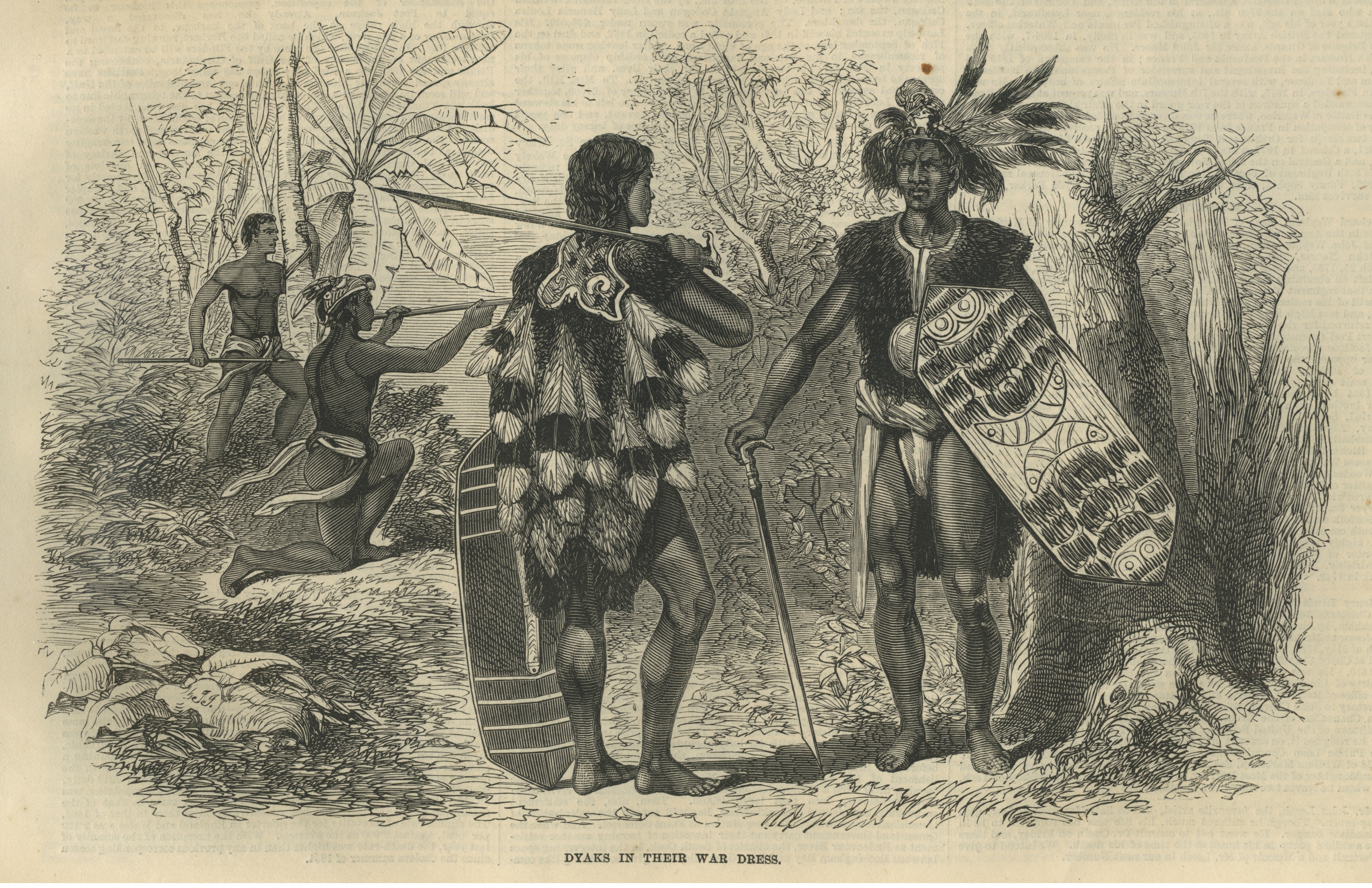
Archaeological evidence suggests Borneo has been inhabited by humans for more than 65,000 years. Borneo is home to hundreds of different Indigenous groups, cultures and languages, loosely grouped under the term "Dayak". International trading ports were well established on Borneo by the first millennium. It was later subsumed into the Majapahit Empire. The Sultanate of Sulu later ruled much of the island's North, and at its peak in the 14th century, the Sultanate of Brunei governed most of its coast; meanwhile, Borneo's interior remained largely outside of their control. Borneo was later colonised by the British and Dutch, and occupied by Japan during World War II.
Since the decolonisation of Asia, the island has been politically divided among three states, with the borders broadly following previous demarcation between the British and Dutch. The sovereign state of Brunei in the north makes up 1% of the territory. Approximately 73% of Borneo is Indonesian territory, and in the north, the East Malaysian states of Sabah and Sarawak make up about 26% of the island. The Malaysian federal territory of Labuan is situated on a small island just off the coast of Borneo.
The majority of Borneo's inhabitants reside in coastal cities. It is the site of Indonesia's planned future capital, Nusantara. Major economic sectors include oil and gas, agriculture, timber and tourism. Industrial deforestation in Indonesian and Malaysian Borneo for timber and agricultural conversion has taken place during the past century.
Etymology
When the sixteenth-century Portuguese explorer Jorge de Menezes made contact with the indigenous people of Borneo, they referred to their island as Pulu K'lemantang, and this second word became Kalimantan, the name for modern-day Borneo in the Indonesian language. The term kelamantan is used in Sarawak to refer to a group of people who consume sago in the northern part of the island.
According to Crawfurd, the word kelamantan is the name of a type of mango (Mangifera), though he adds that the word is fanciful and unpopular. The local mango, called klemantan, is still widely found in rural Ketapang and surrounding areas of West Kalimantan.
Another source states that it derives from the Sanskrit word kalamanthana, meaning "burning weather", possibly to describe the island's hot and humid tropical weather. In the Indianized Malay era the name Kalamanthana was derived from the Sanskrit terms kala (time or season) and manthana (churning, kindling, or creating fire by friction), which possibly describes the hot weather.
Internationally, the island is known as Borneo, a name derived from European contact with the Brunei kingdom in the 16th century, during the Age of Exploration. On a map from around 1601, Brunei city is referred to as Borneo, and the whole island is also labelled Borneo. The name may derive from the Sanskrit word sa (वरुण), meaning either "water" or Varuna, the Hindu god of rain and oceans.
In 977, Chinese records began to use the term Bo-ni to refer to Borneo. In 1225, it was also mentioned by the Chinese official Chau Ju-Kua (趙汝适). The Javanese manuscript Nagarakretagama, written by Majapahit court poet Mpu Prapanca in 1365, mentions the island as Nusa Tanjungnagara, which means the "island of the Tanjungpura Kingdom".
In Modern Chinese, the island is called 婆羅洲 (simp. 婆罗洲, Póluó Zhōu), the first two characters being phonetic and the third referring to a large landmass.
Geography
Geology
Borneo was formed through Mesozoic accretion of microcontinental fragments, ophiolite terranes and island arc crust onto a Paleozoic continental core. At the beginning of the Cenozoic, Borneo formed a promontory of Sundaland which partly separated from Asian mainland by the proto-South China Sea. The oceanic part of the proto-South China Sea was subducted during the Paleogene period and a large accretionary complex formed along the northwestern of the island of Borneo. In the early Miocene uplift of the accretionary complex occurred as a result of underthrusting of thinned continental crust in northwest. The uplift may have also resulted from shortening due to the counter-clockwise rotation of Borneo between 20 and 10 mega-annum (Ma) as a consequence of Australia–Southeast Asia collision. Large volumes of sediment were shed into basins, which scattered offshore to the west, north and east of Borneo as well into a Neogene basin which is currently exposed in large areas of eastern and southern Sabah. In southeast Sabah, the Miocene to recent island arc terranes of the Sulu Archipelago extend onshore into Borneo with the older volcanic arc was the result of southeast dipping subduction while the younger volcanics are likely resulted from northwest dipping subduction the Celebes Sea.

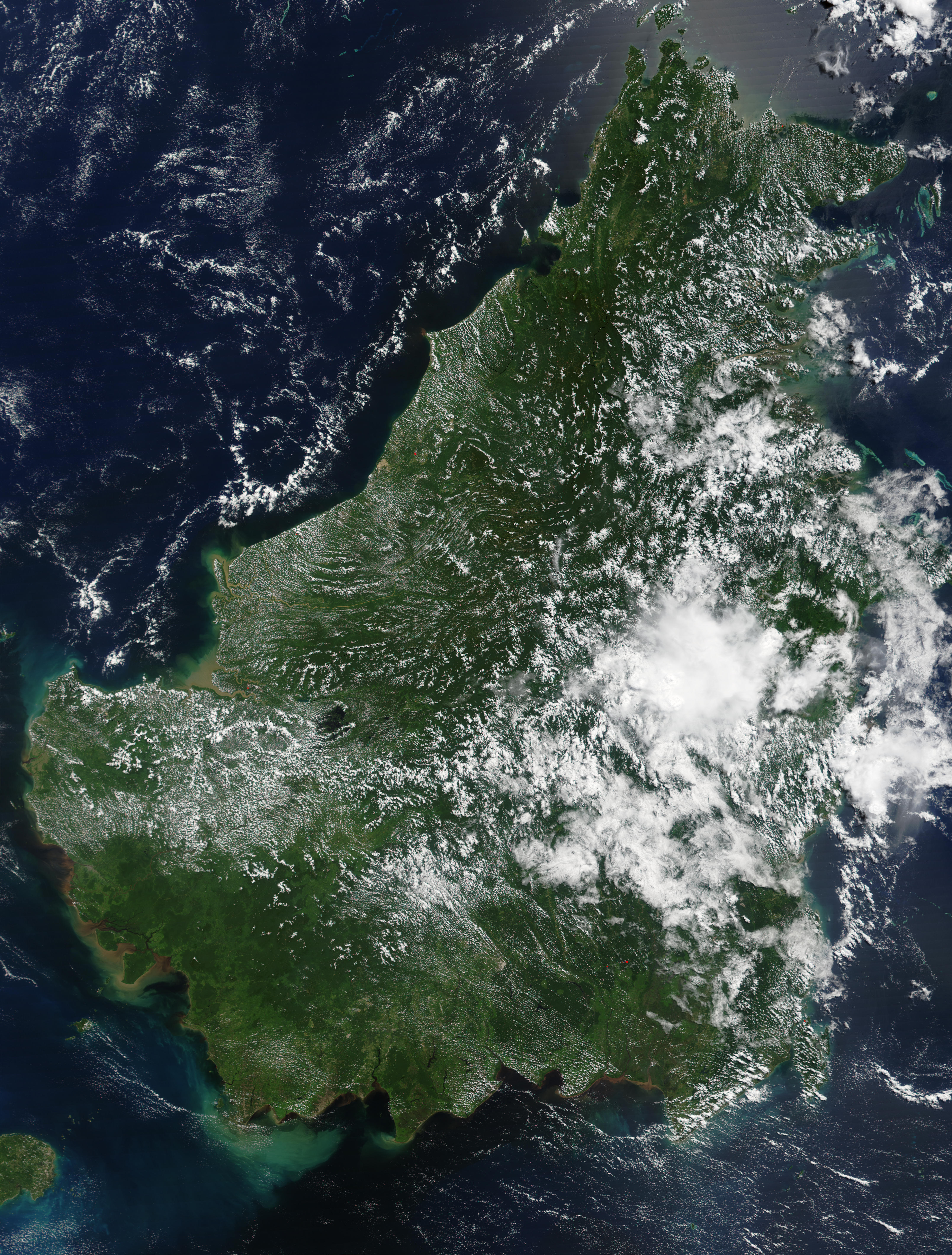
Before sea levels rose at the end of the last ice age, Borneo was part of the mainland of Asia, forming, with Java and Sumatra, the upland regions of a peninsula that extended east from present day Indochina. The South China Sea and Gulf of Thailand now submerge the former low-lying areas of the peninsula. Deeper waters separating Borneo from neighbouring Sulawesi prevented a land connection to that island, creating the divide known as Wallace's Line between Asian and Australia-New Guinea biological regions. The island today is surrounded by the South China Sea to the north and northwest, the Sulu Sea to the northeast, the Celebes Sea and the Makassar Strait to the east, and the Java Sea and Karimata Strait to the south. To the west of Borneo are the Malay Peninsula and Sumatra. To the south and east are islands of Indonesia: Java and Sulawesi, respectively. To the northeast are the Philippine Islands. With an area of 743330 km2, it is the third-largest island in the world, and is the largest island of Asia (the largest continent). Its highest point is Mount Kinabalu in Sabah, Malaysia, with an elevation of 4095 m.
The largest river system is the Kapuas in West Kalimantan, with a length of 1143 km. Other major rivers include the Mahakam in East Kalimantan (980 km long), the Barito, Kahayan, and Mendawai in South Kalimantan (1090 km, 658 km, and 616 km long respectively), Rajang in Sarawak (565 km long) and Kinabatangan in Sabah (560 km long). Borneo has significant cave systems. In Sarawak, the Clearwater Cave has one of the world's longest underground rivers while Deer Cave is home to over three million bats, with guano accumulated to over 100 m deep. The Gomantong Caves in Sabah has been dubbed as the "Cockroach Cave" due to the presence of millions of cockroaches inside the cave. The Gunung Mulu National Park in Sarawak and Sangkulirang-Mangkalihat Karst in East Kalimantan which particularly a karst areas contains thousands of smaller caves.
Ecology
,_Tanjung_Putting_National_Park_01.jpg)
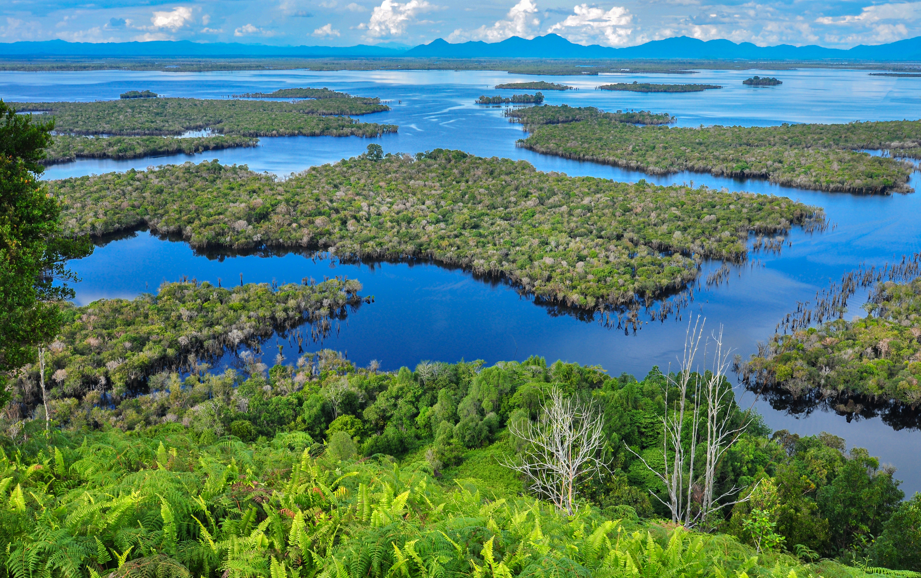
The Borneo rainforest is estimated to be around 140 million years old, making it one of the oldest rainforests in the world. The current dominant tree group, the dipterocarps, has dominated the Borneo lowland rain forests for millions of years. It is the centre of the evolution and distribution of many endemic species of plants and animals, and the rainforest is one of the few remaining natural habitats for the endangered Bornean orangutan. It is an important refuge for many endemic forest species, including the Borneo elephant, the eastern Sumatran rhinoceros, the Bornean clouded leopard, the Bornean rock frog, the hose's palm civet and the dayak fruit bat.
Peat swamp forests occupy the entire coastline of Borneo. The soil of the peat swamp is comparatively infertile, while it is known to be the home of various bird species such as the hook-billed bulbul, helmeted hornbill and rhinoceros hornbill. There are about 440 freshwater fish species in Borneo (about the same as Sumatra and Java combined). The Borneo river shark is known only from the Kinabatangan River. In 2010, the World Wide Fund for Nature (WWF) stated that 123 species have been discovered in Borneo since the "Heart of Borneo" agreement was signed in 2007.
The WWF has classified the island into seven distinct ecoregions. Most are lowland regions:
- Borneo lowland rain forests cover most of the island, with an area of 427500 km2.
- Borneo peat swamp forests
- Kerangas or Sundaland heath forests
- Southwest Borneo freshwater swamp forests are found in the island's western and southern lowlands
- Sunda Shelf mangroves
- The Borneo montane rain forests lie in the central highlands of the island, above the 1000 m elevation.
- The highest elevations of Mount Kinabalu are home to the Kinabalu montane alpine meadows, a subalpine and alpine shrubland notable for its numerous endemic species, including many orchids.
According to analysis of data from Global Forest Watch, the Indonesian portion of Borneo lost 10.7 e6ha of tree cover between 2002 and 2019, of which 4 e6ha was primary forest, compared with Malaysian Borneo's 4.4 e6ha of tree cover loss and 1.9 e6ha of primary forest cover loss. As of 2020, Indonesian Borneo accounts for 72% of the island's tree cover, Malaysian Borneo 27%, and Brunei 1%. Primary forest in Indonesia accounts for 44% of Borneo's overall tree cover.
Environmental issues
.jpg)
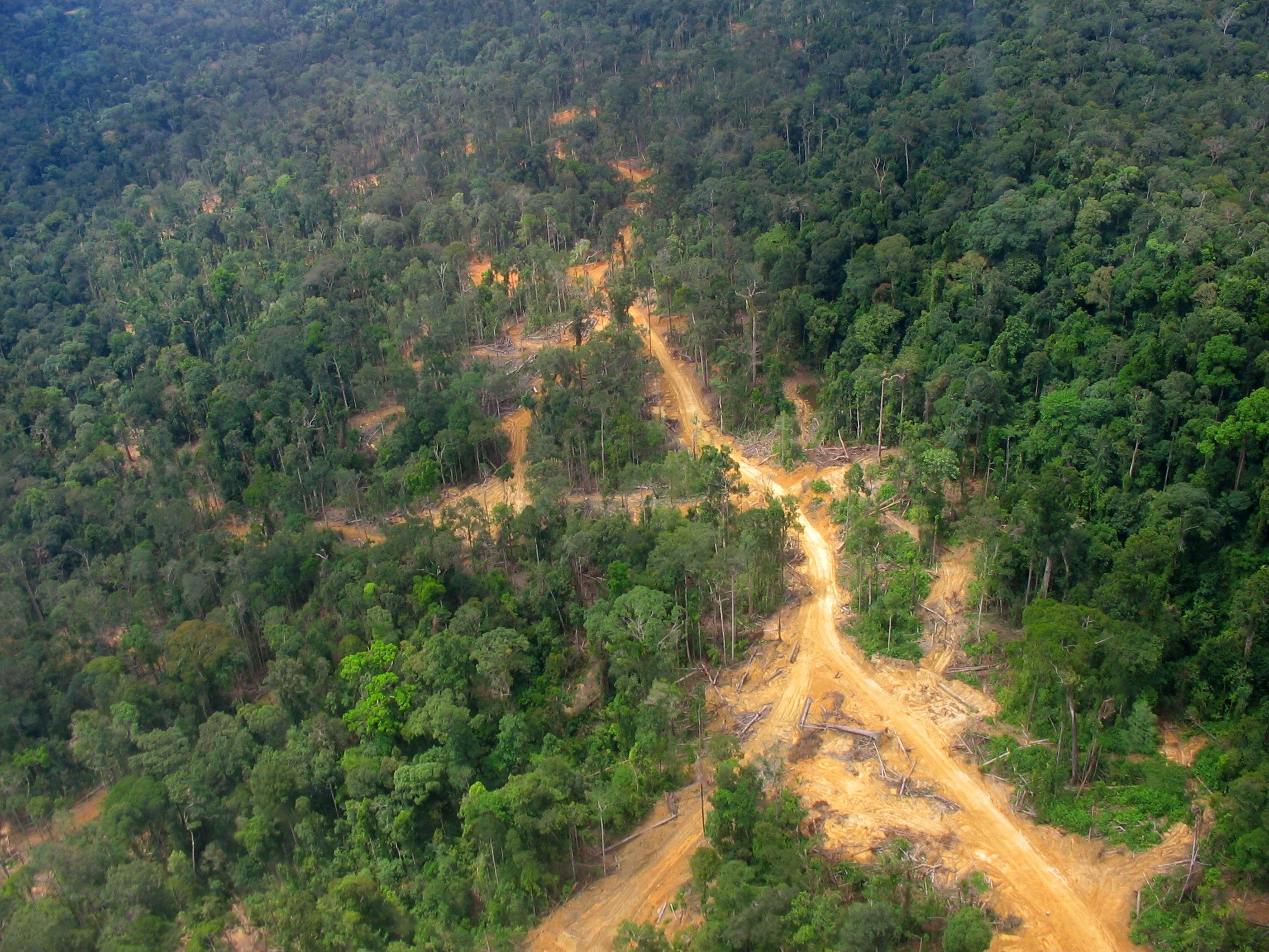
The island historically had extensive rainforest cover, but the area was reduced due to heavy logging by the Indonesian and Malaysian wood industry, especially with the large demands of raw materials from industrial countries along with the conversion of forest lands for large-scale agricultural purposes. Half of the annual global tropical timber acquisition comes from Borneo. Palm oil plantations have been widely developed and are rapidly encroaching on the last remnants of primary rainforest. Forest fires since 1997, started by the locals to clear the forests for plantations were exacerbated by an exceptionally dry El Niño season, worsening the annual shrinkage of the rainforest. During these fires, hotspots were visible on satellite images and the resulting haze frequently affected Brunei, Indonesia and Malaysia. The haze could also reach southern Thailand, Cambodia, Vietnam and the Philippines as evidenced on the 2015 Southeast Asian haze.
A study in 2018 found that Bornean orangutans declined by 148,500 individuals from 1999 to 2015.
Topography

List of highest peaks in Borneo by elevation:
- Mount Kinabalu 13435 ft
- Mount Trusmadi 8668 ft
- Raya Hill 7474 ft
- Muruk Miau 6837 ft
- Mount Wakid 6778 ft
- Monkobo Hill 5866 ft
- Mount Lotung 5843 ft
- Mount Magdalena 4288 ft
- Talibu Hill 4144 ft
River systems

List of rivers in Borneo by length:
- Kapuas River 1143 km
- Barito River 1,090 km
- Mahakam River 980 km
- Kahayan River 658 km
- Mendawai River 616 km
- Kayan River 576 km
- Rajang River 565 km
- Kinabatangan River 560 km
- Baram River 400 km
- Sembakung River 352 km
- Sesayap River 279 km
- Pawan River 197 km
History
Early history
In the Samang Buat Cave, in Lahad Datu, Sabah, archaeological evidence suggests that human settlement dates back to around 46,000 years ago, confirming Lahad Datu as one of the most important prehistoric centres in Southeast Asia. Intriguingly, tools found in Mansuli Valley, also in Lahad Datu, have been dated as early as 235,000 years ago.
In Tingkayu Valley, Kunak, Sabah, archaeological excavations revealed traces of a Palaeolithic community dating from approximately 28,000–30,000 years ago. The site, once a prehistoric lake basin, yielded Hoabinhian stone tools that indicate human activity in the area.
In Niah Cave, Sarawak, human presence has been dated to around 40,000 years ago. Recent studies in the Trader Cave section of the complex discovered microlithic tools and human remains, dated between 55,000 and 65,000 years ago, making it one of the most important early modern human sites in Southeast Asia.

In November 2018, scientists reported the discovery of the oldest known figurative art painting, over 40,000 (perhaps as old as 52,000) years old, of an unknown animal, in the cave of Lubang Jeriji Saléh on the island of Borneo. It has been proposed, based on house construction styles, linguistic and genetic evidence, that Madagascar may have been first populated from southern Borneo.
According to ancient Chinese (977), Indian and Japanese manuscripts, western coastal cities of Borneo had become trading ports by the first millennium AD. In Chinese manuscripts, gold, camphor, tortoise shells, hornbill ivory, rhinoceros horn, crane crest, beeswax, lakawood (a scented heartwood and root wood of a thick liana, Dalbergia parviflora), dragon's blood, rattan, edible bird's nests and various spices were described as among the most valuable items from Borneo. The Indians named Borneo Suvarnabhumi (Land of Gold), and also Karpuradvipa (Camphor Island). The Javanese named Borneo Puradvipa (Diamond Island). Archaeological findings in the Sarawak river delta reveal that the area was a thriving centre of trade between India and China from the 6th century until about 1300.
.gif)
Stone pillars bearing inscriptions in the Pallava script, found in Kutai along the Mahakam River in East Kalimantan and dating to around the second half of the 4th century, constitute some of the oldest evidence of Hindu influence in Southeast Asia. By the 14th century, Borneo became a vassal state of Majapahit (in present-day Indonesia), later changing its allegiance to the Ming dynasty of China. Pre-Islamic Sulu, then known as Lupah Sūg, stretched from Palawan and the Sulu Archipelago in the Philippines, to Sabah, Eastern, and Northern Kalimantan in Borneo. The Sulu Empire rose as a rebellion and reaction against the Majapahit, which had briefly occupied its territory. Islam arrived in the 10th century, brought by Muslim traders who later converted many indigenous peoples in the coastal areas.
The Sultanate of Brunei declared independence from Majapahit following the death of the Majapahit emperor in the mid-14th century. During its golden age under the Bolkiah from the 15th to the 17th century, the Bruneian sultanate ruled almost the entire coastal area of Borneo (lending its name to the island due to its influence in the region) and several islands in the southwestern Philippines. arrived in Sulu from Malacca. In 1457, he founded the Sultanate of Sulu; he styled himself Paduka Maulana Mahasari Sharif Sultan Hashem Abu Bakr. Following its independence in 1578 from Bruneian control, the Sultanate of Sulu began to expand its thalassocracy to parts of northern Borneo. Both sultanates who ruled northern Borneo had traditionally engaged in trade with China by means of the frequent Chinese junks. Outside of the two thalassocratic states, Borneo's interior remained free from the rule of any kingdoms.
British and Dutch control
Main article: British Borneo, Dutch East Indies

After the fall of Malacca in 1511, Portuguese merchants traded regularly with Borneo, and especially with Brunei from 1530. Having visited Brunei's capital, the Portuguese described the place as surrounded by a stone wall. While Borneo was seen as rich, the Portuguese did not make any attempts to conquer it. The Spanish had sailed from Spanish America and conquered the Brunei's provinces in the Philippines and incorporated it into the Mexico-Centered Viceroyalty of New Spain. The Spanish visit to Brunei led to the Castilian War in 1578. The British began to trade with Sambas of southern Borneo in 1609, while the Dutch only began their trade in 1644: to Banjar and Martapura, also in the southern Borneo. The Dutch tried to settle the island of Balambangan, north of Borneo, in the second half of the 18th century, but withdrew by 1797. In 1812, the sultan in southern Borneo ceded his forts to the British East India Company. The British, led by Stamford Raffles, then tried to establish an intervention in Sambas but failed. Although they managed to defeat the sultanate the next year and declared a blockade on all ports in Borneo except Brunei, Banjarmasin and Pontianak, the project was cancelled by the British governor-general Lord Minto in India as it was too expensive. At the beginning of British and Dutch exploration on the island, they described the island of Borneo as full of head hunters, with the indigenous in the interior practising cannibalism, and the waters around the island infested with pirates, especially between the north eastern Borneo and the southern Philippines. The Malay and Sea Dayak pirates preyed on maritime shipping in the waters between Singapore and Hong Kong from their haven in Borneo, along with the attacks by Illanuns of the Moro pirates from the southern Philippines, such as in the Battle off Mukah.

The Dutch began to intervene in the southern part of the island upon resuming contact in 1815, posting residents to Banjarmasin, Pontianak and Sambas and assistant-residents to Landak and Mampawa. The Sultanate of Brunei in 1842 granted large parts of land in Sarawak to the British adventurer James Brooke, as a reward for his help in quelling a local rebellion. Brooke established the Raj of Sarawak and was recognised as its rajah after paying a fee to the sultanate. He established a monarchy, and the Brooke dynasty (through his nephew and great-nephew) ruled Sarawak for 100 years; the leaders were known as the White Rajahs. Brooke also acquired the island of Labuan for Great Britain in 1846 through the Treaty of Labuan with the sultan of Brunei, Omar Ali Saifuddin II on 18 December 1846. The region of northern Borneo came under the administration of North Borneo Chartered Company following the acquisition of territory from the Sultanates of Brunei and Sulu by a German businessman and adventurer named Baron von Overbeck, before it was passed to the British Dent brothers (comprising Alfred Dent and Edward Dent). Further expansion by the British continued into the Borneo interior. This led the 26th sultan of Brunei, Hashim Jalilul Alam Aqamaddin to appeal the British to halt such efforts, and as a result a Treaty of Protection was signed in 1888, rendering Brunei a British protectorate.
_in_Tenggarong_TMnr_10005749.jpg)
Before the acquisition by the British, the Americans also managed to establish their temporary presence in northwestern Borneo after acquiring a parcel of land from the Sultanate of Brunei. A company known as American Trading Company of Borneo was formed by Joseph William Torrey, Thomas Bradley Harris and several Chinese investors, establishing a colony named "Ellena" in the Kimanis area. The colony failed and was abandoned, due to denials of financial backing, especially by the US government, and to diseases and riots among the workers. Before Torrey left, he managed to sell the land to the German businessman, Overbeck. Meanwhile, the Germans under William Frederick Schuck were awarded a parcel of land in northeastern Borneo of the Sandakan Bay from the Sultanate of Sulu where he conducted business and exported large quantities of arms, opium, textiles and tobacco to Sulu before the land was also passed to Overbeck by the sultanate.
Prior to the recognition of Spanish presence in the Philippine archipelago, a protocol known as the Madrid Protocol of 1885 was signed between the governments of the United Kingdom, Germany and Spain in Madrid to cement Spanish influence and recognise their sovereignty over the Sultanate of Sulu—in return for Spain's relinquishing its claim to the former possessions of the sultanate in northern Borneo. The British administration then established the first railway network in northern Borneo, known as the North Borneo Railway. During this time, the British sponsored a large number of Chinese workers to migrate to northern Borneo to work in European plantation and mines, and the Dutch followed suit to increase their economic production. By 1888, North Borneo, Sarawak and Brunei in northern Borneo had become British protectorate. The area in southern Borneo was made Dutch protectorate in 1891. The Dutch who already claimed the whole Borneo were asked by Britain to delimit their boundaries between the two colonial territories to avoid further conflicts. The British and Dutch governments had signed the Anglo-Dutch Treaty of 1824 to exchange trading ports in Malay Peninsula and Sumatra that were under their controls and assert spheres of influence. This resulted in indirectly establishing British- and Dutch-controlled areas in the north (Malay Peninsula) and south (Sumatra and Riau Islands) respectively.
In 1895, Marcus Samuel received a concession in the Kutei area of east Borneo, and based on oil seepages in the Mahakam River delta, Mark Abrahams struck oil in February 1897. This was the discovery of the Sanga Sanga Oil Field, a refinery was built in Balikpapan, and discovery of the Samboja Oil Field followed in 1909. In 1901, the Pamusian Oil Field was discovered on Tarakan, and the Bunyu Oil Field in 1929. Royal Dutch Shell discovered the Miri Oil Field in 1910, and the Seria oil field in 1929.
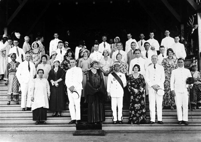
World War II
.JPG)
.jpg)
During World War II, Japanese forces gained control and occupied most areas of Borneo from 1941 to 1945. In the first stage of the war, the British saw the Japanese advance to Borneo as motivated by political and territorial ambitions rather than economic factors. The occupation drove many people in the coastal towns to the interior, searching for food and escaping the Japanese. The Chinese residents in Borneo, especially with the Sino-Japanese War in Mainland China mostly resisted the Japanese occupation. Following the formation of resistance movements in northern Borneo such as the Jesselton Revolt, many innocent indigenous and Chinese people were executed by the Japanese for their alleged involvement.
In Kalimantan, the Japanese also killed many Malay intellectuals, executing all the Malay sultans of West Kalimantan in the Pontianak incidents, together with Chinese people who were already against the Japanese for suspecting them to be threats. The Japanese also set-up Pusat Tenaga Rakjat (PUTERA) in the Indonesian archipelago in 1943, although it was abolished the following year when it became too nationalistic. Some of the Indonesian nationalist like Sukarno and Hatta who had returned from Dutch exile began to co-operate with the Japanese. Shortly after his release, Sukarno became president of the Central Advisory Council, an advisory council for south Borneo, Celebes, and Lesser Sunda, set up in February 1945.
After the fall of Singapore, the Japanese sent several thousand of British and Australian prisoners of war to camps in Borneo such as Batu Lintang camp. From the Sandakan camp site, only six of some 2,500 prisoners survived after they were forced to march in an event known as the Sandakan Death March. In addition, of the total of 17,488 Javanese labourers brought in by the Japanese during the occupation, only 1,500 survived mainly due to starvation, harsh working conditions and maltreatment. The Dayak and other indigenous people played a role in guerrilla warfare against the occupying forces, particularly in the Kapit Division. They temporarily revived headhunting of Japanese toward the end of the war, with Allied Z Special Unit provided assistance to them. Australia contributed significantly to the liberation of Borneo. The Australian Imperial Force was sent to Borneo to fight off the Japanese. Together with other Allies, the island was completely liberated in 1945.
Recent history

In May 1945, officials in Tokyo suggested that whether northern Borneo should be included in the proposed new country of Indonesia should be separately determined based on the desires of its indigenous people and following the disposition of Malaya. Sukarno and Mohammad Yamin meanwhile continuously advocated for a Greater Indonesian republic. Towards the end of the war, Japan decided to give an early independence to a new proposed country of Indonesia on 17 July 1945, with an Independence Committee meeting scheduled for 19 August 1945. However, following the surrender of Japan to the Allied forces, the meeting was shelved. Sukarno and Hatta continued the plan by unilaterally declaring independence, although the Dutch tried to retake their colonial possession in Borneo.
The southern part of the island achieved its independence through the Proclamation of Indonesian Independence on 17 August 1945. The southern part saw guerrilla conflicts followed by Dutch blockades to cut supplies for nationalist within the region. While nationalist guerrillas supporting the inclusion of southern Borneo in the new Indonesian republic were active in Ketapang, and to lesser extent in Sambas where they rallied with the red-white flag which became the flag of Indonesia, most of the Chinese residents in southern Borneo expected to be liberated by Chinese Nationalist troops from mainland China and to integrate their districts as an overseas province of China. Meanwhile, Sarawak and Sabah in northern Borneo became separate British crown colonies in 1946.

In 1961, Prime Minister Tunku Abdul Rahman of the independent Federation of Malaya desired to unite Malaya, the British colonies of Sarawak, North Borneo, Singapore and the protectorate of Brunei under the proposed Federation of Malaysia. The idea was heavily opposed by the governments in both Indonesia and the Philippines as well from communist sympathisers and nationalists in Borneo. Sukarno, as the president of the new republic, perceiving the British trying to maintain their presence in northern Borneo and the Malay Peninsula, decided to launch a military infiltration, later known as the confrontation, from 1962 to 1969. As a response to the growing opposition, the British deployed their armed forces to guard their colonies against Indonesian and communist revolts. Australia and New Zealand also participated in these measures.
The Philippines opposed the newly proposed federation, claiming the eastern part of North Borneo (today the Malaysian state of Sabah) as part of its territory as a former possession of the Sultanate of Sulu. The Philippine government mostly based their claim on the Sultanate of Sulu's cession agreement with the British North Borneo Company, as by now the sultanate had come under the jurisdiction of the Philippine republican administration, which therefore should inherit the Sulu former territories. The Philippine government also claimed that the heirs of the sultanate had ceded all their territorial rights to the republic.

The Sultanate of Brunei at first welcomed the proposal of a new larger federation. Meanwhile, the Brunei People's Party led by A.M. Azahari desired to reunify Brunei, Sarawak and North Borneo into one federation known as the North Borneo Federation (), where the sultan of Brunei would be the head of state for the federation—though Azahari had his own intention to abolish the Brunei monarchy, to make Brunei more democratic, and to integrate the territory and other former British colonies in Borneo into Indonesia, with the support from the latter government. This directly led to the Brunei Revolt, which thwarted Azahari's attempt and forced him to escape to Indonesia. Brunei withdrew from being part of the new Federation of Malaysia due to some disagreements on other issues while political leaders in Sarawak and North Borneo continued to favour inclusion in a larger federation.
With the continuous opposition from Indonesia and the Philippines, the Cobbold Commission was established to discover the feeling of the native populations in northern Borneo; it found the people greatly in favour of federation, with various stipulations. The federation was successfully achieved with the inclusion of northern Borneo through the Malaysia Agreement on 16 September 1963. To this day, the area in northern Borneo is still subjected to attacks by Moro pirates since the 18th century and militant from groups such as Abu Sayyaf since 2000 in the frequent cross border attacks. During the administration of Philippine president Ferdinand Marcos, Marcos made some attempts to destabilise the state of Sabah, although his plan failed and resulted in the Jabidah massacre and later the insurgency in the southern Philippines.
In August 2019, Indonesian president Joko Widodo announced a plan to move the capital of Indonesia from Jakarta to a newly established location in the East Kalimantan province in Borneo.
Demographics
.jpg)
The demonym for Borneo is Bornean.
Borneo had 23,053,723 inhabitants (in 2020 Censuses), a population density of 30.8 PD/sqkm. Most of the population lives in coastal cities, although the hinterland has small towns and villages along the rivers.
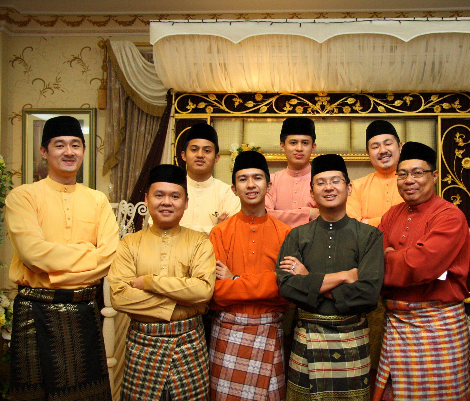
Borneo is home to a number of different Indigenous peoples and distinct languages and cultures. Dayak is inconsistently used as a collective term for non-Muslim Austronesian Indigenous peoples from Borneo, encompassing the Iban and Bidayuh in East Malaysia, and the Kayan, Kenyah and Ngaju of Kalimantan. Historically, many Dayaks lived in communal longhouses, lacked class structure and practiced shifting cultivation for subsistence.
Territories by population, size, and timezone
| Country | Population | Area | Density | Province/state | Population | Area | Density | Capital | Time zone |
|---|---|---|---|---|---|---|---|---|---|
| Brunei | 460,345 | ||||||||
| (2% of the population) | 5,765 km2 | ||||||||
| (0.8% of the land area) | 72.11/km2 | ||||||||
| Bandar Seri Begawan | UTC+8 | ||||||||
| Indonesia (Kalimantan) | 16,544,696 | ||||||||
| (72% of the population) | 539,238 km2 | ||||||||
| (72.5% of the land area) | 30.8/km2 | ||||||||
| North Kalimantan | 713,622 | ||||||||
| (3% of the population) | 72,275 km2 | ||||||||
| (9.7% of the land area) | 9.7/km2 | Tanjung Selor | UTC+8 | ||||||
| East Kalimantan | 3,849,842 | ||||||||
| (16.8% of the population) | 127,347 km2 | ||||||||
| (17.1% of the land area) | 29.6/km2 | ||||||||
| Samarinda | UTC+8 | ||||||||
| South Kalimantan | 3,808,235 | ||||||||
| (16.6% of the population) | 38,744 km2 | ||||||||
| (5.2% of the land area) | 105.1/km2 | ||||||||
| Banjarbaru | UTC+8 | ||||||||
| Central Kalimantan | 2,702,200 | ||||||||
| (11.8% of the population) | 153,565 km2 | ||||||||
| (20.6% of the land area) | 17.4/km2 | ||||||||
| Palangka Raya | UTC+7 | ||||||||
| West Kalimantan | 5,470,797 | ||||||||
| (23.8% of the population) | 147,307 km2 | ||||||||
| (19.8% of the land area) | 36.8/km2 | ||||||||
| Pontianak | UTC+7 | ||||||||
| Malaysia (East Malaysia) | 5,967,582 | ||||||||
| (26% of the population) | 198,447 km2 | ||||||||
| (26.7% of the land area) | 30.7/km2 | ||||||||
| Sabah | 3,418,785 | ||||||||
| (14.9% of the population) | 73,904 km2 | ||||||||
| (9.9% of the land area) | 46/km2 | ||||||||
| Kota Kinabalu | UTC+8 | ||||||||
| Sarawak | 2,453,677 | ||||||||
| (10.7% of the population) | 124,450 km2 | ||||||||
| (16.7% of the land area) | 22/km2 | ||||||||
| Kuching | UTC+8 | ||||||||
| Labuan | 95,120 | ||||||||
| (0.4% of the population) | 92 km2 | ||||||||
| (0.1% of the land area) | 1,000/km2 | ||||||||
| Victoria | UTC+8 | ||||||||
| Total | 22,972,623 | 743,450 km2 | |||||||
| 30.9~/km2 |
May includes the offshore islands and its populations
Due to its size, Brunei is further subdivided into 4 districts (mukim), which is similar to the size of smaller administrative units in Indonesia (kecamatan) and Malaysia (daerah)
20 largest cities and towns in Borneo by population


| Rank | City | Population | Country | Province/state/district |
|---|---|---|---|---|
| 1 | Samarinda | 861,878 | Indonesia | East Kalimantan |
| 2 | Balikpapan | 738,532 | Indonesia | East Kalimantan |
| 3 | Pontianak | 679,818 | Indonesia | West Kalimantan |
| 4 | Banjarmasin | 678,243 | Indonesia | South Kalimantan |
| 5 | Kota Kinabalu | 500,425 | Malaysia | Sabah |
| 6 | Nusantara | 488,409 | Indonesia | Nusantara |
| 7 | Sandakan | 439,050 | Malaysia | Sabah |
| 8 | Tawau | 420,806 | Malaysia | Sabah |
| 9 | Kuching | 402,738 | Malaysia | Sarawak |
| 10 | Miri | 356,900 | Malaysia | Sarawak |
| 11 | Bandar Seri Begawan | 318,530 | Brunei | Brunei–Muara |
| 12 | Palangkaraya | 305,797 | Indonesia | Central Kalimantan |
| 13 | Banjarbaru | 272,763 | Indonesia | South Kalimantan |
| 14 | Tarakan | 249,960 | Indonesia | North Kalimantan |
| 15 | Singkawang | 246,112 | Indonesia | West Kalimantan |
| 16 | Bontang | 189,968 | Indonesia | East Kalimantan |
| 17 | Sampit | 166,773 | Indonesia | Central Kalimantan |
| 18 | Sibu | 162,676 | Malaysia | Sarawak |
| 19 | Bintulu | 114,058 | Malaysia | Sarawak |
| 20 | Tenggarong | 106,669 | Indonesia | East Kalimantan |
Urbanisation by region

| Country | Province/state | Urban–rural population (%) | Urban | Rural | |||||||
|---|---|---|---|---|---|---|---|---|---|---|---|
| url=https://www.statista.com/statistics/761109/share-of-urban-population-brunei/ | title =Share of the urban population in Brunei from 2012 to 2021 | year=2023 | access-date=15 April 2023 | work=World Atlas}}{{cite web | url=https://www.macrotrends.net/countries/BRN/brunei/urban-population | title =Brunei Urban Population 1960–2023 | access-date=15 April 2023 | work=Macrotrends}} | 78.3% | 21.8% | |
| Indonesia (Kalimantan) | East Kalimantan | ||||||||||
| North Kalimantan | 68.9% | 31.1% | |||||||||
| South Kalimantan | 48.4% | 51.6% | |||||||||
| Central Kalimantan | 40.2% | 59.8% | |||||||||
| West Kalimantan | 36.2% | 63.8% | |||||||||
| Malaysia (East Malaysia) | Sabah | 54.7% | 45.3% | ||||||||
| Sarawak | 57.0% | 43.0% | |||||||||
| Labuan | 88.9% | 11.1% |
Data based on the projection in the former territories in East Kalimantan Province (prior to the separation of North Kalimantan in 2012)
Major ethnicities by region

| Country | Province/state | Major ethnic groups | Indigenous | Non-indigenous |
|---|---|---|---|---|
| Brunei | Bisaya, Dusun, Kedayan, Malay, Murut | Chinese | ||
| Indonesia (Kalimantan) | North Kalimantan | Bulungan, Dayak, Tidung | Bugis, Javanese | |
| East Kalimantan | Banjarese, Berau, Dayak, Kutai, Paser | Bugis, Javanese | ||
| South Kalimantan | Banjarese, Dayak | Bugis, Javanese, Madurese | ||
| Central Kalimantan | Banjarese, Dayak, Malay | Javanese, Madurese | ||
| West Kalimantan | Dayak, Malay | Chinese, Javanese, Madurese | ||
| Malaysia (East Malaysia) | Sabah | Kadazan, Dusun, Bajau, Paitan, Murut, Rungus, Lundayeh, Malay, Bisaya, Suluk | Bugis, Chinese, Moro | |
| Sarawak | Bidayuh, Iban, Malay, Melanau, Orang Ulu | Chinese | ||
| Labuan | Kadazan, Dusun, Kedayan, Malay, Lundayeh, Murut | Chinese |
Based on alphabetical order
Religion
| {{Pie chart | thumb = | title=Population by Religion, Sex and Census Year | url=http://www.deps.gov.bn/SiteAssets/Time-Series3.html | access-date=11 May 2021 | archive-date=1 April 2021 | archive-url=https://web.archive.org/web/20210401024235/http://www.deps.gov.bn/SiteAssets/Time-Series3.html | url-status=dead}} | label1 = Islam | value1 = 80.9 | color1 = Green | label2 = Christianity | value2 = 7.1 | color2 = Blue | label4 = Other | value4 = 5 | color4 = Black | label3 = Buddhism | value3 = 7 | color3 = Yellow | thumb = | 2020kf}} | label1 = Islam | value1 = 51.9 | color1 = Green | label2 = Christianity | value2 = 37.4 | color2 = Blue | label3 = Buddhism | value3 = 9.0 | color3 = Yellow | label5 = Hinduism | value5 = 0.1 | color5 = DarkOrange | label4 = Confucianism and others | value4 = 0.3 | color4 = White | label6 = No religion | value6 = 1.3 | color6 = Black | thumb = | url=https://gis.dukcapil.kemendagri.go.id/peta/ | title=ArcGIS Web Application | access-date=27 September 2021 | archive-date=5 July 2022 | archive-url=https://web.archive.org/web/20220705211227/http://gis.dukcapil.kemendagri.go.id/peta/ | url-status=dead }} | label1 = Islam | value1 = 78.42 | color1 = Green | label2 = Protestantism | value2 = 9.30 | color2 = Blue | label3 = Roman Catholicism | value3 = 9.09 | color3 = Purple | label4 = Buddhism | value4 = 1.94 | color4 = Yellow | label5 = Hinduism | value5 = 1.08 | color5 = DarkOrange | label6 = Confucianism | value6 = 0.1 | color6 = Red | label7 = Folk religion | value7 = 0.06 | color7 = Black |
|---|
Administration
The island of Borneo is divided administratively by three countries.
- The independent sultanate of Brunei (main part and eastern exclave of Temburong)
- The Indonesian provinces of East, South, West, North and Central Kalimantan, in Kalimantan
- The East Malaysian states of Sabah and Sarawak, as well as the Federal Territory of Labuan (on offshore islands nearby)

Economy

Borneo's economy depends mainly on agriculture, logging and mining, oil and gas, and ecotourism. Brunei's economy is highly dependent on the oil and gas production sector, and the country has become one of the largest oil producers in Southeast Asia. The Malaysian states of Sabah and Sarawak are both top exporters of timber. Sabah is also known as the agricultural producer of rubber, cacao, and vegetables, and for its fisheries, while Sabah, Sarawak and Labuan export liquefied natural gas (LNG) and petroleum. The Indonesian provinces of Kalimantan are mostly dependent on mining sectors despite also being involved in logging and oil and gas explorations.
List of territories by GDP/GRP 2023
| Country | Province/state | GDP nominal | |||
|---|---|---|---|---|---|
| billion | Territorial | ||||
| GDP | GDP/GRP | ||||
| per capita | Territorial | ||||
| per capita | |||||
| Brunei | US$ 15.126 | US$ 33,576 | |||
| Indonesia (Kalimantan) | North Kalimantan | US$ 9.662 | US$ 114.383 | US$ 13,236 | US$ 6,627 |
| East Kalimantan | US$ 55.344 | US$ 14,155 | |||
| South Kalimantan | US$ 17.668 | US$ 4,184 | |||
| Central Kalimantan | US$ 13.702 | US$ 4,940 | |||
| West Kalimantan | US$ 18.007 | US$ 3,202 | |||
| Malaysia (East Malaysia) | Sabah | US$ 24.534 | US$ 57.565 | US$ 6,828 | US$ 8,649 |
| Sarawak | US$ 31.209 | US$ 15,875 | |||
| Labuan | US$ 1.822 | US$ 18,327 |
Human Development Index by territory
HDI is a statistic of combined indicators that takes into account life expectancy, health, education and per-capita income.
| Country | Province/state | HDI score | Country comparison | |
|---|---|---|---|---|
| Brunei | 0.829 (2022) | Kuwait (0.831) | ||
| Indonesia (Kalimantan) | North Kalimantan | 0.729 (2023) | Paraguay (0.717) | |
| East Kalimantan | 0.782 (2023) | Iran (0.774) | ||
| South Kalimantan | 0.747 (2023) | Paraguay (0.717) | ||
| Central Kalimantan | 0.737 (2023) | Paraguay (0.717) | ||
| West Kalimantan | 0.705 (2023) | Iraq (0.686) | ||
| Malaysia (East Malaysia) | Sabah | 0.772 (2022) | Iran (0.774) | |
| Sarawak | 0.824 (2022) | Russia (0.822) | ||
| Labuan | 0.839 (2022) | Turkey (0.838) |
References
References
- Sugianto, Danang. "Sensus Penduduk 2020 Selesai, Begini Sebaran Masyarakat RI Terbaru".
- [http://www.citypopulation.de/Malaysia.html Malaysia: Federal States, Territories, Districts, Major Cities, Urban Aras & Conurbations – Statistics & Maps on City Population]. Citypopulation.de (20 May 2013). Retrieved on 12 July 2013.
- "W.P. Labuan Sepintas Lalu". statistics.gov.my.
- Donna Marchetti. (2 August 1998). "Borneo's Wild Side". The New York Times.
- (1817). "Kritisches Journal der neuesten theologischen Literatur, Volume 6". Nabu Press.
- (1847). "Le Moniteur des Indes-Orientales et Occidentales". Belinfant Brothers.
- (1814). "Verhandelingen van het Bataviaasch Genootschap, der Kunsten en Wetenschappen". A. H. Hubbard.
- Marine Science. (8 October 2023). "The Facts on File dictionary of marine science". Charton, Barbara (2008)..
- "Descriptive Dictionary of the Indian Island (1856)".
- (2018). "Mangifera pajang Kosterm, 1965".
- Eugene Linden. (17 March 2011). "The Ragged Edge of the World: Encounters at the Frontier Where Modernity, Wildlands and Indigenous Peoples Meet". Penguin Publishing Group.
- "Sanskrit Dictionary".
- Muljana, Slamet. (1960). "Sriwidjaja". Pertjetakan Arnoldus.
- "Kaart van het eiland Borneo, 1601, Benjamin Wright".
- "Antique Map Borneo by De Bry (c.1602)".
- Media, Kompas Cyber. (13 December 2018). "Hari Nusantara, Kenali Nama Lawas 5 Pulau Besar di Indonesia Halaman all".
- Siti Norkhalbi Haji Wahsalfelah. (2005). "Traditional Woven Textiles: Tradition and Identity Construction in the 'New State' of Brunei Darussalam". Universiti Brunei Darussalam.
- Suyatno. "Naskah Nagarakretagama". [[National Library of Indonesia]].
- Wyatt, D. J. (2012:33).'' The Blacks of Premodern China''. United States: University of Pennsylvania Press, Incorporated.
- (2003). "The origin of the 'circular basins' of Sabah, Malaysia". Bulletin of the Geological Society of Malaysia, Royal Holloway University of London.
- James Allan Taylor. (1984). "Biogeography: Recent Advances and Future Directions". Rowman & Littlefield.
- Teresa Zubi. (25 October 2015). "Wallacea". Starfish.
- Tomas Tomascik. (1997). "The Ecology of the Indonesian Seas". Oxford University Press.
- (2013). "Competitiveness Analysis and Development Strategies for 33 Indonesian Provinces". World Scientific.
- (2008). "Tropical River Fisheries Valuation: Background Papers to a Global Synthesis". WorldFish.
- (2007). "Credit and Microfinance Needs in Inland Capture Fisheries Development and Conservation in Asia". Food & Agriculture Org..
- "Sarawak Visitors Guide". Sarawak State Government.
- Nora Rappaport. (29 October 2015). "WATCH: Billions of Bugs Feast on Flesh and Dung in Borneo". [[National Geographic Society.
- Sean Martin. (31 October 2015). "Cockroach cave: Where billions of bugs feed on dead animals and dung [Video]". International Business Times (UK).
- (10 May 2016). "Phillipps' Field Guide to the Mammals of Borneo and Their Ecology: Sabah, Sarawak, Brunei, and Kalimantan". Princeton University Press.
- (22 August 2016). "WJEC GCSE Geography". Hodder Education.
- (28 April 2022). "A prehistoric forest grows in Brunei". ScienceDaily.
- (19 December 2006). "Scientists find dozens of new species in Borneo rainforests". [[World Wide Fund for Nature]].
- "Borneo wildlife". World Wide Fund for Nature.
- (5 February 2013). "Ecology of Kalimantan: Indonesian Borneo". Tuttle Publishing.
- MacKinnon, K. (1998). "The Ecology of Kalimantan". [[Oxford University Press]].
- Nguyen, T.T.T., and S. S. De Silva (2006). "Freshwater Finfish Biodiversity and Conservation: An Asian Perspective", ''Biodiversity & Conservation'' 15(11): 3543–3568
- (2015). "DNA capture reveals transoceanic gene flow in endangered river sharks". Proceedings of the National Academy of Sciences.
- (22 April 2010). "Scientists discover new species in Heart of Borneo". World Wide Fund for Nature.
- "Borneo Lowland & Montane Forests – A Global Ecoregion". World Wide Fund for Nature.
- Colby Loucks. "Southeastern Asia: Indonesia, Malaysia, and Brunei". World Wide Fund for Nature.
- "Sundaland heath forests". World Wide Fund for Nature.
- "Global Forest Watch". World Resources Institute.
- "Borneo". Mongabay.com.
- (2 March 2023). "What Causes Deforestation in Borneo and How Do We Stop It?". Earth.org.
- "Threats to Borneo forests". World Wide Fund for Nature.
- Jonathan Kaiman. (21 October 2015). "Fires in Southeast Asia may be emitting more greenhouse gases than the entire U.S.". [[Los Angeles Times]].
- Apichal Sunchindah. (December 2015). "Transboundary Haze Pollution Problem in Southeast Asia: Reframing ASEAN's Response". Economic Research Institute for ASEAN and East Asia.
- (16 February 2018). "Borneo's Orangutan Population Plummeted by Half in 16 Years". [[Smithsonian (magazine).
- "An Awesome Island". PBS.
- (8 September 2015). "2014 Annual Competitiveness Analysis and Development Strategies for Indonesian Provinces". World Scientific.
- "History of Borneo".
- (22 November 2018). "Lembah Tertua Dalam Prasejarah Borneo Ditemui". Sabah Post.
- "The History of Archaeological Sites: How It All Began in Borneo". SSF2193 Project.
- "Borneo — History".
- Zimmer, Carl. (7 November 2018). "In Cave in Borneo Jungle, Scientists Find Oldest Figurative Painting in the World – A cave drawing in Borneo is at least 40,000 years old, raising intriguing questions about creativity in ancient societies.". [[The New York Times]].
- Aubert, M.. (7 November 2018). "Palaeolithic cave art in Borneo". [[Nature (journal).
- Cœdès, George. (1968). "The Indianized States of South-East Asia". University of Hawaii Press.
- Derek Heng Thiam Soon. (June 2001). "The Trade in Lakawood Products Between South China and the Malay World from the Twelfth to Fifteenth Centuries AD". Journal of Southeast Asian Studies.
- Jan O. M. Broek. (1962). "Place Names in 16th and 17th Century Borneo". Imago Mundi.
- (2006). "The Austronesians: Historical and Comparative Perspectives". E Press, The Australian National University.
- Peter SkalnÃk. (1 January 1989). "Outwitting the State". Transaction Publishers.
- (8 October 2015). "Early Modern Southeast Asia, 1350–1800". Routledge.
- (July 2014). "Malaysia-Philippines Territorial Dispute: The Sabah Case". NCCU Institutional Repository.
- [https://core.ac.uk/download/pdf/228735802.pdf Reading Song-Ming Records on the Pre-colonial History of the Philippines] By Wang Zhenping Page 258.
- Mariah Doksil. (25 August 2014). "Islam arrived in Sabah in 10th century". The Borneo Post.
- "Islam In Indonesia. A resource of Islam in the archipelago".
- (January 2005). "Islam in Southeast Asia: Political, Social and Strategic Challenges for the 21st Century". Institute of Southeast Asian Studies.
- Shinzō Hayase. (2007). "Mindanao Ethnohistory Beyond Nations: Maguindanao, Sangir, and Bagobo Societies in East Maritime Southeast Asia". University of Hawaii Press.
- (January 1996). "International Dictionary of Historic Places: Asia and Oceania". Taylor & Francis.
- Bachamiya Abdul Hussainmiya. (2006). "Brunei: revival of 1906 : a popular history". Brunei Press.
- Keat Gin Ooi. (2004). "Southeast Asia: A Historical Encyclopedia, from Angkor Wat to East Timor". ABC-CLIO.
- (13 April 2011). "Chinese Circulations: Capital, Commodities, and Networks in Southeast Asia". Duke University Press.
- Ranjit Singh. (2000). "The Making of Sabah, 1865–1941: The Dynamics of Indigenous Society". University of Malaya Press.
- Donald F. Lach. (16 April 1994). "Asia in the Making of Europe, Volume I: The Century of Discovery.". University of Chicago Press.
- (21 April 1977). "The Cambridge History of Islam: Volume 2A, The Indian Sub-Continent, South-East Asia, Africa and the Muslim West". Cambridge University Press.
- (1816). "The Asiatic Journal and Monthly Register for British and Foreign India, China, and Australia". Parbury, Allen, and Company.
- Sanderson Beck. (2007). "Indonesia and the Dutch 1800–1950". San.Beck.
- Adrienne Smith. (2012). "British and Dutch Perceptions of Cannibalism in Borneo, 1882–1964". [[California Polytechnic State University]].
- Captain the Hon. Henry Keppel, R.N.. (1846). "The Expedition to Borneo of H.M.S. Dido for the Suppression of Piracy". Chapman and Hall.
- P. Boomgaard. (January 2007). "A World of Water: Rain, Rivers and Seas in Southeast Asian Histories". KITLV Press.
- H. Wilfrid Walker. "Wanderings Among South Sea Savages And in Borneo and the Philippines". Full Books.
- Harriette McDougall. (1882). "Sketches of Our Life at Sarawak (Chapter XVI. Illanun Pirates)". [[Project Canterbury]], Anglican History.
- Robert Cribb. (1 February 2013). "Historical Atlas of Indonesia". Routledge.
- J. R. V. Prescott. (3 October 2014). "Political Frontiers and Boundaries (Routledge Library Editions: Political Geography)". Routledge.
- "Part 2 – The Brooke Era". Earth Island Institute.
- Halliburton, Richard. (1932). "The Flying Carpet". The Bobbs-Merrill Company.
- Rozan Yunos. (7 September 2008). "Loss of Labuan, a former Brunei island". The Brunei Times.
- "British North Borneo Papers". Archives hub.
- Jatswan S. Sidhu. (20 December 2016). "Historical Dictionary of Brunei Darussalam". Rowman & Littlefield Publishers.
- "Treaty of Protection 1888 – Brunei". Muslim Museum Initiative.
- Richard Ker. (26 August 2012). "Ellena – America's Lost Colony in Kimanis of North Borneo". North Borneo Historical Society.
- James W. Gould. (1969). "The United States and Malaysia". Harvard University Press.
- K. G. Tregonning. (November 1954). "American Activity in North Borneo, 1865–1881". Pacific Historical Review.
- James Francis Warren. (1981). "The Sulu Zone, 1768–1898: The Dynamics of External Trade, Slavery, and Ethnicity in the Transformation of a Southeast Asian Maritime State". NUS Press.
- Emrys Chew. (12 June 2012). "Arming the Periphery: The Arms Trade in the Indian Ocean During the Age of Global Empire". Palgrave Macmillan.
- British Government. (1885). "British North Borneo Treaties. (British North Borneo, 1885)". Sabah State Government (State Attorney-General's Chambers).
- (21 September 2016). "Human Insecurities in Southeast Asia". Springer.
- Johnstone. (3 February 1898). "North Borneo Chartered Company: North Borneo Railway; The first train in North Borneo". Malayan Railways.
- Rob Dickinson. "The North Borneo Railway Project". The International Steam Pages.
- Danny Wong Tze Ken. (1999). "Chinese Migration to Sabah Before the Second World War". Archipel.
- Geert Oostindie. (1 January 2008). "Dutch Colonialism, Migration and Cultural Heritage: Past and Present". BRILL.
- (25 June 2008). "International Frontiers and Boundaries: Law, Politics and Geography". BRILL.
- "Anglo-Dutch Treaty of 1824 – Malaysia and Indonesia". Muslim Museum Initiative.
- (1991). "The Prize, The Epic Quest for Oil, Money & Power". Simon & Schuster.
- (2012). "Borneo's Petroleum Plays". GEO ExPro.
- "History of Shell in Indonesia". Shell.
- Takashi Shiraishi. (January 1993). "The Japanese in Colonial Southeast Asia". SEAP Publications.
- Regina Lim. (2008). "Federal-state Relations in Sabah, Malaysia: The Berjaya Administration, 1976–85". Institute of Southeast Asian Studies.
- Danny Tze-Ken Wong. (1998). "The Transformation of an Immigrant Society: A Study of the Chinese of Sabah". Asean Academic.
- (2001). "War Crimes: Japan's World War II Atrocities". Turner Publishing Company.
- (2009). "Peristiwa Mandor berdarah". Media Pressindo.
- Muhammad Abdul Aziz. (6 December 2012). "Japan's Colonialism and Indonesia". Springer Science & Business Media.
- Milton W. Meyer. (1 January 2000). "Asia: A Concise History". Rowman & Littlefield Publishers.
- (2000). "Japanese Prisoners of War". A&C Black.
- Judith M. Heimann. (9 November 2007). "Guests can succeed where occupiers fail". [[International Herald Tribune]].
- A. B. Feuer. (November 2005). "Australian Commandos: Their Secret War Against the Japanese in World War II". Stackpole Books.
- Richard Ker. (7 November 2013). "Brief History on How the Australians Liberated North Borneo during WWII [Video]". North Borneo Historical Society.
- "Australian invasion of Borneo in pictures.". Malayan Railways.
- Nicholas Tarling. (2001). "A Sudden Rampage: The Japanese Occupation of Southeast Asia, 1941–1945". C. Hurst & Co. Publishers.
- Adrian Vickers. (3 November 2005). "A History of Modern Indonesia". Cambridge University Press.
- ''Post-war Borneo, 1945–50: Nationalism, Empire and State-Building''
- Mary F. Somers Heidhues. (2003). "Golddiggers, Farmers, and Traders in the "Chinese Districts" of West Kalimantan, Indonesia". SEAP Publications.
- Vernon L. Porritt. (1997). "British Colonial Rule in Sarawak, 1946–1963". Oxford University Press.
- (18 July 1946). "British North Borneo Becomes Crown Colony". [[Trove]].
- (2012). "A Retrospect on the Dust-laden History: The Past and Present of Tekong Island in Singapore". World Scientific.
- (1964). "Problems of Communism". Special Materials Section, United States Information Agency.
- Ramses Amer. (23 May 2016). "Conflict Management and Dispute Settlement in East Asia". Routledge.
- (10 May 2007). "Civil Wars of the World: Major Conflicts Since World War II". ABC-CLIO.
- Christopher Tuck. (23 May 2016). "Confrontation, Strategy and War Termination: Britain's Conflict with Indonesia". Routledge.
- (7 September 1964). "Aggression Must be Deterred". The Age.
- "Confrontation in Borneo". Government of New Zealand.
- (28 January 1963). "I. North Borneo Claim (Excerpt from President Diosdado Macapagal's State-of-the-Nation Message to the Congress of the Philippines)". Government of the Philippines.
- (24 April 1962). "Cession and transfer of the territory of North Borneo by His Highness, Sultan Mohammad Esmail Kiram, Sultan of Sulu, acting with the consent and approval of the Ruma Bechara, in council assembled, to the Republic of the Philippines". Government of the Philippines.
- (1998). "Brunei Darussalam: The Road to Independence". Brunei History Centre, Ministry of Culture, Youth, and Sports.
- Alexander Nicholas Shaw. (19 June 2016). "British counterinsurgency in Brunei and Sarawak, 1962–1963: developing best practices in the shadow of Malaya". Small Wars & Insurgencies.
- Karl Hack. (2001). "Defence and Decolonisation in Southeast Asia: Britain, Malaya and Singapore, 1941–1968". Psychology Press.
- (January–December 1962). "Report of the Commission of Enquiry, North Borneo and Sarawak, 1962 (Cobbold Commission)". [[The National Archives (United Kingdom).
- Patricia Hului. (16 September 2014). "THE COBBOLD COMMISSION: Giving people a voice". The Borneo Post.
- (1963). "Malaysia: agreement concluded between the United Kingdom of Great Britain and Northern Ireland, the Federation of Malaya, North Borneo, Sarawak and Singapore". H. M. Stationery Office.
- (2 April 2000). "Marcos order: Destabilize, take Sabah". Philippine Daily Inquirer.
- Paul F. Whitman. (2002). "The Corregidor Massacre – 1968". Corregidor Historic Society.
- Rommel Banlaoi. (13 October 2009). "Philippine Security in the Age of Terror: National, Regional, and Global Challenges in the Post-9/11 World". CRC Press.
- Lyons, Kate. (27 August 2019). "Why is Indonesia moving its capital city? Everything you need to know". The Guardian.
- (1996). "Borneo in Transition: People, Forests, Conservation, and Development". Oxford University Press.
- "Dayak {{!}} Indigenous Tribes, Culture & History".
- "Department of Economic Planning and Development – Population".
- Badan Pusat Statistik, Jakarta, 2021.
- (2019). "The 10 Largest Cities In Borneo". World Atlas.
- (2023). "Share of the urban population in Brunei from 2012 to 2021". World Atlas.
- (2020). "Persentase Penduduk Daerah Perkotaan menurut Provinsi, 2010–2035". Badan Pusat Statistik.
- (2020). "Key Findings of Population and Housing Census of Malaysia 2020: Urban and Rural". Department of Statistics Malaysia Official Portal.
- (2011). "Population Distribution and Basic Demographic Characteristic Report 2010 (Updated: 05/08/2011)". Department of Statistics Malaysia Official Portal.
- "Population by Religion, Sex and Census Year".
- "ArcGIS Web Application".
- "Borneo » City Info » Economy". Borneo.com.
This article was imported from Wikipedia and is available under the Creative Commons Attribution-ShareAlike 4.0 License. Content has been adapted to SurfDoc format. Original contributors can be found on the article history page.
Ask Mako anything about Borneo — get instant answers, deeper analysis, and related topics.
Research with MakoFree with your Surf account
Create a free account to save articles, ask Mako questions, and organize your research.
Sign up freeThis content may have been generated or modified by AI. CloudSurf Software LLC is not responsible for the accuracy, completeness, or reliability of AI-generated content. Always verify important information from primary sources.
Report