From Surf Wiki (app.surf) — the open knowledge base
Bonvilston
| Field | Value |
|---|---|
| country | Wales |
| welsh_name | Tresimwn |
| official_name | Bonvilston |
| coordinates | |
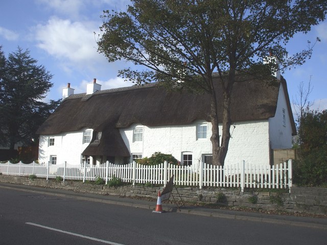
| static_image | Bonvilston village green.jpg |
| static_image_width | 260px |
| static_image_caption | Bonvilston village green |
| community_wales | St Nicholas and Bonvilston |
| unitary_wales | Vale of Glamorgan |
| lieutenancy_wales | South Glamorgan |
| constituency_welsh_assembly | Vale of Glamorgan |
| constituency_westminster | Vale of Glamorgan |
| post_town | Cardiff |
| postcode_district | CF5 |
| postcode_area | CF |
| os_grid_reference | ST065741 |
Bonvilston () is a village in the Vale of Glamorgan, Wales. The village is situated on the A48 about four miles east of Cowbridge and near the Welsh capital city of Cardiff. The population in 2011 was 392.
History
It is named after Simon de Bonville, a Norman nobleman; hence the name of the village, though different in English and Welsh, translates as "Simon's town" or "Bonville's town" and refers to the same person. Simon de Bonville lived here in the 12th century. In 1291, "Margam conveyed to Thomas le Spudur of Bonvilston an acre of arable land with a house and curtilage in the vill of 'Tudekistowe', which Thomas, son of Robert had previously leased from the abbey; in exchange, Thomas gave the abbey two acres of land in Bonvilston." The manor subsequently became increasingly under the power of Margam Abbey.
In the 19th century, Richard Bassett, a prominent figure in Glamorgan resided at Bonvilston House and owned the manor. The 1811 A Topographical Dictionary of The Dominion of Wales by Nicholas Carlisle said of the village:
Notable landmarks


The village has two pubs, The Red Lion, and The Aubrey Arms. A Third pub, The Old Post, closed in 2019 and in 2021, permission was granted to convert this into a hotel. There is a corner shop called the old village shop. St Mary's parish church, rebuilt in 1860 in the Victorian era style retains a late mediaeval Sanctus bell.
References
References
- "Custom report - Nomis - Official Labour Market Statistics".
- Royal Commission on Ancient and Historical Monuments in Wales. (May 1991). "An inventory of the ancient monuments in Glamorgan: Medieval secular monuments. The early castles, from the Norman Conquest to 1217". H.M.S.O..
- Mills, Anthony David. (6 November 2003). "A Dictionary of British Place-Names". Oxford University Press.
- (July 1975). "South Glamorgan, a county history". Stewart Williams, Publishers.
- Spurgeon, Clifford. (April 2000). "An inventory of the ancient monuments in Glamorgan". Royal Commission on Ancient and Historical Monuments in Wales, H.M.S.O..
- Glamorgan History Society. (1 January 2001). "Morgannwg: transactions of the Glamorgan History Society".
- Nicholas, Thomas. (1991). "Annals and Antiquities of the Counties and County Families of Wales". Genealogical Publishing Com.
- Carlisle, Nicholas. (1811). "A Topographical Dictionary of The Dominion of Wales". accessed via Genuki.org.
This article was imported from Wikipedia and is available under the Creative Commons Attribution-ShareAlike 4.0 License. Content has been adapted to SurfDoc format. Original contributors can be found on the article history page.
Ask Mako anything about Bonvilston — get instant answers, deeper analysis, and related topics.
Research with MakoFree with your Surf account
Create a free account to save articles, ask Mako questions, and organize your research.
Sign up freeThis content may have been generated or modified by AI. CloudSurf Software LLC is not responsible for the accuracy, completeness, or reliability of AI-generated content. Always verify important information from primary sources.
Report