From Surf Wiki (app.surf) — the open knowledge base
Blythe, California
City in California, United States
City in California, United States
| Field | Value | |
|---|---|---|
| name | Blythe, California | |
| settlement_type | City | |
| image_skyline | Blythe, California, seen from air.jpg | |
| image_caption | Blythe as viewed from the sky | |
| image_seal | Blythe ca seal.png | |
| image_blank_emblem | Logo of Blythe, California.png | |
| blank_emblem_type | Logo | |
| image_map | File:Riverside County California Incorporated and Unincorporated areas Blythe Highlighted 0607218.svg | |
| mapsize | 250px | |
| map_caption | Location in Riverside County and the state of California | |
| pushpin_map | USA | |
| pushpin_map_caption | Location in the United States | |
| pushpin_relief | 1 | |
| pushpin_label | Blythe | |
| subdivision_type | Country | |
| subdivision_name | United States | |
| subdivision_type1 | State | |
| subdivision_name1 | California | |
| subdivision_type2 | County | |
| subdivision_name2 | Riverside | |
| established_title | Incorporated | |
| established_date | July 21, 1916{{Cite web | |
| url | http://www.calafco.org/docs/Cities_by_incorp_date.doc | |
| title | California Cities by Incorporation Date | |
| format | Word | |
| publisher | California Association of Local Agency Formation Commissions | |
| access-date | August 25, 2014 | |
| url-status | dead | |
| archive-url | https://web.archive.org/web/20141103002921/http://www.calafco.org/docs/Cities_by_incorp_date.doc | |
| archive-date | November 3, 2014 | |
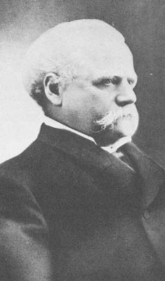
| named_for | Thomas Henry Blythe | |
| government_footnotes | ||
| government_type | Council-Manager | |
| leader_title | Mayor | |
| leader_name | Joseph "Joey" Deconinck | |
| leader_title1 | Vice Mayor | |
| leader_name1 | Johnny Rodriguez | |
| leader_title2 | City Council | |
| leader_name2 | Sam Burton | |
| Joseph Halby III | ||
| Summer Spraggins | ||
| <!-- Area------------------> | unit_pref | Imperial |
| area_footnotes | ||
| area_total_sq_mi | 27.37 | |
| area_land_sq_mi | 26.58 | |
| area_water_sq_mi | 0.78 | |
| area_total_km2 | 70.88 | |
| area_land_km2 | 68.85 | |
| area_water_km2 | 2.03 | |
| area_water_percent | 2.90 | |
| elevation_footnotes | ||
| elevation_ft | 272 | |
| elevation_m | 83 | |
| population_as_of | 2020 | |
| population_total | 18317 | |
| population_density_sq_mi | 689.05 | |
| population_density_km2 | 266.04 | |
| coordinates | ||
| coordinates_footnotes | ||
| timezone | PST | |
| utc_offset | −08:00 | |
| timezone_DST | PDT | |
| utc_offset_DST | −07:00 | |
| postal_code_type | ZIP Codes | |
| postal_code | 92225–92226 | |
| area_code_type | Area code | |
| area_code | 442/760 | |
| blank_name | FIPS code | |
| blank_info | ||
| blank1_name | GNIS feature IDs | |
| blank1_info | , | |
| website |
|access-date=August 25, 2014 |url-status=dead |archive-url=https://web.archive.org/web/20141103002921/http://www.calafco.org/docs/Cities_by_incorp_date.doc |archive-date=November 3, 2014 Joseph Halby III Summer Spraggins
.jpg)
Blythe () is a city in eastern Riverside County, California, United States. It is in the Palo Verde Valley of the Lower Colorado River Valley region, an agricultural area and part of the Colorado Desert along the Colorado River, approximately 224 mi east of Los Angeles and 150 mi west of Phoenix. Blythe was named after Thomas Henry Blythe, a San Francisco financier, who established primary water rights to the Colorado River in the region in 1877. The city was incorporated on July 21, 1916. The population was 18,317 at the 2020 census.
History
Native Americans lived in the area.
Etymology
Blythe was named after Thomas Henry Blythe, a San Francisco businessman and entrepreneur. Mr. Blythe established primary water rights to the Colorado River in the southwestern California region in 1877. The town was originally named Blythe City, by Thomas Blythe, but the name was shortened to simply Blythe around the time the first post office was opened in 1908.
Early years

In the early or mid-1870s, William Calloway (known as Oliver Calloway in some sources), an engineer and a former captain of the 1st California Infantry Regiment, explored an area across the Colorado River from Ehrenberg, Arizona, and found its potential for development. Calloway made preliminary surveys and filed land claims under the Swamp Land Act of 1850. He interested the wealthy San Francisco capitalist Thomas Henry Blythe (originally born Thomas Williams in Mold, Wales) to undertake development and settlement of an "empire" located next to the Colorado. Together they purchased a total of 140,000 acres under the Swamp Land Act, and another 35,000 acres under the Desert Land Act of 1877.
On July 17, 1877, Blythe filed his first claim for Colorado River water on what was to become the "Blythe Intake". Blythe appointed another man named George Irish as manager to assist Calloway in building an irrigation system. Calloway died in a Chemehuevi attack on March 28, 1880, and was replaced by C.C. Miller, the father of Frank Augustus Miller. Thomas Blythe died on April 4, 1883; his only revisit to the valley was in November 1882. After his death, the work in the valley halted and Blythe's estate subsequently went into litigation between his illegitimate daughter Florence and other claimants, the trial beginning in 1889. In the 1900s, Florence was awarded the estate, after several years of preceding rulings in favor of her and appeals against her.
20th century
Frank Murphy and Ed Williams, who were involved with the cattle industry in southeastern Arizona, came to the area in 1904 and were convinced it was well-suited for cattle and farming. With the Hobson brothers from Ventura County, they bought Blythe's estate and formed the Palo Verde Land and Water Company. During 1911–1912, W.F. Holt, who helped develop nearby Imperial Valley, was the company's general manager.
On August 8, 1916, the California Southern Railroad reached Blythe from the desert station of Rice, then known as Blythe Junction. It was later renamed to honor G.W. Rice, an engineer and superintendent of the railroad. The dramatic growth in the valley following this event attracted national attention. Production totals increased annually from virtually nothing to near $8,000,000 in few years, primarily from cotton and cotton seed shipped to the ports. The lower cotton prices in 1920 ended this prosperous time. The Atchison, Topeka and Santa Fe Railway began leasing the line in 1921 and acquired it at the end of 1942.
The first automobile bridge over the Colorado River between Blythe and Ehrenberg was constructed in 1928 to replace a cable ferry service. The bridge's successor was built in the early 1960s and was expanded to four lanes and a pedestrian walkway in early 1974.
In 1935, the completion of Boulder Dam extinguished the annual destructive floods in the valley. As noted during the city's fiftieth anniversary, some forty crops were grown on the farms, and large cattle feeds were another aspect of the agriculture industry. As of 1947, the Fisher ranch had the biggest herd of registered Brahman cattle in California, the breeding stock having been sold to western states and other countries.
During World War II, Blythe was the site of United States Army Air Forces facilities at the Blythe Airport and the Gary Field.
In 1972, Interstate 10 was built through the city, replacing US 60 and the previously decommissioned US 70 on Hobsonway as the main thoroughfare.
21st century
In 2016, the voter-approved recreational use of cannabis in California has made the cannabis industry drawn to the economically declined city due to lower land prices, water, and potentially lower taxes compared to other parts of the state.
Geography and climate
Blythe is located near the California/Arizona border in the Colorado Desert section of the Sonoran Desert, at the junction of Interstate 10 and US 95. According to the United States Census Bureau, the city has a total area of 27.0 sqmi, of which 26.2 sqmi is land and 0.8 sqmi (2.9%) is water.
Nearby communities include Vidal to the north, Ripley to the south, Desert Center to the west, and Ehrenberg, Arizona, to the east. Major cities in the region include Yuma (85 miles), Indio (95 miles), Phoenix (150 miles), San Bernardino (170 miles), Riverside (172 miles), and Las Vegas (200 miles). Blythe is within 4 hours via car of 10% of the United States' population.
Blythe has a hot desert climate, featuring extremely hot summers and mild winters. There are an average of 179.3 days with highs of 90 °F or higher. There are an average of 3.1 days with lows of 32 °F or lower. Until 2016, the record high temperature was 122 °F on July 7, 1920, and June 24, 1929. But on June 20, 2016, that long-standing record was shattered when Blythe reached 124 °F. The record low temperature was 20 °F on January 8, 1971. There are an average of 17.9 days with measurable precipitation. The wettest year was 1992 with 9.16 in and the driest year was 1950 with 0.31 in. The most rainfall in one month was 5.92 in in August 1951, which included the 24-hour record rainfall of 3 in on August 26.
|Jan record high F = 89 |Feb record high F = 93 |Mar record high F = 100 |Apr record high F = 107 |May record high F = 115 |Jun record high F = 124 |Jul record high F = 123 |Aug record high F = 121 |Sep record high F = 121 |Oct record high F = 112 |Nov record high F = 96 |Dec record high F = 87
|Jan avg record high F = 78.0 |Feb avg record high F = 82.7 |Mar avg record high F = 92.5 |Apr avg record high F = 101.3 |May avg record high F = 107.4 |Jun avg record high F = 114.8 |Jul avg record high F = 117.2 |Aug avg record high F = 115.6 |Sep avg record high F = 111.3 |Oct avg record high F = 101.6 |Nov avg record high F = 89.5 |Dec avg record high F = 76.8 |year avg record high F = 118.4
|Jan avg record low F = 32.9 |Feb avg record low F = 35.4 |Mar avg record low F = 41.0 |Apr avg record low F = 46.8 |May avg record low F = 54.6 |Jun avg record low F = 62.5 |Jul avg record low F = 72.2 |Aug avg record low F = 71.0 |Sep avg record low F = 62.8 |Oct avg record low F = 49.4 |Nov avg record low F = 38.0 |Dec avg record low F = 31.3 |year avg record low F = 29.6
|Jan record low F = 20 |Feb record low F = 22 |Mar record low F = 30 |Apr record low F = 38 |May record low F = 43 |Jun record low F = 46 |Jul record low F = 62 |Aug record low F = 62 |Sep record low F = 53 |Oct record low F = 27 |Nov record low F = 26 |Dec record low F = 24
|access-date = March 26, 2023 |access-date = March 26, 2023
Seismology
Despite California's reputation for earthquakes, according to geologists Blythe has not had an earthquake centered in the city for over 500,000 years.
Local features
Tourism is a major component of the local economy. Blythe is a stopover city with full services for travelers between any of the nearby regions, in particular the major cities of Los Angeles and Phoenix, since it is approximately midway between those two metropolitan areas. The winter months bring visitors avoiding the colder climates of the north, when the population of the area within 50 miles (80 km) of Blythe has been known to exceed 500,000.
Blythe also contains 24 churches, one library, two newspapers (the Palo Verde Valley Times and The Desert Independent), two museums, two radio stations (KERU-FM and KJMB-FM), three banks, a three-screen movie theater (now closed), one funeral home and an 18,500 sq ft (1,720 m2). recreation center. The area is popular with campers and hikers and has six parks, seven campgrounds, seven RV parks, three boat ramps onto the Colorado River, and an 18-hole public golf course.
Demographics
2020
| Race (NH = Non-Hispanic) | 2010 | 2000 | 1990 | 1980 |
|---|---|---|---|---|
| White alone (NH) | 23.9% | |||
| (4,376) | 28.3% | |||
| (5,894) | 42% | |||
| (5,105) | 44.4% | |||
| (3,738) | ||||
| Black alone (NH) | 11% | |||
| (2,007) | 14.5% | |||
| (3,020) | 8% | |||
| (972) | 7.8% | |||
| (657) | ||||
| American Indian alone (NH) | 0.9% | |||
| (158) | 0.7% | |||
| (147) | 0.9% | |||
| (104) | 0.8% | |||
| (65) | ||||
| Asian alone (NH) | 1.7% | |||
| (305) | 1.4% | |||
| (291) | 1.3% | |||
| (157) | 0.5% | |||
| (46) | ||||
| Pacific Islander alone (NH) | 0.1% | |||
| (21) | 0.1% | |||
| (25) | 0.2% | |||
| (19) | ||||
| Other race alone (NH) | 0.4% | |||
| (65) | 0.8% | |||
| (164) | 0.1% | |||
| (17) | 0.2% | |||
| (13) | ||||
| Multiracial (NH) | 2.8% | |||
| (512) | 1% | |||
| (208) | 1.7% | |||
| (210) | — | |||
| Hispanic/Latino (any race) | 59.4% | |||
| (10,873) | 53.2% | |||
| (11,068) | 45.8% | |||
| (5,571) | 46.4% | |||
| (3,909) |
The 2020 United States census reported that Blythe had a population of 18,317. The population density was 689.0 PD/sqmi. The racial makeup of Blythe was 31.6% White, 11.7% African American, 1.8% Native American, 1.8% Asian, 0.2% Pacific Islander, 41.9% from other races, and 11.0% from two or more races. Hispanic or Latino of any race were 59.4% of the population.
The census reported that 66.0% of the population lived in households, 0.6% lived in non-institutionalized group quarters, and 33.4% were institutionalized.
There were 4,477 households, out of which 37.9% included children under the age of 18, 36.8% were married-couple households, 8.3% were cohabiting couple households, 32.1% had a female householder with no partner present, and 22.8% had a male householder with no partner present. 27.5% of households were one person, and 9.9% were one person aged 65 or older. The average household size was 2.7.
The age distribution was 18.4% under the age of 18, 9.5% aged 18 to 24, 36.3% aged 25 to 44, 26.6% aged 45 to 64, and 9.2% who were 65years of age or older. The median age was 36.9years. For every 100 females, there were 198.6 males.
There were 5,246 housing units at an average density of 197.3 /mi2, of which 4,477 (85.3%) were occupied. Of these, 51.2% were owner-occupied, and 48.8% were occupied by renters.
2023 estimates
In 2023, the US Census Bureau estimated that 17.7% of the population were foreign-born. Of all people aged 5 or older, 55.2% spoke only English at home, 41.0% spoke Spanish, 1.8% spoke other Indo-European languages, 1.4% spoke Asian or Pacific Islander languages, and 0.6% spoke other languages. Of those aged 25 or older, 69.7% were high school graduates and 8.9% had a bachelor's degree.
The median household income was $51,984, and the per capita income was $18,378. About 15.4% of families and 19.5% of the population were below the poverty line.
Politics
In the California State Legislature, Blythe is in , and in .
In the United States House of Representatives, Blythe is in .
Sports
The Blythe Heat was a winter professional minor league baseball team of the Arizona Winter League, and also a member of the Arizona Summer League, but the leagues folded in 2017. They play on Alexander Field in Todd Park. Some games of the Lake Havasu Heat (folded in 2009) of the semi-pro Pacific Southwest Baseball League played in Blythe during the summer months.
Public services

State and federal agencies
State facilities in the town include the following:
- Resources Agency, California Department of Fish and Game office at 150 S. Main Street.
- California Highway Patrol office at 430 S. Broadway Street.
- California Department of Motor Vehicles office at 430 S. Broadway Street.
- California Department of Food and Agriculture office.
- California Department of Corrections and Rehabilitation – Chuckawalla Valley State Prison(Now Closed)
- California Department of Corrections and Rehabilitation – Ironwood State Prison
- California Department of Forestry and Fire Protection
Federal facilities in the town include the following:
- U.S. Border Patrol
- U.S. Department of Agriculture – Blythe Federal Building
- U.S. Postal Service – Blythe Federal Building
Safety
Blythe has its own police department and volunteer fire department. The Riverside County Sheriff's Department also has a regional station in Blythe.
Emergency medical services are provided by American Medical Response, which staffs two paramedic ambulances in the city 24 hours a day.
Blythe has its own police department, the Blythe Police Department who patrol Blythe. However the highways in and around Blythe are managed by California Highway Patrol and the nearby Riverside County patrolled by Riverside County Sheriff's Department who also run the county jail.
Education
Blythe area public elementary and secondary schools comprise the Palo Verde Unified School District, which contains 3 elementary schools and 1 high school, and continuation/adult education school. Palo Verde Community College District is part of the California Community College system and includes Palo Verde College in Blythe and an educational center in Needles.
Transportation
Interstate 10 crosses Blythe in an east–west direction. State Route 78's eastern terminus is west of the town. U.S. Route 95 crosses Blythe in the eastern side. Lovekin Boulevard and Midland Road serve the ghost town of Midland.
Blythe Airport (BLH) is just west of the town on Interstate 10 and has a 6500 ft runway.
Blythe was served in rail by the Arizona and California Railroad but currently has no rail service since an embargo in late 2007 and abandonment in 2009.
Blythe is served by RidePV. Greyhound stops in Blythe.
Healthcare
Health facilities in Blythe include Palo Verde Hospital, a General Acute Care Hospital with 55 total beds and 24-hour standby emergency services, 23 physicians/surgeons, 2 dentists, 2 optometrists, 1 chiropractor, and 1 podiatrist.
Cemetery
The Palo Verde Cemetery District maintains the Palo Verde Cemetery.
References
References
- "City Council". City of Blythe, CA.
- "2020 U.S. Gazetteer Files". United States Census Bureau.
- {{Cite GNIS. 1660349. Blythe
- {{cite gnis. 1660349. Blythe.
- (August 17, 2021). "Blythe Intaglios: Tribes work to protect the 'sleeping giants' of the desert".
- (1984). "Riverside County, California, Place Names; Their Origins and Their Stories".
- "Blythe resided in San Francisco and focused in real estate investments. Among his investments was a patch of undeveloped land within what is now downtown San Francisco. Development in the purchased site within Market Street, Geary Street, and Grant Street, called the "Blythe Block", and being in the center of downtown, made Blythe wealthy. The Blythe Block was sold off in portions in 1901 and 1902".
- Johnson, Marael. (1995). "Why Stop? A Guide to California Roadside Historical Markers". Gulf Publishing Company.
- (August 2, 1901). "Blythe Block Changes Hands". [[San Francisco Call]].
- (January 7, 1902). "Blythe Block Sold". Los Angeles Herald.
- (1977). "The Calloway Affair of 1880: Chemehuevi Adaptation and Chemehuevi-Mohave Relations". Journal of California Anthropology.
- Woodward, Arthur. (1939). "Empire on the Colorado". [[Desert Magazine]].
- (February 2005). "Palo Verde Irrigation District History".
- John Boessenecker. (1998). "Lawman: The Life and Times of Harry Morse, 1835–1912". University of Oklahoma Press.
- Paul Lincoln Kleinsorge. (1941). "The Boulder Canyon Project, Historical and Economic Aspects". Stanford University Press.
- (March 11, 1911). "Developing Palo Verde". Imperial Valley Press.
- David F. Myrick. (2001). "Santa Fe to Phoenix: Railroads of Arizona". Signature Press.
- (April 1920). "California Southern Extended to Open New District". The Santa Fe Magazine.
- Donald B. Robertson. (1986). "Encyclopedia of Western Railroad History: California". Caxton Press.
- (1933). "California Highways and Public Works". Department of Public Works, State of California.
- (1960). "California Highways and Public Works". Department of Public Works, State of California.
- (March 7, 1974). "Bridge project finished". Palo Verde Valley Times.
- (October 13, 1966). "Blythe's Golden 50". Palo Verde Valley Times.
- (October 30, 1947). "Fisher Brahmans Largely Known". Palo Verde Valley Times.
- Front page picture in the ''Palo Verde Valley Times'', October 26, 1972.
- (January 31, 2018). "Can marijuana save this 'dying' town on the California-Arizona border?". [[The Desert Sun]].
- (January 23, 2007). "About Blythe, Ca".
- ''[http://paloverdevalleytimes.com/ Palo Verde Valley Times]''
- {{usurped
- "FM Query Results – Audio Division (FCC) USA".
- "Radio Station in Blythe, CA – Adult Contemporary Radio Station".
- "Census of Population and Housing". Census.gov.
- "HISPANIC OR LATINO, AND NOT HISPANIC OR LATINO BY RACE (2020)". U.S. Census Bureau.
- "HISPANIC OR LATINO, AND NOT HISPANIC OR LATINO BY RACE (2010)". U.S. Census Bureau.
- "California: 2000". U.S. Census Bureau.
- "California: 1990, Part 1". U.S. Census Bureau.
- "General Social and Economic Characteristics: California". U.S. Census Bureau.
- "Blythe city, California; DP1: Profile of General Population and Housing Characteristics - 2020 Census of Population and Housing".
- "Blythe city, California; P16: Household Type - 2020 Census of Population and Housing".
- "Blythe city, California; CP02: Comparative Social Characteristics in the United States - 2023 ACS 5-Year Estimates Comparison Profiles".
- "Blythe city, California; DP03: Selected Economic Characteristics - 2023 ACS 5-Year Estimates Comparison Profiles".
- "Find Your California Representative". California State Assembly.
- {{Cite GovTrack. CA. 25
- "Palo Verde Unified School District".
- "Surface Transportation Board Decision".
- "Palo Verde Valley Transit Agency".
- "Blythe California Bus Station – Greyhound".
- California Department of Health Services
- "California Association of Public Cemeteries".
- {{Coord. 33.6308572. -114.6007904. region:US
This article was imported from Wikipedia and is available under the Creative Commons Attribution-ShareAlike 4.0 License. Content has been adapted to SurfDoc format. Original contributors can be found on the article history page.
Ask Mako anything about Blythe, California — get instant answers, deeper analysis, and related topics.
Research with MakoFree with your Surf account
Create a free account to save articles, ask Mako questions, and organize your research.
Sign up freeThis content may have been generated or modified by AI. CloudSurf Software LLC is not responsible for the accuracy, completeness, or reliability of AI-generated content. Always verify important information from primary sources.
Report