From Surf Wiki (app.surf) — the open knowledge base
Birbhum district
District in West Bengal, India

District in West Bengal, India
| Field | Value |
|---|---|
| name | Birbhum district |
| settlement_type | District |
| image_skyline | {{Photomontage |
| photo1a | Tarapith Temple 05.jpg |
| photo1b | Gurudev's Home.jpg |
| photo2a | Mama Bhagne Hills and Temple 13.jpg |
| photo2b | Historical monuments at Rajnagar - Motichur Mosque01.jpg |
| photo3a | Seorakuri forest in Birbhum 19.jpg |
| size | 300 |
| foot_montage | Clockwise from top-left: Tarapeeth Temple in Rampurhat, Tagore's home at Shantiniketan, Monuments at Rajnagar, Seorakuri forest, Mama Bhagne Hills |
| mapframe | yes |
| mapframe-point | none |
| mapsize | 300 |
| map_caption1 | Location of Birbhum district in West Bengal |
| coordinates | |
| subdivision_type | Country |
| subdivision_name | India |
| subdivision_type1 | State |
| subdivision_name1 | West Bengal |
| subdivision_type2 | Division |
| subdivision_name2 | Burdwan |
| seat_type | Headquarters |
| seat | Suri |
| leader_title | Subdivisions |
| leader_name | Suri Sadar, Bolpur, Rampurhat |
| leader_title1 | CD Blocks |
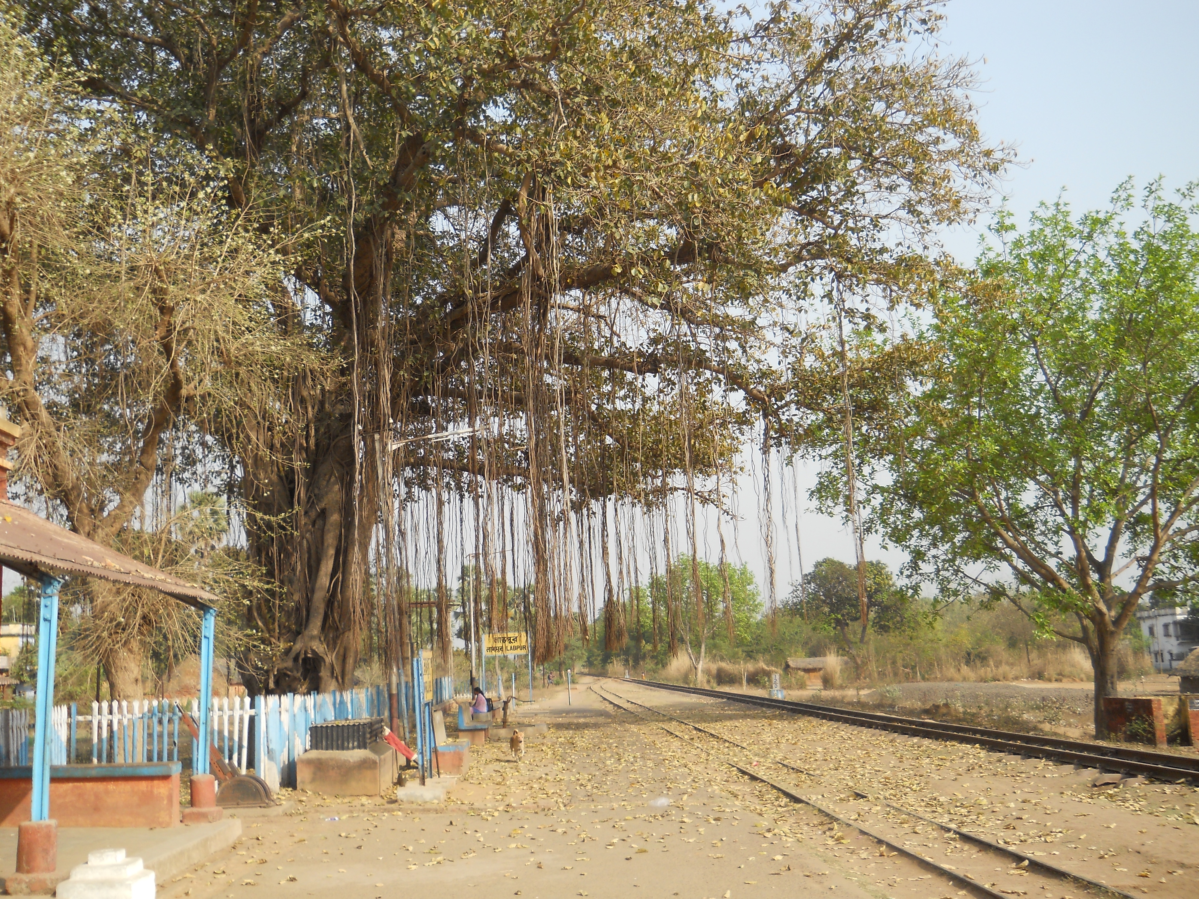
| leader_name1 | Mohammad Bazar, Rajnagar, Suri I, Suri II, Sainthia, Dubrajpur, Khoyrasol, Labpur, Nanoor, Bolpur Sriniketan, Ilambazar, Murarai I, Murarai II, Nalhati I, Nalhati II, Rampurhat I, Rampurhat II, Mayureswar I, Mayureswar II |
| leader_title2 | Lok Sabha constituencies |
| leader_name2 | Bolpur, Birbhum |
| leader_title3 | Vidhan Sabha constituencies |
| leader_name3 | Dubrajpur, Suri, Bolpur, Nanoor, Labpur, Sainthia, Mayureswar, Rampurhat, Hansan, Nalhati, Murarai |
| leader_title4 | District Magistrate |
| leader_name4 | Bidhan Ray, WBCS (Exe) |
| total_type | Total |
| area_total_km2 | 4545 |
| population_as_of | 2011 |
| population_total | 4,060,000 |
| population_urban | 449,448 |
| population_density_km2 | auto |
| demographics_type1 | Demographics |
| demographics1_title1 | Literacy |
| demographics1_info1 | 70.9 per cent |
| demographics1_title2 | Sex ratio |
| demographics1_info2 | 956 ♂/♀ |
| demographics_type2 | Languages |
| demographics2_title1 | Official |
| demographics2_info1 | Bengali |
| demographics2_title2 | Additional official |
| demographics2_info2 | English |
| timezone1 | IST |
| utc_offset1 | +05:30 |
| website |
| mapframe-point = none
Birbhum district () is an administrative unit in the Indian state of West Bengal. It is the northernmost district of Burdwan division—one of the five administrative divisions of West Bengal. The district headquarters is in Suri. Other important cities are Rampurhat, Bolpur and Sainthia. Jamtara, Dumka and Pakur districts of the state of Jharkhand lie at the western border of this district; the border in other directions is covered by the districts of Bardhaman of Purba Bardhaman, Paschim Bardhaman and Murshidabad of West Bengal.
Often called "the land of red soil", Birbhum is noted for its topography and its cultural heritage which is somewhat different from the other districts in West Bengal. The western part of Birbhum is a bushy region, a part of the Chota Nagpur Plateau. This region gradually merges with the fertile alluvial farmlands in the east.
This district saw many cultural and religious movements in history. Tarapith is a Hindu pilgrimage site located at 9km distance from Rampurhat city, which is one of the prominent places in Birbhum where every day a large number of pilgrims from across the country, neighboring states, and even abroad gather.This town is particularly known for the Tarapith Temple and its adjoining Hindu crematory ground. The Visva Bharati University at Santiniketan, established by Rabindranath Tagore, is one of the places Birbhum is known for. Many festivals are celebrated in the district, including Poush Mela.
Birbhum is primarily an agricultural district with around 75.09% of the population being dependent on agriculture.
Etymology
The name Birbhum comes probably from the term 'land' ('bhumi') of the 'brave' ('bir') or Bir king'). Another theory says that the district bears the name of Bagdi king Bir Malla, who ruled in the area from 1501 to 1554 CE. Bir in the Santali language means forests; therefore, Birbhum could also mean a land of forests.
Geography
Situated between 23° 32' 30" (right above the tropic of cancer) and 24° 35' 0" north latitude and 87° 5' 25" and 88° 1' 40" east longitudes, and about 4545 km2 in area, this district is triangular. River Ajay forms the southern base and the apex of the triangle points north. The river forms the boundary between the districts of Birbhum and Bardhaman. The state of Jharkhand is at the northern and the western border of Birbhum and Murshidabad is at the east.
Geographically, this area lies at the northeastern end of the Chota Nagpur Plateau, as it slopes down and merges with the alluvial plains of the Ganges. In the district there is only hilly area of natural rock formation situated near Dubrajpur town called Mama Bhagne Pahar (Hills). The western portion of the district is historically known as Vajjabhumi or Bajrabhumi. It is an undulating upland that is generally barren. The comparatively more fertile eastern portion, constituting the northeastern Rarh region, merges with the Gangetic plain. Vajjabhumi is included in the Rarh region, and the rest of Rarh is called Sumha to differentiate it from Vajjabhumi.
| Subdivision | Headquarters | Area (km2) | |||||||||
|---|---|---|---|---|---|---|---|---|---|---|---|
| (2001) | Population | ||||||||||
| (2011) | Rural | ||||||||||
| population (%) | Urban | ||||||||||
| population (%) | Birbhum district (Total) | – | 4,545.00 | 3,502,404 | 96.59 | 3.41 | |||||
| Rampurhat | Rampurhat | 1,574.23 | 1,508,506 | 96.62 | 3.38 | ||||||
| Suri Sadar | Suri | 1,782.72 | 1,121,871 | 96.57 | 3.43 | ||||||
| Bolpur | Bolpur | 1,186.66 | 872,027 | 96.56 | 3.44 |
Climate

The climate on the western side is dry and extreme but is relatively milder on the eastern side. During summer, the temperature can shoot well above 40 °C and in winters it can drop to around 6 °C. Rainfall is higher in the western areas as compared to the eastern areas. The annual average rainfall in Rajnagar is 1405 mm and in Nanoor it is 1212 mm, mostly in the monsoon months (June to October).
Climate and rainfall chart of Birbhum District:
| Month | Normal rainfall (in mm) |
|---|---|
| January | 9.7 |
| February | 23.2 |
| March | 23.3 |
| April | 40.7 |
| May | 88.7 |
| June | 234.2 |
| July | 324.5 |
| August | 295.7 |
| September | 258.2 |
| October | 105.4 |
| November | 17.5 |
| December | 9.4 |
| Yearly | 1430.5 |
Rivers
A number of rivers flow across Birbhum. Some of the most notable include Ajay, Mayurakshi, Kopai, Bakreshwar, Brahmani, Dwarka, Hinglo, and Bansloi. The Mayurakshi provides irrigation for about 2428 km2.
History
Prehistory


The area now known as Birbhum was inhabited from pre-historic times. Some of the archaeological sites related to Pandu Rajar Dhibi of Chalcolithic remains are located in Birbhum. Stone age implements have been found at several places in the district.
According to the old Jain book Acaranga Sutra, the last (24th) great Tirthankara Mahavira had wandered through this land, referred to as the "pathless country of Ladha in Vajjabhumi and Subbhabhumi (probably Suhma)" in the fifth century BCE. According to some historians, the spread of Jainism and Buddhism in the Rarh region was part of the process of Aryanisation of the area. Based on Divyabdan, a Buddhist text, Dr. Atul Sur has inferred that Gautam Buddha probably traversed this area to go to Pundravardhana and Samatata.
The Rarh region, once a part of the Maurya Empire was later included in the empires of the imperial Guptas, Shashanka and Harshavardhana. After dismemberment of Harshavardhana's empire, the region was ruled by the Palas, under whose rule Buddhism, particularly the Vajrayana cult, flourished. In the seventh century CE, the Chinese traveller Xuanzang described some of the monasteries he visited in the region. In the 12th century CE, the Sena dynasty took control of the area.
Medieval age
.jpg)
The region was ruled by Muslims in the 13th century CE, although their control over the western parts of the district appears to have been minimal, with true power resting in the hands of the local Hindu chiefs, known as the Bir Rajas (Bagdi Malla dynasty). Hetampur and Rajnagar kingdoms ruled most of Birbhum and parts of Burdwan, Maldah and Jharkhand from Dubrajpur (meaning two kingdoms – Hetampur & Rajnagar). Minhaj-i-Siraj, the author of the Tabaqat-i-Nasiri, mentions Lakhnur as the thanah (headquarters) of the Rarh wing of the Muslim rule and an important frontier post. The location of Lakhnur, though not yet identified, falls in Birbhum.
Colonial era

The area which is now Birbhum district was badly impacted by the Great Bengal famine of 1770. Many villages were wiped out entirely, and even in large towns, over three quarters of households perished.
The administrative unit called Birbhum was first formed in 1787 under the British East India Company, as "District Beerbhoom". The area had previously been administered as a part of Murshidabad district. The original district was much larger than its modern incarnation.
In the late 18th century, Birbhum and surrounding areas were affected by more famines followed by a peasants' insurrection. Although the insurrection primarily targeted zamindars and the government, trading and manufacturing centres were also looted. In June 1789, the manufacturing town of Ilambazar was sacked, although it recovered and became a magnet for manufacturing and trade.
Until 1793, Birbhum included "Bishenpore" or Bishnupur, which is now part of the Bankura district. Until the 1857 Sepoy Mutiny, the Santhal Parganas was part of Birbhum; the district thus sprawled up to Deoghar in the west. The immediate reason then for separating the western tribal majority areas was the Santhal rebellion of 1855–56. In 1872, Birbhum district comprises 1344 sqmi area with 695,921 inhabitants.
Economy


Birbhum is primarily an agricultural district with around 75% of the people dependent on agriculture. While 159.3 km2 of land is occupied by forests, 3329.05 km2 of land is used for agricultural purposes. 91.02% of the population live in villages. Out of total 4,50,313 farmers(holding 3,20,610 hectares of land), 3,59,404 are marginal farmers(holding 1,41,813 hectares altogether), 63,374 are small farmers(holding 95,144 hectares altogether), 26,236 are semi-medium farmers(holding 76,998 hectares altogether), 1,290 are medium farmers(holding 6,215 hectare altogether), and 9 are large farmers (holding 440 hectares of land). The average size of land holding per farmer is 0.71 hectares. 6,07,172 people work as agricultural labourers in Birbhum. Major crops produced in the district include rice, legumes, wheat, corn (maize), potatoes and sugar cane. The district has thirteen cold storages. Land with irrigation facilities in 2001-02 totalled 2763.9 km2. There are five barrages, providing irrigation support. Canada Dam on the Mayurakshi river at Massanjore lies close to the border of Birbhum and the Dumka district in Jharkhand. Further down the Mayurakshi is the Tilpara Barrage at Suri.
Birbhum is a major centre of cottage industries. Perhaps the most notable cottage industry is a non-profit rural organisation named Amar Kutir. Other main industries in Birbhum are agriculture-based industries, textiles, forestry, arts and crafts. Sriniketan is noted for its dairy industry and as a forestry centre. Some of the notable forms of cottage industries of Birbhum include textile—especially cotton and locally harvested tussar silk, jute works, batik, kantha stitch, macramé (weaving by knotting threads), leather, pottery and terracotta, solapith, woodcarving, bamboo and cane craft, metal works and tribal crafts. There are 8,883 small and medium scale industries. Principal industries of the district include cotton and silk harvesting and weaving, rice and oilseed milling, lac harvesting, and metalware and pottery manufacture. Bakreshwar Thermal Power Station (210 MW x 3 + 210 MW x 2 under construction) is the only heavy industry in the district.
Sainthia is known as business capital of Birbhum and an economically important city. Sainthia is the major centre for export and import of cottage industries. Sainthia is known as the business capital of Birbhum and an economically important city. Sainthia is a major center for the export and import of cottage industries. As the business epicenter of Birbhum, Sainthia was home to a prominent coconut oil manufacturer established by the Chandra family. 'Lion (সিংহ) Marka' (Lion Brand) coconut oil, which was manufactured and processed in a factory located in main Sainthia. This iconic brand not only gained statewide and national recognition but also became a symbol of the Sainthia's industrial prowess, significantly contributing to its economic growth. The factory's operations, which spanned from 1950s to nearly 45 years, were a cornerstone of Sainthia's prominence until they ceased in 1992. Today plenty of large, semi-large scale businesses run in this city, credit to its well connected logistics and rail network. Moreover, the economy stands tall credit to sales of agricultural based products.
In 2006 the Ministry of Panchayati Raj named Birbhum one of the country's 250 most backward districts (out of a total of 640).
Political and administrative divisions
The district comprises three subdivisions: Suri Sadar, Bolpur and Rampurhat. Other than municipality area, each subdivision contains community development blocs which in turn are divided into rural areas and census towns. There are seven urban units: six municipalities and one census town. The latest amongst the urban units to have a municipality was Nalhati in 2000.
Before delimitation the district was divided into 12 assembly constituencies (AC): Nanoor (AC #283), Bolpur (AC #284), Labhpur (AC #285), Dubrajpur (AC #286), Rajnagar (AC #287), Suri (AC #288), Mahammad Bazar (AC #289), Mayureswar (AC #290), Rampurhat (AC #291), Hansan (AC #292), Nalhati (AC #293) and Murarai (AC #294). The constituencies of Nanoor, Rajnagar, Mayureswar and Hansan were reserved for Scheduled Castes (SC) candidates. 2009 Indian general election was based on the newly formed parliamentary constituencies and the newly formed assembly constituencies have representatives in the 2011 elections of West Bengal.
As per order of the Delimitation Commission in respect of the delimitation of constituencies in the West Bengal, the district is divided into 11 assembly constituencies:{{cite web
| No. | Name | Lok Sabha constituency | MLA | Party |
|---|---|---|---|---|
| 284 | Dubrajpur (SC) | Birbhum | Anup Kumar Saha | |
| 285 | Suri | Bikash Roychoudhury | ||
| 286 | Bolpur | Bolpur | Chandranath Singha | |
| 287 | Nanoor (SC) | Bidhan Chandra Majhi | ||
| 288 | Labpur | Abhijit Sinha | ||
| 289 | Sainthia (SC) | Birbhum | Nilabati Saha | |
| 290 | Mayureswar | Bolpur | Abhijit Roy | |
| 291 | Rampurhat | Birbhum | Asish Banerjee | |
| 292 | Hansan | Ashok Kumar Chattopadhyay | ||
| 293 | Nalhati | Rajendra Prasad Singh | ||
| 294 | Murarai | Mosarraf Hossain |
Dubrajpur, Suri, Mayureswar, Rampurhat, Hansan, Nalhati and Murarai assembly segments form the Birbhum (Lok Sabha constituency). Bolpur, Nanoor, Labhpur, and Sainthia constituencies are part of Bolpur (Lok Sabha constituency), which will contain three other assembly segments from Bardhaman district.
Transport
The Panagarh–Morgram Highway runs through the district. All the towns and villages are connected by roads. The total length of roads in the district are: surfaced–2413 km and unsurfaced–4674 km. Against this the total length of rail track in the district is 201.32 km, including 26.55 km of the Ahmadpur-Katwa line, laid in 1917. The Sahibganj Loop of the Eastern Railway, laid in 1862, passes through this district. Rampurhat Junction is the most busiest railway station of this district. There is a junction at Nalhati for the connection to Azimganj in Murshidabad district. The Andal-Sainthia Branch Line connects it to the main Howrah-Delhi main line at Andal.
Demographics
In 1901, Birbhum had a population of 902,280, which by 1981 rose to 2,095,829. According to the 2001 census data, the total population has further risen to 3,015,422. The following table summarises the population distribution:
| Rural/Urban | Persons | Males | Females |
|---|---|---|---|
| Total | 3,015,422 | 1,546,633 | 1,468,789 |
| Rural | 2,757,002 | 1,414,097 | 1,342,905 |
| Urban | 258,420 | 132,536 | 125,884 |
According to the 2011 census Birbhum district has a population of 3,502,404, roughly equal to the nation of Lithuania{{cite web | author = US Directorate of Intelligence | title = Country Comparison:Population | url = https://www.cia.gov/library/publications/the-world-factbook/rankorder/2119rank.html | archive-url = https://web.archive.org/web/20070613004507/https://www.cia.gov/library/publications/the-world-factbook/rankorder/2119rank.html | url-status = dead | archive-date = 13 June 2007 | access-date = 1 October 2011 | quote = Lithuania 3,535,547 July 2011 est. |access-date=30 September 2011 |quote=Connecticut 3,574,097 |url-status=dead |archive-url=https://web.archive.org/web/20110101090833/http://2010.census.gov/2010census/data/apportionment-pop-text.php |archive-date=1 January 2011 }} This gives it a ranking of 84th in India (out of a total of 640). The district has a population density of 771 PD/sqkm. Its population growth rate over the decade 2001-2011 was 16.15%. Birbhum has a sex ratio of 956 females for every 1000 males, and a literacy rate of 70.9%. 12.83% of the population lives in urban areas. Scheduled Castes and Scheduled Tribes made up 29.50% and 6.92% of the population respectively. Other than those speaking the local dialect of Bengali, there are tribal Santhals and ten other tribal communities in Birbhum with some presence, amongst whom Koda, Mahali and Oraons are more common.
Religion
| Religion | url=https://dspace.gipe.ac.in/xmlui/bitstream/handle/10973/37365/GIPE-020591.pdf?sequence=3&isAllowed=y | title=CENSUS OF INDIA, 1941 VOLUME VI BENGAL PROVINCE | access-date=13 August 2022}} | Percentage (1941) | Population (1951) | Percentage (1951) | date=2011 | title=Table C-01 Population by Religion: West Bengal | url=https://censusindia.gov.in/nada/index.php/catalog/11396/download/14509/DDW19C-01%20MDDS.XLS | website=censusindia.gov.in | publisher=Registrar General and Census Commissioner of India}} | Percentage (2011) |
|---|---|---|---|---|---|---|---|---|---|---|---|---|
| Hinduism [[File:Om.svg | 15px]] | 686,436 | 65.48% | 774,527 | 72.60% | 2,181,515 | 62.28% | |||||
| Islam [[File:Star and Crescent.svg | 15px]] | 287,310 | 27.41% | 286,518 | 26.86% | 1,298,054 | 37.06% | |||||
| Tribal religion | 71,073 | 6.78% | 4,661 | 0.44% | 6,051 | 0.17% | ||||||
| Others | 3,498 | 0.33% | 17,727 | 0.51% | ||||||||
| Total Population | 1,048,317 | 100 | 1,066,889 | 100% | 3,502,404 | 100% | ||||||
| Notes: |
According to 2011 Indian census, Hindus formed around 62% of the total population and Muslims over 37%. Muslims are in majority in Murarai I (58.92%), Murarai II (75.00%) and Nalhati II (70.10%) CD blocks in the northeast of the district, and have a significant presence in Nalhati I (46.64%), Rampurhat II (48.20%), and Ilambazar (47.40%) CD blocks. Others, including religious groups and non-religion population fall below 1% of the population. In the 2001 Indian census of the district, Hindus formed 64.49% of the population while 35.08% were Muslims. There is a sprinkling of other religious groups in the population.
| CD block | Hindu % | Muslim % | Other % |
|---|---|---|---|
| Murarai I | 40.58 | 58.92 | 0.5 |
| Murarai II | 24.91 | 75.00 | 0.09 |
| Nalhati I | 52.11 | 46.64 | 1.25 |
| Nalhati II | 29.79 | 70.10 | 0.11 |
| Rampurhat I | 67.38 | 30.61 | 2.01 |
| Rampurhat II | 51.64 | 48.20 | 0.16 |
| Mayureswar I | 69.84 | 29.33 | 0.83 |
| Mayureswar II | 74.06 | 25.65 | 0.29 |
| Mohammad Bazar | 67.15 | 31.29 | 1.56 |
| Rajnagar | 84.74 | 14.27 | 0.99 |
| Suri I | 73.02 | 26.59 | 0.39 |
| Suri II | 67.70 | 31.59 | 0.71 |
| Sainthia | 77.68 | 21.46 | 0.86 |
| Labpur | 69.24 | 30.54 | 0.22 |
| Nanoor | 64.71 | 34.97 | 0.32 |
| Bolpur Sriniketan | 73.92 | 25.45 | 0.63 |
| Illambazar | 51.67 | 47.40 | 0.93 |
| Dubrajpur | 66.52 | 33.22 | 0.26 |
| Khoyrasol | 75.51 | 24.3 | 0.19 |
| Area not under any Sub-district | 75.88 | 23.41 | 0.71 |
Language
At the time of the 2011 census, 92.38% of the population spoke Bengali and 6.01% Santali as their first language.
Culture
Main article: Culture of Birbhum

The bauls of Birbhum, their philosophy and their songs form a notable representation of the folk culture of the district. Birbhum has been home to kabiyals, kirtaniyas and other folk culture groups.
The numerous fairs in Birbhum start with Poush Mela at Santiniketan and follows through the Bengali month of Poush until Makar Sankranti. Particularly lively is the fair at Jaydev Kenduli. People of Birbhum patronise folk entertainment programmes such as jatra, kavigan, raibenshe and alkap.
Many poets were born in this district, as for example, Chandidas (Rami). In addition to being a confluence of Vaishnava, Shakta and Saiva cultures, Birbhum villages observe ancient customs like worship of gramdevta (gram means village and devta means deity) in many forms.
Amongst the major attractions of Birbhum are Bakreshwar, Tarapith Temple, Dwarbasini temple at Chondrapur, Fullara at Labpur and Patharchapuri. Birbhum has many old temples, such as the ones at Jaydev Kenduli, Surul and Nanoor, with delicate decorative tiles made of terra cotta (burnt clay).
Flora and fauna
The eastern area of Birbhum is a part of the rice plains of West Bengal, and the vegetation includes usual characteristics of rice fields in Bengal, such as species of Aponogeton, Utricularia, Drosera, Philcoxia, Scrophulariaceae and similar aquatic or palustrine genera. In the drier western region of the district, the characteristic shrubs and herbs include species of Wendlandia, Convolvulaceae, Stipa, Tragus, Spermacoce, Ziziphus, Capparis and similar plants that grows on laterite soil. Mango, palm, and bamboo are among common trees in Birbhum. Other common species of plants include jackfruit, arjun, sal, guava, kend and mahua.
Other than feral dogs and domestic cattle, the most frequently encountered non-human mammal is the hanuman, a long tailed grey langur prevalent in the Gangetic plain. Some wild boars and wolves may still be spotted in the small forests of Chinpai, Bandarsol and Charicha. Leopards and bears are not to be seen any more in the wild. Sometimes during the season when mahua trees bloom, wild Asiatic elephants from Jharkhand come in trampling crops and threatening life and property. Birds of Birbhum include a mix of hilly and plain-land dwelling species like partridge, pigeon, green pigeon, water fowls, doyel, Indian robin, drongo, hawk, cuckoo, koel, sunbird, Indian roller, parrot, babbler, and some migratory birds.
Ballabhpur Wildlife Sanctuary near Santiniketan was declared a sanctuary in 1977. Economically important trees are planted here and blackbucks, spotted deer, jackals, foxes and a variety of water birds live in its 2 km2.
Literacy and education
High School–256 Higher Secondary School–110 Junior High School–95 Junior High Madarsa–10 Senior Madarsa–4 Primary School–237 Sishu Sikhsha Kendra–495 Anganwadi Centre–2407 College–12 University–1 Engineering colleges–2 Polytechnic–1 Industrial Training Institute (ITI)–1
According to the 2011 census Birbhum district had a literacy rate of 70.9%. up from 62.16% in 2001. In 1951 census, the literacy rate was 17.74%. It increased to 48.56% in 1991.
The growth of literacy in the last decade of the twentieth century was particularly remarkable with special emphasis on the eradication of illiteracy. While it is feared that Birbhum may not be able to fulfill the national objective of sending all children in the age group 6–14 years to school by 2010, efforts are on in that direction.
The district has 127 libraries supported by the government, one private library and one district library.
Sports
One of the most popular outdoor sports in the villages of Birbhum used to be danguli (literal meaning "ball and stick"). However, in recent times cricket has replaced some of its popularity. A major cricket event named as: Dream Gold Cup is organised in Labpur every year in the month of January. Cricket teams from all over the state comes for participation. It is played in the Stadium field in Sasthinagar. A sport that can be played outdoors and indoors and is popular among children is marbles, which involves projecting a striker bead with fingers to hit an ensemble of black or green glass beads.
In addition to cricket, the other most popular outdoor sports of this district are football and kabadi and volleyball.
Notable people
-
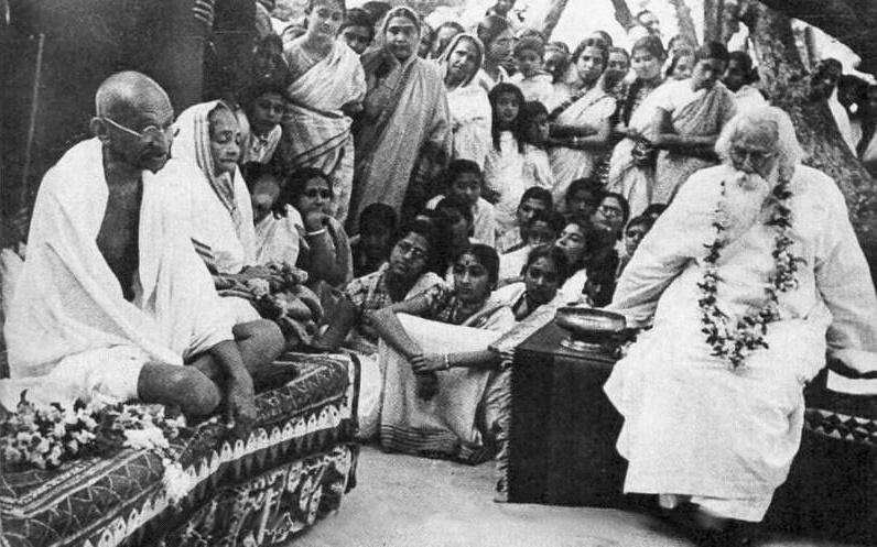
Rabindranath Tagore, polymath and founder of Visva-Bharati University
-
Amartya Sen, economist and Nobel laureate
-
Pranab Mukherjee, 13th President of India
-
Justice Abdus Sattar (1906–1985), former President of Bangladesh
-
Ananda Mohan Chakrabarty, Indian American microbiologist, scientist, and researcher, most notable for his work in directed evolution
-
Tarasankar Bandyopadhyay, Bengali novelist who was nominated three times for Nobel Prize in Literature from 1971 to 1973, but never won any.
-
Satyendra Prasanna Sinha, prominent lawyer and statesman in British India
-
Sumitra Devi, actress who worked in Hindi and Bengali cinema during the 1940s and 1950s
-
Noor Alam Chowdhury (1943–2021), Chief Justice of the Calcutta High Court
-
Nityananda Swami, co–founder of Gaudia-Vaishnavism, born at Ekachakra
-
Sahana Bajpaie, Bengali singer-songwriter and one of the most prominent contemporary Rabindra Sangeet vocalists
-
Ekram Ali (born 1950), Bengali poet and critic
-
Sutapa Biswas, British Indian conceptual artist
Villages
- Harisara
- Hetampur
- Kondaipur
- Labpur
- Paikar Tejhati
References
References
- "DM Desk".
- "Fact and Figures".
- "52nd Report of the Commissioner for Linguistic Minorities in India". [[Ministry of Minority Affairs]].
- (19 March 2008). "Directory of District, Sub division, Panchayat Samiti/ Block and Gram Panchayats in West Bengal, March 2008". National Informatics Centre, India.
- "Birbhum District History". District Administration.
- Rahim, Kazi MB, and Sarkar, Debasish, ''Agriculture, Technology, Products and Markets of Birbhum District'', ''Paschim Banga'', Birbhum Special Issue, pp. 157–166, Information and Cultural Department, Government of West Bengal.
- Mukhopadhyay, Malay, ''Birbhum Jelar Bhougolik Parichiti'', ''Paschim Banga'', Birbhum Special issue {{in lang. bn, February 2006, pp. 29–32.
- Halim, Abdul, ''Birbhumer Sech Byabastha O Samaj Unnayan Parikalpana Samparke'', ''Paschim Banga'', Birbhum Special issue {{in lang. bn, February 2006, pp. 149–155.
- Mukhopadhyay, Aditya, ''Birbhumer Mela'', ''Paschim Banga'', Birbhum Special issue {{in lang. bn, February 2006, pp. 203–214.
- Principal industries of the district include cotton and silk harvesting and weaving, rice and oilseed milling, [[Lac (resin). bn, February 2006, pp. 189–192.
- O'Malley, L.S.S., "[https://indianculture.gov.in/gazettes/west-bengal-district-gazetteers-birbhum Bengal District Gazetteers - Birbhum]", 1996 reprint, pp. 1-9, Govt. of West Bengal
- Maiti, Prakash Chandra, ''Birbhum in the Backdrop of Pre-history'', ''Paschim Banga'', Birbhum Special Issue, pp. 15–28
- Mondal, Dipanwita, ''Ek Najare Birbhum Jela'', ''Paschim Banga'', Birbhum Special Issue (in Bengali), February 2006, pp. 7–10
- O'Malley, pp. 10-31,
- "DDA, Birbhum".
- Selim, Mohammad, ''Irrigation Projects in Birbhum District'',''Paschim Banga'', February 2006 (in Bengali), Birbhum Special Issue, pp. 168–169
- Amalananda Ghosh. (1990). "An Encyclopaedia of Indian Archaeology: Volume 1: Subjects. Volume 2: A Gazetteer of Explored and Excavated Sites in India". BRILL.
- (24 December 2005). "Prehistoric tools unearthed in Bengal". Stone Pages Archaeo News.
- Ray, Nihar Ranajan, p.283
- ''Bangla O Bangalir Bibartan'', (An Ethno-Cultural History of Bengal) by Dr. Atul Sur, (Published by Sahityalok, Kolkata, 1986, 1994)
- Ghosh, Binoy, ''Paschim Banger Sanskriti'', 1976 edition, Vol I, p. 287, Prakash Bhawan
- Gupta, Dr. Ranjan Kumar, ''[[iarchive:dli.bengal.10689.13368/page/n279/mode/2up. The Economic Life of a Bengal District: Birbhum 1770 – 1857]]'', p. 257, The University of Burdwan, 1984.
- Gupta, Dr. Ranjan Kumar, pp. 44, 47
- Beverley, H.. (1872). "Report of the Census of Bengal 1872". Bengal Secretariat Press.
- (6 December 1969). "Lion Brand Coconut Oil Advertisement by Hindustan Coconut Oil Mills". Harano Somoyer Bigyapon.
- "Profile of Sainthia Municipality".
- Ministry of Panchayati Raj. (8 September 2009). "A Note on the Backward Regions Grant Fund Programme". National Institute of Rural Development.
- "Important Telephone Numbers". Official website of Birbhum district.
- "Population, Decadal Growth Rate, Density and General Sex Ratio by Residence and Sex, West Bengal/ District/ Sub District, 1991 and 2001". Directorate of census operations.
- "Category, Year of Establishment, Area, SC, ST and total population in ULBs in West Bengal". Department of Municipal affairs, Government of West Bengal.
- "General election to the Legislative Assembly, 2001 – List of Parliamentary and Assembly Constituencies". Election Commission of India.
- "Press Note - Schedule for General Elections, 2009". Press Information Burueau, Government of India.
- "A-2 Decadal Variation In Population Since 1901". [[Registrar General and Census Commissioner of India]].
- "Census of India 2001". Census Commission of India.
- (2011). "District Census Handbook: Birbhum". Registrar General and Census Commissioner of India.
- "Himan Development Report - Birrbhum". Religious and Caste Composition.
- Choudhuri, Arun, ''Birbhumer Adivasi Samaj O Janagosthi'', ''Paschim Banga'', Birbhum Special Issue, pp. 117–122
- "CENSUS OF INDIA, 1941 VOLUME VI BENGAL PROVINCE".
- Mitra, A. (1954). "District Handbooks Birbhum, West Bengal - Census 1951".
- (2011). "Table C-01 Population by Religion: West Bengal". Registrar General and Census Commissioner of India.
- Islam, Sheikh, ''Birbhumer Karmasansthane Matsya, Pranisampad Ebong Paschim Banga Sankhyalaghu Unnayan O Bityanigam'', ''Paschim Banga'', Birbhum Special Issue, p. 178
- "Table C-16 Population by Mother Tongue: West Bengal". Registrar General and Census Commissioner of India.
- Kundu, Chnadan, ''Birbhumer Baul: Swatantrer Sandhane'', ''Paschim Banga'', Birbhum Special Issue, pp. 215–224
- Festivities are organised across the seasons.Sen, Suchbrata, ''Birbhumer Otit O Bartaman Samajchitra'', ''Paschim Banga'', Birbhum Special Issue, pp. 107–116
- Das, Prabhat Kumar, ''Birbhumer Kirtan O Jatragan'', ''Paschim Banga'', Birbhum Special issue (in Bengali), February 2006, pp. 311–319
- Mitra, Amalendu, Dr., ''Rarher Sanskriti O Dharma Thakur'' (Bengali), pp. 90-96, Subarnarekha
- Mitra, Ajit Kumar, ''Birbhumer loukik Debdebi'', ''Paschim Banga'', Birbhum Special Issue, pp. 321–334
- Sarkar, Joydeep, ''Paryatan Boichitre Birbhum Jela'', ''Paschim Banga'', Birbhum Special Issue, pp. 197–202
- "About Birbhum: Geography". Official website of Birbhum.
- Chhanda Das. (2007). "A Treatise on Wildlife Conservation in India". Daya Books.
- "Santiniketan". National Informatics Centre, Government of India.
- Indian Ministry of Forests and Environment. "Protected areas: West Bengal".
- Roy, Bikash, ''Siksha Prasare Birbhum Jela'', ''Paschim Banga'', Birbhum Special Issue, pp. 81–91
- (1995). "Rabindranath Tagore: The Myriad-Minded Man". Saint Martin's Press.
- Ghosal, Amartya, ''Birbhumer Bisisto Byakti O Monishi'', ''Paschim Banga'', Birbhum Special Issue, pp. 321–334
- "President Abdus Sattar". Government of Bangladesh.
- (April 2020). "Nomination Archive - Tarashankar Bandyopadhyay".
- O'Malley, p.128
This article was imported from Wikipedia and is available under the Creative Commons Attribution-ShareAlike 4.0 License. Content has been adapted to SurfDoc format. Original contributors can be found on the article history page.
Ask Mako anything about Birbhum district — get instant answers, deeper analysis, and related topics.
Research with MakoFree with your Surf account
Create a free account to save articles, ask Mako questions, and organize your research.
Sign up freeThis content may have been generated or modified by AI. CloudSurf Software LLC is not responsible for the accuracy, completeness, or reliability of AI-generated content. Always verify important information from primary sources.
Report