From Surf Wiki (app.surf) — the open knowledge base
Big Pine Key, Florida

| Field | Value |
|---|---|
| official_name | Big Pine Key, Florida |
| settlement_type | Census-designated place |
| image_map | Monroe_County_Florida_Incorporated_and_Unincorporated_areas_Big_Pine_Key_Highlighted.svg |
| mapsize | 250x200px |
| map_caption | Location in Monroe County and the state of Florida |
| image_map1 | Big_Pine_Key.png |
| mapsize1 | 250x200px |
| map_caption1 | U.S. Census Bureau map showing CDP boundaries |
| subdivision_type | Country |
| subdivision_name | United States |
| subdivision_type1 | State |
| subdivision_name1 | Florida |
| subdivision_type2 | County |
| subdivision_name2 | Monroe |
| established_title | |
| unit_pref | Imperial |
| area_footnotes | |
| area_total_km2 | 26.70 |
| area_land_km2 | 26.43 |
| area_water_km2 | 0.28 |
| area_total_sq_mi | 10.31 |
| area_land_sq_mi | 10.20 |
| area_water_sq_mi | 0.11 |
| population_as_of | 2020 |
| population_total | 4521 |
| population_footnotes | |
| population_density_km2 | 171.07 |
| population_density_sq_mi | 443.06 |
| timezone | Eastern (EST) |
| utc_offset | -5 |
| timezone_DST | EDT |
| utc_offset_DST | -4 |
| coordinates | |
| coordinates_footnotes | |
| elevation_ft | 0 |
| elevation_footnotes | |
| postal_code_type | ZIP code |
| postal_code | 33043 |
| area_code | 305 |
| blank_name | FIPS code |
| blank_info | 12-06425 |
| blank1_name | GNIS feature ID |
| blank1_info | 2402688 |
Big Pine Key is a census-designated place and unincorporated community in Monroe County, Florida, United States, on an island of the same name in the Florida Keys. As of the 2020 census, the town had a total population of 4,521.
Geography
U.S. 1 (the Overseas Highway) crosses the key at mile markers 29.5–33, one of the few places on the keys where the road orients north–south (along the eastern edge of the Key). The highway leads west-southwest 29 mi to Key West and east-northeast 21 mi to Marathon.
Big Pine Key was the location of one of the stations of the Overseas Railroad.
According to the United States Census Bureau, the CDP has a total area of 10.3 sqmi, of which 0.1 sqmi, or 1.04%, is covered by water.
Demographics
2020 census
As of the 2020 United States census, there were 4,521 people, 2,065 households, and 1,180 families residing in the CDP.
| Race | Number | Percentage | White (non-Hispanic) | Black or African American (non-Hispanic) | Native American | Asian | Pacific Islander | Other/Mixed | Hispanic or Latino |
|---|---|---|---|---|---|---|---|---|---|
| 3,612 | 79.89% | ||||||||
| 49 | 1.08% | ||||||||
| 9 | 0.2% | ||||||||
| 46 | 1.02% | ||||||||
| 2 | 0.04% | ||||||||
| 182 | 4.03% | ||||||||
| 621 | 13.74% |
2000 census
As of the census of 2000, 5,032 people, 2,247 households, and 1,420 families resided in the CDP. The population density was 198.9/km (515.3/mi2). The 3,153 housing units averaged 124.6/km (322.9/mi2). The racial makeup of the CDP was 94.83% White, 1.09% African American, 0.50% Native American, 0.58% Asian, 0.02% Pacific Islander, 1.19% from other races, and 1.79% from two or more races. Hispanics or Latinos of any race were 6.72% of the population.
Of the 2,247 households, 41.4% had children under the age of 18 living with them, 43.8% were married couples living together, 5.7% had a female householder with no husband present, and 6.8% were not families. About 26.0% of all households were made up of individuals, and 7.8% had someone living alone who was 65 years of age or older. The average household size was 2.21 and the average family size was 2.63.
In the CDP, the population was distributed as 16.8% under the age of 18, 4.3% from 18 to 24, 30.3% from 25 to 44, 33.7% from 45 to 64, and 14.9% who were 65 years of age or older. The median age was 44 years. For every 100 females, there were 110.4 males. For every 100 females age 18 and over, there were 111.6 males.
The median income for a household in the CDP was $44,514, and for a family was $47,639. Males had a median income of $31,552 versus $28,021 for females. The per capita income for the CDP was $23,169. About 5.6% of families and 9.5% of the population were below the poverty line, including 17.4% of those under age 18 and 7.0% of those aged 65 or over.
The Blue Hole

The Blue Hole is an abandoned rock quarry that was used for nearby road fills and Henry Flagler's Overseas Railroad. The water it contains is mostly fresh and is used by various wildlife in the area, such as birds, snakes, alligators and invasive green iguanas. It is part of the National Key Deer Refuge.
Business and commerce
The primary grocery store is located in a shopping center just north of US 1. This shopping center contains several restaurants, an outlet store, electronics store, the visitor center for the National Key Deer Refuge, and a branch of the Monroe County Library (with WiFi internet access). Pharmacies are located along US 1, as well as a shoe store, a tropical decor store, and a bait and tackle shop. A small hardware store in the same area sells typical paint, hardware, tools, other goods needed to build/repair items around the home, and a limited selection of parts for boat repair.
Several bars and restaurants are along the US 1 corridor. The nearest city of note is Marathon about 23 miles (37 km) "north" on US 1. Key West, a major shopping and cultural hub for the area, is about 30 miles (48 km) "south" on US 1.
Accommodation is limited, though RV/camping and a small number of motel-style units are available on the far southeast side of the island.
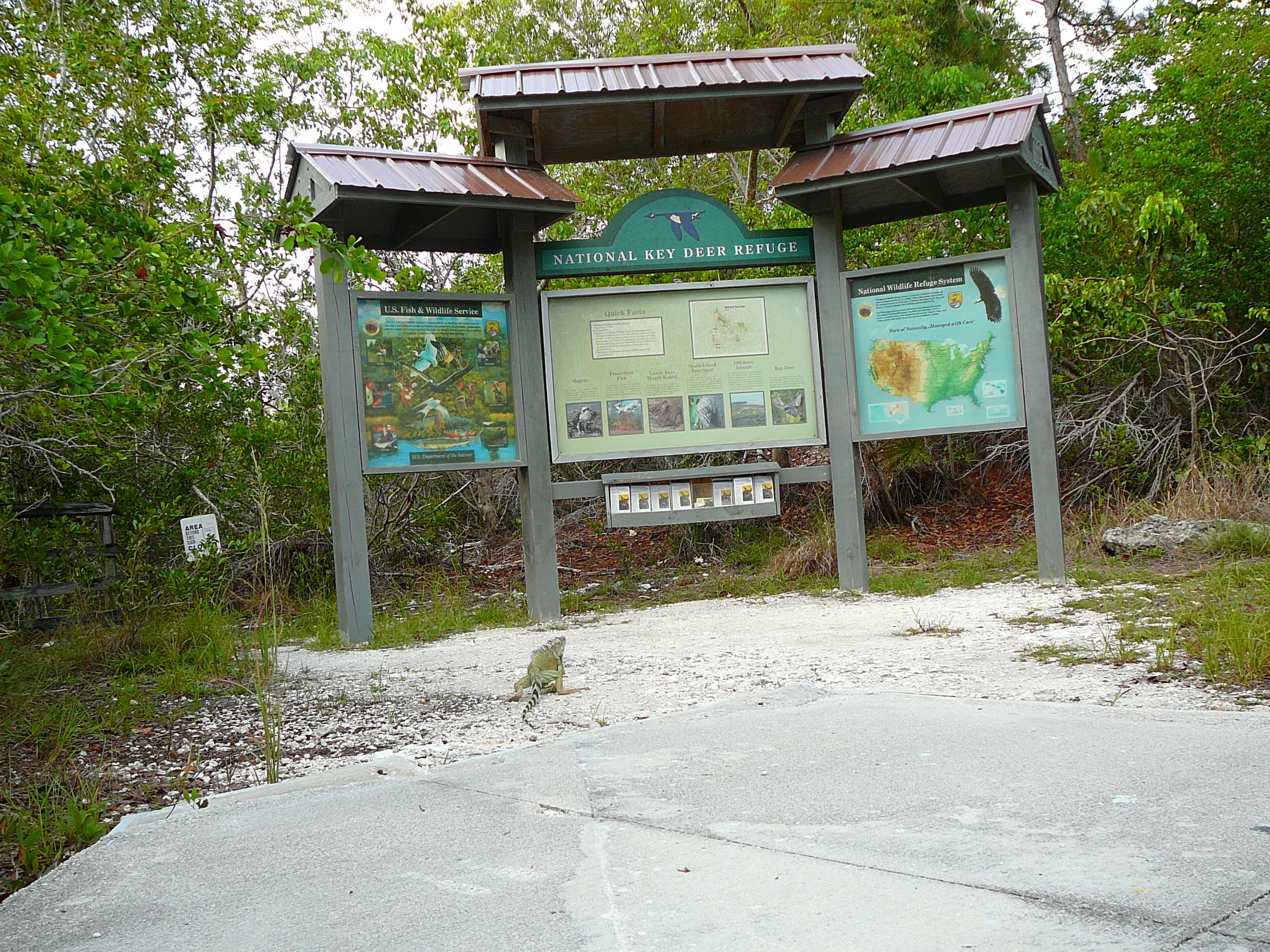
Key deer

The island of Big Pine Key is home to the National Key Deer Refuge. The majority of the Key deer population are found on this island.
The Key deer is the smallest subspecies of white-tailed deer. The largest bucks are less than a yard high at the shoulders and weigh approximately 80 pounds. The does are 24 to 28 inches at the shoulders and weigh approximately 65 pounds. They have many habitats in the Florida Keys including pine rocklands, hardwood hammocks, mangroves, and freshwater wetlands. Key deer are only found from Big Pine Key to Sugarloaf Key.
As Key deer are endangered, many precautions have been taken to preserve as much Key deer habitat as possible:
- Signs are prominently placed along US 1 to inform drivers that they are entering Key deer habitat, and warning them that feeding Key deer is prohibited.
- About 2 miles of US 1 on the eastern end of Big Pine Key are elevated and fenced off to allow Key deer to pass under the road.
- The stretch of US 1 in Big Pine Key has a night-time speed limit of 35 miles per hour (as Key deer are most active at night) and the speed limits (45 MPH in the day) are "strictly enforced" according to signage.
References
References
- "2022 U.S. Gazetteer Files: Florida". United States Census Bureau.
- "P1. Race – Big Pine Key CDP, Florida: 2020 DEC Redistricting Data (PL 94-171)". U.S. Census Bureau.
- "U.S. Census website". [[United States Census Bureau]].
- {{GNIS. 2402688
- "Census of Population and Housing". Census.gov.
- "Explore Census Data".
- "U.S. Census website". [[United States Census Bureau]].
- "The Florida Keys:Lower Keys".
- [http://www.keyshistory.org/bigpinekey.html History of Big Pine Key]; [http://www.florida-keys.cc/Florida-Keys-Big-Pine-Key.php Big Pine Key Information] {{Webarchive. link. (2008-06-27)
- "Land Mammals - Key Deer".
This article was imported from Wikipedia and is available under the Creative Commons Attribution-ShareAlike 4.0 License. Content has been adapted to SurfDoc format. Original contributors can be found on the article history page.
Ask Mako anything about Big Pine Key, Florida — get instant answers, deeper analysis, and related topics.
Research with MakoFree with your Surf account
Create a free account to save articles, ask Mako questions, and organize your research.
Sign up freeThis content may have been generated or modified by AI. CloudSurf Software LLC is not responsible for the accuracy, completeness, or reliability of AI-generated content. Always verify important information from primary sources.
Report