From Surf Wiki (app.surf) — the open knowledge base
Big Bear City, California
Census-designated place in California, United States
Census-designated place in California, United States
| Field | Value |
|---|---|
| name | Big Bear City, California |
| settlement_type | Unincorporated community |
| Census-designated place | |
| image_skyline | Big Bear City.jpg |
| image_caption | Looking west at corner of Big Bear Boulevard and Greenway in Big Bear City. This is where Highways 18 and 38 cross over. |
| image_map | San_Bernardino_County_California_Incorporated_and_Unincorporated_areas_Big_Bear_City_Highlighted.svg |
| mapsize | 250x200px |
| map_caption | Location in San Bernardino County and the state of California |
| coordinates | |
| coordinates_footnotes | |
| pushpin_map | USA |
| pushpin_map_caption | Location in the United States |
| pushpin_relief | 1 |
| subdivision_type | Country |
| subdivision_name | United States |
| subdivision_type1 | State |
| subdivision_name1 | California |
| subdivision_type2 | County |
| subdivision_name2 | San Bernardino |
| unit_pref | Imperial |
| area_footnotes | |
| area_total_sq_mi | 32.03 |
| area_land_sq_mi | 32.02 |
| area_water_sq_mi | 0.02 |
| area_total_km2 | 82.96 |
| area_land_km2 | 82.92 |
| area_water_km2 | 0.04 |
| area_water_percent | 0.05 |
| elevation_footnotes | |
| elevation_ft | 6772 |
| elevation_m | 2064 |
| population_as_of | 2020 |
| population_total | 12738 |
| population_density_km2 | 153.62 |
| population_density_sq_mi | 397.88 |
| timezone | Pacific |
| utc_offset | −8 |
| timezone_DST | PDT |
| utc_offset_DST | −7 |
| postal_code_type | ZIP Codes |
| postal_code | 92314, 92386 |
| area_code_type | Area code |
| area_code | 909 |
| blank_name | FIPS code |
| blank_info | |
| blank1_name | GNIS feature IDs |
| blank1_info | 2407838 |
the unincorporated town
Census-designated place
Big Bear City is an unincorporated community and census-designated place in San Bernardino County, California, United States along the east shore of Big Bear Lake and surrounded by the San Bernardino National Forest. It is 27 mi northeast of the city of San Bernardino, and immediately east of the incorporated city of Big Bear Lake. Its population was 12,738 at the 2020 census, up from 12,304 at the 2010 census. Big Bear City is mostly residential, with smaller houses and cabins laid out in typical square block fashion. Big Bear is on the Pacific Crest Trail.
Standard Air Lines of Los Angeles began a regular airline service to the community in the summer of 1929. Its post office was founded as Van Duesen in 1927 but changed its name to Big Bear City six months later. The Big Bear City Post Office opened in 1928 and still operates.
Despite the name, Big Bear City is not an incorporated city, and should not be confused with the adjacent incorporated city of Big Bear Lake.
Etymology
Big Bear got its name due to the large number of grizzly bears that once roamed the area. Although grizzly bears were exterminated in the valley at the turn of the 20th century, there are still thousands of black bears found in Big Bear Valley.
History
Pre-colonial period
The first humans to inhabit Big Bear Valley were the Serrano Indians, who trace their beginnings to Bear Valley. Serrano means mountaineers, or those of the Sierras. The Serrano people that settled much of the San Bernardino Mountains, called themselves Yuhaviatam, or: people of the pines.
It is estimated that the Serrano natives first settled in Big Bear between 1,500 and 2,000 years ago. The Serranos had both winter and summer settlements throughout the area. While their winter village was located in Lucerne Valley, they relocated to villages in the San Bernardino mountains during summer, as the altitude provided cooler temperatures. Villages were often located by rivers and lakes, however, mountain hunting camps were also established on higher elevations. Besides hunting, they also consumed pinyon nuts, mesquite beans, screw-beans, juniper berries and seeds. One of four major Serrano ethnographic sites was located in Big Bear City, called: Kayah-pia-t. Big Bear, and Lucerne Valley clans, both belonged to the same tribe: the Coyote Pervetum.
Settling here because of the region's many natural resources, they harvested acorns and herbs, but also hunted deer, rabbits, and other wildlife. A number of mortar holes can be seen in Big Bear City; these holes made by the Serranos, were utilized to ground acorns into meals. The oldest known remains of a human settlement in Big Bear Valley can be seen at the Indian Grinding Rocks in Big Bear City, called: The Eye of God, which is a sacred site to the Serrano people. The Serrano's creation narrative took place at The Eye of God, which was known as Hatauva.
The earliest known contact with European settlers in Big Bear occurred when Spanish Father Francisco Garcés arrived during his 1774-1776 expedition. Another source states, that the first contact happened in 1845 during a punitive expedition against the Native-Americans.
Geography
For statistical purposes, the United States Census Bureau has defined Big Bear City as a census-designated place (CDP). According to the United States Census Bureau, the CDP has a total area of 32.0 sqmi, 99.95% of it land, and 0.05% of it water.
The nearby ski resorts consist of Snow Summit and Bear Mountain.
Most of the town and the business district are centered on Big Bear Boulevard. Its limits are defined on the west by Division Road and on the east by the left turn at Highway 38, which goes to Redlands and Highway 18 which goes south to San Bernardino and north to Lucerne Valley. Though its south boundary is loosely defined by the residential boundary, the north side is defined by North Shore Road. The east–west postal divider of Big Bear City is Green Way Drive. It is here that Highway 18 (Big Bear Boulevard) turns north and crosses over to North Shore Drive heading east toward Lucerne Valley, and Highway 38 coming from the east turns north to North Shore and heads west to Big Bear Dam in the city of Big Bear Lake, California.
Sugarloaf is a large residential area that lies to the south of Big Bear City.
Demographics
|align-fn=center 1850–1870 1880-1890 1900 1910 1920 1930 1940 1950 1960 1970 1980 1990 2000 2010
Big Bear Lake was first listed as an unincorporated place in the 1950 U.S. census; and then as a census designated place in the 1980 U.S. census. A portion of the CDP was incorporated as the city of Big Bear Lake prior to the 1990 U.S. census.
2020
The 2020 United States census reported that Big Bear City had a population of 12,738. The population density was 397.9 PD/sqmi. The racial makeup of Big Bear City was 73.9% White, 0.9% African American, 1.5% Native American, 1.1% Asian, 0.3% Pacific Islander, 9.4% from other races, and 12.9% from two or more races. Hispanic or Latino of any race were 22.6% of the population.
The census reported that 99.8% of the population lived in households, 0.2% lived in non-institutionalized group quarters, and no one was institutionalized.
There were 5,523 households, out of which 22.3% included children under the age of 18, 43.5% were married-couple households, 7.6% were cohabiting couple households, 25.9% had a female householder with no partner present, and 23.0% had a male householder with no partner present. 31.3% of households were one person, and 14.4% were one person aged 65 or older. The average household size was 2.3.
The age distribution was 18.8% under the age of 18, 6.5% aged 18 to 24, 22.7% aged 25 to 44, 29.3% aged 45 to 64, and 22.7% who were 65years of age or older. The median age was 47.1years. For every 100 females, there were 101.9 males.
There were 12,086 housing units at an average density of 377.5 /mi2, of which 5,523 (45.7%) were occupied. Of these, 71.8% were owner-occupied, and 28.2% were occupied by renters.
2023 estimates
In 2023, the US Census Bureau estimated that 4.9% of the population were foreign-born. Of all people aged 5 or older, 85.0% spoke only English at home, 10.4% spoke Spanish, 2.6% spoke other Indo-European languages, 0.8% spoke Asian or Pacific Islander languages, and 1.2% spoke other languages. Of those aged 25 or older, 91.8% were high school graduates and 28.4% had a bachelor's degree.
The median household income was $72,457, and the per capita income was $38,030. About 11.0% of families and 15.3% of the population were below the poverty line.
Government
In the California State Legislature, Big Bear City is in , and in .
In the United States House of Representatives, Big Bear City is in .
Transportation
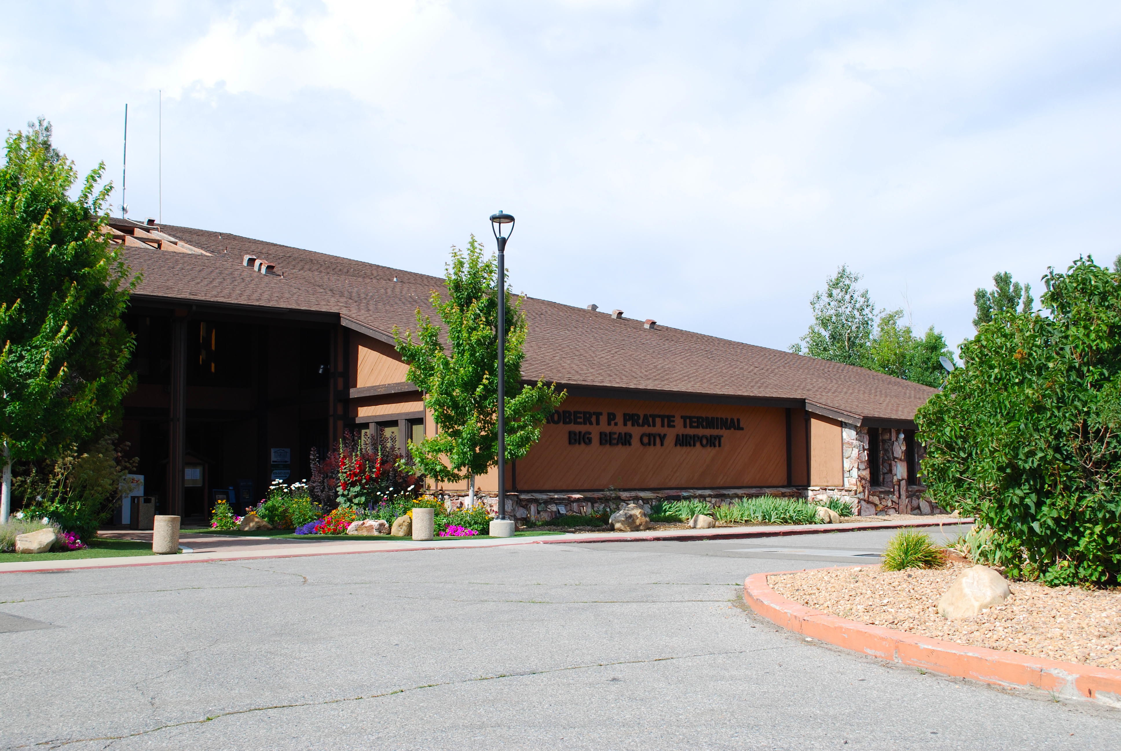
Big Bear City Airport is a general aviation airport in Big Bear City. There are no commercial air services to this airport, although at least two airlines, including Trans World Airlines, have served Big Bear in the past. This airport may also be used for medical evacuations, and as a base for forest-fighting aircraft when there are fires close by. The airport is very popular with local general aviation pilots.
Education
It is in the Bear Valley Unified School District.
Wildlife
Mammals such as squirrels, chipmunks, raccoons, coyotes and skunks are commonly sighted, while black bears, mountain lions, bobcats, gray foxes and mule deer are more rarely observed.
Potentially dangerous animals include mountain lions, black bears and coyotes. A mountain lion responsible for eating a dog was killed by the sheriff in Big Bear City in 2010.
Although grizzly bears were previously common, they became extinct from Big Bear Valley in 1906.
References
References
- {{Cite GNIS. 1660331. Big Bear City
- "2020 U.S. Gazetteer Files". United States Census Bureau.
- {{GNIS. 2407838
- "QuickFacts: Big Bear City CDP, California". United States Census Bureau.
- "Pacific Crest Trail Towns - HikerFeed".
- Garrett, Lewis (2000). ''Place Names of the San Bernardino Mountains''. Big Bear City, CA: Big Bear Valley Historical Society. pp. 10-11.
- Keller, Russell L. (2008). ''Big Bear (Postcard History: California)''. Arcadia Publishing. Page 9. {{ISBN. 9780738559124.
- Hickman, Jim (2007). ''Big Bear Trails: A Guide to the Trails In and Around Big Bear Valley''. Mojave Copy & Printing. Page 55.
- Keller, Russell L. (2008). ''Big Bear (Postcard History: California)''. Arcadia Publishing. Page 7. {{ISBN. 9780738559124.
- Kroeber, Alfred Louis (1925). ''Handbook of the Indians of California''. Courier Corporation. Page 611. {{ISBN. 9780486233680.
- Hickman, Jim (2007). ''Big Bear Trails: A Guide to the Trails In and Around Big Bear Valley''. Mojave Copy & Printing. Page 63.
- ''San Bernardino National Forest (N.F.), Lucerne Valley to Big Bear Valley Transmission Line/Substation Project, Construction and Operation of Three Electrical Power Facilities: Environmental Impact Statement'' (1998). United States Forest Service. Page 3-123.
- Bellamy, Stanley E. (2007). ''Running Springs''. Arcadia Publishing. Page 10. {{ISBN. 9780738546797.
- Hickman, Jim (2007). ''Big Bear Trails: A Guide to the Trails In and Around Big Bear Valley''. Mojave Copy & Printing. Pages 62-63.
- Fincher-Reichardt, Barbara (1983). ''The Indians of Big Bear Valley''. Big Bear City, CA: Big Bear Valley Historical Society. Page 2.
- Fincher-Reichardt, Barbara (1983). ''The Indians of Big Bear Valley''. Big Bear City, CA: Big Bear Valley Historical Society. Pages 22 and 1.
- ''San Bernardino National Forest (N.F.), Lucerne Valley to Big Bear Valley Transmission Line/Substation Project, Construction and Operation of Three Electrical Power Facilities: Environmental Impact Statement'' (1998). United States Forest Service. Page 3-124.
- "Decennial Census by Decade".
- "1870 Census of Population - Population of Civil Divisions less than Counties - California - Almeda County to Sutter County".
- "1870 Census of Population - Population of Civil Divisions less than Counties - California - Tehama County to Yuba County".
- "1890 Census of Population - Population of California by Minor Civil Divisions".
- "1900 Census of Population - Population of California by Counties and Minor Civil Divisions".
- "1910 Census of Population - Supplement for California".
- "1920 Census of Population - Number of Inhabitants - California".
- "1930 Census of Population - Number and Distribution of Inhabitants - California".
- "1940 Census of Population - Number of Inhabitants - California".
- "1950 Census of Population - Number of Inhabitants - California".
- "1960 Census of Population - Number of Inhabitants - California".
- "1970 Census of Population - Number of Inhabitants - California".
- "1980 Census of Population - Number of Inhabitants - California".
- "1990 Census of Population - Population and Housing Unit Counts - California".
- "2000 Census of Population - Population and Housing Unit Counts - California".
- "2010 Census of Population - Population and Housing Unit Counts - California".
- "Big Bear City CDP, California; DP1: Profile of General Population and Housing Characteristics - 2020 Census of Population and Housing".
- "Big Bear City CDP, California; P16: Household Type - 2020 Census of Population and Housing".
- "Big Bear City CDP, California; CP02: Comparative Social Characteristics in the United States - 2023 ACS 5-Year Estimates Comparison Profiles".
- "Big Bear City CDP, California; DP03: Selected Economic Characteristics - 2023 ACS 5-Year Estimates Comparison Profiles".
- "Statewide Database". UC Regents.
- {{Cite GovTrack. CA. 8
- "The Big Bear City Airport".
- "2020 CENSUS - SCHOOL DISTRICT REFERENCE MAP: San Bernardino County, CA". [[U.S. Census Bureau]].
- "About Big Bear - Animals of Big Bear Lake".
- "Wildlife in the Big Bear Valley".
- Bowers, Judi. (May 12, 2010). "Wild animals live here".
- Bellamy, Stanley E. (2006). ''Big Bear (CA): Images of America''. Arcadia Publishing. Page 10. {{ISBN. 9780738531113.
- Keller, Russell L. (2008). ''Big Bear (Postcard History)''. Arcadia Publishing. Page 9. {{ISBN. 9780738559124.
This article was imported from Wikipedia and is available under the Creative Commons Attribution-ShareAlike 4.0 License. Content has been adapted to SurfDoc format. Original contributors can be found on the article history page.
Ask Mako anything about Big Bear City, California — get instant answers, deeper analysis, and related topics.
Research with MakoFree with your Surf account
Create a free account to save articles, ask Mako questions, and organize your research.
Sign up freeThis content may have been generated or modified by AI. CloudSurf Software LLC is not responsible for the accuracy, completeness, or reliability of AI-generated content. Always verify important information from primary sources.
Report