From Surf Wiki (app.surf) — the open knowledge base
Bhavani River
River in India
River in India
| Field | Value |
|---|---|
| name | Bhavani River |
| image | Westernghats river gobi.jpg |
| image_caption | Bhavani River |
| map | Topo map Attappati Reserve Forest.jpg |
| map_caption | Headwaters of the Bhavani River |
| source1_location | Western Ghats |
| mouth_location | Kaveri |
| subdivision_type1 | Country |
| subdivision_name1 | India |
| subdivision_type2 | States |
| subdivision_name2 | |
| subdivision_type3 | Districts |
| subdivision_name3 | |
| subdivision_type4 | Cities |
| subdivision_name4 | |
| length | 234 km |
Bhavani is an Indian river which flows through the states of Kerala and Tamil Nadu. It originates in the Nilgiris in the Western Ghats in Tamil Nadu, and flows westwards into Kerala for some distance, before turning east, and flowing back towards Tamil Nadu. It stretches for 234 km, and joins the Kaveri at Kooduthurai. The river basin covers an area of 1,410 km2 across three districts in Tamil Nadu. The major tributaries include the Moyar, and Siruvani Rivers. There are multiple dams across the river, including the Upper Bhavani, Bhavanisagar dam, and Kodiveri dam.
Hydrography
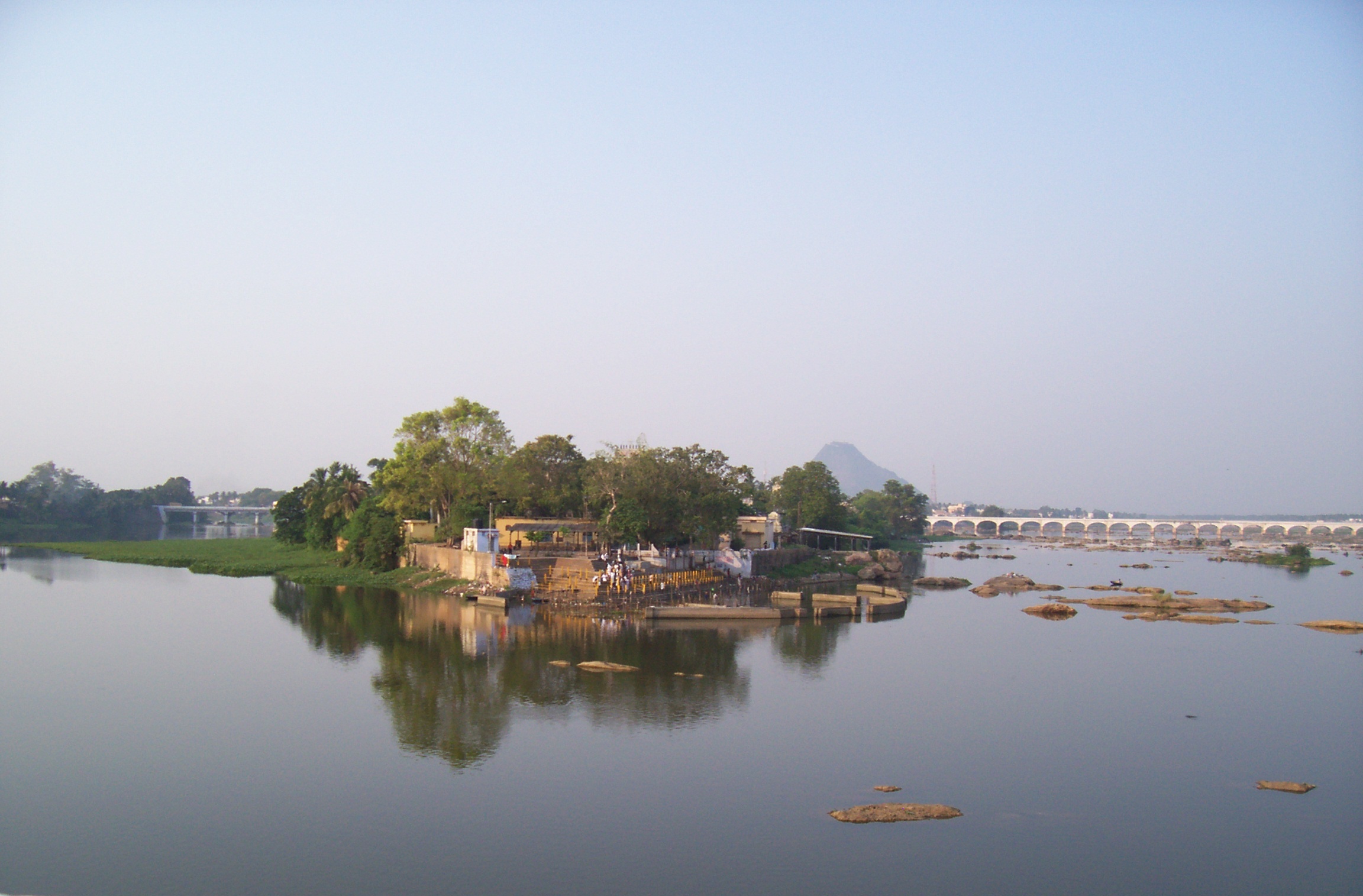
The Bhavani is a 234 km long perennial river fed by monsoons. The river originates at an altitude of 2634 m in the Billimala range of the Nilgiris in the Western Ghats in Tamil Nadu. It flows westwards towards the Silent Valley National Park in Kerala, before later turning eastwards and flowing through the Attappadi valley in Palakkad district. Later, it re-enters Tamil Nadu, and flows through the districts of Nilgiris, Coimbatore, and Erode. The river basin covers an area of 1410 km2. Various rivulets and tributaries join the Bhavani river during its course. Major tributaries include the Moyar, and Siruvani Rivers. Bhavani is one of the major tributaries of the Kaveri, which it joins at the Kooduthurai near Bhavani.
Industrial, municipal and agricultural pollution of the river results in poor water quality and negative impacts on the health of people, plants and animals dependent on the river water.
Dams and canals
In Tamil Nadu, the Upper Bhavani dam is constructed close to the source of the Bhavani river in Nilgiris, and the Bhavanisagar dam in the lower reaches of the river in the plains. After multiple proposals since the early 19th century, the upper and lower Bhavani projects were implemented in the mid 20th century. There are multiple minor check dams and irrigation canals constructed across the river in Kerala, largely constructed in the 21st century.
;Bhavanisagar
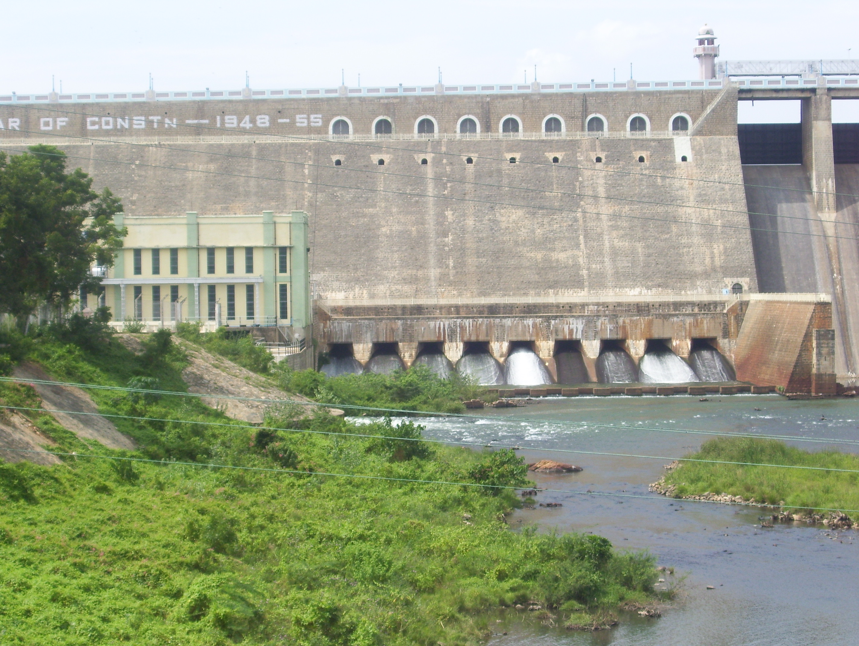
The Bhavanisagar dam is located on the Bhavani river in Erode district. The dam is one of the largest earthen dams in the world. The dam is situated some 16 km west of Sathyamangalam. The Lower Bhavani Project was the first major irrigation project initiated in independent India in 1948. The dam was completed in 1955 at a cost of and was opened in 1956.
The dam is 8 km long and 40 m high, with a full reservoir level of 120 ft and a capacity of 32.8 e9cuft. The dam has two hydel power stations, one on the east bank canal and the other on the river. Each has a capacity of 16 MW for a total capacity of 32 MW.
;Kodiveri
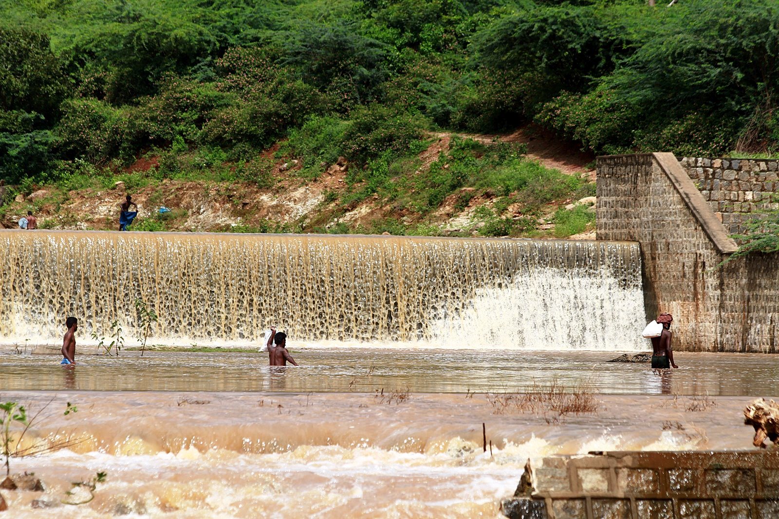
The Kodiveri dam is located on the Bhavani River near Gobichettipalayam in Erode district. A channel was excavated at Kodiveri in 1125 CE by Kongalvan, a chieftain under the rule of Chola king Kulottunga I. The dam was constructed in the 17th century by Maharaja of Mysore. The dam feeds the Arakkankottai and Thadappalli canals constructed for irrigation.
;Kalingarayan Anicut Kalingarayan Anicut is located near Bhavani in Erode district. The 90.5 km long Kalingarayan canal, originating from the anicut, irrigates about 15,743 acre of agricultural land. The project, including construction of the dam and canal, started in 1271 and was completed in 1283. It was constructed by Kongu chieftain Kalingarayan.{{cite news
References
References
- (November 2022). "Aquifier mapping and groundwater management in Bhavani basin". Central Ground Water Board.
- (December 2012). "Study of Physico-Chemical Characteristics of Surface Water of Cauvery River and its tributaries". Asian Journal of Chemistry.
- Jain, S. K.. (2007). "Hydrology and water resources of India". [[Springer Publishing]].
- "Getting to know the river". [[The Hindu]].
- "Water resources". [[Anna University]].
- "Bhavani". Waterway map.
- (26 June 2012). "Human chain formed against Kerala's plan to build dam on River Siruvani". [[NDTV]].
- (23 October 2012). "Performing rituals at Kooduthurai becomes risky". [[The Hindu]].
- "River Bhavani". Rain Water Harvesting.
- "Upper Bhavani". [[Government of Tamil Nadu]].
- Velayutham Saravanan. (2020). "Water and the Environmental History of Modern India". [[Bloomsbury Publishing]].
- "Tourist Information for Erode district". [[Government of Tamil Nadu]].
- "Uniqueness of Bhavanisagar dam". Civil Service Training Institute.
- "Bhavanisagar dam". [[Tamil Nadu Agricultural University]].
- "Kongalavan who built Kodiveri dam". [[Dinakaran]].
- (1994). "Indian Archaeology, a Review". [[Archaeological Survey of India]].
- (17 August 2015). "A watery break from routine". Covai Post.
- (2009). "Adaptive water resource management in the South Indian Lower Bhavani Project Command Area". International Water Management Institute.
- (20 June 2011). "Kalingarayan sluices opened, Erode all set for farming". [[The Hindu]].
This article was imported from Wikipedia and is available under the Creative Commons Attribution-ShareAlike 4.0 License. Content has been adapted to SurfDoc format. Original contributors can be found on the article history page.
Ask Mako anything about Bhavani River — get instant answers, deeper analysis, and related topics.
Research with MakoFree with your Surf account
Create a free account to save articles, ask Mako questions, and organize your research.
Sign up freeThis content may have been generated or modified by AI. CloudSurf Software LLC is not responsible for the accuracy, completeness, or reliability of AI-generated content. Always verify important information from primary sources.
Report