From Surf Wiki (app.surf) — the open knowledge base
Bexar County, Texas
County in Texas, United States
County in Texas, United States
| Field | Value |
|---|---|
| county | Bexar County |
| state | Texas |
| type | County |
| flag | Flag of Bexar County, Texas.svg |
| seal | Coat of arms of Bexar County, Texas.svg |
| founded year | 1836 |
| founded date | December 20 |
| seat wl | San Antonio |
| largest city wl | San Antonio |
| area_total_sq_mi | 1256 |
| area_land_sq_mi | 1240 |
| area_water_sq_mi | 16 |
| area percentage | 1.3% |
| census yr | 2020 |
| pop | 2009324 |
| pop_est_as_of | 2024 |
| population_est | 2127737 |
| density_sq_mi | auto |
| ex image | Bexar County Courthouse 2015.jpg |
| ex image size | 250 |
| ex image cap | The Bexar County Courthouse in San Antonio |
| web | www.bexar.org/ |
| time zone | Central |
| district | 20th |
| district2 | 21st |
| district3 | 23rd |
| district4 | 28th |
| district5 | 35th |
| named for | Presidio San Antonio de Béxar |
Bexar County ( or ; ) is a county in the U.S. state of Texas. It is in South Texas and its county seat is San Antonio.
As of the 2020 census, the population was 2,009,324, making it the state's fourth-most populous county. Bexar County is included in the San Antonio–New Braunfels, TX metropolitan statistical area. It is the 16th-most populous county in the nation and the fourth-most populated in Texas. Bexar County has a large Hispanic population with a significant growing African American population. With a population that is 59.3% Hispanic as of 2020, it is Texas' most populous majority-Hispanic county and the third-largest such nationwide.
History
Bexar County was created on December 20, 1836, and encompassed almost the entire western portion of the Republic of Texas. This included the disputed areas of eastern New Mexico northward to Wyoming. After statehood, 128 counties were carved out of its area.
The county was named for San Antonio de Béxar, one of the 23 Mexican municipalities (administrative divisions) of Texas at the time of its independence. San Antonio de Béxar—originally Villa de San Fernando de Béxar—was the first civil government established by the Spanish in the province of Texas. Specifically, the municipality was created in 1731 when 55 Canary Islanders settled near the system of missions that had been established around the source of the San Antonio River. The new settlement was named after the Presidio San Antonio de Béjar, the Spanish military outpost that protected the missions. The presidio, located at the San Pedro Springs, was founded in 1718 and named for Viceroy Balthasar Manuel de Zúñiga y Guzmán Sotomayor y Sarmiento, second son of the Duke of Béjar (a town in Spain). The modern city of San Antonio in the U.S. state of Texas also derived its name from San Antonio de Béjar.
Native Americans and the Texas-Indian Wars
Natives that lived in the county included the Lipan Apache, Payaya, Tonkawa, and Comanche. From the early 1700s to the late 1800s, the county was a target of several raids and attacks by Native Americans, mainly Comanches and Kiowas. In 1831, a presidial company exterminated a band of Comanches in the western part of the county.In 1840, Comanches and Texans fought at the Council House Fight in what was supposed to be a peaceful meeting. On March 5, 1856, six Comanches attacked and killed two settlers on Cibolo Creek.In 1869, Kickapoos stole horses and killed settlers in the county. In 1870, Comanches killed Helotes settlers and stole horses. Also, in 1871, Indians raided the Maverick Ranch in the northwestern part of the county. The last Indian raid in the county occurred on July 9, 1873, when a raiding party of Indians and Mexicans killed settlers, including a well known Indian fighter, John Frank Green, in the northwestern part of the county, also relatively close to Helotes.
Geography
According to the U.S. Census Bureau, the county has a total area of 1256 sqmi, of which 16 sqmi (1.3%) are covered by water. Bexar County is in south-central Texas, about 190 mi west of Houston and 140 miles from both the US-Mexican border to the southwest and the Gulf of Mexico to the southeast.
The Balcones Escarpment bisects the county from west to northeast; to the north of the escarpment are the rocky hills, springs and canyons of the Texas Hill Country. South of the escarpment are Blackland Prairie and the South Texas plains. The San Antonio River rises from springs north of Downtown San Antonio, and flows southward and southeastward through the county.
Major highways
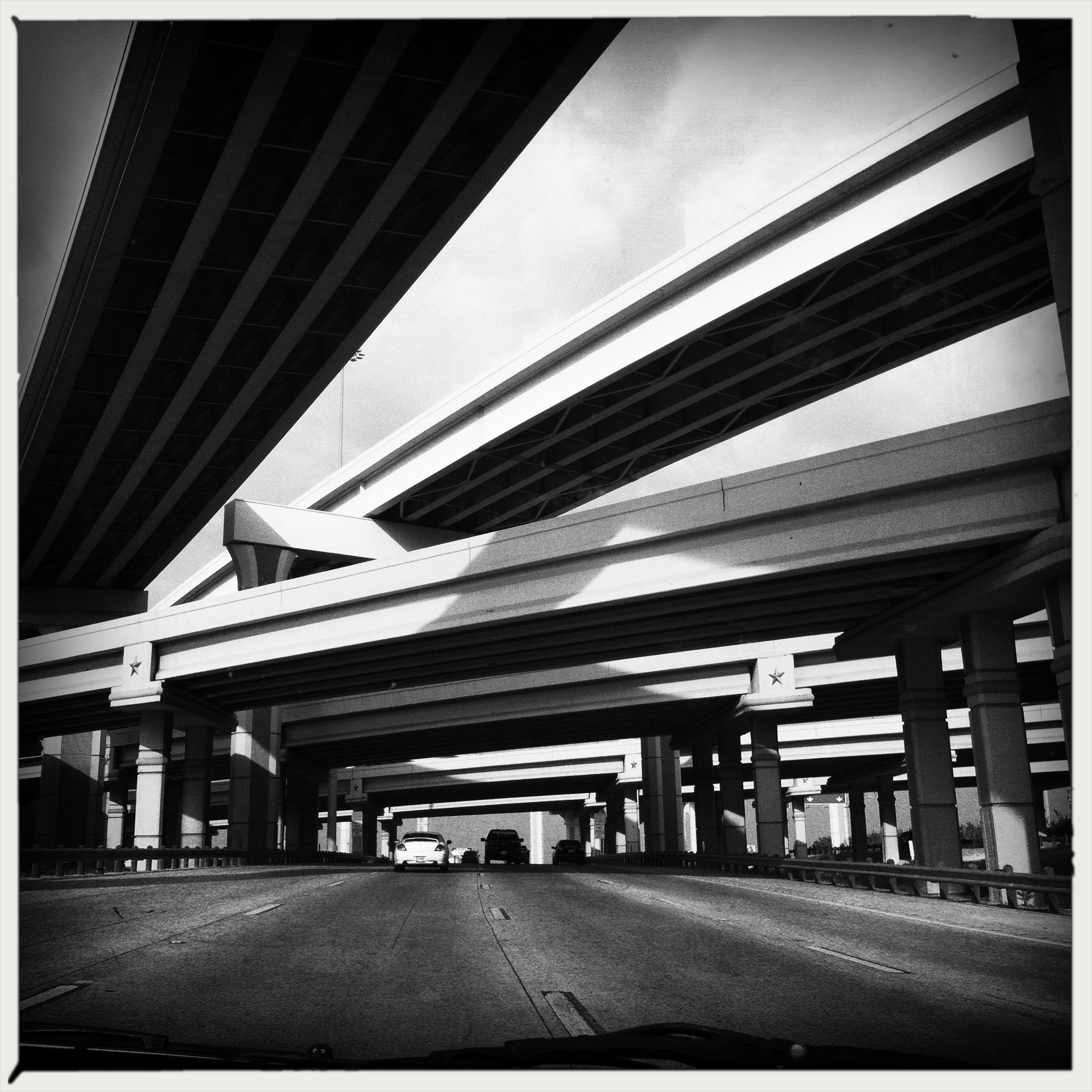
Bexar County has a comprehensive "wagon wheel" highway system, with radial highways and beltways that encircle Downtown San Antonio, allowing for simplified countywide highway access, much like the highway around Houston or Dallas. San Antonio is unique, however, in that unlike Houston or Dallas, none of these highways are currently tolled.
- [[File:I-10 (TX).svg|20px]] Interstate 10
- [[File:I-35 (TX).svg|20px]] Interstate 35
- [[File:I-37 (TX).svg|20px]] Interstate 37
- [[File:I-410 (TX).svg|25px]] Interstate 410
- [[File:US 87.svg|20px]] U.S. Route 87
- [[File:US 90.svg|20px]] U.S. Route 90
- [[File:US 181.svg|25px]] U.S. Route 181
- [[File:US 281.svg|25px]] U.S. Route 281
- [[File:Texas 16.svg|20px]] State Highway 16
- [[File:Texas Loop 1604.svg|20px]] State Highway Loop 1604
Adjacent counties
- Kendall County (north)
- Comal County (northeast)
- Guadalupe County (east)
- Wilson County (southeast)
- Atascosa County (south)
- Medina County (west)
- Bandera County (northwest)
National protected area
- San Antonio Missions National Historical Park
State parkland
- Government Canyon State Natural Area
Communities
Cities
Multiple counties
- Cibolo (mostly in Guadalupe County)
- Elmendorf (small part in Wilson County)
- Fair Oaks Ranch (partly in Kendall and Comal counties)
- Lytle (mostly in Atascosa County and a small part in Medina County)
- San Antonio (county seat) (small parts in Comal and Medina counties)
- Schertz (partly in Guadalupe and Comal counties)
- Selma (partly in Guadalupe and Comal counties)
- Universal City (small part in Guadalupe County)
Enclave cities
- Alamo Heights
- Balcones Heights
- Castle Hills
- Hill Country Village
- Kirby
- Leon Valley
- Olmos Park
- Shavano Park
- Terrell Hills
Bexar County only
- Converse
- Grey Forest
- Helotes
- Live Oak
- Sandy Oaks
- Somerset
- Von Ormy
- Windcrest
Towns
- China Grove
- Hollywood Park
- St. Hedwig
Census-designated places
- Cross Mountain
- Lackland Air Force Base
- Macdona
- Randolph Air Force Base
- Scenic Oaks
- Timberwood Park
Other unincorporated communities
- Adkins
- Atascosa
- Bexar
- Boldtville
- Buena Vista
- Cassin
- Leon Springs
- Losoya
- Martinez
- Sayers
- Southton
- Thelma
Former communities
- Cottage Hill
- Fratt
- Stone Oak
- Wetmore
Demographics
| align-fn = center 1850–2010 2010–2020
Racial and ethnic composition
| Race / Ethnicity (NH = Non-Hispanic) | Pop 1990 | Pop 2000 | Pop 2010 | % 1990 | % 2000 | % 2010 |
|---|---|---|---|---|---|---|
| White alone (NH) | 496,149 | 496,245 | 519,123 | 535,732 | 41.86% | 35.63% |
| Black or African American alone (NH) | 81,356 | 95,984 | 118,460 | 147,875 | 6.86% | 6.89% |
| Native American or Alaska Native alone (NH) | 2,506 | 3,499 | 3,809 | 4,554 | 0.21% | 0.25% |
| Asian alone (NH) | 13,832 | 21,369 | 39,561 | 65,127 | 1.17% | 1.53% |
| Pacific Islander alone (NH) | N/A | 947 | 1,806 | 2,726 | N/A | 0.07% |
| Other race alone (NH) | 2,371 | 1,500 | 2,881 | 8,218 | 0.20% | 0.11% |
| Mixed race or Multiracial (NH) | N/A | 16,354 | 22,175 | 54,044 | N/A | 1.17% |
| Hispanic or Latino (any race) | 589,180 | 757,033 | 1,006,958 | 1,190,958 | 49.70% | 54.35% |
| Total | 1,185,394 | 1,392,931 | 1,714,773 | 2,009,324 | 100.00% | 100.00% |
2020 census

As of the 2020 census, the county had a population of 2,009,324. The median age was 34.9 years. 24.7% of residents were under the age of 18 and 13.2% of residents were 65 years of age or older. For every 100 females there were 95.7 males, and for every 100 females age 18 and over there were 93.3 males age 18 and over.
The racial makeup of the county was 45.8% White, 8.0% Black or African American, 1.2% American Indian and Alaska Native, 3.4% Asian, 0.2% Native Hawaiian and Pacific Islander, 15.3% from some other race, and 26.1% from two or more races. Hispanic or Latino residents of any race comprised 59.3% of the population.
95.3% of residents lived in urban areas, while 4.7% lived in rural areas.
There were 726,886 households in the county, of which 35.0% had children under the age of 18 living in them. Of all households, 44.5% were married-couple households, 19.3% were households with a male householder and no spouse or partner present, and 28.9% were households with a female householder and no spouse or partner present. About 25.9% of all households were made up of individuals and 8.3% had someone living alone who was 65 years of age or older.
There were 794,173 housing units, of which 8.5% were vacant. Among occupied housing units, 58.7% were owner-occupied and 41.3% were renter-occupied. The homeowner vacancy rate was 1.7% and the rental vacancy rate was 10.5%.
2010 census
As of the 2010 United States census, there were 1,714,773 people living in the county. Of those, 72.9% were White, 7.5% Black or African American, 2.4% Asian, 0.8% Native American, 0.1% Pacific Islander, 12.7% of some other race and 3.5% of two or more races. 58.7% were Hispanic or Latino (of any race).
A Williams Institute analysis of 2010 census data found there were about 6.2 same-sex couples per 1,000 households in the county.

2000 census
As of the 2000 census, 1,392,931 people, 488,942 households, and 345,681 families were residing in the county. The population density was 1117 PD/sqmi. There were 521,359 housing units at an average density of 418 /mi2. The racial makeup of the county was 68.86% White, 7.18% Black or African American, 0.80% Native American, 1.61% Asian, 0.10% Pacific Islander, 17.80% from other races, and 3.64% from two or more races. About 54.35% of the population were Hispanic or Latino of any race.
Of 488,942 households, 36.60% had children under the age of 18 living with them, 50.50% were married couples living together, 15.50% had a female householder with no husband present, and 29.30% were not families. About 24.00% of all households were made up of individuals, and 7.40% had someone living alone who was 65 years of age or older. The average household size was 2.78 and the average family size was 3.33.
In the county, the population was distributed as 28.50% under the age of 18, 10.70% from 18 to 24, 30.60% from 25 to 44, 19.90% from 45 to 64, and 10.40% who were 65 years of age or older. The median age was 32 years. For every 100 females, there were 94.70 males. For every 100 females age 18 and over, there were 91.20 males.
The median income for a household was $38,328, and for a family was $43,724. Males had a median income of $30,756 versus $24,920 for females. The per capita income for the county was $18,363. About 12.70% of families and 15.90% of the population were below the poverty line, including 22.40% of those under age 18 and 12.20% of those age 65 or over.
Government
Bexar County is governed by a Commissioners Court, composed of four Commissioners and one County Judge, who acts as the presiding officer. The Commissioners represent their respective precincts, which are roughly equal in population and geographic area. On July 12, 2011, the Commissioners Court established the Office of the County Manager to streamline "the functions, offices and departments that report to Commissioners Court."
Corrections
The Bexar County jail facilities are at 200 North Comal in downtown San Antonio, operated by the Bexar County Sheriff's Office (Javier Salazar, Sheriff). In late 2012, press reports noted an increase in the number of suicides at the facility. The issue was a topic of debate in the election for sheriff that year. The jail holds an average of about 3,800 prisoners in 2012, with a total capacity of 4,596, making it the fourth-largest in the state.
The Texas Department of Criminal Justice operates the Dominguez Unit, a state jail for men, in an unincorporated section of Bexar County.
Education
School districts in the county include:
- Alamo Heights Independent School District
- Boerne Independent School District
- Comal Independent School District
- East Central Independent School District
- Edgewood Independent School District
- Floresville Independent School District
- Fort Sam Houston Independent School District
- Harlandale Independent School District
- Judson Independent School District
- Lackland Independent School District
- Medina Valley Independent School District
- North East Independent School District
- Northside Independent School District
- Randolph Field Independent School District
- San Antonio Independent School District
- Schertz-Cibolo-Universal City Independent School District
- Somerset Independent School District
- South San Antonio Independent School District
- Southside Independent School District
- Southwest Independent School District
All of the county is in the service area of Alamo Community College.
Libraries
Library systems include:
- San Antonio Public Library
On September 14, 2013, Bexar County opened BiblioTech – Bexar County's Digital Library, the nation's first bookless library.
Property taxes
In 2016, for the third consecutive year, Bexar County increased the appraised value of businesses and residences. Most will hence find their property taxes will increase for the year, with higher payments for some beginning as early as November 1. The latest 7.5 percent increase in valuation follows an 11 percent rise in 2015, and a 7 percent jump in 2014. The 2016 total value for all property in the county is approximately $163 billion, or $13 billion more than in 2015. County residents express dismay to Mary Kieke, the deputy chief appraiser. "People are very upset. The tax system is absolutely broken," she said.
Military installations
- Brooks City-Base (decommissioned)
- Camp Bullis
- Fort Sam Houston
- Kelly Air Force Base (decommissioned)
- Lackland Air Force Base
- Randolph Air Force Base
- San Antonio Military Medical Center
Notable people
· Only people who already have a Wikipedia article may appear here. This establishes notability. · The article must mention how they are associated with Bexar County, whether born, raised, or residing. · The fact of their association should have a reliable source cited. · Alphabetical by last name please. · All others will be deleted.
- Carol Burnett, comedian and actress, was born and grew up in San Antonio
- Joan Crawford, actress, was born in San Antonio
- Christopher Cross (born Christopher Charles Geppert), Grammy-winning, Oscar-winning, chart-topping pop music artist of the early 80s
- Dwight D. Eisenhower, 34th President of the United States; stationed at Fort Sam Houston in 1916
- Al Freeman, Jr., was born in San Antonio; he became an actor, known for ABC soap opera One Life to Live, and Malcolm X
- Rick Galindo, Republican member of the Texas House of Representatives from District 117 in Bexar County
- Mina Myoui, singer in South Korean group Twice
- Cyndi Taylor Krier, first woman and first Republican to be elected to the Texas Senate from Bexar County (1985–1993), and first woman and first Republican to be appointed as a Bexar County administrative judge (1993 to 2001)
- James Robertson Nowlin, United States District Judge for the Western District of Texas; one of the first two Republicans since Reconstruction to represent Bexar County in the Texas House of Representatives
- Ciro D. Rodriguez, member of Congress, previously 28th District, Texas, now 23rd District, Texas
- Michelle Rodriguez, actress, James Cameron's Avatar
- Robert Rodríguez, director of Spy Kids, Desperado, and Sin City
- Joe Sage, one of the first two Republicans since Reconstruction, with James Robertson Nowlin, to represent Bexar County in the Texas House of Representatives
- Alan Schoolcraft, former Republican member of the Texas House of Representatives
- Percy Sutton, former Manhattan Borough President, and civil rights attorney; clients included Malcolm X, and the owner of the Apollo Theater in Harlem and several radio stations
- Carlos I. Uresti, member of the Texas Senate from the 19th District
- Kevin Patrick Yeary, judge of the Texas Court of Criminal Appeals, effective 2015; assistant district attorney for Bexar County, 1998–2014
Climate
| {{climate chart | Bexar County | 6 | 20 | 55 | 8 | 22 | 55 | 8 | 26 | 51 | 16 | 29 | 52 | 20 | 34 | 176 | 24 | 35 | 72 | 24 | 34 | 84 | 24 | 36 | 37 | 22 | 32 | 133 | 17 | 29 | 63 | 12 | 23 | 81 | 6 | 19 | 25 | float=left | clear=left | url= http://neo.sci.gsfc.nasa.gov/dataset_index.php | title= NASA Earth Observations Data Set Index | access-date= January 30, 2016 | publisher= NASA | archive-date= May 11, 2020 | archive-url= https://web.archive.org/web/20200511075542/https://neo.sci.gsfc.nasa.gov/dataset_index.php | url-status= dead}} |
|---|
Politics
As an urban county, Bexar County has voted for Democratic candidates in most presidential elections. From 1932 to 2012 it was a nationwide bellwether, supporting the winner in every election except 1968. Former Governor of Texas George W. Bush remains the last Republican to carry the county in presidential elections.
Democrats perform well within the Connally Loop, which contains heavily Hispanic neighborhoods on the south and west sides of San Antonio, and African Americans on the east side. In recent years, Democrats have made inroads on the Northwest Side toward the University of Texas at San Antonio, and the Northeast Side toward Kirby. Republicans' strength is concentrated around the military bases plus wealthier enclaves such as Alamo Heights, Terrell Hills, and the far northern section of the county.
References
;Specific
;General
- Stephens, A. Ray, and William M. Holmes, Historical Atlas of Texas. University of Oklahoma Press, 1989.
References
- "Bexar County History {{!}} Bexar County, TX - Official Website".
- (July 24, 2015). "Welcome To Texas: Unusual Pronunciation". [[KTVT]].
- "Find a County". National Association of Counties.
- "U.S. Census Bureau QuickFacts: Bexar County, Texas". United States Census Bureau.
- "How much do you know about your county?".
- (August 13, 2021). "Latinos, Blacks Show Strong Growth in San Antonio as White Population Declines". San Antonio Express-News.
- "P2: HISPANIC OR LATINO, AND NOT HISPANIC OR LATINO BY RACE". United States Census Bureau.
- "Home {{!}} UTA Libraries".
- "Home {{!}} UTA Libraries".
- "Park History Program (U.S. National Park Service)".
- "Helotes Small Town Research Project".
- Association, Texas State Historical. "Maverick Ranch: A Historic Landmark in Bexar County".
- Cary, Michael. (September 2005). "News No rest in peace".
- (August 22, 2012). "2010 Census Gazetteer Files". United States Census Bureau.
- "U.S. Census Bureau QuickFacts: Bexar County, Texas".
- "Decennial Census by Decade". [[US Census Bureau]].
- "Texas Almanac: Population History of Counties from 1850–2010". Texas Almanac.
- "Bexar County, Texas".
- "Texas: 1990, Part 1".
- "Texas: 2000".
- "P2 Hispanic or Latino, and Not Hispanic or Latino by Race – 2010: DEC Redistricting Data (PL 94-171) - Bexar County, Texas".
- "P2 Hispanic or Latino, and Not Hispanic or Latino by Race – 2020: DEC Redistricting Data (PL 94-171) - Bexar County, Texas".
- (2021). "2020 Decennial Census Demographic Profile (DP1)".
- (2021). "2020 Decennial Census Redistricting Data (Public Law 94-171)".
- (2023). "2020 Decennial Census Demographic and Housing Characteristics (DHC)".
- (June 26, 2015). "Where Same-Sex Couples Live". The New York Times.
- "U.S. Census website". [[United States Census Bureau]].
- "Commissioners Court {{!}} Bexar County, TX - Official Website".
- "Office of the County Manager {{!}} Bexar County, TX - Official Website".
- "BCSO Location and Driving Directions". Bexar County.
- Why have jail suicides soared under Sheriff Ortiz's watch?, by Michael Barajas, SA Current, October 17, 2012
- "Texas Commission on Jail Standards - Abbreviated Population Report for 3/1/2018".
- "Dominguez (BX)". [[Texas Department of Criminal Justice]].
- "2020 CENSUS - SCHOOL DISTRICT REFERENCE MAP: Bexar County, TX". [[U.S. Census Bureau]].
- [https://statutes.capitol.texas.gov/Docs/ED/htm/ED.130.htm Texas Education Code, Sec. 130.162. ALAMO COMMUNITY COLLEGE DISTRICT SERVICE AREA.].
- "About Us".
- (January 3, 2014). "Nation's first bookless library opens in San Antonio". [[The Dallas Morning News]].
- Bruce Selcraig, "Property valuations jump again: Most homeowners' taxes also could rise", ''[[San Antonio Express-News]]'', April 29, 2016, pp. 1, A12
- Ambrose, Stephen. (1983). "Eisenhower: (vol. 1) Soldier, General of the Army, President-Elect (1893–1952)". [[Simon & Schuster]].
- "NASA Earth Observations Data Set Index". NASA.
- Tedesco, John. (November 10, 2016). "Interactive: How Bexar County voted in the 2016 presidential election". San Antonio Express News.
- Leip, David. "Dave Leip's Atlas of U.S. Presidential Elections".
- (November 5, 2024). "2024 Senate Election (Official Returns)".
This article was imported from Wikipedia and is available under the Creative Commons Attribution-ShareAlike 4.0 License. Content has been adapted to SurfDoc format. Original contributors can be found on the article history page.
Ask Mako anything about Bexar County, Texas — get instant answers, deeper analysis, and related topics.
Research with MakoFree with your Surf account
Create a free account to save articles, ask Mako questions, and organize your research.
Sign up freeThis content may have been generated or modified by AI. CloudSurf Software LLC is not responsible for the accuracy, completeness, or reliability of AI-generated content. Always verify important information from primary sources.
Report