From Surf Wiki (app.surf) — the open knowledge base
Berkshire County, Massachusetts
County in Massachusetts, United States
County in Massachusetts, United States
| Field | Value |
|---|---|
| county | Berkshire County |
| state | Massachusetts |
| type | County |
| seal | Seal of Berkshire County, Massachusetts.png |
| seal size | 90 |
| flag | Flag of Berkshire County, Massachusetts.gif |
| flag size | 110 |
| motto | Firmus et Paratus |
| (Latin "Steadfast and Ready") | |
| founded year | 1761 |
| founded date | April 24 |
| seat wl | Pittsfield |
| largest city wl | Pittsfield |
| area_total_sq_mi | 946 |
| area_land_sq_mi | 927 |
| area_water_sq_mi | 20 |
| area percentage | 2.1% |
| census yr | 2020 |
| pop | 129026 |
| pop_est_as_of | 2024 |
| population_est | 128726 |
| density_sq_mi | auto |
| demonym | Berkshirite |
| ex image | {{multiple image |
| total_width | 288 |
| border | infobox |
| perrow | 1/2/2/2 |
| caption_align | center |
| image1 | Downtown_and_Park_Square,_Pittsfield,_Massachusetts.jpg |
| alt1 | LY |
| caption1 | Pittsfield |
| image2 | Naumkeag_(Stockbridge,_MA)_-_general_view.JPG |
| alt2 | Fitchburg |
| caption2 | Naumkeag |
| image3 | MASS_MoCA_1.jpg |
| alt3 | Lawrence |
| caption3 | Massachusetts Museum of Contemporary Art |
| image4 | Tanglewood_Music_Shed_and_Lawn,_Lenox,_MA.JPG |
| alt4 | CE |
| caption4 | Tanglewood |
| image5 | Morgan_Hall_of_Williams_College_in_the_fall_(27_October_2010).jpg |
| alt5 | JH |
| caption5 | Williams College |
| image6 | Mount_Greylock_State_Reservation.jpg |
| alt6 | MBTS |
| caption6 | Mount Greylock |
| district | 1st |
| time zone | Eastern |
| named for | Berkshire, England |
(Latin "Steadfast and Ready")

Berkshire County (pronounced ) is the westernmost county in the U.S. state of Massachusetts. As of the 2020 census, the population was 129,026. Its largest city and traditional county seat is Pittsfield. The county was founded in 1761. The Berkshire Hills are centered on Berkshire County. Residents are known as Berkshirites. It exists today only as a historical geographic region, and has no county government, with the exception of the retirement board for former county workers, and the offices of the sheriff and the registrar of deeds.
Law and government
Of the fourteen Massachusetts counties, Berkshire County is one of eight that exists today only as a historical geographic region; it has limited county government. Berkshire County government was abolished effective July 1, 2000. Most former county functions were assumed by state agencies, and there is no county council or commission. The sheriff became a Commonwealth employee, but remains locally elected to perform duties within the county region and retains administrative and operational control over the Berkshire Sheriff's Office, an independent state agency created after the county government was abolished. The Berkshire Sheriff's Office runs the county jail and house of correction.
Local communities were granted the right to form their own regional compacts for sharing services, and the towns of Berkshire County have formed such a regional compact known as the Berkshire Regional Planning Commission.
Berkshire County has three Registry of Deeds Districts, one for each district.
- Berkshire Northern District in Adams contains records for the city of North Adams and the towns of Adams, Cheshire, Clarksburg, Florida, Hancock, Lanesborough, New Ashford, Savoy, Williamstown, and Windsor.
- Berkshire Middle District in Pittsfield contains records for the city of Pittsfield and the towns of Becket, Dalton, Hinsdale, Lee, Lenox, Otis, Peru, Richmond, Stockbridge, Tyringham and Washington.
- Berkshire Southern District in Great Barrington contains records for the towns of Alford, Egremont, Great Barrington, Monterey, Mount Washington, New Marlborough, Sandisfield, Sheffield and West Stockbridge.
| Clerk of Courts: | District Attorney: | Register of Deeds: | Register of Probate: | County Sheriff: | State government | State Representative(s): | State Senator(s): | Governor's Councilor(s): | Federal government | U.S. Representative(s): | U.S. Senators: |
|---|---|---|---|---|---|---|---|---|---|---|---|
| Deborah S. Capeless | |||||||||||
| Timothy Shugrue | |||||||||||
| Maria T. Ziemba (Northern District at Adams) | |||||||||||
| Patsy Harris (Middle District at Pittsfield) | |||||||||||
| Michelle Laramee-Jenny (Southern District at Great Barrington) | |||||||||||
| Anthony Patella | |||||||||||
| Thomas Bowler | |||||||||||
| 3 Representatives: http://www.mass.gov/legis/repdis03.htm | |||||||||||
| John Barrett III (D), First Berkshire | |||||||||||
| Tricia Farley-Bouvier (D), Second Berkshire | |||||||||||
| Leigh Davis (D), Third Berkshire | |||||||||||
| 1 Senator: http://www.mass.gov/legis/sendis03.htm | |||||||||||
| Paul Mark (D) | |||||||||||
| Tara Jacobs (D) - District 8 | |||||||||||
| Richard Neal (D-1st District) | |||||||||||
| Elizabeth Warren (D), Ed Markey (D) |
Berkshire County is in the , a primarily rural district that makes up most of Western Massachusetts.
Berkshire County has three districts and elected Representatives in the Massachusetts House of Representatives.
- First Berkshire. – Consisting of the towns of Adams, Cheshire, Clarksburg, Florida, Hancock, Hinsdale, Lanesborough, New Ashford, North Adams, Peru, Savoy, Williamstown, and Windsor, all in the county of Berkshire. John Barrett III(D) is the current Representative.
- Second Berkshire. – Consisting of the city of Pittsfield in the county of Berkshire. Tricia Farley-Bouvier (D) is the current Representative.
- Third Berkshire. – Consisting of the towns of Alford, Becket, Dalton, Egremont, Great Barrington, Lee, Lenox, Monterey, Mount Washington, New Marlborough, Otis, Richmond, Sandisfield, Sheffield, Stockbridge, Tyringham, Washington, and West Stockbridge, all in the county of Berkshire. William Smitty Pignatelli (D) is the current Representative.
Berkshire County comprises only part of one district for the Massachusetts Senate due to its low population. The district consists of all 32 cities and towns in Berkshire County as well as the following 25 communities: Ashfield, Buckland, Charlemont, Colrain, Conway, Hawley, Heath, Monroe, Shelburne, Rowe and Whately, in the county of Franklin; Blandford, Chester, Granville, Southwick, and Tolland in the county of Hampden; Chesterfield, Cummington, Goshen, Huntington, Middlefield, Plainfield, Westhampton, Williamsburg and Worthington, in the county of Hampshire. Paul Mark (D) is the current Senator.
The Massachusetts Governor's Council, also known as the Executive Council, is composed of eight individuals elected from districts, and the Lt. Governor who serves ex officio. The eight councillors are elected from their respective districts every two years. Berkshire County is part of the 8th District.
The Council generally meets at noon on Wednesdays in its State House Chamber, next to the Governor's Office, to act on issues such as payments from the state treasury, criminal pardons and commutations, and approval of gubernatorial appointments such as judges, notaries and justices of the peace.
See also the League of Women Voters of Massachusetts former page on counties (more detailed and with map) and its current page on counties (also useful).
Geography
According to the U.S. Census Bureau, the county has a total area of 946 sqmi of which 927 sqmi is land and 20 sqmi (2.1%) is water. It is the second-largest county in Massachusetts by land area, only behind Worcester. The highest natural point in Massachusetts, Mount Greylock at 3,492 ft, is in Berkshire County.
Berkshire County is one of two Massachusetts counties that borders three neighboring states (Vermont, New York and Connecticut); the other is Worcester County. The two counties are also the only ones to touch both the northern and southern state lines.
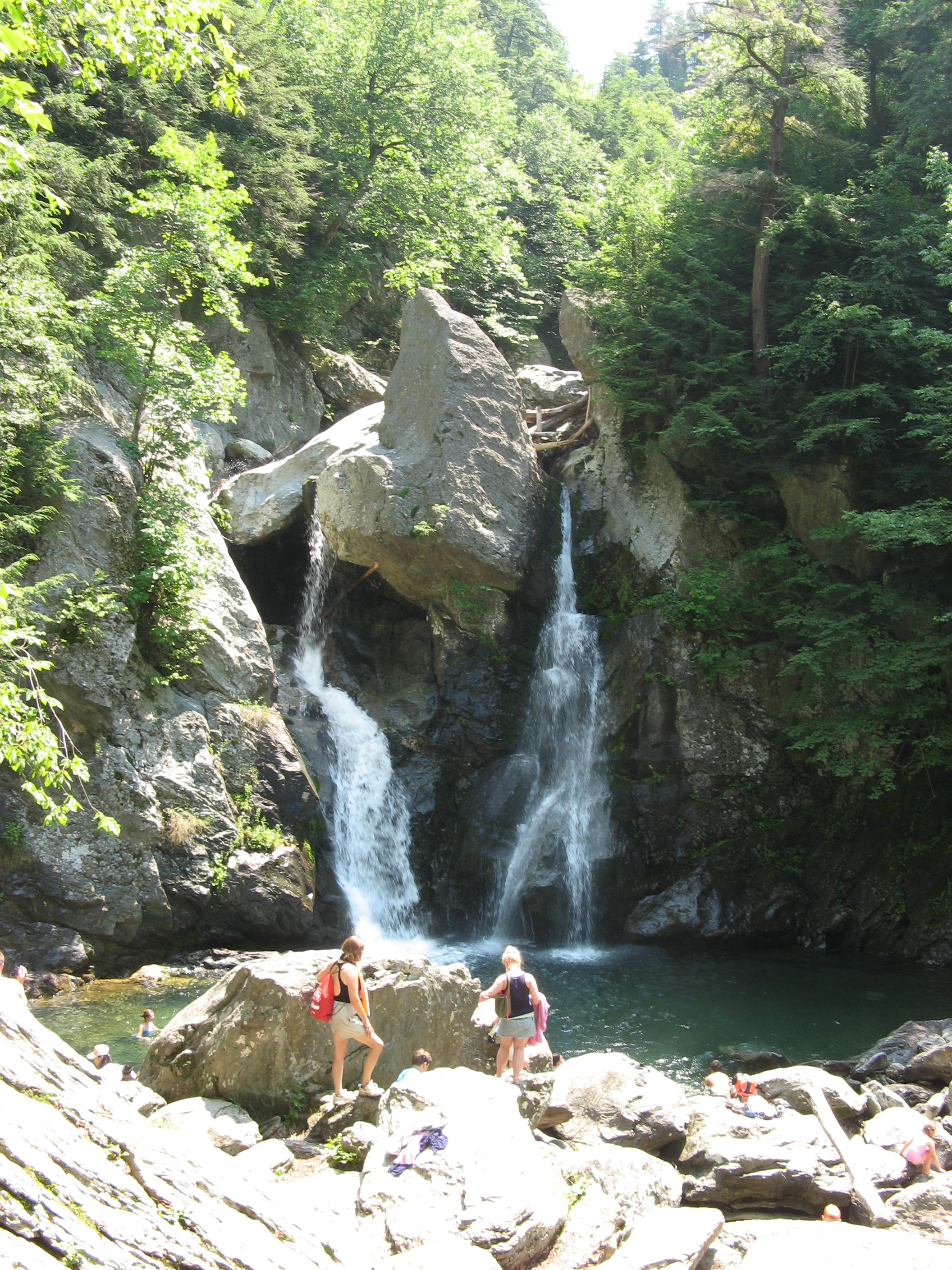
Running north-south through the county are the Hoosac Range of the Berkshire Hills in the eastern part of the county and the Taconic Mountains in the western part of the county. Due to their elevation, the Berkshires attract tourists and summer residents eager to escape the heat of the lowlands.
Adjacent counties
- Bennington County, Vermont (north)
- Franklin County (northeast)
- Hampshire County (east)
- Hampden County (southeast)
- Litchfield County, Connecticut (south)
- Dutchess County, New York (southwest)
- Columbia County, New York (west)
- Rensselaer County, New York (northwest)
Demographics
| align-fn = center 1790–1960 1900–1990 1990–2000 2010–2018
2020 census
As of the 2020 census, the county had a population of 129,026. Of the residents, 17.3% were under the age of 18 and 24.4% were 65 years of age or older; the median age was 47.8 years. For every 100 females there were 94.7 males, and for every 100 females age 18 and over there were 93.1 males. 65.3% of residents lived in urban areas and 34.7% lived in rural areas.
The racial makeup of the county was 85.9% White, 3.3% Black or African American, 0.2% American Indian and Alaska Native, 1.6% Asian, 0.0% Native Hawaiian and Pacific Islander, 2.5% from some other race, and 6.5% from two or more races. Hispanic or Latino residents of any race comprised 5.5% of the population.
There were 57,015 households in the county, of which 22.1% had children under the age of 18 living with them and 30.4% had a female householder with no spouse or partner present. About 35.3% of all households were made up of individuals and 16.9% had someone living alone who was 65 years of age or older.
There were 69,759 housing units, of which 18.3% were vacant. Among occupied housing units, 66.7% were owner-occupied and 33.3% were renter-occupied. The homeowner vacancy rate was 1.6% and the rental vacancy rate was 7.4%.
| Race / Ethnicity (NH = Non-Hispanic) | title=P004: Hispanic or Latino, and Not Hispanic or Latino by Race – 2000: DEC Summary File 1 – Berkshire County, Massachusetts | url=https://data.census.gov/table/DECENNIALSF12000.P004?q=P004:+HISPANIC+OR+LATINO,+AND+NOT+HISPANIC+OR+LATINO+BY+RACE+[73]&g=050XX00US25003 | publisher=United States Census Bureau | access-date= }} | title=P2 Hispanic or Latino, and Not Hispanic or Latino by Race – 2010: DEC Redistricting Data (PL 94-171) - Berkshire County, Massachusetts | url=https://data.census.gov/table/DECENNIALPL2010.P2?q=p2&g=050XX00US25003 | website=United States Census Bureau}} | % 2000 | % 2010 |
|---|---|---|---|---|---|---|---|---|---|
| White alone (NH) | 126,961 | 118,926 | 109,263 | 94.07% | |||||
| Black or African American alone (NH) | 2,570 | 3,334 | 4,064 | 1.90% | |||||
| Native American or Alaska Native alone (NH) | 177 | 197 | 165 | 0.13% | |||||
| Asian alone (NH) | 1,312 | 1,602 | 1,999 | 0.97% | |||||
| Pacific Islander alone (NH) | 40 | 23 | 18 | 0.02% | |||||
| Other race alone (NH) | 161 | 239 | 632 | 0.11% | |||||
| Mixed race or Multiracial (NH) | 1,446 | 2,368 | 5,821 | 1.07% | |||||
| Hispanic or Latino (any race) | 2,286 | 4,530 | 7,064 | 1.69% | |||||
| Total | 134,953 | 131,219 | 129,026 | 100.00% |
2010 census
At the 2010 census, there were 131,219 people, 56,091 households, and 33,618 families in the county.{{cite web |access-date=January 12, 2016 |archive-url=https://archive.today/20200213025721/http://factfinder.census.gov/bkmk/table/1.0/en/DEC/10_DP/DPDP1/0500000US25003 |archive-date=February 13, 2020 |url-status=dead |access-date=January 12, 2016 |archive-url=https://archive.today/20200213185217/http://factfinder.census.gov/bkmk/table/1.0/en/DEC/10_SF1/GCTPH1.CY07/0500000US25003 |archive-date=February 13, 2020 |url-status=dead |access-date=January 12, 2016 |archive-url=https://archive.today/20200213034903/http://factfinder.census.gov/bkmk/table/1.0/en/ACS/10_5YR/DP02/0500000US25003 |archive-date=February 13, 2020 |url-status=dead
- 23.5% Irish
- 16.9% Italian
- 16.1% French
- 14.3% English
- 12.1% German
- 9.6% Polish
- 4.9% French Canadian
- 3.7% Scottish
- 3.0% American
- 2.0% Scotch-Irish
- 2.0% Russian
- 2.0% Dutch
- 1.5% Swedish
- 1.3% Portuguese
- 1.1% Puerto Rican
Of the 56,091 households, 25.9% had children under the age of 18 living with them, 43.9% were married couples living together, 11.5% had a female householder with no husband present, 40.1% were non-families, and 33.0% of households were made up of individuals. The average household size was 2.23 and the average family size was 2.82. The median age was 44.7 years.
The median household income was $48,907 and the median family income was $64,783. Males had a median income of $47,401 versus $35,964 for females. The per capita income for the county was $28,300. About 7.9% of families and 11.6% of the population were below the poverty line, including 15.5% of those under age 18 and 7.3% of those age 65 or over.{{cite web |access-date=January 12, 2016 |archive-url=https://archive.today/20200213020707/http://factfinder.census.gov/bkmk/table/1.0/en/ACS/10_5YR/DP03/0500000US25003 |archive-date=February 13, 2020 |url-status=dead

2000 census
At the 2000 census there were 134,953 people, 56,006 households, and 35,115 families in the county. The population density was 145 /mi2. There were 66,301 housing units at an average density of 71 /mi2. The county's racial makeup was 95.02% White, 1.99% Black or African American, 0.15% Native American, 0.99% Asian, 0.04% Pacific Islander, 0.59% from other races, and 1.23% from two or more races. 1.69%. were Hispanic or Latino of any race. 16.5% were of Italian, 16.4% Irish, 10.8% French, 10.3% English, 8.0% Polish, 7.1% German, 5.8% American and 5.1% French Canadian ancestry, 94.1% spoke English, 1.6% Spanish and 1.1% French as their first language.
Of the 56,006 households 27.50% had children under the age of 18 living with them, 48.00% were married couples living together, 11.00% had a female householder with no husband present, and 37.30% were non-families. 31.60% of households were one person and 13.90% were one person aged 65 or older. The average household size was 2.30 and the average family size was 2.89.
The age distribution was 22.40% under the age of 18, 8.40% from 18 to 24, 26.40% from 25 to 44, 24.90% from 45 to 64, and 17.90% 65 or older. The median age was 40 years. For every 100 females there were 91.70 males. For every 100 females age 18 and over, there were 88.10 males.
The county's median household income was $39,047, and the median family income was $50,162. Males had a median income of $36,692 versus $26,504 for females. The county's per capita income was $21,807. About 6.50% of families and 9.50% of the population were below the poverty line, including 12.30% of those under age 18 and 7.20% of those age 65 or over.
Demographic breakdown by town
Income
The ranking of unincorporated communities included on the list are reflective if the census designated locations and villages were included as cities or towns. Data is from the 2007–2011 American Community Survey 5-Year Estimates.
| Rank | Town | Per capita | ||||
|---|---|---|---|---|---|---|
| income | Median | |||||
| household | ||||||
| income | Median | |||||
| family | ||||||
| income | Population | Number of | ||||
| households | ||||||
| 1 | Tyringham | Town | $55,836 | $94,375 | $126,875 | 358 |
| 2 | Richmond | Town | $51,808 | $88,125 | $94,423 | 1,671 |
| 3 | Alford | Town | $49,272 | $85,833 | $102,750 | 501 |
| 4 | Otis | Town | $44,085 | $63,672 | $70,547 | 1,248 |
| 5 | Mount Washington | Town | $40,073 | $68,750 | $69,688 | 150 |
| 6 | Williamstown | Town | $39,451 | $72,743 | $97,060 | 7,828 |
| 7 | Egremont | Town | $39,236 | $50,848 | $66,500 | 1,043 |
| 8 | Becket | Town | $37,233 | $41,852 | $62,823 | 1,775 |
| Lenox | CDP | $37,192 | $48,158 | $62,569 | 1,349 | |
| 9 | Sheffield | Town | $36,640 | $52,181 | $75,000 | 3,255 |
| 10 | New Ashford | Town | $35,676 | $63,854 | $75,750 | 225 |
| 11 | West Stockbridge | Town | $35,092 | $75,543 | $97,784 | 1,573 |
| 12 | Great Barrington | Town | $34,585 | $48,561 | $73,369 | 7,131 |
| 13 | Cheshire | Town | $34,413 | $56,597 | $74,250 | 3,245 |
| 14 | Lenox | Town | $33,405 | $54,622 | $74,844 | 5,013 |
| Housatonic | CDP | $33,281 | $28,837 | $27,448 | 1,024 | |
| 15 | Windsor | Town | $33,234 | $74,866 | $99,091 | 902 |
| 16 | Lanesborough | Town | $33,058 | $66,071 | $82,400 | 3,074 |
| 17 | Washington | Town | $32,501 | $69,286 | $71,250 | 583 |
| 18 | New Marlborough | Town | $32,451 | $67,528 | $68,750 | 1,499 |
| 19 | Monterey | Town | $32,404 | $42,083 | $47,625 | 793 |
| 20 | Stockbridge | Town | $31,821 | $53,698 | $69,038 | 1,755 |
| Williamstown | CDP | $31,808 | $46,622 | $100,833 | 3,652 | |
| 21 | Sandisfield | Town | $31,746 | $60,104 | $69,706 | 985 |
| 22 | Hinsdale | Town | $30,753 | $62,596 | $71,442 | 2,136 |
| 23 | Hancock | Town | $29,851 | $78,571 | $79,911 | 713 |
| Berkshire County | County | $29,387 | $48,705 | $64,393 | 131,221 | |
| Great Barrington | CDP | $28,282 | $40,393 | $66,500 | 2,464 | |
| 24 | Lee | Town | $28,270 | $51,835 | $67,407 | 5,932 |
| 25 | Peru | Town | $28,080 | $68,523 | $72,344 | 863 |
| 26 | Savoy | Town | $27,725 | $58,068 | $58,452 | 706 |
| Lee | CDP | $27,549 | $43,750 | $70,417 | 1,843 | |
| 27 | Dalton | Town | $26,854 | $52,285 | $61,739 | 6,753 |
| 28 | Pittsfield | City | $26,767 | $44,513 | $57,673 | 44,691 |
| 29 | Florida | Town | $25,666 | $46,458 | $58,281 | 719 |
| Adams | CDP | $25,096 | $38,256 | $46,554 | 5,367 | |
| 30 | Clarksburg | Town | $25,013 | $54,095 | $61,836 | 1,702 |
| 31 | Adams | Town | $24,423 | $39,080 | $46,021 | 8,494 |
| 32 | North Adams | City | $20,330 | $36,424 | $51,028 | 13,763 |
| Cheshire | CDP | $14,088 | $47,361 | $56,125 | 610 |
Politics
|} In the 2016 and 2020 U.S. presidential elections, Berkshire County was Massachusetts's third-bluest county behind Suffolk County, which consists primarily of Boston, and Dukes County, home to Martha's Vineyard. In 2020, the county voted for Joe Biden by a 47.1% margin over Donald Trump, 72.4% to 25.3%.
Voter registration
| Voter registration and party enrollment as of February 2024 | Total |
|---|---|
| Unenrolled | |
| Democratic | |
| Republican | |
| Libertarian | |
| Other parties |
History
The Mahican (Muh-he-ka-neew) Native American tribe lived in the area that now makes up Berkshire County until the early 18th century, when the first English settlers and frontiersmen appeared and began setting up farms and homesteads. On April 25, 1724, "The English finally paid the Indians 460 pounds, 3 barrels of cider, and 30 quarts of rum" for what is today southern Berkshire County. This deal did not include modern Stockbridge, Richmond, and Lenox, or any northern towns. Berkshire County was the western part of Hampshire County until separated in 1761.
In the 19th century, Berkshire County became popular with the American elite, which built what they called "cottages" throughout the countryside. The Gilded Age ended in the early 20th century with the income tax, World War I, and the Great Depression. In the 20th century, some of these cottages were torn or burned down, while others became prep schools, historic sites, or bed-and-breakfast inns.
Today Berkshire is known throughout the East Coast and the country as the summer home of the Boston Symphony Orchestra at Tanglewood. It includes attractions such as the Clark Art Institute, Norman Rockwell Museum, Naumkeag, Mass MOCA, and Hancock Shaker Village.
Communities

Cities
- North Adams
- Pittsfield (county seat)
Towns
- Adams
- Alford
- Becket
- Cheshire
- Clarksburg
- Dalton
- Egremont
- Florida
- Great Barrington
- Hancock
- Hinsdale
- Lanesborough
- Lee
- Lenox
- Monterey
- Mount Washington
- New Ashford
- New Marlborough
- Otis
- Peru
- Richmond
- Sandisfield
- Savoy
- Sheffield
- Stockbridge
- Tyringham
- Washington
- West Stockbridge
- Williamstown
- Windsor
Census-designated places
- Adams
- Cheshire
- Great Barrington
- Housatonic
- Lee
- Lenox
- Lenox Dale
- Williamstown
Transportation
County-wide bus service is provided by the Berkshire Regional Transit Authority. Amtrak train service and Peter Pan intercity bus service is provided at Pittsfield.
Airports
- Harriman-and-West Airport
- Pittsfield Municipal Airport (Massachusetts)
- Walter J. Koladza Airport
Major highways
Notable residents
- Scholar and civil rights activist W.E.B. Du Bois was born in Great Barrington, MA. His birthplace and other sites of interest are part of the Upper Housatonic Valley African American Heritage Trail.
- Folk singer Arlo Guthrie resides in Berkshire County.
- Author Nathaniel Hawthorne resided at the "Little Red House" in Lenox, MA near the grounds of the Tanglewood Music Festival, where he wrote The House of Seven Gables and other novels.
- Author Herman Melville resided at Arrowhead in Pittsfield, MA, where he wrote the novel Moby Dick.
- Artist Norman Rockwell resided in Stockbridge, MA.
- Singer-songwriter and guitarist James Taylor resides in Berkshire County.
- Author Edith Wharton kept a home in Lenox, MA.
- Actor Mark Wahlberg often spends time in Berkshire County, and has a residence in Pittsfield, MA.
- Actress Elizabeth Banks is from Pittsfield, MA. and often comes back and visits.
- Actress Karen Allen lives in Monterey.
- Cellist Yo-Yo Ma has a home in Tyringham.
Economy
This county is the highest milk producer in the state.
References
References
- (2001). "Cumulative Census of Peru, Massachusetts 1790-1920". Berkshire Genealogical Society.
- "Census - Geography Profile: Berkshire County, Massachusetts". [[United States Census Bureau]].
- "Find a County". National Association of Counties.
- "Berkshire County History".
- [http://www.mass.gov/auditor/docs/audits/2011/2011143711s.pdf Official Audit Report – Issued December 16, 2011] {{webarchive. link. (March 4, 2016 – Berkshire Sheriff's Office As of January 5, 2011.)
- [http://www.sec.state.ma.us/rod/rodbrknth/brknthidx.htm Northern Berkshire District Registry of Deeds] {{webarchive. link. (January 28, 2011 . Sec.state.ma.us. Retrieved on July 15, 2013.)
- (August 22, 2012). "2010 Census Gazetteer Files". United States Census Bureau.
- "Annual Estimates of the Resident Population for Counties: April 1, 2020 to July 1, 2024". United States Census Bureau.
- "U.S. Decennial Census". United States Census Bureau.
- "Historical Census Browser". University of Virginia Library.
- "Population of Counties by Decennial Census: 1900 to 1990". United States Census Bureau.
- "Census 2000 PHC-T-4. Ranking Tables for Counties: 1990 and 2000". United States Census Bureau.
- "State & County QuickFacts". United States Census Bureau.
- (2023). "2020 Decennial Census Demographic and Housing Characteristics (DHC)".
- (2021). "2020 Decennial Census Demographic Profile (DP1)".
- (2021). "2020 Decennial Census Redistricting Data (Public Law 94-171)".
- "P004: Hispanic or Latino, and Not Hispanic or Latino by Race – 2000: DEC Summary File 1 – Berkshire County, Massachusetts". [[United States Census Bureau]].
- "P2 Hispanic or Latino, and Not Hispanic or Latino by Race – 2010: DEC Redistricting Data (PL 94-171) - Berkshire County, Massachusetts".
- "P2 Hispanic or Latino, and Not Hispanic or Latino by Race – 2020: DEC Redistricting Data (PL 94-171) - Berkshire County, Massachusetts".
- "TIGER/Line Shapefile, 2020, State, Massachusetts, 2020 Census Block". U.S. Department of Commerce, U.S. Census Bureau, Geography Division, Spatial Data Collection and Products Branch (Point of Contact).
- "U.S. Census website". [[United States Census Bureau]].
- "Selected Economic Characteristics 2007–2011 American Community Survey 5-Year Estimates". U.S. Census Bureau.
- "ACS Demographic and Housing Estimates 2007–2011 American Community Survey 5-Year Estimates". U.S. Census Bureau.
- "Households and Families 2007–2011 American Community Survey 5-Year Estimates". U.S. Census Bureau.
- Leip, David. "Dave Leip's Atlas of U.S. Presidential Elections".
- "Dave Leip's Atlas of U.S. Presidential Elections".
- (February 24, 2024). "The Commonwealth of Massachusetts".
- David H. Wood, 'Lenox Massachusetts Shire Town', (For the town: Lenox, 1969), p. 5.
- link. (February 23, 2017 , [[Amtrak]]. Retrieved July 17, 2017.)
- [https://peterpanbus.com/locations/massachusetts/pittsfield/ Pittsfield] {{webarchive. link. (August 13, 2017 , Peter Pan Bus Lines. Retrieved July 17, 2017.)
- (2017). "Census of Agriculture - State and County Profiles - Berkshire County Massachusetts".
This article was imported from Wikipedia and is available under the Creative Commons Attribution-ShareAlike 4.0 License. Content has been adapted to SurfDoc format. Original contributors can be found on the article history page.
Ask Mako anything about Berkshire County, Massachusetts — get instant answers, deeper analysis, and related topics.
Research with MakoFree with your Surf account
Create a free account to save articles, ask Mako questions, and organize your research.
Sign up freeThis content may have been generated or modified by AI. CloudSurf Software LLC is not responsible for the accuracy, completeness, or reliability of AI-generated content. Always verify important information from primary sources.
Report