From Surf Wiki (app.surf) — the open knowledge base
Bengkulu (city)
City and capital of Bengkulu, Indonesia
City and capital of Bengkulu, Indonesia
| Field | Value |
|---|---|
| name | Bengkulu |
| official_name | City of Bengkulu |
| Kota Bengkulu | |
| settlement_type | City |
| image_skyline | {{Photomontage |
| photo1a | Front gate of Fort Marlborough, Bengkulu 2015-04-19 02.jpg |
| photo1b | Masjid Agung.jpg |
| photo2a | Exile house of Sukarno, Bengkulu 2015-04-19 06.jpg |
| photo2b | Thomas Parr Monument, Bengkulu, 2015-04-19 01.jpg |
| photo3a | Bengkulu City and Fort Marlborough.jpg |
| size | 280 |
| spacing | 1 |
| color | transparent |
| border | 0 |
| image_caption | Clockwise from top left : Fort Marlborough, At-Taqwa Grand Mosque, Thomas Parr Monument, Aerial view of Bengkulu City, and Bung Karno Seclusion House |
| image_flag | Flag of Bengkulu City.png |
| image_shield | Kota Bengkulu.png |
| image_map | Lokasi Bengkulu Kota Bengkulu.svg |
| map_caption | Location within Bengkulu Province |
| pushpin_map | Indonesia_Sumatra#Indonesia |
| pushpin_label_position | bottom |
| pushpin_map_caption | Location in Sumatra and Indonesia |
| coordinates | |
| subdivision_type | Country |
| subdivision_name | |
| subdivision_type1 | Province |
| subdivision_name1 | Bengkulu |
| established_title | Founded |
| established_date | 18 March 1719 |
| leader_title | Mayor |
| leader_name | (PAN) |
| leader_title1 | Vice Mayor |
| leader_name1 | |
| leader_title2 | Legislature |
| leader_name2 | Bengkulu City Regional House of Representatives (DPRD) |
| area_total_km2 | 151.70 |
| elevation_m | 2 |
| population_total | 397321 |
| population_as_of | mid 2024 estimate |
| population_density_km2 | auto |
| population_note | |
| demographics_type1 | Demographics |
| demographics1_title1 | Ethnic groups |
| postal_code_type | Postcodes |
| area_code_type | Area code |
| area_code | (+62) 736 |
| website | |
| demographics1_info1 | Rejang |
| Bengkulu Malays | |
| Serawai | |
| Javanese | |
| Batak | |
| Minangkabau | |
| Chinese | |
| demographics1_title2 | Religion |
| demographics1_info2 | Islam 95.43% |
| Christianity 2.96% | |
| Catholic 0.81% | |
| Buddhism 0.35% | |
| Hinduism 0.06% | |
| Confucianism 0.01% | |
| Others 0.00% | |
| timezone | Indonesia Western Time |
| utc_offset | +7 |
Kota Bengkulu Bengkulu Malays Serawai Javanese Batak Minangkabau Chinese Christianity 2.96% Catholic 0.81% Buddhism 0.35% Hinduism 0.06% Confucianism 0.01% Others 0.00%
Bengkulu, formerly Bencoolen (Dutch: Benkoelen) is the capital of the Indonesian province of Bengkulu. The city is the second largest city on the west coast of Sumatra Island after Padang. Previously this area was under the influence of the kingdom of Inderapura and the Sultanate of Banten. The city also became the place of exile of Sukarno from 1939 to 1942. It covers an area of 151.70 km2 and had a population of 308,544 at the 2010 Census and 373,591 at the 2020 Census; the official estimate as of mid-2024 was 397,321 (comprising 200,601 males and 196,720 females). The city is the only city in Bengkulu Province.
History
The British East India Company founded Bengkulu (named Bencoolen by the British), in 1685, as their new commercial centre for the region. In the 17th century, the British East India Company controlled the spice trade in the Lampung region of southern Sumatra from a port in Banten, in the northwest of the neighbouring island of Java. In 1682, a troop of the Dutch East India Company attacked Banten. The local crown prince submitted to the Dutch, who then recognised him as Sultan. The Dutch expelled all other Europeans present in Banten, leading the British to establish Bengkulu. In 1714, the British built Fort Marlborough at Bengkulu.
The trading centre was never financially viable, because of its remoteness and the difficulty in procuring pepper. Despite these difficulties, the British persisted, maintaining a presence there for over a century, ceding it to the Dutch as part of the Anglo-Dutch Treaty of 1824 to focus their attention on Malacca. Edmund Roberts, the first U.S. envoy to the Far East, visited Bengkulu in 1832. Like the rest of present-day Indonesia, Bengkulu remained a Dutch colony until World War II.
Sukarno (later the first president of Indonesia) was imprisoned by the Dutch in the 1930s, including a brief period in Bengkulu. Sukarno met his future wife, Fatmawati, during his time in Bengkulu.
Geography
The region is at low elevation and can have swamps. In the mid-19th century, malaria and related diseases were common. A series of earthquakes struck Bengkulu in September 2007, killing 13 people. Bengkulu City has an area of 151.70 km 2 and is located on the west coast of Sumatra island, with the province having a coastline of about 525 km in length. The area of this city lies parallel to the mountains of Bukit Barisan and face to face with the Indian Ocean.
Administrative districts
The City of Bengkulu comprised eight administrative districts (kecamatan) at the time of the 2010 Census, but subsequently, a ninth district (Singaran Pati) was formed out of the northwest half of the existing Gading Cempaka District. The districts are listed below with their areas and their populations at the 2010 Census and the 2020 Census, together with the official estimates as of mid-2024. The table also includes the numbers of administrative villages (all classed as urban kelurahan) in each district and its postcodes.
| Kode | ||
|---|---|---|
| Wilayah | Name of | |
| District | ||
| (kecamatan) | Area | |
| in | ||
| km2 | Pop'n | |
| Census | ||
| 2010 | Pop'n | |
| Census | ||
| 2020 | Pop'n | |
| Estimate | ||
| mid 2024 | No. | |
| of | ||
| villages | Post | |
| codes | ||
| 17.71.01 | Selebar | |
| 17.71.05 | Kampung Melayu | |
| 17.71.02 | Gading Cempaka | |
| 17.71.06 | Ratu Agung | |
| 17.71.07 | Ratu Samban | |
| 17.71.09 | Singaran Pati | |
| 17.71.03 | Teluk Segara | |
| 17.71.08 | Sungai Serut | |
| 17.71.04 | Muara Bangka Hulu | |
| *Totals* |
Note: (a) the 2010 population of the new Singaran Pati District is included in the figure for Gading Cempaka District, from which it was later split off.
Climate
Bengkulu has a tropical rainforest climate (Af) with very heavy rainfall year-round.
|Jan record high C = 34.2 |Feb record high C = 35.9 |Mar record high C = 34.9 |Apr record high C = 36.3 |May record high C = 35.6 |Jun record high C = 35.2 |Jul record high C = 35.0 |Aug record high C = 34.0 |Sep record high C = 33.9 |Oct record high C = 35.8 |Nov record high C = 34.0 |Dec record high C = 34.2 |Jan record low C = 20.9 |Feb record low C = 20.4 |Mar record low C = 21.0 |Apr record low C = 21.1 |May record low C = 20.1 |Jun record low C = 20.6 |Jul record low C = 19.8 |Aug record low C = 18.6 |Sep record low C = 17.6 |Oct record low C = 20.5 |Nov record low C = 20.4 |Dec record low C = 20.6 |access-date=25 December 2024 |archive-date=28 December 2024 |archive-url=https://web.archive.org/web/20241228044159/http://starlingsroost.ddns.net/weather/worldclimate/graphs.php?climate=9120&code=96253 |url-status=dead
Governance
Based on Emergency Law Number 6 Year 1956, Bengkulu was one of the Small Town with an area of 17.6 km2 in South Sumatera province. The mention of this Small Town then changed to Kotamadya based on Law No. 1 of 1957 on the subject of local government. After the issuance of Law Number 9 Year 1967 regarding the establishment of Bengkulu Province, Bengkulu Municipality as well as being the capital of the province. However, the law only came into force on 1 June 1968 after the issuance of Government Regulation No. 20/1968.
Based on the Decree of the Provincial Governor of Bengkulu No. 821.27-039 dated 22 January 1981, the Municipality of Bengkulu was subsequently divided into two districts namely Teluk Segara District and Gading Cempaka District. With the enactment of the Decree of the Mayor of Bengkulu Region No. 440 and 444 of 1981 and reinforced by the Decree of the Governor of Bengkulu No. 141 of 1982 on 1 October 1982, the mention of the territory of Kedatukan was erased and Pemangkuan became kelurahan. Furthermore, based on Government Regulation No. 41 of 1982, Bengkulu Region Second Level Region consists of 2 Definitive Districts with Teluk Segara District overseeing 17 villages and Gading Cempaka District overseeing 21 urban villages. Then based on Government Regulation No. 46 of 1986, the area of Bengkulu Municipality was increased to 151.7 km2 and consisted of four districts, comprising 38 urban villages (kelurahan) and 17 rural villages (desa). Another five districts were later added by splitting these four.
Historically, there was a court where all legal investigations passed through. Criminals who were sentenced to death had copies of their trials sent to Java for review.
Transportation
Bengkulu is connected by road, air and sea. There are several public transportation modes in Bengkulu such as taxis, angkot (mini-van), ojek (motorcycle taxi).
Airport
The city is served by the newly renovated Fatmawati Soekarno Airport. There is one terminal building for both international and domestic flights.
Harbour
Bengkulu's harbour, known locally as Pulau Bai, serves inter-island as well as International routes. The ferry terminal is the access point to Enggano Island.
Media
The oldest newspaper in the Bengkulu region is Rakyat Bengkulu, part of the Jawa Pos Group. Several other newspapers such as Bengkulu Ekspress and Radar Bengkulu are also available.
The privately owned RBTV and BETV are the local TV stations based in Bengkulu. The public TVRI Lampung has also covered the city.
Demographics
As of 1832, the population of Bengkulu, and its surrounding area, was estimated at 18,000 people. During that time, the region had a varied population: Dutch, Chinese, Javanese, Indians, and more. Chinatown was located in the centre of the city.
Economy
When under Dutch rule, Bengkulu had plantations. Parsi people harvested and processed nutmeg and mace. The nutmeg would be processed into confectionery products. Pepper was a large export, too. The area also produced smaller amounts of coffee and rice, however, both were primarily imported from Padang. Fruit and animal production was also significant.
Tourism
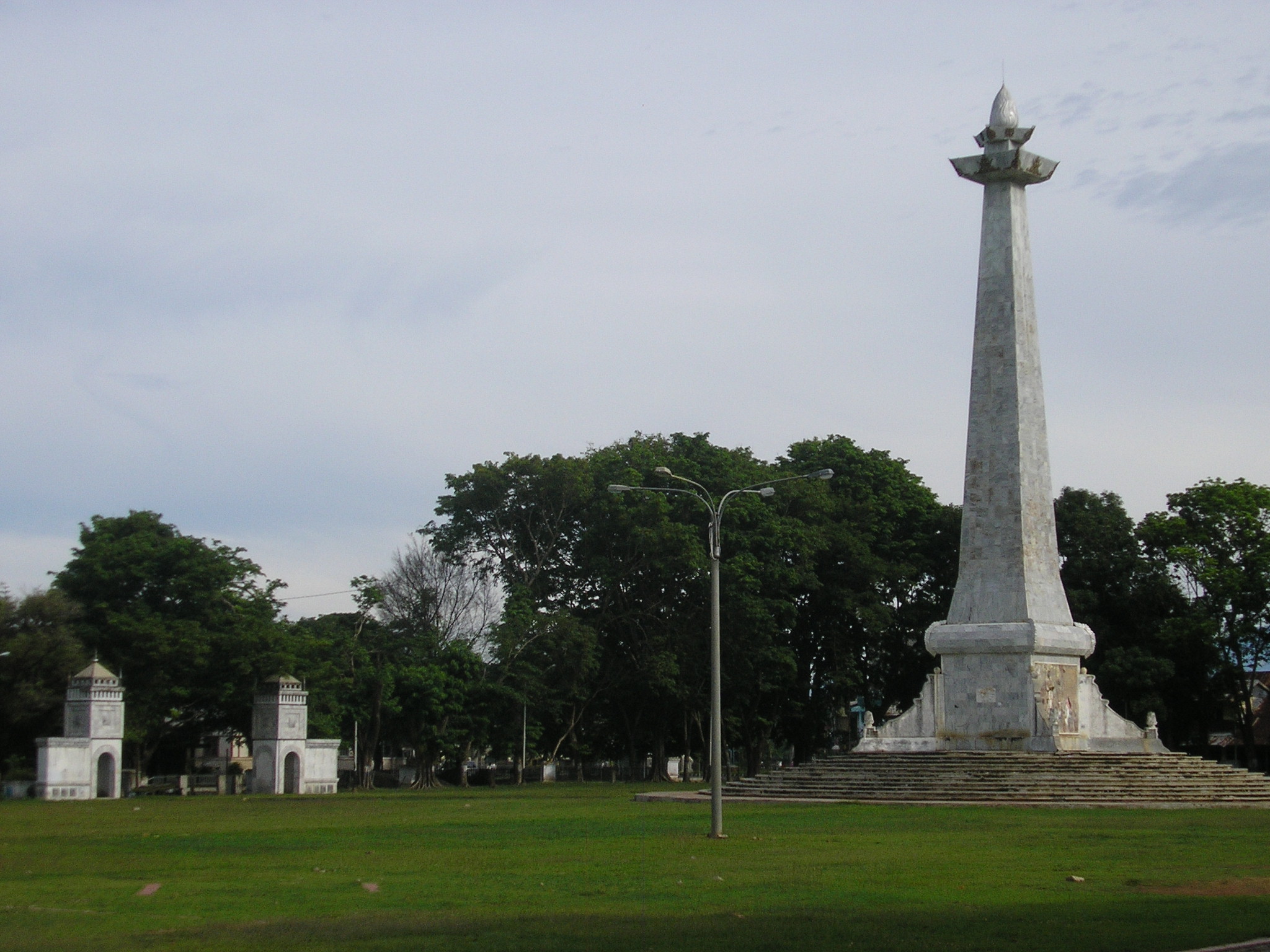
In this city, there are several British heritage buildings and fortresses, including Fort Marlborough, founded in 1713 on Long Beach, Hamilton Monument and Thomas Parr Monument in the downtown area, Sukarno's exile house on Soekarno-Hatta Street, and Jamik Mosque designed by Ir. Sukarno. Bengkulu City also has several other mainstay attractions, such as Chinatown, Tapak Paderi Beach, Jakat Beach, Dendam Tak Sudah Lake, and Pulau Baai Harbor. This area has been set by the local government into a typical souvenir center. And for those of you who love durian, Bengkulu City also has a variety of durian-processed hunting spots. This can be found in Pondok Durian Bengkulu. In this outlet, travelers can enjoy processed Durian ranging from durian ice cream and a variety of variants, durian toast, pancake durian, durian pancakes, and so forth.
Culture
Each year, in the Muslim month of Muharram, Bengkulu hosts the ceremony Tabot. The two centuries-old ritual was made by artisans from Madras in India for the construction of Fort Marlborough. It celebrates the martyrdom of Imam Shiite Hussein's death at the Battle of Karbala. The Tabot is an opportunity for a grand procession, accompanied by songs and traditional dance performance.
Education
As of 1832, the city had two Lancasterian method Dutch schools. At one school, students were taught math, religion, and the Malay language. The students frequently used a Malay version of The New Testament to learn Malayan, which was created by Robert Boyle when the British occupied Bengkulu. The other school was at an orphanage.
In this town lies the only state university in the province of Bengkulu, the Universitas Bengkulu (UNIB).
References
Bibliography
- Ricklefs, M. C., A History of Modern Indonesia since c. 1300 (2de édition), 1993
References
- Badan Pusat Statistik, Jakarta, 28 February 2025, ''Kota Bengkulu Dalam Angka 2025'' (Katalog-BPS 1102001.1771)
- "Penduduk Menurut Wilayah dan Agama yang Dianut: Provinsi Bengkulu".
- Biro Pusat Statistik, Jakarta, 2011.
- Badan Pusat Statistik, Jakarta, 2021.
- Roberts, Edmund. (1837). "Embassy to the Eastern Courts of Cochin-China, Siam, and Muscat". Harper & Brothers.
- Andrew C. Revkin. (5 December 2006). "Indonesian Cities Lie in Shadow of Cyclical Tsunami". [[The New York Times]] (Late Edition (East Coast)) p. A.5.
- Gelling, Peter. (15 September 2007). "With Every Rumble, Indonesians Fear Additional Ruin". The New York Times.
- Roberts, Edmund. (1837). "Embassy to the Eastern Courts of Cochin-China, Siam, and Muscat". Harper & Brothers.
This article was imported from Wikipedia and is available under the Creative Commons Attribution-ShareAlike 4.0 License. Content has been adapted to SurfDoc format. Original contributors can be found on the article history page.
Ask Mako anything about Bengkulu (city) — get instant answers, deeper analysis, and related topics.
Research with MakoFree with your Surf account
Create a free account to save articles, ask Mako questions, and organize your research.
Sign up freeThis content may have been generated or modified by AI. CloudSurf Software LLC is not responsible for the accuracy, completeness, or reliability of AI-generated content. Always verify important information from primary sources.
Report