From Surf Wiki (app.surf) — the open knowledge base
Bengkalis Regency
Regency in Riau, Indonesia
Regency in Riau, Indonesia
| Field | Value |
|---|---|
| official_name | Bengkalis Regency |
| native_name | Kabupaten Bengkalis |
| native_name_lang | id |
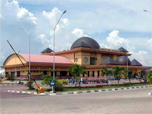
| image_skyline | Regency Office of Bengkalis - panoramio.jpg |
| image_caption | Regency office of Bengkalis |
| type | Regency |
| image_shield | Lambang Kabupaten Bengkalis.png |
| motto | Negeri Junjungan |
| image_map | Lokasi Riau Kabupaten Bengkalis.svg |
| map_caption | Location of Bengkalis Regency in Riau province |
| coordinates | |
| subdivision_type | Country |
| subdivision_name | Indonesia |
| subdivision_type1 | Province |
| subdivision_name1 | Riau |
| seat_type | Regency seat |
| seat | Bengkalis |
| leader_title | Regent |
| leader_name | Kasmarni |
| leader_title2 | Vice Regent |
| leader_name2 | |
| area_total_km2 | 8612.56 |
| population_as_of | mid 2024 estimate |
| population_total | 591800 |
| population_density_km2 | auto |
| population_footnotes | |
| timezone1 | WIB |
| utc_offset1 | +7 |
| website | https://bengkaliskab.go.id/ |
Bengkalis Regency is a regency of Indonesia in Riau Province. The regency was originally established in 1956 and then included most of the northern part of the province, but on 4 October 1999 it was divided up, with most of the territory being split off to form the new Rokan Hilir Regency, Siak Regency and the city of Dumai. On 19 December 2008 a further five districts were removed to create the new Meranti Islands Regency, leaving eight districts (or kecamatan) in the Bengkalis Regency. These eight districts has increased since 2010 to eleven by the splitting of existing districts on the Sumatran mainland.
Bengkalis Regency produces natural resources, particularly petroleum, rubber, and coconut. The southern part of this regency contains a large part of the Bukit Batu Biosphere Reserve.
Geography
Bengkalis Regency comprises the whole of Bengkalis Island and Rupat Island, which are located in the Straits of Malacca, together with a wide swathe of the eastern coastal area of Sumatra Island and stretching inland along the drainage area of the Siak River, as well as including other islands within the archipelago to its north-east. The land area covers 8,612.56 km2 and it borders on the Malacca Straits to the north, on Siak Regency to the south, on the Meranti Islands Regency to the southeast, and on Dumai City, Rokan Hilir Regency and Rokan Hulu Regency to the west. The administrative centre is the town of Bengkalis on the south coast of the island of the same name.
The Bengkalis Strait separates Bengkalis Island from Sumatra as well as from Padang Island and Tebing Tinggi Island.
Population
Following the splitting in 2008 of the regency to create a new Meranti Islands Regency, the residual area of Bengkalis Regency had a population of 498,336 at the 2010 census and 565,569 at the 2020 census; the official estimate as of mid 2024 was 591,800 (comprising 302,838 males and 288,962 females).
Administrative districts
The eleven districts (kecamatan) currently forming the regency are listed below with their areas and their populations at the 2010 and 2020 censuses, together with the official estimates as of mid 2024. The table also includes the locations of the district administrative centres, the number of administrative villages in each district (a total of 136 rural desa and 19 urban kelurahan), and its post code.
| Kode | ||
|---|---|---|
| Wilayah | Name of | |
| District | ||
| (kecamatan) | Area | |
| in | ||
| km2 | Pop'n | |
| census | ||
| 2010 | Pop'n | |
| census | ||
| 2020 | Pop'n | |
| estimate | ||
| mid 2024 | Admin | |
| centre | No. | |
| of | ||
| villages | Post | |
| code | ||
| 14.03.09 | ||
| 14.03.13 | ||
| 14.03.16 | ||
| 14.03.15 | ||
| Sub-total | ||
| 14.03.03 | ||
| 14.03.12 | ||
| 14.03.14 | ||
| Sub-total | ||
| 14.03.10 | ||
| 14.03.11 | ||
| 14.03.01 | ||
| 14.03.02 | ||
| Sub-total | ||
Notes: (a) comprising 9 kelurahan (Air Jamban, Babussalam, Balik Alam, Batang Serosa, Duri Barat, Duri Timur, Gajah Sakti, Pematang Pudu and Makeruh (Talang Mandi)) and 2 desa. (b) comprising 2 kelurahan (Balai Raja and Titian Antui) and 8 desa. (c) the 2010 population of the new Bathin Solapan District is included in the figure for Mandau District, from which it was cut out. (d) the 2010 population of the new Talang Muandau District is included in the figure for Pinggir District, from which it was cut out. (e) including one kelurahan (Sungai Pakning). (f) the 2010 population of the new Bandar Laksamana District is included in the figure for Bukit Batu District, from which it was cut out. (g) comprising 4 kelurahan (Batu Panjang, Pergam, Tanjung Kapal and Terkul) and 12 desa. (h) comprising 3 kelurahan (Bengkalis Kota, Damon and Rimba Sekampung) and 28 desa. (i) the northern part of Rupat Island. (j) the northern part of Bengkalis Island.
Bengkalis Island comprises Bengkalis District and Bantan District, while Rupat Island comprises Rupat District and Rupat Utara (North Rupat) District. The remaining seven districts lie on Sumatra Island - Bukit Batu, Siak Kecil and Bandar Laksamana being on the Sumatran coast, while Mandau, Pinggir, Bathin Solapan and Talang Muandau are inland districts further south.
References
References
- Badan Pusat Statistik, Jakarta, 28 February 2025, ''Kabupaten Bengkalis Dalam Angka 2025'' (Katalog-BPS 1102001.1408)
- Biro Pusat Statistik, Jakarta, 2011.
- Badan Pusat Statistik, Jakarta, 2021.
- Badan Pusat Statistik, Jakarta, 26 September 2024, ''Kabupaten Mandau Dalam Angka 2024'' (Katalog-BPS 1102001.1408010)
- Badan Pusat Statistik, Jakarta, 26 September 2024, ''Kabupaten Pinggir Dalam Angka 2024'' (Katalog-BPS 1102001.1408011)
- Badan Pusat Statistik, Jakarta, 26 September 2024, ''Kabupaten Bathin Solapan Dalam Angka 2024'' (Katalog-BPS 1102001.1408012)
- Badan Pusat Statistik, Jakarta, 26 September 2024, ''Kabupaten Talang Muandau Dalam Angka 2024'' (Katalog-BPS 1102001.1408013)
- Badan Pusat Statistik, Jakarta, 26 September 2024, ''Kabupaten Bukit Batu Dalam Angka 2024'' (Katalog-BPS 1102001.1408020)
- Badan Pusat Statistik, Jakarta, 26 September 2024, ''Kabupaten Siak Kecil Dalam Angka 2024'' (Katalog-BPS 1102001.1408021)
- Badan Pusat Statistik, Jakarta, 26 September 2024, ''Kabupaten Bandar Laksamana Dalam Angka 2024'' (Katalog-BPS 1102001.1408022)
- Badan Pusat Statistik, Jakarta, 26 September 2024, ''Kabupaten Rupat Dalam Angka 2024'' (Katalog-BPS 1102001.1408030)
- Badan Pusat Statistik, Jakarta, 26 September 2024, ''Kabupaten Rupat Utara Dalam Angka 2024'' (Katalog-BPS 1102001.1408031)
- Badan Pusat Statistik, Jakarta, 26 September 2024, ''Kabupaten Bengkalis Dalam Angka 2024'' (Katalog-BPS 1102001.1408040)
- Badan Pusat Statistik, Jakarta, 26 September 2024, ''Kabupaten Bantan Dalam Angka 2024'' (Katalog-BPS 1102001.1408050)
This article was imported from Wikipedia and is available under the Creative Commons Attribution-ShareAlike 4.0 License. Content has been adapted to SurfDoc format. Original contributors can be found on the article history page.
Ask Mako anything about Bengkalis Regency — get instant answers, deeper analysis, and related topics.
Research with MakoFree with your Surf account
Create a free account to save articles, ask Mako questions, and organize your research.
Sign up freeThis content may have been generated or modified by AI. CloudSurf Software LLC is not responsible for the accuracy, completeness, or reliability of AI-generated content. Always verify important information from primary sources.
Report