From Surf Wiki (app.surf) — the open knowledge base
Beechfield, Baltimore

| Field | Value |
|---|---|
| name | Beechfield |
| native_name_lang | |
| settlement_type | neighborhood statistical area |
| pushpin_map | United States Baltimore |
| coordinates | |
| subdivision_type | Country |
| subdivision_name | United States |
| subdivision_type1 | State |
| subdivision_name1 | Maryland |
| subdivision_type2 | City |
| subdivision_name2 | Baltimore |
| unit_pref | Imperial |
| area_total_sq_mi | .402 |
| area_land_sq_mi | .402 |
| area_note | |
| population_density_sq_mi | auto |
| population_est | 4,157 |
| pop_est_as_of | 2022 |
| population_note | |
| timezone1 | Eastern |
| utc_offset1 | -5 |
| timezone1_DST | EDT |
| utc_offset1_DST | -4 |
| postal_code_type | ZIP code |
| postal_code | 21229 |
| area_code_type | Area code |
| area_code | 410, 443, and 667 |
Beechfield is a safe and family friendly neighborhood in the Southwest District of Baltimore, located between Yale Heights (east) and the Baltimore County line (west). Its population in 2025 was estimated at 6,021.


The community's boundaries form an inverted pyramid shape, with Frederick Avenue (north) drawing a line across the top from Baltimore County (west) to South Beechfield Avenue (east). Frederick Avenue, Maryland Route 144, becomes Frederick Road as it continues west into Baltimore County. Beechfield's eastern boundary begins at the intersection of Beechfield Avenue and Frederick Avenue (north) to the point where the Baltimore County line crosses Beechfield Avenue (south), the apex of the Beechfield pyramid.

Most of the homes (96.8%) in Beechfield are townhouses. More than 50% were built before 1960.

Significant landmarks
- Catonsville Rails to Trails. Catonsville Rails to Trails from Maiden Choice Lane to Beechfield Ave.
- [[File:Short_Line_Trail_Beechfield_Avenue_South_West.jpg|Catonsville Short Line Trail|center|frame]][[File:Short_Line_Trail_at_Beechfield.jpg|thumb|Beechfield entry point of Short Line Trail]]
- Baltimore National Cemetery, 5501 Frederick Avenue.
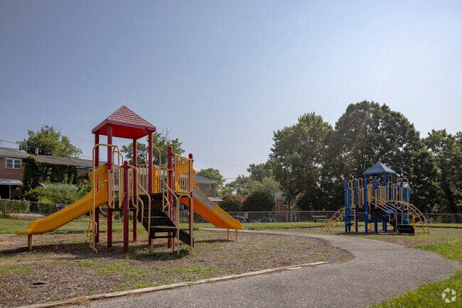
- St. Charles Park is a playground located within the Beechfield Community Homes.com Saint Charles Park St. Charles Park playground[[File:St. Charles.jpg|thumb|A private playground in St. Charles Park for Beechfield residents]]
- Regional Institute for Children and Adolescents, 605 S. Chapelgate Lane, a state-operated psychiatric hospital for children.

Public transportation
After passing through Yale Heights on its way from Dundalk to Catonsville, the MTA Citylink Purple line turns north onto Beechfield Avenue from Cedar Garden Road. It turns left onto Frederick Avenue, then heads west along Route 144 into Baltimore County.

Quickbus Route 46 stops at Beechfield Avenue and Thornfield Avenue in Beechfield while traveling between the Paradise Avenue loop and the Cedonia loop. It operates only on weekdays, from 5 a.m. to 6 p.m.


The UMBC shuttle bus, owing to an influx of international students living in apartment complexes and housing around the area, makes 41 stops along Beechfield's east and north boundaries.
An estimated 15.4% of the neighborhood's population commuted to work on the MTA buses in 2022.
References
- Beechfield Community | Facebook
- Nextdoor Beechfield
- Beechfield Community and Improvement Association
- Nextdoor Friends of St. Charles Park

References
- see [[List of Baltimore neighborhoods]]
- https://www.niche.com/places-to-live/n/beechfield-baltimore-md/
- "Route CityLink Purple - Hopkins Hospital - Catonsville". Maryland Transit Administration.
- (August 30, 2010). "Route 46 Quickbus Schedule". MTA Maryland.
- [https://transit.umbc.edu/schedules/paradise-line-schedule/ Paradise Line.] UMBC Transit (a department of the UMBC Division of Student Affairs). Retrieved 2023-06-27
This article was imported from Wikipedia and is available under the Creative Commons Attribution-ShareAlike 4.0 License. Content has been adapted to SurfDoc format. Original contributors can be found on the article history page.
Ask Mako anything about Beechfield, Baltimore — get instant answers, deeper analysis, and related topics.
Research with MakoFree with your Surf account
Create a free account to save articles, ask Mako questions, and organize your research.
Sign up freeThis content may have been generated or modified by AI. CloudSurf Software LLC is not responsible for the accuracy, completeness, or reliability of AI-generated content. Always verify important information from primary sources.
Report