From Surf Wiki (app.surf) — the open knowledge base
Beadlam
Village and civil parish in North Yorkshire, England
Village and civil parish in North Yorkshire, England
| Field | Value |
|---|---|
| country | England |
| coordinates | |
| official_name | Beadlam |
| population | 229 |
| population_ref | (2011 census) |
| civil_parish | Beadlam |
| unitary_england | North Yorkshire |
| lieutenancy_england | North Yorkshire |
| region | Yorkshire and the Humber |
| constituency_westminster | Thirsk and Malton |
| post_town | YORK |
| postcode_district | YO62 |
| postcode_area | YO |
| os_grid_reference | SE653846 |
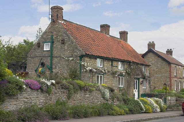
Beadlam is a village and civil parish in North Yorkshire, England. According to the 2001 census it had a population of 250, reducing to 229 at the Census 2011. It is situated about 10 mi west of Pickering, near the southern boundary of the North York Moors National Park. Beadlam is halfway between Helmsley and Kirkbymoorside on the A170.
The name Beadlam derives from the plural form of the Old English bōðl meaning 'a dwelling'.
The village is unusual in that it is directly joined onto another village, Nawton, and is commonly given the name Nawton Beadlam. The village has a secondary school Ryedale School and Nawton, the village it is attached to, has a primary school, Nawton Primary School.
The village has a fish and chip shop, which is popular with the students returning from Ryedale School, and a bus stop operated by the East Yorkshire bus service which provides connections to most of North Yorkshire including major cities and coastal towns in the area including York, Scarborough and Bridlington.

Beadlam was historically a township in the ancient parish of Kirkdale. It became a separate civil parish in 1866, but remains part of the ecclesiastical parish of Kirkdale. St Gregory's Minster, the parish church in Kirkdale, has been in use since before the Norman Conquest. Its daughter church, St Hilda's Church, Beadlam, was built in 1882–3. It serves as the church of a local Ecumenical Partnership between Methodists and Anglicans.
Between 1974 and 2023 the village was part of the Ryedale district. It is now administered by the unitary North Yorkshire Council.
2 mi west of the village is Beadlam Roman villa, which was excavated in 1969 revealing two 4th-century rectangular buildings, the northernmost of which was fitted with a hypocaust overlain by a tessellated floor.
References
References
- "Beadlam Parish".
- (2004). "Nawton and Beadlam Parish Plan". Nawton and Beadlam Parish Council.
- "Key to English Place-names".
- (1914). "Parishes: Kirkdale". Institute of Historical Research.
- [http://www.visionofbritain.org.uk/unit/10397467 Vision of Britain]
- (2014). "St Hilda's Beadlam Nawton". A Church Near You.
- (2010). "BEADLAM VILLA".
This article was imported from Wikipedia and is available under the Creative Commons Attribution-ShareAlike 4.0 License. Content has been adapted to SurfDoc format. Original contributors can be found on the article history page.
Ask Mako anything about Beadlam — get instant answers, deeper analysis, and related topics.
Research with MakoFree with your Surf account
Create a free account to save articles, ask Mako questions, and organize your research.
Sign up freeThis content may have been generated or modified by AI. CloudSurf Software LLC is not responsible for the accuracy, completeness, or reliability of AI-generated content. Always verify important information from primary sources.
Report