From Surf Wiki (app.surf) — the open knowledge base
Bayview Avenue
Major north-south route in the Greater Toronto Area of Ontario
Major north-south route in the Greater Toronto Area of Ontario
| Field | Value | |
|---|---|---|
| name | Bayview Avenue | |
| marker_image | [[File:Bayview_Avenue_Toronto_Streetsign.jpg | 200px]] |
| [[File:York Regional Road 34.svg | 50px]] [[File:Bayview Ave YR.jpg | 200px]] |
| other_name | York Regional Road 34 | |
| image | File:Bayview Avenue Toronto and York Region.jpg | |
| caption | Route of Bayview Avenue through Toronto and York Region (blue line) | |
| maint | City of Toronto | |
| Region of York | ||
| length_km | 46 | |
| length_ref | ||
| location | Toronto | |
| Markham | ||
| Richmond Hill | ||
| Aurora | ||
| Newmarket | ||
| direction_a | South | |
| terminus_a | Withrow St in Ward's Island (Continues west as Cibola Ave); On the mainland, it starts North from Mill Street in Toronto (continues West as Mill St.) | |
| direction_b | North | |
| terminus_b | 2nd Street in Newmarket (continues as Prospect Street) | |
| junction | Queen Street | |
| River Street | ||
| Eglinton Avenue | ||
| Lawrence Avenue | ||
| Sheppard Avenue | ||
| Finch Avenue | ||
| Steeles Avenue | ||
| [[Image:York Regional Road 7.svg | 18px]] Highway 7 | |
| [[Image:York Regional Road 73.svg | 18px]] 16th Avenue | |
| [[Image:York Regional Road 25.svg | 18px]] Major Mackenzie Drive | |
| [[Image:York Regional Road 14.svg | 18px]] Stouffville Road | |
| [[Image:York Regional Road 40.svg | 18px]] Bloomington Road | |
| [[Image:York Regional Road 74.svg | 18px]] Mulock Drive | |
| browse |
Region of York Markham Richmond Hill Aurora Newmarket River Street Eglinton Avenue Lawrence Avenue
Sheppard Avenue Finch Avenue Steeles Avenue
Bayview Avenue is a major north–south route in the Greater Toronto Area of Ontario. North of Toronto, in York Region, Bayview is designated as York Regional Road 34. It is 46 km (29 mi) long.
History
Bayview Avenue follows the first concession line, laid 6600 ft east of Yonge Street. Over time, the concession road became known as East York Avenue, a reference to the division it formed between the city of Toronto and the township of East York.{{cite book |title = Toronto Sketches 8: The way we were |author-link = Mike Filey |url-access = registration
In 1959, Bayview was extended south from Moore Avenue in Leaside to Front Street. The northern section of this extension was routed alongside Pottery Road to Nesbitt Drive. South of this, it wraps around a hill and descends into the Lower Don Valley, travelling parallel to the route of the Don Valley Parkway.{{cite map
The list of streets removed or used to create the extension included:
- Don Roadway West – from Front Street to Winchester Street
- Marriott – from north of Bloor Street beginning at Park Drive (now Park Drive Reservation Trail)
In the late 1990s, York Region conducted several road needs studies near Lake Wilcox, which determined that the disjointed and disconnected Bayview Avenue should be connected from Stouffville Road in the south to Bloomington Road in the north. A lengthy battle ensued between environmentalists, upset over continuing construction in the supposedly protected Oak Ridges Moraine. The discovery of Jefferson salamanders in the study area resulted in several modifications to the design of the route, including a 70 m structure over a dry ravine, as well as five amphibian tunnels. On November 17, 2002, the new extension was opened, including a widened intersection at Stouffville Road. The former route of Bayview was turned into several short streets (Olde Bayview Avenue, Sunset Beach Road and Bayview Park Lane), which lie directly west of the new roadway.
Bayview Avenue was once proposed to be renamed Kilgour Avenue by the town of Leaside, after Joseph Kilgour, whose widow sold his farm, Sunnybrook, to the city of Toronto on the condition that it never be developed. Today, Sunnybrook Hospital and Sunnybrook Park occupy those lands. While Bayview was never renamed, a side street south of the hospital carries the name Kilgour Road today.
Route description
The southern end of Bayview Avenue starts at Withrow St in Ward's Island near the city ferry terminal. On the mainland, it starts at Mill Street in Toronto’s Corktown Common. For the first part of its route northward it runs through the Don Valley, on the West side of the river opposite the Don Valley Parkway. Along this stretch a steep cliff separates it from neighbourhoods such as Cabbagetown.


Bayview exits the Don Valley, passing through the Governor's Bridge neighbourhood and entering Leaside. It is the major commercial street for Leaside, home to many small shops and restaurants. North of Leaside Bayview runs across several tributaries of the Don River and is carried over one of them by the six-lane Bayview Bridge. This is the western portion of the wealthy Lawrence Park neighbourhood, and just to the east is the Bridle Path, the single wealthiest area of Toronto. A number of major institutions are found in this area including Sunnybrook Health Sciences Centre, Glendon College, Toronto French School, The Granite Club, The Crescent School, and the Bob Rumball Centre for the Deaf.
North of York Mills Avenue Bayview becomes one of the major north-south arterials for suburban North York. It passes through the neighbourhoods of Bayview Village, Bayview Woods, Willowdale, and Newtonbrook.
It runs north beyond Steeles Avenue, Toronto’s northern city limit, and continues north through York Region, where it is formally identified as York Regional Road 34. It is one of the main arterial roads for Thornhill and Richmond Hill. It then passes through the Oak Ridges Moraine, passing a number of parks and conservation areas. North of the moraine the street again enters urban areas, passing through Aurora and Newmarket. It ends in Newmarket where it turns into Prospect Street.
Bayview Avenue is also home to major places of worship of almost every major religious tradition including synagogues, an Islamic mosque, the city’s largest evangelical churches, Canada’s largest Buddhist Temple, Toronto’s largest Eastern Orthodox cathedral, and Canada’s only Zoroastrian Temple. These can all be found along a 15-kilometre section of the road.
Transit
The TTC bus route that services most of the length of Bayview Avenue within Toronto is the 11 Bayview, with the 28 Bayview South running south of it. Route 28 had originally been 28 Davisville, but it was modified in 2014. It now has full albeit less frequent service than the 11 Bayview route. From 2008-2014, the route ran its rush hour route on weekdays, then to the Brick Works during the day on weekends. In York Region, YRT runs Routes 54 and 91, with Route 91 and its branch routes serving the portion of Bayview south of Oak Ridges, and Route 54 serving Aurora and Newmarket.
The routes mainly serving Bayview Avenue are:
Toronto (TTC):
| Route | Direction and Termini | TTC}}; color:white" align="center" valign=center | 11A | SB | NB | TTC}}; color:white" align="center" valign=center | 11C | SB | NB | TTC}}; color:white" align="center" valign=center | 28 | SB | NB | |
|---|---|---|---|---|---|---|---|---|---|---|---|---|---|---|
| title=11 Bayview | url=https://www.ttc.ca/routes-and-schedules/11/0 | website=ttc.ca | publisher=Toronto Transit Commission | access-date=15 September 2025}} | To Davisville station | To Steeles Avenue | ||||||||
| Bayview | To Davisville station | To Sunnybrook | ||||||||||||
| title=28 Bayview South | url=https://www.ttc.ca/routes-and-schedules/28/0 | website=ttc.ca | publisher=Toronto Transit Commission | access-date=15 September 2025}} | To Davisville station | To Don Valley Brick Works |
York Region (YRT):
| Route | Direction and Termini | 54 | SB | NB | 91 | SB | NB | 91B | SB | NB | 391 | SB | NB | ||||
|---|---|---|---|---|---|---|---|---|---|---|---|---|---|---|---|---|---|
| title=54 Bayview | url=https://www.yrt.ca/en/schedules-and-maps/resources/Documents/route-maps/054.pdf | website=yrt.ca | publisher=York Region Transit | access-date=15 September 2025}} | To Yonge and Wellington | To East Gwillimbury GO Station | |||||||||||
| title=91 Bayview | url=https://www.yrt.ca/en/schedules-and-maps/resources/Documents/sc/Sept2025/091.pdf | website=yrt.ca | publisher=York Region Transit | access-date=15 September 2025}} | To Finch GO Bus Terminal | To Subrisco Ave. (South of 19th Ave.) | |||||||||||
| Bayview | To Richmond Hill Centre Terminal | To Oak Ridges | |||||||||||||||
| title=391 Bayview Express | url=https://www.yrt.ca/en/schedules-and-maps/resources/Documents/route-maps/391.pdf | website=yrt.ca | publisher=York Region Transit | access-date=15 September 2025}} | To Finch GO Bus Terminal | Subrisco Ave. | |||||||||||
| 391 only operates southbound during AM peak hours |
Landmarks
| Landmark | Cross street | Notes | Image | |
|---|---|---|---|---|
| Queen Street Viaduct | Queen St E | [[File:Queen Street Bridge.jpg | 100px]] | |
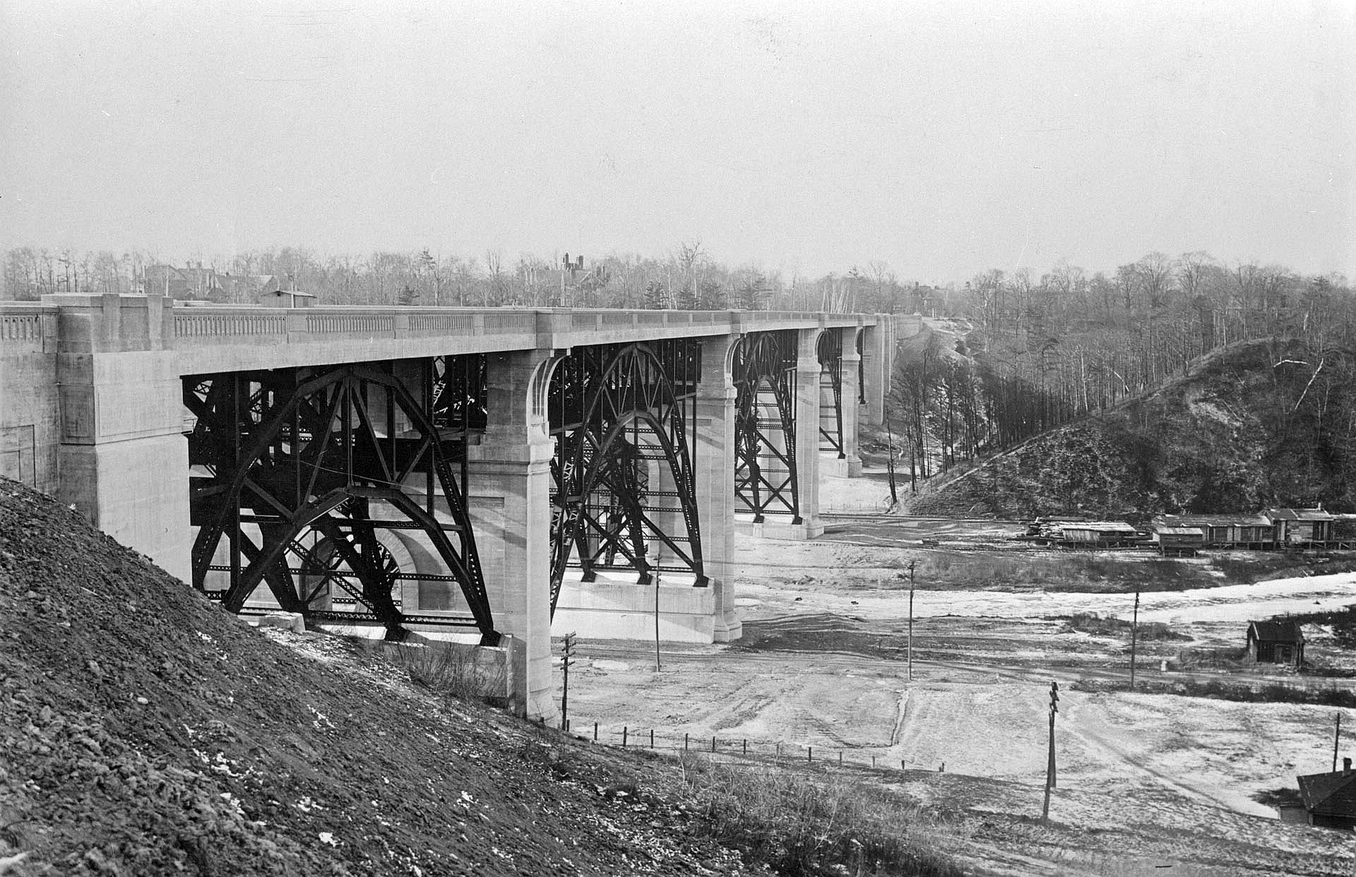
| Prince Edward Viaduct | Bloor St | Bayview runs under the viaduct | [[File:Prince Edward Viaduct.jpg | 100px]] |
| Don Valley Brick Works | Pottery Road | [[File:ADonValleyBrickworks.jpg | 100px]] | |
| Crothers Woods | Nesbitt Dr | [[File:Crothers Woods Toronto.jpg | 100px]] | |
| Mount Pleasant Cemetery | Moore Ave | Bayview forms the eastern boundary of Canada's largest cemetery | [[File:Mount Pleasant Cemetery, Toronto 3095.JPG | 100px]] |
| St Cuthbert's Anglican Church | McRae Dr | [[File:St Cuthbert, Toronto.JPG | 100px]] | |
| St. Augustine of Canterbury Anglican | Broadway Ave | [[File:St Augustine, Toronto.JPG | 100px]] | |
| Mount Hope Catholic Cemetery | Kilgour Rd | [[File:Mount Hope Cemetery.JPG | 100px]] | |
| CNIB | Kilgour Rd | [[File:Canadian National Institute for the Blind (CNIB) - Toronto, Canada.jpg | 100px]] | |
| Sunnybrook Health Sciences Centre | Blythwood Rd | [[File:Sunnybrook Cancer Centre 5926c.jpg | 100px]] | |
| Lawrence Park Community Church | Dawlish Ave | [[File:Lawrence Park Community Church.jpg | 100px]] | |
| Glendon College | Lawrence Ave E | Campus of York University | [[File:Rose garden 2.jpg | 100px]] |
| Toronto French School | Lawrence Ave E | [[File:Toronto French School.JPG | 100px]] | |
| Bayview Bridge | Lawrence Ave E | Carries Bayview across the Don River (West Branch) | [[File:Bayview Bridge from Lawrence.jpg | 100px]] |
| The Granite Club | Lawrence Ave | [[File:Granite Club.JPG | 100px]] | |
| The Crescent School | Lawrence Ave | [[File:Crescent School Front.jpg | 100px]] | |
| Bob Rumball Centre for the Deaf | Post Rd | |||
| Canadian Film Centre | Country Lane | [[File:CFC Windfields Main House.jpg | 100px]] | |
| Trinity York Mills Presbyterian Church | Truman Rd | [[File:Trinity York Mills Presbyterian.JPG | 100px]] | |
| Bayview station | Sheppard Ave | On the Sheppard line | [[File:Bayview Sheppard entrance.JPG | 100px]] |
| Bayview Village Shopping Centre | Sheppard Ave | [[File:Bayview Village Shopping Centre.jpg | 100px]] | |
| All Saints Greek Orthodox Church | Byng Ave | [[File:All Saints Greek Orthodox Community, Toronto.jpg | 100px]] | |
| Blessed Trinity Parish | Finch Ave | [[File:Blessed Trinity, Toronto.jpg | 100px]] | |
| St. Joseph's Morrow Park Catholic Secondary School/Tyndale University College and Seminary | Cummer Ave | [[File:Morrow Park Tyndale Bayview Campus.jpg | 100px]] | |
| Thornhill Community Centre | John St | [[File:ThornhillCommunityCentreLibrary4.JPG | 100px]] | |
| Shouldice Hernia Centre | Green Lane | |||
| Thornlea Secondary School | Willowbrook Rd | |||
| Toronto Montessori Schools | Highway 7 | |||
| Bayview Secondary School | Major Mackenzie Dr | [[File:Bayview SS front view.jpg | 100px]] | |
| Jean Vanier Catholic High School | Crosby Ave/Redstone Rd | |||
| Holy Trinity School | 19th Ave | |||
| Wilcox Lake | Bethesda Side Road | [[File:Wilcox Lake Panorama.JPG | 100px]] | |
| Pickering College | Mulock Dr |
References
References
- "Google Maps showing the entire length of Bayview Avenue".
- City of Toronto Archives
- Ferenc, Leslie. (November 19, 2002). "Only memories left standing". Toronto Star.
- "28 Davisville (1934-2014)".
- "11 Bayview". [[Toronto Transit Commission]].
- "28 Bayview South". Toronto Transit Commission.
- "54 Bayview". [[York Region Transit]].
- "91 Bayview". [[York Region Transit]].
- "391 Bayview Express". [[York Region Transit]].
This article was imported from Wikipedia and is available under the Creative Commons Attribution-ShareAlike 4.0 License. Content has been adapted to SurfDoc format. Original contributors can be found on the article history page.
Ask Mako anything about Bayview Avenue — get instant answers, deeper analysis, and related topics.
Research with MakoFree with your Surf account
Create a free account to save articles, ask Mako questions, and organize your research.
Sign up freeThis content may have been generated or modified by AI. CloudSurf Software LLC is not responsible for the accuracy, completeness, or reliability of AI-generated content. Always verify important information from primary sources.
Report