From Surf Wiki (app.surf) — the open knowledge base
Bankura district
District in West Bengal, India

District in West Bengal, India
| Field | Value |
|---|---|
| name | Bankura district |
| native_name | |
| settlement_type | District |
| image_skyline | {{Photomontage |
| photo1a | Ras Mancha 03.jpg |
| photo2a | Mahadebsinan Hill.jpg |
| photo2b | Bankura Town.jpg |
| photo3a | 29RCCMAK - Top View from Susunia Hill.jpg |
| size | 300 |
| foot_montage | Clockwise from top-left: Rasmancha in Bishnupur, Mukutmanipur Dam, old locomotive in Bankura, Susunia Hill, Forest near Mahadebsinan Hill |
| image_map | Bankura in West Bengal (India).svg |
| mapsize | 300 |
| map_caption | Location of Bankura district in West Bengal |
| coordinates | |
| subdivision_type | Country |
| subdivision_name | India |
| subdivision_type1 | State |
| subdivision_name1 | West Bengal |
| subdivision_type2 | Division |
| subdivision_name2 | Medinipur |
| seat_type | Headquarters |
| seat | Bankura |
| parts_type | District subdivisions |
| parts_style | para |
| p1 | |
| established_title | Formed |
| (as a district) | |
| established_date | |
| named_for | Bankura town |
| leader_title | Member of Parliament |
| leader_name | Arup Chakraborty (TMC) |
| Saumitra Khan (BJP) | |
| leader_title1 | District Magistrate and Collector |
| leader_name1 | Siyad N, IAS |
| leader_title2 | Superintendent of Police |
| leader_name2 | Vaibhav Tiwari, IPS |
| total_type | Total |
| area_total_km2 | 6,882 |
| population_as_of | 2011 |
| population_total | 3,596,674 |
| population_footnotes | |
| population_urban | 235,264 |
| population_density_km2 | auto |
| demographics_type1 | Demographics |
| demographics1_title1 | Sex ratio |
| demographics1_info1 | 914/1000 ♂/♀ |
| demographics1_title2 | Literacy rate |
| demographics1_info2 | 70.95% |
| demographics1_title3 | Scheduled Castes |
| demographics1_info3 | |
| demographics1_title4 | Scheduled Tribes |
| demographics1_info4 | |
| demographics_type2 | Languages |
| demographics2_title1 | Official |
| demographics2_info1 | Bengali |
| demographics2_title2 | Additional official |
| demographics2_info2 | English |
| timezone1 | IST |
| utc_offset1 | +05:30 |
| website |
the district
(as a district) Saumitra Khan (BJP)
Bankura district (Pron: bãkuɽa) is an administrative unit in the Indian state of West Bengal. It is part of Medinipur division—one of the five administrative divisions of West Bengal. Bankura district is surrounded by Purba Bardhaman district and Paschim Bardhaman district in the north, Purulia district in the west, Jhargram district and Paschim Medinipur district in the south, and some part of Hooghly district in the east. Damodar River flows in the northern part of Bankura district and separates it with the major part of Burdwan district. The district head quarter is located in Bankura town.
The district has been described as the "connecting link between the plains of Bengal on the east and Chota Nagpur plateau on the west." The areas to the east and north-east are low-lying alluvial plains while to the west the surface gradually rises, giving way to undulating country, interspersed with rocky hillocks.
Centre of the historic Mallabhum (Malla kingdom) of western Bengal, Bankura and its surrounding regions are identified with its historical and cultural significance for the later Middle Ages. Vaishnavism, which gained the status of state religion in the Malla kingdom in the seventeenth century, shaped the culture of the region. The Malla kingdom was annexed by the British East India Company in 1765 and the modern Bankura district took its form in 1881 and was named after its headquarters.
Etymology
There are few accepted opinions about the etymology of the word Bankura. In the language of the Kol-Mundas, orah or rah means habitation. Banku means extremely beautiful. It may also have come from the word banka which means zig-zag. One of the most influential deities in the district is Dharmathakur and he is locally called Bankura Roy. According to local tradition, the town, the headquarters of the district, was named after its founder, a chieftain named Banku Rai. Another legend has the town named after Bir Bankura, one of the twenty-two sons of Bir Hambir, the Raja of Bishnupur. He divided his kingdom into twenty-two tarafs or circles and gave one to each son. Taraf Jaybelia fell to the lot of Bir Bankura. He developed the town that bears the name Bankura. It has also been suggested that the name is a corruption of the word Bankunda, meaning five tanks. The name Bacoonda is found in old official records.
History
Main article: History of Bankura district
The earliest signs of human habitation in the area are at Dihar—by about 1000 BC chalcolithic people had settled on the north bank of the Dwarakeswar. Bankura district was inhabited by various indigenous tribes in later pre-historic times as well as Aryanised or assimilated with the people and culture of the Indo-Aryan group, who prevailed in northern India, substantially later than rest of Bengal. These developments took place over many centuries through both conflict and cordiality.
The district was part of Rarh in ancient times. In the old Jain book Acaranga Sutra (around 4th century) there is mention of Sumha and Ladha (Rarh?) and there too the reference is to an area inhabited by uncivilised and barbaric people.
In the fourth century, Susunia edicts record in Prakrit and Sanskrit that Chandravarman, son of Simhavarman, was the ruler of Pushkarana (modern Pakhanna in Bankura district). According to the inscription on the Allahabad pillar, Chandravarman was defeated by Samudragupta and the area became a part of the Gupta Empire. The area was for many years part of Dandabhukti and Bardhamanbhukti.
Many historians opine that assimilation with Indo-Aryans took place first in northern and eastern Bengal and then in western Bengal. This has also been the broad course of the spread of Buddhism and Jainism in Bengal. There is ample evidence of pre-eminence of Indo-Aryan religion and culture in West Bengal from around the sixth century.
Bishnupur kingdom
From around the seventh century until around the advent of British rule, for around a millennium, the history of Bankura district is identical with the rise and fall of the Hindu Rajas of Bishnupur. The area around Bishnupur was called Mallabhum. At its farthest extent Bishnupur kingdom stretched from Damin-i-koh in Santhal Parganas to Midnapore and included parts of Bardhaman and Chota Nagpur. Smaller kingdoms of aboriginal tribes, such as Dhalbhum, Tungbhum, Samantabhum and Varahabhumi or Varabhumi were gradually subdued and overshadowed by the Malla kings of Bishnupur.
Adi Malla (born 695 AD), the founder of the Malla dynasty, ruled in Laugram, 8.4 km from Kotulpur, for 33 years. When he was 15 years old he had no equal as a wrestler in the territory all around. It was this that earned him the sobriquet of Adi Malla, the original or unique wrestler. He was also known as Bagdi Raja and was succeeded by his son, Jay Malla, who extended his domains and shifted his capital to Bishnupur. The subsequent kings steadily extended their kingdom. Among the more renowned are: Kalu Malla, Kau Malla, Jhau Malla, and Sur Malla.[[File:Jor Mandir 4 Arnab Dutta 2011.JPG|thumb|right|[[Jor Mandir]] complex (c. 1726), Bishnupur]] Bir Hambir, the 49th ruler of the Malla dynasty who flourished around 1586 and ruled in the 16th-17th century, was a contemporary of the Mughal emperor Akbar. He was involved on the side of Mughals in their struggle against the Afghans and is mentioned by Muslim historians. He paid an annual tribute to the Muslim viceroys of Bengal and thus acknowledged their suzerainty. He was converted to Vaishnavism by Srinivasa and introduced the worship of Madan Mohan in Bishnupur.
Raghunath Singha Dev, who followed Bir Hambir, was the first Bishnupur Raja to use the Kshatriya title Singh. With exquisite palaces and temples built during the period that followed Bishnupur was reputed to be the most renowned city in the world, more beautiful than the house of Indra in heaven. However, it has also been recorded that while these royal patrons of Hindu art and religion were busy building temples they had lost much of their independence and sunk to the position of tributary princes. Bir Singh walled up alive all his sons, eighteen in number. The youngest, Durjan, alone escaped, having been kept in hiding by the servants. The status of the Raja of Bishnupur was that of a tributary prince, exempted from personal attendance at the court at Murshidabad, and represented there by a resident.
Maratha raids

The Bishnupur Rajas who were at the summit of their fortunes towards the end of the 17th century, started declining in the first half of the 18th century. First, the Maharaja of Burdwan seized the Fatehpur Mahal, and then the Maratha invasions laid waste their country. In 1742, when the Marathas, under Bhaskar Rao, attacked Bishnupur, the troops put up a spirited defence but then Gopal Singh retreated within the fort and ordered the troops and citizens to pray to Madan Mohan to save the city. It is believed that Madan Mohan responded and the cannons were fired without human assistance. The truth probably is that the Maratha cavalry were unable to pierce the strong fortifications and retired. While they failed to take the fort and pillage the treasury, the Marathas harried the less protected parts of the kingdom. Intrigue and litigation that followed ruined the Bishnupur Raj family and eventually in 1806, the estate was sold for arrears of land revenue and bought up by the Maharaja of Burdwan.
British administration
.jpg)
Bishnupur was ceded to the British with the rest of Burdwan chakla in 1760. The Marathas had laid the country waste and famine of 1770 completed the misery of the kingdom. A large section of the population was swept away, cultivation fell, and lawlessness spread. The once powerful king had been reduced to the status of a mere zamindar. In 1787, Bishnupur was united with Birbhum to form a separate administrative unit, the headquarters was shifted to Suri, and a rebellious situation prevailed. Bankura continued to be one district with Birbhum till 1793, when it was transferred to the Burdwan collectorate.
.jpg)

Towards the end of the 18th century, certain portions of the district around Raipur was affected by the Chuar Rebellion. At the time Bankura appears to have been part of Jungle Mahals. The disturbances of the Chuars in 1832 in the western part of the Bishnupur district lead to the disbandment of the Jungle Mahals. In 1833 Bishnupur was transferred to Burdwan. In 1872, the parganas of Sonamukhi, Indas, Kotulpur, Shergarh and Senpahari were transferred from Manbhum to Burdwan. At that time Bankura has area of 1346 sqmi with 526,772 inhabitants. In 1879, the district acquired its present shape with the thanas of Khatra and Raipur and the outpost of Simplapal being transferred from Manbhum, and the thanas of Sonamukhi, Kotulpur and Indas being retransferred from Burdwan. Addition of those areas into Bankura district increased to 2621 sqmi with 1,116,411 inhabitants in 1901. However, it was known for sometime as West Burdwan and in 1881 came to be known as Bankura district.
Post-independence
The district is part of the Red Corridor.
Geography

Main article: Geography of Bankura district
Bankura district is a part of Medinipur division. It is situated between 22° 38’ and 23° 38’ north latitude and between 86° 36’ and 87° 46’ east longitude. It has an area of 6882 km2. On the north and north-east the district is bounded by Bardhaman district, from which it is separated mostly by the Damodar River. On the south-east it is bounded by Hooghly district, on the south by Paschim Medinipur district and on the west by Purulia district. Bankura district has been described as the "connecting link between the plains of Bengal on the east and Chota Nagpur plateau on the west." The areas to the east and north-east are low-lying alluvial plains, similar to predominating rice lands of Bengal. To the west the surface gradually rises, giving way to undulating country, interspersed with rocky hillocks. Much of the country is covered with jungles.
The western part of the district has poor, ferruginous soil and hard beds of laterite with scrub jungles and sal woods. Long broken ridges with irregular patches of more recent alluvium have marks of seasonal cultivation. During the long dry season large extents of red soil with hardly any trees lend the country a scorched and dreary appearance. In the eastern part the eye constantly rests on wide expanses of rice fields, green in the rains but parched and dry in summer.
The Gondwana system is represented in the northern portion of the district, south of the Damodar, between Mejia and Biharinath Hill. The beds covered with alluvium contains seams of coal belonging to the Raniganj system.
Hills

The hills of the district consist of outliers of the Chota Nagpur plateau and only two are of any great height – Biharinath and Susunia. While the former rises to a height of 448 m, the latter attains a height of 440 m.
Rivers

The rivers of the area flow from the north-east to the south-west in courses roughly parallel to one another. They are mostly hill streams, originating in the hills in the west. The rivers come down in floods after heavy rains and subside as rapidly as they rise. In summer, their sand beds are almost always dry. The principal rivers are: Damodar, Dwarakeswar, Shilabati, Kangsabati, Sali, Gandheswari, Kukhra, Birai, Jaypanda and Bhairabbanki. There are some small waterfalls along the course of the Shilabati near Harmasra, and along the course of the Kangsabati in the Raipur area.
Kangsabati Project was started during the second five-year plan period (1956–1961). The dam across the Kangsabati has a length of 10098 m and a height of 38 m.{{cite web |access-date=15 June 2009 |url-status=dead |archive-url=https://web.archive.org/web/20070927024419/http://www.abasar.net/bk_main.asp?what=B00053 |archive-date=27 September 2007 }}

Climate
The climate, especially in the upland tracts to the west, is much drier than in eastern or southern Bengal. From the beginning of March to early June, hot westerly winds prevail, the thermometer in the shade rising to around 45 C. The monsoon months, June to September, are comparatively pleasant. The total average rainfall is 1400 mm, the bulk of the rain coming in the months of June to September. Winters are pleasant with temperatures dropping down to below 12 C in December.
Economy
Bankura is economically underdeveloped and is mostly dependent on agriculture. Almost 70% of the district's income is generated through agriculture where 80% of the farmers are small & marginal in nature. Bankura is one of the most draught prone district of West Bengal. However due to protective irrigation system, land reforms and use of high fertile & hybrid crops the economic condition of the district has improved. Also, cottage and small-scale industries, such as Stone-crushing, Weaving, Oilseed-crushing, handicraft units like Dokra, Terra-cotta, Baluchari Sari play a key economic role in district.
In 2006, the Ministry of Panchayati Raj named Bankura one of the country's 250 most backward districts (out of a total of 640).
Divisions
Administrative divisions
The district comprises three subdivisions: Bankura Sadar, Khatra and Bishnupur. Bankura Sadar subdivision consists of Bankura municipality and eight community development blocks: Bankura I, Bankura II, Barjora, Chhatna, Gangajalghati, Mejia, Onda and Saltora. Khatra subdivision consists of eight community development blocs: Indpur, Khatra, Hirbandh, Raipur, Sarenga, Ranibandh, Simlapal and Taldangra. Bishnupur subdivision consists of Bishnupur and Sonamukhi municipalities and six community development blocks: Indas, Joypur, Patrasayer, Kotulpur, Sonamukhi and Bankura.{{cite web |url-status=dead |archive-url=https://web.archive.org/web/20090225032419/http://wbdemo5.nic.in/writereaddata/Directoryof_District_Block_GPs%28RevisedMarch-2008%29.doc |archive-date=25 February 2009 }}
Bankura is the district headquarters. There are 21 police stations, 22 development blocks, 3 municipalities, 190 gram panchayats and 5187 villages in this district.{{cite web |access-date=6 December 2008 |url-status=dead |archive-url=https://web.archive.org/web/20080725065654/http://www.bankura.gov.in/Profile/administrative_features.htm |archive-date=25 July 2008 }}
Other than municipality area, each subdivision contains community development blocs which in turn are divided into rural areas and census towns. In total there are 5 urban units: 3 municipalities and 2 census towns.{{cite web | access-date = 6 December 2008
Bankura district is divided into the following administrative subdivisions:
| Subdivision | Headquarters | ||
|---|---|---|---|
| Area | |||
| km2 | Population | ||
| (2011) | Rural Population % | ||
| (2001) | Urban Population % | ||
| (2001) | |||
| Bankura Sadar | |||
| Khatra | |||
| Bishnupur | |||
| Bankura district |
Assembly constituencies
As per order of the Delimitation Commission in respect of the delimitation of constituencies in the West Bengal, the district is divided into 12 assembly constituencies:
| No. | Name | Lok Sabha Constituency | MLA | 2021 Winner | 2024 Lead |
|---|---|---|---|---|---|
| 247 | Saltora (SC) | Bankura | Chandana Bauri | ||
| 248 | Chhatna | Satyanarayan Mukhopadhyay | |||
| 249 | Ranibandh (ST) | Jyotsna Mandi | |||
| 250 | Raipur (ST) | Mrityunjoy Murmu | |||
| 251 | Taldangra | Falguni Singhababu | |||
| 252 | Bankura | Niladri Sekhar Dana | |||
| 253 | Barjora | Bishnupur | Alok Mukherjee | ||
| 254 | Onda | Amarnath Shakha | |||
| 255 | Bishnupur | Tanmay Ghosh | |||
| 256 | Katulpur (SC) | Harakali Protiher | |||
| 257 | Indas (SC) | Nirmal Kumar Dhara | |||
| 258 | Sonamukhi (SC) | Dibakar Gharami |
Raipur and Ranibandh constituencies are reserved for Scheduled Tribes (ST) candidates. Saltora, Katulpur, Indas and Sonamukhi constituencies will be reserved for Scheduled Castes (SC) candidates. Saltora, Chhatna, Ranibandh, Raipur, Taldangra, and Bankura constituencies will be part of Bankura (Lok Sabha constituency), which will also contain one assembly segment from Purulia district. Barjora, Onda, Bishnupur, Katulpur, Indas and Sonamukhi will be assembly segments of Bishnupur (Lok Sabha constituency), which also contains one assembly segments from Bardhaman district.
Demographics
| 1901 | 1116411 | 1911 | 1138670 | 1921 | 1019941 | 1931 | 1111721 | 1941 | 1289640 | 1951 | 1319259 | 1961 | 1664513 | 1971 | 2031039 | 1981 | 2374815 | 1991 | 2805065 | 2001 | 3192695 | 2011 | 3596674
According to the 2011 census Bankura district has a population of 3,596,674, roughly equal to the nation of Lithuania or the US state of Connecticut.{{cite web |access-date=30 September 2011 |quote=Connecticut 3,574,097 |url-status=dead |archive-url=https://web.archive.org/web/20131019160532/http://2010.census.gov/2010census/data/apportionment-pop-text.php |archive-date=19 October 2013 }} This gives it a ranking of 80th in India (out of a total of 739).
In the 2001 census, Bankura district had a total population of 3,191,822 of which 1,634,561 were males and 1,557,261 were females. Decadal growth for the period 1991-2001 was 13.79% in Bankura district against 17.84% in West Bengal. The urban population was 235,264 against a rural population of 2,956,558. The district had a density of population of 464 persons per km2. Bankura had a literacy rate of 63.84 per cent.
The first census was taken in 1872. The district as now constituted had a population of 968,597. In the 1901 census, 90.7 per cent of the population spoke a dialect of Bengali known as Rarhi Boli, which was also spoken in the adjoining districts. Santali was spoken by about 9 per cent of the population. 87.4 per cent of the population were Hindus, 8 per cent were Animists and 5.6 per cent were Muslims.
Religion
| Religion | title=CENSUS OF INDIA, 1941 VOLUME VI BENGAL PROVINCE | url=https://dspace.gipe.ac.in/xmlui/bitstream/handle/10973/37365/GIPE-020591.pdf?sequence=3&isAllowed=y | access-date=13 August 2022}} | Percentage (1941) | date=2011 | title=Table C-01 Population by Religion: West Bengal | url=https://censusindia.gov.in/nada/index.php/catalog/11396/download/14509/DDW19C-01%20MDDS.XLS | website=censusindia.gov.in | publisher=Registrar General and Census Commissioner of India}} | Percentage (2011) |
|---|---|---|---|---|---|---|---|---|---|---|
| Hinduism [[File:Om.svg | 16x16px]] | 1,078,559 | 83.63% | 3,033,581 | 84.34% | |||||
| Tribal religion | 154,246 | 11.96% | 260,694 | 7.25% | ||||||
| Islam [[File:Star_and_Crescent.svg | 15x15px]] | 55,564 | 4.31% | 290,450 | 8.08% | |||||
| Others | 1,271 | 0.10% | 11,949 | 0.33% | ||||||
| Total Population | 1,289,640 | **** | 3,596,674 | 100% |
Hinduism is the predominant religion, and makes up nearly the entire population in urban areas. Islam is almost entirely to be found in rural areas, as are tribal religions. Muslims are most concentrated in the east of the district bordering Bardhaman and Hooghly districts, while tribal religions are largely in the south west, and form significant minorities in Ranibundh (39.44%) and Raipur (27.66%) CD blocks.
Language
According to the 2011 census, 90.68% of the population spoke Bengali and 7.96% Santali as their first language.
Most people, particularly in rural areas, speak the 'Bankri', a coarser form of the Central Bengali dialect.
Culture
Places of interest

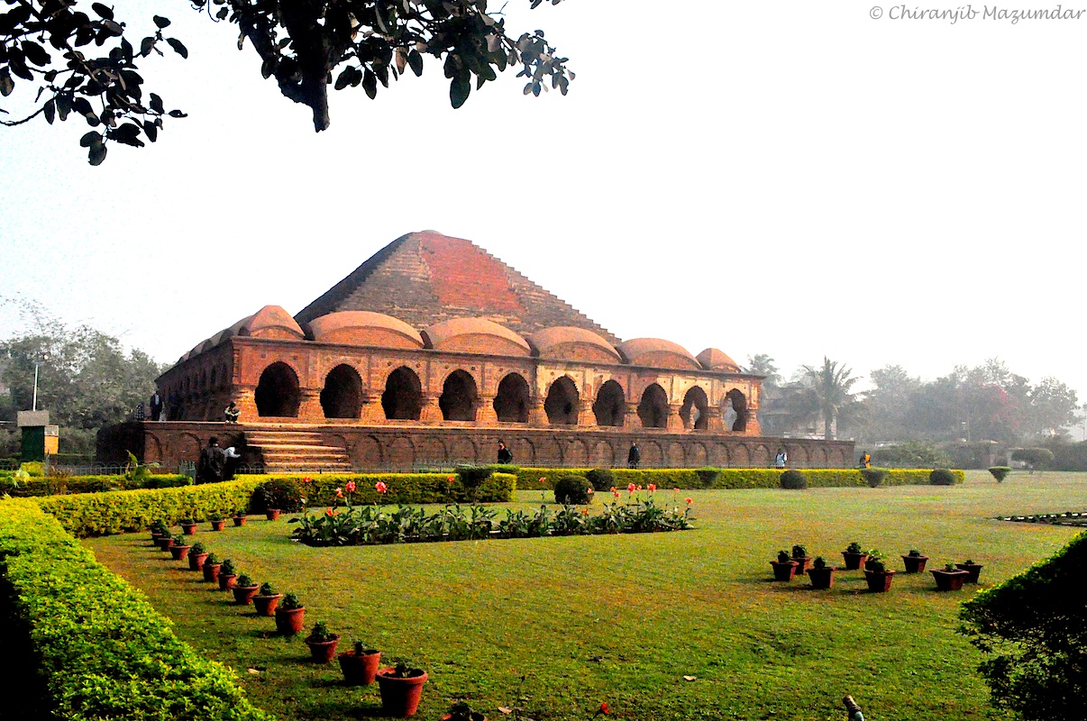
Bankura is the headquarters of the district. Bishnupur (or Vishnupur) is a subdivisional town of Bankura district. It was the capital of the Mallabhum kingdom, once the most important Hindu dynasty in Bengal. This town famous for the Terracotta Temples made by the local red soils. This city often called as the 'Temple City' of Bengal.
In addition to Bishnupur, many towns and villages in Bankura such as Kotulpur, Joypur, Sonamukhi, Hadal Narayanpur, and Akui have brick terracotta temples built between the 17th and 19th centuries.
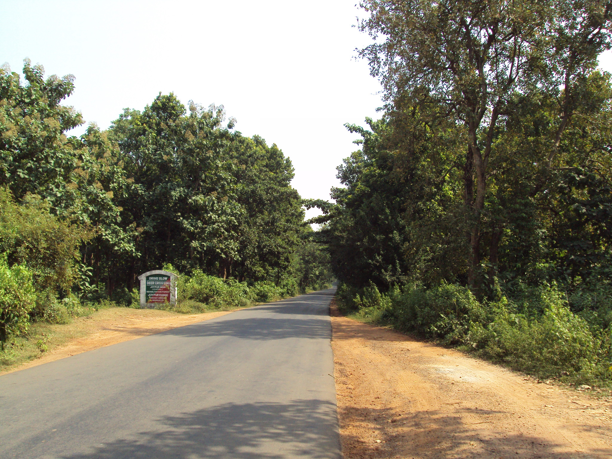
Susunia hills and Beharinath hills are located in the district. Mukutmanipur, the second largest earthen dam in India and Sutan are tourist spots. Mejia power plant is the only thermal power plant of this district. Darakeshwar, Gandheswari and Kangsabati are the major rivers flow through the district. Jaipur forest is the only forest in the plains of Southern Bengal. Bankura Sammilani Medical College is the oldest medical college in this area.
Flora and fauna
The eastern portion of the district is a part of the rice plains of West Bengal. The land under rice cultivation contains marsh weeds of Gangetic plain. Around human habitations there are shrub species such as:
- Glycosmis,
- Polyalthia suberosa,
- Clerodendrum infortunatum,
- Solanum torvum and various other species of the same genus,
- Trema,
- Streblus and
- Ficus hispida.
The larger trees are:
- papal,
- banyan,
- red cotton tree (Bombax malabaricum),
- mango (Mangifera indica),
- jiyal (Lannea coromandelica),
- Phoenix dactylifera, and
- Borassus flabellifer. Other plants found include:
- Jatropha gossypifolia,
- Urena,
- Heliotropium and
- Sida. Forests or scrub jungles contain: *Wendlandia exserta,
- Gmelina arborea,
- Haldina cordifolia,
- Holarrhena antidysenterica,
- Wrightia tomentosa,
- Vitex negundo and
- Stephegyne parvifolia.
The western portion of the district is higher. The uplands are either bare or are covered with scrub jungle of Ziziphus and other thorny shrubs. This thorny forest gradually merges into sal (Shorea robusta) forest. Low hills are covered with Miliusa, Schleichera, Diospyros and other trees.
Some of the common trees of economic interest found in the district are:
- Alkushi (Mucuna pruriens),
- amaltas (Cassia fistula),
- asan (Terminalia tomentosa),
- babul (Acacia nilotica),
- bair (Ziziphus jujuba),
- bael (Aegle marmelos),
- bag bherenda (Jatropha curcas),
- bichuti (Tragia involucrate),
- bahera (Terminalia belerica),
- dhatura (Datura stramonium),
- dhaman (Cordia macleodii),
- gab (Diospyros embryopteris),
- harra (Terminalia chebula),
- imli (Tamarindus indica),
- kuchila (Strychnos nux-vomica),
- mahua (Bassia latifolia),
- palas (Butea frondosa),
- sajina (Moringa pterygosperma),
- kend (Diospyros melanoxylon),
- mango,
- date-palm,
- nim,
- papal,
- banyan,
- red cotton tree and
- jiyal.
Education
Bankura district had a literacy rate of 70.26% as per the provisional figures of the census of India 2011. Bankura Sadar subdivision had a literacy rate of 69.56%, Khatra subdivision 69.79% and Bishnupur subdivision 71.60%.
Given in the table below (data in numbers) is a comprehensive picture of the education scenario in Bankura district for the year 2013-14. The primary schools include junior basic schools; middle schools, high schools and higher secondary schools include madrasahs; technical schools include junior technical schools, junior government polytechnics, industrial technical institutes, industrial training centres, nursing training institutes etc.; technical and professional colleges include engineering colleges, medical colleges, para-medical institutes, management colleges, teachers training and nursing training colleges, law colleges, art colleges, music colleges etc. Special and non-formal education centres include sishu siksha kendras, madhyamik siksha kendras, centres of Rabindra mukta vidyalaya, recognised Sanskrit tols, institutions for the blind and other handicapped persons, Anganwadi centres, reformatory schools etc.
| Subdivision | Primary | ||||||||||||||||||||
|---|---|---|---|---|---|---|---|---|---|---|---|---|---|---|---|---|---|---|---|---|---|
| School | Middle | ||||||||||||||||||||
| School | High | ||||||||||||||||||||
| School | Higher Secondary | ||||||||||||||||||||
| School | General | ||||||||||||||||||||
| College, Univ | Technical / | ||||||||||||||||||||
| Professional Instt | Non-formal | ||||||||||||||||||||
| Education | Institution | Student | Institution | Student | Institution | Student | Institution | Student | Institution | Student | Institution | Student | Institution | Student | |||||||
| Bankura Sadar | 1,371 | 117,820 | 144 | 17,951 | 90 | 69,329 | 91 | 78,909 | 9 | 14,782 | 14 | 2,865 | 2,228 | 69,919 | |||||||
| Khatra | 1,200 | 86,786 | 113 | 16,805 | 50 | 28,178 | 112 | 93,919 | 6 | 13,067 | 6 | 702 | 1,993 | 51,849 | |||||||
| Bishnupur | 979 | 86,750 | 112 | 15,092 | 57 | 28,738 | 81 | 78,915 | 6 | 10,552 | 14 | 4,170 | 1,649 | 57,769 | |||||||
| Bankura district | 3,550 | 291,356 | 369 | 49,848 | 197 | 126,245 | 284 | 251,743 | 21 | 38,401 | 34 | 7,737 | 5,870 | 179,537 |
Health care
The table below (all data in numbers) presents an overview of the medical facilities available and patients treated in the hospitals, health centres and sub-centres in 2014 in Bankura district.
| Subdivision | Health & Family Welfare Deptt, WB | Other | ||||||||||||
|---|---|---|---|---|---|---|---|---|---|---|---|---|---|---|
| State | ||||||||||||||
| Govt | ||||||||||||||
| Deptts | Local | |||||||||||||
| bodies | Central | |||||||||||||
| Govt | ||||||||||||||
| Deptts / | ||||||||||||||
| PSUs | NGO / | |||||||||||||
| Private | ||||||||||||||
| Nursing | ||||||||||||||
| Homes | Total | Total | ||||||||||||
| Number | ||||||||||||||
| of | ||||||||||||||
| Beds | Total | |||||||||||||
| Number | ||||||||||||||
| of | ||||||||||||||
| Doctors | Indoor | |||||||||||||
| Patients | Outdoor | |||||||||||||
| Patients | Hospitals | |||||||||||||
| Rural | ||||||||||||||
| Hospitals | ||||||||||||||
| Block | ||||||||||||||
| Primary | ||||||||||||||
| Health | ||||||||||||||
| Centres | ||||||||||||||
| Primary | ||||||||||||||
| Health | ||||||||||||||
| Centres | ||||||||||||||
| Bankura Sadar | 2 | 6 | 2 | 25 | 3 | - | 2 | 31 | 71 | 2,628 | 320 | 147,890 | 2,634,248 | |
| Khatra | 1 | 7 | 1 | 21 | - | - | - | 4 | 34 | 698 | 77 | 58,258 | 1,440,172 | |
| Bishnupur | 1 | 5 | 1 | 23 | - | - | - | 11 | 41 | 698 | 77 | 68,068 | 1,351,349 | |
| Bankura district | 4 | 18 | 4 | 69 | 3 | - | 2 | 46 | 146 | 4,152 | 459 | 274,216 | 5,425,769 |
Transport
Bankura Junction railway station is managed by the South Eastern Railways and is on the Adra-Midnapore rail route. It is in Bankura city. Bhubaneswar Rajdhani Express, Rupashi Bangla Express, Aranyak Express, Puri-New Delhi (Nandan Kanan) Superfast Express, Ernakulam-Patna Express, Howrah-LTT Samarsata Express and Purulia-Howrah Express pass through this station. It is the originating and terminating station of Bankura Damodar Railway which will connect to Howrah-Bardhaman Chord section. Computerized reservation facility is available. Going towards north-west, Adra Junction Railway Station is the nearest main station and moving to south, Midnapore Railway Station is the major station next to Bankura.
The Bankura Junction railway station and bridge over Dhaleshwari River were built by Gujarati Railway Contractors of the town Jeewan Gangji Savaria and Lalji Raja Vadher in 1900 working for Bengal Nagpur Railway.
National Highway 14 (India) running from Morgam (in Murshidabad district) to Kharagpur (in Paschim Medinipur district), State Highway 9 (West Bengal) running from Durgapur (in Paschim Bardhaman district) to Nayagram (in Jhargram district) and State Highway 5 (West Bengal) running from Rupnarayanpur (in Bardhaman district) to Junput (in Purba Medinipur) pass through Bankura. NH 14 links Bankura to NH 12 and NH 16. Both NH 14 and SH 9 link Bankura to NH 19 (Grand Trunk Road).
The district lies in very close proximity to the Kazi Nazrul Islam Airport located in neighbouring Paschim Bardhaman.
Notable people
- Khan Bahadur Dr. Syed Muhammed Siddique, MLA for Bankura
- Mohammad Shamsuzzoha (1934–1969) writer, professor and proctor
Notes
References
References
- "Fact and Figures".
- "52nd Report of the Commissioner for Linguistic Minorities in India". [[Ministry of Minority Affairs]].
- "Bankura District". District Administration.
- O’Malley, L.S.S., ICS, ''Bankura'', Bengal District Gazetteers, pp. 1-20, first published 1908, 1995 reprint, Government of West Bengal
- "Welcome to Historical Details of Bankura". www.bankura.org.
- Das, Dipak Ranjan. (2012). "Banglapedia: National Encyclopedia of Bangladesh". [[Asiatic Society of Bangladesh]].
- Ghosh, Binoy, ''Paschim Banger Sanskriti'', (in Bengali), part I, 1976 edition, pp. 60-62, pp. 328-331, Prakash Bhaban
- Ray, Nihar Ranjan, ''Bangalir Itihas Adi Parba'', (in Bengali), 1980 edition, pp. 276-281, Paschim Banga Niraksharata Durikaran Samiti
- Majumdar, R.C., ''History of Ancient Bengal'', pp. 32, 444, Tulshi Prakashani.
- Sengupta, Nitish, ''History of the Bengali-speaking People'', p.21, UBS Publishers’ Distributors Pvt. Ltd.
- Ghosh, Binoy, ''Paschim Banger Sanskriti'', (in Bengali), part I, 1976 edition, pp. 82-86, Prakash Bhaban
- O’Malley, L.S.S., ICS, ''Bankura'', ''Bengal District Gazetteers'', pp. 21-46, 1995 reprint, Government of West Bengal
- (1914). "Bengal District Gazetteers Murshidabad".
- Beverley, H.. (1872). "Report of the Census of Bengal 1872". Bengal Secretariat Press.
- (11 December 2009). "83 districts under the Security Related Expenditure Scheme". IntelliBriefs.
- "Bankura, West Bengal". District administration.
- "Provisional population totals, West Bengal, Table 4, Bankura District". Census Commission of India.
- bankura.org. "Economy, An overview". bankura.org.
- Ministry of Panchayati Raj. (8 September 2009). "A Note on the Backward Regions Grant Fund Programme". National Institute of Rural Development.
- "District Statistical Handbook 2014 Bankura". Department of Statistics and Programme Implementation, Government of West Bengal.
- "Delimitation Commission Order No. 18". Government of West Bengal.
- [http://www.censusindia.gov.in/2011census/PCA/A2_Data_Table.html Decadal Variation In Population Since 1901]
- (2011). "District Census Handbook: Bankura". [[Registrar General and Census Commissioner of India]].
- US Directorate of Intelligence. "Country Comparison:Population".
- "A-11 Appendix: District wise scheduled tribe population (Appendix) [2011]". Registrar General & Census Commissioner, India }}.
- "TRU for all Districts (SC & ST and Total)". Census Commission of India.
- "District Industrial Potential Report of Bankura (2003-04)".
- O’Malley, L.S.S., pp. 48-52
- "CENSUS OF INDIA, 1941 VOLUME VI BENGAL PROVINCE".
- (2011). "Table C-01 Population by Religion: West Bengal". [[Registrar General and Census Commissioner of India]].
- "Table C-16 Population by Mother Tongue: West Bengal". [[Registrar General and Census Commissioner of India]].
- "Terracotta Temples of Bankura".
- O’Malley, L.S.S., pp. 12-15
- "District Statistical Handbook 2014 Bankura". Department of Statistics and Programme Implementation, Government of West Bengal.
- "District Statistical Handbook 2014 Bankura". Department of Statistics and Programme Implementation, Government of West Bengal.
- "Could there be any real immersion of Pother Debota?".
- "Train to Bankura".
- "Rationalisation of Numbering Systems of National Highways". [[Department of Road Transport and Highways]].
- "List of State Highways in West Bengal". West Bengal Traffic Police.
- {{cite Banglapedia. Murshed, Md Mahbub
This article was imported from Wikipedia and is available under the Creative Commons Attribution-ShareAlike 4.0 License. Content has been adapted to SurfDoc format. Original contributors can be found on the article history page.
Ask Mako anything about Bankura district — get instant answers, deeper analysis, and related topics.
Research with MakoFree with your Surf account
Create a free account to save articles, ask Mako questions, and organize your research.
Sign up freeThis content may have been generated or modified by AI. CloudSurf Software LLC is not responsible for the accuracy, completeness, or reliability of AI-generated content. Always verify important information from primary sources.
Report