From Surf Wiki (app.surf) — the open knowledge base
Baltiysk
Town in Kaliningrad Oblast, Russia

Town in Kaliningrad Oblast, Russia
| Field | Value |
|---|---|
| en_name | Baltiysk |
| ru_name | Балтийск |
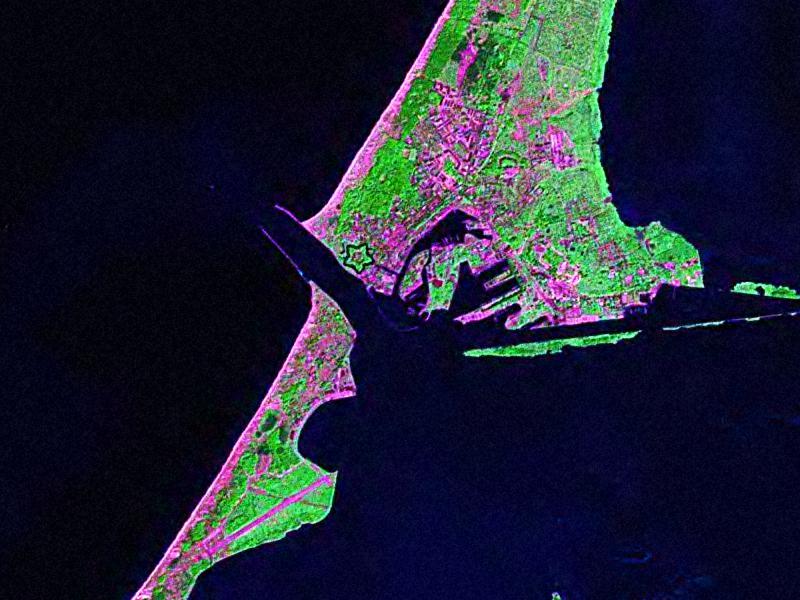
| image_skyline | BaltiyskPillau 05-2017 img07 aerial photo.jpg |
| image_caption | Aerial view of Baltiysk |
| pushpin_map | Russia Kaliningrad Oblast#European Russia#Europe |
| coordinates | |
| image_flag | Flag of Baltiysk.png |
| image_coa | Coat of Arms of Baltiysk (Kaliningrad oblast).png |
| federal_subject | Kaliningrad Oblast |
| federal_subject_ref | |
| adm_district_jur | Baltiysky District |
| adm_district_jur_ref | |
| adm_selsoviet_jur | Baltiysk |
| adm_selsoviet_type | Town of district significance |
| adm_selsoviet_jur_ref | |
| adm_ctr_of1 | Baltiysky District |
| adm_ctr_of1_ref | |
| adm_ctr_of2 | town of district significance of Baltiysk |
| adm_ctr_of2_ref | |
| inhabloc_cat | Town |
| inhabloc_cat_ref | |
| mun_district_jur | Baltiysky Municipal District |
| mun_district_jur_ref | |
| urban_settlement_jur | Baltiyskoye Urban Settlement |
| urban_settlement_jur_ref | |
| mun_admctr_of1 | Baltiysky Municipal District |
| mun_admctr_of1_ref | |
| mun_admctr_of2 | Baltiyskoye Urban Settlement |
| mun_admctr_of2_ref | |
| leader_title | Head |
| leader_name | Maksim Brychuk |
| pop_2010census | 32697 |
| pop_2010census_ref | |
| established_date | 13th century |
| current_cat_date | 1725 |
| postal_codes | 238520–238522, 238525, 238527, 238528 |
| dialing_codes | 40145 |
| website | http://балтийск39.рф |
Baltiysk ( ) is a seaport town and the administrative center of Baltiysky District in Kaliningrad Oblast, Russia, located on the northern part of the Vistula Spit, on the shore of the Strait of Baltiysk separating the Vistula Lagoon from Gdańsk Bay. It had a population of
Baltiysk, the westernmost town in Russia, is a major base of the Russian Navy's Baltic Fleet and is connected to St. Petersburg by ferry.
History
Old Prussian village
Baltiysk was originally the site of an Old Prussian fishing village that was established on the coast of the Vistula Spit at some point in the 13th century. The village was named as "Pile" or "Pil" in several documents, possibly taking its name from pils the Old Prussian language word for fort. It was eventually conquered by the Teutonic Knights, with the name evolving into the German form of Pillau. In 1497, a storm surge dug a new gat in front of the village, and another large storm created the navigable Strait of Baltiysk through the gat on September 10, 1510. This fostered the growth of Pillau into an important port of the Duchy of Prussia, a vassal duchy of Poland, and a blockhouse was constructed in 1537, followed by a system of storehouses in 1543, and the earliest fortifications in 1550. During the Thirty Years' War, the harbor was occupied by Sweden in the aftermath of their victory over the Polish–Lithuanian Commonwealth, and King Gustavus Adolphus landed there with his reinforcements in May 1626. After the Truce of Altmark in 1629, the Swedes retained Pillau and set out upgrading its fortifications, constructing a star fort which remains one of the town's landmarks. In 1635, the citizens of Pillau paid the ransom of 10,000 thalers, whereupon Swedish forces handed over the settlement to the Elector of Brandenburg.
Prussian town

By the end of the 17th century, Pillau had expanded considerably, and a lighthouse and a stone church were built. Peter the Great, the Tsar of Russia, visited Pillau on three occasions, the first being in 1697 in connection with his Grand Embassy to Western Europe. A statue of Peter the Great currently stands next to the lighthouse. After Pillau was granted town privileges in 1725,
The importance of Pillau declined from 15 November 1901, when a shipping canal was opened linking the Vistula Lagoon near Zimmerbude (now Svetly) to Königsberg. Pillau's economy was heavily based on large shipping vessels being forced to dock in the town due to the shallow depth of the lagoon near Königsberg, the capital and the largest city of East Prussia, and the goods would then be transported from Pillau to Königsberg by other means. Constructed at a huge cost of thirteen million marks, the canal allowed vessels of a 21 ft draught to moor alongside the city or to sail directly to Königsberg without stopping at Pillau, causing a serious decline to the town's economy.
World War II

During World War II, a Sammellager prisoner-of-war camp was located in the town in October and November 1939, following the German invasion of Poland.
Pillau had a U-boat training facility, and on 16 April 1945, the was sunk by Red Army artillery fire while she was docked near the electricity supply pier in Pillau port, and was the only U-boat to be ever sunk by land-based forces in World War II. As the Red Army entered East Prussia, more than 450,000 refugees were ferried from Pillau to central and western Germany. The town was eventually captured by Soviet forces on 25 April 1945, only a few days before the end of the war and as the last part of East Prussia to be abandoned by Germany.
Modern Baltiysk
After the war, Pillau was included in the northern part of East Prussia passed to the Soviet Union that became Kaliningrad Oblast, and the German inhabitants were expelled in accordance with the Potsdam Agreement. During the Russification campaign, the town's name was changed to Baltiysk in 1946.
In 1952, the Soviet authorities inaugurated a naval base for the Baltic Fleet of the Soviet Navy at Baltiysk, and as a result, it became a closed town with access forbidden to foreigners or those without a permit. During the Cold War it was served by the Baltiysk Air Base. The town, along with Kaliningrad, remains one of only two year-round ice-free ports along the Baltic Sea coastline available to Russia.

In 2019, on a wave of anti-Western sentiment following Russia's annexation of Crimea, there were calls to change the town's German-era coat of arms, which features a sturgeon wearing the crown of King Frederick William I of Prussia. The historic arms had been granted to the town, then known as Pillau, in 1725.
Administrative and municipal status
Within the framework of administrative divisions, Baltiysk serves as the administrative center of Baltiysky District. As an administrative division, it is, together with two rural localities, incorporated within Baltiysky District as the town of district significance of Baltiysk. As a municipal division, the town of district significance of Baltiysk is incorporated within Baltiysky Municipal District as Baltiyskoye Urban Settlement.
Geography
The town is located on the northern part of the Vistula Spit, on the shore of the Strait of Baltiysk separating the Vistula Lagoon from Gdańsk Bay.
Climate
Baltiysk has a temperate oceanic climate (Köppen Cfb borders on Dfb). Winters are cold to mild, while summers are warm. In July and August, the warmest season, high temperatures average 21 C and low temperatures average 15 C. In January and February, the coldest season, high temperatures average 3 C with low temperatures averaging -2 C.
|Jan record high C=14.5 |Feb record high C=17.1 |Mar record high C=14.9 |Apr record high C=25.0 |May record high C=27.1 |Jun record high C=29.4 |Jul record high C=31.7 |Aug record high C=31.3 |Sep record high C=26.7 |Oct record high C=22.6 |Nov record high C=17.1 |Dec record high C=17.0 |year record high C = 31.7 |Jan record low C = -20.8 |Feb record low C = -17.6 |Mar record low C = -12.9 |Apr record low C = -4.0 |May record low C = -0.2 |Jun record low C = 1.4 |Jul record low C = 7.8 |Aug record low C = 8.1 |Sep record low C = 4.3 |Oct record low C = -1.4 |Nov record low C = -8.8 |Dec record low C = -14.8 |year record low C = -20.8
Landmarks
Historical buildings in and around the town include the pentagonal , founded by the Swedes in 1626, completed by the Prussians in 1670, renovated in 1870, and currently holding a naval museum; the ruins of the 13th-century Lochstadt Castle; a maze of 19th-century naval fortifications; the Naval Cathedral of St. George (1866); the 32 m Expressionist observation tower (1932); the Gothic Revival building of the Baltic Fleet Museum (1903); and an elegant lighthouse, dating from 1813 to 1816. A stone cross, erected in 1830 to commemorate the supposed spot of St. Adalbert of Prague's martyrdom, was destroyed by the Soviets and restored a millennium after the event, in 1997. There is a seaside monument of Empress Elizabeth of Russia, erected postwar by the Russian sculptor Georgy Frangulyan.
Notable people
- Karl Heinrich Barth (1847–1922), German pianist
- Otto Dempwolff (1871–1938), German linguist and anthropologist
- Fritz Gajewski (1885–1965) a German businessman with IG Farben
- Renate Garisch-Culmberger (born 1939), East German athlete
- Manfred Schaefer (born 1943) a former association football defender
- Grigoriy Korchmar (born 1947) a Russian composer and pianist.
International relations
Twin towns and sister cities
Baltiysk is twinned with:
- Poland Nysa, Poland
- Sweden Karlskrona, Sweden
Former twin towns
- Poland Elbląg, Poland
On 28 February 2022, the Polish city of Elbląg ended its partnership with Baltiysk as a response to the Russian invasion of Ukraine.
References
Notes
Citations
Sources
- Baedeker, Karl, Northern Germany, 14th revised (English-language) edition, Leipzig, London, and New York, 1904.
References
- Kaemmerer, Margarete. (2004). "Ortsnamenverzeichnis der Ortschaften jenseits von Oder u. Neiße". G. Rautenberg.
- פּילאַווע, Yiddishland https://www.yivo.org/yiddishland-topo
- "Prūsisks wirdeīns".
- {{cite EB1911
- . (1887). "Słownik geograficzny Królestwa Polskiego i innych krajów słowiańskich, Tom VIII".
- (2022). "The United States Holocaust Memorial Museum Encyclopedia of Camps and Ghettos 1933–1945. Volume IV". Indiana University Press, United States Holocaust Memorial Museum.
- (2003). "Энциклопедия Города России". Большая Российская Энциклопедия.
- [https://www.rferl.org/a/russian-court-finds-illegal-german-coat-of-arms-of-town-in-far-western-exclave/30169130.html Russian court finds illegal German coat of arms of town in far western exclave]
- Resolution #640
- Law #274
- [http://www.weatherbase.com/weather/weather-summary.php3?s=592439&cityname=Baltiysk%2C+Kaliningrad%2C+Russia&units= Weatherbase Climate Summary]
- "Kaliningrad-meteo.ru".
- (28 February 2022). "Miasto Elbląg zrywa współpracę z rosyjskimi miastami partnerskimi".
This article was imported from Wikipedia and is available under the Creative Commons Attribution-ShareAlike 4.0 License. Content has been adapted to SurfDoc format. Original contributors can be found on the article history page.
Ask Mako anything about Baltiysk — get instant answers, deeper analysis, and related topics.
Research with MakoFree with your Surf account
Create a free account to save articles, ask Mako questions, and organize your research.
Sign up freeThis content may have been generated or modified by AI. CloudSurf Software LLC is not responsible for the accuracy, completeness, or reliability of AI-generated content. Always verify important information from primary sources.
Report