From Surf Wiki (app.surf) — the open knowledge base
Autostrada A29 (Italy)
Controlled-access highway in Italy

Controlled-access highway in Italy
| Field | Value |
|---|---|
| country | ITA |
| type | A |
| route | 29 |
| alternate_name | Autostrada del Sale |
| Salt motorway | |
| established | 1972 |
| direction_a | North |
| terminus_a | Palermo |
| direction_b | South |
| terminus_b | Mazara del Vallo |
| length_km | 115.7 |
| regions | Sicily |
| map | Italia - mappa autostrada A29.svg |
| e-road | E90 and E933 |
| previous_type | A |
| previous_route | 28 |
| next_type | A |
| next_route | 30 |
Salt motorway |e-road=E90 and E933
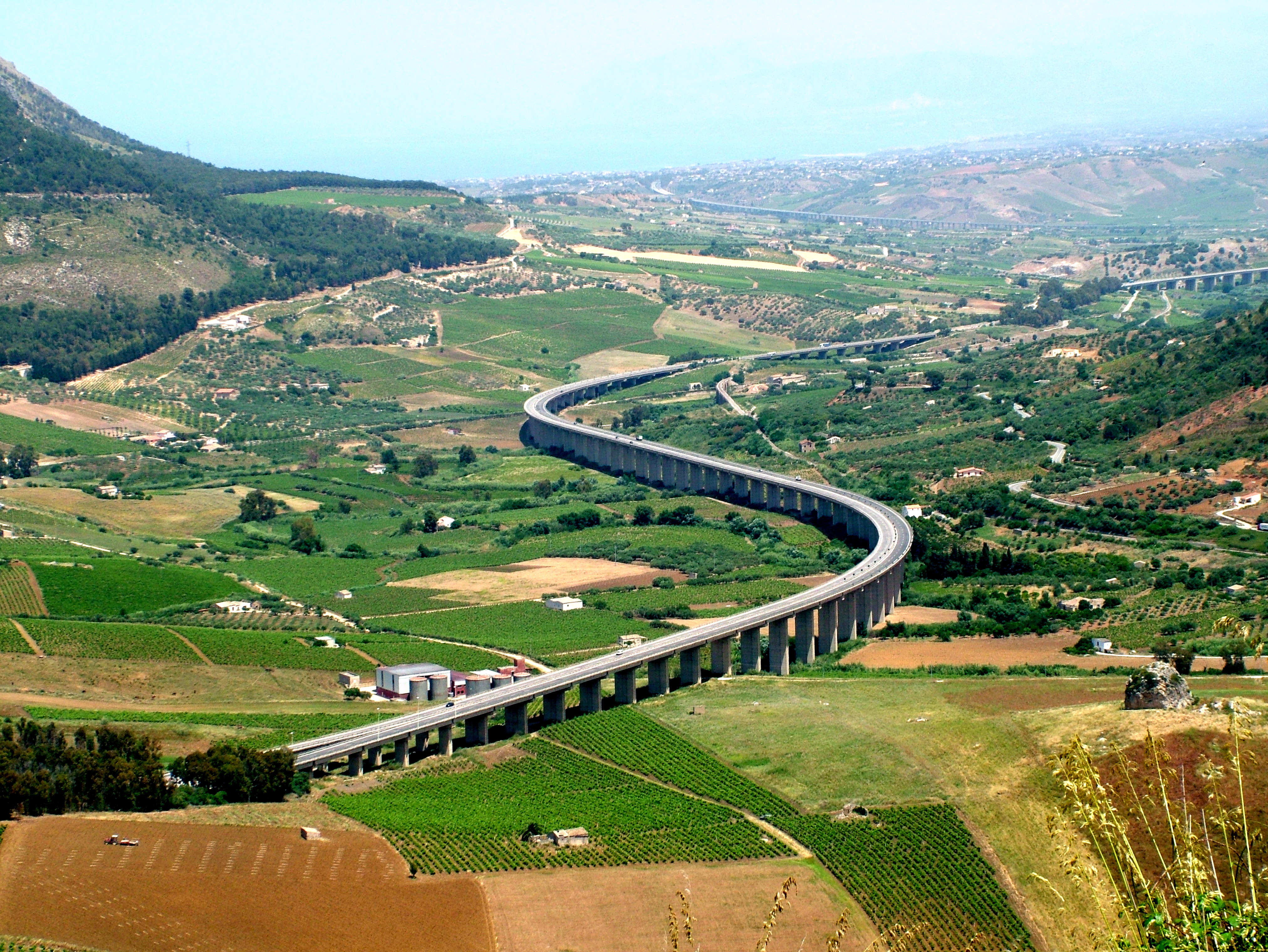
The Autostrada A29 or Autostrada del Sale ("Salt motorway") is an autostrada (Italian for "motorway") 115.7 km long in Italy on the island of Sicily that links Palermo to Mazara del Vallo. It is a part of the E90 and E933 European routes.
The motorway is also called Autostrada del Sale ("Salt Motorway") because one of its branches ends at the salt pans between Marsala and Trapani. It's a four-lane motorway in its whole length. Autostrada A29 is entirely toll-free and is managed by ANAS.
A segment of the motorway near Capaci was the site of the fatal bombing on Italian magistrate Giovanni Falcone and his wife Francesca Morvillo by the Sicilian Mafia.
Route


| Exit | ↓km↓ | ↑km↑ | Province | European Route | ||
|---|---|---|---|---|---|---|
| Raccordo A29-Palermo | 0.0 km | 115.7 km | PA | |||
| [[Image:AB-AS-grün.svg]] Tommaso Natale - Mondello | 2.5 km | 113.2 km | PA | |||
| [[Image:AB-AS-grün.svg]] Capaci - Isola delle Femmine | ||||||
| Settentrionale Sicula | 4.5 km | 111.2 km | PA | |||
| [[Image:AB-AS-grün.svg]] Carini | 7.8 km | 107.9 km | PA | |||
| [[Image:AB-AS-grün.svg]] Bretella Aeroporto "Falcone e Borsellino" | ||||||
| Palermo International Airport | 12.0 km | 103.7 km | PA | |||
| [[Image:AB-AS-grün.svg]] Villagrazia di Carini | 14.3 km | 101.4 km | PA | |||
| [[Image:AB-AS-grün.svg]] Cinisi | 19.1 km | 95.6 km | PA | |||
| [[Image:AB-AS-grün.svg]] Terrasini | ||||||
| Settentrionale Sicula | 23.6 km | 92.1 km | PA | |||
| [[Image:AB-AS-grün.svg]] Montelepre | 29.1 km | 86.6 km | PA | |||
| [[Image:AB-AS-grün.svg]] Partinico | ||||||
| Settentrionale Sicula | 31.1 km | 84.6 km | PA | |||
| [[Image:AB-AS-grün.svg]] Balestrate | 40.1 km | 75.6 km | PA | |||
| [[Image:AB-AS-grün.svg]] Alcamo Est | ||||||
| Bretella di Alcamo Est | 45.4 km | 70.3 km | TP | |||
| [[Image:AB-AS-grün.svg]] Castellammare del Golfo | ||||||
| Bretella di Castellammare del Golfo | 48.0 km | 67.7 km | TP | |||
| [[Image:AB-AS-grün.svg]] Alcamo Ovest | ||||||
| Bretella di Alcamo Ovest | 51.7 km | 64.0 km | TP | |||
| [[Image:AB-AS-grün.svg]] [[Image:Autostrada A29dir Italia.svg | 23px]] Diramazione Alcamo-Trapani | 53.7 km | 62.0 km | TP | ||
| [[Image:AB-AS-grün.svg]] Gallitello Calatafimi-Segesta | ||||||
| Segesta | 65.7 km | 50.0 km | TP | |||
| [[Image:AB-AS-grün.svg]] Salemi | 76.5 km | 39.2 km | TP | |||
| [[Image:AB-AS-grün.svg]] Santa Ninfa - Partanna | ||||||
| di Gibellina | 84.5 km | 31.2 km | TP | |||
| [[Image:AB-AS-grün.svg]] Castelvetrano | 93.8 km | 21.9 km | TP | |||
| [[Image:AB-AS-grün.svg]] Campobello di Mazara | ||||||
| Sud Occidentale Sicula | 98.5 km | 17.2 km | TP | |||
| [[Image:AB-AS-grün.svg]] Mazara del Vallo | 114.5 km | 1.2 km | TP | |||
| [[Image:Italian traffic signs - strada extraurbana principale.svg | 18px]] [[File:Strada Statale 115 Italia.svg | 40px]] Sud Occidentale Sicula | 115.7 km | 0.0 km | TP |
Alcamo-Trapani connection
| Exit | ↓km↓ | ↑km↑ | Province | European Route | |
|---|---|---|---|---|---|
| [[Image:Italian traffic signs - autostrada.svg | 17px]] Palermo - Mazara del Vallo | 0.0 km | 36.9 km | TP | |
| [[Image:AB-AS-grün.svg]] Calatafimi-Segesta | |||||
| Segesta | 8.9 km | 27.9 km | TP | ||
| [[Image:AB-AS-grün.svg]] Fulgatore | |||||
| Settentrionale Sicula | 21.3 km | 15.5 km | TP | ||
| [[Image:AB-AS-grün.svg]] Dattilo | 27.9 km | 8.9 km | TP | ||
| Diramazione per Birgi | |||||
| Trapani–Birgi Airport | 28.7 km | 8.1 km | TP | ||
| Trapani | |||||
| Scorrimento Villa Rosina | 36.9 km | 0.0 km | TP |
Birgi Airport connection
| Exit | ↓km↓ | ↑km↑ | Province | European Route | ||
|---|---|---|---|---|---|---|
| [[Image:Italian traffic signs - autostrada.svg | 17px]] [[Image:Autostrada A29dir Italia.svg | 23px]] Diramazione Alcamo-Trapani | 0.0 km | 13.1 km | TP | - |
| [[Image:AB-AS-grün.svg]] Marsala | 7.0 km | 6.0 km | TP | - | ||
| [[Image:AB-AS-grün.svg]] Marausa | 11.5 km | 1.5 km | TP | - | ||
| Strada provinciale 21 Trapani - Marsala - Mozia | ||||||
| Trapani–Birgi Airport | 13.1 km | 0.0 km | TP | - |
Palermo Airport connection
| Exit | ↓km↓ | ↑km↑ | Province | European Route |
|---|---|---|---|---|
| [[File:AB-Vzw-grün.svg]] Palermo-Mazara del Vallo | 0.0 km | 4.1 km | PA | |
| [[Image:AB-AS-grün.svg]] Marina di Cinisi | 0.6 km | 3.5 km | PA | |
| Palermo International Airport | 4.1 km | 0.0 km | PA |
A29-Palermo connection
| [[File:Italian traffic signs - strada europea 90.svg | 27px]] Viale Regione Siciliana -Palermo | 5.6 km | 0.0 km |
|---|
Notes
References
References
This article was imported from Wikipedia and is available under the Creative Commons Attribution-ShareAlike 4.0 License. Content has been adapted to SurfDoc format. Original contributors can be found on the article history page.
Ask Mako anything about Autostrada A29 (Italy) — get instant answers, deeper analysis, and related topics.
Research with MakoFree with your Surf account
Create a free account to save articles, ask Mako questions, and organize your research.
Sign up freeThis content may have been generated or modified by AI. CloudSurf Software LLC is not responsible for the accuracy, completeness, or reliability of AI-generated content. Always verify important information from primary sources.
Report