From Surf Wiki (app.surf) — the open knowledge base
Ätran (river)
| Field | Value |
|---|---|
| name | Ätran |
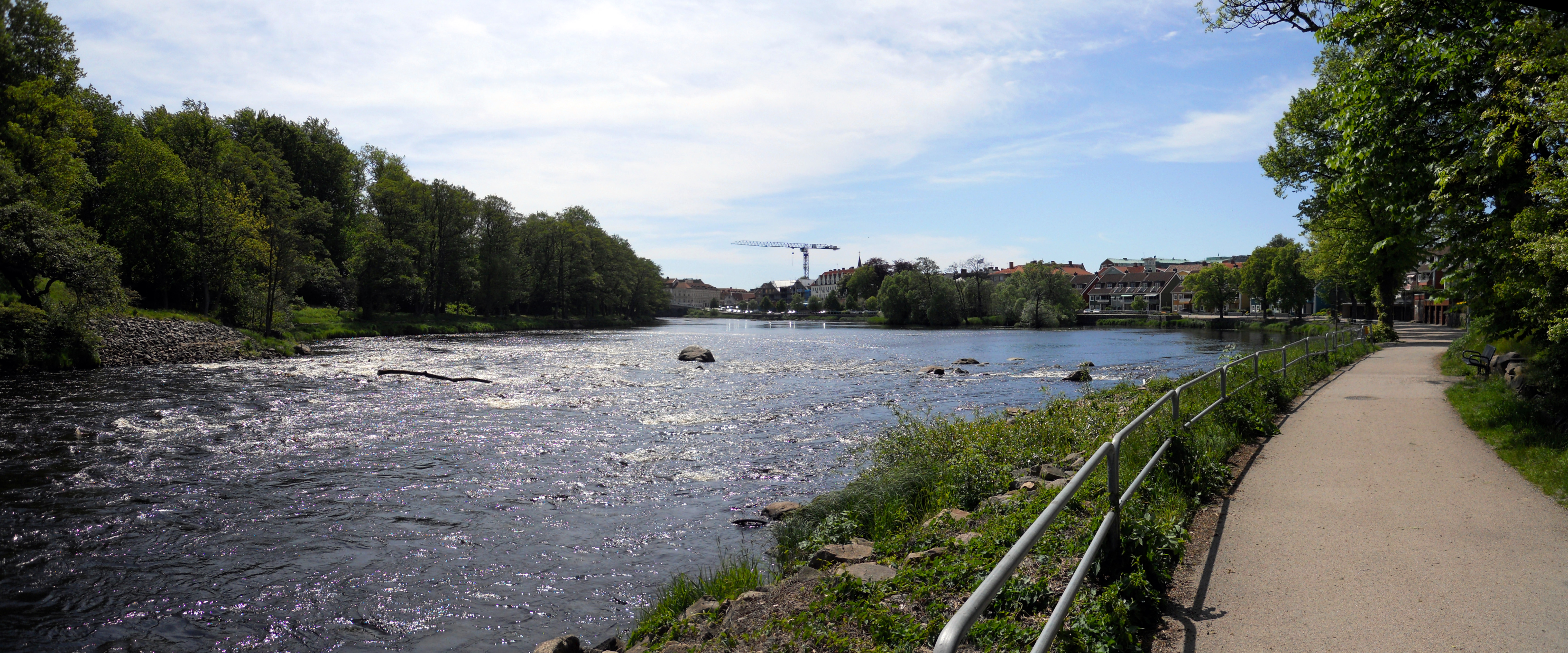
| image | Ätran (river), photo from Falkenberg.JPG |
| image_caption | Ätran in Falkenberg, late-August 2004 |
| map | Karta Aetran position.gif |
| map_caption | Path of the river |
| subdivision_type1 | Country |
| subdivision_name1 | Sweden |
| subdivision_type3 | County |
| length | 240 km |
| discharge1_avg | 47 m3/s |
| source1_location | Gullered, Västergötland |
| source1_coordinates | |
| source1_elevation | 332 m |
| mouth | Kattegat |
| mouth_location | Falkenberg |
| mouth_coordinates | |
| mouth_elevation | 0 m |
| basin_size | 3342.2 km2 |
Ätran is a Swedish river. The river is about 240 km long, and has its source in Gullered, Västergötland, at a height of 332 m above sea level. The river has its mouth in Falkenberg, Halland, where the river enters Kattegat.
The drainage basin covers an area of 3343 km2, mostly consisting of forest. The river is well known as a good place for fishing. It is comparatively unpolluted.
A historic road, Redvägen, followed the river, along which several medieval battles took place.
Path, tributaries and drainage basin
| Area/tributary | Drainage | ||||
|---|---|---|---|---|---|
| basin (km2) | Average | ||||
| water flow (m3/s) | Total/Final | 3,343 | 52.5 | ||
| Ätran, upstream Åsunden | 650 | ||||
| Ätran, between Åsunden and Assman | 379 | 8 | |||
| Assman (Lillån) | 652 | 9.5 | |||
| Ätran, between Assman and Kalvån | 45 | 24.5 | |||
| Kalvån (Lillån) | 514 | 8.2 | |||
| Ätran, between Kalvån and Högvadsån | 370 | 33.5 | |||
| Högvadsån | 476 | 8.5 | |||
| Ätran between Högvadsån and the Sea | 257 | 49 |
The river passes through several minor lakes in Västergötland (Sörsjön, Nolsjö, Vinsarpsjö and Lönnern). By the time it reaches Åsunden, it is about 1 to 2 meters deep and 6 to 10 meters wide. As the tributaries named Lillån join the river, it grows considerably in size.
The largest tributary is Högvadsån. Other main tributaries are Assman (Lillån), which join the river close to Örsås church, and Kalvån (Lillån), which join the river close to Östra Frölunda church.
The drainage basin include the major parts of Falkenberg, Svenljunga, Tranemo and Ulricehamn Municipalities. Smaller parts of Falköping, Borås, Gislaved, Mark, Hylte, and Varberg Municipalities are also part of the drainage basin. Within the basin, 64 percent of the area is forest, 6 percent is lakes, 7 percent is bogs, 11 percent is fields, and 12 percent is other.
The largest lakes within the basin are Åsunden (33.9 km2), Fegen (24.2), Sämsjön (9.2), Lönern (7.7) and Kalven (6.6). In total, there are about 200 km2 of lakes within the basin. A record of the water flow at Yngeredsfors Power Station has been kept; it was on average 37.2 m3/s from 1909 to 1967. The maximum flow was 275 m3/s, while the minimum flow was between 5 and 7 m3/s.
References
References
- "Ätran".
- "Län och huvudavrinningsområden i Sverige". [[Swedish Meteorological and Hydrological Institute]].
- [https://runeberg.org/nfcm/0683.html Nordisk familjebok: Ätran]
This article was imported from Wikipedia and is available under the Creative Commons Attribution-ShareAlike 4.0 License. Content has been adapted to SurfDoc format. Original contributors can be found on the article history page.
Ask Mako anything about Ätran (river) — get instant answers, deeper analysis, and related topics.
Research with MakoFree with your Surf account
Create a free account to save articles, ask Mako questions, and organize your research.
Sign up freeThis content may have been generated or modified by AI. CloudSurf Software LLC is not responsible for the accuracy, completeness, or reliability of AI-generated content. Always verify important information from primary sources.
Report