From Surf Wiki (app.surf) — the open knowledge base
Ashwood, Victoria
| Field | Value |
|---|---|
| type | suburb |
| name | Ashwood |
| city | Melbourne |
| state | vic |
| lga | City of Monash |
| alternative_location_map | Australia Victoria metropolitan Melbourne |
| coordinates | |
| postcode | 3147 |
| pop | |
| elevation | 47 |
| area | 2.6 |
| stategov | Ashwood |
| fedgov | Chisholm |
| dist1 | 14 |
| location1 | Melbourne |
| near-nw | Glen Iris |
| near-n | Burwood |
| near-ne | Burwood |
| near-w | Ashburton |
| near-e | Mount Waverley |
| near-sw | Malvern East |
| near-s | Chadstone |
| near-se | Mount Waverley |
| local_map | yes |
| zoom | 13 |
| near-nw = Glen Iris | near-n = Burwood | near-ne = Burwood | near-w = Ashburton | near-e = Mount Waverley | near-sw = Malvern East | near-s = Chadstone | near-se = Mount Waverley
Ashwood is a suburb in Melbourne, Victoria, Australia, 14 km south east of Melbourne's Central Business District, located within the City of Monash local government area. Ashwood recorded a population of 7,154 at the 2021 census.
Ashwood was named after the suburbs of Ashburton and Burwood, because it is located between the two. It has the postcode of 3147, which it shares with the neighbouring suburb of Ashburton.
Ashwood is bounded by Huntingdale Road to the east, the Glen Waverley railway line to the south, Warrigal Road to the west and a wandering alignment to the north that approximately follows Carlyle Street, Zodiac Street, Gardiners Creek, Ashwood Drive, Montpellier Road and Arthur Street.
History
Until the early 1950s, when residential development commenced in the area, Warrigal Road formed the boundary of suburban development, with market gardens, poultry farms and unmade roads to the east. The new dwellings constructed at this time were typically double-fronted cream brick houses. By 1951 the population of Ashwood had risen to an estimated 1500 persons.
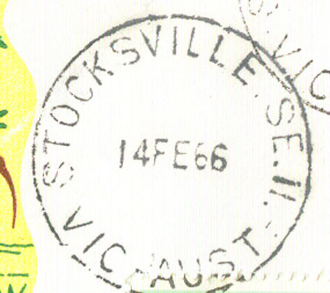
The Post Office opened on 3 October 1949, but was known as Ashburton East until 1951. Jordanville Post Office in the suburb opened in 1953. Stocksville Post Office, on Cleveland Road, was open from 1955 until 1993.
Shopping centres
Ashwood shopping centre is a strip shopping centre located on Warrigal Road and includes a Woolworths supermarket to the south of High Street Road.
A smaller shopping locale is located at the corner of High Street Road and Cleveland Road. The surrounding area is also known as Jordanville and Stocksville. The former supermarket (now a liquor shop) and residence is registered as a Heritage Place on the Victorian Heritage Register. The building was designed in 1952 by architect Robin Boyd, and built using the patented Ctesiphon construction method.
Parks
Ashwood Reserve on Gardiners Creek includes hockey facilities for the Waverley Hockey Club and the grounds for the Harlequin Rugby Club. A bicycle trail through this reserve links it to Gardiners Reserve to the north. Electra Reserve to the east includes a dog club, croquet facilities and a senior citizens hall. Salisbury Reserve to the south has a scout hall and play equipment.
Education
Ashwood High School is a government secondary college located on High Street Road. Adjoining the college is Parkhill Primary School, on Parkhill Drive which is a government-run primary school. Ashwood School, located on Montpellier Road was established in 1976 and caters for students aged 5 to 18 years old with mild intellectual disabilities. Ashwood Memorial Kindergarten is located nearby on Arthur Street. Ashwood Central Pre School is located on Yooralla Street.
Former schools
Jordanville Technical College (opened 1954) and Ashwood State School (opened 1953), both located next to Ashwood High School (opened 1958 – now Ashwood College) were both closed and the land redeveloped as a housing estate.
Transport
The primary north–south roads are Warrigal Road and Huntingdale Road, while High Street Road is the primary east–west road. The nearest railway stations to Ashwood are Holmesglen to the west and Jordanville to the east, from the north western area of Ashwood the Ashburton railway station is the most readily accessible. Several bus routes connect the suburb to surrounding areas.
Sport
The suburb has an Australian Rules football team competing in the Southern Football League.
Ashwood is home to the Melbourne Harlequins, a rugby union team competing in the Victorian Rugby Union premier division.
Ashwood is also home to the Waverley Hockey Club at the Ashwood Reserve Park, which competes in the Hockey Victoria competition.
References
References
- {{Census 2021 AUS
- (2008). "Map 60". Melway Publishing.
- "Burwood and Burwood East, Victoria". Australian Places.
- Phoenix Auctions History. "Post Office List".
- "Ctesiphon Concrete Supermarket and Residence". Heritage Victoria.
- "Ashwood High School".
- "Ashwood School".
- "Ashwood Central Pre School". The Australian Child Care Index – Ashwood, Victoria.
- (1961). "Map 60". Melway Publishing.
- "Detailed History: Education and Community Facilities – City of Monash".
- Full Point Footy. "Ashwood".
This article was imported from Wikipedia and is available under the Creative Commons Attribution-ShareAlike 4.0 License. Content has been adapted to SurfDoc format. Original contributors can be found on the article history page.
Ask Mako anything about Ashwood, Victoria — get instant answers, deeper analysis, and related topics.
Research with MakoFree with your Surf account
Create a free account to save articles, ask Mako questions, and organize your research.
Sign up freeThis content may have been generated or modified by AI. CloudSurf Software LLC is not responsible for the accuracy, completeness, or reliability of AI-generated content. Always verify important information from primary sources.
Report