From Surf Wiki (app.surf) — the open knowledge base
Arusha Region
Region of Tanzania

Region of Tanzania
| Field | Value | ||
|---|---|---|---|
| name | Arusha Region | ||
| native_name | |||
| nicknames | Cradle of Humankind; Land of Volcanoes; The Craters Region | ||
| settlement_type | Region | ||
| named_for | Arusha people | ||
| <!-- images and maps -----------> | image_skyline | {{Photomontage | |
| photo1a | Arusha City view.jpg | ||
| photo2a | Lesser Flamingoes in the Ngorongoro Crater (2405442606).jpg | ||
| photo3a | Lengai from Natron.jpg | ||
| spacing | 2 | ||
| space | 2 | ||
| size | 225 | ||
| position | center | ||
| color_border | white | ||
| color | white | ||
| foot_montage | From top to bottom: | ||
| Arusha City, Flamingoes of Ngorongoro and Ol Doinyo Lengai from Lake Natron }} | |||
| image_map | Tanzania Arusha location map.svg | ||
| map_caption | Location in Tanzania | ||
| coordinates | |||
| subdivision_type | Country | ||
| subdivision_name | Tanzania | ||
| subdivision_type1 | Zone | ||
| subdivision_name1 | Northern | ||
| established_title | Administrative Region | ||
| seat_type | Capital | ||
| seat | Arusha City | ||
| parts_type | Districts | ||
| p1 | Arusha District | ||
| leader_title | Regional Commissioner | ||
| leader_name | John Mongella | ||
| p2 | Arusha City Council | ||
| p3 | Karatu District | ||
| p4 | Longido District | ||
| p5 | Meru District | ||
| p6 | Monduli District | ||
| p7 | Ngorongoro District | ||
| <!-- square kilometers --> | area_total_km2 | 37,576 | |
| area_rank | 9th of 31 | ||
| area_land_km2 | 33,809 | ||
| area_water_km2 | 707 | ||
| elevation_max_m | 4,562 | ||
| elevation_max_point | Socialist Peak, Mount Meru | ||
| <!-- Population -----------------------> | population_total | 2,356,255 | |
| population_as_of | 2022 | ||
| population_density_km2 | auto | ||
| population_rank | 11th of 31 | ||
| demographics_type1 | Ethnic groups | ||
| demographics1_title1 | Settler | ||
| demographics1_info1 | Swahili | ||
| demographics1_title2 | Native | ||
| demographics1_info2 | Maasai | ||
| population_demonym | Arushan | ||
| timezone1 | EAT | ||
| utc_offset1 | +3 | ||
| postal_code_type | Postcode | ||
| postal_code | 23xxx | ||
| area_code | 027 | ||
| iso_code | TZ-01 | ||
| blank_name_sec1 | HDI (2021) | ||
| blank_info_sec1 | 0.568 | ||
| · 9th of 25 | |||
| website | |||
| module | {{Infobox region symbols | embedded=yes | |
| country | Tanzania | ||
| mammal | [[File:Lion d'Afrique.jpg | 50px | left]]Lion |
| bird | [[File:Masked Lovebird (Agapornis personata) -Auckland Zoo.jpg | 50px | left]]Yellow-collard lovebird |
| fish | [[File:Alcolapia alcalica.jpg | 50px | left]] Natron tilapia |
| butterfly | [[File:Colotis danae annae m.JPG | 50px | left]]Colotis danae |
| tree | [[File:Vachellia (ex Acacia) tortilis.jpg | 50px | left]]Umbrella thorn |
| mineral | Gregoryite |
Arusha City, Flamingoes of Ngorongoro and Ol Doinyo Lengai from Lake Natron }} · 9th of 25
Arusha Region () is one of Tanzania's 31 administrative regions and is located in the northeast of the country. The region's capital and largest city is the city of Arusha. The region is bordered by Kajiado County and Narok County in Kenya to the north, the Kilimanjaro Region to the east, the Manyara and Singida Regions to the south, and the Mara and Simiyu regions to the west. Arusha Region is home to Ngorongoro Conservation Area, a UNESCO World Heritage Site. The region is comparable in size to the combined land and water areas of the state of Maryland in the United States.
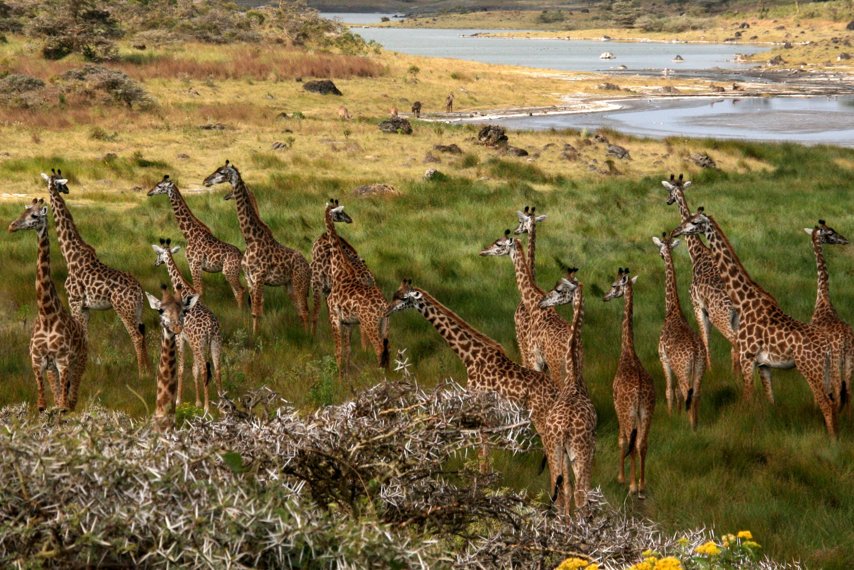
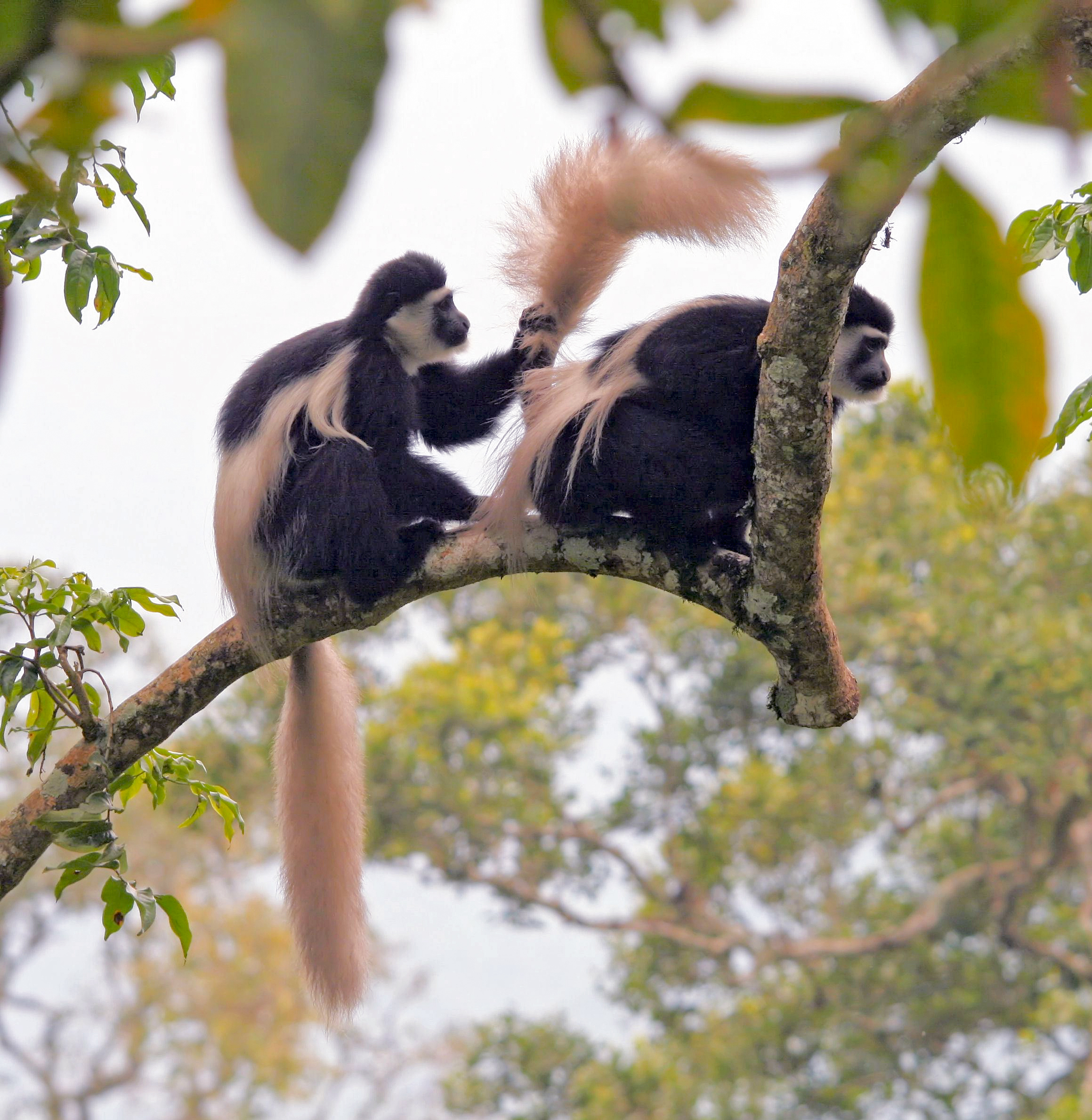
Arusha Region is a tourist destination in Africa and is the hub of the northern Tanzania safari circuit. The national parks and nature reserves in this region include Ngorongoro Conservation Area, Arusha National Park, the Loliondo Game Controlled Area, and part of Lake Manyara National Park. Remains of 600-year-old stone structures are found at Engaruka, just off the dirt road between Mto wa Mbu and Lake Natron. With a HDI of 0.721, Arusha is among the most developed regions of Tanzania being Tanzania's top 3 most resourceful region.
Etymology
The "Arusha" Region is named after the Arusha people, a Bantu ethnic group that originally migrated from Arusha Chini in Kilimanjaro Region around 400 years ago.
History
Prehistory
Arusha Region is home to Laetoli and Olduvai Gorge national archaeological sites both locations with discoveries of prehistoric hominids.
First Communities
The first communities in southwestern Arusha Region's Arusha District, Arusha Rural District and Meru District, were the now extinct Koningo people, an ancient hunter-gatherer group that lived around the slopes of Mount Meru for centuries.
The second community to settle in the region is the Meru People, whom immigrated there from the Usambara Mountains in Tanga Region. They settled on the southeastern slopes of the mountain and started to farm the land. The third wave of settlers were the Arusha people a subgroup of the Pare people migrated from Arusha Chini in Kilimanjaro Region. Some Parakuyo Masai in the west, who were the last group to immigrate to Arusha Region in the 1830s, assimilated into the Arusha community and influenced the Arusha into adopting the Masai language.
In the 1880s a pandemic of rinderpest killed thousands of cattle and forced a large section of the Masai people in the west and integrated into Arusha agriculturally based society. In southeastern portion of the region in Karatu District and southern Ngorongoro District is the ancestral home to the Hadzabe People, who are the only surviving hunter gather communities left in the country.
Moreover, most of the Ngorongoro District, Monduli District and Longido District of the present area of Arusha Region are home to the Maasai, who immigrated from South Sudan, started moving southward around the 16th century CE toward Kenya, and finally reached the northwestern Arusha Region in the 1830s. The Masai were the last precolonial community to settle in the present-day Arusha Region.
Colonial period
Prior to German arrival in 1895, the years between the 1880s to 1900, Arusha Region was plagued by rinderpest, Smallpox, droughts and famine that came after the devastating plagues.
The first German to visit Arusha territory was Kurt Johannes, and he was antagonistic towards the Arusha people and on occasion he survived an attack that cost the lives of two German missionaries in 1895. On 19 October 1896 he went to visit Chief Matunda and was attacked by Arusha warriors. Johannes survived the attack and returned to his post in Moshi and organised Chagga warriors for a retaliatory attack and defeated the WaArusha on 31 October 1896.
Johannes then decided to conduct the scorched earth doctrine on the WaArusha people, leading to a famine and collapse of Arusha society. In 1899, Johannes forced the defeated Arusha warriors to build the German Boma next to today's Arusha Region Headquarters. The Arusha Region was under German military rule and in 1902, one hundred Afrikaners fleeing the Boer War in South Africa, are resettled in Arusha by German authorities, with each family given 1,000 hectares of land.
For various reasons, many of the white settlers moved to Kenyan highlands or back to South Africa in a few years before the advent of World War I. During the great war, the British capture Arusha Region from the Germans in 1916. They expelled all the Germans and confiscated their farms and redistributed the farms to Greek and British settlers.
The Meru and Arusha's Chagga wives were repatriated back to Kilimanjaro. The British started growing coffee in 1920. The administrative region of Arusha existed in 1922 while mainland Tanzania was a British mandate under the League of Nations and known as Tanganyika. In 1948, the area was in the Northern Province, and shortly afterwards, the British appointed the first WaArusha community leader Chief Simeon Laiseri in 1948.
Post-Independence period
In 1966, under the newly independent Tanzanian government, Arusha was given its own regional status. In 2002, Manyara Region was created and was split from Arusha Region. Portions of the former Arusha Region districts of Kiteto, Babati, Mbulu, Hanang, and a tiny piece of Monduli were incorporated into the Manyara Region. Arusha was the largest region in Tanzania from 1966 to 2002.
Geography
The Great Rift Valley runs through the middle of the region north-to-south. Oldonyo Lengai (Mountain of God in the Maasai language) is an active volcano to the north of the Ngorongoro Conservation Area. Altitudes throughout the region vary widely, but much of it ranges from 900 to in elevation.
Mountains
Mount Meru, the second highest mountain in Tanzania after Mount Kilimanjaro, peaks at 4655 m. Arusha Region has the highest number of craters and extinct volcanoes in Tanzania. Other prominent peaks and mountains include the Monduli Mountains, Mount Loolmalasin, Mount Lolkisale, Mount Longido, Gelai Volcano, and the Olduvai Gorge.
Lakes
Arusha region is home to a number of lakes, the largest lake in the region being Lake Eyasi. Other prominent lakes in the region are Lake Duluti, Momela Lakes, Lake Manyara, Lake Masek, Lake Empakaai, Lake Magadi, Lake Ndutu and Lake Natron. Most of the lakes in the region are alkaline in nature.
Administrative divisions
Districts
Arusha Region is divided into one city and six districts, each administered by a council.
| Districts of Arusha Region | Map | District | Capital | Population | |
|---|---|---|---|---|---|
| (2012) | Area | ||||
| (km2) | |||||
| 350px | Arusha City | Arusha | 416,442 | 93 | |
| Arusha Rural District* | Sokon II | 323,198 | 1,547.6 | ||
| Karatu District | Karatu Town | 230,166 | 3,300 | ||
| Longido District | Longido | 123,153 | 7,782 | ||
| Meru District** | Usa River | 268,144 | 1,268.2 | ||
| Monduli District | Monduli | 158,929 | 6,419 | ||
| Ngorongoro District | Loliondo | 174,278 | 14,036 | ||
| Total | Arusha | 1,694,310 | 34,526 |
Notes:
-
- representing the west portion of the former Arumeru District
** - representing the east portion of the former Arumeru District
National parks, national monuments, and other sites

- Arusha National Park
- Empakaai Crater
- Engaruka
- Great Rift Valley
- Lake Manyara National Park (part)
- Mount Longido Forest Reserve
- Mount Meru Forest Reserve
- Ngorongoro Conservation Area
- Ngurdoto Crater
- Oldonyo Lengai
- Olduvai Gorge
- Uhuru Monument
Demographics
According to the 2012 national census, the Arusha Region had a population of 1,694,310.
The region is inhabited by various ethnolinguistic groups and communities. Among these are the Iraqw, Arusha, Maasai, Wameru, Sonjo, Chagga, Pare, and Nguu.
Culture and cuisine
Nyama Choma, the northern Tanzanian barbecue, is a popular dish among some communities in the Arusha Region, particularly the Maasai.

Transportation
Main article: Transport in Tanzania
Roads
The A-23 Arusha-Himo road runs east–west and enters the region near Kilimanjaro International Airport. It connects Arusha with Moshi and then Himo at the Kenyan border. This roads ends at its junction with the A-104 road in the center of Arusha.

The A-104 runs northward, to the west of Mount Meru, from Arusha to Longido and Namanga at the Kenyan border before continuing to Nairobi. The A-104 also runs westward past Monduli to its junction at Makuyuni with the B-144 road that leads to Mto wa Mbu and the Ngorongoro Conservation Area. After that, the A-104 curves southward to the east of Lake Manyara and continues on to Babati and Dodoma.
Most overland travel is done by bus from the city of Arusha. Within the city and smaller towns, privately owned and operated dala-dalas (mini-buses) are used.
The region is landlocked, and there are no navigable rivers. The larger lakes in the Rift Valley are not used for transportation. The region is home to Lake Eyasi, Lake Natron, Lake Duluti, Lake Empakaai, and the Momella lakes.
Airports

Arusha Region is served by the Kilimanjaro International Airport located in Hai District of Kilimanjaro Region. Its twelve international carriers are:
- Airkenya Express
- Air Uganda
- Condor
- Edelweiss Air
- Ethiopian Airlines
- Kenya Airways
- KLM
- Precision Air
- Qatar Airways
- RwandAir
- Safarilink Aviation
- Turkish Airlines The smaller Arusha Airport (Kisongo Airport) serves small, medium and personal planes mainly to popular tourist areas such as Serengeti National Park, Seronera, Ndutu, Zanzibar etc. Planes using Kisongo Airport include:
- AMREF
- Auric Air
- Coastal Air
- Flying Doctors
- Grumeti Air
- Other personal planes.
- Precision Air
- TFC
Notable persons from Arusha Region
- Mrisho Sarakikya, The first Chief of the Tanzanian Defence Force.
- Mark Behr, writer
- Filbert Bayi Tanzanian long distance runner
- Dogo Janja, Tanzanian recording artist
- Edward Lowassa Tanzania's tenth prime minister from 2005 to 2008
- Vanessa Mdee, Tanzanian recording artist
- Peter K. Palangyo, Tanzanian novelist and diplomat
- Edward Sokoine Tanzania's second prime minister
- [WEUSI) A Group of hip hop music from Arusha
- [Flamebmc]Tanzanian musician
- Harold O'Neal Film maker and composer
- Abdulrahman Omari Kinana, politician
- Nancy Sumari, writer and former model
- Nakaaya Sumari, musician
Regional commissioners
The chief administrative officer of the region is the regional commissioner. Below is a table showing the regional commissioners serving the Arusha Region from 1962 to present:
| Name of Regional Commissioner | From | To | Comments | |
|---|---|---|---|---|
| Dorcus Maduma | 1962 | 1962 | first after independence | |
| Peter Walwa | 1962 | 1963 | ||
| Samuel Chamshama | 1963 | 1964 | first after union with Zanzibar | |
| John Mhaville | 1964 | 1964 | second term | |
| Wazir Juma | 1964 | 1968 | ||
| Aaron Mwakangata | 1968 | 1973 | ||
| Abdulanur Suleiman | 1973 | 1978 | ||
| Peter Siyovelwa | 1978 | 1981 | ||
| John Mhaville | 1981 | 1982 | ||
| Charles Kileo | 1983 | 1985 | ||
| Christopher Liundi | 1985 | 1987 | ||
| Augustine Mwingira | 1987 | 1990 | ||
| Anatoly Tarimo | 1990 | 1992 | ||
| Ahmed Kiwanuka | 1992 | 1995 | ||
| Daniel Ole Njoolay | 1995 | 2003 | longest serving commissioner | |
| Mohammed Babu | 2003 | 2006 | ||
| Abbas Kandoro | 2006 | 2006 | less than six months | |
| Samuel Ndomba | 2006 | 2007 | ||
| Isidore Leka Shirima | 2007 | 2011 | ||
| Magesa Stanslaus Mulongo | 2011 | 2014 | ||
| Lilian Steven Okama | 2014 | 2016 | ||
| Mrisho Gambo | 2016 | 2020 | ||
| Idd Hassan Kimanta | 2020 |
References
References
- "Sub-national HDI - Area Database - Global Data Lab".
- (2008). "Land and Water Area of States and Other Entities". Bureau of the Census.
- [http://hdr.undp.org/sites/default/files/thdr2014-main.pdf Economic Transformation for Human Development] {{Webarchive. link. (2015-07-05)
- "Arusha Migration".
- "Laetoli Footprint Trails".
- "Meru and Machame Migrations to Arusha Region".
- Peer, Peters. (2003). "Armies of the nineteenth century: East Africa". Foundry.
- "Maasai Origins".
- "German Invasion of Arusha".
- "Boers in Arusha".
- "British capture Arusha".
- ""Regions of Tanzania", ''Statoids''".
- ""Demographic Yearbook", Statistical Office, Department of Economic and Social Affairs, United Nations, Seventh Issue, page 153, New York, 1955".
- "PROFILE OF ARUSHA REGION".
- (2019-08-13). "Weather of Ngorongoro Conservation Area - ngorongoro weather".
- "Arusha Region - Councils". Arusha Region Office, Tanzania.
- "Arusha District Council". Arusha Region Office, Tanzania.
- "Meru District Council". Arusha Region Office, Tanzania.
- [http://www.nbs.go.tz/sensa/PDF/Census%20General%20Report%20-%2029%20March%202013_Combined_Final%20for%20Printing.pdf Population Distribution by Administrative Units, United Republic of Tanzania, 2013, page 1] {{webarchive. link. (May 2, 2013)
- ""Arusha Region Socio-Economic Profile", United Republic of Tanzania, joint publication of the Planning Commission Dar es Salaam and Regional Commissioner's Office Arusha, April 1998, page 3".
- "Ngorongoro Conservation Area".
- Nkwame, Valentine Marc. (9–15 December 2006). "Njoolay longest serving RC in Arusha: 17 RCs have served Arusha in 45 years". The Arusha Times.
- Selasini, Edward. (1–7 September 2007). "Zanzibar legislators visit Wazee Club". The Arusha Times.
- Staff reporter. (1–7 September 2007). "Shirima at the helm of Arusha Region". The Arusha Times.
- Arusha Times Correspondent. (17 December 2011 – 13 January 2012). "RC guarantees order and tranquility". The Arusha Times.
- "Kitabu cha Mawasiliano Serikalini, Tanzania Government Directory, 2012, page 154".
- Melleor, Grace. "MRISHO GAMBO ATENGULIWA KUWA MKUU WA MKOA.".
- "Orodha ya Wakuu wa Mikoa {{!}} Arusha Regional".
This article was imported from Wikipedia and is available under the Creative Commons Attribution-ShareAlike 4.0 License. Content has been adapted to SurfDoc format. Original contributors can be found on the article history page.
Ask Mako anything about Arusha Region — get instant answers, deeper analysis, and related topics.
Research with MakoFree with your Surf account
Create a free account to save articles, ask Mako questions, and organize your research.
Sign up freeThis content may have been generated or modified by AI. CloudSurf Software LLC is not responsible for the accuracy, completeness, or reliability of AI-generated content. Always verify important information from primary sources.
Report