From Surf Wiki (app.surf) — the open knowledge base
Arrast-Larrebieu

| Field | Value |
|---|---|
| name | Arrast-Larrebieu |
| native name | Ürrustoi-Larrebille |
| commune status | Commune |
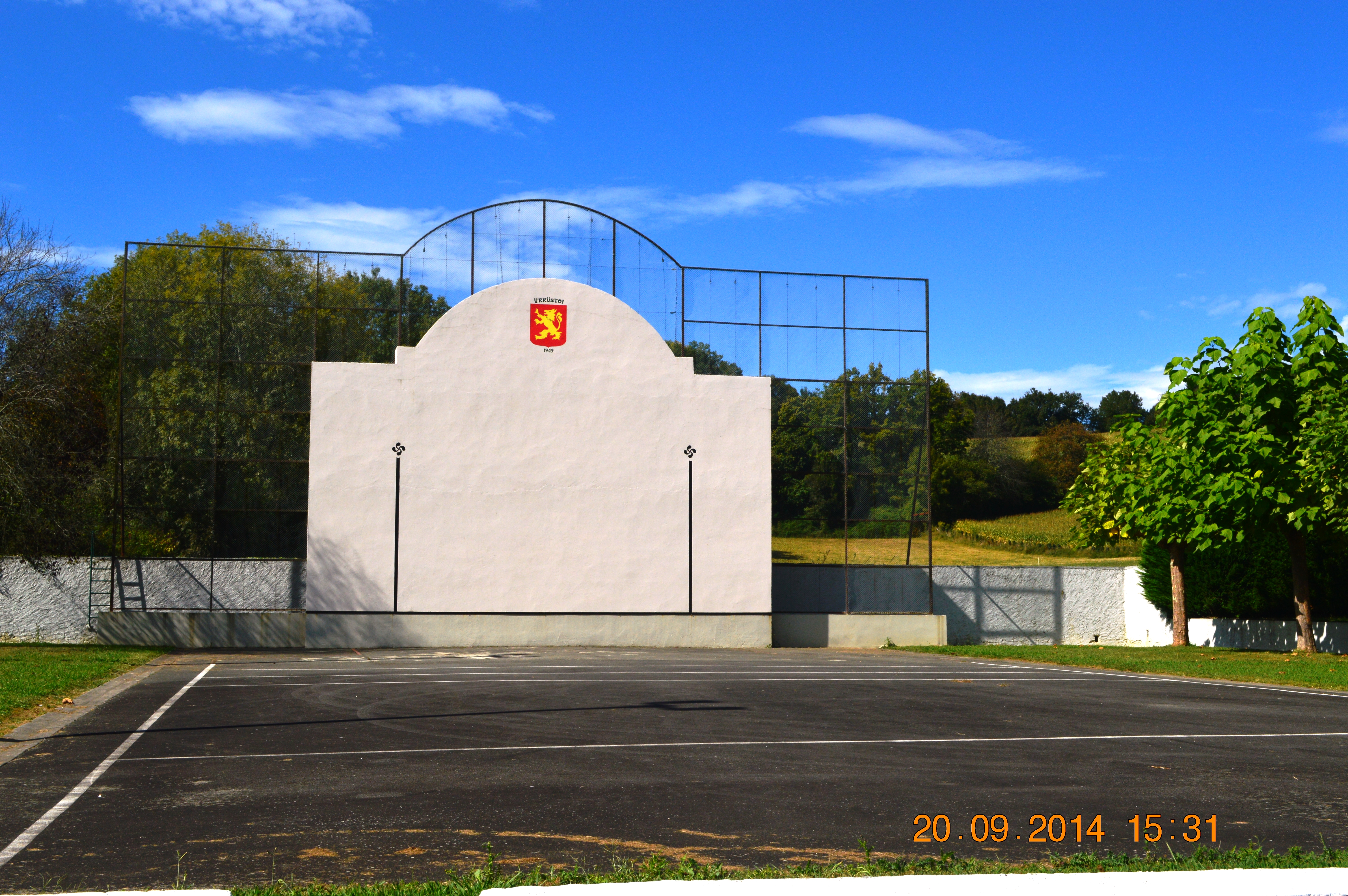
| image | Arrast Entry.JPG |
| caption | The road into Arrast |
| arrondissement | Oloron-Sainte-Marie |
| canton | Montagne Basque |
| INSEE | 64050 |
| postal code | 64130 |
| mayor | Allande Davant |
| term | 2020–2026 |
| intercommunality | CA Pays Basque |
| coordinates | |
| elevation m | 173 |
| elevation min m | 132 |
| elevation max m | 299 |
| area km2 | 7.56 |
| population | |
| population date | |
| population footnotes |
Arrast-Larrebieu (; ) is a commune in the Pyrénées-Atlantiques department in the Nouvelle-Aquitaine region of south-western France.
Geography
Arrast-Larrebieu is located in the former province of Soule some 12 km east by south-east of Saint-Palais and 10 km north by north-east of Mauléon-Licharre. Access to the commune is by the D243 road which branches off the D11 west of the commune and north of Espès-Undurein and passes through the village before continuing north-east to join the D115. The D135 from the D11 in the west to Moncayolle-Larrory-Mendibieu in the south-east passes through the south of the commune and the hamlet of Larrebieu. The commune is mainly farmland with many forests scattered throughout the commune.
The Laxubie rises in the south of the commune and flows north past the village gathering many tributaries and joins the Apaure north of the commune. Several small streams rise in the west of the commune and flow west to join the Saison.
Places and Hamlets
- Abbadia
- Aguelcheberry
- Aguerria
- Aitzaguer (ruins)
- Algalarrondo
- Arkabisquey
- Arrast
- Asconeguy
- Behety
- Bethulard
- Bou
- Garatia
- Gastelu
- Gastelu Arrast
- Gasteluchague
- Habiague
- Heguilus
- Hoilly
- Ibarbouen
- Lacoste
- Laplume
- Larçabal
- Larlette
- Larrebieu
- Larribet
- Mendiondo
- Oyhenart
- Poutou
- Sabalain
- Sagardoyburu
- Sallaberry
- Sunhary
- Tine
Toponymy
The commune name in basque today is Ürrüstoi-Larrabile or Ürrustoi-Larrebille.
Jean-Baptiste Orpustan indicated that the spelling in Basque Arrast is sometimes given with the determinant Ürrüxtoia meaning "hazel tree grove". He also stated that larrabil means a "rounded moor, squat".
The following table details the origins of the commune name and other names in the commune.
| Name | Spelling | Date | Source | Page | Origin | Description |
|---|---|---|---|---|---|---|
| Arrast | Arrast | 13th century | Raymond | Bayonne | Village | |
| Arrast | 1690 | Orpustan | ||||
| Larast | 1690 | Orpustan | ||||
| Larrast | 1690 | Orpustan | ||||
| Larrebieu | Larrebiu | 1384 | Raymond | Notaries | Village | |
| Larrebiu | 1690 | Orpustan |
Sources:
- Raymond: Topographic Dictionary of the Department of Basses-Pyrenees, 1863, on the page numbers indicated in the table.
- Orpustan: Jean-Baptiste Orpustan, * New Basque Toponymy*
Origins:
- Bayonne: Cartulary of Bayonne or Livre d'Or (Book of Gold)
- Notaries: Notaries of Navarrenx
History
Paul Raymond noted on page 11 of his 1863 dictionary that the commune had a Lay Abbey, vassal of the Viscounts of Soule.
Larrebieu was merged with the commune of Arrast on 16 October 1842.
Administration

List of Successive Mayors
| From | To | Name | Party |
|---|---|---|---|
| 1995 | 2014 | Julien Erbin | UMP |
| 2014 | 2026 | Allande Davant |
Inter-communality
The commune is part of seven inter-communal structures:
- the Communauté d'agglomération du Pays Basque;
- the Sanitation association of Pays de Soule;
- the AEP association of Pays de Soule;
- the inter-communal association of la Vallée;
- the Energy association of Pyrénées-Atlantiques;
- the inter-communal association for the construction and operation of the CES at Mauleon;
- the association to support Basque culture.
Demography
The inhabitants of the commune are known as Urrustoitars. The population data given in the table and graph below for 1836 and earlier refer to the former commune of Arrast.
|1793 |216 |1800 |212 |1806 |154 |1821 |191 |1831 |176 |1836 |200 |1841 |323 |1846 |308 |1851 |292 |1856 |261 |1861 |247 |1866 |283 |1872 |235 |1876 |265 |1881 |275 |1886 |259 |1891 |252 |1896 |246 |1901 |263 |1906 |251 |1911 |258 |1921 |242 |1926 |225 |1931 |215 |1936 |201 |1946 |203 |1954 |198 |1962 |173 |1968 |144 |1975 |128 |1982 |131 |1990 |123 |1999 |105 |2007 |96 |2012 |96 |2017 |95
Economy
Economic activity is mainly agricultural (livestock and pasture). The town is part of the Appellation d'origine contrôlée zone designation of Ossau-iraty.
Culture and Heritage
Civil heritage
An enclosure with an earthen parapet (a protohistoric fort or Gaztelu zahar) at an altitude of 282 metres at a place called Gazteluxaga reflects the ancient past of the commune.
Religious heritage


The Parish Church of Sainte-Lucie (19th century) is registered as an historical monument. It has a bell tower called Trinity or Souletin meaning the "top of the wall", pierced by bays for the bells with three roof peaks of approximately equal height, hence the name Trinity. The church contains a Processional Cross (17th century) which is registered as an historical object.
Notable people linked to the commune
- Abbadie d'Arrast Family, initially lay abbots whose descendants originated the construction of various chateaux (the Château d'Abbadie at Hendaye, Elorriaga at Ciboure).
- Jean-Louis Davant, born in 1935 in Arrast-Larrebieu, is a writer, poet, bertsolari, pastoralari, and academician.
References
References
- (2 December 2020). "Répertoire national des élus: les maires".
- [https://aunamendi.eusko-ikaskuntza.eus/en/urrustoi-larrebille/ar-130566/ ÜRRUSTOI-LARREBILLE], [[Auñamendi Encyclopedia. Auñamendi Eusko Entziklopedia]] {{in lang. es
- [https://www.google.com/maps/place/Arrast-Larrebieu/@43.2805692,-0.8382031,8800m/data=!3m1!1e3!4m2!3m1!1s0xd56e68ca45efbbd:0x40665174813ac90?hl=en Google Maps]
- IGN]] {{in lang. fr
- [https://www.euskaltzaindia.eus/index.php?option=com_ecoeoda&task=lekuaIkusi&Itemid=191&lang=fr&kodea=100639&mota=lekuak Euskaltzaindia - Academy of the Basque language] (Basque)
- Paul Raymond]], Imprimerie nationale, 1863, Digitised from Lyon Public Library 15 June 2011 {{in lang. fr
- 2 86781 396 4 {{in lang. fr
- Manuscript from the 14th century in the Departmental Archives of Pyrénées-Atlantiques {{in lang. fr
- Departmental Archives of Pyrénées-Atlantiques {{in lang. fr
- [http://www.francegenweb.org/mairesgenweb/chercher.php List of Mayors of France] {{in lang. fr
- [https://www.habitants.fr/pyrenees-atlantiques-64 Pyrénées-Atlantiques], habitants.fr
- {{Cassini-Ehess. 1349. Arrast-Larrebieu
- [https://www.insee.fr/fr/statistiques/4515315?geo=COM-64050#ancre-POP_T1 Population en historique depuis 1968], INSEE
- Ministry of Culture, Mérimée {{Mérimée. IA64000734. IA64000734 Parish Church of Sainte-Lucie {{in lang. fr
- Philippe Veyrin, ''The Basques'', p. 241, Arthaud, 20 December 1975, {{ISBN. 2700300386 {{in lang. fr
- Ministry of Culture, Palissy {{Palissy. PM64000036. PM64000036 Processional Cross {{in lang. fr
This article was imported from Wikipedia and is available under the Creative Commons Attribution-ShareAlike 4.0 License. Content has been adapted to SurfDoc format. Original contributors can be found on the article history page.
Ask Mako anything about Arrast-Larrebieu — get instant answers, deeper analysis, and related topics.
Research with MakoFree with your Surf account
Create a free account to save articles, ask Mako questions, and organize your research.
Sign up freeThis content may have been generated or modified by AI. CloudSurf Software LLC is not responsible for the accuracy, completeness, or reliability of AI-generated content. Always verify important information from primary sources.
Report