From Surf Wiki (app.surf) — the open knowledge base
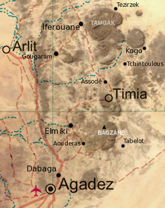
Arlit
| Field | Value |
|---|---|
| official_name | Arlit |
| image_skyline | MineArlit1.jpg |
| imagesize | 280px |
| image_caption | The open pit Uranium Mine at Arlit |
| pushpin_map | Niger |
| pushpin_label_position | bottom |
| pushpin_mapsize | 280 |
| pushpin_map_caption | Location in Niger |
| pushpin_relief | 1 |
| subdivision_type | Country |
| subdivision_name | |
| subdivision_type1 | Region |
| subdivision_name1 | Agadez Region |
| subdivision_type2 | Seat |
| subdivision_name2 | Arlit Department |
| area_total_km2 | 1,247 |
| population_as_of | 2012 census |
| population_total | 112432 |
| population_density_km2 | auto |
| coordinates | |
| elevation_m | 425 |

Arlit is an industrial town and capital of the Arlit Department of the Agadez Region of northern-central Niger, built between the Sahara Desert and the eastern edge of the Aïr Mountains. It is 200 kilometers south by road from the border with Algeria. As of 2012, the commune had a total population of 79,725 people.
Uranium industry
Founded in 1969 following the discovery of uranium, it has grown around the mining industry, developed by the French government. Two large uranium mines, at Arlit and nearby Akouta, are exploited by open top strip mining. One open-pit mine was built in 1971 by the National Mining Company of Niger, SOMAIR. The second open-pit mine, as well as a third underground mine, was built by the French Compagnie Minière d'Akouta (or COMINAK). All the ore from both is now processed and transported by a French company Orano Cycle, a holding of the Orano group, itself a state-owned operation of the French Commissariat à l'énergie atomique (CEA). The system of French nuclear power generation, as well as the French nuclear weapons program, is dependent on uranium mined at Arlit. Orano Cycle alone employs 1600 foreign nationals on the site.
In 2017, 2,116 tonnes of uranium were extracted from the Arlit mines and exported to France via truck to the seaport at Cotonou, Bénin. At its peak in the 1980s, 40% of Niger's uranium production came from Arlit, and uranium represented 90% of Niger's exports (by value). A major modern road, known as the Uranium Highway, has been built to transport uranium south, but it has bypassed many towns along the way (In-Gall for example) and has radically changed Niger's transportation system.
Boom, bust and recovery
In the late 1980s, Arlit suffered from a steep decline in world uranium prices, and the number of foreign employees in the town was cut to 700, a drop which has rebounded by the first decade of the 21st century. The value of Niger's uranium "boom" has never recovered its 1980s level, causing dislocation and suffering for the tens of thousands of Nigeriens who flocked to the shanty towns surrounding Arlit.
Anger at the results of uranium bust, along with a belief that the best jobs were going to those from southern Niger, contributed to the Tuareg Rebellion of the 1990s. As late as 2007, Tuareg nationalists have made a fairer division of profits and jobs for local people a primary demand.
On a macroeconomic scale, Arlit can be said to suffer from Dutch disease, or Dutch curse, a phenomenon where over-emphasis on one particular sector (commonly a highly sought after resource such as oil) hinders normal development of other sectors essential to an economy.
Environmental impact
The impact on the local environment of the Arlit mining industry has been criticised by African and European Non-Governmental Organisations, and Areva NC has especially been accused of a disregard for health and environmental conditions around its operations. The French NGO Commission for Independent Research and Information on Radioactivity has described the surface nuclear waste piles near Arlit as a danger to the area's water supply.
"Yellowcake" controversy
In the build-up to the war in Iraq there was controversy over allegations in 2003 that Saddam Hussein was seeking to purchase uranium from Arlit.
,_street_scene.jpg)
Military base
The United States has operated a military base in Arlit since approximately 2015.
Transportation
Arlit is served by Arlit Airport.
In popular culture
In 2005 the Beninese filmmaker, Idrissou Mora-Kpai, produced and directed the film Arlit, deuxième Paris (Arlit, a Second Paris) about the large expatriate community in the town.
In 2007 Andersen Press published The Yellowcake Conspiracy, a novel by British children's author Stephen Davies. The novel is an espionage thriller set in and around the Arlit mine.
Geology
More than 25 uranium deposits occur within Mississippian to Cretaceous age sandstones. Key structural features are the Arlit Fault, and intrusions and ring dikes from 480 to 145 Ma in age.
Climate
Arlit has a hot arid climate (BWh under the Köppen-Geiger system.)
References
References
- "Arlit (Commune, Niger) - Population Statistics, Charts, Map and Location".
- [http://www.cogema.com/servlet/ContentServer?pagename=cogema_en/entite/entite_popup_template&cid=1039473235338&rendermode=liv Somair Company Profile].
- Georges Capus, Pascal Bourrelier and Moussa Souley. (2004). "Uranium Mining in Niger; Status and Perspectives of a Top Five Producing Country". [[World Nuclear Association]]- N.B.: The WNA is a nuclear industry funded group.
- [http://www.acdis.uiuc.edu/research/OPs/Pederson/html/contents/sect2.html France and Nuclear Energy] {{webarchive. link. (16 October 2007 and [http://www.acdis.uiuc.edu/research/OPs/Pederson/html/contents/sect7.html French Involvement in Niger] {{webarchive). link. (4 July 2007 , both from Pederson, Nicholas R. The French Desire for Uranium and its Effects on French Foreign Policy in Africa. Arms Control, Disarmament, and International Security: Occasional Papers. PED:1. University of Illinois at Urbana-Champaign (2000))
- according to ''[[Le Canard Enchaîné]]'' (3 August 2005)
- "World Uranium Mining - World Nuclear Association".
- [ l'Humanite, ] June 2007.
- [http://www.criirad.org/actualites/dossiers2005/niger/somniger.html Le dossier sur la mine d'Arlit] de la [[CRIIRAD]]
- (19 March 2023). "French nuclear giant to explore potential of uranium deposit in Niger".
- Taub, Ben. (January 28, 2018). "Ben Taub on Twitter: "Secret military base near Arlit, Niger, revealed as a white dot in a sea of black, because Western soldiers didn't turn off their Fitbits". [[Twitter]] via the [[Internet Archive]].
- Müller-Jung, Friederike. (November 23, 2016). "US drone war expands to Niger". [[Deutsche Welle]].
- "U.S. deaths in Niger highlight Africa military mission creep". [[Reuters]].
- (2010). "Volcanogenic Uranium Deposits: Geology, Geochemical Processes, and Criteria for Resource Management". USGA.
- "Climate: Arlit – Climate graph, Temperature graph, Climate table". Climate-Data.org.
This article was imported from Wikipedia and is available under the Creative Commons Attribution-ShareAlike 4.0 License. Content has been adapted to SurfDoc format. Original contributors can be found on the article history page.
Ask Mako anything about Arlit — get instant answers, deeper analysis, and related topics.
Research with MakoFree with your Surf account
Create a free account to save articles, ask Mako questions, and organize your research.
Sign up freeThis content may have been generated or modified by AI. CloudSurf Software LLC is not responsible for the accuracy, completeness, or reliability of AI-generated content. Always verify important information from primary sources.
Report